
 |
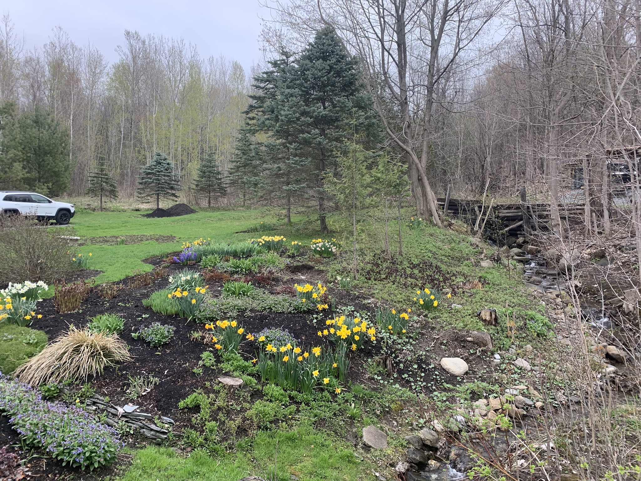
| With the recent damp, mild weather, garden flowers in St. Albans have recovered nicely from a snowstorm nine days ago, and the forest out back is slowly getting greener. Unfortunately, a few snowflakes possible late tonight, but not enough to set anything back. |
Let's get that out of the way first.
Even so, today - Friday - won't exactly be the best one for your outdoor plans. It'll rain most of the day, especially in the northern half of Vermont, and I think we've already seen the warmest temperatures of the day.
At dawn today it was mild and drenching with a steady, soaking rain once again. The day was off to a pretty mild start, too, with temperatures across the Green Mountain State right around 50 degrees.
The damp, mildish weather of the past couple of days has really pushed the spring greening process out there, which is nice.
So, of course, later today, tonight and first thing in the morning will be yet another slap in the face. Just not as hard a slap as we've seen with wintry events earlier this month.
Temperatures will slowly fall into and through the 40s this afternoon as west and northwest winds pick up. A strengthening storm near the New England coast this morning is to blame for that. As it pulls off to the northeast, it will get even stronger.
The pressure difference between that and high pressure over the western Great Lakes is to blame for that.
By tonight, it will be downright blustery and cold with continued showers, especially in the mountains. These northwest winds will affect most of the East Coast, where wind advisories are up for a large area from New England to North Carolina.
Here in Vermont, snow will break out on the summits this evening and work their way down the slopes. The National Weather Service in South Burlington is thinking one to three inches of accumulation above 2,000 feet, which is fine since not that many of us live up that high.
But a possible slushy coating of snow down as low as 500 feet in elevation could give us an unwelcome reminder of winter. Snowflakes early Saturday will probably reach valley floors in much of Vermont. I wouldn't be surprised to see the flakes fly down in Burlington for awhile. Even parts of southern New England away from the coast are in for a little snow
Don't worry, though, this won't be another daffodil destroyer. Outdoor plants, except the ones that should't be out yet anyway, will be just fine.
Saturday's weather should improve as the day goes on, but it will stay chilly for the season. (Highs near 50 instead of the normal low 60s).
Another disturbance will have our Sunday begin showery, but improve later in the day. Showery weather will persist early next week, with drying after that. Temperatures will be just slightly cooler than average, but nothing weird for early May.
No comments:
Post a Comment