Sunday, December 31, 2023

New Year's Eve Is Here: What To Expect In Vermont Tonight, Tomorrow

Yet another day of thick overcast kept Vermont dreary on
New Year's Eve, but at least there's no ice or snow to mess
up the roads tonight. The low clouds might interfere a 
bit with midnight fireworks shows, though. 
 It's been a day of low, dark overcast as a temperature inversion - common for this time of year - has kept clouds trapped below a lid of slightly warmer air several thousand feet above us. 

This continues our long streak of bleak days, but at least we don't have the dense fog that pestered us Vermonters for days this past week.  

The weather forecast continues to look pretty safe, though not gorgeous for any outdoor New Year's Eve festivities tonight. 

A few snowflakes might flutter down from time to time this evening, but they won't amount to anything.  Roads should be in good shape, with no surprise icing like we saw Saturday afternoon.

Temperatures under the thick clouds held in the 20s all day today, as they prevented any weak December sun from boosting readings just a bit.

Those same thick clouds will keep the temperature from falling much tonight.  It should be somewhere between 18 and 25 degrees at midnight, which isn't bad for the season.

We do see one problem with tonight's weather: Fireworks and the low clouds. The overcast is so low that it might interfere with viewing midnight fireworks. Especially in towns that launch them from relatively high elevations, or if they involve fireworks that go way up into the sky before exploding. 

Another problem is the same temperature inversion that's keeping the low clouds locked in place will probably also trap smoke from the fireworks beneath the clouds. The smoke won't disperse all that easily, so we could see some local air pollution problems with this. 

New Year's Day still looks pretty good, fingers crossed. A very weak cold front early in the day should touch off more snow flurries, especially in the mountains and along the south and east shores of Lake Champlain early in the day. 

The cold front doesn't really have much in the way of cold air behind it, but it does have drier air. That could set us up for some - YAYYY! --- sun in the afternoon. No promises, the inversion could hold, but let's be optimistic. If the sun does come out, that would be the first time most of us have seen any sun since Tuesday. 

Temperatures will still be OK tomorrow with highs in the 25-32 range for most of us. 

Happy New Year, everyone!


Vermont Maple Syrup Production In December? Whacky Climate Change Partly The Cause

A tanker truck loading up sap at a maple sugaring 
operation in St. Albans, Vermont in March, 2020. That's
usually the season for sugaring in Vermont, but recent
December warmth has prompted some sugarers
to produce off season. 
Now that it's gotten a little colder, I guess maple sugaring season is done.

Wait, what?  

As any good Vermonter knows, sugaring season comes in March and April. That's when we start crawling out of the depths of winter. 

We start getting those chilly nights and mild days, which makes the sap flow in the maples and we start boiling away to make syrup. 

But, mainly due to a  better understanding of maple trees and a little bit due to climate change making our winters gonzo, some maple producers got some production in this December.  

As NBC5 reported, the warm spell that helped produce Vermont's destructive floods on December 18 and 19 had a tiny silver lining. 

Branon Family Maple Orchard in Fairfield made about 300 gallons of syrup during that episode. Temperatures briefly cooled down and they had to stop. But we had another warm week in the closing days of December, so Branon probably made more.

Other sugar makers in Vermont have reported making syrup, too.

Large maple producers like Branons tap trees early, since they have such an expanse of maple forests to cover. If sugaring weather is unseasonably favorable, like it was in the past couple of weeks, they can produce. 

Don't worry about the trees. It's not like sugar maples have a limited amount of sap and that's it. As long as it's warm, the maples will draw moisture from the ground to produce sap.  And the amount of sap taken from trees through maple sugaring is negligible, as far as the tree is concerned. 

At least we don't think so. Advances in technology and methods have greatly increase yields from Vermont maple trees.  That's one of the many things the University of Vermont  Proctor Maple Research Center is planning to look into as it launches a detailed maple industry and forest sustainability study.   

The same thing happened last year. After a brief, relatively harsh cold wave around Christmas, 2022, near record warmth hit Vermont in the closing days of December and the beginning of January, 2023.

Vermont is the largest maple producer in the United States, making about half the total for the whole nation. The biggest maple syrup producer in the world is Quebec. 


The UVM Proctor Maple Research Center is wo

Saturday, December 30, 2023

Some Vermont Roads Surprisingly Icy This Saturday Evening

A truck makes its way across a somewhat icy parking lot
in St. Albans, Vermont late Saturday afternoon. Light
freezing drizzle and snow flurries have slickened
roads this evening across parts of the state
 Just a little bit of freezing drizzle and snow flurries have left many northern Vermont roads surprisingly icy late this Saturday afternoon and evening. 

So much for my thoughts this morning that it was smooth sailing this weekend. 

Driving home from work at around 4:45 p.m., Interstate 89 was perfectly fine heading north from Burlington until I hit the Lamoille Bridge in Milton. 

There was a minor accident at the bridge, and the road all the way north to St. Albans was icy. 

Vermont State salt shaker trucks are out, but it'll take time to make everything safe. I'm sure many other roads across mostly northern and central Vermont are iffy at best. 

Accumulations are minimal.  Here in St. Albans, it looks like we got 0.2 inches of snow, mixed with a little glaze. 

So just be careful overnight, 

The rest of the quiet forecast I described this morning remains intact. Any flurries will end by morning, except maybe on the mountaintops.

I'm not sure how much it will clear up tomorrow, but there's a shot of some sun in the afternoon, .New Year's Eve night still looks partly to mostly cloudy and kinda mild for this time of year. 

Not warm, by any means. but temperatures should be between 18 and 28 at midnight. Not bad, considering how many New Year's Eves have been below zero.

No precipitation is in the forecast, except for maybe some lake effect snow flurries near Lake Champlain. 

So for now, just be careful out on the roads tonight. No drinking and driving, please. 

Quiet New Year's Eve Vermont Weather To Aid Any Noisy Celebrations

Another reason to cheer this New Years. Weather in
Vermont on New Years Eve and Day is going to
be quiet and not especially cold. 
 If you were out on the Vermont roads over the Christmas holiday, there really wasn't any travel trouble to speak of, aside from that ever-present fog. 

Now we have kind of a happy two-fer. If you're going out on New Year's or New Year's Day, it's clear sailing. And I mean clear, because the fog will finally be gone.

This Saturday morning, the rain finally turned to snow, at least in some parts of Vermont. A few of us have a dusting of snow on the ground. 

The northern Green Mountains should be in the light snow most of the day, so they'll pick up a couple inches of powder. Not much, but I'm sure they'll take it.

For us valley dwellers, you won't see much of anything at all 

The big bonus is the fog is clearing up.  As of 8 a.m. it was still a little murky out there in spots, but it's much better.

That takes us to New Year's Eve.

And.... there will be no weather, really to report. The day Sunday will be dry, except maybe a few morning flurries up in the mountains. It'll be colder, too, with many of us not getting above freezing for the first time in over a week. 

Cold is a relative term, though. A high within a few degrees of 32 is still pretty good for this time of year. 

As the festivities ramp up tomorrow night and before midnight, temperatures should gradually fall through the 20s. Again, not bad for this time of year, especially since there isn't going to be much wind to add to any chill.

For comparison, the normal high on New Years is 30, with a low of 12. Average precipitation is 0.1 inches for the day, which average snowfall of 0.8 inches. So overall, this New Years will be vaguely warmer, but also drier than normal,

No snow, no ice, no rain, no fog this year on New Year's Eve.  Just the usual dangerous drunk drivers. So please be careful on the roads and make sure you have a designated driver if you indulge. 

PAST NEW YEARS WEATHER 

This will be Vermont's coldest New Years since 2018, but that's not saying much. It's been really warm at the start of each of the past five years. Last January 1, we had the warmest minimum temperature for the opening day of the year - 38 degrees. The previous evening, as Vermont approached midnight, people enjoyed outdoor temperatures at about 40 degrees, give or take. Pretty damn mild.

That probably wasn't the warmest New Year's Eve, though. On December 31, 1965, temperatures were in the 50s well into the night. And it was still in the 50s in the early morning hours of January 1, 1966. (The rest of January, 1966 was quite cold and snowy, however).

We've had a lot of cold New Years in the past, the most recent one being 2018.  It was 15 below in Burlington hat morning, so surely below zero hours earlier at the stroke of midnight

Digging deeper into stats from the National Weather Service office in South Burlington, the New Year's holiday has had many weather extremes in Vermont compared to other holidays,  The coldest, snowiest most wintry January 1 in Burlington was 17 below in 1970. (Most record lows this time of year are in the 20s below zero).

Of course that 1970 January 1 chill set the stage for what would become by far the coldest month on record. There was 28 inches of snow on the ground that 1970 New Years Day, the calling card of a tremendous post-Christmas storm in 1969. 

New Year's 1918 is also in the running for coldest New Years. We'd been in the ice box for days. Temperatures had crashed on Christmas Day, 1917, with temperatures in the teens and 20s below zero daily from December 29 through January 3. That included 94 consecutive hours below zero in Burlington, ending at noon January 1, 1918,

Yeah, I would have just huddled by the fire and forgotten about any celebrations that year. 

The stormiest New Years Day had to be in 1945. That year, 1.46 inches of rain and melted snow fell. That day also featured 1.2 inches of snow. So it was probably pretty messy out there. That's just Burlington, though. 

Overall, for Vermont the wettest end to the year was in 1948. The last couple of days of December, 1948 featured significant flooding in southern Vermont with as much as seven inches of rain falling in Bennington County on December 30 and 31 that year. 

Burlington's snowiest New Year's Eve was in 2000, with 8.2 inches of new snow. New Years Day, 1961 started the year with 14.5 inches of fluff. 

We're had a tumultuous weather year in 2023. Let's hope the quiet start to 2024 portends an equally docile weather year in Vermont. We deserve it! 


Friday, December 29, 2023

Massive Pacific Waves Smash California Coast, Eight Injured

Screen grab of a sneaker wave overwhelming people
in California Thursday as they tried to run away.
 It was another beautiful Thursday along the southern California coast, except for one big problem. Or many big problems, really. 

Massive waves smashed into the coastline, catching people off guard and battering oceanfront homes and businesses.  It was one of the strongest wave onslaughts on record along the California coast. 

The culprit was an intense offshore storm that stirred up the Pacific Ocean, creating the high surf that punished pretty much the entire California coastline. 

Despite warnings to stay away from beaches and other areas that could be hit by waves, people flocked to the shore to watch, which was part of the problem.

Anytime you have high surf in California like on Thursday, so-called sneaker waves will catch people off guard.  A sneaker wave is one that is much bigger than all the others, aka they sneak up on you. You feel safe because all the waves you've been watching for the past half hour have all stopped well away from you. 

Then the sneaker wave comes in, and suddenly, you're in the surf. 

The sneaker waves also smashed into shoreline buildings, including one instance in which waves crashed through a barrier, then through ground floor windows of an occupied motel in Ventura.  Streets were also flooded in Santa Barbara.

Further north, beach neighborhoods in Marin County were evacuated due to flooding, though residents were allowed to return later. Two children in the Bay Area were knocked down and washed onto a walkway by a big wave, but they appeared not to be injured. 

Some very worth watching videos the California waves can be viewed by clicking HERE  HERE and HERE

The waves have subsided somewhat today, but are still pretty huge. Officials are still telling everyone to stay away from the water. The storm is now bringing rain to northern and central California, and a bit of minor flooding is possible today and/or tomorrow.

Storms that produce big waves are pretty common in California during the winter. With El Nino now  raging, I expect California to be at risk for more of these big waves, strong winds and episodes of heavy rain through the winter. 

Climate change is probably making things worse too. The warming planet adds a little extra turbo charge to storms, making them stronger. Sea levels are rising, so wave heights that might not have caused much trouble decades ago now cause some coastal flooding.

That will continue to gradually escalate in the coming years and decades. 

No, Bitter Cold Isn't Coming Anytime Soon, Despite Social Media Click Bait

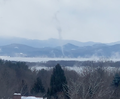
A brief but intense cold wave last February 3 brought steam
devils and funnels over the relatively warm waters of
Lake Champlain. That cold spell hit in an otherwise
warm winter. Despite the hype, there's no 
guarantees on whether it will turn frigid 
later this winter. 
 If you pay attention to any of the click bait weather sites on social media, you'd think we're headed into a new ice age later on in January. 

Oh, we have a sudden stratospheric warming!  The polar vortex is going to go haywire! Incredible cold is going to envelop the Northern Hemisphere for the rest of the winter! We're ALL GONNA DIE!!!!!!

Um, no. Relax, folks. 

For us here in Vermont, and for the rest of the nation for that matter, we probably will see some sharp cold spells in January and February. 

It's winter, after all. Climate change does not prevent subzero cold waves. It just makes them somewhat less likely, 

And honestly, it's incredibly hard to imagine our January will be nearly as much warmer than normal as this December has been. This month will very likely be the second warmest December on record in Burlington. 

THE REALITY

Like all internet hype, there are grains of truth in them and the basic science behind the hype is also fairly accurate. But that doesn't mean a frigid Armageddon.  It just means we'll have interesting weather. Nobody in their right mind is able to tell you what kind of interesting weather we'll see beyond, say New Year's Day.  So we'll have to work with what we have.

To set this up, let's review the basics. First, the polar vortex.  It's a big whirl of cold air in the atmosphere that's always somewhere in or near the Arctic during the colder months. Depending on where the polar vortex is, and how the jet stream is oriented around it, the Arctic air might slip down into Europe, or Asia, or North America. Or it could remain bottled up near the Arctic.

For the most part, the polar vortex has lately been pretty tight and sitting way up there in the far north. That's keeping the bulk of the ridiculously cold air far to our north. That's why it's so warm. 

The jet stream is in the process of reconfiguring itself, so it might get a little colder as we head into the New Year, but it will still be fairly mild. 

The next big thing in the hype machine is that sudden stratospheric warming.  For some reason, in roughly half of all winters, the stratosphere warms up over the far north. It's part of a pattern in which the polar vortex abruptly weakens and gets disorganized. The polar vortex can also stretch out in weird directions and can temporarily relocate it further south. 

When this happens, bitter Arctic air can easily slam southward........somewhere.  Again, could be Europe, could be Asia, could be southern Canada and the United States.

The reason people online are getting the vapors is because there are signs a sudden stratospheric warming might be about to happen.  We're not absolutely sure whether it will happen, but the way signs are pointing, experienced meteorologist wouldn't' be surprised if it does in the next couple of weeks. 

The effects of this on the ground are delayed a bit. So whoever loses the luck of the draw - if anybody - in this, it won't happen until maybe the second half of January into February. 

On top of all this, we have other factors to consider.  We're in a raging El Nino, which keeps the southern end of the jet stream across the U.S. South active. Will a weirded out polar vortex work in concert with El Nino to direct Arctic cold and blizzards into the United States?   Or will El Nino direct any cold air toward Europe?  

The answer? Dunno. 

But wait, there's more! Other complex factors will help determine whether we have any kind of old fashioned Arctic blast later this winter, or will it be another pffft type of season.  

 Will the weather pattern feature a jet stream blowing hard into the West Coast then heading east across America? That could keep us on the warm side. Or maybe a ridge of high pressure will develop over the Rockies and western Canada. That would send cold air plunging our way. Or maybe there will be blocking high pressure in or near Greenland, which could also make us cold and stormy. Another possibility is a ridge of high pressure off the southeast coast, which keep us in New England mild.

Yeah, it's complicated. 

BOTTOM LINE

It's fun to try to read the tea leaves to figure out what the rest of the winter will be like. I plead guilty to that sort of thing. 

Some weather enthusiasts love to imagine epic East Coast blizzards.  That's all well and good. But some of them are wishcasting - defined as forecasting for the kind of weather they want, and not necessarily what will actually happen. 

Basically, don't believe any forecast you hear that's more than five days out. If you wake up on Saturday morning to hear that a blizzard is coming the following Saturday, ignore it until midweek, and then see whether wintry weather is coming or not. 

Chances are, thet blizzard that one computer model run out of of hundreds spit out will go poof, and we'll just have boring January weather instead.  

Thursday, December 28, 2023

No Surprise: Dense Fog Advisory Up For Northern Vermont

Taylor Park in St. Albans this evening, as seen from the
Lake Street intersection with Main Street. You can 
barely make out the dude walking the dog there
on the sidewalk. A dense fog advisory is in effect.
 A late Thursday afternoon update on the murky weather in Vermont I described this morning

It's gotten worse since yesterday, if you ask me. The National Weather Service agrees.  

At around 4 p.m. today, the National Weather Service office in South Burlington has issued a dense fog advisory for northern and central Vermont through 10 a.m. Friday. 

The fog is thickest north of a weak nearly stationary weather front oriented roughly west to east across central Vermont. South of the front, it's cloudy and gloomy, but visibility isn't so bad. North of that front, it's been foggy all day. 

The fog has been really thick all day here in St. Albans, Vermont. I don't think I've ever seen a day that entirely consisted of dense fog. Sure, we get thick fog for a few hours on some occasions, but all day? I got up at 7 a.m. and visibility was about a quarter mile. It has stayed that way through 4:30 p.m. as I write this. 

My house has a great distant view of Lake Champlain. I haven't seen the lake since dusk on Tuesday. Almost makes you wonder if it's still there. 

At least as remarkably, starting at 9 a.m. yesterday the visibility in Burlington has been two miles or less, except for a two-hour period late last night when it was four miles. The fog was getting even thicker today as darkness fell, with visibility close to zero in some spots. 

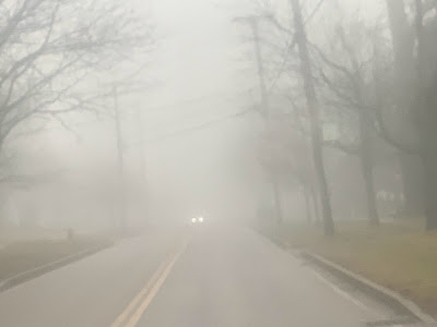
The so-called view through my windshield this
afternoon on Fairfield Street in St. Albans, Vermont. 
I had to do some errands on the road today and the National Weather Service is right. The fog is dense enough that you really have to be careful while driving. 

With the even now thicker fog, you really need to be careful driving, especially on high speed highways like Interstates 89 and 91, or highways that have a lot of curves and hills that can hide surprises.  

If somebody has stopped in front of you, or cuts you off, you won't see it until it's too late if you drive at normal speeds. Drive way slower than usual if you're out on the roads this evening and overnight. 

Also, if you're flying in or out of the Patrick Leahy Burlington International Airport, keep on eye on flight stats.

Some flights have already been diverted to other airports or canceled today and this evening. Flights later this evening were still listed as on time as of 5 p.m., but if the fog persists, that could easily change. 

Chances are the fog will start to get somewhat less dense through late morning and afternoon Friday, but it will stay murky. 

Bad visibility is routine on Vermont roads during the winter. But that is pretty much always due to heavy snow. A long fog attack like this one is new on me. 


One Telling Example Of Why Climate Change Adaptation Is Hard

Aerial view of flooding in Waterbury, Vermont this
summer. Photo from University of Vermont via Vermont Public.
We had yet another flood in Vermont this month.  For the second time in five months, the town of Waterbury was hit especially hard. 

Like many communities in Vermont - and around the world for that matter - Waterbury is trying to figure out how to adapt to climate change. 

The town is built in large part in the Winooski river flood plain. Wetter and more intense storms are making the Winooski more likely to flood, and that trend will continue well into the future. 

It's literally sink or swim for Waterbury. 

Recent events, though, demonstrate how hard it can be to adapt. Even seemingly simple, relatively inexpensive ideas are easily shot down. 

After the severe flooding in Waterbury from Tropical Storm Irene in 2011, town officials began to seek ways to mitigate future disasters. One idea in particular popped out.

As Vermont Public reports:

"Experts quickly identified a straight forward project that could provide huge relief for a modest expense. They determined that a small field in neighboring Duxbury sat at a crucial spot on the river, and that building a floodplain in the field could dramatically reduce flood levels a mile away in Waterbury Village.

For $3 million, the project would reduce flooding in downtown Waterbury by as much as 12 inches and prevent millions of dollars of damage to homes and businesses, officials said. 

Better yet, converting the field into a floodplain didn't require knocking down a home or any building. And Waterbury taxpayers wouldn't suffer much of a hit - FEMA would pick up 75 percent  of the cost, and officials hoped to secure grants to spare taxpayers the 25 percent local match."

There's a choke point on the Winooski River in Waterbury a little north of the Winooski Street Bridge. At that point the river runs between the private property and railroad tracks near and parallel to Route 2.

Somewhat elevated land on both sides of the river at that spot means the river can't spread out. It creates a sort of dam that eventually releases a crapload of water back into the town during severe rainstorms.  The idea was to lower land owned by the Harvey family so the water would spill onto that property, which would spread out the water and reduce flooding in the village. 

The problem is that somebody owns that private property in Duxbury. 

That would be the Harvey family, who have lived  on an adjacent property for more than a century. Vermont Public says the family would have kept their land, would have been paid an unspecified price for its use, or may received another piece of land for allowing the project to happen. 

To be fair to the Harveys, they need that land. It's a big part of their livelihood. They train and pasture horses on the parcel that would face more frequent inundations under the plan. So they wouldn't entertain the idea of turning their land into more of a flood plain to potential reduce trouble in Waterbury. 

Vermont Public goes on: 

"They have used the field, which is less than 10 acres to train racehorses, and feared that if it flooded more frequently, it wouldn't be usable. Maureen Harvey told Vermont Public recently.  They were also skeptical of the project's purported benefits. 'I'm not saving the world, I'm not saving Waterbury,' Harvey said. 'It's not a plan that really, I don't think, in the long term is going to do squat.'"

I can understand the Harveys' point of view.  It can be hard to imagine how the plan would work if you're not a hydrologist. That's not to say the experts are wrong about the potential benefits of the plan. They probably are correct. It's just hard to picture it. Especially when the plan threatens the use of your land the way you had intend. 

The State of Vermont could have played hardball. They could have seized the property under eminent domain by declaring the land was necessary for flood control projects. But ultimately, state officials declined to do that. 

Vermont Public explains

"The way things work in Vermont is we don't take people's land or force then to do things on their land,' said Roy Schiff, a water resource engineer and scientist who authored the 2013 study that identified the Harveys' field as a potential site for a floodplain."

The Harveys refusal to participate and the state's reluctance to push the issue, probably predicts what will happen when officials try even more complicate flood prevention projects. 

Of course, the December flood added more urgency to the idea of mitigating floods in Waterbury. Once again, parts of the town flooded, including a number of homes on Randall and parts of Elm Streets. 

The Waterbury thing would have been a relatively easy fix. Now imagine what Vermont flood-prone communities need to do when there's a lot more moving parts, and a lot more private properties involved.

Barre is another flood prone Vermont city.  In October, Gov Phil Scott, who grew up in Barre, presented an ambitious major re-do of Barre to flood proof the community. 

It's only a first draft, but as VTDigger describes it, the plan envisions demolishing 92 existing housing units - both single family homes and apartments - in the flood prone north side of downtown. That area would be replaced by parkland and flood plain.

On the edge of this area, above where flood waters would reach, the idea is to building mid and high rise buildings and single family homes, for a total of 225 new homes and apartments. 

Again, it's just an idea. But can you imagine how difficult it would be to get everybody to sign on to this?  Yeah, stay tuned. 

All this is just two examples of the extremely difficult task Vermont has in facing the consequences of  climate change. It's mot just about making a few culverts bigger. Been there, done that. We're going to need to find away to redesign much of the Green Mountain State. 


Vermont/Northeast Mired In Persistent Fog; What Next? Monsters?

Spent sunflower plants add a bit of The Addams family
character amid thick fog in St. Albans,
Vermont this morning. 
 This is certainly a rare spell of weather for Vermont:

Day after day of fog, drizzle, light rain, unseasonable warmth and constant dampness.  Video I took of all this is at the bottom of this post.  

It's beginning to feel like "The Mist," that Steve King movie in which a mysterious fog envelopes a Maine town and big man-eating creatures lurk in the mist. 

Thankfully, the biggest creature myself and Jackson the Weather Dog encountered in our fog-shrouded yard this morning was a rabbit. (Also, no reports of deadly creatures in Maine, which is also engulfed in fog today).

In the winter, weather patterns are usually vigorous, with storms, cold fronts, warm fronts and often cold high pressure systems from Canada blasting through in quick succession. Those changed in the weather, and the gusty winds those changes create, make long sieges of fog fairly rare in a Vermont winter. 

Sure, we have lots of low clouds, overcast and dreary weather this time of year, but not usually nearly as murky as this.  

Although this kind of long foggy spell is rare in a Vermont winter, it's interesting there was a similar bout of foggy, drizzly weather in the Green Mountain State back in early January. 

This time, the weather pattern has been more gummed up than usual, as a large upper level low that has been in the middle of the nation slowly lumbers eastward. It's cut off from the jet stream, so it's taking its sweet time moving. The low is also picking up plenty of Gulf of Mexico and Atlantic moisture, so the air is wet and warm

The overall jet stream is further north than usual, so nothing has been able to flush out our damp air in recent days. (Tuesday afternoon being an exception, when we had a few welcome hours of sunshine after a foggy morning). 

A tangled tree in the fog near Highgate, Vermont Wednesday.

No organized, vigorous storm has been able to form in this wet airflow, so rainfall has been on the light side. Along with the fog, that state of affairs will continue through Friday. 

We'll have bouts of light rain and showers mixed with the fog for awhile today, then a tonight, and off and on during Friday. 

We're still expecting no flooding over this. At least here. Some flooding has cropped up in and near New Jersey this morning from heavy rain, but that's not headed in our direction. 

The light rain here is keeping Lake Champlain elevated, so we'll have some more problems with wave splash over and such when the wind finally picks up. And it will, eventually. 

Relief will start to come in Saturday as the overall air flow over the Northeast begins to pick up.   It'll come from the northwest, too, which means temperatures will drop enough for some snow to fall. 

Not much, but at least a little snow cover will brighten things up a little.  In the valleys, snow Friday night and Saturday will likely be on the wet and sloppy side again. But there won't be much of it, so power failures and tree damage are not on the play book. 

Mountains could pick up a two or three inches of snow by Saturday night, but most valleys, if they get any snow at all, will probably manage an inch or less.

The good news, though, is if the fog hasn't lifted by Saturday, it certainly will by Sunday New Year's Eve.  The early guess on New Year's Eve weather is quiet, and sort of, kinda on the warm side (Highs in the 30s, lows in the teens and low 20s).

Video: Traffic in northwestern Vermont moves through the fog, carefully with headlights on. And the landscape has taken on a ghostly appearance in the mist. Click on this link to view, or if you see the image below, click on that:


Wednesday, December 27, 2023

Tension Between Politicians And Meteorologists Boils Over Again, This Time In Maine

Vermont Gov. Phil Scott, shown here repairing
a neighbor's driveway after July's floods,
seems to work well with the National 
Weather Service when coordinating storm
emergencies. responses. However,
politicians sometimes use the NWS as
scapegoats when an emergency response
doesn't go as well as hoped. 
 "It came without warning," is the usual phrase we often hear after a weather disaster. Be it a tornado, wind storm, or flood, somebody will blame a meteorologist for not telling them danger was coming.

It's true that sometimes meteorologists, who are only human practicing an inexact science, indeed get it wrong. But often, the perception is at odds with the facts.  

So it was in Maine last week. 

The flood we experienced here in Vermont on December 18-19 was bad enough. In New Hampshire and Maine, it was even worse than what we experienced in the Green Mountain State. This was likely the second worst flood in Maine history. Only a 1987 flood was worse.

Which brings us to a tiff between Maine Gov. Janet Mills and the National Weather Service.

As the Bangor Daily News reports:

"'The National Weather Service did not predict five or six inches of rain in any community in Maine,' said Governor Mills Wednesday, speaking at a press conference after touring flood damage in Kennebec County."

But au contraire!

The National Weather Service in Maine rebuffed the governor. The storm was "well-forecasted and communicated in advance, including the potential for rainfall totals of 4-6 inches with localized areas receiving higher amounts," says the NWS.

The NWS noted that it provided forecasts and briefings to local and state officials starting on December 15, more than two full days before the disaster struck. 

"In advance for the hazards that were likely to occur on Monday, December 18, NWS forecasters informed local and state officials in the days leading up to the storm through daily email briefing packages, direct phone  conversation and virtual city and statewide briefings."

The NWS continued in their statement:

"The first flood watch and high wind watch were issued on Saturday afternoon, two full days before the storm. The state of Maine hosts a coordination call Sunday afternoon with NWS forecast offices in Gray and Caribou briefing on the expected flood, wind and coastal flood impacts. Rain began on Sunday bight, and by Monday morning NWS offices had issue flood warnings."

As you can see, the National Weather Service keeps all their receipts. There are many good reasons for this: Those receipts can clear up misinformation regarding their forecasts. 

This really came in handy back in 2019, when then-president Trump said Hurricane Dorian was going to hit Alabama. A National Weather Service office in Alabama refuted Trump's claim. When they got annoying blowback (including through the infamous hurricane Sharpie map) from Trump and his MAGA minions, the National Weather Service was able to prove how their Dorian forecasts evolved. The NWS showed how and why they reassured Alabamans that the storm would be no threat to them. 

There's another important reason for all those NWS receipts after a severe weather event.  If their storm predictions turned out to be even a little inaccurate, the National Weather Service  can use its huge paper trails to figure out went wrong to improve future forecasts. And how to better communicate with local and state leaders, not to mention the public. 

The comments by Maine Gov. Janet Mills were not nearly as egregious as what Trump did there. Her criticism was pretty mild and fleeting. It didn't involve any direct interference in their operations. Politicians almost never go that far. Still,   politicians will sometimes blame the meteorologists and their messengers if they mishandle a weather emergency. 

Those politicians know screwing up a storm response can end their careers. Or enhance their careers, if they handle the emergency deftly. (To be fair to the Maine governor, the National Weather Service offices in Maine DID warn of strong winds, but those winds were slightly stronger than forecast).

Still, efforts by politicians to blame supposedly inaccurate weather forecasts are a tried and true way to go.

When flash flooding from former Hurricane Ida inundated New York City and took 13 lives of residents in the process, then-mayor Bill de Blasio said, 'Here's what we did not know, that we would have literally shocking and unprecedented rainfall," the mayor said after the storm.  "No one projected that coming."

Only they did. The National Weather Service and other local meteorologists spent the days and hours ahead of the Ida flash flood pulling their hair out telling the public that the flooding would be especially severe and scary. 

Here in Vermont, it seems like the state's political leaders have a good working relationship with the National Weather Service. 

Prior to the Hurricane Irene floods in 2011, then-governor Peter Shumlin activated the state's emergency management center. He repeated NWS warnings of impeding severe floods. 

Much more recently, just ahead of, during and after the state's devastating July floods, Gov. Phil Scott kept going out of the way urging Vermonters to take NWS weather forecasts and warnings seriously. 

The day before the floods July 10 floods hit, Scott used National Weather Service's (accurate!) forecasts to declare a state of emergency, deploy swift water rescue teams around the state and warn people to be on guard and to take NWS flood warnings seriously. 

The combination of the NWS flood forecasts, the Scott administration's reaction to those forecasts and media attention to all this likely saved lives. Two people died in the summer floods, which is obviously tragic. But a disaster of that magnitude "should have" created more fatalities. It didn't. The coordinated weather warnings between the NWS and Vermont leaders surely helped. 

The December floods were a bit more complicated. Rainfall was slightly more than the NWS predicted and snowmelt was slightly more intense than expected. So the flooding that emerged that Monday was worse, somewhat catching the Scott administration by surprise. 

But by late morning and early afternoon that day, Vermont emergency managers were on top of it. So was the National Weather Service office in South Burlington.

The bottom line is, the next time you hear politicians and even the public say the "storm came with no warning," check out the receipts from the National Weather Service. Sometimes they do botch a forecast, or don't issue a timely warning. But often, they're just a convenient scapegoat.  

Springtime After Christmas: More Rain In Vermont, Too

Since it was so springlike yesterday in Vermont, I dragged
out my tools and started a bit of early spring garden
cleanup.  It's been remarkably warm this month. 
Honestly, it really feels like early spring.

Yesterday, Boxing Day, had me outdoors on a really nice early April late December day. 

The air had the muddy, organic aroma of spring promise. For the first time in days, low clouds and fog broke up for a few hours to bring us some sunshine. 

The weather surely had many of us wanting go out and start your spring garden cleanup tasks, at least in the corners of the garden that weren't too soggy. Of course that's exactly what I did Tuesday.

It was both nice and disconcerting out there, me with no jacket, comfortable in a thick-ish black t-shirt, primping up at least some corners of the perennial beds. It was only 50 degrees or so, but with light winds and a little sun and getting some exercise, you didn't need to bundle up at all. 

 It was even more strange seeing tentative new fresh green daffodil shoots poking up.  That's the fourth warm December in a row that's happened. 

This ain't your grandfather's Christmas season, that's for sure. 

April, oops I mean December showers returned after dark last evening, and we're back to the fog, gloom, drizzle and light rain we've gotten used to this month. At least it's not pouring, like it has on some occasions in the past few weeks. 

The strange warmth will continue the rest of the week, but will begin to fade toward the end of the week. Temperatures will remain a little above normal through the New Year holiday, but not as warm as today and tomorrow. 

Daytime highs are not extreme.  The thick clouds today and tomorrow will hold us in the 40s, which is about 15 degrees on the warm side. Records for warmest daily lows for the date are in jeopardy today and tomorrow. Many of us won't go under 40 degrees until Thursday night. That's insanely warm. About average for early May. 

Rainfall will keep coming and going amid a complex mess of weather disturbances meandering around and near a sprawling upper level low pressure in the Midwest, heading toward the southeast as forecast.

No one system will really wind up to provide any huge dumps of rain.  So we'll deal with the risk of periods of light rain, especially this afternoon and during the day tomorrow.  There's no worries about flooding. 

By Friday, at least some of the higher elevations will see a return of some snow, though nothing heavy. We might eventually see dustings of snow in the valleys, too.  Gee, what a shock for New Years.

Long range forecasts suggest that January will be more wintry than December has been. Then again that's an awfully low bar. 

All this winter warmth is not to say frigid weather is impossible. We can still get bitingly cold months here in Vermont.  It's the luck of the draw. As recently as January, 2022, we had a much colder than average month with numerous days below zero.

But with climate change, those bitterly cold months will be less frequent.  The dice that decide whether it will be a cold or warm month are now definitely loaded in favor of the warm side. 

You're a lot less likely to be able to tell your grandchildren you trudged through four feet of snow on your walk to school, uphill both ways.  

Tuesday, December 26, 2023

Rainy, Foggy Christmas Week Unwelcome In Vermont During Oddly Warm December

We've had a lot of rainy days and nights in Vermont this
month, like this scene in downtown St. Albans, Vermont
on December 10. Another unwelcome rainy spell is hitting
tonight through Thursday. 
 Early this morning, fog blanketed much of the Northeast, including Vermont. In some places, it was freezing fog so there might be a slick patch or two on the roads until  mid-morning.

 At least you might have caught a glimpse of some very pretty frost on the trees left behind by the sub-freezing mist.

At least before all that melted.  

It was a warm and rather dark Christmas Day in the weather department, and that trend is going to continue most of the week.

 I almost wrote "moist of the week" which is actually a pretty accurate description, too. Which is unfortunate for vacationers wanting  ski week in Vermont.

The ski areas are all of course open, and they made snow when they could. But it's not like there's deep powder anywhere. 

I suppose the best day you'll have for winter recreation is today.  After the fog lifts this morning, it'll be cloudy, but rain-free. Temperatures will be very warm again for the season, reaching the 40s. Even at most of the ski ares. 

Next up is a long lasting, complicated period of wet, inclement weather for us. It'll be rain, even up on the mountain summits,  until possibly toward the end of the week when a little snow might mix in. We shall see.

The root of all the wet warmth in Vermont this week is a large, swirling upper level low in the middle of the nation. It's the one that is causing a blizzard and ice storm in the central and northern Plains

Rain should spread into Vermont this evening, continue overnight at least off and on through Wednesday and probably Wednesday night. At first it'll be spottier the further north and east you go, but by Wednesday afternoon, everyone should be into a soaking rain again.

But not that soaking. Unlike the last storm, which causes serious flooding across Vermont and the rest of northern New England, this one won't be nearly enough to cause any serious worries. Rivers will probably go up a bit, but not hit flood stage.

Even if this storm ends up surprising us with more rain than forecast - like the last one did - we still don't really have much to worry about with flooding. We won't have nearly the amount of rain we did a little over a week ago. 

The exception to the no flood forecast might be Lake Champlain. The rain and runoff could push it toward or even minor flood stage of 99.5 feet by later in the week.  Above 99 feet, the lake can cause problems with waves, erosion splash-overs, especially on windy days. As we well know, it's often windy this time of year.  

When it gets below freezing the waves and splash over can ice over nearby roads, which is what happened last week. 

But that's a problem for a few days down the road.

As the large whirl in the atmosphere keeps slowly drifting toward the south and east toward the southeastern U.S. coast, it's kind of hard to tell how it will interact with other weather disturbance passing by to the north of it. 

In general, it will start to turn cooler, but not abruptly cold Thursday into Friday.  Some lingering rain and/or snow is a good bet on those days, but at least as far as I can tell, it's pretty hard to tell at this point how much. 

But at least the mountains have a shot at regaining a little of the snow lost last week and during the war, rainy spell we're getting into now.

STRANGE WARMTH

For now, the main oddity of this whole storm system is how warm it is. Daytime highs won't get anywhere close to recor highs. But following a trend we've seen all this year, really, nights have been and will be strangely warm this week - well above freezing. New records for highest minimum temperatures will probably be set. 

The temperature at Burlington rose above freezing at 10 a.m. Saturday and will stay above 32 degrees until later Thursday night at the earlier.  Nearly six continuous days above freezing in the depths of winter! 

For comparison, record lows in Burlington this time of year are in the 20s below zero. 

 At a time of year when subzero temperatures are routine, the coldest it's gotten so far in Burlington is a comparatively balmy 14 degrees. It looks like that will be the chilliest temperature this entire month. It's a very rare December that fails to get into the single digits above or below zero at least a couple times.  

The only December that compares to this was the bonkers warm month of December, 2015, which is by far the warmest on record. 

It looks like this December will end up being Burlington's second warmest and second wettest on record, but I'll have the final say on this when complete stats for the month are available on New Years Day. 

 Temperatures will be closer to normal  heading into the New Year and during the first week in January, but not downright cold. I'm sure we'll have a spell of frigid, subzero cold eventually, but so far, it's not in the cards for awhile, anyway.

Monday, December 25, 2023

Atmospheric Rivers, Famous On U.S. West Coast, Are A Peril To East, Including Vermont, Too

The atmospheric river that caused the big New England
flood of December 18-19 turned the tiniest stream
in front of my house into a raging river too.
 The December flooding that befell New England, especially Maine, New Hampshire and Vermont, was largely the handiwork of an atmospheric river.  

If you've heard of atmospheric rivers, you probably associate them with storms that sometimes slam into the West Coast during the winter. 

But these so-called atmospheric rivers can come off of the Atlantic Ocean or Gulf of Mexico, too. As we've seen lately, these sometimes have disastrous results. 

As the Washington Post describes it in an article published Thursday: 

"Atmospheric rivers - jets of intense precipitation that curl around powerful ocean storms - are generally considered a West Coast phenomenon. But it turns out a top tier atmospheric river - rated Category 5 on a scale of 1 to 5 - was part of the East Coast storm that killed at least five people and cut power to more than 800,000 customers this week."

Every state along the eastern seaboard from Florida to Maine - including Vermont - saw at least four inches of rain and wind gusts of over 50 mph. 

The December storm will almost certainly join the long list of weather disasters this year costing $1 billion or more. 

Atmospheric rivers are long narrow corridors of deep tropical moisture that are pulled into the mid-latitudes by storms. These atmospheric rivers usually aren't that wide in the grand scheme of things. The one that just hit us in New England was probably about 400 miles wide.

But they can be thousands of miles long. Some of the atmospheric rivers that strike the West Coast extend as far west as Hawaii, which is why those storms are often dubbed a "Pineapple Express."

The distance between Los Angeles and Honolulu by the way is about is about 2,500 miles.

The reason we hear so much more about atmospheric rivers on the West Coast than elsewhere is because of geography.

The West Coast atmospheric rivers that come generally west to east across the Pacific encounter California, Oregon and Washington with land that rises from sea level to mountains in perpendicular to the flow of this wet air.  

That atmospheric rivers collision with mountain ranges such as the Sierra Nevada forces the air to rise.   The rising air forces all that moisture in the atmospheric river to condense in rain and snow, which dumps big time on the Pacific coast. 

One reason why the December flooding was actually worse than the already bad inundation in Vermont was for the same reason California gets slammed by those atmospheric rivers,

The one last week that came off the Atlantic approached New England from the southeast. The air flow was only partly perpendicular to the north/south oriented Green Mountains, so the rising air releasing moisture was impressive, but not as efficient as it was in New Hampshire and Maine.  

Map shows strong atmospheric river hitting the Northeast
and a weaker one hitting California on December 18.
Map and data from the Center for Western Weather
and Water Extremes. 

The White Mountains of New Hampshire and the mountains of western Maine run generally southwest to northeast. That was a perfect arrangement to wring out the most rain possible.

Other historic storms in New England - including Vermont  - were products of atmospheric rivers.   The Great Flood of 1927 in Vermont also stemmed from an atmospheric river off the Atlantic Ocean. 

In some unlucky years, you can have multiple atmospheric rivers. In October 1996, an episode caused severe flooding in eastern New England, and another one in November the year triggered serious flooding in eastern New York.

Atmospheric rivers can also cause flood disasters far from a coastline. One such event in May, 2010, caused what was probably the worst flood in Tennessee history. 

These atmospheric rivers are surprisingly common along the East Coast, actually. One estimate pegs the number per year to about 40 in the Mid-Atlantic states, though they are seldom severe enough to cause significant flooding. 

Atmospheric rivers are categorized in a one to five ranking system, similar to tornadoes. Not surprisingly, the one we had on December 18 was a Category 5, the most severe you can get. 

But here's something to worry about. As the Washington Post points out, atmospheric rivers have been around ever since there was an actual atmosphere on Earth.

Climate change, though, is tending to make them worse, in general. Per WaPo:

"....data suggests they're becoming wetter. Winter is the fastest-warming season run the Northeast and Mid-Atlantic, and warmer air can hold and transport more water and thus release more of it. In fact, for every degree Fahrenheit the air temperature rises, the air can hold 4 percent more water. Most atmospheric rivers happen in the cool season."

The bottom line for us in Vermont is: Most atmospheric rivers will remain tame and not cause too many problems. But a growing percentage of them will cause trouble, expense and danger like the one a week ago did. 


Sunday, December 24, 2023

A Little Travel Trouble In Vermont This Morning, Big Time Mess In Plains

It was sprinkling and barely above freezing in St. Albans,
Vermont when I took this photo, but that break in the
cloud hinted that it would stop by afternoon.
 There was a teeny, tiny bit of freezing rain and schmutz in Vermont overnight. Meanwhile, a nasty storm is brewing for Christmas in the middle of the nation. Let's take Vermont first

VERMONT GLAZE

But even the lightest of icing can cause real trouble, and that was the case early this morning in the Green Mountain State and in adjacent New York and New Hampshire. 

 Most places around the region received a trace to 0.05 inches of precipitation overnight, which is a trifle. 

But that's enough to really ice up the pavement, and such was the case overnight and early this morning. 

The VT Roads group on Facebook was reporting widespread glare ice on northern and central Vermont roads overnight. There were a few crashes and incidents here and there, including a vehicle going into a ditch near the Fairfax Dam on Route 104, and other slide offs in Milton, Westford and other towns. 

Things were starting to improve as of 7:30 a.m. Sunday.  Some roads have been treated,  Other roads in the warmer valleys were just wet as of 7 a.m. But untreated roads statewide, along with driveways and sidewalks are glare ice. 

Scattered areas of very light sprinkles of rain, freezing rain, sleet and snow were still around Vermont as of 8 a.m. and that will continue to some extent most of the morning. I'd postpone doing any driving or walking this morning until after 10 or 11 a.m., when temperatures in most areas should be above freezing. 

We don't expect any travel trouble for the rest of the Christmas holiday in Vermont after this morning but I can't say the same for other parts of the nation.

BLIZZARDS AND FOG, OH MY

Last Christmas gave the nation a travel meltdown as a massive pre-Christmas storm fouled up airline flights pretty much from coast to coast. You might remember the Southwest airlines mess last Christmas holiday. They canceled thousands of flights and stranded 2 million or so travelers, sometimes for days. 

This year isn't nearly as bad, but there is travel trouble to talk about.

The biggest problem looks to be around swaths of Nebraska and South Dakota, where blizzard warnings are up for Christmas Day and on Tuesday.   On Christmas, only emergency travel is recommended as seven to 15 inches of expected new snow will be propelled by winds as high as 55 mph. 

In the eastern half of the blizzard zone, some freezing rain could be mixed in at times, which would make things really fun. If there is freezing rain, it's most likely in eastern South Dakota and western Minnesota.

Elsewhere, dense fog was an issue around the Great Lakes this morning. I'm sure that's delaying or canceling a few flights. 

It could be worse. As of 8 a.m. Flight Aware reported 96 cancellations within, into or out of the United States. Chicago Midway was the worst, with 13 percent of flights canceled and 11 percent delayed. Visibility was down to a quarter to a half mile overnight at Midway, which explains the flight trouble.

The fog around the Great Lakes is forecast to at least partly lift during the day. 

Overall, though, it could have been worse.  Some Christmas holidays are a lot stormier.

Saturday, December 23, 2023

Scenes From A Vermont Flood, In Photos And Video

The Lamoille River blasting through Fairfax Falls
near Cambridge, Vermont on December 19
 It's odd to see a serious flood in Vermont in the early winter. 

This  year, though, it happened.  Weather geek that I am, I documented it with photos and video. 

Photos are first, and below those are two videos. One shows the Winooski river in various spots between Richmond and Winooski. The other shows the Lamoille River between Cambridge and Milton. 

Severe flooding in Vermont is obviously unwanted. Especially during the Christmas season. 

I don't want to say anything positive about the disaster. Except that, since we had to endure it, there was an almost stark, terrible beauty about it. 

The landscape was on the edge of winter. But there was water everywhere. The sounds and odor of rushing, flooding river water is what we expect during the spring thaw, or after extreme summer storms, or while an errant late summer or early autumn tropical storm passes through Vermont. 

Somber December colors lit up with glimpses of sun
and blue skies during this week's flooding. This
is at submerged North Williston Road between
Essex and Williston, Vermont. 
This time, it hit while Vermont should have been freezing up and whitening up with snow.  

The flood hit just a few days before the winter solstice, the darkest time of year. 

The flood went on to make things even darker. Even as glimpses of sun and snow flurries mixed in with the images of high water. 

It was a strange disaster, but I guess in the age of climate change, we now have to expect more and more weather weirdness. 


Only a boat would have gone the speed limit of 35
mph on North Williston Road during the December 18-19 flood.


The Winooski River blasts past buildings in Winooski,
Vermont, as seen from the Chase Mill in Burlington on
December 19, 2023   

The Lamoille River comes perilously close to a house
in Fairfax, Vermont during snow showers on Dec 19, 2023.    

The Lamoille River blocking access to the "Wrong Way Bridge"
area of Route 15 in Cambridge, Vermont while damaging
properties on December 19 2023.     

TWO VIDEOS

First video shows flooding along the Winooski River at various locations between Richmond and Williston, Vermont. Click on this link to view the video, or if you see the image below:


The second video also shows serious flooding, this time along the Lamoille River between Cambridge and Milton, Vermont. Again click on this link to view, or if you see the image below, click on that:


Minor Weather Annoyances, But Mostly Smooth Sailing Through Vermont Christmas Holiday

The elves at the North Pole leaked this photo of just a 
tiny, tiny, tiny percentage of presents Santa has prepared to
deliver to Vermonters. Although there might be
some low clouds and a little fog Christmas Eve,
Santa, guided by Rudolph's nose, will have 
absolutely no weather trouble with his 
Vermont deliveries to children across the state and beyond.
 It's Christmas Eve Eve this Saturday, and I'm sure people are doing their last minute holiday shopping. 

I heard it was a zoo in and near many Vermont downtowns and shopping malls on Friday, and I expect the same today. And Sunday, Christmas Eve.   

We still don't have too many weather problems to report for this holiday, but as always, there are some minor complications.

After a spell of relatively cool weather, it's turning mild again, and it will stay that way through Christmas Day and beyond. The chances of a white Christmas still look bleak. 

And the skies will be rather gloomy much of the time as well.

The deets:

SATURDAY/SATURDAY NIGHT

Expect clouds all day as temperatures creep up to a little above freezing by afternoon.  

One little issue comes through this evening and tonight. A weak, dying storm is heading in from the west. It seems destined to drop just a little scattered snow, sprinkles and freezing rain sprinkles across much of the area, especially south and west of Interstate 89.

This isn't a huge deal at all, but it could be enough to cause some spotty icy spots on the roads between late this afternoon and midnight tonight. Just be aware. 

CHRISTMAS EVE

Warm, but gloomy, but no real weather issues. Under overcast skies temperatures should rise to near 40. That would melt the tiny bits of snow on the ground in some valleys in Vermont. 

 Clouds and maybe a little fog will probably last into the night. But the low clouds and light fog will be no match for Rudolph's nose and Santa's sleigh.  Old St. Nick will be able to deliver his presents to Vermont children without any trouble at all. 

CHRISTMAS DAY

Forecasters are going with partly sunny on Christmas Day, but I'm a little skeptical on how much the clouds clear out. Many spots in Vermont could stay cloudy all day.  If it gets sunny, as it might, consider that a bonus. 

It will be really warm for this time of year, so it'll be easy to go for walks to work off any Christmas feasts. Highs should make it into the low 40s, with upper 30s in the higher towns. No rain or snow or schmutz  is in the forecast on Christmas.

WARM AND WET OUTLOOK

This will be another long warm spell, especially during the nights. For instance, temperatures will barely hit 32 in the Champlain Valley tonight, and are then expected to stay continuously above freezing from early Saturday morning through Thursday evening. That's an oddly long time for that kind of thing in late December. 

Highs through the period look to be in the 40s. That wont break any records, but it's still toasty for this time of year,

Even worse, it appears we have another rain storm to deal with. Rain seems likely from later Tuesday through Thursday. 

Unlike the last storm, the rain won't be especially heavy - much less than we saw on Monday.  Plus there's not that much snow left to melt. Which means we're NOT in for another flood, thank goodness. 

But rivers will rise just a bit, but stay in their banks. And it will keep Lake Champlain near minor flood stage. The worst of it is that the rain will hit even in the mountains, so that's bad news for the ski areas and other winter sports venues.

If you want winter weather to finally arrive, there's a glimmer of hope. If long range forecasts turn out to be true, a somewhat colder, but not super stormy weather pattern could hit as we welcome the New Year. 


Friday, December 22, 2023

For Sixth Month In A Row, World Shatters High Temperature Record

The world was red in November, meaning most of it was
warmer than normal. In fact, despite chill in Antarctica,
November was the world's warmest on record.
So far, December is looking toasty, too.
Another month, another month of insane global high temperatures. 

I didn't get a chance to write this up recently as I was all in with this weeks Vermont December flood. But a week ago, the National Centers for Environmental Information released its report on the world's climate for November, 2023.

November was by far the world's warmest, coming in at 0.7 degrees Fahrenheit above the previous record set in 2015.  Breaking a temperature record by less than 1 degree sounds like a trifle, but on a global basis, setting a new mark by that margin is insane.   

This was the sixth consecutive month that a new world record was set for hottest monthly temperature. It was also the eighth consecutive month that global sea temperatures hit a record high

For those of you keeping track, if you are under the age of 47, you have never seen a global November that was cooler than the long term average.

Given this string of records, 2023 is pretty much assured of being the hottest year on record. That's especially true given that December around the world so far has been wicked toasty, too.

The fact that 2023 will be the warmest year on record is a bit of a surprise. As the year opened, experts knew an El Nino was on the way. El Nino boosts global temperatures. As I've noted ad nauseam at this point, El Nino is working in concert with climate change to boost global temperatures. 

But early this year, the thought was that the full effects of El Nino wouldn't be felt until 2024. So, eleven months ago, the idea was 2023 would be wicked warm, but we'd have to wait until 2024 to see a new record warm year.

So much for that idea. 

In November, the warmest areas compared to average was much of the Arctic, Alaska, northwestern and central Canada, Siberia, eastern Europe, the Mideast, central Africa and central South America. Also, the eastern and central Pacific, thanks to El Nino.

There were a few tiny glimmers of hope. 

As Antarctica was heading toward its summer, November for most of that continent was actually decidedly cooler than average. That probably slowed early season ice melt a little bit, which is great. The Antarctic coolness does very little to slow ice loss and sea level rise, but any last it was a teeny, tiny break for the world. 

The only other relatively cool areas in the world in November were a zone centered on Mongolia, the North Sea, and an area of the Pacific Ocean southwest of South America. 

Also, there were only four tropical cyclones in the world during November, the lowest number since at least 1981

Another minuscule bright note is that the El Nino that is working in concert with climate change to boost world temperatures to record levels might end sooner than many experts anticipated. 

As Fox Weather reports, El Nino, which has been boosting global temperatures in concert with climate change, might wane a bit prematurely.  Says Fox Weather:

"NOAA's latest forecast now suggests El Nino may be over as soon as April - a month earlier than last month's forecast. The probability of El Nino conditions remaining in April has dropped from 62 percent to 37 percent."

A few months after El Nino ends, the sharp increase in global temperatures we've seen during this phenomenon will probably tend to level off. If we eventually flip to a cooler La Nina phase, global temperatures would probably end up a tiny bit cooler than the record levels of 2023 and the expect record high levels of 2024.

That's not exactly big relief. Even during the theoretical "cooler" La Nina conditions that might hit by 2025, global temperatures will probably remain stuck a little above the levels of the La Nina years of 2020 to 2022.

As we know, climate change crises such as wildfires, record, deadly heat waves and unprecedented storms continued in 2020-22, because global temperatures were well above those of the 19th century thanks to climate change.

We should expect more of that kind of awfulness no matter whether we're in an El Nino or La Nina.