Sunday, July 31, 2022

Kentucky Flash Flood Weighs On Me More Than Most Other Climate Disasters

Like most Americans, I'm in shock and in mourning over this past week's mega flash flood in Kentucky. 

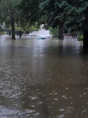
In a photo posted on Twitter by @ShawnRichards,
a 98-woman is trapped in her flooded 
Kentucky home. She was later rescued
and is now reported to be safe.
At last report, the confirmed death toll is at 26, including four children.  More are missing and the death toll will rise.  These stats are awful, but don't haunt me as much as the photos from the flood zone. 

There was one pic on social media showing a 98 year old woman trying to balance on a chair floating in three feet of water inside her Kentucky home. (She was later rescued and was reported to be safe). 

Or a road that once had a row of house. The houses are gone now, leaving behind a couple concrete slabs.  What happened to the people in those houses?

The flash flood hit in the middle of the night. Eight inches of rain poured down on steep terrain already waterlogged by repeated rounds of thunderstorms in the past month. This was the second 1 in 1,000 year flood to hit a part of the United States within a week. (St. Louis was hit a couple days earlier).

The timing of this cataclysmic flood could not have been worse. It was the middle of the night. Maybe the sound of the initial downpours roaring on the roofs that evening lulled people into a relaxing sleep. They certainly weren't ready to hear the flash flood warnings. Plus, the water came so fast, who could react in time?

Walls of water and mud poured off the slopes in the darkness. Victims awoke to the sound of rushing water and debris flowing into their homes, or making their homes float away while they were inside. It had to be beyond terrifying. You couldn't see in the darkness, you couldn't find your loved ones as the cold water and debris battered their houses, and their bodies. 

That hundreds of people have been rescued is in itself a miracle. And a testament to the bravery of Kentuckians who went out on this rescue missions.

The Kentucky disaster affected me more than most of the other stream of climate related disasters we've had this year, and in the past few. Yes, this one was probably climate driven. Heavy rain storms are now heavier under a climate change regime. What might have been a problematic flash flood a few decades ago was catastrophic now. 

First of all, it's not like Kentucky needed another storm crisis. 

As the New York Times reports in this run on sentence: 

"'I wish I could tell you why we keep getting hit here in Kentucky,' Gov Andy Beshear said during a briefing in which he updated residents on the rising death toll and displayed a sense of anguish and exhaustion that many in the state have felt after recurring disasters, including a powerful ice storm last year that cut off power to 150,000 people in eastern Kentucky, a flash flood last July that left many stranded in their homes and a rare December tornado that carved a nearly 200-mile path of destruction that killed 80 people."

The other disasters, and this week's flood in particular, hit people that have even fewer resources to deal with kind of thing that most people. 

An irony of the Kentucky flood is it hit coal country. But the coal industry is now greatly diminished, as the world works toward finding other sources of energy other than things like coal, which contribute greatly to climate change. 

This declining coal industry left Appalachia, including the flood zone, even more impoverished than it was before. Which means the people suffering most from this disaster the fewest means to recover from it 

And no, before you leap to conclusions, I'm not blaming the former coal miners and their families for the flash flood that just ruined their lives. They are innocent in this whole thing.

This terrible flood hit kind of close to home for me, too. I grew up in Vermont, which at first glance cannot seem more different than the hollows of eastern Kentucky. 

You can see in the news footage that this flood did not hit the kind of quaint, prosperous and pretty villages Vermont is famous for. The disaster zone was pretty gritty even before the first drops of rain fell last week. 

But there really are a lot of similarities between Vermont and eastern Kentucky. I grew up in West Rutland, Vermont. Don't get me wrong, West Rutland is a wonderful small town. But it's not touristy Woodstock or Stowe. It's decidedly working class. People in West Rutland don't have million dollar bank accounts handy to recover from setbacks. 

And it's surrounded by steep mountains. There's also a lot of winding back, gravel roads and blacktop rural lanes that wind up and down these hills. Modest houses, many more than you'd think, are hidden in these woods. I just pictured the same storm that hit Kentucky roaring through West Rutland and environs. And shuddered. 

Most other areas of Vermont, away from the tourist destinations, are very much like West Rutland.

We're certainly not immune from these terrible flash floods. Vermont has essentially the same terrain as eastern Kentucky. It's easy for heavy rains to prompt terrible flash floods and we certainly have a history of those. November, 1927. September, 1938. June, 1973. August, 1995. July, 1997. June, 1998. the spring floods of 2011. Tropical Storm Irene, August, 2011.

Those floods all caused tremendous damage in Vermont, and some of them resulted in deaths. There's videos on YouTube of serious Irene flooding in West Rutland. 

But climate change ups the ante. It could even possibly be much worse than that video taken from a truck splashing through 2011 West Rutland flood waters. The Kentucky flood was "impossible" until it happened. Other impossible extremes are also happening. Will the impossible happen in Vermont? I really don't know. 

My mother died in May, and now the West Rutland house where she lived and where I grew up in is up for sale. A nice young couple is interested in buying it. The house isn't near any creeks or streams. It's on a hill, not a flood plain. I don't recall it ever suffering any kind of flood damage. 

But the stakes are now higher. If this couple buys the house, I don't think they'll ever have to deal with flooding. If they buy, I hope the enjoy the place for many, many years.

But suddenly, I no longer am that sure that house will survive a climate disaster. Or my house in St. Albans, Vermont. Or anybody else's house for that matter.

It's not that I stay up all night worrying about it. But that thought is in the back of my head. And if we're honest, it's in the back of many people's heads. It probably was for some of the flood victims in Kentucky, and then the nightmare became a reality. 

The chances of an "impossible" weather calamity hitting any individual is low. But unlike in past decades, the impossible is now possible. As Kentucky and St. Louis demonstrated last week.


Saturday, July 30, 2022

Beginning The Long Slide Toward (Ahem) Winter, But In No Hurry

A sign that the season is progressing. The hydrangeas
near my lower deck start out white, and are now turning
pink as we head toward late summer. By autumn,
they'll be a nice russet color. 
 If you look at what are considered average temperatures, we began our slide toward the depths of winter on Friday.  

Don't worry, the National Weather Service will not be issuing winter storm warnings anytime soon.  Heat advisories, maybe, but no winter stuff. 

Still, what is considered the normal average temperature on Friday was 72.5 degrees, down every so slightly from the 73 degree "normal" readings that were the summer peak throughout the middle of July.

Of course, the downward trend will continue - slowly at firs - then more rapidly until it bottoms out in January. 

There's plenty of summer to get through, though. August can be hot, as we know. The weather pattern suggests that for now, we're not going to see much of a cooling trend.

In fact, today might well be the coldest day we'll see in Vermont through mid-August. Not that you're going to freeze. Afternoon highs today will be in the 70s, with the warmest spots maybe touching 80 degrees. 

That's maybe a couple degrees cooler than average, but definitely not autumnal. Tonight will be comfortable, too.  Definitely a nice day, with sun, and some puffy clouds mixed in. And a nice breeze.

Then it heats up.

The dreaded heat dome that's been drifting around the nation all summer is back at it.  The heat this week and weekend is focused on the Pacific Northwest, where dozens upon dozens of new high temperature records have been set. It's also an unusually long heat wave for them, lasting a full week. Which makes the heat especially dangerous. Four heat related deaths have already been reported in Oregon. 

But that heat dome wants to expand and slosh eastward next week. That'll finally cool places like Washington and Oregon down a bit. But the nation's middle will turn torrid again. The expanding heat dome, with an assist from the Bermuda High out in the Atlantic Ocean, will ensure most of the Uniteed States, including Vermont stay toasty for at least the next week or two.  

Luckily, we're far enough north so that occasional weak cold fronts from Canada through mid-month will on some days blunt the heat here. For the next couple of weeks, it looks like some days in Vermont will be hot, other days will be merely warm and a little uncomfortable. For the upcoming week, the hottest days look to be Monday and Thursday. 

Enjoy it while it lasts. Before you know it, you'll be reading about wind chill and winter storm watches in this here blog thingy. .


Friday, July 29, 2022

Thursday Storms: Not Much Severe, But A Few Impressive Rainers

Bicyclist caught in a thunderstorm with a rainfall
rate of two inches per hour Thursday in 
South Burlington, Vermont. 
UPDATE:

Data that came in later this morning show that Chittenden County storm was definitely an exception with yesterday's storms.

The most precipitation reported in the state was 2.93 inches in Shelburne.  Many Vermont towns only reported around a tenth of an inch of rain, with a few places getting just a trace.

So the needed rain yesterday was more miss than hit. Which is too bad. We could use a more widespread rain, and nothing major is in the forecast.

PREVIOUS DISCUSSION

It turns out severe thunderstorms were few and far between across Vermont yesterday, but some of the storms that developed contained some really impressive rains. 

Severe weather was less widespread than expected, which of course is a good thing. The storms really began to crank up as expected around noon or shortly after in New York's St. Lawrence Valley and in western New York.

Then, they storms faded for some reason in the Adirondacks and western Hudson Valley of New York.  As the storm remnants approached the western Champlain Valley, they blossomed again to give some of Vermont -  not all - quite a torrential downpour. 

The storms were strong, but mostly didn't reach severe levels until you got to eastern Vermont. Storms in South Strafford and Perkinsville, Vermont did knock over several trees.

One particular storm had some of the most impressive rain rates I've seen in Vermont.  (Luckily, I was able to position myself in it. Video is at the bottom of this post). It came across Lake Champlain while strengthening and moved through Shelburne and South Burlington, then on into Williston and Jericho. 

The storm clipped the National Weather Service office in South Burlington with an inch of rain. Just a mile or two south of that, though in South Burlington closer to the Shelburne order, 1.75 inches fell in less than an hour. A rain gauge in Williston caught 2.3 inches.

In Jericho, a whopping 1.7 inches came down in 25 minutes. In the Nashville section of Jericho,  two inches fell in just 55 minutes. 

Traffic fights its way through near zero visibility in
torrential rain Thursday in South Burlington, Vermont.

Had it not been dry beforehand and had the storm lasted a little while longer, there could have been a damaging flash flood with this storm. 

Luckily, the storm moved forward at a reasonable clip, so the rain in any particular location stopped before causing too much damage. There were some driveway washouts, problems on the edges of gravel roads in parts of Chittenden County, and street flooding in South Burlington and Williston. 

As always, the storms and their rain was hit and miss.  I collected a respectable 0.8 inches in St. Albans, Vermont. Montpelier logged just 0.33 inches. 

Also, since the rain was so torrential, those that did get nailed saw most of the water run off instead of soaking into the ground. 

That's too bad, because it's still too dry in most Vermont, especially east of the Green Mountains. Chances of rain don't look great for the next week or so. 

I suppose there could be an isolated shower this afternoon, especially close to the Canadian border, but most of us won't get wet and the few who do won't receive all that much rain.

The next chance of showers and storms is Tuesday, and so far, I'm not impressed with the potential strength of that weather system. 

Hot weather will make a return, too. Saturday will be pleasantly cool and dry. Sunday morning will start off fresh too, but by afternoon it will be relatively hot, but still dry (mid to upper 80s)

We have a shot at a possible 90 degree day Monday before the heat dials back just a bit and temporarily Tuesday and Wednesday. Chances still look good of a hot end to next week. 

Video: Storm strengthens on approach to South Burlington, Vermont, results in incredible rain rates, street flooding. Click here to view, or click on the image below: 


Thursday, July 28, 2022

Another Day, Another Huge Flash Flood Disaster, This Time Kentucky

Hindman, Kentucky this morning amid massive flash floods
 Two days after up to a foot of rain swamped St. Louis and environs, another extreme flash flood has hit eastern Kentucky. 

It was pretty much a worst case scenario: Up to ten inches of rain poured down on already waterlogged, rugged terrain in the middle of the night, sending walls of water through hamlets in the valleys below. 

As of this writing the extent of the loss is just beginning to be assessed as communications are cut off and roads are impassable. I greatly fear loss of life, as it's clear a number of homes and cars were swept away and disintegrated in the extreme flash flooding. So far one death has been confirmed, but that number could easily rise. 

NBC News says about 20 people are unaccounted for in just one county, but it's unclear if it's because people can't reach the area where the people are, or whether they are in jeopardy. 

Early video from the disaster zone shows houses crunched up against trees or embankments, or completely missing. Piles of wood that might have been houses are along the shores of creek beds that are now receding. 

In some ways, this disaster isn't a surprise.  Serious flash flooding had been expected in the Tennessee Valley and central Appalachians all week.  The threat is not over at all.  Torrential downpours are expected in many of the same areas today and tomorrow. 

Other significant flash floods are ongoing and expected to spread through parts of Arizona, New Mexico and Colorado as monsoon moisture causes downpours there. It's especially dangerous near spots that recently had wildfires, since the rains will set off debris flows of mud, ash and charred branches. 

Flash flooding and debris flows have been harassing Flagstaff, Arizona all week. 

The Monday St. Louis floods, which dumped up to a foot of rain in just a few hours, caused two deaths and widespread damage.  The city had 25 percent of its normal annual rainfall in just 12 hours. 

I'll keep an eye on updates from Kentucky, and the expected new flooding in that region this week.

Another Vermont Severe Storm Watch Today, Ugly Hot Weather Pattern Possible Next Week

A slight risk of severe storms. (alert level 2 of 5)
is centered over Vermont this afternoon
UPDATE:12:30 p.m.

To pretty much nobody's surprise, a severe thunderstorm watch is now up for all of Vermont, most of central and eastern New York and far western Massachusetts. 

Storms have been firing up in western and central New York, including one that prompted a tornado warning east of Buffalo, New York. 

Although a renegade storm could pop up at anytime starting now in Vermont, the main push of storms has been postponed by about an hour or so.  

Most storms will come through between 2 and 7 p.m.  The severe thunderstorm watch is up until 8 p.m., mostly to account for storms that might be just winding up at that point in far eastern Vermont.  

It's looking like the peak of the storms in Vermont would be in the 3 to 6 p.m. time frame. Though of course I want to emphasize the some storms could come before or after that. 

The main threat continues to be strong straight line winds in the strongest storms. 

Satellite imagery continued to show a fair amount of sun over Vermont and northeastern New York, which is helping to destabilize the atmosphere. The fact that the sun will stay out an hour or so longer than originally anticipated could help strengthen the storms further, and make them slightly more numerous than in earlier forecasts. 

The humidity continues to climb as well, so that will also help feed storms. So expect an active weather afternoon in Vermont

PREVIOUS DISCUSSION:

We've had quite a few days with severe storm risks in Vermont lately and today's another one, despite the bright clear skies you see this morning. 

Those bright clear skies are actually one ingredient that will help prompt today's storms.  

Severe thunderstorm watch includes all of Vermont 
until 8 p.m. this evening. 

It's the usual set up for mid-summer storm outbreaks in Vermont.  A cold front is approaching, but it's well to the west.  Ahead of that front, in the humid air, is a little disturbance called a pre-frontal trough. These little lead disturbances are common with summertime cold fronts. 

The sun's heating and the increasing humidity will make the air more and more unstable. The pre-frontal trough will add just enough lift to the fire up storms, some of which will high in the sky and produce locally severe storms. 

NOAA's Storm Prediction Center has a blob of slight severe risk, level two out of five risk centered today right over Vermont, and also affecting eastern New York, New Hampshire, Massachusetts and Connecticut.  Environment Canada is watching the storm risk in southern Quebec. 

The biggest threat of damage from any of today's storms is strong straight line winds.  Only a small number of Vermont towns will suffer this damage, as usual. Only we can't tell in advance where this will be.  You'll have to pay attention to severe thunderstorm warnings this afternoon, and take it from there. 

So just keep near a sturdy building, or at least an enclosed car, just in case. This is another day to postpone a hike in the mountains or day with your boat on the lake or an afternoon golf outing.  It's supposed to be nice this weekend. Do it then.  

Like we've seen a few times this summer, there's actually a very, very low, but not zero risk of a brief spin up tornado today. The atmosphere isn't great to produce the kind of spinning storm that would produce a tornado potential, but it's not impossible either. 

A strong thunderstorm with heavy rain tosses trees a 
bit this past Monday in St. Albans, Vermont. Similar
scenes are likely to play out in parts of the state today.

The overall air flow is from the southwest, but the Champlain Valley channels the wind in a more southerly direction. So with south winds at the surface and west winds aloft, that could create some spin in a storm or two. 

Even if that happens, a storm that rotates is no guarantee of a brief tornado. But still, I guess the Champlain Valley has become Vermont's version of tornado alley.  Again, chances of a tornado are quite low.

Other risks from today's storms, even if you're not in a severe one, include frequent cloud to ground lightning, which is why you shouldn't be golfing or out on your boat this afternoon. 

Some storms will produce torrential downpours. That could create a few areas of street flooding or some gully washing.  The storms won't sit over one particular place for all that long, so the risk of any substantial flash flooding is pretty low. 

One or two spots could get some hail out of this too. There's a low, but not zero risk that one or two storms could produce big enough hail to ding cars and that sort of thing. 

Timing this out, the risk hours for storms are probably around 1 to 5 p.m. west of the Green Mountains and 2 to 6:30 or so east of the Greens. 

UGLY HEAT?

We seem to be coming into some risk of nasty heat next week, most likely later in the week.  The hot air will start flooding in Monday, when highs could reach 90 degrees. But that initial surge of heat will get cut off at the pass by a weak cold front Tuesday. But then, signs point to the heat really re-asserting itself.

The Bermuda High off the East Coast is forecast to set up a hot southwest flow over us.  Also, an air flow from the west seems to want to grab some of that super hot air now causing a nasty heat wave in the Pacific Northwest and bring it in our direction.

We still have a lot of questions as to how hot it will actually get and how long it will last. No promises, but there's the potential late next week for temperatures in the mid to even upper 90s. We'll keep an eye on that. But ugh!! 

To get you in the mood for today's storms, here's a video of a fairly strong, but non-severe storm that passed through St. Albans, Vermont on Monday. Click on this link to view, or watch in the image below: 


Wednesday, July 27, 2022

There Was A Second Vermont Tornado On July 18 After All

 It turns out the rotating storm that produced an EF-1 tornado in Addison, Vermont on July 18 also created a second twister a little to the northeast in Waltham, Vermont.   

Screen grab from video by Chas Eller of a weak tornado
in Waltham, Vermont on July 19. It was the second
of two tornadoes a rotating storm produced in 
Addison County that day. This second tornado 
caused little damage and was more beautiful than anything else.

The National Weather Service office in South Burlington on Tuesday confirmed the EF-0 tornado based largely on video taken by Chas Eller and posted on Twitter by Ben Frechette. Tornado strength is categorized on a scale of zero to five, with zero being the weakest.

This was a weak tornado, and based on Eller's video, it was more beautiful than harmful. 

Officially,  the tornado had top winds of 70 mph, was on the ground for just two minutes, with a path length of 0.7 miles and a width of 25 yards. It caused minor tree damage. Your basic severe thunderstorm would normally cause more damage than that. 

But as I said, the video is gorgeous.   I don't mean to diminish the danger from even a weak tornado, but still you can appreciate them, especially this one. 

In the video the upper portion of the funnel is dark, as is the foreground under the thickest portion of the storm.  But the picturesque Champlain Valley farmland in the background glows a soft green in the rain and fog, while the cloudy sky to the left has a peach hue due to haze and a low sun angle.

The part of the funnel that periodically touches the ground takes on a mix of the light gray of the background and the peach hue of the hazy evening.  Toward the end, the tornado startles a murder of crows, some of which seem to get briefly caught up in the tornado's circulation. 

When I first reported on this tornado, I wondered if there was a second tornado that day in southeastern Vermont, given some pretty strong rotation detected radar over Marlboro and West Brattleboro.  However, that southeastern Vermont circulation remained aloft, so there was no twister there. 

But this rotating storm in Addison County did manage to produce two tornadoes.

Of course nowadays, everybody has a camera on their phones, which they carry with them all the time. I actually doubt anybody would have noticed the Waltham tornado without Eller's good eye and presence of mind to take video.

This could be the beginning of an uptick in confirmed tornado reports in Vermont. Not necessarily because there are more tornadoes, but because the chances of somebody seeing and recording them has increased. 

Tomorrow, there is some risk of some scattered strong to severe thunderstorms over Vermont.  It doesn't look like it will be a widespread outbreak, and tornadoes are NOT expected.

Tuesday, July 26, 2022

BREAKING: Huge St. Louis Flood To Start Dangerous Flood Week In Mid-South

@sarahkendzior took this photo of her
St. Louis area street this morning. 
Incredible rains have hit in and around St. Louis this morning, creating massive flash floods in the whole metro region.  

The situation was ongoing and it was still raining torrentially as I write this at 8 a.m. eastern time Tuesday. But as of 7 a.m. St. Louis had received 8.0 inches of rain it's wettest day in history. The old record was 6.85 inches. 

At least an inch or two more rain seems likely as more storms were upstream.  The National Weather Service there has declared this an emergency and a "particularly dangerous situation," words only used in weather warnings when the event is extreme. 

Some areas near St. Louis have had ten inches of rain, and probably will have a foot of rain by the time the rain tapers off.  This is considered a 1,000 year event which means there's a one in one thousand chance of this happening at any given time. 

It does look like the rain will finally taper off in and around St. Louis by mid-morning. 

The flooding is mostly in a narrow, 50 mile or so wide band from central Missouri, through St. Louis and on into south central Illinois. It's a classic "training storm" in which one thunderstorm after another goes over the same area like boxcars on a railroad track. 

People were being rescued from homes and cars as I write this.  News video from St. Louis includes two television reporters who were rescued by firefighters from a car that became swamped in the flash flood. 

The Weather Channel reported some cars on highways were completely submerged, so we need to hope the people that had been in them were able to get out. 

This is the beginning of a dangerous flash flood week in parts of the Midwest, Tennessee Valley and central Appalachians.  A weather front has stalled in an west to east line from around Missouri to Virginia.

The kind of training storms St. Louis is experiencing could easily happen today, tomorrow and Thursday in parts of this region. 

West Virginia is going to be a particularly scary trouble spot. It's been a really rainy summer there, so the soil is soggy. Heavy showers and thunderstorms are expected most of this week with up to 10 inches of rain in the forecast. The state has mostly steep mountainous terrain and lots of fast moving creeks.  West Virginia is notorious for flash floods, and this could be one of the state's worst episodes. 

Extreme Local Weather Disasters Most Often Hit In The Summer

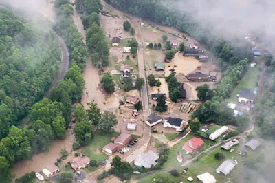
Aerial view of the aftermath of a massive flash flood in a
mountainous region of southwestern Virginia a couple
weeks ago. 
 During the autumn, winter and spring, weather disasters usually come in the form of large, strong storm systems that wreak havoc over a pretty large area.  

 Sure, large scale heat waves, wildfires and early season hurricanes can hit in the summer, causing major disruptions and threats to life. 

In the summertime, though, it's the pin prick disasters that will get you. Summertime extremes tend to be, well, more extreme, but hit a much smaller, local area.  Two such events recently caught my attention.

VIRGINIA

Last week, storms stalled over mountainous southwestern Virginia, which is always bad news for anywhere in the Appalachians, from Maine to Georgia. The torrents of rain can send walls of water down steep slopes onto sleepy hamlets in the valleys. 

This happened at night, and people suspected the worst. Were people asleep in their homes, unaware everything was going to wash away? After all, a similar summer flash flood in Tennessee last year killed 21 people. 

Initial reports indicated 40 or so people were missing. But that was mostly due to the fact that cell phone service sucks in that mountainous corner of Virginia. Plus, since roads were washed out, people couldn't just drive to Aunt Martha's house in Buchanan County to check on her. 

It turns out everyone survived, which honestly is a miracle. Aftermath videos and photos show houses washed hundreds of feet from where they once stood, utterly destroyed. 

Terrible to think about, though. You go to bed on a muggy evening and everything's fine. Before the night's over, lives are upended.  And you know it could happen anywhere, even here in little old Vermont. 

I love listening to summer downpours roar down on the roof of my St. Albans, Vermont home in the dark pre-dawn hours. It's always pleasant, but paranoid me thinks, what if this downpour doesn't stop?  I choose not to worry about it though. It's not worth worrying about something that won't happen. Probably. 

MONTANA

Last week, a surprising dust storm in Montana didn't have such a positive result. Six people were reported killed when the blinding storm roared across Interstate 90 near Hardin, Montana. 

I didn't know they can have dust storms in Montana, but after this disastrous one, I can see how it can happen. But Hardin is in a relatively open, semi-arid area east of Billings.  

Aftermath of July 15 dust storm crash near
Hardin, Montana. 

The thunderstorm that caused the disaster wasn't even really over Hardin.  It was basically what is known as an outflow boundary from a thunderstorm many miles away.

The parent storm was at least 30 mph away, but created a rush of wind gusting over 60 mph through the Hardin area, said Nick Vertz, a National Weather Service meteorologist in Billings, Montana. 

"'If they looked up in the sky while they're in Hardin, they probably didn't see much of what you'd think of a thunderstorm cloud, maybe not even much at all," Vertz said. 'It was just a surge of wind that kind of appeared out of nowhere.'"

It has been hot and dry before the storms in that part of Montana, so the surge of rainless wind was able to pick up a lot of dust. It was enough to cause what I would call a brownout - very much like a whiteout in the winter when blowing snow cuts visibility to zero. 

Twenty one vehicles piled up, including tractor trailers, and those crashes killed six people. 

It could have been even worse. Video of the scene shows that many other vehicles were able to stop safely behind the wreck without crashing into each other.  Traffic was backed up for miles. 

I'm sure there have been other local disasters in the United States this summer and there will be more. It's a part of the season. 

VIDEOS:

Inside Edition report on that flood in Buchanan County, Virginia. Click on this link if you don't see the video image, otherwise, watch below: 


Local news report on the Hardin, Montana crash, with brief glimpses of how bad things were during the actual dust storm. Click on this link or watch below:


Monday, July 25, 2022

Vermont Heat Wave Ends While State Threads Needle, Avoids Damaging Storms

Evening light shines through a shower in St. Albans, Vermont
Sunday evening. Severe weather avoided Vermont 
1 p.m update:

The process to end our heat wave has continued to create hiccups and complications for meteorologists.

The latest issue is that one last narrow line or lines of storms ahead of the cold front that's finally making it into Vermont.

We expected that line of storms to form, but its a little more rambunctious than some forecasters thought. 

When one part of it moved through St. Albans, I saw gusts in the 35-40 mph range and a quick heavy downpour.

By the time this cell made it into the Northeast Kingdom, it had grown stronger, prompting a severe thunderstorm warning for winds of up to 60 mph. 

These line segments of storms are continuing to move slowly southeastward and eastward through Vermont early this afternoon, so a few places might see a quick strong storm as it goes through.

Southeastern New England is still under the gun for more severe storms this afternoon.  Behind that line of Vermont storms, I think we're done. We should see humidity continue to slowly wane as the afternoon wears on

PREVIOUS DISCUSSION 

As a heat wave began to end overnight in Vermont, we also threaded the needle and avoided damaging storms and some flooding that happened around us. 
Final batch of storms approaching St. Albans, Vermont
late this morning. 


More storm problems are due in parts of New England today, but again, Vermont will mostly avoid trouble. There's still some risk of local flash flooding in the southern half of the Green Mountain State this morning, and a low risk of a severe storm clipping the southeastern half of the state, but that's it. 

HOT WEATHER ENDING

So let's get into what's happening, beginning with the heat. 

As I noted yesterday, the heat was persistent. Burlington, Vermont topped out at 91 degrees Sunday, the sixth consecutive day of 90 degree weather. This heat wave was only one of a total of seven that have lasted that long in Burlington since the 1880s. 

There's an outside chance of it making it to 90 today before the cool air floods in but it is extremely doubtful it will get that warm. The National Weather Service in South Burlington is going with predicted high of 85 degrees today. 

It'll be a warmish week, but still a big break from the hot weather. Depending upon which day you're talking about, highs daily probably through next Sunday will mostly be in the 80 to 85 degree range. However, I see some signs that the heat will return next week. 

The heat was more intense Sunday in sunnier southern New England. Boston, for instance, reached a record high of 100 degrees. It was only the 27th time in 150 years or so Boston had a triple digit reading, so that's impressive. 

STORMS MENACE AND MISS

The worries yesterday and last night were the risk of severe storms and flash flooding, but it was fortunately not to be in Vermont. 

Geographically, we came close relatively close to trouble, enough to prompt some weather warnings on the edges of Vermont. 

A severe thunderstorm warning for northeastern New York extended as far east as Vermont's northern Champlain Islands around midnight last night, but I've seen no reports of damage there.  That warning has long since expired so no worries there. 

Flash flood warnings were also hoisted for northwestern New York, but so far, I've seen no reports of any trouble extending eastward into Vermont. 

Sunday and Sunday evening, Vermont was sandwiched between two bands of severe weather. One band traveled along the New York/Pennsylvania border and into southwestern New England during the evening, prompting a string of severe storm warnings and reports of downed trees and power lines, including around Albany, New York and the Massachusetts Berkshires

The warnings for severe storms extended into far southern Vermont with this band, but I haven't seen any reports of damage along the Route 9 corridor between Bennington and Brattleboro. So, close but no cigar.

It was even worse to our northwest.  In southeastern Ontario to the west of northern New York, we have reports of a destructive tornado about midway between Toronto and Ottawa. Initial reports indicate severe damage to homes in that area, but I don't have a lot of confirmation yet.

Showers and storms were still ongoing across much of Vermont early this morning. They had pretty much ended in far northwestern Vermont, where I feel cheated out of a needed garden drink. I only measured 0.15 inches of rain. (I might get a little more today, but I'm not holding my breath).

Other areas of the state were doing better with needed rain. Burlington got about a third of an inch. 

As of 7 a.m. some heavy showers and a few thunderstorms were rolling through southern Vermont, and I bet a few areas down there will get a good inch of rain out of this.  During the heat of the day those southern Vermont showers will move into southeastern New England.

Once they get there, either this band of showers will turn into locally severe storms or new ones will pop up. But that will be outside of Vermont, mostly.

NEXT UP

The cold front itself was still up in Ontario, Quebec and central New York this morning, so it will take some time to get through here and freshen up the air. It'll still feel humid for much of the day, but you'll notice a change, especially toward evening and especially in northern Vermont. 

A few scattered storms might get going along the actual cold front as it moves through today, but I'm doubting it will be anything that widespread here. 

Tomorrow has a shot of being the "coldest" day since July 14 as lower humidity drops overnight temperatures into the upper 50s and highs "only" reach about 80 degrees.

Dry and warm weather is forecast Wednesday. We're keeping an eye out for Thursday, as a system coming in could bring us more strong storms, if the timing is right. 

Comfortable air will close out the week and start our weekend. As noted, I see strong signs of another heat wave next week. It's not a slam dunk yet, but so far, the weather pattern looks favorable for another hot spell coming up. 


Sunday, July 24, 2022

Another Hot Vermont Day, Chances Of Strong Storms Remain, Maybe

Severe storm risk in the Northeast today. Highest risk
is in the orange areas. Lower risk in the green areas.
UPDATE 10 PM SUNDAY

No severe weather developed across most of Vermont this evening, but surprisingly, we're not out of the woods yet.


This is highly unusual, as most severe storms develop in the afternoon and evening, then diminish at night. 

Apparently, though, the atmosphere is still primed for the possibility of severe storms.  A destructive tornado has been reported upstream from us, in southern Ontario, Canada, a little north of Lake Ontario.

As of 10 p.m., lightning detection showed quite a bit of activity in southern Ontario, edging toward northwestern New York. 

The earlier computer models were kind of right taking downpours through both northern and southern Vermont this evening. The northern Vermont storms were weaker than many forecasts called for. A few storms in far southern Vermont did carry severe weather warnings. 

The storms overnight, especially in northwestern Vermont will still carry the risk of strong damaging wind gusts, and even a very low chance still of a brief spin up tornado.  Torrential thunderstorms expected statewide overnight and on Monday morning still carry the risk of torrential rains and local flash flooding. 

UPDATE 5:30 PM SUNDAY

Very few thunderstorms, none of them severe have so far erupted around Vermont today.  

That's kind of to be expected, because forecasts had called for most storms to get going in the late afternoon and evening.

Still, it's even a little quieter at this hour than expected, but there's still a window for severe storms in the next few hours. 

Later on tonight, and tomorrow morning, the risk of local flash floods also remains in play. 

The air is very humid and unstable, so it's primed for storms. We just need a trigger to set them off. 

I think an area of clouds that moved across much of Vermont today helped squelch the chances of any big storm development, at least until now. 

The cold front is still way to the north, so that won't be a factor before midnight. Instead, maybe a weak boundary or outflow from a distant Quebec storm might initiate new storms. 

If anything gets going this evening, chances are it will go from a nothingburger to something dangerous pretty quickly.   Some, but certainly not all of the short range computer models are still insisting on what looks to be strong storms in northern Vermont north of Route 2 this evening, and some more mostly south of Route 4.

There were signs as of 5:30 p.m. that something was perhaps, maybe ready to take off and turn into a storm or cluster of storms over northern New York.   But it wasn't definite.

So it's a wait and see game if on whether we see any severe weather this evening. 

Overnight and basically into early Monday morning, more showers and storms are expected to fill in across the region. Some of these will have really torrential downpours. 

For most of us, this will mean a relatively sleepless night, with high humidity, and occasional lightning and thunder and the roar of downpours on the roof. For an unlucky few, we still have the risk of flash flooding in some spots that really get raked repeatedly by storms. 

We can't know in advance who that might be, or even if it will happen. It's just a risk to keep an eye out for. 

Burlington did make it to 90 degrees today before that batch of clouds moved in to "cool" us into the mid and upper 80s. So it was the sixth consecutive day of 90 degree temperatures.   Including this week, there have only been seven occasions since the late 1880s in which we had six or more consecutive days in the 90s

PREVIOUS DISCUSSION

Yesterday was the fifth consecutive day in Burlington, Vermont that reached 90 degrees and we actually tied a record high for the date.  

It wasn't an impressive record, as Burlington reached 93 degrees. That's just about the lowest record high for any date in July.  Most daily record highs are in the 95 to 99 degree range during the month. 

We've got one more hot day to go today, a transition day tomorrow, and then warm, but not hot weather the rest of the upcoming week. In that mix is a risk of strong storms and local flash flooding later today and tonight. 

If Burlington makes it to 90 degrees today, which seems pretty likely, it will be only the seventh time since the 1880s that the city has had at least six days in a row with 90 degree temperatures. (The longest stretch of consecutive 90-degree days was eight on August 10-17, 1944).  

We're under a heat advisory again in the Champlain and lower Connecticut River valleys, and the lower elevations of Rutland County, where the "real feel" temperature when you factor in the humidity will be in the 95-100 degree range. Actual temperatures will be 90-95. But the whole state will be hot, so it's an excellent day to take it easy. Maybe find some air conditioning. Maybe some theaters are running matinees you can check out. 

STORMY WEATHER?

The other risk is storms.  The system coming in has a history of producing rough weather. Lots of severe weather was reported in the Midwest yesterday. And in Ontario and Quebec. A tornado touched down in Quebec, about 55 miles northwest of Montreal, and a severe thunderstorm skirted the Vermont/Canada border last evening between Jay Peak and the New Hampshire border.  Hail up to the size of quarters covered the ground around Averill, Vermont. 

We have sort of mixed signals for what kind of rough weather we'll have later today, if any. There's definitely a risk of strong to severe storms scattered about starting this afternoon and going into the evening.  For the record, NOAA's Storm Prediction Center has most of Vermont under a slight risk of severe storms, which is alert level two out of five.

Out in western and central New York, there''s even a higher chance of severe storms, and they were already starting to pop out that way by mid morning.

We in Vermont will have to wait until afternoon to see any action.   Generally speaking, the peak heating hours between say, 2 and 7 p.m. are prime time for strong storms. 

You can get isolated ones in this kind of heat and humidity, but you need a trigger to get a lot more of them going, like we had on Thursday.

I question whether an approaching cold front will be close enough to give us anything widespread later today. Maybe, maybe not. Computer models disagree a bit on this as of this morning. It's something to be aware of if you have outdoor plans, so that you can quickly get into a sturdy building, or at least an enclosed car, if severe or strong storms get going. 

If any big storms do get going, there's actually quite a bit of "spin" in the air.  Winds this afternoon will be shifting in speed and direction as you go up in elevation.  That brings us the very low, but not zero chance of a brief tornado.  

Unstable looking sky over St. Albans, Vermont 
Saturday evening. That could be an alert that we
might have severe storms in much of Vermont
later today amid the oppressive heat

If that happens, or if the National Weather Service ends up having to issue a tornado warning, we'll have another rare case here in Vermont. 

It would make it the third time within a week in which either an actual tornado touches down (like in Addison, Vermont Monday) or a tornado warning is issued, like on Thursday in the Northeast Kingdom. No known tornado touched down Thursday, but there was a warning because radar detected rotation.

The best, but again, very low chance of a brief spin up would probably be in the Champlain Valley very late this afternoon or early this evening. 

Because of the loss of daytime heating, the threat of severe thunderstorms drops to near zero overnight. But the cold front will still be approaching and passing through. With all this humid air, some of these storms will have torrential downpours. Parts of the state might have several rounds of storms overnight. 

That opens up the risk of flash flooding. If that happens, it will be localized. Even though it's been dry, it's a real risk.  If some hilly or mountainous part of Vermont gets a few inches of rain in a short time, that water rushes down the slopes and can create a dangerous flash flood. 

Flash flooding is more dangerous at night, too. If you're in a flood prone area, make sure you have some sort of weather radio or device to wake you up if a storm or flash flood warning pops up.  If for some reason you're camping tonight, set things up well uphill from any brooks, streams or rivers.

The cold front will be slow, so many of us will still be dealing with humidity and downpours Monday morning. But the air will start to clear and feel fresher later in the day, especially northwest. A new threat of severe storms will develop in southern New England Monday, but Vermont should escape that. 

we During peak heating today, mid af

Saturday, July 23, 2022

Cool Summer A Thing Of The Past, At Least For Awhile

An intense snow squall blasts into St. Albans, Vermont
in February, 2022. No snow squalls in today's forecast!
UPDATE: 2:50 p.m. 

Burlington indeed made it into the 90s this afternoon before some clouds and some showers not far away from the city brought temperatures back down to 88 degrees.

So that's the fifth day in a row and six out of seven days this week with 90 degree temperatures. It might still bounce back up to 90 degrees again as skies perhaps clear out more later this afternoon.

We're still on track for a sultry night, another oppressive day Sunday.  There will only be isolated showers and storms for the rest of the day today, but we'll see a rising chance of storms Sunday afternoon and evening. 

In fact, NOAA's Storm Prediction Center has upgraded the chances of severe storms for Vermont tomorrow from marginal to slight, (level 1 up to level 2 in risk category).  They've also added another tornado risk, albeit a low risk. If that forecast results in a tornado warning, that would be the third day within a week in which either a tornado touched down in Vermont or a tornado warning was issued. Quite a hot, active week! 

PREVIOUS DISCUSSION 

Boy, the character of this summer's weather changed fast didn't? 

While the world was sweltering around us, we enjoyed a sunny, breezy, comfortable summer here in Vermont until mid-July. 

Then someone turned on the furnace. 

Today, Burlington, Vermont's high temperature will almost surely go above 90 degrees. Which will mean only one day this week (Monday) failed to make it to 90 degrees.

More heat is definitely on the way. 

I illustrated this post with winter photos, and you can enjoy some winter videos at the bottom of this post. Think of them as sort of a visual Popsicle on a hot day. 

Back in early July, it was beginning to  look like we could have a summer that had fewer than average 90 degree days, but that's no longer the case. Through Friday, we had seven such days in Burlington this year, against an average of six or so for most years.

Or at least that was the average. Recent summers have piled on the 90 degree days, so by some estimates, we should now expect at least ten days a year that reach that magical scorcher 90 degrees.  

It reached 90 degrees 14 times last summer. The year before that was even worse, with 20 such days. 

The record for the most 90 degree days in a single year still stands at 26, in 1949.  It looks like that record is safe this year, unless we have an absolutely insane August and early September. 

Ice covered berries after some freezing rain in St 
Albans, Vermont, January, 2019. 

Though we have some relief coming next week, we still have some torrid conditions to go.  Although Friday was  hot, it was less humid than in some previous days, so it felt a little better.

The humidity will begin to creep up today amid the heat.  The extra bit of humidity could be enough to trigger an isolated thunderstorm or two, probably over the mountains. Then things get interesting.

HOT AND STORMY

We'll slog through another terribly humid and hot Sunday.  Some of us will hit 90 degrees again, depending upon when clouds arrive.

A storm system is set to cause a lot of severe weather in the Midwest today, and that will be approaching us on Sunday.  Some of the initial storms that form Sunday afternoon could be strong to severe, given how humid and unstable the air is.

Snow falls from pine trees in West Rutland, Vermont
after a storm in December, 2017.
Even though it's been dry, we'll have to watch out for possible areas of flash flooding Sunday night. Several rounds of torrential thunderstorm should rumble through.

 Some areas could have too much rain too fast, resulting in overburdened small streams, washouts, that kind of thing. It's not clear yet how extensive this might be and precisely who, if anyone, sees a flash flood.

But it's something to keep an eye on. Especially since any flooding that does develop would start at night, when people are either sleeping and don't get warnings, or are out driving and can't see the deep water ahead of them.

In any event, Sunday night looks pretty sleepless, with the humidity, the downpours, the rumbles of thunder. Kinda yucky.  

The humidity doesn't quite clear out Monday, so it'll be another uncomfortable day, with maybe a lingering risk of storms.

Then, starting Tuesday, things get better. Next week will still generally be a little warmer than average, but not nearly as hot as this week nor as humid. 

Long range forecasts into early August continue to call for warmer than average temperatures, so we'll see how that works out. 

Videos:

An intense snow squall rushes into St. Albans, Vermont, February 27, 2022. Click on this link to view if you don't see image below, otherwise, click on image.


Next, sort of a highlight reel of the Pi Day Blizzard in St. Albans, Vermont, March 14, 2017. Click on this link to view, or click on image below if you see it. 


Next, the dogs check out the snow, and we also slow things down to make a snow globe effect. Click on this link to view or click on image below if you see it. 


Friday, July 22, 2022

Thursday's Storms Erupted As Expected; Next Storm Threat Later Sunday, Heat Rolls On Until Then

Forecasts prior to Thursday's storms turned out to be totally accurate as several waves of strong and severe weather rolled through Vermont through most of the day. 
Severe thunderstorm looking south from Hinesburg,
Vermont. Not sure but looks a little like a wall cloud
structure in there. This storm was not tornadic, though.


This was an atmosphere that was really primed for storms. It was fascinating to watch just little triggers ignite a fuse to create storms in minutes.

Video of some of the stormy weather is at the bottom of this post.

The first wave began on schedule in the late morning over the Adirondacks as a cluster of storms that congealed into something that looked like a supercell that went across the northern Champlain Valley and on into the Northeast Kingdom.

By the time the storm got to the NEK, it had prompted a tornado warning, though no tornado is known to have touched down. The storm did pelt some NEK towns with hail, some of which was a little bigger than golf balls. Strong winds caused damage as well.

In areas that did not get directly hit by that storm, updrafts in the atmosphere caused storms to erupt instantaneously, going from just a towering cumulus cloud to something strong enough to prompt severe storm warnings in minutes.

Also as expected a final line of storms erupted just ahead of a cold front of sorts late in the afternoon.

Again, the trigger seemed to be right on the New York/Vermont border. Many areas from Burlington south had not had a thunderstorm by 3 p.m., so the hot, humid air was still highly unstable.

I watched a small cluster of benign showers over eastern New York become a powerful but broken line of storms that extended from near the Canadian border all the way to southern Vermont. The time it took for the storms to just begin producing rain to getting to the point they were strong enough to prompt storm warnings was as little as 15 minutes.  

Storm just starting to form looking north from Milton, Vermont
at 2:04 p.m. Thursday.

I was impressed.

Aside from the effects of large hail, we were lucky that pretty much the only damage in Vermont was lots of fallen trees and power lines. At its peak, just under 7,000 homes and businesses were without power in the Green Mountain State because of the storms. 

Power has since been restored to just about everybody.

I'm also glad the storms were moving right along. We had incredible amounts of moisture to work with so the downpours were beyond torrential.  I saw instances of very flash flooding in Georgia and Colchester, even from downpours that lasted less than 15 minutes.

HEAT GOES ON

The heat before the storms allowed Burlington to log its first official heat wave of 2022.  (A heat wave is defined as three consecutive days of temperatures of 90 or over). Since Sunday, four out of five days reached at least 90 in Burlington. Monday was the exception under clouds and showers. 

Burlington has a shot at seeing more 90 degree weather. That cold front, as it were, wasn't exactly cold. The air behind it, the conditions were are in now, are less humid for the moment, but not much cooler than they were.

It'll get well into the 80s, possibly near 90 today with mostly sunny skies. Same for Saturday, except there might be a few extra clouds due to rising humidity. Isolated showers and storms might erupt too.

Sunday is looking sultry as well, but changes are afoot that would give us our next chance of possibly nasty storms, and then a bonafide cool down. 

Just ten minutes later, that little tower had 
become a mature, strong thunderstorm

The chances of severe weather on Sunday seem to be lower than they were yesterday, but late in the day, there could be some strong winds with a few storms. 

The main threat comes Sunday night as a front slowly sinks southward through the area.  This could encourage storms to "train," which means one storm after another goes over the same spot, like boxcars along the railroad tracks. 

Because the air will be very humid, the rain could be torrential, so we'll have to watch for a couple spots of possible flash flooding.

More on that as we get closer to the event.

Then, finally, temperatures take a good crash, at least temporarily.  By Tuesday high temperatures are forecast to be in the 70s. Readings will creep up again on subsequent days, but hopefully, not to the extent they did this week. 

Video:

Some of my encounters with storms in Vermont Thursday.  Click on this link to view, or if you see the image below on your device, you can click on that as well. 


Thursday, July 21, 2022


UPDATE: 11:15 a.m

Storms earlier over far northwestern Vermont and southern Quebec were just a teases, and now the main show is beginning.
Storms like this one developed yesterday in the hot humid air
in northwestern Vermont but couldn't sustain themselves.
 A trough of low pressure and a cold front will ensure that
storms, some severe will be prevalent this afternoon.

Storms have started to strengthen over the Adirondacks as they move northeastward toward northwestern Vermont.

Other storms are just about to take off.  NOAA's Storm Prediction Center said just a short while ago they expect to issue a severe thunderstorm watch for parts of eastern New York and New England within the next hour. The watch will almost surely include parts of or all of Vermont.

Remember, a severe thunderstorm watch means conditions are favorable for severe storms.  A severe thunderstorm warning means a dangerous storm in imminent. I will be out reporting and documenting  the storms today, so for brief updates, see my Twitter feed, @mattalltradesb


UPDATE 9:45 a.m. 

Storms already just starting to get going NW tip of Vermont. Expecting them to develop further south soon.

They'll develop rapidly, I think, and move swiftly across northern Vermont.  Forecast as set by the National Weather Service and described below still looks good.

 
PREVIOUS DISCUSSION, 9:15 a.m.

Before we get into today's severe weather threat, can we talk about last night? The overnight low of 80 degrees in Burlington would tie the record for the warmest "low" for any date in history.  

The record was first set in 2018.  I doubt this record will hold as thunderstorms and a cold front will ver likely drop temperatures below 80 degrees by midnight tonight. Still, last night was impressive, and not in a good way.  

You can tell by the oppressive airmass over us that we can get storms easily. We saw that yesterday, when some pop up storms prompted a couple of severe storm warnings over northwest Vermont.  The storms couldn't really last, since there wasn't a trigger to keep them going, but it was a demonstration of how easily a storm could form in an instant.

Today, the trigger IS there for storms that will last and streak across Vermont. 

Given all the heat and humidity, it won't take much for today's thunderstorms to get going.  They'll begin earlier than we're used to in hot, oppressive weather. 

Traditionally, we wait until at least early to mid afternoon for storms to really get going during summer storm outbreaks in Vermont.

However, the first disturbance, a "pre-frontal trough" should reach the Champlain Valley by around 11 a.m. Usually, when these little disturbances reach the western Vermont border that early in the day, then places west of the Green Mountains miss out on the storms. The storms focus on eastern Vermont.

Not today. The atmosphere is so primed that storms should easily begin to pop up in eastern New York as early as 10 a.m. today.  A broken line of strong storms could well be entering the Champlain Valley by 11 a.m. 

(One model has storms getting going by 9 a.m., about the time I'm writing this, and I just don't see it. There were a couple isolated storms in southern Quebec, but I think it'll be another hour at least before things really get going).

Not everyone will see a storm, which is the usual case.  NOAA's Storm Prediction Center continues to go with a slight risk of severe weather over Vermont today, which means there will be scattered instances of storm damage, but the majority of us should be OK.  Of course, you never know exactly who gets the severe storm until they form and move over you, so it's a crap shoot. 

Some of the storms that will be around will  become strong to severe pretty quickly.  This initial broken line of storms will probably intensify somewhat further as they zip across Vermont early this afternoon and into New Hampshire by mid-afternoon. 

Most of New England, including all of Vermont, remains
under a slight risk of severe storms today. That means
there will likely be at least scattered instances of
storm damage. 

Behind that first line, the atmosphere looks like it will be unstable enough to allow more storms, some possible severe, to develop early this afternoon in New York and cross Vermont in the mid to late afternoon, with the late afternoon storms focused on eastern and southern parts of the state. 

As is always the case, not everyone will see a severe storm. Just a few places will get nailed. But those who do get nailed could see some real damage. As previously forecast, winds aloft are pretty strong for this time of year, which can really help with the strong downburst winds with some storms. Some of these gust could be strong than the usual 60 mph whiffs we get during "traditional" strong storms. 

 A few places could also see some large hail. 

The threat of tornadoes is very, very low but not zero. Winds do change direction with height somewhat, but the airflow isn't ideal for tornadoes. However, it's within the realm of possibility that a renegade storm ahead of the main line of clusters of storms today could produce a brief spin up. 

Today really looks like a hit and miss situation. As noted, a few places will get absolutely nailed. A fair number of us will have sub-severe storms, meaning dangerous lightning, gusty winds, torrential downpours, that kind of thing. Some of us will also skate by with pretty much nothing at all.

Since storms will be developing rapidly and zipping right along once they do form, it's best to stay close to home or office today. No hiking, no going out for a quick spin with the boat on the lake.  I'd even stay fairly close to home when it's time to go walk the dog. 

If you do get a severe thunderstorm warning, just get yourself in a sturdy building, stay away from the windows as best you can and you should be fine. Also remember, you might see a storm coming and not be under a severe storm warning. But that approaching storm could turn severe by the time it reaches you, so it's best to consider that as well.

The good news about these storms getting going so early in the day is that they'll be over fairly early, too.  We might see a few renegade, tardy storms at the first part of this evening, but they'll probably be few and far between. 

A cold front is helping to cause this. And with the dynamic atmosphere, you'd expect it to be nice and refreshing and cool starting tomorrow. Nope!!

It'll be slightly less humid and slightly cooler, but temperatures will still top out in the upper 80s, with a few spot 90 degree temperatures Friday and Saturday. 

We'll have to watch another storm Sunday, which could cause more severe weather.  After that disturbance, it looks like we do get into fresher air early next week.