Showing posts with label humidity. Show all posts

Sunday, June 7, 2026

Forecasters Back Off SLIGHTLY From Torrid Vermont Upcoming Week Forecast, But It Will Still Be Hot

Early Sunday afternoon satellite pic shows Vermont
in the middle of a big cloudy patch that will
keep the rest of today cloudy and damp. But
looks at those clear skies to the northwest\
in Ontario and central Quebec. That's our
weather tomorrow and Tuesday. 
Just landed after my return trip from Minnesota, so you saw no morning post today. So I'll try a very late, afternoon attempt. 

As expected, a few scattered strong to severe storms erupted in Vermont yesterday. The worst of them seem to cross central Vermont in a west to east band very roughly about  20 or 30 miles north of Route 4. 

I'm kinda sure there was some tree damage across the middle of Vermont, but the only report of damage I see so far is the several trees fell along Route 73 between Whiting and Sudbury. 

As you'd expect, rainfall was super variable with the scattering of storms yesterday. Many places, as expected got somewhere in the neighborhood of a half inch of rain.

 But there were those torrential downpours, as you'd expect. The biggest totals I saw were  near the Canadian border: 1.85 inches in Montgomery Center, 1.58 inches at Derby Line and 1.54 inches 

Meanwhile, a few towns got seriously cheated. West Windsor reported just 0.05 inches of rain. 

During this morning and early afternoon, a final band of rain was working north to south across Vermont, As you can tell, it's pretty cool today under the clouds and showers and north winds, with most places holding in the 60s as of early afternoon. 

Except for nights and very early mornings at the beginning of the week, this will be last cool weather you'll see for awhile. 

REST OF THE WEEK

Judging from the satellite photos, we won't get much clearing today. Maybe some places will get some sun in the evening. Since it's cool this afternoon, we're set up for a comfortable night.  Lows Monday morning will be in the 40s, with some low 50s in banana belt towns in the Champlain Valley. 

Monday: A beauty. Sunshine, low humidity and highs in the 70s to around 80.

Tuesday: Another nice one. Warmer, with highs in the low to mid 80s. Maybe a couple upper 80s in the warmest valleys. The humidity will stay low.

Wednesday: Here's where trouble starts. Humidity levels will creep up. Forecasters have backed off on the idea of three or four consecutive days near 90 degrees in the warmer valleys. Instead, we'll probably wait for a couple of days for a shot at 90. 

A weather disturbance that was expected to be a nothing burger a few days ago will now have a little oomph when it arrives here. Nothing dramatic, just some showers and maybe some embedded thunder. Highs should still make it into the 80s as it turns noticeably more humid.

Thursday/Friday: These will be the hot days, at least if the forecast holds. It is subject to change. As it is, we might seem some showers and storms both days as highs potentially reach a humid 90 degrees.

Next Weekend.  Frankly, not sure yet. Depends upon whether some cold fronts arrive to rescue us from the humidity or not. Cold fronts would also mean a potential shower risk. But don't make plans based on the weather for next weekend. We really have almost no idea what will happen then


Sunday, August 3, 2025

Sunday Vermont Update: The Smoke Is Back, And How Dry We Are, And Will Be

Image from firesmoke.ca  shows smoke from fires in
central Canada is spreading far and wide in
North America, including here in Vermont 
The smoke is back. 

And it will probably harass us off and on all week while rain (mostly) stays resolutely away from the Green Mountain State. 

Oddly strong high pressure will take the blame and the credit for a long period of dry weather, often smoky skies and warm summer weather. 

Saturday started off pretty clear but the haze thickened through the day. The thickest smoke stayed aloft, but some of the pollution, inevitably, made it to the ground. Evening was a hazy mess, at least in northern parts of the state.

Canada has gotten even smokier as fires have intensify and grown widespread in central parts of that vast nation. New, large fires have also exploded in the Northwest Territories and Nunavut.

There's now a hell of a lot of smoke belching into the skies above North America. 

This is a widespread smoke attack. Air quality alerts have been in effect for a few days, and remain on in places like Michigan, Minnesota and Wisconsin.    Most of Maine and the northern half of New Hampshire joined the air quality alert party Saturday afternoon, warning residents that most of today would be smoky.

By late Saturday afternoon, the National Weather Service office in Burlington, in their forecast discussion, were already monitoring the smoke, which had already turned our skies hazy and greyed out some of our Green Mountain views.

Before dinnertime, the Vermont Agency of Natural Resources issued our own air quality alert.  

TODAY 

That bad air alert is now in effect at least until midnight tonight. The breezes, which had been from the north, have shifted to the south. That will keep the worst of the air toward northern Vermont. The smoke will be even thicker up in Quebec and Ontario.

Still there is some air flow aloft coming from the opposite direction - the north, which would bring more smoke our way.  High pressure systems feature sinking air, so some of that smoke aloft will make it down here to the ground, where we all live and breathe.

The bottom line is that air quality was moderate to unhealthy for sensitive groups this morning.  That already kinda bad air might worsen a little more through the day,  but will not be as bad as the abysmal air quality we endured on July 26.

It'll still be a little rough on the lungs, though.     

Otherwise, another comfortably cool morning will morph into a warm, sunny, if hazy day.  The humidity will stay perfectly reasonable, 

MONDAY

 Weather systems - both storms and areas of fair, sunny weather - tend to be weak this time of year.  But high pressure is growing over Quebec and New England.

This high pressure will be at near record strength for August. It's more typical of the super strong high pressures that give us periods of Indian Summer weather in October if we get lucky. High pressure means sinking air. Sinking air means it's really hard for rain clouds to form. Hence the very dry forecast. 

The southern end of this high pressure over New England is weakening in favor of a center over Quebec. This will send a weak cold front our way tomorrow.  

The air is so dry that at most the front might produce isolated light showers. More than 90 percent of us won't see any rain at all. The very few of us that do see raindrops will get only a trace to maybe a couple hundredths of an inch, Not even enough to wet things down at all. 

The front will bring another wave of smoke with it. so I anticipate some possible new air quality alerts this week. Highs should make it into the 80s again. 

REST OF WEEK

The high pressure will sit strong all week, only slowly dropping south from Quebec through New England between now and next weekend. It's huge, and will extend down as far south as Georgia this week. 

Monday's cold front will make Tuesday a degree or two "cooler" with highs "only" in the 78 to 84 degree range for most of us. 

The orientation of the high, and the fact that it pushed last week's cold front almost all the way to the Gulf Coast. That will deep tropical humidity away from us probably at least through the end of the week. 

That means the air will stay fairly comfortable (aside from any smoke).  I suppose an isolated shower or two could figure out a way to develop over the mountains on one or two afternoons this week, but almost everybody will stay dry. 

We might, maybe could get a bit of a break from the smoke later in the week. Southerly winds in the worst often fire zone in Manitoba and Saskatchewan later this week might temporarily drive most of the smoke north into Nunavut and western Hudson Bay.  

Back here in Vermont, the odd August combination of daily sunshine, sort of low humidity and warm temperatures sets the stage for a growing forest fire risk.

The brush fire risk was already high in the Champlain Valley this weekend, and I imagine the moderate risk on most of the rest of the state will increase to high this week. Watch those campfires, cigarette butts and backyard burns. 

Also, unlikely but possible is the risk of a flash drought.  

This is a weird, long stretch of dry weather with a lack of humidity, quite uncharacteristic of August. If this continues all month, then we have to start worrying about too-dry conditions and possible drought.

It's too early to sound the alarm on that. We could still get a lot of rain starting mid month, we just don't know yet. But I already have to water my gardens thoroughly today for the first time this summer, and that state of affairs should continue. 

The next chance of any more widespread showers looks to be a week from tomorrow, and even that looks iffy at this point.  

Tuesday, July 29, 2025

One More Hot Day, But The Big Vermont (Temporary) Cool Down Is Just Starting

Our outdoor living summer living space in St. Albans,
Vermont. It looks like the weather will be conducive
to enjoying it most of the time for the next week. 
It was another warm, stuffy night in Vermont, and it will be another hot one today. 

But the heat is starting to wane. It will be slow at first. Today, you'll barely notice the improvement. But the cool down will pick up the pace within the next day or two.  

But that doesn't mean summer is over. More warm weather is on the way.  

It got to 91 degrees in Burlington Monday, the 12th time it has gotten to 90 this year. Springfield had its 13th such reading of the year.  

It's also highly likely July, 2025 will be one of Burlington's top 10 hottest Julys. That would make it three Julys in a row that are in the top ten hottest. 

Since June was tied for seventh warmest, we might well have one of our hottest summers on record. If August is warm.  These aren't your grandparents' Vermont summers, that's for sure. 

August will start off cool, but not necessarily stay that way. More on that in a bit.

TODAY

Even though temperatures before dawn in some areas like the Champlain Valley were in the 70s, it won't necessarily be another 90 degree day. The air flow has shifted into the northwest, starting the change in the weather, 

A weak disturbance in that northwest flow has brought air that's a touch cooler than yesterday. Maybe. And if it is cooler, it'll just be by a degree or two.  I give Burlington less than a 50/50 shot of making it to 90 degrees again today. But who knows?  

That allegedly cooler air today won't really make it into southern Vermont, so Springfield has a good shot at seeing their 14th day of the year to reach 90 degrees.  

I suppose there could be an isolated shower or rumble of thunder this afternoon, but don't count on it. Despite the relative warmth and humidity the ingredients just aren't there.

WEDNESDAY

The "real" cold front should come through tomorrow to drop our temperatures. But it will come through in pieces. That means the front probably won't be able to create much of an organized line of big storms to mark the change.

Instead there will probably be a broken batch of scattered showers and storms  coming through. They will be hit and miss.  Some places won't see any rain at all. A small minority of us will see a nice but fairly brief torrential downpour. The chances of a severe storm are not zero, but don't count on any barn busters. If there is something rambunctious, it's most likely south of Route 4. 

Most of us will just have light rains coming from the cold front. Aside from the few places bullseyed by the few real storms we'll see, count on a quarter inch or less of rain. As noted, some rain gauges will remain dry. 

 It'll still be fairly warm and muggy. In fact, some southern Vermont towns like Springfield could hit 90 one last time. But some of us, especially in the north, will start to feel a change in the air later in the day.

THURSDAY

It now looks like the flip to cooler and drier air has some complications. Wednesday's cold front looks like it will get hung up in southern New England temporarily, and a ripple of a storm will probably form along it.

This thing looks like it will dump a huge boatload of rain on southern New England and the Mid-Atlantic States, possibly causing some flooding.

Some of the models are throwing the rain back northward for a time on Thursday. Far southern Vermont could end up with a drenching rain on Thursday. Even though it's only a couple days away, we still don't know for sure whether that will happen, so forecasters will have to keep an eye on it. 

It's a little dry in southern Vermont, so if a good soaking does manage to materialize, that would be a good thing, actually. 

We also don't know yet how far north the rain will get. There's still a good chance it won't rain at all in the north. But it might not be quite as sunny up there as we originally thought.

We do know everyone in Vermont will find the air much cooler Thursday. And much less humid, at least  in the north.

BEYOND THURSDAY

The weather does look delightful Friday through Sunday, at least mostly.

The air will be super dry and comfortable through that period. It should be sunny, too. Delightful! Except for the risk of wildfire smoke. Since the air is coming from Canada, and central Canada is still burning, we get smoke. 

It's a little early to know how much smoke we'll see, but this pleasant spell of weather might not feature nice blue skies, but some haze.

I keep saying it's going to be cool toward Friday and Saturday but not really. The nights will have a bit o a chill, getting into the 40s in many places and low 50s in the Champlain Valley. But daytimes will reach the comfortable 70s.

Temperatures should get quite warm again starting Sunday and continuing much of next week. I don't know if we'll have more 90 degree weather. That remains to be seen. But summer ain't over in Vermont!


Wednesday, July 23, 2025

Hot Times Coming Back To Vermont But It Probably Won't Last All That Long

The gardens around my shed and elsewhere on my
St. Albans, Vermont property are starting to take
on that ragged, late summer look as we head 
toward August. After more heat and humidity coming
in the next few days, another cool spell 
looks like it wants to welcome us into August.
 I hope you enjoyed another cool, crisp Vermont morning today, because it's back to the heat and humidity, for awhile, anyway. 

TODAY/TOMORROW

Today will still be reasonable, and actually perfect for summertime outdoor fun. The humidity will start to increase, but it really won't be all that bad. 

 So taking a hike or other outdoor activity won't necessarily kill you. But grab the sunscreen and the water to drink if you do go out to conquer Camels Hump or something like that. 

Temperatures under sunshine will get into the low or even mid 80s in many places, so it's a great beach day. 

Also, since winds will be light, no need to worry about dangerous conditions on the lakes. Though winds might be so light that sailboats might not work perfectly. But all in all, enjoy today. 

Because you won't necessarily like tomorrow. 

The humidity will surge in tonight. You'll notice it getting stuffy. And we've got at least one more 90 degree, oppressive day to get through. The record high tomorrow in Burlington is 95 degrees. We could get close to that, but chances are we'll just miss. 

In Montpelier, the record high of 89 tomorrow is in jeopardy. But St. Johnsbury's record high tomorrow of 95 looks safe.

On hot, humid days, we often have thunderstorms.  Not this time, though. The chances of storms Thursday are very, very low, due to lots of sinking air with high pressure nearby. I suppose one or two could briefly get going over the mountains, but those will be few and far between.

There might be some activity near the Canadian border in the evening. There's also a chance that people in northern Vermont might, maybe get a light show of potential heat lightning Thursday night from storms in Quebec. 

As a reminder, heat lightning is just regular lightning that's too far away for us to hear the thunder. 

FRIDAY

Friday could be a stormy day for some of us. A cold front will be slowly pressing down from Quebec. It all depends on the timing to determine how things go.

Anytime you get a cold front coming in during the day during hot, humid weather, you risk severe thunderstorms. 

If the cold front is a quickie, coming through earlier in the day,  northern Vermont might escape severe weather as the front will have passed. The slightly cooler more stable air behind the front would squash any wannabe thunderstorms. But northern areas would still get some rain out of the deal. 

 In this quicker case, southern Vermont would be under the gun for scattered severe weather, as storms will have a chance to build in the heat before the cold front finally makes its way to southern parts of the state in the afternoon,

If the front is slower, northern and central Vermont gets the storms. Southern Vermont would just be hot and humid again, as the storms wouldn't get there until evening, when they would be losing some of their punch. 

I hope we'll have a better bead on the front's timing by tomorrow, and whether there might be some strong storms and where. 

 FRIDAY-TUESDAY

There's not a lot of cooler air behind Friday's front, so summer weather should continue for awhile. Generally speaking, it will be warm, with highs in the 80s Saturday through Tuesday. Humidity will be moderately high. A disturbance could kick off a few showers and storms on Sunday, we'll see about that. 

On Tuesday, a stronger cold front will be approaching with its storms and rain.

And then....

AUTUMN RETURNS?

NOAA's outlook for early August has a strong signal
or leaning toward odds of cooler than average 
temperatures for at least few days 
There's a strong signal that next week's cold front - coming at us as July closes and August begins - could be another summer doozy, introducing a cool spell even chillier than the one we just had .

So much for the dog days of August. 

The forecast I've been mentioning stays the same. The heat dome in the middle and eastern part of the nation will migrate westward, allowing for a northwest flow to hit the northeastern United States. 

This looks like it will be an expansive break from summer heat, encompassing most of the Great Lakes area, Northeast and Middle Atlantic States.

It's a little soon to figure out how cool it will get, and how long the lower temperatures will last. But this could be a slightly nippier - and maybe longer lasting spell of uncharacteristically fresh summer weather. 

Early guesses point to about at least a good four days of cool weather. It's a long range forecast, so no promises. It'll be interesting to see how it works out. 

There's also still time for more hot, humid weather in mid-August and beyond, though. Don't expect summer to end next week. It'll probably be just a pause. 

Tuesday, July 22, 2025

"Corn Sweat" (It's A Thing!) Worsening Midwest Heat Dome This Week

"Corn sweat" is making a spell of heat and super high
humidity in the Midwest even worse. A squirt of that
steamy air is due here in Vermont/New England at
the end of this week. 
The dreaded "heat dome" is taking up residence over the middle of the United States. 

Sinking air under the high pressure will compress the air, heating it up. The hot sun will add to it. Weak winds from the Gulf of Mexico and Atlantic Ocean will turn the air disgustingly humid over wide areas of the Midwest. 

Heat warnings and advisories today extend from South Dakota and Minnesota southward along a roughly 500 mile wide band sort of following the Mississippi River all the way to the Gulf Coast.

The heat index could reach 110 degrees or higher in some areas under the heat alert. It's nasty. 

The actual temperatures generally won't be near record highs, but the dew points, a rough measure of how humid it is and how much moisture is in the air, will be as high as they can get. 

The timing of this heat dome could not be worse, because, something called "corn sweat" will make the humidity in the U.S. agricultural belt even more oppressive and dangerous than it otherwise would be. 

The Washington Post describes it this way: 

 "Like a person breathing, corn exhales water vapor through its leaves - a process called evapotranspiration - which exacerbates humidity in agricultural regions during the summer."

.........According to Iowa state climatologist Justin Glisan, this is the time of the year when humidity contributions from corn sweat are highest - around the time to tasseling and pollination, when the flower emerges from the corn stalk."

Under the corn sweat-saturated heat dome, some areas of the Midwest could see dew points near 80 degrees, something you often see along the Gulf Coast in July, but not nearly as often in places like Illinois or Iowa. But, occasionally, during corn sweat season, it gets that bad. 

The high humidity, aided by this corn sweat, could help add to the long list of destructive flooding events we've had in the U.S. this month. 

Weather disturbances moving along the northern periphery of the heat dome will tap into that incredible reservoir of humidity and touch off the risk of flash flooding in the Great Lakes region over the next two or three days, and possibly in parts of the Northeast toward Friday or Saturday 

VERMONT EFFECTS

This morning was pretty cool, with most of Vermont down in the 40s, as expected. There might have been some upper 30s in a couple spots in the Northeast Kingdom, based on reported readings of 35 degrees in Saranac Lake, New York, and 38 degrees in Whitefield, New Hampshire. The Champlain valley stayed above 50 degrees.

One note to demonstrate how climate change has altered "normal."  In the century ending in the 1980s, Burlington would get into the 40s on at least one or two July nights most years. That began to gradually change in the 1990s.  Including last night, Burlington has not had a July morning under 50 degrees since 2015.

That's not to say it will never be in the 40s on a Burlington July night again,  but climate change has been one factor in keeping summer nights warmer than they once were.   

Today and tonight will remain cool.  More sunshine than yesterday will help boost today's highs well into the 70s. Still a little below normal for this time of year but still nice. Most of us will get down into the 45 to 55 degree range tonight. 

Winds will gradually shift and come from the west and southwest, eventually bringing that hot, and very humid air - aided a little by that corn sweat - into New England Thursday into Friday. 

Wednesday will be warmer, and by Thursday, it's full steam (literally!) ahead with the heat and humidity. It should make it to 90 degrees or more in many Vermont valleys Thursday and possibly Friday.

We'll have to watch the first in a series of weak cold fronts that could touch off some strong thunderstorms either Thursday night or Friday. 

A series of weak cold fronts will continue to gradually temper the heat, though it probably will stay warmer than normal into the early part of next week, 

After that - as we've been saying for days -  that heat dome will shift west, probably keeping New England on the cooler side as we get to August.  

Wednesday, July 16, 2025

A BIG Break Coming In Vermont Heat, Humidity, Storm Threat Siege

Another muggy morning dawns on my mid-summer
perennial gardens in St. Albans, Vermont. Much 
better air is finally due around here on Friday,
but we have heat and storm threats before then.
Yesterday was the eighth day already this summer that Burlington, Vermont made it to 90 degrees, so we're already ahead of normal for the entire year with those kinds of temperatures. 

It used to be the average number of 90 degree days was half that. Now, I see the average being bandied about as six, as such hot days have increased in recent years.

MORE HEAT

Today is a lock in Burlington - and many other towns in Vermont, for another day with temperatures above 90 degrees. It'll even be a little hotter than yesterday, 

The National Weather Service has issued heat advisories for the Champlain and lower Connecticut River valleys. If you combine today's heat and high humidity, the air will feel like it's in the mid and upper 90s. 

The rest of Vermont doesn't quite qualify for an official heat advisory, but it will feel horrible out there. You'll need to take it easy. 

The good news is the smoke and haze from wildfire smoke from yesterday is a little thinner. The bad news is it's still in the air, though. So the combination of a  little air pollution and the hot, humid air won't be so great on the lungs. 

CHANGES AFOOT

If you're tired of this weather, I've got a little more good news. A cold front that would end the heat is looking like it has a little more oomph than previously thought, and it's coming at us a little more quickly that originally planned. 

Before we get there, it's going to be hot and noisy.  Very typically, something called a pre-frontal trough often comes through before the actual cold front. That pre-frontal trough looks like it will come through after midnight tonight, 

So on top of the stuffy, humid air you'll deal with if you don't have air conditioning, you might be woken up early in the morning by thunder or the roar of a downpour on the roof, Not everyone will bet that, but some of us will.

The clusters of storms will move fairly slowly, so there's a low risk of local flash flooding. If anything happens, it will be isolated.

There's a slight chance Burlington could make it to 90 again tomorrow, but clouds and storm threats will probably keep things in the humid 80s. 

The actual cold front looks like it wants to come through in the late afternoon or evening. The timing is such that we might have another round of severe thunderstorms 

It looks to be the typical thing. Hit and miss. A few towns will get blasted by damaging winds and hail and torrential rains. Many of us will get a garden variety storm or just some rain. A few places will get nothing at all.

One literal twist in this is the low pressure system attached to the cold front will past by not far to our northwest, in southern Ontario and southern Quebec. This little low pressure system will add a bit of spin to the atmosphere. If that happens, as NOAA's Storm Prediction Center suggests, there would be a very, very low, but not zero chance of a brief tornado with this.

That type of chance happens two or three times a summer, it seems, so there you go.

For now, there's a lowest level marginal chance of severe storms and flash floods in Vermont. I suspect they might eventually slightly boost the chances of severe storms from "marginal" to "slight" which would be level two out of five on the risk scale. Stay tuned

WHAT COMES NEXT

The dew point, a rough measure of how humid the air feels, has been hovering in the mid 60s to low 70s for days. That -  as you know - is oppressive as hell.

You're going to love Friday and Saturday. Dew points Friday and Saturday are forecast to crash down into the 50s, which is quite comfortable. It will stay warm but certainly not hot. Highs Friday will be in the 70s, with a couple spot low 80s here and there. 

Friday night's temperatures should drop into the 50s, so fling open those windows and let those cool night breezes in! Saturday looks sunny, the humidity will stay low and temperatures should pop back up into the low 80s. A Chamber of Commerce weather day, at least we hope!

We have an uncertain chance of showers on Sunday, we're not sure about that yet. But if it does rain a little in Burlington Sunday, that'll break the record for most consecutive weekends with rain at 31,  It's fun to see record broken, so I actually hope we get a sprinkle or two Sunday. Maybe before dawn or after dusk would be nice. 

Tuesday, July 15, 2025

Climate And Environmental Pessimism In Vermont/U.S: Heat, Smoke, Floods, Invasives And More

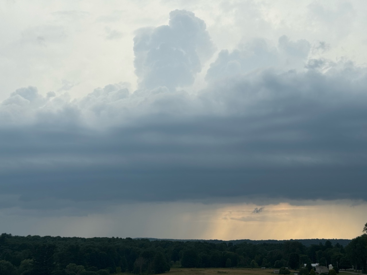
This gloomy thunderstorm cloud, photographed Sunday
matched my mood Monday evening as I contemplated
bad weather, climate change, and environmental threats
I fell into a negative mood last evening. 

I was sitting outside, sweating in the tropical Vermont humidity, a few hours after an alleged "cold front" had passed through town where I am, not far from the Canadian border. 

I'd tried to do some needed yard work, but it was too sultry to get much done. I figured I should just sit down and enjoy the day lilies blooming around me. 

 Mid-summer flowers usually improve my mood. Last evening, those flowers, bright as they are, weren't lifting my spirits as much as I'd like. 

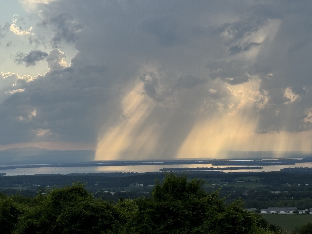
Sure, Vermont was lucky with the weather once again on Monday. A few places around the state saw some strong storms, but there wasn't really any damage, no real flooding this time. That was good news.  

But as usual these days, my social media feed last evening was filled with news of new weather emergencies, probably fueled in large parts by climate change. 

A tropical system was brewing near Florida. But once again, it produced news of another one in 1,000 year rainfall event. This time it was around Plant City, Florida, which managed to receive 10 inches of rain in just three hours. Funny how those one in one thousand year flood events keep happening like, every hour. 

I continued on, doom scrolling with my iPhone, coughing a bit in the Vermont air that had once again become smoky from giant, distant wildfires in Canada. I saw we're under another air quality alert. So much for pristine Green Mountain air. 

That air quality alert will stay in effect through at least today.  It's going to be another hot, humid one, too. Health officials are telling us that the combination of sultry, tropical air, the smoke and all that means we should once again limit outdoor activity, especially if you have pre-existing health issues. 

More weather updates on my phone. New York City just had its second wettest hour on record, with 2.07 inches, half its normal monthly installment of rain.  The Central Park downpour was second only to the mega-former Hurricane Ida floods in the Big Apple in 2021.  

Subway service was suspended, roads were under water, cars were trapped, flights were delayed, What a mess!

In neighboring New Jersey, as much as six inches of rain fell in a matter of hours. Flash flood warnings were blaring in most of the Mid-Atlantic states. Parts of the New Jersey Turnpike were really rivers. Fast flowing water raced through homes and businesses in Plainfield, New Jersey, and other towns.  The governor of New Jersey declared a state of emergency

Emergency? Yeah, no kidding. 

Climate change is really turbocharging summer downpours. As I've written previously, it's the summer of floods in the U.S.. and that shows no signs of change.  

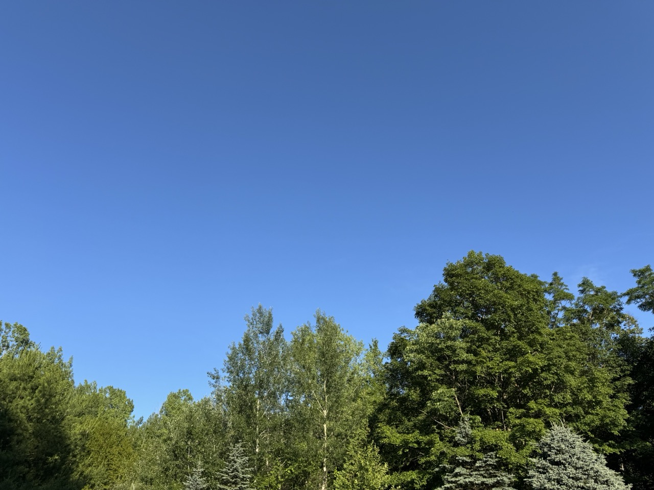
Day lilies glow in the hazy morning sun today in St
Albans, Vermont. Despite worries like climate change
and the environment, there's lots to be grateful for, 

I gazed up my phone at the yard as it was growing dark.  A couple fireflies blinked half-heartedly in the humid dusk. 

There used to be a lot more fireflies. I don't know whether this is a one-summer lull at my house or something else. But I do know firefly  numbers are declining. 

I used to enjoy the bats that once swooped around my deck at dusk in the summer. They're gone, too, decimated by something called white nose syndrome, a fungus that kills them, 

My crowded perennial gardens used to buzz with bees. This summer, only a few have been buzzing around. Was it this year's rainy weather or something else? I know bee populations are crashing, mostly because of our use of pesticides and a disease spreading mite that came from overseas in the 1980s. 

Global trade is great on our pocketbooks, but not on the environment.  All kinds of invasive are killing things we love.  Giant chestnut trees were lost at the turn of the 20th century Our big gracious big elms in the mid-century to dutch elm disease.

I glanced upward last night in the gathering dusk around my house at the nearby dead trees. They were deceased white ash trees, decimated by the emerald ash borer. Those dead ash trees are everywhere now, giving a winter look in spots to our oppressively hot, smoky Vermont summer. 

Next on the list potentially is our beloved sugar maples, central to Vermont's identity. Asian longhorn beetles are spreading in the U.S., and could eventually create real, disheartening trouble to our maple syrup industry.

I turned again to the weather forecast before giving up for the evening. We'll have a couple days that reach at least 90 degrees in many locations today and tomorrow.  Great beach days, right? Despite the smoke?

Well, some beaches are closed due to algae blooms. And Burlington has an unfortunate mishap at the sewage treatment plant, and that closed beaches around that city. 

By Thursday, the risk of showers and thunderstorms returns with the approach of a cold front. 

That might be a reason to lift my spirits.   The next cold front looks like it means business. We could actually have some delightfully dry and seasonably cool air by later Friday and Saturday.  A reason to go on living! 

I've always been fascinated and embrace the weather, the outdoors, nature. Sure, I get gloomy sometimes thinking about what's going on.  With climate change. Environment trouble. Invasives.  

The solution, of course, is to not let the negativity that I was experiencing last evening to linger. Do something about climate change and the environment to the best of your ability. There's only so much we can contribute, of course. 

Most importantly we need to love what we still have. And if you think about it, that's still plenty. 

Which brings us to this morning. Songbirds, as usual, were my sunrise happy alarm clock. I ventured outdoors.   The view from my house of Lake Champlain and the Adirondacks beyond was obscured by smoke. 

But those day lilies happily danced in the early morning breeze and hazy sunshine, this time doing their job and making me smile. 

The woods around my house had that beautiful, soothing deep green mid-summer lushness it always has in July. The hydrangeas were decked out in their early season white blooms, flecked with delicate pink. A couple of dragonflies did their helicopter-like aerial acrobatics, expertly removing annoying biting insects from the yard. 

Despite everything, there's still a lot of beauty out there. Enjoy it. For your own sanity. 


Monday, July 14, 2025

The Usual For Vermont These Days: Humidity, Storms, Wildfire Smoke, But Where Will The Worst Of It Hit?

A menacing thunderstorm with great structure approaching
Georgia, Vermont last evening. Despite appearance, the
storm wasn't severe. Storms that came through parts of
Vermont Sunday were relatively tame, so no problems
with wind damage or floods were reported. 
 It's another humid morning out there in Vermont among many humid morning we've already seen this summer. 

There's more on the way, so that will be a familiar topic. So, too, will be the risk of storms, local flash flooding. Plus our old friend wildfire smoke is returning too. Oh, joy! 

Someday, we'll have cool, dry, clean air, but not too soon I'm afraid.

There is good news to report. None of the showers and storms that came through Vermont yesterday and last evening were severe, even if they were accompanied by menacing looking clouds. 

Some of the storms knocked down a few trees and power lines in northern New York, but none of those storms caused trouble once they crossed the border into the Green Mountain State. 

Those storms kept their flooding issues west and north of Vermont, too.  We was a flash flood warning for a time in part of the Adirondacks. And further west, there was substantial flash flooding in central New York, especially around Newark Valley, New York, southeast of Ithaca. 

Flash flooding was also reported around the Montreal metro area. Up to three inches of rain in a short time flooded basements and highways, cut power and caused flight delays at the city's airports. 

We have a new weather record to report, too. At least a tie.  Burlington received a little rain Sunday, just 0.16 inches. But that's enough to have made this past weekend the 30th in a row with at least some precipitation.  That ties the record for most consecutive weekends with at least some rain or snow in Burlington. 

STORMS/FLOOD POTENTIAL

The additional good news - for Vermont anyway - is that if we do see any flash flooding from additional storms today those instances will be pretty isolated. 

The more substantial flood trouble will be to our south, most in the Mid-Atlantic region. Down by Washington DC, Philadelphia, New Jersey and that area, there's a serious risk of real flood trouble today.  

While we will have thunderstorms in Vermont today they're also unlikely to be severe.

One thing that's helping is the weather front that will be driving today's storms is moving a bit faster than expected. It's technically a cold front, but unlike most cold fronts it doesn't get any cooler or much less humid behind it. 

Showers and thunderstorms seen erupting late
Sunday afternoon looking west from Georgia, Vermont. 

But the front does have a punch of drier air higher up in the atmosphere, and that will help suppress showers and  thunderstorms in northwestern Vermont, which got the most rain yesterday. 

 I suspect areas north of Route 2 and west of the Green Mountains should be done with the shower and storm risk by mid-afternoon at the latest. 

We'll still have to watch through the day for potential isolated instances of flash flooding in the Northeast Kingdom, parts of which are still recovering from last week's flood. 

If we do have any flash flooding today - remember, that's just an if - far southern Vermont will be the most likely place. They had some pretty heavy downpours Saturday. And today's storm and downpour threat will last all day into the early evening down there. 

Do note that almost everybody in Vermont will get much less than an inch of rain today. It will just be a few pinpoint locations that really get hit with the downpours. 

SMOKE

Those wildfires in central Canada, after simmering down for a time, have really perked up again. Those fires have also spread into Ontario.  

Smoke from the fires has been choking the Upper Midwest for a few days now. This weather front coming into Vermont today will help pull some of that smoke into our area starting later today and continuing at least through tomorrow and probably beyond.

You'll notice the haze tomorrow for sure. The air quality will probably not be all that great either. Especially since it will be combined with the expected heat and humidity, the smoke could be a problem for people with health issues. So you'll want to take it easy.  People with asthma will want to have their stuff together in case of an attack

HEAT/HUMIDITY

Despite the sun being dimmed a bit from the smoke, a burst of hot weather is likely Tuesday, Wednesday and maybe Thursday.  Warmer valley could reach 90 degrees all three days. The hottest day looks like it will be Wednesday, when many of us will see highs in the low 90s. 

The humidity will remain awful. On the bright side, I suppose, high pressure will ensure that thunderstorms will probably remain few and far between Tuesday and Wednesday. But the slightest little trigger in this kind of weather can pop up a slow moving storm with torrential downpours, so we won't be completely out the woods. 

THE END?

A slightly better cold front than that poor excuse for today's weather front seems like it wants to approach us later Thursday or Friday. We'll have to watch that one for heavy rains and a flood risk again toward the end of the week. But it looks like temperatures and humidity should fall to near normal levels by the weekend. 

That "normal" is  the new normal of course. In this climate changed world, normal high and low temperatures are higher than they once were. This time of year "normal" highs and lows in Burlington are deemed at 83/63.   The normal high and low in Burlington in mid-July a few decades ago was 80/59.

Friday, July 11, 2025

For 3rd July 10 In A Row, Vermont Suffers Through Damaging Floods, More Trouble Ahead?

Thunderstorms developing near Lake Champlain 
caused falling rain and sunshine to mix in
interesting patterns, as seen from St. Albans, Vermont
Thursday. Though this storm was picturesque,
other storms elsewhere in Vermont caused a lot
of flood damage for the third July 10 in a row. 
 Yes, incredibly, as you might have already heard, for the third July 10 in a row, Vermont suffered through damaging flooding. 

The worst of the trouble this time was up in the Northeast Kingdom, with reports of water in homes, swift water rescue teams rushing a respond, roads closed, and four to five inches of rain in spots. 

Other flooding was reported in parts of Addison County. 

At least one swift water rescue was reported along Calendar Brook Road in Sutton.  They were there to "assist the residents of one  home cut off by floodwater," according to a Vermont Emergency Management statement, as VTDigger reported. 

Other rescue teams were staged around the state just in case. 

Barton and Orleans, and other Northeast Kingdoms communities have now suffered flood damage for the third July 10 in a row. That has to be incredibly disheartening. 

Damage reports from Thursday were a dime a dozen.  Sheffield Road was washed out in Sutton. School Street in West Burke was under water. Route 114 was closed due to a culvert washout in East Haven. Part of Route 58 in Orleans was washed out.

A number of local town roads in the Northeast Kingdom were either damaged or closed or both by washouts and flooding. 

Rainfall amounts in parts of the Northeast Kingdom were impressive to say the least. West Burke reported 5.07 inches, Sutton saw 4.92 inches. Down in Addison County, 4.32 inches fell in New Haven, where at least one road was closed by flooding. 

The storms this time were hit and miss. Parts of northwest and southern Vermont saw almost no rain. Burlington reported just 0.02 inches. Montpelier reported a tame 0.26 inches, which had to be a relief compared to the more than six inches of rain Montpelier endured on July 10-11, 2023, and the more than three inches they had last year. 

 If you want to find a weak silver lining from yesterday, I suppose the trend line is good. Thursday's floods weren't as widespread as last year's. And the floods of 2023 were even worse than in 2024. 

Almost all the damage from yesterday was in limited to the Northeast Kingdom and parts of Addison County. Last year's floods affected most of northern Vermont. The July, 2023 floods affected almost the entire state. 

So each July 10 is better, maybe?

That's cold comfort to anyone who suffered damage yesterday. It was especially distressing to have another July 10 in which the weather radio was crackling with an onslaught of flood and severe storm warnings. 

Still, another bright side was that some towns and cities that were hard hit in 2023 and 2024 like Barre, Montpelier and Johnson, reported little damage from Thursday's storms.  

Severe thunderstorms with powerful winds also roamed parts of the state Thursday. The roof of Middlbury High School was damage by powerful storm winds. Multiple trees crashed to the ground and blocked parts of Route 125 in Middlebury and Weybridge, along with Route 17 in Weybridge. 

Some tree damage was reported in Williamstown and Hyde Park

I don't know whether Thursday's damage qualified Vermont for federal disaster aid. Complicating the picture is the Trump administration is famously withholding disaster funds.  

The flood and storm reports from yesterday are still coming in, so I'll update as warranted throughout this. 

HEAT AND STORMS TO CONTINUE

Much like in the aftermath of the floods of July 2023, and 2024, Vermont is now settling into a weather pattern featuring hot, humid weather accompanied by some risk of additional damaging storms. 

NOAA's Weather Prediction Center, keeps Vermont (and many other parts of the nation) in a marginal risk for more flash flooding Saturday, Sunday and Monday. That's the least dire of four tiers of flood risk, meaning there's a chance of isolated flash floods.

On Saturday, there's only going to be scattered storms here and there, mostly just because the air mass will be warm and humid. At this point I think Saturday's the lowest risk day, and chances are good we'll get through the day with no trouble.

Forecasters are watching the period from Sunday evening into Monday. The air will be very humid, and a weather front will be approaching from the west. (Some are calling it a cold front, but there's nothing cold about it). 

We could see a few scattered instances of downpours heavy enough to cause some localized new flood issues.  Again, nothing widespread, but something to keep an eye on.

Behind this "cold front" on Monday, the air will stay very warm and humid, so that thing is going to be just a thunderstorm trigger and pretty much nothing else. 

A heat ridge will build in the eastern U.S. next week, ensuring Vermont will stay very warm and humid probably at least until the end of next week. 

Check out these forecast daily highs in Burlington Saturday, through Thursday: 87, 89, 85, 90, 92, 92. So yeah, icky,

Vermont will also be near the northern edge of that heat dome. Clusters of thunderstorms often ride along the northern edge of these things. We'll need to be on guard for the risk of perhaps some severe storms or local flash floods again most of next week. 

We don't know for sure about that. If we're lucky, everything will go by to our north. We'll have better forecasts once we get into next week. 

Sunday, July 6, 2025

Heat And Storms: Must Be July In Vermont, Also, Will This Be First Rain Free Weekend Since Last Year

A small sea of day lilies in St. Albans, Vermont this
morning gear up for a hot, humid Sunday. 
 It seemed strange Saturday morning waking up to cool temperatures in the 50s and finding parts of Vermont were under a heat advisory. 

But that heat advisory is indeed in effect for this afternoon in the Champlain and lower Connecticut River valleys and some low elevations in southwestern Vermont today as we get ready for a brief but pretty strong squirt of hot weather.

The surging heat struggling to make it toward Vermont Saturday as a weak warm front lingered to our north in Quebec. 

That sent some clouds down our way in the afternoon, tempering readings that had been expected to reach the mid-80s. Instead, at least in northern Vermont in was in the 70s to near 80.  

A few of those northern Vermont clouds yielded sprinkles. A few rain drops fell late Saturday afternoon here in St. Albans. So in a sense, that ruined the chances of having our first precipitation-free weekend since mid-December. 

But not officially. Not so much as a single raindrop fell at the National Weather Service office in South Burlington, which is where this rainy weekend streak is being measured. So the 28 consecutive weekends with precipitation will end today unless at rains at the NWS office.

TODAY 

It could actually rain in Burlington today, which is a change from previous forecasts, though odds are still somewhat tilted against showers or storms there today.  

This morning, many of us woke up to a fairly comfortable dawn. Temperatures bottomed out near 60 in most places in Vermont away from the Champlain Valley. . Lows this morning in the Champlain Valley were in the armer low 70s. 

Temperature and humidity will rapidly increase through this morning as the hot blast of air flows in. In areas where the heat advisory is in effect, actual temperatures should hit the low 90s with a heat index in the upper 90s. 

Elsewhere in Vermont it will be uncomfortably hot, too.  It won't be as bad as that extreme, record breaking hot spell on June 23-24, but you will still want to take it easy.

The change in the forecast is the risk of a few thunderstorms this afternoon, especially over the northern half of the state. Previous forecast had indicated too much sinking air and dry conditions high overhead for any storms or showers to form.  

Now, we're not so sure. Some computer models have scattered storms developing while others have practically nothing this afternoon. It's a waiting game to see which ones are correct.  Already, an odd little downpour formed seemingly out of nowhere around  St. Albans shortly after  9 a.m. this morning. 

Almost anytime you have heat and humidity, there's always a chance a storm could fire up. If you have outdoor plans today, go ahead and enjoy, but just be ready to seek shelter inside a building, away from potential lightning, just in case.

MONDAY

There's a much better chance of showers and storms Monday as a weak cold front slowly sinks southward and approaches us from Quebec.

It'll still be very warm and quite humid, with temperatures in the 80s, with low 90s south. With the cold front pushing into that, we could get some decent storms. 

There's a fairly low but still real chance a couple storms could be severe, and an equally low but real chance we could have a few local flash flood issues. 

The biggest threat would be a microburst here or there. A microburst works as follows: 

Strong updrafts feed thunderstorms. Those updrafts also suspend lots of rain drops and hail stones up in the storm. Some storms will reach a point at which the updraft collapses, and all that rain comes down in a  great, high speed gush of downward moving air and water.

That gush hits the ground and causes an small swath of damaging winds and torrential rains. The damage area from these things are usually at most a mile or two wide and a few miles long. But they mean business!

Individual storms Monday should have a fast enough forward motion to prevent flash floods. The problem is the cold front itself will just be crawling southward at a snails pace.

Which means you could get one thunderstorm after another traveling west to east over the same path just south of the cold front. If that happens, a particular spot could get a few thunderstorms, and enough downpours to cause some local flash floods. At this point, it looks unlikely for Monday, but still definitely possible. 

The best chances of storms are in the northern half of Vermont, which will be closer to the front. 

BEYOND MONDAY

The cold front, such as it is, will still be struggling through southern Vermont Tuesday, so the best chances of more storms are down that way.  One slight wild card is soon to be former Tropical Storm Chantal.

It came ashore in South Carolina early today with top winds of 50 mph. Not a huge storm. Chantal's remnants are forecast move northeastward along the coast into or near southern New England midweek. 

Former Chantal's path could possibly slow the cold front down even more. We'll see.

In any event, this isn't exactly a powerhouse cold front. Temperatures for the rest of the week will remain near or a little warmer than normal for the rest of the week. We might get a bit of a break from the humidity Wednesday, but it will be brief.

It looks like humid, unsettled weather will probably return by Thursday.  

Tuesday, July 1, 2025

After A Classic Vermont Summer Day, We Get Classic July 4 Week Changeable Summer Weather.

My two favorite colors on a summer day. A deep blue 
sky and the rich green of late June trees. Which made
Monday in Vermont a perfect summer day. 
Today, the humidity is back. 
I hope you loved the Vermont weather on Monday.

It was my favorite kind of summer weather. I call them blue/green days, for the two colors that dominated a perfect summer day. 

The wildfire smoke that plagued the skies of Vermont, and most of the United States has diminished for now. 

That left us with deep blue summer skies and hills and Vermont mountains glowing a luxurious, verdant  green.  

After a cool, comfortable start, it turned out to be a very warm day. Burlington just missed another 90 degree day, topping out at 89. 

But it wasn't humid at all. A cool dip in the water, followed by a slight breeze on your wet skin in the relatively dry air cooled you off nicely. 

If you weren't at the beach and opted for a hike or gardening or some other outdoor activity, it was comfortable despite the warmth, especially if you kept to the shade.  A classic summer day. 

TODAY

Well, that's over, and the humidity is back. We'll be dealing with that on and off at least through August, so get used to it. The classic summer weather is continuing, but not in the fashion everybody loves, I guess. 

In the Champlain Valley, it never really cooled off last night. It was still 81 at 2 a.m. At dawn, after some rain arrived, it was in the mid 70s with a dew point of a sticky 69 degrees.

That mugginess will be the theme of the day. 

This morning should be the wettest part of the day.   One band of downpours was heading into central and northern Vermont as of 6:30 a.m.  Showers should be around much of the morning.  

We'll get pretty warm again today, with highs in the mid 80s in many places. But the humidity will make it feel worse. A humid day with a cold front approaching is a recipe for lots of severe storms, so you'd think we need to really be on our toes today.

However, we won't see widespread storms.  A lot of clouds will linger, and there's not a lot of upper air support for organized severe weather.  So it's not a great environment for a wild storm day. 

Central and southern Vermont could have a one or two strong or marginally severe storms, but most of us will see garden variety downpours this afternoon, if anything. It'll all be hit and miss, with perhaps half or more of Vermont being in the miss category this afternoon and evening. 

NOAA also has Vermont under a marginal risk of flash floods, but that's a really low risk today. There might be isolated minor problems, but the downpours won't be lingering in any one place for too long, which minimizes the danger. 

The real flood problems look like they'll be in the Mid-Atlantic States, where torrential rains will hit areas that experienced flash flooding on Monday. 

 WEDNESDAY

The "cold front" coming through later today is just a humidity front. In other words, it won't be any cooler on Wednesday than today, but the humidity will be somewhat lower. It won't exactly be Sahara Desert dry, you'll still feel some mugginess. But it won't be awful as temperatures rise once again into the 80s

THURSDAY

This might be another one of my favorite type of summer days, but in a different way than Monday. Another cold front will be coming in, and a chilly pocket of air will move in high overhead. That'll create some beautiful tall billowing clouds that will develop into showers and scattered thunderstorms.

This is shaping up to be yet another version of a  classic Vermont summer day.  The kind where you lie down in the grass and watch the clouds keep making new shapes. At least until the showers arrive. 

That type of day looks best if there is deep blue sky between the clouds. Unfortunately, a little wildfire smoke from Canada could make things a bit hazy, but it still looks like a pretty day. You'll just be dodging scattered storms. It will probably not be the best day to be out on the lake or on mountain summits, given the risk of lightning and thunderstorms. 

There is a marginal risk of one or two strong storms.  Since there will be cold air aloft, the very strongest storms could produce some hail and some gusty winds.  We'll keep an eye on this to see what future forecasts bring. 

FOURTH OF JULY AND BEYOND

It still looks like July 4 will be cool and partly sunny with rock bottom humidity, so that'll be nice for watching the parades. Maybe.

Some forecasts keep an upper level low nearby, which would create a rather overcast Fourth of July for the Green Mountain State. We'll wait and see on that. But at least we know it won't be blazing hot. OK, a cool Fourth of July isn't exactly classic summer weather, but at least you won't die of heat stroke along the parade route. 

The evening at this point should feature mostly clearing skies (cross your fingers) so you won't have trouble checking out the fireworks.  Warmth and humidity look like they want to return for the weekend. Especially on Sunday.

Sunday, June 29, 2025

Weird Vermont Rain And Humidity Moments On Saturday; Slow Clearing Today, Hot Monday, Maybe Nice Fourth?

A small shower that formed east of St Albans, Vermont
in the humid Saturday evening air created this
pretty sky after a very rainy morning and muggy afternoon.
Meteorological weirdness of a sort continued through the day Saturday, after early morning weather hijinks created some wind, rain and humidity oddness, as noted in yesterday's post.  

At least the weather didn't cause trouble or anything particularly noticeably bad for everyone.   Still it was an odd day.

As Saturday continued, I saw one of the steepest single-day increases in humidity I've ever seen. 

A little before dawn in Burlington, dry air had been pulled down from aloft. The gave the city a dew point of 40 degrees, which is very, very low for June. By 5 p.m. the dew point was 65 degrees, which is pretty muggy.

This led to a typical summer evening with a humid mix of clouds and sun and some pop up showers and storms here ad there. 

Earlier, in the morning, there was quite a maldistribution of rainfall, too. Showers and thunderstorms kept flowing across Vermont, north of Route 2. But they largely missed most other places. 

Here in St. Albans, my unofficial rain gauge caught a storm total of 1.1 inches Friday night and Saturday morning, a really solid rainfall. Meanwhile, Burlington, just south of the rain band, captured a paltry 0.05 inches.  Impressively low, considering some forecast several days ahead of Saturday's system were forecasting more than two inches of rain for Burlington. 

Still, Burlington did have measurable rain Saturday.  There have been 100 days with measurable precipitation so far this year in Burlington, which is the most to date of any year in records dating back to 1884.

Rainfall so far this year in Burlington is actually running close to normal. It's just the precipitation has been oddly frequent. 

 This all leaves us with a far northern Vermont, and southern Vermont with decent soil moisture, and some dry conditions across central Vermont.  Odd "winner and loser" type rain situations often happen in a Vermont summer. Hopefully that will even out soon. 

TODAY

Skies have been slow to clear this morning, so it might be awhile for some of us to actually enjoy some sunshine. It'll get there, eventually. The atmosphere is playing with us again, just as it did yesterday. This time, an inversion has formed, with a layer of warm air above cool air.

That trapped some moisture in the lower atmosphere, hence the cloud. The strong late June sunshine is at work mixing the air up, which should disperse the clouds this afternoon. It should still get sunny this afternoon in most places, with highs near 80, a decent amount sun (we hope!) and comfortable humidity. 

LOOKING AHEAD TO THE FOURTH

Monday still looks hot, but at least the humidity will only be moderately high. Warmer valleys could easily make it to 90 degrees again, but the dew point should be in the 60s. That's kinda muggy, but not terrible. Not like last week's heat. 

A cold front of sorts Tuesday will probably spread some showers and thunderstorms across Vermont. There's a low chance some of them will be strong. Since Tuesday will become terribly humid,  some storms might dump some torrential downpours.  We'll keep an eye on that.  I doubt Tuesday will bring us widespread scariness, but the situation is still worth keeping an eye on.

I call Tuesday's system a cold front of sorts because the air behind it won't be any cooler, really, Just drier. Wednesday could be quite a warm day with readings well into the 80s.

It does look like another front with cooler air and even colder air aloft should come through Thursday with its own packet of non-severe showers and storms.

If this all plays out as expected, the Fourth of July could end up being pretty nice. It'll probably be cool for the season, with highs only in the 70s. I imagine we'd see a fair amount of sun, but that chilly air aloft might clutter the afternoon sky with  some so-called fair weather clouds.

I never understood how they can be called fair weather clouds on days when they make the sky mostly cloudy but what do I know? That said, I think we might end up with a good amount of sun on the Fourth.


Wednesday, June 18, 2025

Strong/Severe Storms, Flood Risk, High Humidity, And Eventually, Heat Spices Up Vermont Forecast

NOAA's Storm Prediction Center has much of the eastern
U.S. including all of Vermont in a slight risk zone
(yellow shading) for severe storms Thursday. 
The weather here in Vermont is going to be more interesting than usual for this time of year over the next few days. 

The word "interesting" when describing weather forecasts is seldom welcome, as that usually spells trouble. And sure enough, the weather might complicate your life over the next few days.  

We have high humidity, the risk of strong to severe thunderstorms, a bit of a flash flood risk (again!), and eventually some dangerous summer heat. 

Tomorrow and next Monday and Tuesday are the biggest high alert days.. But, as we usually do, let's walk you through day by day, as every day for at least the next six has something noteworthy to offer us. 

TODAY

The humid air has arrived on schedule. You might have noticed your bedroom getting a bit stuffy overnight. 

The high humidity, combined with expected high temperatures in the low to mid 80s, should be enough to set off some showers and thunderstorms this afternoon and evening.

They could happen anywhere. There's were already a batch of showers passing through far southern Vermont early this morning. But the storms are most likely this afternoon and early evening in the northwestern third of Vermont and over northern New York.

Few, if any of these storms will get exceptionally strong or severe. But one or two of these storms could provide some gusty winds and heavy downpours. The forward motion of these storms will be kinda lame, so a couple spots in northwestern Vermont could really get dumped on.  

There's no risk of widespread flash flooding or anything like that, but those one or two spots, especially north of Route 2 and west of the Green Mountain, might (or might not!)  have a little problem with driveway and back road washouts, that kind of thing. 

Some places will avoid rain altogether today. Classic hit and miss. 

THURSDAY

This is a higher risk day. The high humidity will still be in place. Sunshine in the morning and early afternoon should boost temperatures into the mid or even upper 80s. A cold front will be approaching to make the air more unstable.

Winds aloft will become stronger, and change directions with height. Those are all ingredients to set off severe thunderstorms. 

For now, NOAA's Storm Prediction Center has all of Vermont under a slight risk of severe storms on Thursday. That's a level two out of five on the danger scale. It means there should be some scattered severe thunderstorms. 

As is almost always the case with this type of summer storm situation, only a small minority of us Vermonters will experience a severe storm.  Most of us will get at least some rain and hear thunder, and many of us should get at least a brief downpour.

It's just those few spots that will get nailed. It's impossible to tell more than a half hour to an hour in advance who gets the most dangerous storms. So you'll need to have a weather radio or some other source ready tomorrow to get warnings and advisories.

I'd also skip boating around Lake Champlain or hiking to the summits Thursday afternoon. 

The storms tomorrow will come at us either as relatively short lines of big storms or supercells. The biggest threat is from damaging straight line winds.  Large hail is pretty unlikely, but still possible. There's also a very low, but not zero chance of a brief spin up tornado mixed in there.

The other threat is flash flooding. Any flooding we do get - if we get any -  will be pretty isolated. Most places should be fine. 

However, the rain will be absolutely torrential in some of Thursday's  storms. Luckily, the storms will be moving right along, so they won't linger over one spot for too long to really flood things out. But if you get squarely hit by a big supercell, or microburst; or if two or more lines of storms hit you in rapid succession, there could be a local flash flood problem or too. 

The bottom line is NOAA's Weather Prediction Center has us in a low level marginal risk zone for localized flash floods 

FRIDAY

We get a break in the action. It'll be somewhat cooler and less humid since the cold front will have gone through.  There could be some lingering showers or garden variety thunderstorms scattered around here or there in the afternoon, especially north, but nothing scary. 

SATURDAY

There's an odd bit of uncertainty in Saturday's forecast.  The strong ridge of high pressure will be beginning to build toward us. That's what will set us up for next week's heat. 

We have to watch out for something called a ridge roller Saturday or Saturday night.. These are clusters of thunderstorms that rotate around the northern edge of a developing ridge of hot high pressure. They'd come in from the Midwest and then head southeastward, possibly in this case through northern New York and northern New England.

These things are super hard to predict three days in advance. Computer models are pretty insistent there will be a "ridge roller" but we don't know where it will go. Maybe through us, maybe across Quebec, maybe to our southwest toward western New York and Pennsylvania. Or maybe it won't happen at all. 

Ridge rollers can be pretty benign, and almost unnoticeable, or they could contain severe thunderstorms and flash floods.  This is just something to keep an eye on.  We'll monitor later forecasts.

SUNDAY

You'll start to notice the heat and humidity building up. It'll be a decent beach day, with a fair amount of sun and highs well into the 80s. Hottest spots could flirt with 90. 

MONDAY AND TUESDAY

Looking hot, with a very good chance of temperatures going over 90 degrees in many spots in Vermont. The humidity will be sky high.  Since this will start on Sunday, we'll have three days of this kind of weather. Which can wear on people after awhile and become dangerous. Especially for the elderly and people with health problems. 

The humidity will ensure that nights will stay very warm and muggy, so you won't get any relief after dark.  If there are people in your life who you worry about in this kind of weather,  it would be a good idea to check up on them early next week. Or better yet, "kidnap" them and take them to a chilly movie matinee, a nice cool air conditioned restaurant or shopping center or something. 

BEYOND TUESDAY

It looks like a cold front will cool things down somewhat by Wednesday. It will be no means get "cold" after the cold front, but it should at least feel more reasonable out there. 


Wednesday, June 4, 2025

Vermont's Fate Rest Of Week: Smoke, Heat, Then Storms And (Obviously!) A Rainy Saturday

Visible satellite photo of the Northeast U.S. and part of
southeast Canada at around 4 p.m, Tuesday That hazy
wispy stuff you see stretching from Quebec
through New York and western Vermont and down
off the Mid-Atlantic coast is smoke from 
Canadian forest fires.
A variety pack of weather awaits Vermont during the next few days, but spoiler: You know what Saturday's going to bring!  If you've lived through Saturdays in Vermont this year, you know the wet drill. 

Before that, we have a bunch of stuff to consider

SMOKE

Smoke from Canadian wildfires blew into Vermont as expected Tuesday, or more accurately, over Vermont.

Most of the smoke that turns the sky a sad bluish, yellowish gray and made the sunshine copper colored was high overhead, where we don't breathe.

Some smoke has made it down to the valleys where we live, but not much. Air quality in Vermont was still considered good this morning, though flirting with "moderate" in the north. 

Moderate means the air is still relatively clean, but there's enough stuff like particulates to bother people who are especially sensitive to pollution. 

The smokiness seems to be peaking this morning in Vermont. It looks like it will thin out a little mid to late afternoon, but not entirely go away. It'll still be hazy all day. 

HEAT

Today will be the hottest day of the year so far. You wouldn't think so in eastern Vermont early this morning, as temperatures there were in the 40s. But the Champlain Valley was in the 60s at dawn, and it'll go up sharply from there,

Pretty much everybody will be in the 80s this afternoon.  A few of the hottest spots might touch 90, though the smoke might dim the sun just enough to make us fall short. The National Weather Service is going with a 90 degree high in Burlington today, which would be the first such reading of the year. 

Humidity should be tolerable most of the day, but start to rise this evening. It'll be the first truly muggy night of the summer tonight, with most of us just getting down into the 60s. 

It'll be almost as hot tomorrow, with highs in the 80s, maybe near 90 again this time in the southeastern Vermont valleys. It will be more humid than today, so it will feel worse. And of course, summertime humidity often leads to.....

THUNDERSTORMS

An approaching weak cold front pushing into the heat and humidity will be enough to touch off some showers and thunderstorms in the afternoon and evening. This will be a hit and miss, winners and losers sort of situation. 

Most of us have about a 50/50 shot at seeing an afternoon thunderstorm. Some of us will get absolutely nothing, others will get pretty blasted. Others will have close misses or experience the edges of showers and storms. 

Given the heat and humidity, a couple storms might turn out to be strong to severe. A small minority of Vermont towns could get hit by damaging winds, small hail and torrential downpours. 

NOAA's Storm Prediction Center currently  has all of Vermont and surrounding areas in a marginal risk of severe storms on Thursday. That's a level one out of five alert tiers, and means there could be isolated instances of severe storms.

Only a few areas will see torrential downpours, and the storms will be moving right along instead of lingering over a particular spot, so the chances of flash flooding seem pretty low to me right now.

If things come together more than we think now, there could be slightly more numerous possibly strong storms on Thursday than currently forecast, but we'll wait for updates tomorrow morning.

FRIDAY

That weak cold front will limp into Vermont and stall over us or nearby.  Not sure exactly where yet, but we'll still have a chance of showers, Especially near where the front hangs up.  It'll be a little cooler, too, but still a bit on the warm side. We're calling in mid 70s to around 80 for now.

SATURDAY

It looks like we'll make it Vermont's 11th Saturday in a row with rain.  The entire state has a really good chance of seeing raindrops. It's now a question of whether it will be light and scattered or heavy, Even maybe heavy enough for a flood risk 

Before you panic, we don't even know whether it will rain torrentially anywhere,  That stalled front will be around....somewhere. 

A small storm will ride southwest to northeast along the front, which should produce the band of heavier rain. But the computer models as of this morning were all over the place with exactly where that might be. The area of downpours could be focused near Montreal, Or near New York City. Or someplace in between.

Since Vermont is - duh! between Montreal and New York, that does open the possibility that part of the Green Mountain State could see some torrents on Saturday. I guess we'll have to stay tuned to see where this goes. 


Wednesday, September 11, 2024

Just A Couple Small Hiccups In Very Long Vermont Dry, Sunny Spell

A blue sky morning today in St. Albans, Vermont. Get
used to it, as it will last much of the month. Although
every once in awhile a few clouds or wildfire smoke
and haze could intrude. 
Vermont's long stretch of warm, fair weather is just beginning now, and all the forecasts indicate this will stick around for a long time.  

September so far in the Green Mountain State has turned out to be a little on the cool side. 

Through yesterday, the month was running about three degrees cooler than the "new normal" in Burlington. That "new normal" is warmer than decades ago, so by historical standards, the first week of the month was pretty average.

That will change. 

Starting this afternoon, temperatures will start to run warmer than average for this time of year. Those temperatures will stay above normal for probably at least the next ten days, probably more. Quite possibly through the end of the month, in fact.

Despite the cool start, September, 2024 in Vermont will go down as yet another warm one. 

If you like warm, dry weather, this will be your month. But as always, there's a few hiccups thrown in. 

Hints of Humidity

 The humidity has been incredibly comfortable the past couple days. In fact, dew points - a rough measure of how humid it feels out there - hit the rock bottom 30s on Tuesday. 

It usually starts to feel a bit sticky when the dew point reaches 60 or so. It does seem like we will have more of a humid feel to the air starting tomorrow and lasting who knows how long. An ultra-weak system from Canada might temporarily drop the humidity to comfortable levels over the weekend, but those hints of mugginess should return next week.

This won't be super oppressive. Those dew points should rise into the low to mid 60s, enough to make it feel like summer. The humidity will also keep most nights somewhat on the warm. I guess it's a little soon to take down the window air conditioner. 

Fog and Sunshine Interruptions

Despite the remarkable strength and staying power of high pressure parking itself nearly overhead for days on end, tiny little disturbance should make inroads from time to time.  You might see somewhat cloudy periods here and there. One such little thing will come through tonight and part of tomorrow, which will interrupt the sun at times. Perhaps an isolated spot could even see a couple raindrops. But that's it. 

Much more importantly, this type of calm, mostly clear high pressure is a recipe for dense morning fog, especially this time of year. 

As the nighttime air cools, warm ground and water helps moisture condense into fog, especially in the valleys. Early morning commuters will need to be careful most mornings. Probably for the rest of the month at least. 

Wildfire Smoke

Record heat in the West as greatly intensified wildfires across California, Nevada and other states. Some of that smoke aloft will drift our way, so skies could become hazy at times once again. The amount of smoke in the air will wax and wane over the coming week or two. However, most of it will be aloft, and not so much near the surface. So, knock on wood, air quality will remain OK down here where we breathe. 

Tropical Storm Shield

This big, fat, stuck high pressure over New England and southeast Canada will deflect any tropical storms,  hurricanes or former tropical storms away from us during the next couple weeks. Hurricane Francine, set to slam into the Louisiana coast this morning, will at first head northeastward once it comes inland.

Often, that would eventually mean a good rainstorm for us. In this case, though, the remnants of Francine will smack into the high pressure and get trapped in or near Arkansas and die. No problem for us. 

There are some signs some sort of subtropical storm or tropical storm might form off the Southeast coast next week.  Some forecasts have it heading inland into the Carolinas.  Again, though, early indications are the high pressure will hold firm, keeping that potential system away from us. 

So bottom line, enjoy!