Showing posts with label flash floods. Show all posts

Sunday, June 14, 2026

So Far, Nothing Terrible In Vermont, But The Test Is This Evening, Flood, Severe Threat Continues

Not much activity in Vermont as of 5:20 p.m. as this
National Weather Service radar showed. But there
was a mess of showers, thunderstorms and 
downpours across western and central New York, 
 Things have felt pretty safe weather wise in Vermont so far today, but it looks like the critical time will be between now and about midnight or so. Especially for the flood risk. 

Rain showers have zipped across Vermont all day,  mostly north of Route 2 as expected. 

Although some of the showers had briefly heavy rain, they haven't yet been enough to set off any flooding concerns. 

The main atmospheric dynamics and the approach of the cold front will occur over the next few hours. 

Heavy rain and thunderstorms have blossomed over western New York and especially southeast Ontario, All the was headed generally eastward.

Whether or not this translates to severe thunderstorms or flash flooding in Vermont remains to be seen. 

Storms

As of late this afternoon, the threat of severe storms was more iffy than the heavy rain. Overcast skies have kept the instability in check.  

 A special discussion from NOAAs Storm Prediction Center noted the clouds holding instability in check across northern New York and northern Vermont might be overwhelmed by the strong winds aloft. 

If some thunderstorms get going, they might be able to create some strong wind gusts and hail However, if big storms do form, they will be pretty isolated in nature. That means storm in  northern Vermont probably won't be widespread enough to t warrant any kind of severe thunderstorm watch. 

The National Weather Service in South Burlington says they've noted bit of converging air masses roughly along a line from Saranac Lake, New York to Montpelier, 

Strong to severe storms might still fire up along that line this evening. Maybe. It still remains to be seen. 

In southern Vermont, there have been breaks of sun, and it's a little warmer and more humid down there. So the ingredients are still in place for strong to severe storms down there .

Flooding

This still looks like the greater of the two threats. But that doesn't mean another Flood of '23 by any stretch of the imagination. 

However, that doesn't let us entirely off the hook. There could be some spots with flash flooding, especially in the northern Green Mountains and in the Northeast Kingdom. And maybe near that convergence zone on the Saranac Lake to Montpelier line, 

Heavy bursts of rain will occur almost everywhere in Vermont. So any place that gets repeatedly hit by downpours this evening and early tonight is at risk for flash flooding.

The heaviest rain seems to be running a little behind scheduled. Downpours could persist until midnight or even a little after, so if we get any flash flooding, it could continue into the early morning hours of Monday. 

The flood watch in the northern half of Vermont remains in effect until 8 a.m. Monday. 

All the influences going on with this evening's weather are touch and go, So we might see severe storms and flooding or, if we're lucky, this will be another whiff.

In this case, whiffs are good. No damage, no scary moments, then no complaints. But we still need to be on our toes into this evening. 

The cold front will pass overnight. We're still anticipating delightful weather tomorrow. 


Stormy Vermont Weather Today To Bring Risk Of Damaging Winds, Local Flash Floods

Areas in yellow have the highest chance of 
seeing at least scattered severe thunderstorms
today. You see Vermont is included. 
 Yesterday was as perfect a summer day you can get in Vermont. The skies were blue and flecked with a few pretty puffy clouds. There was no haze, so the Green Mountains glimmered in their proper color. The air was quite warm, the humidity was gone, and a light breeze made it all feel perfect.  

Today, not so much. 

That strong cold front we've been talking about is threatening us with some really bad weather today. For most of us, it will be merely unpleasant, loud and at times dramatic. For a small minority of us, it could actually be dangerous. 

The two threats today are severe thunderstorms and local flash flooding. There is already a flood watch in effect for the northern half of Vermont today into early Monday. 

Who gets slammed with the worst weather today is mostly the luck of the draw. It depends on where the worst storms set up, and where the heaviest downpours fall.

But it's not entirely a guessing game. We do have a broad idea what will happen. But thunderstorms develop pretty quickly, so the exact spot that gets in trouble becomes clear often only minutes before the actual trouble arrives.  

This is the kind of day that you'll maybe want to rethink outdoor plans like hiking in the mountains or boating across Lake Champlain or a picnic on that gorgeous meadow,. 

You'll also want a way to receive warnings from the National Weather Service. I do think a few severe thunderstorm warnings will go out today. And there might well be a flash floor warning or two, especially north. 

 Severe Storms 

Areas in green shading have a very low, but not zero
chance of seeing a tornado today. Note that 
includes northern Vermont. 
On Friday, we didn't have much in the way of severe thunderstorms because the upper winds weren't very strong. That's not the issue today. Those winds high above us will be strong this afternoon and evening, and they will change direction with height. Storms could bring those high winds down on us. 

NOAA's Storm Prediction Center early this morning updated their outlook. All of Vermont is in a slight risk zone of severe storms . That's a level two out of five risk level.  Actually a huge area is under that slight risk zone, from the western half of New England, as far west as Ohio, and all the way down the East Coast as far as northern Georgia. 

In all these areas, including Vermont, the biggest hazard  from this set up is strong, damaging straight line winds. 

However, in many areas under this risk zone, there's a risk of a brief tornado. That little twister risk includes Vermont north of Route 4 and northern New York, New Hampshire and Maine. 

The risk of a tornado is very, very low, but not zero. 

The best chance for severe storms is from about noon to 6 p.m. north, possibly lasting a little longer than that central and south. 

Flash Flooding

Weather radar at 10 a.m. showed areas of heavy rain
already starting to move toward far northern Vermont.
Repeated rounds of storms and downpours today 
and tonight could lead to some flash flooding, 
Don't let  today's early morning low humidity fool you, a big surge of moisture is coming in, an is about to interact with that slow moving cold front coming at us from the northwest. 

This will be like the thunderstorm risk: Most places won't have a flood, but there's at least a chance some places will, Especially north of Route 2, and most especially near the Canadian border. 

One area of rain, with a few embedded downpours, seemed to be moving into far northern Vermont as of 9:30 a.m. which could be the start of the soaking up there. 

Waves of thunderstorms and torrential showers should sweep across Vermont today and the first half of tonight, and that's especially true in the north. 

Some areas in northern parts of the sate could see more than 2.5 inches of rain out of this, though most places there will get a little over an inch. 

Individual showers and storms will be moving quite fast. That means just one or two storms moving over the same area won't linger long enough to produce flooding rains. But today,   numerous storms look like they will follow the same path, possibly dumping way too much water for brooks, creeks, ditches and culverts to handle. 

It looks like the latest data supports the idea of a flood risk. Early this morning, northern Maine was under a flood watch. By 8:43, a flood watch went up for northern New Hampshire. Then, at 9:23 a.m., the National Weather Service in South Burlington issued that flood watch for northern Vermont. 

Bottom line: Today is one of those annoying days where we'll be dodging bad and sometimes dangerous weather. Unfortunately, a very few of us might be picked by Ma Nature to end up picking up pieces and filing insurance claims. 

Not just here, but up and down the East Coast. 

REST OF THE WEEK

The good news, I suppose, is that this cold front will usher in some delightful weather tomorrow and Tuesday. 

Highs both days will be in the 70s under partly to mostly sunny skies.

Another strong storm for this time of year possibly looms for this Thursday, but let's worry about today and get to that one later. 


Tuesday, June 9, 2026

lt's Flash Flood Season In Much Of the U.S. No Big Threats In Vermont - Yet

Damage from flash flooding near Hinesburg, Vermont
in July, 2024. We're now entering prime flash flood
season, and Vermonters still have some PTSD from
the floods of the last three summers. Very slight 
chance of some local flash floods Wednesday night
in Vermont, but no big threats ---yet
Summer is the season of flash floods in the United States.

Such floods can happen anytime of year, of course. But summer, with its slow moving and/or intense thunderstorms, is the prime season. 

Sunday night, a flash flood emergency was declared in and around Huntsville, Alabama, where people had to be plucked from flooded cars. Water also got into several homes. 

We're already seeing some pretty big flash floods this week.  On Monday, rain fell at a rate of up to four inches per hour around Joplin, Missouri, and some people had to be rescued from inundated cars. Fox Weather reports. Downtown Seneca, Missouri was also flooded out. 

Flash flooding was reported in Texas, too.

Overnight, severe storms prompted flash flood warnings in central Kansas, where up to 5.5 inches of rain fell and another one to two inches was expected. Parts of the southeastern U.S. and Tennessee Valley are at risk for flash floods today.  

For Wednesday night, NOAA's Weather Prediction Center added a marginal risk for flash flooding in northern New York, all but far southern Vermont and northern New Hampshire. 

The agency said very humid air and a weather disturbance cold cause some instances of local flash flooding. 

Local meteorologists and myself are not too worried about flash flooding tomorrow and tomorrow night. We could easily see some gully washer downpours, but serious flooding looks doubtful. 

Most of us will get a half inch or less of rain Wednesday through Thursday. That doesn't scream "flooding."  But, thunderstorms could dump much more than that in small, localized areas.

Still, this is Vermont, and we have a long history of flash flooding. Our steep terrain in many areas encourages water to rush out of the hills during torrential rains. Climate change has raised the stakes, as downpours in a warmer world tend to be more intense. Warmer air can hold more water. That water can get released in the right conditions. 

Those "right conditions" in Vermont led to severe, destructive and deadly summertime flash floods in 2023 and 2024. Less extensive but still severe flash floods hit parts of the Northeast Kingdom last summer.

As a result, we're all gun shy and a little bit PTSD-wracked when it comes to flash flood risks across the Green Mountain State. Tis the season to keep a close eye on weather forecasts around here, especially if it's really humid and threatening to storm. 


Tuesday, October 21, 2025

Tropical Storm Melissa Forms In Caribbean; Future Track A Toss Up

The forecast track of a tropical storm or hurricane 
usually takes the form of a "cone of uncertainty."
The future track of Tropical Storm Melissa is
SO uncertain that the cone of uncertainty is a
circle, meaning it could go anywhere. 
 
was born this morning in the central Caribbean Sea, but where this storm will eventually end up is anybody's guess.

The disturbance that grew into Melissa had been rocketing westward across the Atlantic Ocean. It was moving so fast, it couldn't really develop into analyzing. 

Now, the storm's forward speed is slowing way down, so it has been able to grow into a tropical storm. As of 11 a.m. this morning top wind speeds were 50 mph.  

The National Hurricane Center alerts the public about a predicted path of a tropical storm or hurricane with something called a cone of uncertainty

It's called that because the graphic looks like a cone. The middle of the cone is where the official forecast is, but areas either side of the path are shaded in to reflect the possibility the storm could go to the left or right of its predicted path. 

Forecasters usually know where a tropical system is headed over the next 12 to 24 hours so the range of predicted paths is initially small. A few days out, there's more uncertainty, so the areas on a map shaded in where the system might go is wider. Hence the cone of uncertainty. 

I bring this up because today's "cone of uncertainty" for Melissa is essentially a circle. Which basically means it could go anywhere.  It's the weirdest cone of uncertainty I can remember with any tropical storm or hurricane. 

Steering winds in the atmosphere are weakening so it's hard to say which direction Melissa might go. That said, even though steering winds are weak,  there are fairly strong winds blowing the tops of Melissa's thunderstorms askew, so the storm might not strengthen all that fast. Plus, dry air might get injested into Melissa, which would also slow a strengthening trend. 

Satellite view of Tropical Storm Melissa shows it's kind of
a mess, as strong upper level winds are screwing
up the thunderstorms that power the storm. 

Whether Melissa grows into a hurricane also depends on where it goes. If it gets stuck over land, it would weaken, or at least not really strengthen. 

On the other hand, the Caribbean waters are at record warm levels for this time of year.  If it stays over the water, there's a chance this thing could get pretty strong. 

Super warm water is jet fuel for tropical systems, so if Melissa ends up growing into a pretty good size hurricane, I wouldn't be surprised.

Since Melissa will be moving so slowly, any island it nears will get incredible boatloads of rain. 

 Big flash floods and landslides are already in the forecast though this weekend in the Dominican Republic and Haiti. 

A hurricane watch is also in effect in parts of Haiti. Jamaica is under a tropical storm watch.  

It's going to take a few days to figure out where Melissa is headed and whether it would be a threat to the United States. If it does eventually make it to the U.S., the most likely state to be hit would be Florida. But even there, the chance looks reasonably low at this point. 

Tuesday, October 14, 2025

Oddly Early Winter Storm Snarls California, And Additional Rough, Wet Weather Hits Other Parts Of U.S. Southwest

Workers try to clear storm drains in San Francisco
Monday as cars splash through the deep puddles.
An oddly early, strong storm is hitting
Californian. Photo from the San Fransisco 
Chronicle, via Facebook
.
 California is being hit today by the kind of storm they usually have to wait until January or February to see. 

The storm features locally heavy rains, the threat of debris flows and mudslides, heavy snow in the mountains and even a low but still real chance of a brief tornado in the Los Angeles basin. 

This type of storm hits California fairly regularly in the dead of winter, but they almost never happen this early in the season. 

The biggest threat from this storm is for people who live near and below the sites of those giant, deadly wildfires that hit the L.A. area last January. 

The City of Los Angeles issued evacuation warnings for homes near the fire burn areas in Pacific Palisades and Malibu, KTLA tells us. 

People who live near the site of a big January fire in and around Altadena were also told to be on the alert to possible evacuations. Same was true near other burn scars in Orange County. 

Valleys in southern California can expect an inch of rain, give or take, which is wildly big for October. The mountains and foothills can expect two to four inches. 

Normal rainfall for the entire month of October in Los Angeles is about a half inch. 

The biggest problem is that the rain in southern California should come in a relatively brief time, with most of it falling within four to six hours. Such downpours can really move rocks and dirt in areas where vegetation was destroyed by wildfires. 

As of 5:30 a.m local time, a gusty thunderstorm with downpours and gusts to 55 mph was blustering through the Los Angeles basin. Very odd for what is normally a dry time of year. 

Further north, the first snows of the season have started falling in the notoriously snowy Sierra Nevada mountains. 

By midwinter standards, this storm isn't huge. But for October, it's impressive. Snow levels were forecast to fall to 5,000 feet above sea level today. Interstate 80 through Donner Pass should have slushy snow and traffic delays along it today. Higher up, some ski resorts, though not open yet, can expect maybe a foot of snow. So I imagine some renegade skiers and riders will be up there doing their thing.

In the San Francisco Bay Area, torrential rains flooded roads and drowned cars in many areas. Several days, mostly Ubers and Lyfts leaving the airport, got trapped in flash flooding Monday night, ABC7 News in San Francisco reported

San Francisco on average receives 0.79 inches of rain during the entire month of October. More than that fell in just one day Monday, as the city received 0.87 inches, at least as measured at the airport. 

The oddly early preview of the California rainy season might or might not be good news for the fall and early winter wildfire season.

Strong, dry Santa Ana winds propel the ferocious wildfires in southern California. The worst of them hit from about now through mid December. (Last year, the lack of rain and the Santa Anas kept going well into January, hence the deadly mega fires in the L.A area).

Initially, everything will be damp, so the wildfire risk will be low. But the rain will inspire new plant growth - grass, weeds, that kind of thing. 

By this time of year, northern California is close enough to the normal storm track so that wildfire season is probably over up there. 

But in southern California, that new growth could dry out and become tinder for fires later this fall and early winter.  Southern California is not out of the woods for wildfires just yet. 

That's true even though the weird October rains in California might not be over. Another storm, smaller and weaker than the one they're getting now, could come through next Monday with a little more rain. After that, it seems California will revert back to its normal dry, sunny late October weather.

SOUTHWEST STORMS 

An intense microburst caused a lot of damage in
Tempe, Arizona Monday. It was part of a stormy
pattern in the normally dry southwest U.s. 
It's been a strangely stormy autumn in the Southwest this year, thanks in part to the remnants of Hurricane Priscilla, which originated off the west coast of Mexico. The storm remnants became Priscilla, the (very wet) queen of the desert.   

In Tempe, Arizona, an intense thunderstorm microburst Monday packing winds of at least 70 mph tore roofs off apartment buildings, mobile homes and businesses, displacing at least 130 people. Parts of warehouses collapsed, semi-trucks overturned, and power lines collapsed in the storm. Luckily, there were no serious injuries. 

Another microburst Sunday in Tucson, Arizona damaged several properties, blew over trees and saguaro cactus and caused flooding. The city received 1.2 inches of rain, the biggest storm in almost a year. 

On Sunday, flash floods damaged several homes in Mesa, Arizona and closed roads. 

The bad weather extended into New Mexico and Colorado, causing damaging flash floods in both states. 

In normally arid southwest Colorado, flash floods wrecked about 100 homes, prompted nearly a dozen high water rescues and blocked roads. As much as five inches of rain fell in that part of Colorado. Flooding also hit around Salt Lake City, Utah.   

Wednesday, October 8, 2025

Up To 1,000 Hikers Stranded by Blizzard On/Near Mount Everest, Most Of Them Rescued; Lower Elevation Rain Fatal In Nepal

Hundreds of hikers being rescued from a blizzard near
Mount Everest after the unseasonable storm. 
About 1,000 hikers were caught in a blizzard Friday and Saturday up on Mount Everest, or near it as unseasonable weather took hold. 

Hiking in the region is most popular this time of year because the wet monsoon season is usually over and October skies are usually clear in the region. 

Temperatures are also usually mild in the region this time of year. And the weekend coincided with a local holiday in which tens of thousands of people traveled to the mountains. 

Most of the hikers weren't the type seeking to reach the top of the world's highest mountain, but they were pretty far up there. The stranded hikers were at an elevation of around 16,000 feet above sea level. Mount Everest is about 29.000 feet tall. 

USA Today reported that officials recruited hundreds of local villagers and rescue teams to help remove snow blocking access to the area the hikers were trapped.

As NBC describes it:

"'About one-third into the trek, it began to rain and the rain kept getting heavier,' Chen Geshuang, a 28-year-old astrophotographer who began climbing Saturday afternoon but decided to retreat Sunday, he told NBC in an online video interview.

'Later, it turned into sleet, and eventually a full-on blizzard.' 

Overnight Saturday the snow intensified, with almost continuous lightning. Hikers had to keep shoveling snow out of their tents, and by Saturday morning, much of the area was under three feet of snow. 

"It was the most extreme weather I've ever faced in all my hiking experiences, without question," said Dong Schuchang, a Chinese trekker who was caught in the storm. He said the blizzard a "violent convective snowstorm."

 As of today, it looks like most if not all the hikers are out of the danger zone. Some have been treated for hypothermia but so far, no deaths have been reported. 

However, at lower elevations, the heavy snow was of course heavy rain. That rain set off a deadly flood in Nepal. 

At least 44 people died there in floods, landslides and lightning strikes, according to the Associated Press. 

The Nepalese government on Saturday grounded all domestic flights because of the bad weather, but flights resumed Sunday. Major highways connecting the Nepal capital Kathmandu were closed by landslides, but some of them have since reopened.   

The entire region affected by the storms is popular with tourists, but the bad weather illustrates how chaotic things can get when the weather doesn't behave the way it usually does. 

Monday, August 11, 2025

Milwaukee Latest Target In Summer Of Flash Floods

Car roofs barely visible in Milwaukee,
Wisconsin late Saturday night/early
Sunday morning as that region became
the latest victim of an epic summer'
of flash floods in the U.S. 
 Milwaukee, Wisconsin was the latest city over the weekend to drown in extreme rains in a summer that has brought a series of record-busting floods.    

More than a foot of rain was reported in some areas near Milwaukee Saturday night and early Sunday.   

One section of Milwaukee reported an incredible 14.49 inches of rain.  If confirmed by the National Weather Service, that would set a new 24 hour rainfall record for the entire state of Wisconsin. (The current record is 11.92 inches in Mellon, Wisconsin back in 1946.) 

The National Weather Service office at the airport roughly six miles south of downtown Milwaukee reported 6.69 inches.  Two inches of that fell within an hour. 

As in many flash floods of this type, the rainfall was highly localized. Mount Pleasant, just 30 miles south of Milwaukee, reported just over an inch of rain, with no trouble there. 

Since the heaviest rain targeted a large urban area, the trouble escalated almost immediately late Saturday night. Hundreds of basements suddenly flooded, dozens of streets and roads became instant rivers.  The Milwaukee River at Estabrook Park reached a record crest of 10.52 feet.

Residents described their cars suddenly submerged, and water cascading through trim, doorframes and vents, filling houses knee deep or worse. As you might imagine, the damage is severe, especially since so many homes and businesses took on water. 

 The storms forced the early closure of the Wisconsin State Fair Saturday night. Its final day on Sunday did not open because of the flooding, notes Wisconsin Public Radio.

The USA Triathlon canceled its Sprint National Championships and Paratriathlon National Championships Sunday due to flooding and damage to the courses.

The Milwaukee Mitchell International Airport temporarily shut down due to flooded runways, taxiways and an underpass tunnel.

Milwaukee and several surrounding communities were under states of emergency Sunday. The city's dispatch center received over 500 calls regarding flooded basements, inundated roads and stuck cars. 

Across Milwaukee, and in nearby suburbs like Wauwatosa,  people were rescued from homes by boat.

So far, no deaths or serious injuries have been reported from Milwaukee.

The Milwaukee flood was part of the same system that also caused 80 mph winds in Nebraska that led to at least one death. 

Separately, wild downpours this weekend dumped 11 inches of rain around Sanibel Island and St. James City, Florida over the weekend, causing serious flash flooding there. 

The Milwaukee storm was one of a serious of extreme flash floods that have hit various parts of the nation this summer. 

The most notable, of course, was the extreme floods that hit the Hill Country of Texas on the Fourth of July weekend, killing 136 people.

Other exceptional floods hit places like Ruidoso, New Mexico, parts of New Jersey, Illinois, Oklahoma and other states this summer. 

Flash flooding is a risk every summer, but some of these floods have gotten more extreme and more frequent. 

Climate change allows the atmosphere to hold more moisture than the cooler global air we had decades ago.  If the right storm comes along, that added atmospheric water unleashes itself in torrential downpours, causing floods much bigger than what would have been expected, say, a century ago.  

Monday, July 14, 2025

The Usual For Vermont These Days: Humidity, Storms, Wildfire Smoke, But Where Will The Worst Of It Hit?

A menacing thunderstorm with great structure approaching
Georgia, Vermont last evening. Despite appearance, the
storm wasn't severe. Storms that came through parts of
Vermont Sunday were relatively tame, so no problems
with wind damage or floods were reported. 
 It's another humid morning out there in Vermont among many humid morning we've already seen this summer. 

There's more on the way, so that will be a familiar topic. So, too, will be the risk of storms, local flash flooding. Plus our old friend wildfire smoke is returning too. Oh, joy! 

Someday, we'll have cool, dry, clean air, but not too soon I'm afraid.

There is good news to report. None of the showers and storms that came through Vermont yesterday and last evening were severe, even if they were accompanied by menacing looking clouds. 

Some of the storms knocked down a few trees and power lines in northern New York, but none of those storms caused trouble once they crossed the border into the Green Mountain State. 

Those storms kept their flooding issues west and north of Vermont, too.  We was a flash flood warning for a time in part of the Adirondacks. And further west, there was substantial flash flooding in central New York, especially around Newark Valley, New York, southeast of Ithaca. 

Flash flooding was also reported around the Montreal metro area. Up to three inches of rain in a short time flooded basements and highways, cut power and caused flight delays at the city's airports. 

We have a new weather record to report, too. At least a tie.  Burlington received a little rain Sunday, just 0.16 inches. But that's enough to have made this past weekend the 30th in a row with at least some precipitation.  That ties the record for most consecutive weekends with at least some rain or snow in Burlington. 

STORMS/FLOOD POTENTIAL

The additional good news - for Vermont anyway - is that if we do see any flash flooding from additional storms today those instances will be pretty isolated. 

The more substantial flood trouble will be to our south, most in the Mid-Atlantic region. Down by Washington DC, Philadelphia, New Jersey and that area, there's a serious risk of real flood trouble today.  

While we will have thunderstorms in Vermont today they're also unlikely to be severe.

One thing that's helping is the weather front that will be driving today's storms is moving a bit faster than expected. It's technically a cold front, but unlike most cold fronts it doesn't get any cooler or much less humid behind it. 

Showers and thunderstorms seen erupting late
Sunday afternoon looking west from Georgia, Vermont. 

But the front does have a punch of drier air higher up in the atmosphere, and that will help suppress showers and  thunderstorms in northwestern Vermont, which got the most rain yesterday. 

 I suspect areas north of Route 2 and west of the Green Mountains should be done with the shower and storm risk by mid-afternoon at the latest. 

We'll still have to watch through the day for potential isolated instances of flash flooding in the Northeast Kingdom, parts of which are still recovering from last week's flood. 

If we do have any flash flooding today - remember, that's just an if - far southern Vermont will be the most likely place. They had some pretty heavy downpours Saturday. And today's storm and downpour threat will last all day into the early evening down there. 

Do note that almost everybody in Vermont will get much less than an inch of rain today. It will just be a few pinpoint locations that really get hit with the downpours. 

SMOKE

Those wildfires in central Canada, after simmering down for a time, have really perked up again. Those fires have also spread into Ontario.  

Smoke from the fires has been choking the Upper Midwest for a few days now. This weather front coming into Vermont today will help pull some of that smoke into our area starting later today and continuing at least through tomorrow and probably beyond.

You'll notice the haze tomorrow for sure. The air quality will probably not be all that great either. Especially since it will be combined with the expected heat and humidity, the smoke could be a problem for people with health issues. So you'll want to take it easy.  People with asthma will want to have their stuff together in case of an attack

HEAT/HUMIDITY

Despite the sun being dimmed a bit from the smoke, a burst of hot weather is likely Tuesday, Wednesday and maybe Thursday.  Warmer valley could reach 90 degrees all three days. The hottest day looks like it will be Wednesday, when many of us will see highs in the low 90s. 

The humidity will remain awful. On the bright side, I suppose, high pressure will ensure that thunderstorms will probably remain few and far between Tuesday and Wednesday. But the slightest little trigger in this kind of weather can pop up a slow moving storm with torrential downpours, so we won't be completely out the woods. 

THE END?

A slightly better cold front than that poor excuse for today's weather front seems like it wants to approach us later Thursday or Friday. We'll have to watch that one for heavy rains and a flood risk again toward the end of the week. But it looks like temperatures and humidity should fall to near normal levels by the weekend. 

That "normal" is  the new normal of course. In this climate changed world, normal high and low temperatures are higher than they once were. This time of year "normal" highs and lows in Burlington are deemed at 83/63.   The normal high and low in Burlington in mid-July a few decades ago was 80/59.

Sunday, July 13, 2025

The Flood And Heat Train Rolls On In Nation And Here In Vermont

The sky over South Burlington, Vermont looked
pretty unstable this morning, hinting at how
the lingering warmth and humidity will trigger
additional rounds of scattered storms today. 
Northern New York today looks most at risk
for local flash floods. 
Across the U.S. the flooding keeps striking, So does the humidity and heat in the East

 Let's get run through today's headlines and then go into details. 

FLOOD: Many areas under the gun this weekend. Texas, Oklahoma, New Mexico, Pennsylvania and New York are most under the gun today. 

HERE IN VERMONT:  The heat and humidity continue. Watching for our own risk of some local flash flooding and strong storms today and tomorrow

BIG RECORD TIED: Vermont ties record for the most consecutive weekends with rain


So let's get into the details

NATIONAL FLOODING CONTINUES TOLL

Saturday, it was Oklahoma, among other places, especially in and around Oklahoma City. It brought us the familiar scenes of blinding rain, stranded cars in deep water and water rescues.

Meanwhile, central Texas, including the Hill Country, is seriously under the gun again today. Flash flood warnings are in effect for a broad area of the state, and in parts of the area where more than 100 people died in flooding last weekend. 

Some places have gotten more than six inches of rain, and it's still pouring. Still, the amounts that are coming down aren't quite as extreme as last weekend. Plus, Texans are on high alert, given what has already happened. 

For the rest of today, renewed flash flooding is likely in New Mexico, scene of some horrible floods and debris flows around Ruidoso last week that killed three and severely damaged or destroyed at least 59 homes 

Slow moving or repeated thunderstorms in a wide band from central Virginia to the Adirondacks of New York are expected to create areas of dangerous flash flooding later today, It's impossible to know exactly where in this band the worst of it will be. Just depends on where thunderstorms set up

 VERMONT: MORE HEAT, CONTINUED LOCAL FLOOD RISK

Vermont is on the eastern edge of that risk zone for flash flooding today. 

As of early this afternoon we're starting to watch  eastern New York, including the Adirondacks for the higher risk of locally severe storms and pockets of flash flooding.  That risk in the Adirondacks should start to fire up by mid-afternoon. 

Here in Vermont, some loud thunderstorms erupted this morning in the far northwest corner of Vermont. That might have created a "pre-soak" environment for other storms later today. 

The morning storms also demonstrated how easy it is to fire up storms in such a humid environment. That humidity ensures storms could fire up anywhere during the day.  Between now and late afternoon, they should be pretty random in Vermont, maybe firing up over the mountains and hills, and then slowly moving off into the valleys.

Those slow moving thunderstorms could cause isolated pockets of flash flooding, but the risk is quite low.  The storms drifting in from that heavier, more dangerous activity in New York could trigger some flash flood risk this evening north of Route 2 and west of the Green Mountains. That might be especially true up by Alburgh, Swanton and Highgate, places like that, which got drenched early today. 

Whether or not you get a storm, today will be uncomfortable everywhere. It might be a couple degrees cooler than yesterday, because of the extra clouds around. There's also a breeze in the Champlain Valley, which is helping a little.

Burlington got above 90 degrees again Saturday, for the seventh time this summer so far. I'm guessing Burlington will fall short of 90 degrees today. But who knows? With a long enough period of sun, it could make it to that level again. But even if it doesn't, dew points between 65 and 70 degrees will ensure we're sweating - whether to the oldies or not. 

 MONDAY

The warmth and humidity grind on, as that weather front slowly stumbles across Vermont. It will be another day of showers and thunderstorms 

The risk tomorrow will come if several storms move one after another over the same area as the move parallel to that weak front. That puts us in another what is for now a low level marginal risk of flash flooding.

We'll need to watch trends, though. If updated forecasts call for more storms than forecast, or the storms move more slowly than we expect, that could boost the flash flood risk a bit.

We'll have updates tomorrow morning, of course!  

This hot weather will keep rolling on with seemingly no end in sight.  There is an end in sight, though.

Tuesday and Wednesday look really hot, with a couple more days with 90 degree temperatures. At least as far as I can tell today, it looks like the risk of storms goes down both days, but doesn't completely go away. 

Another, more juicy cold front should approach Thursday. We'll have to watch that day in case more heavy rain wants to break out. After that, early hints suggest - FINALLY - cooler and less humid air arriving maybe on Friday.   

 RAINY WEEKEND RECORD

Some of those northwest Vermont showers and thunderstorms brushed past the National Weather Service office in South Burlington this morning. Enough to drop 0.09 inches of rain, ensuring this weekend is now the 30th consecutive with at least some precipitation. 

This ties the record for most consecutive "wet" weekends, first set between September 1, 1934 and March 23, 1935

 It's obviously too soon to know whether we'll break the record next weekend. Early guesses call for a cooler, much less humid spell next weekend, which might minimize the chances of showers.  But we've seen the forecast change radically in the past. There's no reason it can't happen again. 

Saturday, July 12, 2025

U.S. Summer Of Flash Flood Roars On, Flash Flood "Emergencies" Soar; Vermont On Guard For More Potential Trouble

A large severe-warned storm erupts over the northern
Green Mountains on Thursday. If this type of storm
moves slowly enough, flash floods can develop.
There is a minimal risk of flash floods today
and some risk Sunday night and Monday in Vermont. 
Weather alerts that are worded as as "flash flood emergencies" are rare, accounting for maybe one percent of all flash flood warnings. 

All flash floods are dangerous, but when you hear "flash flood emergency" you know you are in deep trouble - and probably deep water. 

When the National Weather Service issues a flash flood emergency, it's a dire warning telling the public that a catastrophic flood with an extreme threat to life and property is either ongoing or about to happen any minute. 

As extreme rains ramp up, in large part due to climate change, those flash flood emergencies are increasing. There were at least 91 such emergencies in 2024, a record high. 

Vermont is not immune from these emergencies. One was declare in the Northeast Kingdom during the July 30, 2024 floods up there. Emergencies were declared in Vermont in the July, 2023 floods as well. No flash flood emergencies were declared in the Northeast Kingdom flash flooding we had this week. 

We don't have figures for this year, but flash flood emergencies have been declared incredibly frequently in recent weeks. Such an emergency was declared in central Texas for the extreme and deadly July 4 weekend floods there. Another flash flood emergency was declared in Ruidoso, New Mexico on Tuesday as walls of water rushed down from wildfire burn scars above town. 

Just yesterday, another flash flood emergency was declared in and around Davenport, Iowa as intense rains flooded streets, homes and businesses there. 

Expect more of this. A humid air mass has enveloped most of the eastern half to two thirds of the United States. Dew points are practically off the charts in some spots. Any little weather disturbance can touch off a big local flood, especially since there's no large scale storms or fronts to move things along. Things are just sitting there. 

Today, huge parts of Texas, New Mexico and Oklahoma are especially prone to flash flooding. In some places in that broad area, significant, big flash floods are possible today. 

VERMONT RISK

Here in Vermont, we're relatively safe, but definitely not off the hook. With high humidity in place and not much wind to move the inevitable thunderstorms around, there's always the risk of a local flood problem. 

This is going to seem like a broken record until the very humid weather pattern breaks down. We've had hotter, more humid summers lately, and that increases the flash flood risk.

You'll probably get sick of me telling you almost daily about a low but real flash flood risk. But it's unavoidable. And of course, we have to stay on our toes with these things. We'll just keep up with the details each day as forecasts develop,

Today

There's a very low but not zero chance of a local problem today, especially in southern Vermont, where thunderstorms might be a little more numerous this afternoon and evening than in the north.  All of Vermont is under a marginal risk for flash floods today, the lowest of four alert levels. 

There's already been a couple isolated storms here and there early today. A flood advisory was in effect early in the day for the northwest corner of New Hampshire near the Vermont border because of overnight storms. A complex of storms, which seemed to be weakening as of 7 a.m. was approach southwest Vermont from New York State. 

Storms will redevelop in hit and miss fashion this afternoon. 

Many places won't see any rain at all, but a few rogue thunderstorms could sit and dump an enormous rain in a short amount of time in one or two spots. That's where you get your isolated flood problems. 

Meanwhile, highs will get well into the 80s to near 90. The 90 degree readings will hit in broader valleys that either don't see a thunderstorm at all or, ,the showers hold off until late in the day. 

Sunday/Monday

The heat and humidity goes on Sunday, with very humid air and highs once again reaching the 80s to near 90.

A couple random thunderstorms could erupt any time Sunday, but most will hold off until Sunday night and Monday. 

We're watching late Sunday into Monday closely.  A weak weather front will slowly approach and then begrudgingly limp through Vermont overnight Sunday and during the day Monday. 

Moisture should really pool ahead of this front, providing a lot of fuel for showers and thunderstorms. With all that wet air, and storms sluggishly moving parallel to the front, we could see some more spot problems with downpours bad enough to once again touch off a few local flash flood problems. 

This is one to watch for future updates. If things speed up, then that reduces the problems. If the front stalls over us, or just barely to the west, that could set off heavier rain.

We're up against another hot, humid week coming up, which means more scattered storms. The approach of a cold front Thursday or Friday will probably grow more storms, so that's the time period to be on alert again after Monday.  

Wednesday, July 9, 2025

Ruidoso, New Mexico Latest Place To Get Slammed By Flash Flood (Again!)

Screen grab from a video showing a 
house being swept downstream during
flash flooding in Ruidoso, New Mexico
Tuesday. The community has been hit
by repeated flash floods and debris
flows and Tuesday's was the worst yet.
The mountain town of Ruidoso, New Mexico once again been ravaged by floods and debris flows Tuesday, killing three people and destroying houses.

The deaths included a brother and sister, ages 4 and 7, continuing another horrible trend we've seen this summer of children frequently falling victims to floods and other disasters,   

Between 50 and 60 people had to be rescued from the swift flowing water

The main river in the area, the Rio Ruidoso, experienced a record high crest of 20.24 feet during the abrupt Tuesday flood. That's five feet higher than the previous record. 

Several homes were flattened or carried downstream. One widely circulated video shows a home racing along in the rapids and smashing into trees. 

Up to 2.5 inches of rain fell on wildfire-revaged hillsides above town, sending the water crashing through the community of about 8,000 people. 

 Moisture from the remnants of last week's Tropical Storm Barry continue to linger over the Southwest, which contributed to the flood in Ruidoso.

 Those Barry remnants were also a key ingredient to the catastrophic, deadly floods in the Texas Hill Country over the weekend. 

Tuesday's flood was the worst in a series of such floods since a June, 2024 wildfire in and near the town left the community vulnerable to these floods.

Per the Washington Post; 

"Last year's fires burned almost a thousand homes and killed two people. They also left Ruidoso and its population of almost 8,000 people particularly vulnerable to flash flooding, with the destruction of trees and a change in soil composition leaving the hillsides less able to absorb rain. Over the weeks that followed the fires, the scenic town was hit with multiple floods."

It's been an extremely month so far for flooding in the United States. The National Weather Service has received more than 300 reports of flooding since Friday. 

Elsewhere, parts of Chicago were swamped by more than five inches of rain in just an hour and a half. Areas just to the west of the Loop got the most, with numerous reports of people being rescued from flooded cars and buildings.

The flood was very localized, with Midway and O'Hare Airports a little to the northeast of the storm reporting less than a tenth of an inch of rain 

 Late this afternoon, a broad swath of the Mid-Atlantic States were under the gun for what could well be a widespread and serious flash flood event. As of 5 p.m. a large area of torrential thunderstorms was moving through West Virginia, Virginia and Maryland, and new flash flood warning were being hastily issued.

I think it was about this time last year I called it the summer of flash floods. This year is even worse in the United States, apparently.  

On Upcoming Anniversary Of Vermont Dual Floods: Kinda Stormy, But Not That Scary

Rampaging Winooski River roars through Winooski,
Vermont during the big flood of July, 2023
On this date, July 9, in both 2023 and 2024 I had a sense of dread and alarm for Vermont.

With both occasions, Vermont was about to be slammed by horrific and disheartening, destructive floods. 

Now it's July 9 again, and here in 2025 thunderstorms and locally heavy rains are in the forecast for tomorrow again.

 The big and very important difference is this year, it doesn't look like we're facing disaster. Maybe a little inconvenience in a few spots, but - fingers crossed - nothing more. 

No calamity, no real sorrow, very little loss is in the cards this time. 

On July 9, 2023, I wrote the following: "I'm very worried, frankly. All the ingredients are coming together for a Vermont flood that could well be the worst since Irene in 2011."

I was right to be worried. July, 2023 was tragically pretty much as bad as Irene in 2011.  

Last July 9,  I wrote, "On the one-year anniversary of one of the worst floods in Vermont's history, we're about to see that flood's kid brother."

The "kid brother" packed almost as bad a punch as the flood the year before.

JULY 10, 2025

After what we went through in the past two years, I feel like I want to be a little more cautious than usual talking about our forecast this year. Irrationally, I don't want to jinx it.  Everybody in Vermont,  has at least a touch of flood PTSD.

That includes the very lucky ones like me, who suffered little damage to their homes and properties in the two events. I can only imagine what people who suffered terrible losses in the past two July 10 events feel like when rain is in the forecast. 

A destroyed bridge and culvert system near 
Huntington, Vermont after the floods of July, 2024

Today will be fine, with no problems at all. There could be an isolated shower or storm in far southern and eastern Vermont, but, no biggie

Then we get into tomorrow. Yes, there is a marginal risk of an isolated severe thunderstorm. And a marginal risk of isolated flash floods, too.

You have to look at it as a game of chance, and tomorrow's game of chance looks a lot more favorable to us than in the previous two years.

In 2023, forecasts leading up to the event gave people in Vermont a more than 70 percent chance of seeing flash flooding within 25 miles of their location. 

Last year, the forecasts from NOAA gave us a more than 40 percent chance of seeing flash flooding within 25 miles of where they were standing.

Tomorrow, those chances of seeing a flash flood within a couple dozen miles of where you are is just 5 percent. 

Also, those chances in 2023 and 2024 predicted major damage. This year's marginal risk suggests we might have at most some isolated instances of mostly minor flooding in poor drainage areas. 

THE SETUP

The weather system coming in tomorrow to provide those expected storms tomorrow will be weak, barely discernible on weather maps. This will be nothing like the intense blasts of Atlantic and tropical moisture that slammed us in 2023 and 2024.  

But, the humidity will be back. That'll provide plenty of fuel for showers and storms. Air flow in the atmosphere will be sluggish, too, so thunderstorms will be in no hurry to move from place to place.

That's why there's that low risk of local flooding. If a downpour sits over one spot for too long, you start getting washouts, and high water in small streams and creeks.  If we see any of these stalled downpours, they won't cover a wide area, which is why not many people are at risk of any flooding.

 Most of us will only see a half inch of rain or less. We'll get through the day and just end up with wet gardens and grass, so mowing the lawn tomorrow evening is probably out of the question. It won't be a great day for the beach or boating or hiking.

Again, we're facing minor inconveniences tomorrow, not catastrophe. 

BOTTOM LINE

It probably would have been better for everyone's mental health if the Vermont forecast for tomorrow was for wall to wall sunshine. But at least we don't have the feeling of dread we had at this time last year, and the year before.

But I'm going to ruin your mood now. A warmer, climate changed atmosphere can hold much more water than it could decades ago.  That makes flash floods more likely in very many places, including here in Vermont. 

It's been an exceptionally terrible month already in the U.S. for flash floods.  As of this morning, it appears at least 110 people have died in last weekend's Texas Hill Country flood with as many as 161 people still missing. 

On Sunday, four died in a severe flash flood in central North Carolina. Just yesterday, the worst in a series of flash floods and debris flows from a forest fire scar in Ruidoso, New Mexico killed three people and washed away homes. 

And last night, a stalled thunderstorm dumped more than five inches of rain in just an hour and a half in the western parts of Chicago, causing severe local flash flooding and water rescues from cars. 

Though we seem in Vermont  - again, fingers crossed - from any scary flood drama tomorrow, I still have the feeling that the other shoe will drop eventually. So does anybody involved in Vermont emergency management, weather forecasting and climate science. 

Eventually, something like July 10-11, 2023 and July 10-11, 2024 will happen again. And again and again. 

Vermont has always had terrible floods.  But now we are in an era that these disasters are more frequent.  This new reality is changing the very fabric of the state, and those changes will keep coming at least as fast as the flash floods will.

This isn't your grandfather's Vermont anymore.   

Friday, June 27, 2025

Vermont Flash Flood Threat Much Lower Now With Forecast Updates

Newest National Weather Service forecast rainfall
map is much different than yesterday's. Instead of
two to three inches of expected rainfall along and
north of Route 2, roughly an inch is expected there.
Southern Vermont should get some rain, but
nothing extreme. Not shown on this map are the
isolated spots that will see much more in
local torrential downpours. 
This morning brings us one of those cases in which the weather forecast for Vermont has shifted dramatically over the past 24 hours. 

This time, in a good way.

Turns out the chances of flash flooding this weekend in Vermont have gone down quite a bit, though those chances have not entirely gone away. 

A slight shift north in the expected path of weather systems today through Saturday have created the big re-thinking of the weather forecast.  

Though the chances of anybody in the Green Mountain State seeing flash flooding Saturday have greatly diminished, those small chances are now statewide, not just in the north.

FORECAST CHANGES

We're still going to have a warm front lift up into our region today. Moisture won't really begin to invade Vermont with this thing until tonight, so it looks like we'll get through most of the day without any rain. Some showers might finally arrive this evening. 

The warm front should eventually make it pretty much all the way through Vermont before stalling in far southern Quebec. That's different from previous forecast, which suggested the front would struggle to make it that far north. 

We've known that disturbances riding west to east along and north of that warm front would set up a corresponding west to east band of heavy rain. Heavy enough to risk flash flooding. 

The target area for this area of particularly heavy rain had been far northern parts of  New York, Vermont and New Hampshire, along with southern Quebec.

Everything has shifted north with the forecast, so now that heavy rain band is almost exclusively a southern Quebec thing.  Vermont towns immediately adjacent to the border might get some good downpours with this late tonight and before dawn Saturday, but if they do they'll be on the outer edges of the torrents. 

Environment Canada has released a special weather statement alerting residents to the risk of some minor flooding in southern Quebec due to the expected heavy rain there. 

BUT THE DOWNPOURS.,,,

The shift north with this forecast changes the Saturday scenario for the entire state of Vermont. It's going to be a somewhat warmer, and much more humid day than originally forecast. That humidity sets the stage for some locally torrential rain with showers and thunderstorms.  

There could be just isolated instances of flash flooding anywhere in the state if one or two towns get nailed by a couple torrential storms. But the vast majority of us should be fine. Nowadays we're always on edge for a big flood, given recent experience. We're not in for it this time. 

It will rain pretty much everywhere in Vermont Saturday. But it won't rain all day, so you'll get some precipitation-free breaks thrown in. 

As is almost always the case in the summer, rainfall amounts will be highly variable. On average, expect maybe half inch of rain, except more near the Canadian border and in places that really get bullseyed by any Saturday thunderstorms. 

This will make it the 28th weekend in a row with at least a trace of precipitation. The record number of consecutive weekends with precipitation in Burlington is 30, so we're getting close. 

BEYOND SATURDAY

Recent weekends have featured one of the two days turning out pretty nice. Same is expected this weekend. Sunday will be a pretty typical pleasant Vermont summer day with partly sunny skies, moderate humidity and highs in the 75 to 82 degree range. 

Monday will probably give us a quick squirt of heat and humidity. Hotter valleys could get to 90 degrees, and the heat index will probably get into the 90s. This won't be as bad as early this week, but still noticeably uncomfortable.

That high humidity will probably lead to a bunch of shower and storms Monday night and Tuesday, but it's still too soon to figure out how much rain we'd get out of that. The early guess on the opening days of July suggests nothing outlandish, which is a good thing. 


Sunday, June 22, 2025

Away From Vermont, Some Destructive, Sometimes Weird Weather Keeps Hitting

While we get ready to roast in a heat wave here in
New England, it is snowing in parts of the northern
Rockies and elsewhere near summits in the Pacific
Northwest. This is Willamette Pass in Oregon
around 5,000 feet above sea level on
 Friday during the summer solstice. 
There's been lots of weather news around the nation in the past week or so, with devastating flash floods, severe storms and tornadoes, and now, a widespread heat wave.  

The United States has  had more than our share of weather weirdnesses, and cases of bad weather hitting places that have already had far too much of it. 

Here's some examples of some of the weirdness that's been going on lately.  

JUNEAU SEVERE STORM

Juneau, Alaska is not a place for severe thunderstorms. It's hemmed in by the Pacific Ocean on one side, steep hills and mountains on the other. It's not a conducive landscape to encourage intense thunderstorms. 

But on Monday, Juneau residents found themselves under their first-ever severe thunderstorm warning, and that warning verified. A top wind gust of 60 mph was measured in the city's downtown.

The storm caused a cruise ship to break away from its moorings, which nearly made it collide with another cruise ship. The winds toppled trees in at least one Juneau neighborhood and destroyed a canopy next to building.  

Juneau averages only one thunderstorm every other year. Until now, all those storms amounted to little  more than a rumble or two of thunders.  

NORTHERN ROCKIES SNOW

While it will be hot nearly everywhere,  you will be able to find one little cold spot.

Apparently, the area around Glacier National Park in Montana is celebrating the summer solstice with a winter storm of all things 

A winter storm warning is in effect for high elevations of northwest Montana, including around Glacier National Park. 

The popular Going To The Sun Road could be blocked by six to as much as 14 inches of snow. Some mountain peaks around Glacier National Park could receive up to two feet of snow.

Winter weather advisories for somewhat lighter snow are in effect for the rest of the Rocky Mountains in western Montana. 

Snow was reported Friday in high mountain passes of Oregon. 

Heavy snow also struck some  high elevations of British Columbia and Alberta. 

This might seem wild for the summer solstice weekend, but this sort of thing happens every once in awhile this time of year in those cold, high Montana mountains. This bout of winter weather is a little bit more extreme than usual, though even by Montana Rocky Mountain standards. 

 INTERSTATE 40

Tennessee DOT released this photo of flooding and
mudslides that blocked Interstate 40 near the
Tennessee/North Carolina border.  This area
had been being rebuilt after extensive 
damage in Hurricane Helene back in September.
Large sections of Interstate 40 in western North Carolina and in neighboring Tennessee were destroyed in Hurricane Helene flooding last September.

The Interstate has been slowly getting rebuilt. But the major highway got another big setback Wednesday. A mud and rock slide, and flash flood blocked both lanes of Interstate 40 near the Tennessee/North Carolina border once again.  

Several vehicles got trapped in the landslide and flood, though nobody was hurt.

However, the Interstate in that region is once again closed, and might remain closed for up to two weeks. This is right in the same area that saw sections of the Interstate wiped out by Hurricane Helene.

The damage is not as extensive this time, though, 

The National Weather Service told Tennessee DOT that 2.5 to 3.5 inches of rain fell in a short amount of time on Wednesday. Slopes in the wake of Hurricane Helene in the region are now less stable and can easily slide or move in heavy rains. 

HURRICANE ERICK

The first couple weeks of the Atlantic hurricane season has been quiet, but not so on the Pacific side.

Category 3 Hurricane Erick hit the Mexican coast early Thursday about 100 miles east of Acapulco.  It was the earliest in the season such a strong hurricane hit the western Mexico coast.

It also continued a disturbing trend seen in hurricanes over the past few years. It strengthened super rapidly. Erick's top winds offshore grew from 65 mph to 145 mph in just 21 hours.  Climate change may be allowing hurricanes like Erick to gain strength pretty instantaneously, which can take both forecasters and people where the storms hit by surprise.

Recent hurricanes like Otis that devastating Acapulco in 2023, and Beryl last year that exploded into an early season Category 5 hurricane in the Caribbean , are among a fast-growing list of recent hurricanes that went from nothing burgers to monsters in a flash. 

STALLED, BEAUTIFUL TORNADO

There's been quite a few tornadoes around the United States and southern Canada this June. Including sadly, a twister that killed three people in North Dakota late Friday, 

One noteworthy and rather odd tornado  developed on June 16 near Wellfleet, Nebraska. It was  "perfect" tornado as it was visually stunning.  It made for great videos and still photos. 

See some of those videos here and here. 

Either that tornado, or a series from the same supercell thunderstorm,   lasted a long time, and moved only very slowly, traveling as little as two miles in a half hour.  

It was also remote, meaning it did not hit any homes or businesses, sparing anyone injuries or property damage. The tornadoes did damage some power lines.

Thursday, June 19, 2025

All Signs Point Toward Severe Weather In Vermont/Eastern U.S/Quebec Today, Nasty Hot Spell Coming

Today's updated severe thunderstorm threat around the
nation. Yellow areas including Vermont, are in a level
two out of five risk zone for severe storms
meaning there will be scattered instances of damaging
winds. There's a level three of five in the
Mid-Atlantic states (orange shading). The risk
of damaging winds is somewhat higher there, 
Those who were looking for thunderstorms in Vermont yesterday ended up coming up empty. 

Most of the storms stayed in New York, with flash flooding out in central and western New York. 

Some showers and storms did venture into far northwest Vermont but petered out rather quickly last evening.

Today is when everybody in a wide swath from southern Quebec down to the Carolinas is under threat from severe storms.  This obviously includes Vermont. 

Not everybody in this vast patch of real estate will see severe storms, of course, but the threat is there. 

This risk in the entire region I outlined includes damaging straight line winds, large hail, downpours torrential enough to set off some flash floods and even a low but not zero risk of tornadoes.

The biggest threat for tornadoes appears to be in the mostly flatlands of southern Quebec, near and south of Montreal. The higher threat of wind damage at the moment seems to be around New Jersey, Delaware, Maryland and part of Virginia.

That does not mean Vermont is off the hook of course. We still have all of the above threat in play.

On top of that, another round of storms is possible Saturday night here in the Green Mountain State, followed by a brief, dangerous, very torrid spell of weather.

So let's next get to work planning your stormy day today, at least as things stood this morning. Stay on your toes, because things can change rapidly though the day.

TODAY'S SETUP

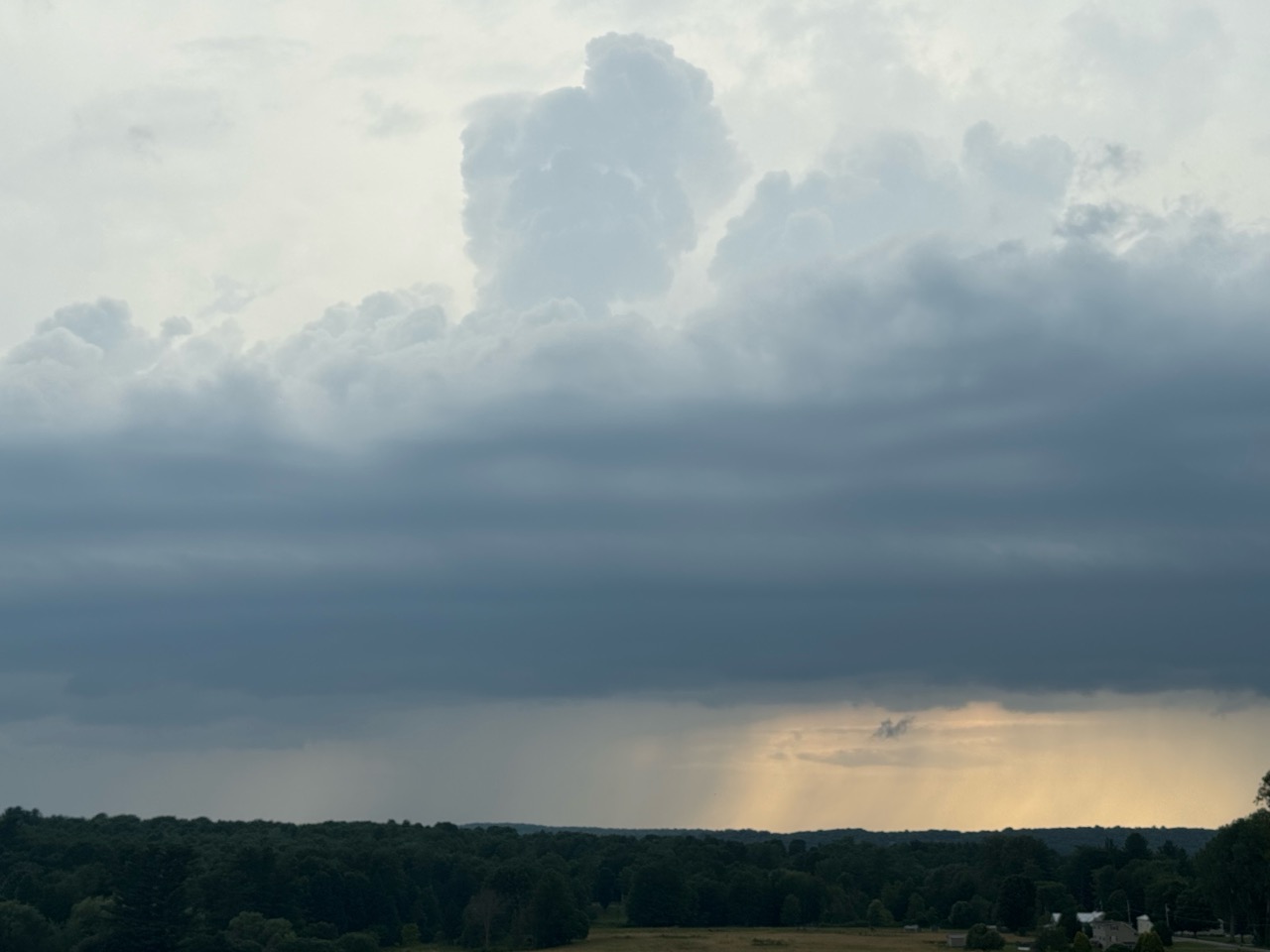
A sort of "preview" storm late Wednesday afternoon
looking west from Georgia Vermont. You can see
a column of torrential rain in the distance. Very few
storms in Vermont Wednesday, but they'll be much
more numerous today. 

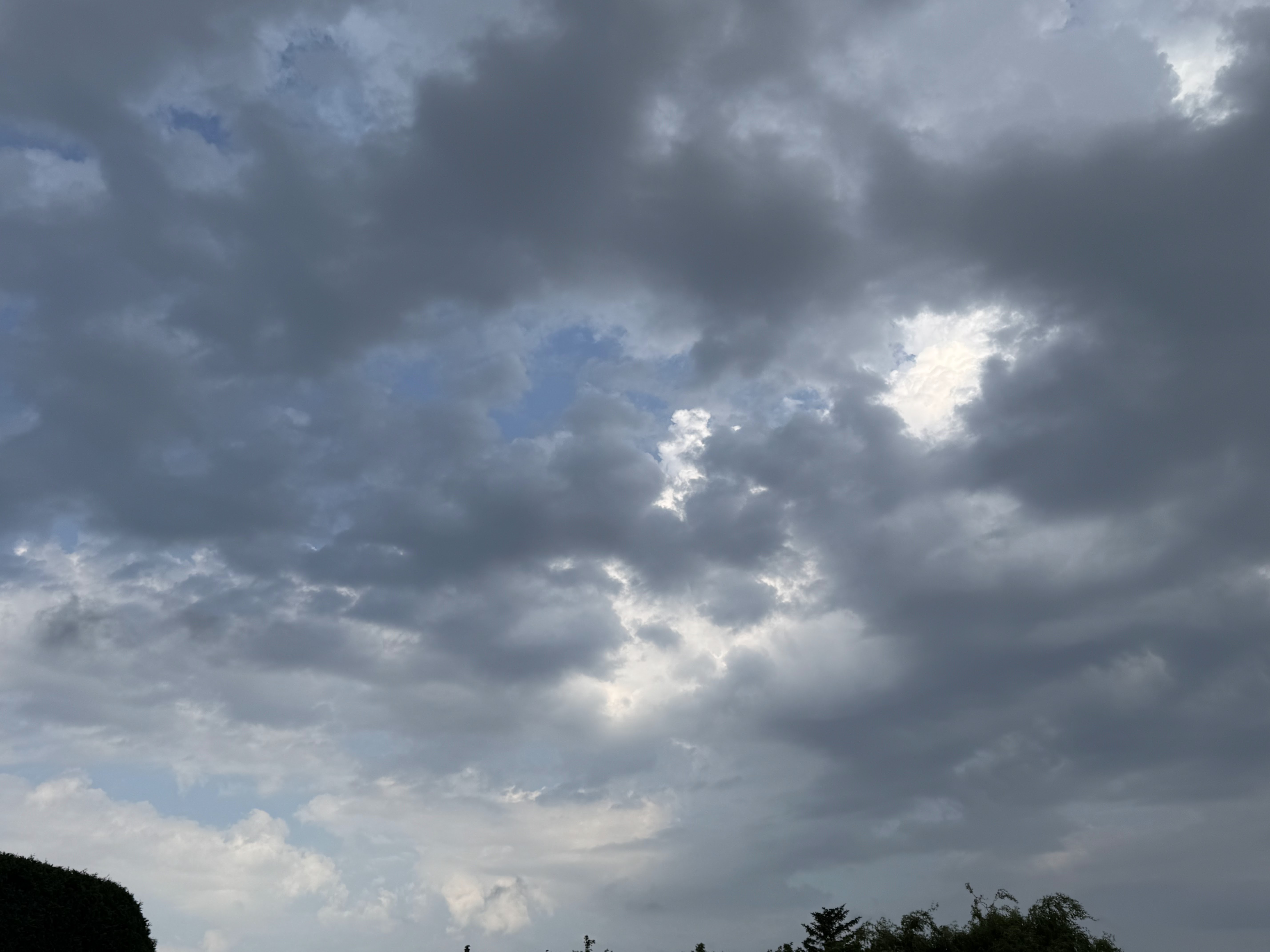
A batch of showers and brief downpours was moving into mostly, but not exclusively into northwest Vermont as of 8 a.m. It looks like most of those were brushing far northwest parts of the state from St. Albans, north. 

It's so humid with an already unstable atmosphere, that a pop up downpour or thunderstorm could happen randomly almost anywhere in Vermont this morning.

They will be relatively few and far between, but enough so that you'll need to keep your eyes on the skies and be ready to head indoors quickly. Even this morning. 

It'll be interesting to see whether these showers, and lingering clouds behind them that would last most of the morning, will stabilize the atmosphere some and reduce the chances of strong storms later. Or maybe this will form a sort of new temperature boundary across part of Vermont that would enhance the storms that due later. 

There will also be a stalled west to east front across southern Quebec most of today that I think will enhance changing wind directions with height in the atmosphere. That's why I think there could be a tornado or two in southern Quebec. 

Northern Vermont will be on the edge of that, so despite the cloud cover today, the chances of severe storms remains in effect north of Route 2. 

All of Vermont should have plenty of humidity today, and especially places south of Route 2 should get into the mid and upper 80s to near 90 in a few places in the lower Connecticut River Valley. That's one ingredient needed for big storms.

The other storm ingredient is a cold front heading due east across New York State towards us. That will act a bit like a snow plow, providing lift in the atmosphere as it shoves into the muggy air over us. That lift is the rising air currents that lead to towering clouds, i.e thunderstorms.

THE RESULTS

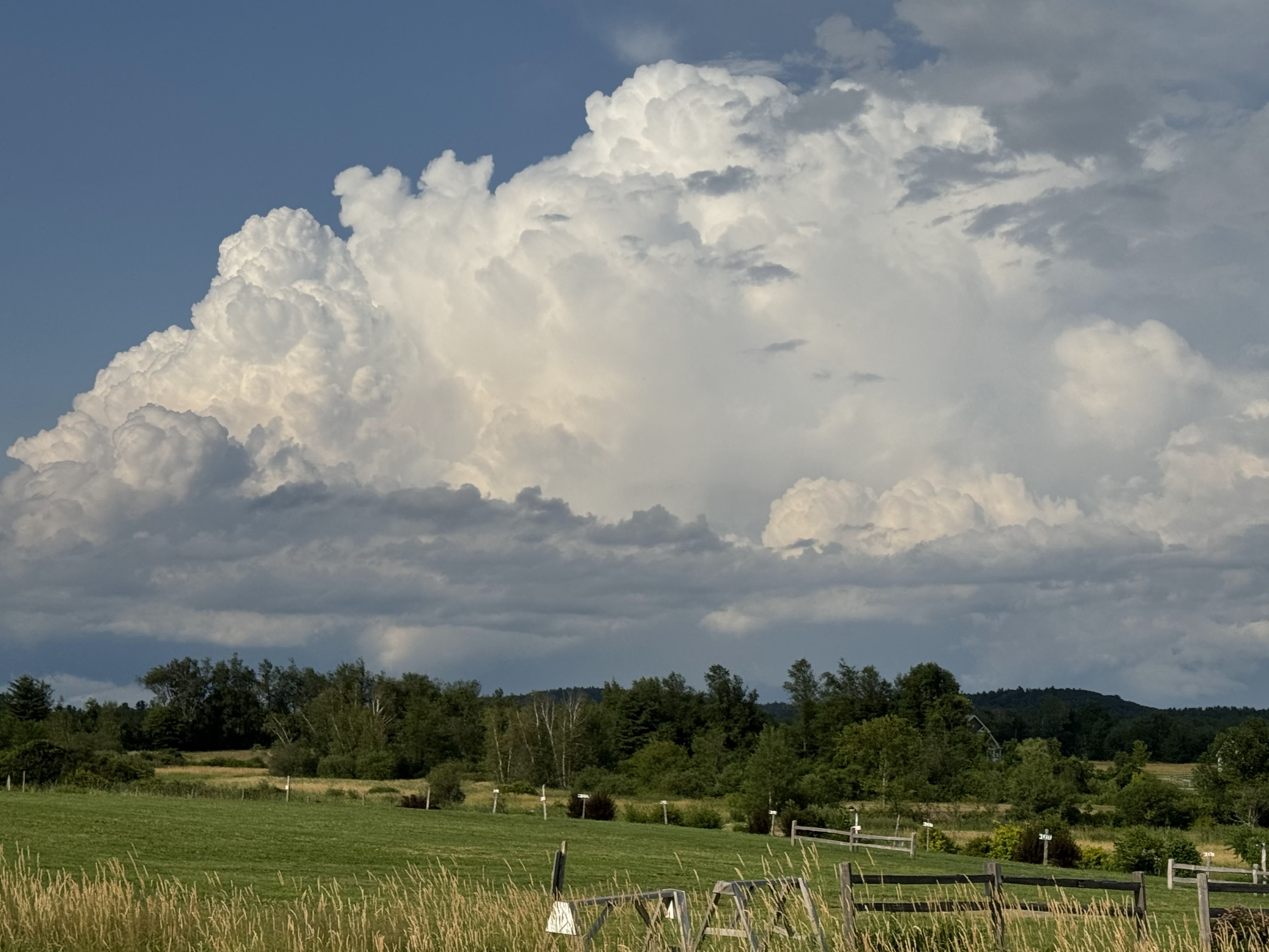
This will be a classic summer severe weather day in Vermont. By that, I mean a few towns - definitely a minority of places in Vermont - will see damaging wind gusts that would take down trees and power lines, and possibly cause a little structural damage.

Most but not all of us will see some sort of thunderstorm today. Some of us will get bullseyed by downpours and a lot of lightning and some wind gusts. A few of us will be on the edge of some of these storms and have only minor effects and not a whole lot of rain.

Another few of us will get nothing at all. People in those towns will wonder what the fuss was about, having endured a humid, but rain-free day. 

I doubt there will be one solid line of storms that comes through. Instead, we're in for short lines and clusters of storms that will keep passing through, mostly between around 2 p.m. this afternoon and 11 p.m tonight. 

I wouldn't expect the storms today to be severe after dark, so we'll say 2 to 8 p.m. is the most likely time for anything severe. 

The other threat from today's storms is flash flooding. The good news is each storm will be moving along at a good clip. That means those torrential downpours won't last long in any particular spot.  They won't have time to put down enough water to cause a flood.

The problems would come if a few unlucky spots get three or four or five rounds of storms instead of just one or two. Then you start running into issues. Flash floods today in Vermont if they happen should be pretty isolated and not cover large areas.

FRIDAY:

Kind of a weird day, but nothing dramatic. The morning will be cool and windy and kind of cloudy, making it almost feel like autumn was in the air. Temperatures before noon should hold in the 60s.  Then, the flow of cool  Canadian air will get most shut off pretty fast. By late afternoon, it should be back in the mid and upper 70s with sharply diminished winds. The sun will have come back out. 

SATURDAY/SATURDAY NIGHT

Saturday itself looks like it will be a nice day for a change. We should have quite a bit of sun, with highs peaking within a couple degrees either side of 80 degrees. The humidity should be moderate, so enjoy!

However, we're still looking at the risk of a cluster of storms blasting through overnight Saturday night and early Sunday. We're still not sure exactly where they'll focus, or even whether they will entirely hit Vermont. But there is the risk of a noisy night with thunder and locally torrential downpours if we get hit squarely.

Stay tuned!

THE HEAT

The hot weather will begin to flood in on Sunday. It still looks like a decent beach day, with highs in the 80s to near 90. You'll also notice the  humidity building.

Monday looks like it'll be the worst of it, It now looks like actual high temperatures should hit the mid-90s in many valley locations in Vermont. Combined with the humidity, the heat index will probably be over 100 degrees. 

It'll be a dangerous day for anybody with health issues or those who exert themselves outdoors. Monday's the day to really take it easy, and seek out air conditioning if you can.

Record highs might fall. The current record highs for Monday are 96 degrees in Burlington, 90 in Montpelier and 93 in St. Johnsbury. 

Monday night will be dreadfully hot and stuffy, with lows staying near or above 70 for most of us with stifling humidity. 

Tuesday is now a bit of a wild card, depending on the timing of a cold front. If it comes through early, the heat won't be too bad, especially north.  If it comes in the afternoon, that means it'll uncomfortably hot with a risk of strong storms. If it comes through in the evening, then Tuesday will be just as bad as Monday.

We'll keep an eye on that.

The front will have come through by Wednesday, but should linger close by, meaning we'll remain at risk for showers and maybe storms later into next week too. It should actually stay near to a little warmer than average even behind the cold front that will end the heat wave