Tuesday, February 28, 2023

Today's Storm Over-Performed In Northern Vermont; Will End Very Soon

After I'd shoveled about three inches of snow off my 
driveway and truck this afternoon, another burst
of snow dumped an additional 1.5 inches of fairly
wet snow on the driveway.
 The supposed "nothing burger" snowfall today turned out to be more than that, at least in parts of northern Vermont. 

Instead of the sporadic periods of wet snow, mixed with rain that would only amount to an inch or two, it snowed all day north of Burlington. As of 5 p.m. today 4.4  inches of snow had accumulated at my place in St. Albans, Vermont. 

That includes 1.6 inches within two hours ending at 5 p.m. (The 1.6 inches was about the forecast entire storm total in forecasts issued yesterday).

Snowfall reports elsewhere in Vermont are pretty scant today. As of 1 p.m., Burlington had received 2.3 inches of new powder. That's a little more than what had been forecast yesterday, but very much in line with what updated forecasts issued early this morning had indicated. 

Other reports I've seen are: 7 inches in Randolph Center;  6 inches in South Strafford, Vermont as of 4:20 p.m.; 4 inches in Morrisville and just 1.5 inches in Rutland. 

In central and southern Vermont, things had pretty much ended by 4 p.m. Judging from Vermont Agency of Transportation, main roads looked pretty good. In parts of central and especially northern Vermont, your current commute home is looking rather icky. 

The snow seemed to be tapering off early to mid-afternoon along and north of Route 2, but a new burst of moderate snow began around before 4 p.m.  Traffic cams showed iffy roads across the north, and that should continue a bit into the evening. 

Luckily, temperatures have warmed into the low 30s, so road salt is working pretty well.

Even better, radar imagery as of 5 p.m. indicated the last band of moderate snow was getting ready to leave northern Vermont. After this goes, we'll just have light snow showers tonight. We won't see much additional accumulation, if any. 

NEXT 2 DAYS

Warmer valleys in Vermont should actually melt a little of the snow tomorrow and Thursday as temperatures climb well into the 30s to near 40.  It still looks like a bit of rain and snow will come down Wednesday night and Thursday, but it won't amount to much. 

A Vermont Agency of Transportation web cam captured
a state snow plow clearing Route 2 in Cabot as a 
school bus followed behind. Today's storm 
over-performed in parts of Vermont. 

WEEKEND STORM 

We still don't have much news to report on a potential larger storm that could come in Friday night and last into Saturday. 

The potential is definitely there for a good dump of snow, but the computer models are still not singing from the same page on this one. 

We could still see mixed precipitation, but it sort of seems like the scenario is leaning toward snow. It's still not clear at all if Vermont will see heavy snow out of this, and if so where. It definitely could happen. 

In many years, the largest snowstorm of the winter strikes in March.  Think Superstorm, 1993, Big snowstorm of March, 2011, and the Pi Day Blizzard of 2017.  

We won't have a storm anywhere as big as those epic storms, but the possibility is there that Saturday could bring us the deepest snowstorm of the winter. I know that's not saying all that much this year.  

With Another Weird Tornado Outbreak Just Ended, 2023 Off To A Very Bad Twister Start

Tornado damage Monday in Norman, Oklahoma. Photo
by Ray Banner, OU Daily 
A two-day outbreak of tornadoes in the U.S. Sunday and Monday continues a fast - and destructive - preview of our annual national spring tornado season.  

Wintertime tornadoes happen virtually every year. But this winter has been much worse than usual. 

NOAA's Storm Prediction Center has so far tallied 191 preliminary reports of U.S. tornadoes through this morning.  That number might go up, as local National Weather  Service offices investigating possible tornadoes Sunday and Monday in Oklahoma, Kansas, Illinois, Indiana and Ohio. 

For comparison, last year through February we only had 48 tornadoes. 

Unfortunately, we've seen eight confirmed tornado deaths so far in 2023 A ninth death will likely be confirmed soon from one of Sunday's tornadoes in Oklahoma. 

The location of some of the tornadoes has been unusual as well. Oklahoma is known for its tornadoes, but they tend to happen in the Sooner State later in the spring and early summer. On Sunday, nine tornadoes were reported in Oklahoma. The previous record high number of February tornadoes there was six. 

Some of Sunday's Oklahoma tornadoes were quite strong, too. The fatal tornado near Cheyenne, Oklahoma swept a house entirely off its foundation and shredded it into small debris. Another tornado in Norman, Oklahoma injured 12 people and caused extensive damage in parts of the city

In a still from a video, debris flies
in front of a motorist in McCordsville,
Indiana from a possible tornado on
Monday. Photo via Twitter from 
Todd Klaassen
Earlier this month, on February, 21, a tornado struck in New Jersey.  It was only the third February tornado on record in that state. It was also the strongest winter tornado to hit New Jersey. 

On Monday, tornadoes were reported as far north as places west of Chicago.  At least one tornado from Monday was confirmed by investigators in Ohio on Tuesday,   making it the second time that state has seen a tornado this February. 

It's interesting that Oklahoma has been so busy with tornadoes this winter. They still see a lot of tornadoes in the spring and early summer, but over the past decades, the trend has been for somewhat fewer tornadoes in the Sooner State and more further east, along and east of the Mississippi River. 

The trouble isn't finished yet.  A potentially significant tornado outbreak appears as if could easily develop in the Gulf Coast states Thursday and Friday. 

It's impossible to tell whether the real tornado season will turn out to be horrible. The number of tornadoes in the U.S. usually begins to ramp up in March, continue to increase in April, then peak in May and early June. 

 I haven't seen a strong trend regarding what happens after a lot of January and February tornadoes. Some tornadic springs follow busy tornado winters. Others do not. It's really not possible to tell for sure in advance what will happen during the business spring severe weather season.  

Today's Vermont Snow: Some Last Minute Forecast Changes

Our back deck in St. Albans, Vermont starting to '
fill in with snow as another day of light snowfall
should deepen what's already on the ground a little more
Now that our latest snowfall has started to arrive in Vermont this Tuesday morning, I see a few tweaks to the forecast since yesterday.  

Most of us will see snow of varying intensity all day, but it won't be super heavy. At times, it might even stop snowing for short intervals. But this last day of February is closing out the month on a snowy note. 

CHAMPLAIN VALLEY 

The biggest change in the forecast is in the Champlain Valley, were somewhat more snow might fall than previous forecasts indicated. It will still fall well short of a blockbuster, with maybe two to as much as four inches of new snow. That's different than the 0.5 to 2 inches of new snow that was in the forecast yesterday.

 The storm, as expected, has split in two. The original storm, which spun off more tornadoes in Illinois and possibly in Indiana and Ohio yesterday, is weakening as it slowly heads from near Buffalo, New York this morning to near Montreal by evening. 

This is a little closer to Vermont than first thought. Which means there's a bit of added lift to the atmosphere, That will ensure kind of a snowy day for most of Vermont, now including the Champlain Valley. 

It won't snow super hard, but enough to make the roads tricky at times. Temperatures this afternoon might be a degree or two cooler than original forecasts. Which means it probably won't get warm enough for the snow to mix with rain in most places. Still, with temperatures in the warmer valleys getting up to between 32 an 34 degrees this afternoon, the powdery stuff we've been seeing early this morning will turn wetter and heavier.  

You might end up being surprised when you shovel "only" two or three inches of snow that will feel pretty heavy.  

Vermont AOT traffic cam caught a state snow plow
at work this morning along Interstate 89 in Georgia.
Main highways aren't too bad this morning, local
roads are a little worse. 

SOUTHERN VERMONT

The second piece of the storm, as expected, formed near the Mid-Atlantic coast and is racing due east out to sea.

Since that storm is a tiny bit further south than forecast and is in a big hurry to get out of Dodge, expected snowfall amounts have been cut back just a bit in far southern Vermont.

 It looks like that area, at least in higher elevations, has already gotten about 2 to 4 inches of new snow by 7 a.m. They'll get as much as another three to five inches during the day today.

Traffic cameras in Bennington appear to show low elevations in southwestern Vermont have only gotten an inch or so of snow so far, and they'll probably be lucky to receive another two.

East facing slopes and summits of the southern Green Mountains should still do well with this storm. Places like Ludlow and Mount Holly will probably see a solid six inches or so of new snow by the time this wraps up this evening.

REST OF VERMONT

Between the dying storm heading toward Montreal and a wet flow of air from the Atlantic Ocean streaming into Vermont on southeast winds, most places should see a solid three to seven inch storm total out of this one. 

Some high elevations in the central and northern Greens could come out with eight or nine inches new out of this. The Green Mountains are blocking some of the moisture from reaching western Vermont, which is why places west of the Greens won't see quite as much. 

All this should wind down statewide during the first half of tonight. 

MORE STORMS?

A weak little system should give us a bit of rain or snow or a mix Wednesday night into Thursday, but I still don't see it as being a huge deal.

A bigger storm still seems to be in the cards for later Friday into Saturday. It's still a tossup as to whether it will be a big snowstorm, a close miss, or a mix. Better details on this storm shoul be available in a day or two.


Monday, February 27, 2023

Vermont Storm Update: Tuesday's Storm Is Different Than Usual

St. Albans, Vermont was a bit of a winter wonderland as
dawn broke today. A new storm Tuesday in much of 
Vermont will dump a few inches of new snow, except
it will largely avoid the Champlain Valley
 It's looking more and more like the winter storm that's going to affect New England late tonight and tomorrow -  including Vermont -  is quite a departure from what we've seen most of this season

Southern New England, areas near New York City and northern New Jersey are in for a pretty good dump of snow with this. Many of those places should see half a foot or more of snow.  

The decent dump of snow still looks like it's going to extend into far southern Vermont.  Most - but not all - of our few sizable snowfalls have avoided the south and instead focused on central and northern parts of the Green Mountain State.

The amount of snow in Vermont from this system is going to be even more variable than usual. Some places might see as little as a half inch. Other places should close in on eight or nine inches. 

There's a little more moisture available in Vermont for this storm than first thought, so forecasted snow amounts have ticked ever so slightly upward for the eastern slopes and summits of the Green Mountains. 

 It's now looking like the eastern half of Vermont, with the exception of much of the Northeast Kingdom, is now in for a decent three to six inch snowfall. The White Mountains will block moisture from the Atlantic as east and southeast winds pick up. 

That means areas near St. Johnsbury could get as little as one to two inches of new snow. 

Which brings us to the Champlain Valley. Those same southeast winds will encounter the Green Mountains. The wet winds will be forced to rise when they encounter the Green Mountains. Rising air means more precipitation. Which means it's going to snow harder on those eastern slopes. 

Once the wind gets to the west side of the mountains, they'll blow downward along those western slopes. Sinking air means less or no precipitation. You see where this is going. The sinking air is really going to squelch the snowfall in the Champlain Valley. This applies to western Rutland County as well. 

It probably won't kill the snow entirely. But it will be very light. And it will mix with rain as we get into the afternoon. I supposed most of the Champlain Valley will get 0.5 to 1.5 inches of new, wet snow. Maybe one or two lucky towns will clock in with two inches. 

So, no excuses this time. Though the roads might be slick in spots for your morning commute in the Champlain Valley, they'll still be very, very passable. Just take a little extra time getting to work or school and you'll be fine. 

In the areas that get the somewhat heavier snow, this will hit during the Tuesday morning commute. Expect some school closures and crappy roads in southern and parts of eastern Vermont. 

After we're through with this little episode tomorrow night, we're still expecting a small storm Wednesday night with probably some annoying mixed precipitation. 

Another larger, probably mostly snowstorm comes along Friday afternoon into Saturday. It's still too soon to figure out how far north the heavy snow gets, and whether it will mix with schmutz. 

As we get into March, it starts to become more likely that a snowstorm can mix with other crappy stuff like ice and cold rain, so keep that in  mind, too.  

Southern California A Winter Wonderland, A Flooded Mess And A Partial Drought Buster. With Videos

In a still from a video posted online
snow falls on a row of palm trees
in San Bernardino, California
during the day Saturday
 California has certainly had its share of chaotic weather lately, with show at elevations lower than seen in decades, and extensive flooding in and around Los Angeles. 

In the highest elevations, feet of snow came down in just a day or two.  The all-time 24 hour record for snowfall in California is 67 inches, and (I believe) the national record is 76 inches. It's possible that record was bested on some mountain somewhere in California, but not all the reports are in. 

The good news is the rain, and more importantly, the epic amounts of mountain snow, is great news for California. The snow pack - and the water stored in the snow - is well above normal for this point in the season. In some places, it's double the normal, and more than what accumulates in an entire season.

Storms that bring snow to the Sierra usually sputter out and mostly disappears by May. On average, three quarters of the snow that usually falls in these mountains does so by the end of March.  

 While it won't entirely erase the two-decade long mega-drought in parts of the state, it is giving some needed drought relief. At least in the short term, like, this year. 

No guarantees as to whether the drought will come roaring back after the one good rain and snow year that's happening now. 

Over the next week, several more feet of snow are forecast for the Sierra Nevada mountains, and several inches of rain in many low elevations of coastal California. So it ain't over yet! 

Some videos of the fun in California in recent days: 

Here's one good summary from Fox 11 in Los Angeles. Click on this link or view just below:


In Valencia, California, the Santa Clara river swept away three RVs and threatens the rest of the RV park:  Again, click on this link or if  you see image below, click on that:


Kind of a classic L.A. storm video. You see a Porche stuck in floodwaters with a well-dressed man standing atop the flooded car, his outfit ruined in the rain along with his Porche. He was later rescued and not injured. Click on this link or view below: 


As you might imagine, people in higher elevations of California faced even bigger challenges. Here's a report from a snowed-in TV journalist. Again, click on this link or watch below:


Gordon Burnham shared this lovely beautiful video of snow falling on his tropical paradise property in southern California, Again, click on this link or view below: 


Snow Slowly Piling Up, Next Installment Favors Southern Vermont

Big snowflakes in the air in St. Albans, Vermont gave
the landscape a pointillism art vibe on Sunday. 
 Snow showers and snow squalls left a few inches of fluff in many areas across northern Vermont Sunday and Sunday night, slightly deepening what is still a fairly thin snow pack in the state for this time of  year. 

It made for a wintry, but at times pretty Sunday in Vermont, as you can see in the video at the bottom of this post. 

There's chances for more snow this week, especially in the mountains, as usual. 

The next installment of snow will be different from most this winter, favoring southern Vermont instead of northern and central sections, which most of the modest storms we've had this winter have done. 

As expected, a wild storm spawned tornadoes and hurricane force straight line wind gusts that caused a lot of damage to houses and other buildings in Oklahoma. At least 12 people were injured.    An especially damaging tornado struck around Norman, Oklahoma. 

At least seven tornadoes touched down, and more will probably be counted as damage is assessed. This is the most tornadoes Oklahoma has had in February. Yes, it's tornado alley, but Oklahoma usually waits until later in the spring to see their twisters.

Anyway, the storm that caused the Oklahoma tornadoes is, as expected headed toward the Great Lakes. It might spit out a couple more tornadoes over Ohio today. That would be the second time Ohio has faced a tornado threat this month. Again, that's really weird for that far north in February.

As we mentioned yesterday, the storm will move across the Great Lakes and into Canada while weakening. A new storm will take over near the Mid-Atlantic states and then zip out due eastward out to sea. 

That's close enough to give a decent dump of snow to far southern Vermont, where a winter storm warning is up for our two southernmost counties. 

In that region, they're expecting four to nine inches of new snow, mostly above 1,500 feet. The valleys should get a few inches, though. 

The heaviest snow in far southern Vermont would come just in time for tomorrow morning's commute. Oh joy! 

Further north in south central Vermont, a winter weather advisory is up for three to six inches of snow with this system. 

wea
The latest snowfall prediction map from the National
Weather Service office in South Burlington. More than
six inches might fall in the higher elevations of 
southern Vermont. Much less north. 

In northern Vermont, the storm scooting off the coast will be too far south to give us much of anything. The dying storm heading into Canada will be too far north and west to contribute all that much snow. 

So, most of us in the northern half of the state should only see a measly one to three inches of new snow.  There might be just a touch more than that in the northern and central Green Mountains. 

In the Champlain Valley, it looks like it will probably get warm enough in the late morning and afternoon for the snow to mix with rain. That would further cut down accumulations. 

A smaller storm Wednesday night and Thursday looks destined to give us a rain/snow mix, with not that much accumulation. But at least the Wednesday night thing will add a little to the snow cover up in the mountains.

Friday and Saturday could get pretty damn interesting. There's the potential for a bigger snowstorm then. However, it's still five days away. So we don't quite know yet if it will go too far south to give us much snow, or come too far north and force mixed precipitation on us. 

For now, just keep an eye out for the end of the week. 

And wouldn't you know, the weather pattern that kept us weirdly toasty all winter is breaking down. Signs are still point toward a potential rather cold March. We shall see! 

Video: Scenes from around St. Albans, Vermont on a blustery February Sunday filled with snow showers. Click on this link to view if you don't see the image below, otherwise click on that image: 


Sunday, February 26, 2023

New Zealand, Madagascar, Brazil Pummeled By Separate Intense Storms

Destruction in New Zealand after recent
 Cyclone Gabrielle 
The United States isn't the only place experience strong, dangerous storms lately. Intense storms have also hit New Zealand, Brazil and parts of eastern Africa. 

NEW ZEALAND

In New Zealand, at least eight deaths have been reported after Cyclone Gabrielle struck earlier this week, (MONDAY 2/13)

Reports the BBC:

"New Zealand's prime minister says he expects there to be more deaths from the violent storm which killed eight people and cut off hundreds of communities.

More than 4,500 people have yet to be contacted after Cyclone Gabrielle hit on Monday, causing significant flooding and landslides across the North Islands.

Many cities and towns are also without power and clean drinking water. A national state of emergency has been declared, only the third in New Zealand's history. 

"This is undoubtedly the biggest natural disaster that we've seen probably this century," Prime Minister Chris Hipkins said."

Most of the 4,500 people who haven't been found are almost surely alive, but are cut off from the rest of the world by cell towers and equipment that have damaged by the storm. Still, Hipkins told the nation to be prepared for the death toll to rise.

At least one body was found in an attic crawl space. The person tried to get as high as possible to avoid the water, but the inundation was so incredible it reached the attic

New Zealand's new prime minister did not mince words describing the chaos. As The Guardian reports: 

"'Cyclone Gabrielle is the most significant weather event New Zealand has seen in this century. The severity and the damage that we are seeing has not been experience in a generation,' the prime minister, Chris Hipkins, said on Tuesday. 'We are still building a picture of the effects of the cyclone as it continues to unfold. But what we do know is the impact is significant and it is widespread.'"

Just to make matters worse, a 6.0 earthquake was felt in New Zealand in the immediate aftermath of the storm, though damage from the earthquake was light. 

Before Gabrielle, Northern New Zealand, including Auckland, had its wettest day and wettest month on record in January, with serious flooding in an area usually known for its calm summer weather. (It's summer in the Southern Hemisphere, as you are probably aware). 

As Bob Henson and Jeff Masters wrote in Yale Climate Connections earlier this month

"Climate change is exacerbating the wet setup, as a freight train of rainmaking systems from the tropical western Pacific draws on unusually high seas surface temperature.. associated with a marine heat wave. Intensified short-term rains and warming oceans are two of the most clearly established effects of a human-warmed planet."

Speaking of those intensified short-term rains..........

BRAZIL

Flooding in parts of Brazil in the past few days have led to at nearly four dozen confirmed deaths, and at least 40 people remained missing at last report. 

Photo shows extensive damage from flooding and landslides
in Sao Sebastiao, Brazil. 

As the AP tells us: 

"Precipitation in San Sebastiao had surpassed 23.6 inches during a 24-hour period over the weekend, among the largest such downpours ever in such a short period in Brazil." 

The flooding hit a scenic area with ocean beaches flanked by mountains. The torrential downpours created walls of water that swept down the hillsides. Other slopes collapsed into landslides amid all the water. 

Many others were evacuated from near saturated hillsides as more landslides threatened amid continued downpours. 

CYCLONE FREDDY

Small but intense Cyclone Freddy shown here in a 
satellite photo heading toward Madagascar this week. 
An intense cyclone named Freddy traversed east to west across the Indian Ocean and smacked into Madagascar this week, (Hurricanes in the Indian Ocean are called cyclones). Freddy was a category 5 hurricane when it was out in the open Indian Ocean. That's the strongest possible hurricane with winds of 157 mph or more.  

Luckily, Freddy weakened to a strong Category 2 with winds of 110 mph when it made landfall in Madagascar.  Despite the fact that Madagascar averages at least one tropical cyclone per year, the infrastructure can't handle these storms all that well. 

So, Cyclone Freddy has created a path of destruction across central Madagascar, killing at least four people, creating a storm surge and blowing roofs off of numerous homes. This comes a few weeks after another cyclone killed 33 people on the island off the east coast of Africa, according to the BBC.

In one hard hit town, deaths were minimized because people living near a river were ordered out before the storm hit. 

Cyclone Freddy was at last report heading westward across the Mozambique Channel. It was expected to lash Mozambique and Zimbabwe with floods in the coming days. 


Winter Is Back! A Potentially Stormy Vermont Week Ahead

An intense snow squall sweeps through St. Albans, 
Vermont on February 27, 2022. More snow squalls
are possible in Vermont today. 
 Winter is back in at least some of its glory. Chances are we will be dealing with a Vermont March that could behave the way January and February could have. 

The first wintry surprise proved me wrong this morning. In yesterday morning's post, I said temperatures wouldn't get to zero again in Burlington for at least a week. 

Oops.

There was a period of nearly clear skies and light winds that brought temperatures in Burlington 0 a little after midnight, giving us the sixth such day this winter. That's still way, way below normal for such cold weather. 

SQUALLY SUNDAY?

Temperatures were slowly rising this more morning as snow showers moved in.  It started snowing here in St. Albans shortly after 8:30 a.m. and those snow showers are moving quickly across northern Vermont. 

The morning snow won't amount  to much, but it's still cold, the wind is blowing, so is the snow, so it will be kind of a not so great trip on the roads

The real problem comes sometimes this afternoon. Temperatures will get up into the 20s to near 30 ahead of a cold front. It has quite a bit of instability with it, so the National Weather Service office in South Burlington tells us to expect snow squalls during the afternoon and early evening. 

I'd say the highest risk of squalls would be between 1 and 8 p.m. today.  Especially across northern and central Vermont. 

Though pretty much everybody should see snow showers and some light accumulation, the snow squalls will be hit and miss. Remember, snow squalls are dangerous on the roads. Visibility goes from perfect to zero in practically an instant, and roads ice up in a hurry.  Snow squalls are notorious for causing some of the worst highway pileups out there.

Today's snow squalls come almost on the anniversary of some of the most intense snow squalls I can remember. On Sunday, February 27, 2022, the squalls caused some pretty dramatic looking skies and intense snowfall rates.'

The snow squalls today might not reach the level they did a year ago, but some will be close. 

THE NEXT STORM

A storm will wildly intensify from not much to a strong system in the central Plains today.  Scary-looking forecasts call for an outbreak of tornadoes and destructive, hurricane force straight line winds in Oklahoma and surrounding states today and tonight.  

If you want to be selfish, though be thankful this storm is short fused. It'll go up toward the Great Lakes. From there on Monday night, the storm will be weakening as energy goes to a new storm forming along the Mid-Atlantic States.

This scenario often means a big dump of snow for us, but not this time. The coastal storm will scoot east out to sea, while the dying original storm passes near us.

That means we can expect a few inches of snow for most of us. The snowiest places, like along the east slopes of the southern and central Green Mountains, could get six inches or more. Early guesses give most other places as little as 1 inch and as much as 7 inches of snow. The National Weather Service office in South Burlington will probably issue winter weather advisories for this later today or tonight. 

There's already a winter storm watch up for Vermont's southernmost two counties which will be closest to the juicier storm that will be scooting out to sea. 

Broad valleys might mix with rain Tuesday as well as temperatures jump into the 30s.

BEYOND TUESDAY

Some sort of system will come through with a mix of snow and rain Thursday, but it doesn't look like it will be huge. 

We also see potential for a quick moving, snowy coastal storm on Friday or so.  It's unclear if it will go too far south for us in Vermont to get much of anything, or will it paste us with snow.

The overall weather pattern is changing, and I don't see any real signs of springtime weather heading into March.  It might not be record cold, but many days will be cold enough. It also looks like the weather pattern will stay busy, so we might have several chances of snow for the next couple of weeks. 

NOAA's Climate Prediction Center thinks it will be colder than average over most of the United States, including here in Vermont between March 10 and 24.  Chances lean a bit toward heavier than average precipitation, too.

If you wanted spring weather, you should have enjoyed it after Christmas, or in mid-February. It'll be awhile before we see anything like that in Vermont. 


Saturday, February 25, 2023

Did Climate Change Create U.S, Global Warming U.S. Refugees In 2022?

People evacuating in Florida ahead of Hurricane Irma
in 2017.  In 2022, 3.3 million Americans had to
evacuate their homes, at least for a little while, 
due to extreme weather. 

Natural disasters forced 3.4 million Americans from their homes in 2022, according to a report from NBC News. 

Says the network: 

"Natural disasters forced an estimated 3.4 million people in the U.S. to leave their homes in 2022, according to Census Bureau data collected earlier this year, underscoring how climate-related weather events are already changing American communities. 

The overwhelming majority of these people were uprooted by hurricanes, followed by floods, then fires and tornadoes. Nearly 40 percent returned to their homes within a week. Nearly 16 percent have not returned home (and may never do so) and 12 percent were evacuated for more than six months."

 Some experts find the numbers from 2022 rather shocking, as NBC reports: 

"'These numbers are very distressing,' said Michael Gerrard, director of the Sabin Center for Climate Change law at Columbia University, who was not involved in the data collection. 'The numbers are what one would expect to find in a developing country. It's appalling to see them in the United States.. They're only going to get worse in the years to come because climate change is making extreme weather events more frequent and more severe.'"

I have to be careful here, though. It's not like the people who  had to leave their homes due to storms are all climate refugees.

Displacement created by climate-boosted disasters is definitely a thing. And it will get worse as the years go by and climate change intensifies.

As tragic as these 2022 disasters were, it would be wrong to call all the 3.4 million people displaced by severe weather climate refugees. Any time somebody is forced out of their homes by a storm, floods or some other disaster, that's unequivocally bad.  

It's fortunate that 40 percent of the people displaced were able to go home within a week. 

But still, we've always had hurricanes, floods tornadoes and fires that displaced people for months.  years or forever. At least some of the displacement highlighted here is due to climate change. But some of it is just dumb, bad luck. 

Also some homes are built in disaster prone areas. I'm not blaming the victim here, as many people are forced by poverty or other circumstances to live in places that can be dangerous.  Racial issues also, as seemingly always, come up. 

The U.S. Census data backs this up. Says NBC:

"Those earning less than $25,000 a year had the highest evacuation rate of any economic group, and Black and Hispanic residents had slightly higher evacuation rates than white residents."  

I don't have complete information on how the number of disaster refugees compare to previous years, but other organizations besides the U.S. Census have estimates.

As NBC News reports, the 1.4 percent of the U.S. adult population that the Census Bureau says were displaced by weather/climate disasters is higher than other estimates Says NBC:

"Data from the Internal Displacement Monitoring Center, part of the humanitarian organization The Norwegian Refugee Council, previously estimated that disasters displaced an average of 800,000 U.S. residents a year from 2008 through 2021."

Dishearteningly, it seems adults who identify as LGBTQ are disproportionately affected by nature disasters. Four percent of LGBTQ people reported having to leave their homes compared to 1.2 percent of straight people.   

In a state by state breakdown, it's no surprise that Florida came in #1 in terms of the number of people displaced in 2022 with just under a million people, North Dakota had the fewest, with 1,088.

Here in Vermont, 1,629 people were displaced at least temporarily from their homes due to storms. I'm guessing most of that is from the effects of power outages during storms. 

Rare (For This Winter, Anyway) Subzero Cold Across Vermont

The sky looking west away from the sunrise at dawn today
in St. Albans, Vermont had that familiar look of a 
subzero morning in Vermont. Such mornings have
that distinctive salmon color near the horizon.
Mornings like today are becoming more rare in 
Vermont due mostly to climate change.
 You probably noticed it if you were an early riser. It was freakin' cold this morning across Vermont. 

Virtually everyone was below zero. Hey there, Bennington, you're a toasty exception. When I checked at around 6:30 a.m. you were a balmy 4 above zero. 

Island Pond got to at least 24 below this morning, and most places in central and northern Vermont away from Lake Champlain were in the teens below zero.

Burlington was at 6 below as of 7 a.m. This isn't record cold by any means, but it's a stinger. 

This is only the fifth subzero day in Burlington this winter, which is way below the long term average. 

We've been in a declining trend in subzero mornings in Vermont over the past several decades, thank sin large part to climate change. Whereas Burlington would usually see winters with at least 20 subzero days back in the 1960s and 1970s, most recent years have had between 5 and 15 such mornings. 

We might have more subzero mornings in Burlington this winter, but I imagine not too many.  It has been below zero there as late as March 29.  But the normal low temperatures are now gradually rising. The normal low in Burlington at the start of the month was 12 above. Now it's 17 degrees. 

To see more subzero chill, it will have to be much colder, relative to average than it would in January as we had into March. 

No below zero weather is in the forecast in Burlington at least through Friday, March 3, and probably beyond that. I suppose we might see brief spells in the rest of the first three weeks of March that could get us below zero in the Champlain Valley, but that seems somewhat unlikely at this point. 

Still, long range forecasts hint at below normal temperatures in the second, third and possibly fourth weeks of March, so it's not impossible to see more below zero weather before winter finally does call it quits, 

Of course places away from the lake can get below zero into April. (Ugh!) For instance, below zero weather happened in northern Vermont on April 5, 1953 and April 7, 1972.

I really hope history doesn't repeat itself in those instances. 


Friday, February 24, 2023

The Nation's Weather Is Wayyyy Off The Rails. Again. Details Here

Extremely rare snow on the coast of northern California
at the Carson Mansion in Eureka.
Photo via Twitter by Kenneth Pinkham. 
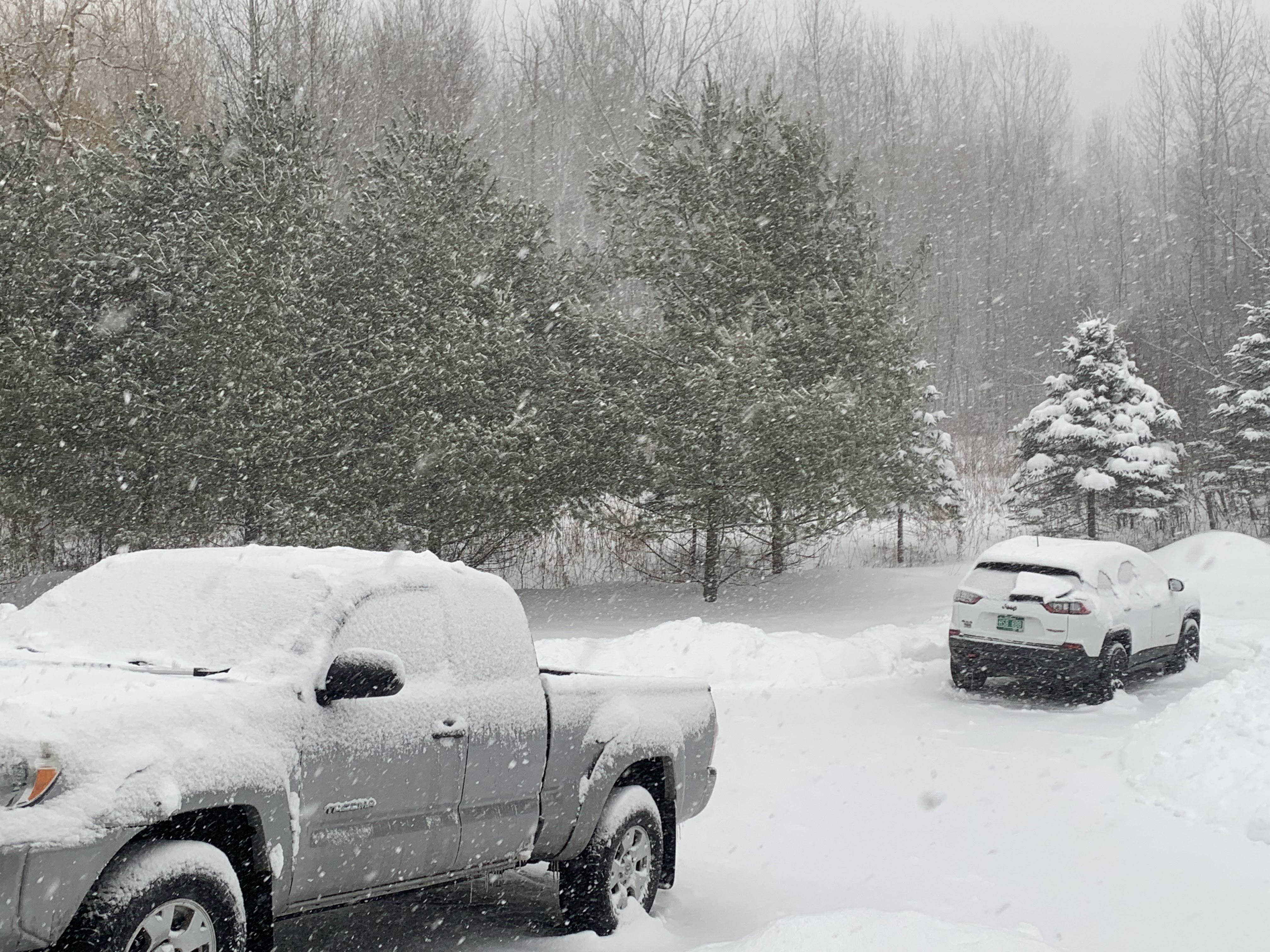
 The weather here in Vermont lately in the grand scheme of things was only moderately interesting this week.

 In many other places around the United States, it was off the charts wild. It makes Vermont look like the calmest oasis in the world. 

Temperatures in the nation Thursday ranged a whopping 137 degrees, from 35 degrees in Lyman, Wyoming to 102 in Falcon Lake, Texas. 

Plenty of areas are seeing weather not seen in decades or ever.  Let's go over the highlight reel. 

CALIFORNIA/WEST COAST

In sunny southern California, it's neither sunny, nor warm.  They're bracing for an epic, very oddly cold storm, the worst of which is sweeping in today and Saturday.

Up and down the California, high elevation highways are already closed, including the notorious Grapevine, which is busy stretch of Interstate 5 between Los Angeles County and the San Joaquin Valley. 

The high elevation stretch of the Grapevine sometimes gets shut down in the winter by snow, especially along a small section whose elevation rises to 4,000 feet.   This time, though, it's expected to be much worse up there since snow levels are expected to fall below 2,000 feet, which encompasses much more of the highway 

The Grapevine section of I-5 closed at 1:30 Friday morning, and officials have no idea when it will re-open. It was snowing hard at the 3,800 foot level of Interstate 5 this morning. 

Some snow, small hail and ice pellets have already pinged down in areas of southern California that haven't seen frozen precipitation in a decade or more. School children in Pasadena rushed outside to enjoy the spectacle of pea sized hail. 

A little snow dusted the famous Hollywood sign in L.A. early this morning. Even more snow might accumulate around that sign Friday night or early Saturday.

The cold storm is also volatile. The National Weather Service office in Los Angeles issued its first tornado warning in three years Friday morning. It was for an area southwest of Santa Maria. As of this writing, it's unknown if a tornado actually touched down. 

Several normally balmy California cities had record low high temperatures Thursday. These included 52 in Palm Springs, 54 in Newport Beach and 57 in Anaheim. Los Angeles also had a record low minimum of 41 degrees Thursday. We've had low temperatures at that level a couple times this winter in Vermont. 

Incredibly, a blizzard warning is up for mountains in Los Angeles County. (These mountains are as high as 8 to 9 thousand feet).

I was mistaken the other day.  This isn't the first time the National Weather Service office in Los Angeles has issued a blizzard warning for its forecast area. It's the second. But Thursday evening, the National Weather Service office in San Diego issued its first ever blizzard warning for the San Bernardino mountains northeast of the city. 

The lowest elevations in southern California are seeing heavy rain.  People have already been evacuated from portions of Ventura County as the rains are expected to cause flash floods, mudslides and debris flows. 

Further north, snow fell on the East Bay hills near San Francisco for the first time in gawd knows how many years. Higher elevations in those hills could see even  heavier snow tonight. Snow levels early today in the area were as low as 700 feet. Most areas in the Bay Area had rain, with embedded thunderstorms, hail and sleet.  

Rare snow also fell at the famed Hearst Castle in San Simeon, California. The castle is no more than 1,000 feet from the Pacific Ocean beach on a hill about half way between San Francisco and Los Angeles. 

Portland Oregon unexpectedly received 10.8 inches of snow Wednesday night, its second largest snowstorm on record.  "Worst case scenario" forecasts ahead of that storm only called for two inches at most. The surprise storm hit during rush hour, and people were stranded on snow clogged roads around Portland for seven hours or more. 

With clear skies and snow on the ground, Portland also reached a record low of 25 degrees Thursday morning. 

Further south, KTVU reported an inch or two of snow in Woodside, California, near Alice's restaurant. That area gets snow on average perhaps once a decade.

Several record lows were set out west, including 11 below in Denver and 13 below in Boulder, Colorado. Rawlins, Wyoming dipped to 25 below, exceeding the previous record low by a full 10 degrees. 

SOUTHEASTERN HEAT

While the West Coast shivered, it was summertime this week in the southeastern quarter of the United States. 

While some cold records are being broken in the West, the Southeast onslaught of record heat is absolutely astounding. 

Amazingly early blossoms this week in 
Washington DC. Photo via Twitter 
by Brad Herson

I don't know where to begin with all the heat records broken, especially Wednesday and Thursday. 

On Wednesday, Atlanta reached its all time high for the month of February at 81 degrees. Thursday, the low temperature in Atlanta was 69 degrees, the warmest low for any date in any February. That low temperature is about normal in Atlanta toward the end of June. 

According to @extremetemps on Twitter , also known by his real name Maximiliano Herrera, this was  "the harshest winter heat wave in history." He backs that up with a litany of all time new February record high temperatures:  

 During Thursday afternoon, most of North Carolina was in the low to mid 80s while one town in the state reached 87 degrees. Pensacola Florida reached 83 degrees for a new February high temperature. 

The heat extended down into Cuba, where Santa Lucia reached 95. That exceeded both the record for the months of February and January. Havana, Cuba, was close behind with an all-time February high this week of 94 degrees. 

The all-time heat records also expanded westward to Mississippi and Alabama.  All time February record highs were set in these Mississippi cities. Columbia (88); Tupelo (87) Laurel (86); and in Alabama, Muscle Shoals (86) and Haleyville (82)  

Nashville, Tennessee, also reached its all-time February high of 85 degrees. Previously, the earliest it had ever been 85 degrees in Nashville was on March 12, 1967.

Thursday, the temperature at Reagan National Airport in Washington DC zoomed up from 68 degrees to 81 degrees between 2 and 3 p.m Thursday. 

Magnolias are already blooming in front of the White House. Green leaves popped open as far north as Philadelphia. 

More ominously, peach and other crops are blooming in the Southeast, weeks prematurely. It will only take one powerful, but seasonable cold front in March to wipe out as much as  $1 billion in crops.  

This is a similar or even worse set up than 2017. That year, another warm February led to a winter storm in March  that killed 85 percent of South Carolina's peach crop and 80 percent of Georgia's blueberry harvest. Total frost damage in March, 2017 was around $1 billion. 

The region is set up for another agricultural disaster this year. Warm, pleasant weather is most definitely not a good thing. 

ELSEWHERE AND OUTLOOK

Ice storms in the Midwest and southern Ontario this week cut power to as many as a million people. 

The ice in Michigan caused the most widespread power outages in that state since a wild squall line of thunderstorms in August, 2021. At one point last night, more than a half million homes and businesses were without power due to the ice.

Parts of the upper Midwest are still digging out from 12 to 20 inches of windblown snow amid nasty wind chills. 

A shopping mall parking garage in Wisconsin partly collapsed under the weight of snow and ice, but thankfully nobody was hurt. 

Forecasters are now worried that the storm in California, as it moves east, could spawn a severe weather and tornado outbreak Sunday and Monday in the southern Plains and parts of the Southeast.

Although the nations' weather will become somewhat less extreme over the coming days, the same basic weather pattern should remain intact through at least the first week in March. That means more cold storminess in the West, and more summer like warmth in the Southeast.

For us here in Vermont, we're kind of in a sweet spot.  For the next week or two, expect active, but not extreme weather. That means temperatures more or less near normal, and frequent precipitation, but nothing super heavy. 

Back To Winter With A Little More Snow, And Colder Than It's Been In Weeks

A wintry Friday morning in St. Albans, Vermont.
We've had a total of 5 inches of snow, including a
little sleet and freezing drizzle since Wednesday night.
 A little snow is lingering in parts of Vermont this morning, but we're not done with winter redux just yet. 

We've got some cold weather to deal with, and at least some more snow.  It's still late February. You didn't think we could coast into spring without some winter weather hitting, did you?

That second wave of precipitation blew through last night with a mix of snow, sleet and freezing rain. My place in St. Albans got another 1.5 inches of snow overnight. Most of it was heavy, sleety stuff, so I'm glad it's not more. It was topped by some very fluffy snow that continued to fall as of 7:30 a.m.  So we'll get a bit more.

So will other areas. Mostly on the west slopes of the Green Mountains and eastern parts of Franklin, Chittenden and Addison counties. I don't imagine it will amount to much more than an additional inch or so this morning, maybe a bit more in the mountains. The lingering snow will dry  up this afternoon.

Burlington managed to accumulate 6.2 inches of snow Thursday.  That's actually a record amount for the date.  The old record was 5.6 inches in 1971.  The 1971 February 23 dump was part of the snowiest winter on record, with 145.7 inches for that season. 

We surely won't break seasonal snow records this winter. Burlington is only up to 45.2 inches of snow so far this winter. That's nearly a foot and a half behind where we should be at on this date. And we'd need another 100 inches of snow by May to break the 1971 record. 

Somehow, I don't think that will happen. 

UP NEXT, COLD

Yes, it's cold out there.

Most of us were in the teens this morning, and it won't get any warmer than that today. Brisk northwest winds will keep wind chills near zero.  And it still looks like it will be below zero for almost all of us by morning.

Saturday will barely make it into the teens, too.

THEN, A LITTLE SNOW

After some very light snow Saturday afternoon, more snow showers are due Sunday amid milder temperatures. Highs will be in the 20s to near 30, which is just a little cooler than normal for this time o year. 

The snow Sunday and Sunday night should only amount to a dusting to three inches, the most being in the mountains.

Forecasters are still talking about a storm Monday night and Tuesday, but I'm starting to get a little dubious about it. Most of my doubts so far are up toward the Northeast Kingdom.

A big chunk of the storm that will bring record snows to southern California in the next couple of days will turn into a strong system that will race toward the Great Lakes by Monday.  This will produce another round of severe weather in parts of the South, and renewed trouble with snow and ice in the Plains and western Great Lakes. 

Normally, this type of storm scenario brings us a mix to rain mess. But in this case, the storm will stall and weaken in favor of a new storm forming somewhere near New Jersey.

This would help lock in the cold air to keep Vermont in mostly snow. But the new storm looks like it might peel of to the east.  If that happens too far south, we might miss out on the heaviest precipitation. Especially in the Northeast Kingdom.

Of course, the storm is several days away and a lot could change. I know the current forecast on this storm will adjust one way or another. So stay tuned as always.  


Thursday, February 23, 2023

Thursday Evening Update: Dreary Day, Icky Evening In Vermont

After this morning's snow, a combination of temperatures in
the teens, periodic snow showers, moments of freezing
drizzle and a low overcast made for a 
dreary February day in St. Albans, Vermont. 
After last night's and this morning's snow, and a dreary day of low overcast, fog, light, grainy snow showers and freezing drizzle - let's call today's weather snizzle - we're now gearing up for Round 2 of our latest Vermont winter storm.  

Round 2 won't be huge. And though this has definitely not been the biggest winter storm ever to hit Vermont, it still caused its share of problems.

The worst was a likely weather related car crash on Interstate 91 in Hartland this morning that killed one person. 

Slide offs and more minor crashes were reported statewide. 

The latest list of storm reports indicate areas kind of between Route 4 and Route 2 got five to eight inches of snow out of this. Amounts tapered off as you headed toward the Canadian border because dry air won out. Only 1.5 to 5 inches fell north of Route 2. My place received an additional 0.3 inches of snow during the day, bringing my total so far to 3.5 inches as of 5 p.m. I got off easy. 

Or not so easy, as you'll learn further down in this post. 

South of Route 4, mixed precipitation cut back on snow amounts. 

TONIGHT

A new winter weather advisory has been posted for along and south of a  line roughly from Vergennes to White River Junction as Round 2 moves in. 

Though temperatures are remaining quite cold near the surface, another strong push of warm air is coming in aloft. It will ride over the cold air. 

In the winter weather advisory zone, snowflakes from way high up will melt on the way down when they encounter that layer of warm air.  Some of those raindrops will re-freeze on the way down when they hit the cold air a little above the surface. That would be sleet.  Other raindrops won't freeze until they hit the surface. That's freezing rain. 

Luckily, this next push of moisture this evening isn't as vigorous as the one last night. So precipitation will be light. But it will be enough to make road conditions deteriorate again, and make things extra dicey underfoot. 

A sign of spring, believe it or not. The sun shone very 
weakly through the clouds around noon today in St. 
Albans, Vermont while temperatures were in the upper
teens. But with a higher sun angle, the sun's rays
were briefly able to melt a small amount of snow'
and ice on my driveway. 


A tiny amount of freezing rain or drizzle can cause real problems. I learned the hard way today. I shoveled the driveway at my house in St. Albans, Vermont today. Then we had a period of light freezing drizzle which froze onto the pavement. So, clumsy me slipped on that thin layer of ice and took a nasty fall. 

Luckily, the result is only a headache, a slightly scraped and bruised arm and an even more seriously bruised ego. So let this be a warning. Be careful out there! 

A sign of spring, though. Toward noon, the sun shown weakly through the clouds. It was only 18 degrees, but still, the sun was enough to briefly melt some of the ice on the driveway. The increased sun angle as we head toward spring is  making a difference. That brief melt would have never happened in December.

Back to the forecast: 

Near Route 2, any mix will probably be just sleet, but we can't rule out any freezing drizzle. Way up north, within, say 20 or 30 miles from the Canadian border, there should be little if any mixed precipitation. Just snow. That's why there's no winter weather advisory in the north. Because there's not much ice to talk about. 

These northern spots should  receive another one to three inches of snow. Some higher amounts will probably fall in the Green Mountains from near Bakersfield to the Canadian border.

FRIDAY

It'll be all over except for scattered snow showers on Friday. As advertised, it will be a frigid, blustery day. For the fourth Friday in a row, temperatures will hold near study or more likely fall slowly through the day. That's, of course, opposite of what you'd expect, with temperatures rising toward a peak in the afternoon. 

But we insist on being half-assed backwards again. 

Friday night and Saturday morning will be by far the coldest since February 4. Almost everybody will be below zero. The cold spots will make it into the teens below zero. This isn't record cold, but it is quite nippy for late February.  

WEEKEND/NEXT WEEK

Saturday will stay cold - not getting out of the teens. There's a risk of a few lame snow showers, too. Sunday brings us a better chance of snow showers, but it will warm up to the 20s to around 30. The snow showers Sunday will probably only give us two inches or less of snow.

I somewhat more substantial storm seems to be in the cards for Monday night and Tuesday. But we don't know how much or what kind of precipitation we'll get. Odds at the moment are leaning towards light to moderate snow, but that could easily change. 

New Jersey Tornado Witness Is Best Interview Ever

New Jersey tornado witness 
Marilyn Anderson tells a 
reporter what happened in 
best possible way. 
 On Tuesday, a rare February tornado struck Mercer County, New Jersey of all places. And a television reporter got the best interview of her career. 

The tornado damage several apartments, homes and other structures in the area. 

This was an unusual event, being the first February tornado in New Jersey since 1999. The tornado was strong for New Jersey in any season, let alone winter, when tornadoes almost never hit that far north, 

The tornado was rated an EF-2 On the tornado strength scale, with top winds of 115 mph. The scale goes from 0 to 5. It traveled for 5.8 miles, which is on the long side for a Northeastern tornado.

 The tornado hit a populated area and caused quite a bit of damage to apartment buildings, businesses and homes in its 200-yard wide path. 

Given how busy the area hit is, and how strong the tornado was, I'm pleasantly surprised there were no injuries. 

As you would expect, local media swarmed into the tornado zone after the storm passed and began interviewing witnesses. A WABC reporter encountered a woman named Marilyn Anderson who was home with her sister when the tornado struck. 

She gave probably the best and most entertaining weather interview I've seen in ages. It's in the video at the bottom of this post. 

Please note I'm not laughing at Anderson. Not at all. I just think she's absolutely terrific. Her animated personality makes me wish I could go out for drinks with her.  A tornado had just scared the bejeezus out of her and damaged her home, yet she remained so positive and animated as she recounted her story.

I wish everybody had as much joie de vivre as Anderson.   

Here's the video. Click on this link if you don't see the image below. Otherwise, click on the image to view.  


Before The Storm: Volatility Showed In Vermont Weather (Video)

A somewhat volatile looking sky over St. Albans, Vermont
Tuesday afternoon ahead of a gusty, squally cold front. 
 Ahead of the winter storm that rolled through Vermont on Thursday, a couple smaller disturbance sort of hinted at the building volatility in the weather.  

A weak cold front came through on Monday, but it had enough oomph to spread snow squalls up near the Canadian border. 

Here in St. Albans, we had no squalls on Monday, but some gusts of winds and some really fast moving clouds. Reminded me of a close miss summer thunderstorm.

A somewhat stronger front came through late in the day on Tuesday.  We got teased by variable winds gusts, fits and starts of snow that didn't amount to much, and finally a squall of sleety snow that deposited a quick inch of icy snow. 

Until that inch of snow, it was odd seeing no snow cover on the ground. The scenes in the video reminded me of late March, not late February. 

This Tuesday cold front helped in enough cold air to ensure that northern Vermont received mostly snow from the main event today. Southern Vermont picked up some snow, too, but it was mixed with sleet. 

Video below shows the mini-weather drama as the weather fronts foreshadowed today's storm. First 35 seconds or so is the quick hit on Monday, and the rest is Tuesday's gusty snow and sleet showers.

Click on this link to view, or if you see the image below, click on that.


Initial Snow Thump Ending In Vermont, But Kinda Ugly Weather Through Tonight

Vermont Agency of Transportation web cams showed
a snowy commute this morning for much of Vermont.
This is Interstate 89 in Colchester at around 6:30 a.m. 
 The first, bigger wave of snow from this long-anticipated winter storm was beginning to wane shortly after dawn today. But don't worry!  There's more fun to be had as the day and night go on. 

Early reports are that central Vermont got a solid six inches or so of snow as of 6 or 7 this morning. Burlington's official total as of 7 a.m. was 5.9 inches so far. 

Up near the Canadian border, dry air hung tough, so less snow fell there than expected. At my place in St. Albans, Vermont, we only had 3.2 inches of new snow as of 6:30 this morning. 

Forecasts had sort of hinted at that, with snowfall prediction maps showing a little less in the far north of Vermont. The snowfall was even a little less than forecast.  Northern zones should make up for some of that "missing snow" tonight. More on that in a bit. 

In far southern Vermont, as expected, sleet and a little freezing rain held down snow amounts. 

This is a colder storm than any we've had this winter in Vermont. Most of them featured temperatures not far from 32 degrees, which, when it did snow, it was wet and heavy. This time, readings this morning are in the teens north, 20s south. That led to a more powdery snow.

It also meant it's a little harder to scrub the snow from Vermont's highways. Traffic cams, especially in central and northern Vermont, showed Interstates and main state highways still snow covered as of 7 a.m. today.

We do see quite a few school closings in Vermont this morning. 

The winter storm warning in effect in central and northern Vermont expires at 1 p.m. today, but that doesn't mean travel trouble on the roads will go away. 

During the day, we won't see much of anything.  But a few snowflakes will fall, and we will see  lovely patchy freezing drizzle. Or frizzle as I call it. That "frizzle", still mixed with a little snow, had already started in St. Albans as of 7 a.m., despite temperatures in the teens. 

Traffic cam also shows a snowy Route 7 in 
Brandon this morning. 

Another wave of precipitation is still expected to come in later this afternoon and tonight, sent here by another storm rippling along a stalled front to our south, and a push of warm air aloft.

It'll stay cold enough down near ground level today and tonight, with temperatures not getting out of the 20s north. This will be the first day Burlington stays below 32 degrees all day since February 4.

At least for awhile this evening, sleet and freezing rain will push further north than it did this morning.  

Sleet and a little freezing rain looks like it might venture as far north as Route 2 this evening. Maybe even a little further north than that. It'll eventually switch back to snow later on pretty much everywhere in Vermont. This new burst of snow and ice should come in after 6 p.m. and last until at least midnight. 

Areas up by the Canadian border have a good shot of staying all snow, which is why I said that area will partly make up for this morning's lackluster accumulations. Expect a good two or three inches of additional snow tonight north of Route 15. A few areas could get a little more than that.

 This evening's round of snow or ice won't be nearly as heavy as this mornings. Away from the Canadian border, expectations are people will see an inch or two of snow and only a thin layer of ice. 

Friday still looks blustery and cold. It's become a Friday tradition this month. This will be fourth Friday in a row in which temperatures fall all day, instead of rising toward a peak in the afternoon. 

We're also still expecting subzero cold Friday night and Saturday. Saturday will also be quite a chilly day, with highs just in the teens. Sunday will reach well into the 20s. Both days contain a risk of some pretty non-consequential snow showers.

Another, larger storm is still due Monday night and Tuesday.  So far, forecasts have been trending a little more toward a mostly snow scenario with that system, but there's still a lot of time for forecasts to change one way or another.