Thursday, December 31, 2020

Of Course, Warm Dry New Year's Eve When We Can't Go Out; Then A Sloppy Schmutz Fest

A messy slush/ice mess starts to slide off my St. Albans,
Vermont roof a couple winters ago. I'm expecting a 
similar situation out of the upcoming storm.
 This isn't anything beyond anecdotal, but it seems to me that New Year's Eve in Vermont tends to bring either bitter subzero cold or a messy, icy storm.   

That kind of weather makes going out for New Year's Eve celebrations tricky. 

This year, New Year's Eve in Vermont features quiet, and relatively warm weather. Easy peasy to go out in. 

Although let's not. We need to stay home this year to limit the spread of Covid. Please DO NOT go out. Skip it this year. Watch it on TV at home, like me and my husband Jeff plan to do. Let's get it together and save lives, people. Being a couch potato is a terrific public health move

That's not to say the new year won't get started with a messy storm. It's tradition in Vermont, after all. It's just running a little late this year. It's not expected to get here until tomorrow night. 

All indications are this storm will indeed by a sloppy schmutz fest. At this point, the Green Mountain State will get it all, wet snow, sleet, freezing rain, a little rain and iffy temperatures. 

Forecasts for this storm have trended colder over the past several days. Remember a few days ago when I said we were in for another warm rain storm? That's now totally off the table. 

It's a tricky forecast, because temperatures will be marginal not only down here on the ground where we live, but through a lot of the atmosphere. 

In their forecast discussion this morning, meteorologists at the National Weather Service in South Burlington said they expect temperatures to be right around 32 degrees through a 3,000 foot thick layer of the atmosphere above us. 

That means anything could happen.  The storm will probably start off as snow, but eventually, there's a good chance that enough warm air will work in to change things to sleet, then freezing rain. 

The northern half of Vermont stands the best chance of getting just snow and sleet, with little if any freezing rain. More freezing rain is expected south. 

If you melt everything that's expected down, we'll probably get the equivalent of at least a half inch of rain out of this storm, likely more in some parts. 

The good news is that since it appears at this point, a relatively low percentage of the precipitation will be freezing rain, we won't have much trouble with trees and power lines. At least that's the way things look now. 

The roads and sidewalks no doubt will be terrible, though, Friday night and Saturday. 

There's a chance that warmer valleys could change to a cold, plain rain for awhile Saturday before things go back to snow. It'll taper off by Saturday night. 

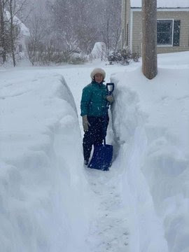
The mess left behind will be hard to shovel. It won't be particularly deep, but the snow and ice will be dense. It'll be like shoveling wet cement, I suspect.

As always, expect some changes to this forecast, since so much could happen if temperatures in the atmosphere go up or down just a couple degrees from predictions.

This is a wide-ranging storm, by the way. It has already dumped several inches of snow in Texas and even in northern Mexico. 

There's a real tornado threat with this storm in the Deep South today. Flooding is a good bet from eastern Texas to Arkansas.

And Vermont isn't the only place that expects ice. Freezing rain and sleet will come down in a broad arc from northern Texas, through much of the Midwest and into New England. 

Another storm Sunday night will go by to our south, but could spread some light snow up into Vermont. 

It will stay on the mild side well into next week, with temperatures running several degrees above normal for this time of year. 

Wednesday, December 30, 2020

Quite A Stormy National Pattern; Not THAT Bad Here In Vermont

Ice covered trees in St. Albans, Vermont a couple years
 ago after some freezing rain. A wide ranging storm
is expected to bring at least some ice from Missouri 
to New England over the next few days. 
 We've fallen into a weather pattern that features lots of storminess across the Lower 48, which will cause all types of havoc.  

Here in Vermont, we'll have our share of icky weather, but at this point, it doesn't look like anything extreme. More on that in a bit. 

One storm yesterday coated much of the Midwest with snow and some ice, and is now heading into Canada. 

An even stronger storm, the one that the other day dumped a good dousing of rain and crackled the skies over southern California with lightning, is now reorganizing over southern Texas.  

This storm promises a boatload of widespread bad weather, including the risk of severe thunderstorms and tornadoes along the Gulf Coast and Southeast, flooding from eastern Texas and across the Arkansas Ozarks, and a wide, huge area of ice from central Texas, through a huge section of the Midwest and eventually on into the Northeast. 

Western Texas, and an area just to the north and west of that big ice area I talked about, is in for a pretty big snowstorm. 

There will be pockets of the ice that will be severe enough to damage tress and power lines. especially in parts of Missouri, and possibly later in a few spots in Pennsylvania.  However, most of the ice-related problems will involve hazardous roads. 

Since this ice will involve a huge chunk of the nation, expect many car crashes and such over the New Year's weekend.  Especially since drunk driving is still a thing on this holiday.  Due to the pandemic, a lot of people will stay home on New Year's Eve, limiting the number of people on the roads. Of course, it would have been better if we had no pandemic, but we're stuck. 

After this storm, the train of storms crossing the nation will continue, but it's too soon to offer details, paths and types of weather they'll bring as we head into January. 

One thing is a little more clear, and that is, at least as January starts, there won't be any severe or long-lasting Arctic outbreaks like there often is this time of year. Most of the frigid air is being bottled up by the current weather pattern way up in northern Canada. 

Eventually this Arctic air will probably plunge southward into the United States, but not anytime soon. It's been a pretty mild winter for the nation so far. 

VERMONT IMPACTS

The storm that hit the upper Midwest yesterday is up in Canada now, and will drag a cold front through Vermont tonight. 

There's not a lot of moisture with it, so we're not going to get a lot of weather. Ahead of the front, it will get windy today. Especially in the Champlain Valley, where some gusts will top 40 mph.

Tonight will bring some snow with the front,  probably kind of on the slushy side in the valleys as temperatures warm up before the cold front gets here. 

Expect just a dusting to an inch in the valleys, with perhaps a bit more than that in the mountains and Northeast Kingdom. No biggie. 

There's no real cold air behind this "cold" front, so New Year's Eve and New Years Day will be quiet and mild. (Highs in the low to mid 30s, lows in the upper teens and 20s).

The storm I talked about above will not get here until Friday night.  With not much cold air around, it looks like precipitation will be a mixed bag.

It's hard to say at this point what proportion of the storm will feature snow, or freezing rain and sleet, or plain rain. Suffice it to say roads will probably get slick amid some mixed precipitation late Friday into Saturday.

I'm sure the National Weather Service in South Burlington and other local meteorologists will be fine tuning this complicated forecast as we get closer to the actual storm. 

Another storm looks like it will form just off the East Coast Monday. At this point, it looks like it will go far enough east to miss Vermont, but we might as well watch it anyway.

The year 2020 brought us a lot of unexpected things. Why should 2021 be any different?


Tuesday, December 29, 2020

Weird Geeky Weather: Record High Pressure And A Weird Subtropical Storm

World record setting high barometric pressures is
occurring in Mongolia. Above is a winter scene from that
nation's capital, Ulaanbaatar. 
 Weather geeks are geeking out over a possible world weather being set in Mongolia of all places.  

There, it appears the strongest high pressure system on record is freezing the region out. 

Reports are coming in of barometric pressure of 1093.5 mb or 32.29 inches, according to aviation meteorologist Michael Adcock

For comparison, on average, the barometric pressure is around 29.92  inches. Readings of 31 inches are extreme and quite rare. 

The extreme barometric readings in Mongolia will have to be verified by the World Meteorological Organization to become official. 

Strong high pressure systems are most likely in the northern hemisphere during the winter as cold, dense air builds up in Arctic regions.  Sometimes, these particularly cold systems head south, bringing frigid air to the mid-latitudes. This is when you're most likely to break high pressure records. 

For instance, some of the highest barometric readings here  in Vermont - a little over 31.10 inches  -occurred with an Arctic high pressure system in 1920 that brought temperatures in the region to the minus 20s and 30s. 

True to form, it's frigid in Mongolia.  This nation is normally bitterly cold in the winter anyway.  Normal low temperatures this time of year in the capital Ulaanbaatar are around -10.  Low temperatures in this likely record strongest high pressure there are in the minus 30s. 

By the way, in and of itself very high or very low barometric pressure is not dangerous to humans. Only the weather associated with these phenomenon.  Obviously the frigid weather in these Arctic high pressure systems is dangerous.

Very low pressure is associated with intense storms, which of course tend to be risky. 

RARE SUBTROPICAL STORM

A subtropical storm named Oquira has formed in the Atlantic Ocean off the coast of Uruguay, South America. This area doesn't usually have much in the way of tropical storms. 

Tropical and subtropical storms depend on warm ocean water to develop. The South Atlantic between South America and Africa tends to be relatively chilly due to ocean currents, so this type of storm is rare off the coast of South America.   

It doesn't look like much but this is a satellite view of
Subtropical Storm Oquira off the coast of 
Uraguay, South America.  Subtropical storms
are rare in this region. 

Also, there tends to be strong upper level winds in the area off of South America, which discourages tropical storms from forming. 

This is the third subtropical storm to form in the Atlantic off of South America this year, which set the record for the most such storms in the region in a single year. 

This of course, is in the same year in which a record was set for the most tropical storms in the Atlantic north of the equator.  (As we know, tropical storms and hurricanes are much more common in the Atlantic between North America and Africa).

Subtropical storms are hybrids between regular old storms which have colder cores relative to the atmosphere around them, and tropical storms, which have warm cores. 

This storm - Oquira- has no chance of developing into a hurricane.  Only one storm in the South Atlantic has been known to become a full-fledged hurricane. That was Hurricane Catarina in 2004, which caused a lot of damage in southern Brazil. 


Monday, December 28, 2020

Northern Vermont "Snow Hole" Storms Avoiding One Particular Area

My St. Albans Vermont driveway during a March, 2017
blizzard. So far this winter, I haven't had anything 
remotely like this and shoveling has been 
practically nonexistent. 
 Up here in St. Albans, not far from the Canadian border in northwestern Vermont, I've only shoveled snow off my driveway once this winter. 

Even then, I could have gotten away with not doing it. There wasn't much, and it melted within a few days. 

Yesterday, I was able to cut some brush on my property. There was only a dusting of snow on the ground. 

It's all evidence that so far this winter, snow is really avoiding northern Vermont, even while most other areas are having a relatively snowy winter so far. 

Much of the Northeast have had above normal snowfall this year. That's mostly driven by a big mid-December snowstorm that has since pretty much melted away.  The snow does not have much staying power this year in a warm weather pattern.

But at least these places got to play in the snow at times. Northern Vermont has practically gotten nothing.

According to the National Weather Service Eastern Region, the only places really with below normal snowfall are Maine, with slightly below snowfall, a small pocket of western New York around Syracuse that has so far managed to avoid lake effect storms, and northern Vermont. 

Snowfall so far in Burlington this season is 10.8 inches, roughly half of what normally falls by this time of year. 

Many other areas of the nation are seeing above normal snowfall so far.  That's especially true in the Plains and Midwest. Minneapolis, with 28 inches of snow so far this year, is 7.6 inches above normal. Even Oklahoma City has had 6.8 inches of snow, which is 4. 6 inches on the plus side. 

Since Burlington, Vermont is so far just 10 inches or so shy of normal, there's still plenty of time to catch up.  One big snowstorm or a couple mid-sized ones would bring that city close to normal. 

However, very little snow is expected now through Thursday.

A wild card comes Friday, when some sort of storm is expected to pass by.  We don't know how heavy the precipitation will be yet.  We don't yet know what exactly will fall from the sky in northwestern Vermont. Rain? Snow? Freezing rain? Sleet?  All of the above?

As it stands now, there won't be a whole lot of cold air around at the end of the week, so anything could happen. We do have a shot, however slim, of several inches of snow, though. 

Beyond Friday, we will stay in a rather stormy pattern, so there's the possibility of more snow. Or rain.  Hard to tell. 

There have been sharp reversals in snow fortunes after a slow start. In the winter of 1992-93, only 5.7 inches of snow had fallen through December 31.  The winter ended with a total snowfall of 116.9 inches, which is still the fifth snowiest winter on record. (A massive March blizzard in 1993 contributed to that total).

All this means I could easily still see my vacation from shoveling the driveway end at any time.  You'll hear my curse words if that happens. On the bright side, it's way, way too early for winter sports enthusiasts in northern Vermont to give up hope for this season. 

Sunday, December 27, 2020

It Never Rains In California. Until It (Mercifully) Does

Wildfire near Camp Pendleton, California last week.
Rain is finally coming to southern California tonight.
Not much and late, but anything will help. Fire
from Cal Fire, via AP
The weather forecast for the Los Angeles area is lousy, and I'm sure people are ecstatic over it. 

It's supposed to rain there later today through tonight and into tomorrow morning.  

As rain storms go, this isn't a biggie. They'll probably get a half inch to an inch of rain, with locally two inches in the hills. Elevations of about 4,500 or so will get some snow. 

The reason everybody is likely happy there is that the rain will probably at least temporarily end the region's extended fire season. As recently as this past weekend, there was an elevated fire danger in southern California. 

Fire season usually dwindles in November as the first rains of the season creep into southern California. The rain is both late and light this year in California. That was just another bad part of the state's worst-ever fire season. By September, 3.2 million acres had burned, and there were more fires after that. 

A wildfire that burned around Camp Pendleton just over the Christmas holiday forced the evacuation of 7,000 people.

Now, finally, the rain is arriving. This won't solve all of California's problems, as the incoming rain doesn't really reflect a real pattern change. Even so there are some additional chances of rain in southern California as we go into January.

Even with this rain, it might not erase the risk of brush fires in southern California just yet. It'll help, but they're surely praying for a wet January, February and March out there.

Northern California, as always, will be wetter than the south over the next few weeks, but even there, so far we don't have evidence that there will be enough in the immediate future to diminish the state's drought much. 

As of late last week, 95 percent of California was in drought, according to U.S. Drought Monitor. 

Tonight's LA rain is one of the ingredients that will give us here in Vermont some inclement weather for the New Year's weekend.  The prospect of another very warm rain storm has gotten more iffy with new forecasts, so we'll just leave things as the fact we have a good chance of getting some sort of precipitation Thursday and Fridah. 


Saturday, December 26, 2020

Another Bonkers Winter Vermont Heat Wave Is Over; They're Getting More Frequent

Sort of back to normal this morning in St. Albans, Vermont.
After record high temperatures in the mid-60s o
Christmas Day, this Boxing Day morning greeted us
with a thin dusting of snow.
Well, that was weird. 

It's not common to feel comfortable outdoors on Christmas in Vermont wearing shorts and a t-shirt, but that's what we got yesterday.

Temperatures soared to 65 degrees in Burlington, Vermont during the morning, and managed to stay in the upper 50s into early evening. 

That 65 degree reading was of course a record high for the date, besting the previous record of 62 degrees in 1964. 

As noted yesterday, Burlington was the warmest major weather station in the continental United States at 8 a.m. yesterday, when it was 64 degrees.

As expected, there was a lot of flooding from the record warmth, rain and snow melt in southern and central Vermont, but it wasn't as bad as the worst fears.

Early this morning, the Otter Creek at Center Rutland was reached 9.6 feet, which is borderline minor/moderate flood stage. It's falling well short of the forecast 13.4 feet, which would have been a major flood, with damaging consequences. 

Elsewhere in southern Vermont, there were some closed roads, minor washouts and flooded basements, but this didn't turn out to be quite as bad as earlier forecasts, which is great news.

Rainfall was a little lighter than forecast. Most areas in southern Vermont had one to 1.5 inches of rain. A lot, but it could have been worse. 

By the way, early indications are a  similar storm to the one we had over Christmas might hit on the New Year's Eve/Day holiday. 

The forecast could easily and dramatically change between now and the end of this upcoming week,  but right now that next holiday storm could bring another blizzard to the Upper Midwest and strong winds, possibly heavy rain and warm temperatures to the East Coast, and that would include Vermont.  

I don't think the New Year's storm will be as warm as Christmas, but still. It's that kind of winter. 

MORE WEIRD WINTER WARMTH

There have always been the occasional weird, springlike day in the winter in Vermont. It was 64 degrees in Burlington in January, 1906, for instance.

But since the early 1980s, these weird spells seem to have gotten more and more frequent as time goes on. 

It started with a week long stretch in February, 1981, when temperatures were in the upper 50s to low 60s each day.

January, 1990 was the second warmest on record. 

Next, in January, 1995, the temperature rose to 66 degrees in Burlington to be the warmest January day on record. Incredibly, the low temperature that day was 58 degrees, which is pretty close to normal for late June. 

The very next year, in January, 1996 it got just as hot. Unfortunately, that heat wave hit when there was a lot of snow and ice on the ground, and it was accompanied by heavy rain. 

The result was a tragic, severe flood across the Northeast, including Vermont. Those flood killed 38 people, two of them in Vermont. 

The pace of the winter heat waves picked up even more in the past five years or so.

On Christmas Eve, 2015, the temperature soared to 68 degrees in Burlington, setting a new record for the entire month of December.  This was even more extreme when you consider most warm records are set in early December. It was 70 degrees on December 24, 2015 in Rutland. 

On February 25, 2017, Burlington soared to an incredible 72 degrees, shattering the record of 63 degrees set a few days earlier. Before that, the warmest February reading on record was 62 degrees in that hot February of 1981.

The very next February, 2018, it got up to 69 degrees in Burlington which would have blasted away the February record if not for the year before. It got up to 70 degrees in Montpelier in the 2018 warm spell, shattering that city's February record.

Now we have this year's Christmas heat. 

It can and does still get brutally cold in Vermont's winters of course. Just look at the frigid month of February, 2015, or the record early subzero cold in November, 2019 for examples. We will almost certainly experience plenty of subzero cold in January and February. 

However, in large part due to climate change, it seems we are more prone than ever before to springtime in winter in the Green Mountain State. 


Friday, December 25, 2020

Flooding, Record Heat Embrace Vermont On Christmas Morning

A Christmas miracle? Climate change? Just a weird year?
Daffodil shoots coming up in my St.Albans, northwestern
Vermont this Christmas morning. The temperature was 
a record breaking 64 degrees when this photo was taken.
 This year has been a strange year to say the least, so obviously the weather this Christmas morning is going to be odd, too.  

Flooding and record warmth is the story in Vermont this morning.  Water, as expected is rising, mostly in southern Vermont as rain, high humidity and those record high temperatures quickly erase the what was until yesterday deep snow in that neck of the woods. 

Up here in northwest Vermont, I worked clearing brush outside in a t-shirt in my snow-free St. Albans, property. It was the second time in five years I found myself enjoying the outdoors in a t-shirt on Christmas Eve. In Vermont. 

Temperatures warmed further overnight.  At 8 a.m. it was 64 degrees in Burlington, Vermont, breaking the old record of 62 for the date set in 1964.  

This record made a liar out of me. On December 1, when we had a record high of 66 degrees, I said we wouldn't have such springlike temperatures again until, well, spring.

I might have missed a couple places, but my quick check this morning reveals that incredibly, the warmest place in the continental United States at 8 a.m. this morning appears to be the town of Highgate, in the northwest corner of Vermont, with 65 degrees (!!!!). The warmest major weather station in the continental United States appears to be Burlington, Vermont with 64 degrees.  

For comparison's sake, it was 54 degrees in Miami, Florida at 8 a.m. It was 49 degrees in Phoenix, Arizona and 53 in Los Angeles.

Snow flurries were in the air last evening and overnight in Atlanta, Georgia, and Charleston, South Carolina. 

The cold front causing the rain and flooding and the one that will quickly end the record warmth has that "negative tilt" I talked about yesterday.  That means its northwest to southeast orientation means this cold front has already gone through the southern United States and Florida. That explains why we are the nation's hot spot this morning. 

 The warmth is incredible, of course, but by far the most serious concern is flooding.  It ain't over yet, despite the relatively light rain in northern Vermont. (As expected, it's been heavier south).

The cold front was on our doorstep this morning. Heavier rain moved into northern Vermont just after 8 a.m., which will put a damper on those record high temperatures. We've reached our peak. 

Rivers are already rising, and flood warnings are being issued left and right in southern Vermont and surrounding areas. 

The expected crest of the Otter Creek has been scaled back slightly to 11.4 feet tonight, but that's high enough to have water approach houses in Rutland and Center Rutland. 

Flood warnings are in effect for stretches of other Vermont rivers as well, including the Walloomsac, West, Hoosic and Williams Rivers in southern Vermont. 

Most rivers and streams in southern and central Vermont will be either high or flooding by this evening. 

You still want to take extra care, because there will be a lot of flooded roads with this.  Do NOT drive through a flooded road or street, even if the water doesn't appear that deep.  Looks are deceiving, and you never know if the road bed was washed out beneath the water. It's dangerous!

As of 9 a.m., no roads had closed yet due to flooding, but I'm sure that will change. Vermont Agency of Transportation reported water getting close to roads in some spots already. 

High winds have been a problem in spots, too. About 1,000 customers scattered across Vermont have no power as of 9 a.m. today, according to Vermont Outage Map.

The cold air is pretty close by. While it was in the 60s this morning in Vermont, lake effect snows were blowing through western New York. 

The colder air will come in fairly gradually, though. Temperatures will fall through the 50s and 40s during this afternoon and evening in Vermont, and things will freeze up tonight. The cold front, once it passes, will shut off most of the rain, too.

The heaviest rain will come between now and early afternoon, just ahead of the cold front. Rainfall totals will exceed an inch in many places.  It will go to two inches in favored places in southern Vermont. With the snow melt, you can see how that's more than enough to set off flooding.

By the way, we're now in a fairly stormy weather pattern. But at least for now, not a particularly snowy pattern. The next two storms look like they'll go by to our west, putting us in the warmer, rainier side of the storms. 

It probably won't get into the 60s again with these storms, but the way this year's going you never know. 

One storm will move past us Monday, with some rain showers, probably beginning and ending as snow showers, with not much accumulation. 

After a midweek cold shot, another rainy storm looks likely around New Year's Eve.  It will probably have some similarities with today's storm, except it will be much weaker and not have nearly as much warm, humid air with it. 

Elsewhere in the Northeast, this Christmas storm has caused a lot of havoc.  Flood warnings are widespread in Pennsylvania and New York.  Winds as high as 71 mph in Connecticut have cut power to thousands. 

Messy day for sure!


Thursday, December 24, 2020

Dangerous Eastern United States Storm Hits Today, Vermont Included

Almost any dangerous weather you can imagine is going on with this storm moving into the eastern United States.  
Just one ominous sign of the storm approaching us.
Forecast calls for major flooding along the Otter 
Creek in Rutland County, Vermont. Widespread,
damaging floods are likely today and/or
tomorrow from Pennsylvania to Maine. 

This isn't just minor inconvenience stuff. Some areas are in for some serious, maybe life-threatening floods.  Tornadoes threaten North Carolina. Damaging winds will roar from the Carolinas to Maine. 

It started with a full blown blizzard with zero visibility and winds gusting to more than 60 MPH in the northern Plains yesterday. 

Today and tomorrow bring heavy snow, dangerous floods, damaging winds and even tornadoes, depending upon on where  you are. 

As usual with these large storms, I'll get into the big picture first, and tell you what us Vermonters are in for.

That opening storm salvo, the blizzard in the Dakotas and Minnesota, left a trail of highway pileups ad closed roads.  It was so bad that plows and police wouldn't go out onto the roads. Too dangerous.

The storm center that caused the blizzard has moved into Canada, but the storm's strong cold front extends all the way down to the Gulf Coast. A new storm is forming on that front. This is what will cause the chaos today and tomorrow in the eastern United States. 

This frontal system is developing something of what is called a negative tilt. Most cold fronts are aligned northeast to southwest or directly north to south.  This one is becoming aligned northwest to southeast.

That's a sign of a strong system, and one that's able to bring a boatload of subtropical moisture northward. That flow of moisture is being aided and abetted by strong winds aloft, bringing all this weather north. 

With that negative tilt, the cold front will go through Florida and the Carolinas before it gets to New England. 

The strong, veering winds aloft has eastern North Carolina at risk for tornadoes today. The storm already has a history of producing a few tornadoes in Mississippi. With even stronger dynamics, this system is almost guaranteed to produce at least a couple spinups. 

The orientation of this cold front will help massive amounts of moisture come inland over the Mid-Atlantic States and New England.  That means heavy rain. 

Unfortunately, the heaviest rain will fall precisely where the heaviest snow fell last week. This goes from central Pennsylvania, central New York, southern and central New England and on up into New Hampshire and Maine.

This rain will be accompanied by very warm, humid air, especially for this time of year. Snow melts most rapidly in humid air. So it will go fast.  One to three inches of "rain" will come from the snowmelt, combined with one to four inches of rain from the sky. 

This sets the region I mentioned just above for a serious flood threat.  This won't be just nuisance flooding.  It could get quite serious in some of these areas. 

High winds are also a problem, especially in southern New England, parts of New Hampshire and Maine, and the high elevations throughout the Northeast. 

Incredible winds will be howling just off the surface, roughly 5,000 feet above the surface.  Peak gusts on summits like Mount Washington in New Hampshire, Mount Mansfield in Vermont and Mount Marcy in New York are likely to exceed 100 mph. 

There won't be anything that strong in lower elevations where people actually live, but damaging winds gusts are still a possibility. 

All in all, between the tornadoes, floods and winds, it seems like some sad Christmas tragedies are inevitable.  Totally on brand for the year 2020

VERMONT IMPACTS

Southern Vermont is within the larger target zone from serious flooding with this storm.  The snow pack there is deep.  This part of Vermont will also get the most rain from this storm, likely 1.5 to 2 inches, with locally higher amounts. 

That very warm, humid air I mentioned will also envelope all of the state tonight and the first part of Christmas Day. While it rains. Hard. 

I'm definitely concerned that in southern Vermont, at least, this won't be just another, "Oh, look, there's some water in Farmer Smith's field again."

If you're in a flood prone area, especially from Route 4 south, keep an eye out. Small streams and brooks will be first to go nuts later on tonight.  There's definitely a risk of culverts failing, back roads washing out and water collecting rapidly in basements.  

It seems that Vermont has become more flood prone in recent decades. The most recent serious flood we had was on October 31-November 1, 2019.  I think the upcoming flood will be nearly as bad as that, but will hit an entirely different part of the state. The Halloween storm hit northern Vermont. This one will focus on southern Vermont. 

It's very hard to see flooding when driving when it's dark out, so be very careful, or better yet, don't venture out at all tonight and tomorrow. We're supposed to say home because of Covid anyway. 

I think there will also be a lot of street flooding in towns.  Many roads in flood plains will go under water.  Whatever you do, don't drive into flood waters. That's always a very dangerous move. It's especially true now, when the water will be frigid and nail you with hypothermia almost instantly. 

The flood warnings, initially only in effect for far southern Vermont, have been extended north to about Route 2.  There's less snow further north, but there's enough to melt, combined with the heavy rains, to trigger flooding. 

As Christmas Day wears on the flooding small streams and brooks will feed into the larger rivers.  At this point, Otter Creek in Center Rutland is expected to go into major flood stage, at 13.1 feet. Flood stage is 8 feet.  The expected crest would be the highest since the record highs of Tropical Storm Irene in 2011.

The Walloomsac River in Bennington County is also expected to go into major flood stage, while numerous other rivers in Vermont will probably hit at least moderate flood stage. 

Strong winds are a secondary threat with this storm in Vermont.  It won't be as bad as in southern and coastal New England, but we could seem some gusts as high as 50 mph mix down to the surface from those screaming winds aloft. Scattered power outages are a threat.

Ahead of the cold front in the rain Christmas morning, it will be strangely balmy and, as I said, humid. Lots of us will be in the upper 50s, which is getting close to record highs.  After the cold front passes in the afternoon, the rain will mercifully shut off as temperatures fall through the 40s and 30s. 

The storm will be over by then, and we'll be left once again, fixing damaged roads, culverts, bridges and likely some homes and businesses. 

Not a good forecast, for sure.  It's worth repeating: Totally on brand for 2020. 

Wednesday, December 23, 2020

Wednesday Evening Update: Some Surprise Snow; Bad Storm Still Due

A bit more snow that expected flew through the air in
St. Albans, Vermont this afternoon. It's a precursor
to the warm storm coming which will bring some 
flooding and strong winds to the region
 A weak warm front, the first sort of salvo of that big storm that's due in the Northeast tomorrow and Christmas Day, has over performed a bit.  

The warm front has caused a little more lift in the atmosphere than I think many forecasters thought, so an area of mostly light snow was passing through northern and parts of central Vermont this afternoon.

Be careful on the roads, there are slick spots because of this snow. Additionally, the wind is beginning to pick up, so there might be a little blowing and drifting snow to make things even a little more interesting.

The snow won't amount to too much, maybe a dusting to two inches, and will end this evening. 

This afternoon's snow announced the start of the warm air that's going to flow into Vermont ahead of and with this storm. 

Temperatures won't fall much overnight. It might even get a little warmer with time overnight in the Champlain Valley. South winds will get stronger and gusty overnight as well. 

I'll have a full update on the meat of the storm with tomorrow morning's update. 

But here's a couple things I've noticed. Forecasts bring the Otter Creek in Center Rutland to major flood status late on Christmas Day. Flood stage is eight feet, the forecast is for 13.1 feet and the record crest is 17.2 feet. So this will be worse than just field flooding if this comes to pass. 

Even in northern Vermont, where there isn't nearly as much snow to melt, the Winooski River at Essex Junction is forecast to reach minor flood status, and be just short of moderate flood level.  The Mad River at Moretown is forecast to go to moderate flood stage and be just shy of major flood status. 

So basically, take the flood threat seriously with this storm. It won't be the worst flood Vermont has ever experienced, but it doesn't take all that much to be dangerous. 


Wet And Windy Christmas Eve/Day: Some Flooding, Wind Problems Still Likely

Winter flooding near Enosburg, Vermont in January, 2018
High temperatures, heavy rain and snow melt could easily
cause flooding tomorrow and Christmas in 
southern and central Vermont. 
 You can tell how energetic our Christmas storm will be as we look to the central and western United States.  

There might be a couple weirdly placed ads in this post again, I don't really have control over where they go, so just scroll past them unless you're interested in them, of course.

There were signs in places like Steamboat Springs, Colorado yesterday with a wild thunderstorm/blinding snow squall that swept through the resort town. 

Today, high wind warnings are up for a huge area from Colorado to North Dakota.  

Blizzard warnings are in effect for parts of the eastern Dakotas and western Minnesota, including the area where a lot of my relatives and friends live around Yankton, South Dakota.

As the storm consolidates tomorrow, flooding will become a concern in much of the zone hit by that epic snowstorm last week. Heavy rains and very mild temperatures will quickly melt that snow during this storm, resulting in the flooding. 

Parts of Vermont are included in this, and I'll get into Vermont specifics in a bit.

Strong winds will also buffet the East Coast and southeastern Canada, leading to the risk of power failures.  There's even the risk of a few tornadoes early on Christmas Day in eastern North Carolina. 

For us here in Vermont, this storm looks fairly impressive, but by no means cataclysmic, unless you like a White Christmas. 

You'll see the winds pick up tomorrow - Christmas Eve - as temperatures rocket upward well into the 40s to around 50.  

Christmas Eve night will be rather stormy, but the air will feel springlike.  The highest winds with this storm look like they'll avoid Vermont, but some areas, especially the western slopes of the Green Mountains and the Champlain Valley, will still see gusts over 40 mph. 

That's enough to bring down a few branches and maybe cause some isolated power outages, but nothing extreme.  

Winds might be even stronger in Bennington County and a few other parts of far southern Vermont, where a high wind watch is up for Christmas Eve and Christmas morning for possible gusts to 60 mph. 

Rainfall with this storm looks like it will unfortunately be heaviest in areas with deep snow cover in southern and central Vermont.  There, rainfall up to two inches through Christmas Day seems sure to create some flooding. 

Again, this won't be an extreme disaster, but certainly something to watch out for. I'm sure roads, streets, parking lots and basements will flood. Remember, if you're driving and you see that the road ahead of you is flooded, just turn around and find another way to get where you're going. 

Stalling out in frigid flood waters is at best an enormous bummer and at worst, fatal. Larger creeks and rivers, like the Otter Creek, will probably at least get into minor flood stage.  Smaller brooks will respond faster and risk causing washouts and culvert collapses, so watch out on those back roads. 

Northern Vermont will get a bit less rain, maybe three quarters of an inch.  There's also not much snow on the ground up there. That means brooks and streams will probably rise sharply, and rivers will go up, too, but any flooding looks to be minor and not widespread at all. 

The storm's cold front will come through a little later on Christmas Day than originally thought.  The first part of the day will be remarkably warm, with temperatures in the 50s.  The record high in Burlington on Christmas Day is 62 degrees, set in 1964.  It's doubtful that it will get that warm, but given how weird this year has been, anything's possible.  

Temperatures will come down during the afternoon Christmas Day, but not as dramatically as first feared. 

This slower pace means earlier predictions of a "flash freeze" won't come to pass, at least not to the extent some of us thought.  A flash freeze is when temperatures crash from very warm levels to sub freezing in, say, ,an hour or two, causing roads to instantly ice up.  Flash freezes are dangerous because they tend to catch people off guard. 

This time, a narrow punch of dry air will come in right after the cold front, shutting down the precipitation. The cold air will also sort of take its time getting here, so it will take several hours before temperatures go below freezing.  This will give the roads a chance to dry out some before freezing 

There will certainly be icy patches around later on Christmas Day and night, but, again, it won't be a disaster. 


Tuesday, December 22, 2020

Flood Risk Here, But Nothing Like Epic Torrent in Iceland, Of All Places

Serious damage from flooding and mudslides last week
in Iceland. 
Snow was falling lightly here and there this mild December morning in Vermont, and up to six inches might accumulate on the mountain peaks by tomorrow morning. 

Valleys will get a dusting to at most two inches.

It's just a minor system passing by as we get ready for the expected Christmas Eve and Day storm. That one is still expected to give us a bout of wind, rain and possible flooding. 

The forecast updates as of this morning have the rain coming in just a little later on Thursday afternoon than earlier indicated, and the rain will last a little longer into Christmas Day before a strong cold front shuts that off.

At least minor flooding seems a good bet with this storm, as an inch or more of rain and very warm temperatures will quickly melt the deep snow in southern Vermont. 

Strong winds are also forecast with this storm. 

Latest indications are that snowfall behind the cold front on Christmas Day won't amount to much as dry air cuts into the storm from the southwest.  The exception might be mountain peaks, which could get the remnants of lake effect snows from western New York. 

Today's update on the Christmas storm is broad brush.  I'll get into more detail in a post tomorrow morning. 

ICELAND FLOOD

The potential flooding in Vermont and elsewhere in the Northeast, while possibly dangerous, pales in comparison to a flood that struck Iceland this month. 

Yes, Iceland can have rain and flooding in the winter. The warm Gulf Stream, which keeps western Europe relatively mild in the winter, also passes by Iceland, so that island isn't all that cold in the winter. And they certainly get thaws.

Iceland is also stormy, especially in the winter. 

However, a storm last week was extreme, and caused a lot of destruction. About 500 people were evacuated from one town after landslides swept away several homes and damaged many more, the Iceland Grapevine reports

One town reported 22 inches of rain in five days, which is a record for rainfall intensity in Iceland. It's still rainy in lower elevations of Iceland this week, but the precipitation has become much less intense.

Video:


Monday, December 21, 2020

Christmas 2020: Strong Winds, Flood Risk And A Flash Freeze

One model run for early Christmas morning shows
a sharp cold front in western Vermont. Low 50s from the
Greens east, upper 20s far west. Timing of the cold front
and its intensity are still in question.
Details are slowly coming together on an expected nasty Christmas Eve and Christmas Day storm here in Vermont and the rest of the Northeast, but timing questions are huge.  

Note The automated ads associated with this blog post might be a little out of control today. If so, please be patient and scroll down to keep reading. 

Forecasters are pretty sure we're in for a good dousing of rain, some strong, potentially damaging winds and something known as a flash freeze, which I'll get into in just a bit. 

 There will probably be some snow with this, too, but just how much is really up in the air.  

Here's what's going on: A parade of storms has been smacking into the Pacific Northwest, dumping a lot of rain out that way, which is pretty typical for winter.  

These storms, most of them in somewhat weakened and definitely dried out form, are eventually zipping through New England with little fanfare, just some light precipitation. 

One came through yesterday, another goes by a little to our south tonight and tomorrow, no big deal. 

However, one of these Pacific storms has a lot of energy with it.  Plus, a deep dip in the jet stream will form as this storm gets going.  

This will allow deep subtropical and warm air to fly north on strong upper level winds ahead of the storm's cold front.

This will unleash what looks like quite a bit of rain on us Christmas Eve day and night. Storm totals could easily go over an inch. 

That deep snow in southern Vermont will rapidly melt with the warmth and rain.  Flooding is definitely a possibility.  

Already, some river forecasting models depict some flooding along the Otter Creek and Mad River, and it's likely most other rivers will rise. 

Most of the trouble with this thaw and rain will most likely be small stream, street and basement flooding. This would literally put a damper on Christmas celebrations, already seriously cut back due to Covid. 

Remember those strong upper level winds I just mentioned that are bringing that warm, wet air to us?  Some of those winds could mix down to the surface, though it's unclear to what extent that will happen.

The rapidly diminishing snow cover in southern Vermont might, just might help create a temperature inversion that would help keep the strongest winds from reaching the surface. But we're not sure.

At this point, the western slopes of the Green Mountains and the Champlain Valley have the best chance of getting slapped by strong, potentially damaging wind gusts. This would be mostly a tree and power line issue. Again, something you don't want to have at Christmastime. 

We could see temperatures get well into the 50s Christmas Eve night. That would get us close to record highs most days this time of year. Except Christmas Eve is the anniversary of a bonkers 2015 holiday heat wave that brought Vermont temperatures as high as 70 degrees. So no record highs that day. 

I suppose there could be readings close to record highs for Christmas Day in the early morning before temperatures fall.

Incredibly, what seemed like a lock for a white Christmas in southern Vermont, which got two to three feet of snow in many areas last week, now looks questionable.  That will depend on the timing of the storm's cold front. 

The cold front on Christmas Day looks to be a real humdinger. I picture a line of heavy downpours just ahead of it, followed abruptly by crashing temperatures and a changeover to snow.

This is that flash freeze I referred to.  All that water from the rain will instantly freeze on roads and sidewalks, presenting a hazard to anyone driving or walking. 

The rain will change to snow with the passing of the front.  It's unclear how much snow will fall, as forecasts are all over the place. It depends mostly upon the timing and strength of a new storm riding northward along this strong cold front. 

Computer models are all over the place, because they don't have a handle on the situation yet. According to this morning's forecast discussion from the National Weather Service in South Burlington, one model has Burlington receiving somewhere between a half inch and 18 inches of new snow on Christmas Day.

I'm guessing the low end of that range, but that's just a guess right now. 

The timing of the powerful cold front is a question mark, too.  It could enter western Vermont before dawn and sweep right through, or it could wait until during the day.  Which means right now, it's impossible to know what conditions will be like when you wake up Christmas morning.  It could be in the 50s and raining, it could be way below freezing with snow and blowing snow outdoors.

Again, the models are all over the place.  One run of computer models has the temperature in Burlington at around dawn somewhere between the upper single numbers to low 50s. Yeah, no help there. 

Whatever happens, the wind will continue to crank as temperatures fall during Christmas Day.  

We might not yet know the timing or the intensity of this year's Christmas storm. It's 2020, after all, anything can happen.

Just plan on rough weather outdoors.  It will be yet another good excuse to heed the warnings of the Vermont Health Department to just stay home with your immediate family and not venture out to somebody else's house. 

This would prevent the spread of Covid, and also prevent you from getting trapped or in a crash on bad, icy or flooded roads. 

Sunday, December 20, 2020

Christmas Ad Depicts The Ultimate Hail Storm

Quite a hailstorm in this Burberry holiday ad.
 Over at my sister blog, Matt of All Trades, I highlighted the best of Christmas holiday ads of 2020, at least in my opinion.  

There was one other, from Burberry, which was sort of a Christmas ad, but it fits more here in this here weather blog thingy.

With an especially cheerful version of "Singing In The Rain" playing, a bunch of dancers bedecked in the finest Burberry coats,, dodge some of the biggest "hail" I've seen. 

The ad is just a concept, but my very literal side has me wondering what people are doing out there. That has to be the biggest hail I've ever seen on video. It could kill somebody! Even if it is more crumbly than "normal" hail I've seen in severe storm videos. 

The damage the Burberry hail would be causing must be immense. Everything is unharmed in the ad, but my gosh, those glass skyscrapers must be getting shattered. At least if this were real life. The roofs of those old buildings in the streetscape must be battered and broken, too. 

I'm sure those stylish Burberry coats are great protection from inclement weather, like London's famous drizzle and rain. But why is an apparent Oklahoma-style supercell dropping such incredible hail in England in December?

I'll invite any and all of my fellow met nerds to explain how the weather in this ad happened.

Here's the video, for what it's worse. Click on the YouTube logo to make it big enough to actually watch: 


Global Hot November And A Cool Political Change

Climate change continues apace, as new November data
shows. But at least Joe Biden is poised to put us
on the correct team to battle it. 
I was a bit distracted by last week's epic snowstorm in southern Vermont and elsewhere, so I never did get into the monthly check on global temperatures, which came out last week. 

The global analysis was for November, and unfortunately, did not contain any surprises.  Unfortunately, because the heat stayed on. 

Out of past 141 Novembers in the global database, this year's was the second hottest on record on a global basis. Only November, 2015 was marginally warmer. 

The data was compiled by NOAA's National Centers for Environmental Information.

The world's ten warmest Novembers have happened since 2004 and the top five have occurred since 2013, so we are having hot times due to climate change.  

Relative to normal, the warmest places on Earth during November, 2020 were northern Russia, Australia, a good chunk of South America, the eastern two thirds of the United States, the North Pacific Ocean and the Bering Sea. 

Even with a warm globe, there's inevitably cool spots. Those were in northwestern Asia, a spot in the North Atlantic and especially the equatorial eastern Pacific Ocean off of South America.

That last spot is especially worth noting. That cool eastern Pacific air and water is a sign that the La Nina weather pattern is in full swing.  La Nina overall tends to suppress global temperatures a bit, so it is alarming we managed to have the second warmest November with a La Nina. 

The opposite, a warming in the Pacific call El Nino, tends to warm the world a bit overall. 

Overall, it looks like 2020 will be the second hottest year on record, after 2016, which I believe had an El Nino.  There's even a chance this year could be THE hottest, depending upon how December goes.

CLIMATE CHANGE TEAM COMING TO WHITE HOUSE

President-Elect Joe Biden certainly has a different approach to climate change than outgoing President Trump. 

Trump has famously called climate change a hoax and pulled the United States out of the Paris Climate Accord. 

Getting back into the Paris agreement will apparently be rather easy.  Biden has pledged to get back into it his first day on the job, January 21.

Biden is also assembling a climate focused team. As NPR reports:

"Biden announced his intention to nominate Rep. Deb Haaland, D-NM to serve as secretary of the interior; former Michigan Gov. Jennifer Granholm to head the Department of Energy; Michael Regan as EPA administrator; Brenda Mallory as chair of the Council on Environmental Quality: Gina McCarthy as national climate advisor and Ali Zaidi as deputy national climate advisory."

Additionally, we know that Biden as nominated Pete Buttigieg a transportation secretary, and it appears he will be active in promoting green technology in our transportation infrastructure. 

While Biden can reverse a number of Trump's anti-climate policies through executive orders, his administration will have a tough time fighting Republican efforts to thwart these policies. That's especially true in the likely event that the January Georgia Senate runoff seats one or two Republicans rather that Democrats. 

The Biden administration also will be unable to stop climate change, or even mitigate it to any huge degree.  But at least with the new administration, the United States will at least be on the right team. 


Saturday, December 19, 2020

Some Last Nor'easter Updates, And A Nasty Christmas Storm?

A man was trapped for 10 hours in this car, which had
been entirely buried in the snow near Owego, NY.
 It's cold this Saturday morning with most of Vermont and surrounding areas seeing subzero temperatures early on. 

The exception was the mountain tops, as we had a big temperature inversion going on.  

The normally frigid summit of Mount Washington, New Hampshire was at a reasonable 18 above, and the summit o Vermont's Mount Mansfield was at 21 degrees. 

On calm, clear winter nights, cold air drains readily into the valleys, so the summits turn into the warm spots. The contrast was even bigger than usual this morning.  The snow cover in valleys that got hit by that snowstorm earlier this week are most prone to the cold.

Speaking of which, Vermont might have broken the state record for the most snow in a 24-hour period.  Peru, in southern Vermont, reported 44.8 inches of new snow Wednesday.  Investigators will look into whether the snow was measured properly there.

If so, it will set the new state record for most snow in a 24 hour period. The current record is 42 inches at Jay Peak. 

The snowstorm turned into a harrowing experience for one man in central New York.  His car went off the road in the torrential snowstorm, then the car got buried by a passing snow plow, whose driver didn't see him . 

The car broke down, so the driver had no heat.  He tried calling 911 but the connection was weak.  Police did launch a search for him, but the motorist was stuck for 10 hours and suffered from hyperthermia and frostbite.

The man was near death, but finally, a New York State Trooper searching for him thought he'd run across a row of mailboxes that were buried.  The cop dug anyway, and found the car and the man, probably less than an hour before the motorist would have died.

NEW, BAD STORM?

For the next few days here in Vermont, we'll see a warming trend with no exciting weather. Small disturbances will trigger snow showers now and then, which could be mixed with rain in the warmer valleys.

But there are signs of trouble for Christmas Eve and Christmas.

Early indications call for the risk of a squirt of very warm air, and the possibility of heavy rain and damaging winds. 

It's all uncertain at this point, but if things come together, there could be flooding from the thaw and rains in places that got a lot of snow. High winds could bring down power lines and trees, too. 

This is still something that's just coming together, so we don't know the details or even if this will happen. But stay tuned, this could pose some holiday trouble.  

Friday, December 18, 2020

What's With All These Huge Snowstorms In Recent Winters?

Snowfall total map from this weeks storm clearly
shows the intense snow band from central 
Pennsylvania to New Hampshire.
As you might have noticed, I've been wicked impressed by the snowfall totals from yesterday's storm. 

I'm just as impressed by the wide area in which reports came in of over 40 inches of snow. These extreme totals were in roughly a 50 mile wide band stretching all the way from Pennsylvania to New Hampshire. 

Anecdotally at least, it seems mega snowstorms in Vermont, and by extension the Northeast, have been getting more common, even if winters in general have been warming up. 

There have always been massive snowstorms in the East and Northeast.  Just check out the Blizzard of 1888, the tragic "Knickerbocker Storm" in Washington DC in 1922 the big New York City snowstorm of 1947 and the Great Appalachian Storm of 1950. 

Yesterday's big snowstorm missed Burlington, Vermont. Only 2.5 inches of snow fell there.  But the pace of these huge storms seems to be increasing. Eleven of Burlington's biggest snowstorms have happened since the year 2000.  Four of the five deepest Burlington snowstorms have happened since 2007. This in a city where climate records go back at least to the 1880s.

Standout storms seem to hit New England almost every year now.  More than two feet of snow smothered far southern Vermont and the Capital District around Albany, New York last year. 

Vermont and New York experienced the epic Pi Day blizzard, with snowfall in the two to three foot range in March, 2017. You might remember the great snow siege in Boston in late January and February, 2015, in which roughly 90 inches of snow fell in just six weeks, crippling the city. 

I think I mentioned this earlier this month, but climate change might be having a role here. 

NOAA research indicates that the second half of the 20th century had twice as many extreme snowstorms in the second half of the century than in the first half. That trend has continued for the past 20 years. 

According to NOAA:

"Some recent research has shown that increasing surface temperatures and reductions in Arctic sea ice may produce atmospheric circulation patterns that are favorable for winter storm development in the eastern United States. Most notably, a greater prevalence of high pressure blocking patterns over the North Atlantic that result in cold outbreaks in the eastern United States along with slower moving systems can further exacerbate the persistence and severity of a storm."

Warmer oceans might also be partly to blame.  A warmer ocean releases more moisture into the atmosphere, which can feed storms.  If all that moisture slams into a big batch of cold air in a storm, that atmospheric wetness would wring itself out in the form of a massive snow dump. 

In the storm this week, a sort of weather front in the midlevels of the atmosphere formed well to the northwest of the parent storm.  This set up is very typical in snowstorms in the Northeast, and usually results in a band of enhanced snowfall. 

A bit of snow in Ludlow, Vermont
yesterday. Photo via Twitter
@JordanChappy3
This storm wasn't especially strong compared to other nor'easters, but it had a terrific supply of moisture from the Pacific, Gulf of Mexico and the Atlantic Ocean. 

The onrushing current of moisture from the south smacked right into that sort of weather front.  When the moisture hit the "front" it was forced to rise. Rising air increases precipitation, so it really came down.  And it was plenty cold enough for the precipitation to be snow. 

The storm near the surface was along or just off the coast. However, a nor'easter's mid level support is often to the west or northwest of the storm. 

The mid level support creates additional rising air. The mid level storm yesterday spun itself along that sort of front from Pennsylvania to Maine, helping to keep that front from moving much and enhancing the snowfall further. 

Snow that came with this storm was light and fluffy and airy, so it accumulated more deeply than a wet snow would have. 

Still, I have to think that warmer oceans created more moisture in the atmosphere, so this storm probably produced more snow than an identical weather set up would have created decades ago. 

Climate change rarely "causes" extreme weather.   However, it often contributes to it. All the things that happened with this storm occur occasionally in nature, which is why there have always been giant snowstorms.  It's possible, even likely, that climate change is helping some of these mega snowstorms to become even more mega. 

There's no way to prove it, but we might have seen this sort of interaction yesterday, when so many southern Vermonters watched their cars and trucks get swallowed in deep snow within hours. 

Thursday, December 17, 2020

Historic Snowstorm Across Southern Vermont Today

 I've often said after quite a few storms in recent months and years that it "over performed," meaning it was more intense than expected.  

Today's storm was easily the definition of over performing. Scroll past ads for much more, if they get in the way.

In southern Vermont, this will go down in history as one of Vermont's biggest and most intense snowstorms on record. 

As of 4 p.m., I don't think all the totals are in, but they are impressive. At a 1,800 foot elevation in Ludlow, a whopping 44 inches of snow fell.  That's awfully close to the single storm record in Vermont - 50 inches in Readsboro in March, 1947. 

Via Twitter. A parking lot at Okemo Ski
Area in Ludlow today. There are two 
trucks buried in the foreground.
Some of the other impressive totals reported today in southern Vermont include 42 inches in Landgrove, 39 inches in Windsor and 38 inches in Springfield. 

Even more remarkable was how much snow managed to fall in such a short period of time. Almost all the snow fell in just an 18 hour period. 

 Snowfall rates in some of the hardest hit towns was probably three or four inches per hour, which is almost unheard of. Especially since those rates sustained themselves for three or four hours or more. 

An example: West Rutland reported 27 inches of new snow. My sister in West Rutland reported the snow depth went from six inches to 20 inches in just over three hours. That's a snowfall rate of roughly 4.5 inches per hour!  

An intense band of snow, caused in large part by converging wind and air masses on the northwest flank of the storm, caused this intense snow.  The storm also had a lot of moisture to work with from sources in the Pacific, Gulf of Mexico and the Atlantic Ocean. 

The cold air in place ensured the snow was light and fluffy, so it would accumulate faster. 

It's pretty common to have a band of heavier snow pretty far to the northwest of a coastal storm.  The unusual thing here was how intense this snow was.  Especially considering that in the grand scheme of things, the parent storm was not especially intense. 

I'm hoping somebody much smarter than me in meteorology can explain in more detail why this storm was so special and wild and extreme.  Any takers? Please reply. 

If you were outside the band, amounts tapered off quickly. Pittsford, Vermont got 14 inches of snow, about half of that down in West Rutland, which is just ten miles away.  

Central Vermont got pretty much the expected two to six inches of snow. While southern Vermont is guaranteed a white Christmas, not so in the northwest corner. My place in St. Albans, Vermont mustered just 0.2 inches of snow. 

The snow band that produced the incredible snows in Vermont extended west and southwestward through the Capital District of New York and on into southwestern New York and central Pennsylvania.  There were numerous reports of 30 to 40 inches of snow in this band. 

All that snow in Vermont and in most of this band of huge dumpage was powdery, so power failures weren't much of a problem. As of mid-afternoon, no real power failures were reported anywhere in Vermont. 

The powdery nature of the snow also means it will settle quite a bit  Places that had three feet of snow today will only have perhaps two feet on the ground by the weekend, without any melting. 

Some thawing will occur Sunday through Wednesday, but it won't be that warm. Which means snow blasted southern Vermont is in for a white Christmas, as noted above.

One more thing to watch: Late this afternoon, skies were clearing. When there's an unusually deep, fresh snow pack, temperatures can really plunge if skies are clear and winds are light. Cold spots in southern Vermont could get way, way below zero tonight. 

Contrast that with areas of northwestern Vermont where little snow fell. Up in places like Burlington and St. Albans,  expect temperatures in run of the mill December lows of 5 to 10 degrees above zero. 

After today, there won't be any really exciting weather to talk about for at least a week. Some fast moving, moisture-starved systems will come through from time to time, bringing gusty winds and just light rain and snow showers. 

It's possible things could get "interesting" in one way or another around Christmas Day, but it's too soon to know for sure. 

Videos. Click on the YouTube logo on each video to make them bigger and easier to seel. 

First one: This morning in Belmont, Vermont.  


Letting the dogs out this morning in Chester, Vermont: 


Nor'easter: Remarkably Accurate Forecast, But Heavy Snow Bands REALLY Overperforming

Web cam on Route 7 in Clarendon, Vermont, just south
of Rutland, shows pretty much white out conditions
amid a nearly stationary snow band at around 
7:45 a.m. today. 
 Huge props to the National Weather Service in South Burlington and other Vermont meteorologists for an incredibly accurate forecast for this horribly difficult to forecast nor'easter. 

Same can generally be said for other forecasts in the Northeast, though some of the snow amounts were way off the charts, much more than even the impressive forecasts indicated.  

A good chunk of southern Vermont is closing in on two feet of snow, so this storm really over performed there, too.

There are reports of more than three FEET of snow in southwestern New York near Binghamton and into parts of Pennsylvania. Litchfield, Pennsylvania reported 40 inches of new snow. A spot just southwest of Binghamton got 41 inches. 

Some of the snowfall rates were amazing. Reports from Pennsylvania and New York told of five inches of snow per hour, with 15 inches piling up in just three hours. 

The culprit was a well-advertised band of especially heavy snow that pivoted through Pennsylvania, parts of New York and on into southern and central New England. That was the forecast, anyway. 

Incredibly deep snow this
morning near 
Binghamton, NY Photo via
Twitter @lisapr1113
And, voila! Light snow started in Burlington a little before 2 a.m. this morning and was continuing past dawn. Meanwhile, at my place in St. Albans, just 28 miles north of Burlington, we hadn't managed so much as a snowflake until 7:15 a.m., when we started to get light flurries.   

There was a question of whether and how deep into southern Vermont that snow band would get.  It did lift through southern Vermont reaching a spot just south of Route 4 before dawn this morning.  It looks like it won't get any further north than that. 

This band of heavy snow stalled out in southern  Vermont this morning, but still produced some impressive snow.  Early reports indicated 21 inches in Reading, Vermont and 18.8 inches in Windsor. 

Do note it was still snowing pretty heavily in these places, so we'll get more impressive totals as the morning goes on. 

The forecast for the northern extent of the snow was spot on.  The meteorologists figured the snow would reach up to Route 2, but not too far beyond that.  You can see how the snow diminishes as you work north. 

So far, Castleton, west of Rutland, had eight inches. There's two to four inches in Addison County.  Photos on social media early this morning showed an inch or two around Burlington. 

As the morning goes on, the snow will pivot east and eventually end.  Needless to say, travel is NOT recommended in southern Vermont this morning with that heavy band.  Roads are tricky through most of Vermont except the far northwest corner. 


Wednesday, December 16, 2020

Evening Nor'easter Update: Vermont Snow STILL Uncertain; Having A Snow Blast South

Just one of many snow prediction maps floating around
out there. Talk about a wide range in Vermont. This 
particular map forecasts 0.2 inches of new snow around 
Alburgh, in the northwest tip of the state, to about
16 inches in the mountains just east of Bennington.
High bust potential on these forecasts.
Figured I'd do a quick evening  update regarding the nor'easter and how it will affect us here in Vermont.   

Most people seem to be going with a persistence forecast since this morning. Meaning they're still calling for heavy snow south, and next to nothing north. 

There remains several wrinkles in this forecast, so I'm all but guaranteeing some busted forecasts.

It looks like there will be a sharp cutoff between a LOT of snow somewhere south and pretty much nothing north.  It's just impossible to place where all this will happen. 

A band of very heavy snow in Pennsylvania late this afternoon will pivot into the Hudson Valley of New York and southern and central New England. Under this band, there could be up to 20 inches of snow from this, most of it coming down in 12 hours or less.

Will this band of super heavy snow make it into far southern Vermont? If so, how far into Vermont.  If it does make it, somebody is going to get nailed.  Here's an example of the challenge:  One set of data suggests Springfield, Vermont will receive somewhere between two and 26 inches of snow overnight and tomorrow morning. Not exactly narrowed down, huh?

In our neck of the woods, this storm reminds me of a storm on Christmas Day, 2002. A narrow band of snow like the one forecast for tonight set up over Rutland County.  I was there that day, and about 18 inches of snow piled up in just five hours. Go north to Middlebury, and only two or three inches of snow fell there. 

For now, the we stick to persistence.  The National Weather Service is still going for six to 12 inches in the southern four counties of Vermont, with locally higher amounts near the Massachusetts border.

Some forecasting models have absolutely no snow at the Canadian border, others give that area a dusting. 

As mentioned yesterday, snow trying to work north will encounter dry air and will tend to evaporate as it starts falling from the clouds. 

That will yield to some weird images if you look at weather radar overnight. Radar is already falsely showing snow falling in the southern half of Vermont. Later, radar will show snow falling statewide. But most of that will actually be snow falling from clouds, but evaporating well before reaching the ground .

Fine Tuning The Nor'easter Forecast On A Frigid Wednesday Morning

Here's the going forecast from the National Weather
Service. The area in yellow, roughly from Route 4
south, can expect six or more inches of snow.
 As expected, temperatures are within a few degrees of zero as we await a nor'easter that still has us asking a lot of questions as to how much snow will come with this. 

Overnight, the guidance on this storm seems to have stabilized somewhat. That was expected as better data comes in as the storm comes nearer.

Still, there are no guarantees as to how far north the snow will make it in Vermont. Also, though we know for sure it will snow in southern Vermont, we don't know if a band of the heaviest snowfall will reach the Green Mountain State. 

As it stands this morning, the National Weather Service has the four southern Vermont counties under a winter storm warning. Similar to forecasts last night, six inches or more of snow seems a good bet from Route 4 southward. 

The nor'easter is still expected to produce a band of very heavy snow from central and eastern Pennsylvania, the lower Hudson Valley of New York and on into southern New England.  If that heavy band sneak north a bit more than forecast, we could be looking at a good 12 to 24 inches in the southern tip of Vermont.

If that band doesn't get that far north, six to 10 inches would be more like it there. 

Then, there's still the question of how much snow goes north of Route 4, and how close to the Canadian border it gets.

The storm will move north along the Mid-Atlantic coast today, and then tend to take a turn eastward south of New England, then out to sea later tonight and tomorrow. 

Overview of expected accumulation in the Northeast.
Darkest orange, mostly in Pennsylvania, indicates an
expected 18 to 24 inches. The next shade down in 
orange, extending well into southern New England,
depicts an expectation of 12-18 inche. 

Upper level support for the storm will be to the northwest of the coastal low, which can help encourage snow to move north.

However, that frigid high pressure system in Quebec is feeding very dry air into northern New England. 

As the snow moves north through Vermont tonight, it will evaporate in the atmosphere because of the dry air. From there, it will be a battle between  moisture working north and dry air trying to bat that moisture to the south again 

The going forecast still has one to five inches of snow between Route 4 and Route 2, with the most accumulation the more south you go. 

It might or might not snow in the northwest corner of Vermont late tonight and tomorrow morning. If it does it won't amount to much.  That is, if the moist air moving north doesn't surprisingly overwhelm the dry stuff from Quebec.

The timing is such that it will be an uneventful day in Vermont, with snow not starting in the south until evening. It'll then slowly move north overnight 

The morning commute in far southern Vermont could be very tricky, because at that point, the snow will be coming down the hardest.  It could go at an inch or more per hour at times, which is hard for the plows to keep up with.

A huge area of the Northeast (in pink) is
under a winter storm warning today 
and/or Thursday.
Any and all snow that falls in Vermont will be powdery, rather than wet and heavy. 

This is good, because power failures shouldn't be an issue, and powdery snow is easier to shovel than the "wet cement" storms we get when the temperature is near 32 degrees.

It's frustrating to have question marks regarding an upcoming winter storm, but like it or not, that's how it always is. The slightest shift in the path of a storm, or its upper air support, can cause big changes on the ground. 

Rather than focus on specific amounts, it's always best to broad brush it in your head. If you're under a winter storm warning, expect some difficult travel and know you will be shoveling snow. 

The main story with this nor'easter still will affect points south of here. Parts of Pennsylvania and maybe parts of the Catskills in New York could see two feet of snow. 

It'll all come down at once, essentially, which is difficult to overcome. Some computer models have 18 inches of snow falling within six hours in parts of Pennsylvania.