Vermont weather geek's hodgepodge of weather and climate news and opinion. Often Vermont focused, but taking a national and global approach, with sometimes an appropriate dash of fun, outrage, cynicism and compassion.
Web cam grab from Chicago this morning showing light snow falling. Blinding snow squalls are expected tonight and tomorrow, which will cause serious travel trouble, and tree and power line damage. Another snowstorm will also hit high elevations of the southern and central Appalachians.
It's a little early in the season for massive snowstorms in most of the United States, but a couple of them are in the forecast.
Areas in and around Chicago, and the southern and central Appalachians are about to get blasted by some big, brutal snows.
The overall blame goes to an unusually strong cold snap smashing into the eastern half of the United States. There are no big storm systems accompanying this frigid blast. But some local effects are creating two big autumn snowstorms.
CHICAGO/ENVIRONS
A pretty dire winter storm warninghas been issued for the Chicago area, and northern Indiana tonight and early Monday.
The cold air is sweeping into the Midwest on north winds. Those north winds are running down the length of still relatively warm Lake Michigan. That's a long fetch down the length of the lake. A great opportunity for the cold air to collect moisture from the still-relatively warm lake.
It's a perfect setup for lake effect snows.
An initial lake effect snow band hit Chicago this morning, but it was just a tease before the main event. This morning's snow was enough to create delays at Chicago's O'Hare airport.
The real show gets underway overnight and on Monday. .
The winter storm warningcalls for "dangerous to impossible travel conditions" due to intense lake effect snow. In some spots, snow could fall at a rate of three inches per hour with local accumulations of 12 to 18 inches. Winds could gust over 30 mph, so they can expect blowing and drifting snow. The intense snows might also be punctuated by thunder and lighting.
Until now, it's been a rather warm autumn in Chicago. Some of the trees still have leaves on them. The snow will accumulate on those leaves and pull branches down. Expected strong, gusty winds won't help. All that would cause a lot of power outages. Chicago might end up with a bunch of damaged homes and other buildings as snow laden trees and large branches crash onto and through roofs.
Lake effect snow bands are usually narrow, so some areas in and near Chicago will get blitzed, and others won't be hit quite as bad. The worst of it will hit before and during the morning commute, so things could get really interesting on the roads and streets Monday morning.
The exact placement of lake affects snows are hard to predict. For now, it looks like the one expected to hit Chicago might wane during the day Monday. But then, another, perhaps stronger snow band off Lake Michigan could plow into northern Indiana, in places like Gary and South Bend tomorrow afternoon and evening.
I'm guessing places from Chicago to South Bend could have their deepest snow for so early in the season by tomorrow.
APPALACHIANS
Pretty much the entire Appalachian chain from Georgia to Maine will see some snow out of this cold outbreak. Parts of the southern and central Appalachians might really get nailed.
The heaviest snow will be limited to the highest elevations. In western North Carolina and eastern Tennessee above Gatlinburg, three to seven inches of snow is forecast above 3,500 feet and 10 inches or more could come down at summit level.
That kind of snowstorm happens from time to time in these mountains but the first half of November is awfully early for such a snowstorm.
Snow showers will extend all the way down to valley floors around Asheville, North Carolina.
Further north, another winter storm warningis in effect for the mountains of eastern West Virginia. Those areas could see seven or more inches of snow. Wind gusts of 40 mph or more combined with the snow might bring down trees and power lines.
Several inches of snow is also likely in the northern Appalachians, especially through New England. That far north, such high elevation snowfalls are pretty common this time of year.
In Illinois, Indiana and the Appalachians, temperatures are forecast to go back to near seasonable levels by the middle of this week. That should melt the early season snow. Then they can safely wait until winter really hits.
One proposed weather map for Wednesday shows a large storm in middle of the nation that will cause a wide variety of dangerous weather across most of the nation.
If you like weather excitement across the U.S., this will be your week, as a variety of rough weather is anticipated across wide areas.
That's all thanks to a large storm that's forecast to affect most of the nation from the Rockies east over the next few days.
Ahead of the storm, dry, windy conditions fanned wildfires in the Carolinas Saturday, threatening homes and forcing evacuations.
Western North Carolina is now at a higher fire risk when it's dry due to all the fallen trees from Hurricane Helene last September. The tree debris is now fuel for wildfires.
Video shows flames reaching tree tops right behind homes as firefighters tried to soak down the houses to prevent them from burning down.
UP NEXT
The large storm will be crossing the nation over the next few days, raising the risks of severe weather, tornadoes, flooding, even blizzards.
The storm will start off in Colorado Monday, then strengthen rapidly as travels to somewhere around Kansas on Tuesday, near Michigan on Wednesday, and then it will finally move to Quebec Thursday will it will begin to diminish.
This will be the first truly spring season-type large storm of the season. Large storms in March, April and sometimes May start over the Rockies and move toward the Great Lakes and Northeast, spreading severe weather and tornado outbreaks to the south and late season winter storms to the north.
Severe Weather/Tornadoes
With this storm, the severe storm risk will last for four days, starting today.
This afternoon and evening, a relatively small area of southwest Oklahoma and northern Texas is potentially under the gun with severe thunderstorms, giant hail and maybe a tornado or two. The severe weather threat then moves to a somewhat larger area of central Oklahoma and north central Texas on Monday.
Thebig, dangerous show is probably on Tuesdayand quite possibly on Wednesday. A large area of the Gulf Coast and South might have severe storms and tornadoes Tuesday. That threat will move to the southeastern United States Wednesday.
Snowstorms
Winter storm watchesare already in effect for parts of Colorado, northwest Kansas, Nebraska and South Dakota. The snow will eventually extend into parts of Minnesota, Wisconsin an the Upper Peninsula of Michigan.
The forecast is still uncertain, but very heavy snow could end up piling up in parts of Wisconsin and Michigan, and near blizzard conditions are possible by Wednesday.
Meanwhile strong, very dry winds behind the storm will create anexceptionally high fire risk today through Tuesday in much of New Mexico and western Texas.
VERMONT EFFECTS
This storm will affect us here in the Green Mountain State, too, first by quickly ending the late season cold wave we're having. Then by giving us quite a thaw again, some rain and maybe a little flooding.
Starting tomorrow, we'll begin to escape this Arctic snap. After lows tonight near or below zero, we'll make it into the 20s Monday. Still quite a bit colder than normal, but better than today.
Then, the storm's warm front will bring light precipitation and temperatures well into the 30s Tuesday.
Wednesday and Wednesday night, part of Thursday, too look rainy and mild, with highs Wednesday and maybe Thursday getting well into the 40s to possibly near 50.
At this point, it's not looking like the rain will be tremendously heavy. But it might be enough, combined with melting snow, to set off some flooding. The thaw and rain could start breaking up river ice, which could cause local ice jam flooding.
We'll have more on this when we get closer to the event.
Buried cars in South Burlington, Vermont, January 3, 2010, after Burlington received a record 33.1 inches of snow. Though it was the biggest storm on record, it's not remembered as much as other, more widespread snowstorms and blizzard in Vermont history.
Fifteen years ago today, Burlington, Vermont was digging out from is biggest snowstorm on record. On January 2-3, 2010, the city was buried beneath 33.1 inches of fresh snow.
Despite that record, the January, 2010 snow blitz isn't really remembered as a top tier historic snowstorm, like the famous Blizzard of 1888, December, 1969, the Valentine's Blizzard of 2007 or even the Pi Day Blizzard of March, 2017.
The storm 15 years ago is a great illustration of how quirky Vermont weather can be.
The January, 2010, was, oddly, pretty much just a phenomenon of the Burlington area, and not particularly widespread. There wasn't a lot of wind with the storm, and the snow's consistency was like the lightest of feathers.
Usually during winter storms, Burlington receives less snow than the mountains, which can more easily collect moisture, or southern Vermont, which more frequently gets clipped by powerful nor'easters along the coast.
In January, 2010, Burlington got more snow than anyone in Vermont. Nearby Essex Junction was close, with 30 inches, and Charlotte had two feet.
But many other areas of Vermont had just a run of the mill midwinter snowfall. The summit of Mount Mansfield only managed 11 inches. Stowe had just 4.5 inches, and Marshfield had a whopping 2.7 inches.
Snow accumulation of over 20 inches was limited to just most of Chittenden County and northern Addison County. Parts of the Northeast Kingdom and some towns in Rutland and Franklin counties sw a foot or so of snow, but much of central Vermont had six inches or less.
There were two main reasons why the January, 2010 storm hit Burlington so hard but wasn't a big deal elsewhere in the state.
One reason was lake effect. All day, the wind flow was just perfect over the unfrozen Lake Champlain to scoop up moisture into clouds and snow. The other reason was a temperature inversion just about summit level along the Green Mountains.
Usually, the moisture in a northwest wind flow doesn't release snow until the wind is forced to ride up the west slopes of the Greens. In January, 2010, that inversion blocked the air flow, so the snow was released from the clouds over Chittenden County, and not the mountains to the east.
Another reason why the January, 2010 storm was so manageable was the lack of water in the snow. It was so light and fluffy that you can almost clear it away with a leaf blower. If you melted Burlington's big January, 2010 storm down, you get the equivalent of just under an inch of rain.
Fluffy snow packs down more readily, too. So within days of the big storm, there wasn't all that much snow on the ground. Despite continuously below freezing temperatures and 9.1 inches of additional snow in the interim, the snow depth in Burlington was down to 13 inches by January 13.
The snow pretty much went away on its own.
Other big snowstorms in Burlington had a much higher water content, meaning the snow was heavier. That made the snow harder to shovel, harder to plow, and easier to get stuck in. Plus, the only way to get rid of the dense snow was through thawing.
Despite temperatures in the single digits above zero, the snow in the Valentine's blizzard of 2007 was dense and heavy. The 25.7 inches of snow that fell in that storm consisted of just under two inches of water.
On December, 25-28, 1969, Burlington was hit by 29.7 inches of snow. The water equivalent was 2.73 inches.
The Pi Day Blizzard in March, 2017 was also relatively light and fluffy, but not quite as feathery as January, 2010. Pi Day dumped 30.4 inches of snow on Burlington with a water equivalent of 1.13 inches.
So yes, the January, 2010 snowstorm was a big deal, at least for Burlington. But what makes a snowstorm truly memorable is not just the amount, but the consistency of the snow, the wind, and how widespread the storm is.
Heavy snow falling in St. Albans, Vermont on March 20. The month was among the wettest and warmest on record in Vermont. A fair amount of that heavy precipitation fell as snow.
If you thought March this year was a never-ending mud season in Vermont, you have good reason to think that.
It was among the wettest Marches on record, and parts of Vermont might have had the wettest March.
In Burlington, 3.97 inches of rain and melted snow fell, enough to make it the fourth wettest March on record.
However, Burlington was "dry" compared to most other places in the Green Mountain State. Montpelier had 5.09 inches of precipitation. St. Johnsbury clocked in with 5.23 inches. Both those places had more than double the normal amount we should expect in March.
It was even soggier in southern Vermont. Rutland reported 6.29 inches of rain, which was 3.65 inches above normal. Bennington saw 6.35 inches, about two and a half times their normal March allotment. Woodstock had a whopping 7.24 inches.
So yeah, March really was a waterlogged month. Small wonder you felt like you were going to sink completely into our Vermont dirt roads.
Unlike the super wet Marches of 1913 and 1936, the precipitation was distributed through the month, and often came in the form of snow, or at least mixed with snow. This kept runoff manageable. There were a couple bouts of minor flooding but nothing to get excited about. After last summer and this past December, we definitely were happy about the lack of March flooding this year.
March was also super warm in Vermont this year, especially during the first half. Overall, pretty much everyone in the Green Mountain State was between five and six degrees warmer than average. At Burlington, March turned out to be the seventh warmest on record.
That first half of the month put us on pace that would have made March the warmest or second warmest on record. By March 15, Burlington was running a full ten degrees warmer than normal.
The second half of the month brought a few bouts of winter weather, though mild days were interspersed in there.
The big event, of course came on March 22, which broughtone of Vermont's largest spring snowstorms on record. Up to 33 inches of snow was reported in the southern Green Mountains, and numerous towns had more than two feet.
Now that we're into April, we're at risk of another big spring snowstorm that could also rewrite the weather history books. But never fear, spring will win out.
In fact, long range forecasts give us a nice glimmer of hope, if they turn out to be accurate. That prediction has warmer than average April weather after the first week of the month.
It's getting to be that time of year. Widespread severe weather possible in the middle of the nation today. especially in Arkansas and eastern Oklahoma.
The nation is getting into a typical, wild spring weather pattern, which brings a huge mix of weather, sometimes dangerous stuff. March and April can be pretty scary sometimes.
Right on schedule, depending on where you were Wednesday, you saw tornadoes, large hail, wildfires, high winds, and snowstorms.
Arguably, the most exciting weather Monday was a least one tornado in Kansas and some large, surely damaging hail hitting populated areas around Kansas City.
Shawnee, a western suburb of Kansas City, reported baseball sized hail. A picturesque dusk tornado caused some damage southwest of Topeka.
So, is all this awfulness coming to the Green Mountain State?
The short answer is no, with details below.
VERMONT
We will blessedly miss out on the big headline weather here in Vermont. Unsettled, yes but nothing scary in the near future.
It's going to be quite warm again today, in what has been an incredibly warm month. If March stopped now, it would be a tie for the fourth warmest Marchon record in Burlington. You'd think we'd be in line for having one of the top few warmest Marches on record, since the second half of the month is usually quite a bit warmer than the beginning days.
By late afternoon Wednesday, warm weather had melted most of Sunday and Monday's snow off my St. Albans, Vermont yard.
That might end up being true, but it's not a slam dunk. That's because the weather pattern is changing toward a cooler one.
Not ridiculously cold, but cooler than it's been. The pattern shift could drive down the average temperature for the month.
Before we get there, we have some mild weather to get through. Today will get into the 50s in many areas once again. That's a good 10 to 15 degrees warmer than average for this time of year.
Tonight and early tomorrow, it looks like a decent slug of rain will come through. Most of us should see somewhere in the neighborhood of a half inch of rain. That's enough to keep waterways high and mud season going full steam ahead. But it won't be enough to set off any flooding.
It'll stay mild-ish through the weekend, with more showers due Sunday. Again, not a blinding downpour, just showers.
The Sunday showers will come along with a cold front that will introduce our chillier air. High temperatures should hold in the 30s for at least the first half of next week, and possibly beyond. Lows will be in the upper teens and low 20s.
That's not awful for March, but it's cooler than we've gotten used to. We'll probably also have a little snow mixed in there as well. But again, nothing crazy.
And remember that completely non-sensical American weather modelI referred to yesterday? The one that depicted a gigantic storm along the East Coast around March 26? Yeah, the latest run shows weak low pressure and scattered mostly light rains in the East that day.
Snow falls from pine trees on Christmas morning, 2017 in West Rutland, Vermont. A 3.5 inch snowfall ensured early in the day ensured a white Christmas that year.
It looks like we're in for a cold and blustery Christmas this year in Vermont.
But, the weather won't be too, too unusual for Vermont. Which is a nice break from the extreme weather we've endured in the past few days.
Still, our Christmas, 2022 will certainly buck recent trends of seeing warm holidays. Today's average temperature will be about ten degrees colder than average for this time of year.
Christmas week as a whole is known for its sometimes bizarre weather, and we sure had that this year in the daysleading up to the Big Day.
With calmer weather today, in let's go down memory lane with the extremes and oddball weather of Christmases past.
As any Vermonter knows, Christmas weather varies wildly year to year. Some years it's springlike. Others, you freeze your tush off. Some years are the gorgeous, traditional white Christmas, others look like mud season.
For the record, the National Weather Service office in Burlington, Vermont says the average high temperature on Christmas is 31, the low would be 15. Note that this is the "new" normal with climate change. The average Christmas decades ago was a little colder than that.
On average, you'd expect 0.11 inches of precipitation, which would translate - if it's normal - to an inch of snow.
All the record for highs, lows, snowiest, wettest etc for Christmas have a lot of asterisks. That's because these records only deal with Christmas Day. But Christmas is a season, essentially, and the days around the holiday have sometimes been more impressive the actual date itself. The most extreme Christmas weeks were parts of exceptionally weird winters.
On the actual date, the coldest Christmas was easily in 1980. The "high" temperature that date in Burlington was minus 5 and the low was a nasty, nasty 25 below. I remember that Christmas as exceeding quiet, as you'd expect, since nobody wanted to go outdoors.
That winter turned out to be one the weirdest in Vermont. December and January scored in the top 10 coldest. The second half of December featured 14 days below zero in Burlington, and all but one of the first 18 days of January were subzero. Then, that February ended up by far as the warmest on record.
The warmest Christmas was just recently, in 2020, in which the temperature peaked at 65 degrees in Burlington. The high temperature occurred in the morning, but temperatures stayed at or abov 60 degrees well into the afternoon. At one point on Christmas morning, Burlington was the warmest spot in the entire Lower 48.
A very green Christmas, Instead of a snow covered ground, daffodil shoots emerge in St. Albans, Vermont on Christmas Day, 2020, which was the warmest on record. The temperature in Burlington that day was 65 degrees.
The snowiest Christmas in Burlington was in 1978, when 16.9 inches fell. That was actually a relatively well-behaved storm, though. Sure, it was disruptive for travel, but at least it was festive, with not a lot of wind or containing any icy mixture.
The 1978 storm also made for the "wettest" Christmas, as the snow melted down to 0.76 of a inch.
The asterisk for snowiest Christmas goes to 1969. One of the most extreme winter storms in Vermont history began Christmas night and continued into the 28th. Not much snow fell Christmas night that year, so it doesn't qualify as snowiest Christmas.
Burlington received 29.8 inches of snow in that huge storm, which finally ended on December 29. This 1969 storm was the biggest snowfall on record in Burlington under even bigger ones hit in January, 2010 and March, 2017. As much as 44 inches pounded central Vermont. Eastern Vermont suffered a devastating ice storm in that episode.
The whitest Christmas, in terms of the amount of snow covering the ground, occurred just a year later, in 1970. While only 0.2 inches of snow fell on Christmas Day that year, there was 32 inches of snow on the ground. This was part of the snowiest winter on record in Burlington with 56.7 inches during December and 145.7 inches for the entire winter. (A whopping 28.8 inches fell just in the eight days leading up to Christmas Day, 1970).
The chances of having a white Christmasin Vermont ranged wildly, from about 60 percent in the Champlain Islands to virtually certain in cold Northeast Kingdom hollows like Island Pond. We did manage to score a white Christmas this year.
Almost all of the snow cover melted during our extreme storm on December 23, only to return that evening during a burst of heavy snow. Most of us woke to a few inches of snow on the ground this morning.
CHRISTMAS TRENDS
I took a look at Christmas average temperatures decade by decade in Burlington since the beginning of the 20th century.. Not surprisingly, with climate change, Christmases are a lot warmer now than they used to be.
It's interesting that the holiday warmed slightly from the the first decade of the 20th century to the 1930s.
Then it cooled off again, with average temperatures bottoming out in the upper teens to low 20s from about the early 1940s through the 1970s.
After that, the Christmas holiday in Burlington began to slowly warm up in the 1980s and 1990s. That trend accelerated starting around 2000.
Here's the average Christmas temperature in Burlington per decade:
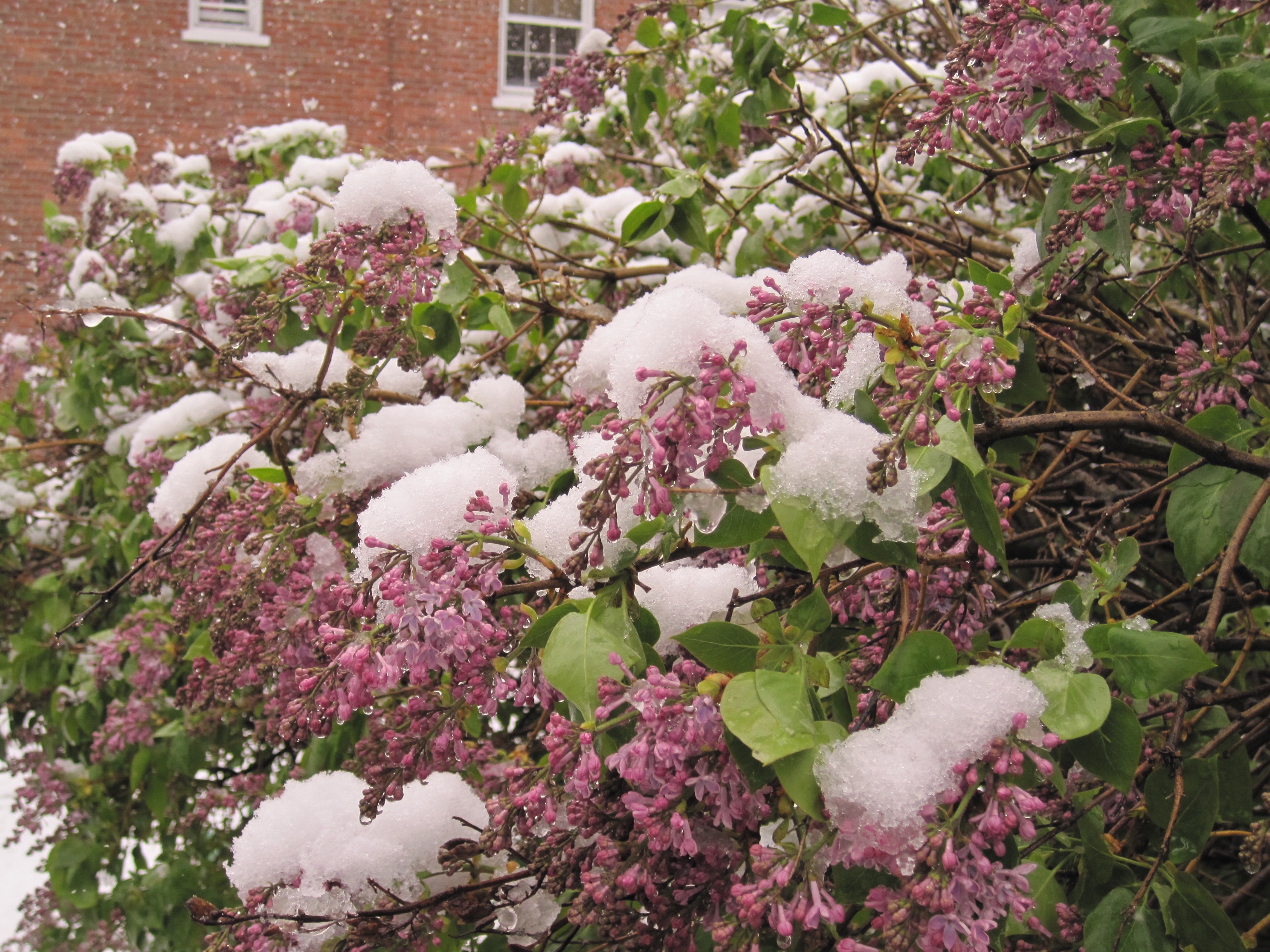
Snow covered lilacs in Burlington, Vermont during a record late heavy snowstorm in April, 2010.
Heres a mostly forgotten past weather event that really made a big impression.
The April, 2010 late season snowstorm on this post makes the snows we've had this month look like the lightest of flurries.
The snow on April 27-28, 2010 itself during that caused a lot of problems, as you might imagine. But the storm is especially memorable to me because of a decision I made during that weather event.
Many people make fateful decisions during storms. Some work out quite well, some disastrously. The decision I made in that April snowstorm had little to do with the actual weather that day. I didn't fall victim to the storm, but I guess I fell in another sort of way.
Here's what happened:
Spring, 2010 had been remarkably warm in Vermont.
March that year was the 6th warmest on record. In early April, temperatures soared to record highs of around 80 degrees. That April turned out to be the third warmest on record in Burlington. Leaves and flowers blossomed weeks ahead of normal. By April 26, neighborhoods and lowland forests in northern Vermont were leafy and green, like mid-May usually is.
But on April 27, 2010, a cold, wet storm struck the Northeast. During the day wet snow dusted lilac and rhododendron blooms in Burlington and surrounding areas. A few sloppy inches piled up by late afternoon in a few locations.
Then a decision entered the picture.
By the evening of April 27, things, at least to me, were looking ominous for the northern Champlain Valley. It would get just a bit colder as the sun set, and heavier snow was moving in. I knew that Interstate 89 northbound up toward Georgia and St. Albans where I live would get treacherous. There would be falling branches and power lines in the heavy snow.
I worked at the Burlington Free Press at the time, and got off for day around 6 p.m. I was anxious to get home ahead of the worst of the storm. At that hour, I would make it before things got too rough on the roads.
A leafed out, nearly blooming lilac bush, which had been 12 feet tall, lies smushed to the ground during the epic late April, 2010 snowstorm in St Albans, Vermont. The lilac bush made a quick recovery and is thriving to this day.
Then my phone rang. It was Jeff. We'd been dating for a few months by then. I liked Jeff's company. He was smart and funny, but I had no commitments.
I wasn't ready for anything special. I even told him he wasn't really my type. I guess I said that to keep my heart frozen, to protect myself from, I don't know what.
Anyway. Jeff was on the phone. He'd just returned home from work to his South Burlington condo and found that his elderly, beloved cocker spaniel Rocky had died during the day in his living room. Jeff needed somebody to be with him in that moment.
So yeah, I wanted to get home ahead of the storm, but this to my mind was much more important. The decision was made. "I'll be right over," I quickly told Jeff.
I arrived and gave Jeff a long hug. Rocky was peacefully passed away in the middle of the living room rug. He was posed as if he was running. Which would be the first time in years for that old, arthritic sweetheart. Rocky's head was posed looking slightly upward. It all seemed a picture of the moment when Rocky was called to cross that famous rainbow bridge.
Jeff talked about Rocky's life, how he loved to romp on the beach in Rhode Island and what a friend that pup had been. Jeff and I shed tears, laughed a little. I felt my heart melting as I took in what a warm, compassionate, wise man I was with.
It was kind of like that old Grinch cartoon, where in the end, his heart got three times bigger, breaking the frame of the X-Ray picture.
Jeff called his kind mother to tell her the sad news, and she managed to make him feel a little better, like all good mothers do. After that, Jeff said he was ready to be alone for the night
I drove home, it must have after 10 p.m. Sure enough, by then, I encountered a real mess heading north once I got past Milton. Interstate 89 was practically impassable, with squiggly tire ruts trailing in the deep wet snow on the highway .
Trees bent menacingly over the edge of the ledges along the highway, ready to snap and fall on passing vehicles below. St. Albans was an obstacle course of fallen branches and wires.
Damage from a severe snowstorm in late April, 2010 in St. Albans, Vermont. Heavy wet snow fell on trees that were already leafing out, causing serious damage.
I got to my house and the trees over the driveway were sagging so much they scraped against the roof of my truck. Normally those branches would have been about eight feet above the top of my truck.
In front of the house, the 12-foot tall lilac tree was smushed to the ground. The daffodils that had been blooming were nowhere to be found.
I went to bed in the cold house with no power, and listened to the branches breaking all night in the woods in back of the house. Through all that, my mind wasn't on the storm at all.
My mind was completely on Jeff.
I awoke next morning to a chaotic, snow plastered scene. Trees around my house bowed and sagged under the snow in defeat. Trees and branches were down throughout town. There was a full 15 inches of snow on my deck, making it the biggest storm of the winter.
This was a Wednesday morning. The annual St. Albans Maple Festival was set to start in two days. And the city was littered with fallen trees, branches, wires, with smushed cars beneath all that.
This being late April, the snow began to melt by mid-morning. Somehow, the city of St. Albans got things cleaned up just enough to pull off the festival.
It was the most extreme late spring snowstorm I'd ever seen, but nature is resilient. That 12 foot lilac that was smushed to the ground in my yard popped back up later in the day. Only one of about two dozen main branches on it had broken.
Within a couple days, the daffodils re-emerged and quickly returned to their sunny, happy selves, as if nothing had happened.
By that Sunday, the snow was gone, the temperature was back up to 80 degrees and the air was humid.
Nothing had changed and everything had changed. The cycle of a Vermont spring continued on as usual.
So what happened with Jeff? He and I will celebrate our 10th wedding anniversary this coming August.
VIDEO
I put together a video, mostly photos of that April, 2010 storm in St. Albans, you can see it below. As always, to best view the video, click on the YouTube logo and then the arrow.
f you don't the video or the image of it on your device, click on this hyperlink to view. Be patient. The video quality isn't great at the start of the video, but the photos are much better.
A leafed out, nearly blooming lilac bush smushed almost to the ground by wet snow on April 28, 2010 in St. Albans, Vermont. The tree was normally 12 feet tall. The lilac bush recovered.
Since the immediate weather forecast seems pretty quiet, I've decided to make you depressed.
Well, not really. If you take this post in the right frame of mind. You'll need to think of it this way: The rest of this April will not be nearly as bad as the ones I'm about to describe. Let's just say it's time to go down a snowy springtime memory lane.
First, the setup.
Spring storms tend to be wetter than those in the winter. It's warmer, after all. Warmer air can hold more moisture. Thankfully, since it is balmier, most of these wetter New England storms in April are mostly or completely rain. April showers bring May flowers, right?
Sometimes, though, the warmer spring air collides with errant batches of cold air, making epic snowstorms in April a possibility. I don't see signs of anything like this happening in our immediate future, but you never know. (Spoiler: The next couple of storms look rainy for us)
However, I have lots of examples of what could happen if things take an unexpectedly white turn.
April, 1874
This was probably the worst month for April snow in Vermont history. According to the Vermont Weather Book snow fell on 13 days that April, amounting to 49 inches. Two large snowstorms there toward the end of that month left 31 inches of snow on the ground on May 2. Ugh. The last of the snow on the ground in Strafford didn't disappear until May 27.
April, 1874 is ancient history, of course, so let's zoom ahead by exactly a century. Modern April snowstorms aren't like 1874, but they still pack punch.
April, 1974
On April 3-4, arguably the worst tornado outbreak in U.S. history struck the Midwest. Ahead of that system on April, temperatures in Vermont reached 70 degrees. But we were in for a bit of a surprise.
The powerful system that caused the tornadoes left behind a deep dip in the jet stream over the East, and a new storm system took advantage of that. On April 9 that year, 13 inches of snow fell on Burlington, and the high temperature that day was only 27 degrees. The snow was widespread, with most locations in Vermont reporting a foot of snow or more.
At least the warm weather quickly returned in 1974. By April 14, it was in the 70s again. The next year, we weren't so lucky.
April, 1975
A vast and powerful nor'easter slammed New England on April 3-4, then stalled over the Canadian Maritimes while slowly weakening until around April 12.
Damage from an April 28, 2010 snowstorm in St. Albans, Vermont. Heavy snow fell on partly leafed out trees, causing many of those trees to collapse.
The initial hit of the storm, then the cold, wet northwest flow around the storm, caused a long period of winter weather in Vermont. Snow totaled 30 inches in Peru, Vermont and around two feet in Enosburg and Montpelier.
The upslope snows along the western slopes and summits of the Green Mountains were particularly impressive. Mount Mansfield had 45.5 inches of new snow from April 3-9 and snow depth reached 22 inches.
The cold was incredibly persistent for April. Burlington endured eight days in a row in which the high temperature never got above 38 degrees from April 3 to 10. No days reached 50 degrees until April 15 that year.
April 7, 1982
Vermont was on the northern edge of a remarkably deep, and remarkably cold blizzard that struck much of New England and New York State on April 6-7, 198.
Albany, New York had 17.7 inches of snow, its biggest snowstorm on record. Fifteen inches pelted Worcester, Massachusetts.
Far northern Vermont missed out on the snow, with just 0.2 inches falling in Burlington. Southern Vermont received a general 3 to 6 inch snowfall. In the far south, high elevation Peru, Vermont got slammed with 15 inches. Woodstock had nine inches.
The remarkable aspect of this storm were the low temperatures. Highs across Vermont were generally in the low 20s, and those readings came in the morning. I was in West Rutland, Vermont that day, and the temperature at 3 p.m. was an incredible 13 degrees. Normal high temperatures for the date were around 50.
Snowy Week, April 16-22, 1983
A deep dip in the jet stream that week created quite a snowy week in northwestern Vermont. The leading edge of the colder air came in the form of a cold front, with a juicy wave of low pressure riding north along that front on April 16 and 17.
The copious moisture was able to dump a ton of snow on western Vermont especially. Burlington had 15.6 inches of snow on April 16-17.
A total of 21.3 inches of snow fell that week as other weaker storms circulated through a trough of low pressure over the Northeast. ..
St. Albans had 18 inches of snow in that initial storm on April 16-17 and 24.5 inches for the entire week.
April, 2000 Snow Week
A weather setup remarkably similar to that in 1983 settled over Vermont. Another cold front with deepening low pressure riding north along it with plenty of moisture dumped 14.3 inches of snow on Burlington. A secondary storm deposited an additional 4.7 inches of snow on April 11-12.
The snow on the ground was mercifully short-lived. By April 15, it was 77 degrees in Burlington.
April, 2001 Deep Snow.
Honestly, it didn't snow much in Vermont that April. But incredible snows that March left Vermont deep in drifts as April 2001 arrived. On April Fool's Day, 2001 there was still 49 inches of snow on the ground in Chelsea, 48 inches in Eden, 42 inches South Lincoln. Even Burlington still had 16 inches of snow on the ground that day.
The deep snow pack led to fears of severe spring flooding, but April, 2001 ended up being among the driest on record. Though there was widespread minor flooding throughout much of the month, nothing serious happened.
April 28, 2010
The month had been very warm in Vermont, with record highs of near 80 in the opening days of the month. Trees were leafing out earlier than normal as residents of St. Albans enjoyed an afternoon high of 64 degrees on April 27.
However, on April 28-29, a whopping 13.5 inches of wet snow fell on St. Albans. Eden reported 18 inches of snow, and some spots on the western slopes of the Green Mountains reported 20 inches.
It didn't get cold enough to freeze the foliage on the trees. But the wet snow, piling up on all those leaves caused many trees and branches to collapse, especially in St. Albans, where the leaves were further along than in the hilly towns to the east.
The storm disrupted St. Albans annual Maple Fest, but power was restored and most of the hundreds of fallen branches and trees were cleaned up within two or three days.
And by May 3, the afternoon high was a muggy 86 degrees in St. Albans.
Finally, a video from last year, showing how spring can turn on a dime. Two days before the video was taken, daffodils were blooming everywhere and the trees were budding, with hints of green. Then this hit. If you can't see the video,click on this hyperlink. Or, if you see the image below, click on it to view. (Two days after this video, temperatures were back up in the 60s).
Saturday's snowstorm had the potential to be much larger than it was, had the ingredients come together better. That would have been in keeping with March, which has a history of epic snowstorms in Vermont.
Some early forecasts for the recently departed storm had called for a blockbuster.
It was not to be, of course, it was just one of those mid-sized late winter storms. Had we gotten a huge dump, though, it would have been totally in character for a Vermont March.
There's something about March that tends to bring on the epic snowstorms. I think it's because the forces of winter are still at full force up in the Arctic, but the first warm flutters of spring air are coming up from the south.
Warmer air holds more moisture, so when that balmy spring air goes on a collision course with an Arctic blast, all hell can break loose. And by that I mean a LOT of snow, when the conditions are right.
I see no snowstorms on the horizon at this point, but remember, we can get a foot of snow in storms well into April.
Which means March is still snow season.
Seven of Burlington, Vermont's 20 biggest snowstorms have occurred in March. That's impressive when you consider this is the time of year when it's starting to warm up a bit, which could make big snowfalls a little less likely.
Here's a highlight reel:
Blizzard of 1888:
This one isn't listed as one of the top 20 March snowstorms in Burlington, due to a lack of reliable records. But since people are still talking about this one, there's no doubt it was the Big Daddy of March storms, or close to it.
Bennington reported 48 inches of snow. Nearby Saratoga Springs, New York reported 58 inches. Other southern Vermont towns were north of 40 inches. Most of the rest of the state was in the two to three foot range.
This, however, was a much windier storm than most of them in the Green Mountain State. Which means the drift were enormous. Wind gusts reached 30 to 40 mph or even more across the state, causing enormous drifts.
VTDigger, in a history lesson about the Blizzard of 1888,described drifts so deep that people built tunnels through them to make their way down sidewalks. Wind swept snow down to bare ground in spots, and piling it elsewhere above the tops of first floor windows.
Of course, Vermont wasn't the only place slammed by this famous storm. Practically everyone from Washington DC north had an enormous snow blockade from this storm, and up to 250 people died in the storm.
The Blizzard of 1888 was caused by a classic nor'easter that stalled and did a slow loop de loop just south of Rhode Island, which prolonged the heavy snow and wind in the Northeast.
Vermont's Deepest Snowstorm, March 2-5, 1947
In March, as we warm up toward spring, we often see storms deposit mostly rain in the valleys with snow in the mountains.
The most extreme example of this kind of thing hit southern Vermont in the opening days of March, 1947.
As the Vermont Weather Bookdescribes it, a strong storm took an unusual path from central New England, northwestward to the northern tip of New York and then up into Ontario.
This created a nearly stalled weather front oriented northwest to southeast just south of southern Vermont. This set up a long-lasting fire hose of moisture into the Green Mountains of southern Vermont.
Valleys had a rain/snow mix. Rutland, for instance had 16.7 inches of new snow from the storm, but 2.38 inches in liquid content, which is a LOT. But in the high elevation towns, it was all snow. Readsboro reported 50 inches of new snow from the storm, the most on record for any place in Vermont in a single storm.
To give you an idea how much water this "fire hose" storm had, melted water equivalent of the snow was four to five inches. That would have created a flash flood had that been rain.
Superstorm, March, 1993
This was arguably the nation's worst winter storm of the 20th century. The storm created a swath of deep snow amounting to 20 inches or more from northeastern Alabama to New England and on into southeastern Canada from March 12 to 14, 1993.
Satellite view of the Superstorm of March, 1993 in the eastern U.S.
The storm's impacts were by far the worst in the South, as an intense blizzard struck large parts of the Southeast. Worse, the storm caused a destructive derecho, tornado outbreak and storm surge in Florida.
Up here in Vermont, the storm just created a bunch of heavy snow and rare thunder snow. The 22.4 inches of snow that piled up in Burlington was at the time the city's third largest snowstorm on record. (Since then, with newer, bigger storms, it's been relegated to 8th place). Montpelier logged 25.6 inches of new snow.
This storm was designated "Storm of the Century" for good reason, but in Vermont, some wags called it "Storm of the Weekend." The bulk of it hit on a Saturday and Saturday night, giving time for road crews to clean up things in time for the Monday morning commute. We moved on pretty quickly.
The storm was certainly disruptive in Vermont, but could have been worse.
Two blasts of frigid late season air did follow this storm, causing some record and near record lows for that late in the season. Burlington reached 12 below on March 15 and 10 below on March 19. Montpelier sank to 13 below on the 15th and 16 below on the 19th.
Town Meeting Day Snow, 2001
A big nor'easter came just in time for Vermont's storied Town Meeting Day. The storm dumped 15 to 30 inches of snow on Vermont on March 5-6, 2001, forcing many towns to postpone Town Meeting. Snowfall rates of 2 to 4 inches per hour were common, which is really big for a winter storm. It was Burlington's seventh largest snowstorm on record.
The storm was the first installment in Vermont's snowiest March on record. Burlington had 47.6 inches of snow for the month. On March 31st that year, some Vermont towns had another installment of about a foot of snow.
On April Fool's Day that year, some towns, like Plainfield and Eden had close to four feet of snow on the ground. That led to fears of severe spring flooding, but April turned out to be among the driest on record. Only minor flooding occurred
March 6-7, 2011
The storm was odd in that it began with a bout of heavy rain and mild temperatures, which caused some minor flooding and ice jams.
Burlington, Vermont's Church Street Marketplace during the snowstorm of March, 2011 one of the largest on record.
But the a sharp cold front dropped temperatures quickly in northern Vermont on the morning of March 6. Burlington dropped 16 degrees in an hour.
As a new storm moved north, snow became heavy, with rates exceeding two inches per hour. Burlington ended up with 25.8 inches of snow, the third greatest snowstorm on record. Most of Vermont, except the far south had 18 to 30 inches of new snow.
Needless to say, such great amounts of heavy snow made things pretty much grind to a halt in Vermont. At least for a day. There was a lot of water in the snow, too,The liquid equivalent was 0.25 inches per hour at Montpelier, with nearly an inch of water in just five hours. Between the rain at the beginning of the storm and the snow, Montpelier had a melted water equivalent of 3.25 inches of precipitation.
That's an inch or so more than what normally falls during the entire month of March.
This was important for later in the spring. This storm ended up being an ingredient to what proved to be a disastrous spring flood season in Vermont. It contributed greatly to an already thick mountain snowpack.
That snow, combined with record rainfall in April and May, produced devastating spring floods and by far the worst Lake Champlain spring flooding on record
Pi Day Blizzard March 14, 2017
After record-shattering warmth in late February, it seemed that we'd have an early spring in 2017. Not so fast.
The heaviest snow fell over northwestern Vermont and northeastern New York, where widespread totals of 24 to 32 inches were logged. Burlington had 30.4 inches of snow, its second biggest snowstorm on record.
The Pi Day Blizzard in March, 2017 snarling traffic and cutting visibility to near zero in St. Albans, Vermont.
During the peak of the storm snowfall rates were as high as five inches per hour, which is incredible for a winter storm.
The snow was created by a nor'easter with a perfect path to put Vermont in a heavy snow zone. The storm also tapped super-rich moisture from the Gulf of Mexico and the Atlantic Ocean and steered it right into the cold air over Vermont.
Strong winds in the Champlain Valley led to blizzard conditions in some areas.
The storm was a relatively slow mover, so that prolonged the storm and contributed to the deep snow.
The snow created near zero visibility and pretty much made roads impassable. The video, below shows the increasing snowfall rates and the disruption to motorists near my house in St. Albans, Vermont. The snow fell too fast for snowplows to keep up with the snow, and even the snowplows had trouble negotiating the road.
If you don't see the video below click on this hyperlink to view it.If you do see it, below, click on the red arrow then the YouTube logo for best viewing.
Jackson the Weather Dog makes his way through deep snow in St. Albans, Vermont Saturday after a large 15.7 inch dump of snow. Individual snowstorms are getting larger in Vermont an elsewhere in the East. It's counter- intuitive, but climate change is likely responsible for these epic snowstorms.
Winter snows in the Northeast are becoming more feast or famine.
It's either big snowstorms, like the one we in northern Vermont Friday or the New England coast blizzard on January 29, or its nothing.
The science seems to be backing this up. Big snow years in the Northeast, including here in Vermont, are becoming more contingent on extremely heavy, often record breaking individual storms rather than the plodding accumulation of small or mid-sized storms that were more common in the past.
"'Extreme snowstorms, even in the face of longer term declines in winter snow, are entirely consistent with the effects of global warming,' Justin Mankin, a professor at Dartmouth College who studies climate change and variability, said in a statement. 'Storms like this are emblematic of the fact that we need to do a better job of managing their risks ow to make us more resilient for the future.'"
In Boston, 15 of the city's largest 30 single day snowfalls have occurred since 2000. In Burlington, Vermont, exactlyhalf of the city's top 20 snowstorms have happened since 2000. This in a city where records go back to the 1880s. Only six of these top 20 snowstorms hit before 1986.
True to form, the blizzard on January 29 that missed Vermont set a record in Providence, Rhode Island as its largest single day snowfall in the city's history.
Cities such as New York City, Baltimore Newark, Portland, Maine and Bridgeport, Connecticut all had their first or second biggest single day snowstorm in the recent years, between 2013 and 2020. ,
A major reason why the snowstorms have been getting bigger have to do with water temperatures in the Atlantic Ocean and Gulf of Mexico.
Those water temperatures are a lot warmer than they used to be. Warmer water can create more evaporation, which provides more moisture to storms than would otherwise be the case. Obviously a wetter storm can drop more rain and snow.
If all that extra moisture smacks into cold air, like it did during the blizzard on January 29, you squeeze out a lot more snow.
Even the snowstorm we just got probably gave us a little extra snow than we otherwise would have gotten. Moisture from this storm came mostly from the Gulf of Mexico,which is also currently much warmer than historical normals.
Some scientists also theorize that a warmer Arctic helps the jet stream meander more than it used to. Larger dips in the jet stream can create larger storms, so that could be a factor. The science isn't settled on this idea, though.
Here in Vermont, the bigger sized snowstorms have had an impact on seasonal snow totals. At least until the past couple winters, snowfall in Vermont has been increasing. Winters up through three years ago were consistently snowier than normal.
The extra snow seems to be on hiatus, at least for now. The winter of 2019-20 brought 69.7 inches of snow to Burlington, Vermont. Last winter tallied up just 63.1 inches. These totals aren't anywhere near record lows, but they certainly fell short of the new average of snowy winters. (For the record, the least amount of snow in a single season for Burlington was 31.8 inches in 1912-13).
The snowstorm we just received in the past few days was another example of an unusually heavy storm fed by warm ocean waters. While the storm did not set records in Vermont, accumulations of 12 to 18 inches is unusually big.
This installment brought Burlington's snow total much closer to normal for the season, at least temporarily. Before it snowed, Burlington was about 17 inches behind normal for the date. As of this morning, we were just a little over four inches behind average for the date.
Now that Friday's storm is over, it's back to the snow drought. Very little snow is expected in Vermont through mid-month, unless there's a really big surprise that forecast models don't see yet. Don't hold your breath for a big storm in the immediate future, though.
One more thing about the snow patterns. Since winters have gotten warmer, the snow from these big storms doesn't stay on the ground for long. The snow cover from the January 29 blizzard in coastal New England is pretty much gone, thanks to warm temperatures and rain that hit them while it was snowing in northern Vermont Thursday and Friday.
Here in Vermont, only minor thawing is expected this week, so most of the new snow should stay on the ground. Just don't expect much additional snow.
This is just one of many, many simulations of what might happen later this week, but this illustrates the huge area the potential winter storm covers. Here, it shows show extending fro New Mexico through northern New England and into Canada. Ice goes fro central Texas to at least Ohio. Heavy rain is south of that.
A large chunk of the United States - most of the real estate east of the Rockies in fact, is in for a week of stormy weather.
Different places will enjoy different types of icky or even dangerous weather at different times this week as the storm progresses. This will cover a really big area for a single winter storm.
But, beginning today, we'll see a progression of snow, rain, ice and even fires as we go through the week.
Vermont's turn comes late Wednesday into Friday, but the only certainty in the forecast for the Green Mountain State is there won't be any wildfires or forest fires. More on Vermont's fate in a bit.
First, let's look at what's going on elsewhere and set things up.
The weirdest part of all this today takes place in Nebraska and South Dakota. Ahead of a cold front that will play a critical role in this storm, warm dry winds will blow over the two states. They've had an odd lack of snow cover out there, so it's actually quite dry.
Despite it being the dead of winter in the northern and central Plains the dry, warm winds have that region in a high rangeland fire risk today. I've seen this sort of thing in the southern Plains in the winter, but not this far north. Very, very strange.
By tomorrow, the cold front will extend roughly from Michigan to Texas. By then, the front will start to pick up a lot of moisture from the Gulf of Mexico as Arctic air plunges south into Texas.
The increasing moisture will go up and over the cold air, squeezing out a bunch of snow and ice. Winter storm watches already extend from Colorado and Kansas into Michigan.
The cold front will slowly move eastward, then kind of temporarily stall along the Appalachian Mountains by Thursday. Waves of low pressure will move northeastward along the front as it ever so slowly presses toward the southeast later Thursday and Friday.
This will ensure a long band of heavy snow and ice and rain from the Gulf Coast all the way up through New England and into southeastern Canada. Large swaths of the nation will see rather heavy snow and areas of freezing rain also slowly press east.
Out ahead of the front, warmer air and rain could create pockets of flooding in the Tennessee Valley. And if the front stays hung up in northern or central New England, parts of the region closer to the coast that had the blizzard Saturday could be dealing with some flooding, too.
VERMONT IMPACT UPDATE
What happens to us with this system is still depending upon where the cold front slows down or stalls.
If current projections are wrong on the position of the front by as little as 50 miles, what I'm about to outline goes out the window. It would be wrong. So stay tuned for changes.
Vermont will squeeze out one thawing afternoon Wednesday ahead of the cold front. A thaw has been a precious rarity through January, so this will be a switch. Don't get used to it though. It won't last.
The front is now expected to stall in central New England which would set most of Vermont up for snow Thursday and Thursday night, with a greater chance of a mix or rain in the southern half of the state.
Since there's so much moisture to work with, whatever falls could be on the heavy side. That means parts of Vermont could get a lot of snow. We're just not sure which parts yet.
The snow or rain will start in lightly Wednesday night and early Thursday before changing to snow during the day from north to south and becoming heavier. At this point it looks like it would be a wet, sticky snow, then turn powdery later on in the event.
This would be an ugly scenario on the roads. The wet pavement would freeze, then wet snow will compact into a thick layer of ice and freeze even harder as temperatures drop. Then snow would pile up on top of all that. A real mess.
So this storm bears watching.
I almost guarantee the storm won't play out exactly as I described above. It could be colder, and there could be less snow if the front positions itself further south. Or there could be more rain or freezing rain if things set up a little further north than people are expecting now.
For what it's worth, the American computer model, which has been more accurate than the European model, has pushed some hints that northern Vermont might largely miss out on precipitation again. That's just one model run, though, so definitely don't hang your hat on that.
The bottom line is to expect a mess Thursday and Friday, but I can't detail yet what kind of mess it will be.
Beginning to see more colors show up on the National Weather Service map. Big red area is fire danger, blue and pink further north is winter weather. In the coming few days, this map will have a many more winter storm, severe weather and flood alerts as things get really active again.
After that mid-February Arctic blast in the nation, followed by a warm up and severe flooding in the Tennessee and Ohio valleys, the weather briefly calmed down quite a bit across the nation in early March.
Those calm days are just about over, with the specter of big snowstorms, severe weather, tornadoes, floods and wildfires now looming over different parts of the nation.
A deep upper low pressure system is digging into southern California. That will help trigger needed rain and snow in the Golden State, which is good news in that drought-ridden state.
But that storm is causing warm, very dry winds in a broad area today from New Mexico into the central Plains. Wildfires have been an issue in recent days there, and it's only going to get worse today. A broad area that includes pretty much all of New Mexico, then extending through northern Texas into Oklahoma, Kansas and eastern Colorado should BOL for wild and rangeland fires today.
SNOWSTORMS:
Parts of Colorado that are under fire alerts today will likely be buried under deep snow by Sunday.
That upper level low in California will spin up a storm that has a classic set up for heavy snow on the front range of Colorado, including the Denver and Colorado Springs area. The storm will send wet winds from the east that will be forced to rise as elevation increases east to west in Colorado.
That sets the stage for an epic snowstorm. Some computer models in recent days, trying to get a handle on the storm, tried to forecast up to five feet of snow in areas near Colorado Springs. Those models are wrong, and they will NOT get that much snow.
However, populated areas of Colorado could get one to two feet of heavy, wet snow, which raises worries over travel, and snow loading on trees and buildings. Stay tuned!
Further north a separate storm is already underway from Colorado through the Dakotas. Record highs in the 70s graced South Dakota Tuesday, with readings as high flirting just shy of 80 degrees around Lake Andes and Mitchell, South Dakota.'
That warm party is definitely over as a storm is now beginning to spread snow from Wyoming to, eventually, northern Minnesota, where there were also record highs Tuesday. Some areas in this long band of winter weather could get up to eight inches of snow.
Winter is not done yet! But next up, a dangerous sign of spring:
SEVERE WEATHER/FLOODS
That storm system is expected to raise the risk of severe weather and tornadoesin the southern Plains and lower Mississippi Valley over the next several days. A follow-up storm will keep things going into early next week.
The storm that will produce a snowfall in the Dakotas today is even prompting the risk of severe weather pretty far north. There's even a very minimal risk of a tornado or two in southeastern Minnesota and southwestern Wisconsin today. That's awfully far north for such a risk this early in the season.
The main show will start this weekend. There's still questions about the exact location and intensity of the severe weather in the South, but it is looking pretty inevitable. Though certainly not record breaking, it does look like it will be the worst and longest lasting severe weather outbreak so far this season, though thankfully, that's not saying much. Still, this probably won't be as bad as the inevitable outbreaks toward April and May, the peak of the season.
I do expect to see several tornadoes at least by early next week. It won't be a big deal if those twisters stay out of populated areas, but as we know, these systems are hit miss.
Flooding is a worry again in the Tennessee and mid-Mississippi valleys as repeated storms rake over that area soaked by heavy rain a week ago. The heavy rain will extend westward into areas like Kansas and Missouri, which have been on the dry side, so that's good.
However, even in the dry areas, the rain early next week might be heavy enough to cause some high water issues there.
VERMONT IMPACTS
Spring fever hits today and tomorrow, after parts of the region got a taste of it Tuesday.
My still-snowy back yard in St. Albans, Vermont this morning. It will be interesting to see how much less snow there is here in two days with the nice mild air moving in. I'll snap a comparison pic on Friday.
The sun came out in earnest over the southern half of Vermont Tuesday, where highs reached 49 in Springfield and 51 in Bennington. Clouds kept the north chillier, near 40 degrees.
After a freeze to help the maple sugarers early this morning, temperatures will rocket into the low 50s today under sunny skies. It'll be pretty breezy in the Champlain Valley, but that's OK.
South winds tonight will keep temperatures up, especially west, and that sets the stage for a really warm Thursday.
Those south winds will continue. Since we'll start out much warmer Thursday morning than the 20s that are starting today, Thursday afternoon looks warmer, too. Some of us could touch 60 degrees, though it will be cloudier than it is today.
The record high in Burlington tomorrow is 56 degrees, which happens to be the "coolest" of all the daily record highs for March. (All the other record highs in Burlington range from 57 to 84 degrees). This gives us a shot at a record high Thursday, since temperatures are expected to reach the upper 50s under those continued south winds.
Other places in Vermont are iffy for record highs. For instance, Montpelier's record high is 61 degrees, so they probably won't make it.
But, this is Vermont in March, so expect a roller coaster. After the balmy weather today and tomorrow, a cold front comes in Friday.
There will be little rain along this first cold front, and it doesn't have a lot of oomph with it, so Friday will still be pretty nice for this time of year, with highs well into the 40s to around 50.
But a second, stronger front is due Friday evening. Again, it doesn't have a lot of water to work with, but it still seems destined to give us some possible snow squalls and another flash freeze as temperatures plunge.
A third cold front Saturday night or Sunday will sprinkle a few more snow showers on us and make it even colder. Highs Sunday and Monday will stay below freezing, and lows will get into the single numbers again. Another slap from winter.
Don't worry, it'll warm up again a little after that, though temperatures in the 50s are out of the picture for awhile. March, um, marches on, so we have to expect more and more thaws as we keep heading toward and into spring.
It also looks like that storminess in the middle of the nation will weaken as those systems head east and shear out to our south, meaning we in Vermont won't get much precipitation - rain or snow- from those storms.
Snowfall total map from this weeks storm clearly shows the intense snow band from central Pennsylvania to New Hampshire.
As you might have noticed, I've been wicked impressed by the snowfall totals from yesterday's storm.
I'm just as impressed by the wide area in which reports came in of over 40 inches of snow. These extreme totals were in roughly a 50 mile wide band stretching all the way from Pennsylvania to New Hampshire.
Anecdotally at least, it seems mega snowstorms in Vermont, and by extension the Northeast, have been getting more common, even if winters in general have been warming up.
Yesterday's big snowstorm missed Burlington, Vermont. Only 2.5 inches of snow fell there. But the pace of these huge storms seems to be increasing. Eleven of Burlington's biggest snowstorms have happened since the year 2000. Four of the five deepest Burlington snowstorms have happened since 2007. This in a city where climate records go back at least to the 1880s.
Standout storms seem to hit New England almost every year now. More than two feet of snow smothered far southern Vermont and the Capital District around Albany, New York last year.
Vermont and New York experienced the epic Pi Day blizzard, with snowfall in the two to three foot range in March, 2017. You might remember the great snow siege in Boston in late January and February, 2015, in which roughly 90 inches of snow fell in just six weeks, crippling the city.
I think I mentioned this earlier this month, but climate change might be having a role here.
NOAA research indicates that the second half of the 20th century had twice as many extreme snowstorms in the second half of the century than in the first half. That trend has continued for the past 20 years.
"Some recent research has shown that increasing surface temperatures and reductions in Arctic sea ice may produce atmospheric circulation patterns that are favorable for winter storm development in the eastern United States. Most notably, a greater prevalence of high pressure blocking patterns over the North Atlantic that result in cold outbreaks in the eastern United States along with slower moving systems can further exacerbate the persistence and severity of a storm."
Warmer oceans might also be partly to blame. A warmer ocean releases more moisture into the atmosphere, which can feed storms. If all that moisture slams into a big batch of cold air in a storm, that atmospheric wetness would wring itself out in the form of a massive snow dump.
In the storm this week, a sort of weather front in the midlevels of the atmosphere formed well to the northwest of the parent storm. This set up is very typical in snowstorms in the Northeast, and usually results in a band of enhanced snowfall.
A bit of snow in Ludlow, Vermont yesterday. Photo via Twitter @JordanChappy3
This storm wasn't especially strong compared to other nor'easters, but it had a terrific supply of moisture from the Pacific, Gulf of Mexico and the Atlantic Ocean.
The onrushing current of moisture from the south smacked right into that sort of weather front. When the moisture hit the "front" it was forced to rise. Rising air increases precipitation, so it really came down. And it was plenty cold enough for the precipitation to be snow.
The storm near the surface was along or just off the coast. However, a nor'easter's mid level support is often to the west or northwest of the storm.
The mid level support creates additional rising air. The mid level storm yesterday spun itself along that sort of front from Pennsylvania to Maine, helping to keep that front from moving much and enhancing the snowfall further.
Snow that came with this storm was light and fluffy and airy, so it accumulated more deeply than a wet snow would have.
Still, I have to think that warmer oceans created more moisture in the atmosphere, so this storm probably produced more snow than an identical weather set up would have created decades ago.
Climate change rarely "causes" extreme weather. However, it often contributes to it. All the things that happened with this storm occur occasionally in nature, which is why there have always been giant snowstorms. It's possible, even likely, that climate change is helping some of these mega snowstorms to become even more mega.
There's no way to prove it, but we might have seen this sort of interaction yesterday, when so many southern Vermonters watched their cars and trucks get swallowed in deep snow within hours.