
 |
| Snowfall total map from this weeks storm clearly shows the intense snow band from central Pennsylvania to New Hampshire. |
I'm just as impressed by the wide area in which reports came in of over 40 inches of snow. These extreme totals were in roughly a 50 mile wide band stretching all the way from Pennsylvania to New Hampshire.
Anecdotally at least, it seems mega snowstorms in Vermont, and by extension the Northeast, have been getting more common, even if winters in general have been warming up.
There have always been massive snowstorms in the East and Northeast. Just check out the Blizzard of 1888, the tragic "Knickerbocker Storm" in Washington DC in 1922 the big New York City snowstorm of 1947 and the Great Appalachian Storm of 1950.
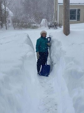
Yesterday's big snowstorm missed Burlington, Vermont. Only 2.5 inches of snow fell there. But the pace of these huge storms seems to be increasing. Eleven of Burlington's biggest snowstorms have happened since the year 2000. Four of the five deepest Burlington snowstorms have happened since 2007. This in a city where climate records go back at least to the 1880s.
Standout storms seem to hit New England almost every year now. More than two feet of snow smothered far southern Vermont and the Capital District around Albany, New York last year.
Vermont and New York experienced the epic Pi Day blizzard, with snowfall in the two to three foot range in March, 2017. You might remember the great snow siege in Boston in late January and February, 2015, in which roughly 90 inches of snow fell in just six weeks, crippling the city.
I think I mentioned this earlier this month, but climate change might be having a role here.
NOAA research indicates that the second half of the 20th century had twice as many extreme snowstorms in the second half of the century than in the first half. That trend has continued for the past 20 years.
"Some recent research has shown that increasing surface temperatures and reductions in Arctic sea ice may produce atmospheric circulation patterns that are favorable for winter storm development in the eastern United States. Most notably, a greater prevalence of high pressure blocking patterns over the North Atlantic that result in cold outbreaks in the eastern United States along with slower moving systems can further exacerbate the persistence and severity of a storm."
Warmer oceans might also be partly to blame. A warmer ocean releases more moisture into the atmosphere, which can feed storms. If all that moisture slams into a big batch of cold air in a storm, that atmospheric wetness would wring itself out in the form of a massive snow dump.
In the storm this week, a sort of weather front in the midlevels of the atmosphere formed well to the northwest of the parent storm. This set up is very typical in snowstorms in the Northeast, and usually results in a band of enhanced snowfall.
 |
| A bit of snow in Ludlow, Vermont yesterday. Photo via Twitter @JordanChappy3 |
The onrushing current of moisture from the south smacked right into that sort of weather front. When the moisture hit the "front" it was forced to rise. Rising air increases precipitation, so it really came down. And it was plenty cold enough for the precipitation to be snow.
The storm near the surface was along or just off the coast. However, a nor'easter's mid level support is often to the west or northwest of the storm.
The mid level support creates additional rising air. The mid level storm yesterday spun itself along that sort of front from Pennsylvania to Maine, helping to keep that front from moving much and enhancing the snowfall further.
Snow that came with this storm was light and fluffy and airy, so it accumulated more deeply than a wet snow would have.
Still, I have to think that warmer oceans created more moisture in the atmosphere, so this storm probably produced more snow than an identical weather set up would have created decades ago.
Climate change rarely "causes" extreme weather. However, it often contributes to it. All the things that happened with this storm occur occasionally in nature, which is why there have always been giant snowstorms. It's possible, even likely, that climate change is helping some of these mega snowstorms to become even more mega.
There's no way to prove it, but we might have seen this sort of interaction yesterday, when so many southern Vermonters watched their cars and trucks get swallowed in deep snow within hours.
No comments:
Post a Comment