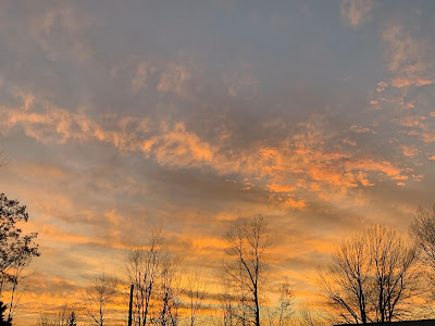
Monday, November 30, 2020

Biggest Effects Of Large Storm Move To Mostly Avoid Vermont

It's been so warm for the season in St. Albans, Vermont that
some of my daffodil shoots are unfortunately coming up.
A warm storm today and tomorrow will keep 
things oddly springlike. 
 No doubt the storm system moving northward today toward the Great Lakes is pretty powerful.

It's not breaking any records, but it's still relatively significant.  It's a "kitchen sink" type of storm, as some people have noted, as it's bringing everything but that mentioned kitchen sink.  

There's the risk of severe storms, even a couple of brief tornadoes along the immediate East Coast from the Carolinas all the way to southern New England. 

Strong winds will also buffet the New England coast. Winter storm warnings are up areas near the shore  Lake Erie in for northern Ohio, Pennsylvania and New York.  

Some snow could fall as far south as Tennessee and northern Alabama and Georgia. Heavy snow is likely in the high elevations in the Smoky Mountains of western North Carolina.

Here in Vermont, things look inclement with this storm, but nothing extreme. Also, it will stay warm.  So much for that plunge into winter I hinted at last week. It ain't happening. 

The biggest issue with this storm is the risk of strong downslope winds along the western slopes of the Green Mountains later today and tonight.

Sometimes, you get really damaging local gusts in the 70 to 90 mph range with the storm systems that favor these western slope winds. This time, it doesn't look that bad. Still, some places there could gust over 50 mph,   raising the risk of scattered power failures.

A steady rain will move in early this afternoon and continue into the evening.  It will be very warm for this time of year tonight, especially west of the Green Mountains. Temperatures will rise to near 50 degrees by late this afternoon, and stay there overnight. 

You'd think Tuesday will be super warm after such a balmy night, but by then, colder air aloft with the core of the storm will start to move overhead.  Tuesday will still be awfully warm for the first day of December with highs reaching the upper 50s for many of us. Those readings will start to fall off during the afternoon, though.

Actually, those temperatures and the weather conditions  - bursts of sun mixed with bursts of rain from showers - will remind you of April, not December.

It's been a warm late fall, so warm in fact that some of my daffodils in St. Albans, Vermont are starting to sprout again. Uh-oh. 

It will be cooler through the end of the week and into the weekend, but it will still be a couple degrees milder than average. Something close to normal December weather is likely next week, but it won't be brutally cold. Just winterish. 


Sunday, November 29, 2020

Nice For One Day Here; Disasters In Sicily And Brazil

Some pastel colors in the sky at dawn Sunday in St. Albans,
Vermont. Calm weather today ahead of storminess tomorrow,'
but at least things won't be extreme like they
are in some parts of the world. 
Today will be strangely nice for late November here in Vermont.  There will be a fair amount of sun during our short daylight hours, and temperatures will warm well into the 40s, and maybe touch 50 degrees in a few spots.  

That's a nice departure from the chill and dark gloom that is normally a near constant aspect of life in Vermont as we near the first of December.

We're still expecting that storm Monday and Monday night with wind and rain. But it will be a warm storm, as temperatures in many areas top 50 degrees both Monday and Tuesday. Highs should be in the 30s this time of year. 

This storm, while bringing inclement weather, will fall far short of any kind of disaster. At worst, there might be some scattered power failures. And no flooding. We'll get a decent slug of rain, but not nearly enough to send creeks, streams and rivers rising to bothersome levels. 

Of course, while we here in Vermont escape weather violence once again, there's always unfortunately some new weather disaster somewhere in the world.

In interior Brazil, inland from Sao Paulo, intense rains caused extreme flash floods in the city of Sao Carlos, sending cars racing through whitewater in city streets.  The city was hit by a whopping 5.4 inches of rain in just one hour.

In all the videos, click on the YouTube logo at the bottom of the videos to get a better, bigger view. Video of the Brazil flood here:


In Sardinia, an island off the west coast of Italy in the Mediterranean Sea, the problem was also flooding. As in Brazil, whitewater rapids raced through city streets on Sardinia. At least three people have been killed by this flooding. 

This next video shows how powerful the Sardinia flooding was.


Finally, in the city of Catania, in Sicily, a tornado swept through, causing damage in much of the city, especially near the airport:


Saturday, November 28, 2020

Big Storm Update: Not So Fast With The Winter Plunge

Still looking at a big storm early in the week over
the Northeast. This map is a forecast for Tuesday morning.
Notice the storm is 
A couple days ago, I mentioned a large storm was coming for early in the week.  That's still happening,.

However, the plunge into winter I advertised for just after the storm isn't happening after all. At least not as quickly as I originally billed it. 

The overall set up is pretty much the same as it's been with this thing.  Pieces of energy from the south and north will merge into a strong storm that will move north from the Southeast into the Great Lakes. 

That will produce a bunch of snow in some parts of the upper Midwest, and a lot of wind and rain for the East, including here in Vermont. 

We've been stuck under clouds and damp air for a few days now, and that state of affairs continues today.  At least it's a little warmer than average for this time of year. We might break out into some peeks of sun Sunday, hut that won't last long with that storm I mentioned that's on the way.

We'll get a decent slug of rain Monday.  The orientation of the storm will probably bring some strong downslope winds to the western slopes of the Green Mountains.  Late fall and early winter seem to be the peak time for these sometimes destructive wind storms along the west slopes of the Greens, so I'm not surprised. 

In this case, not everything is coming together to produce a super wild wind storm.  So there might be a period of strong wind gusts in some areas, it won't be as bad as some of the more epic storms, and probably won't last as long as some we've had in the past. 

Since, we'll be on the warm east side of the storm, we're in for a quick squirt of very mild air for this time of year. Temperatures could actually rise toward 50 degrees overnight Monday, and maybe reach 60 degrees Tuesday before the storms cold front sweeps through in the afternoon. 

The record high temperature for the date Tuesday in Burlington is 64 degrees, so chances are we won't be far off from that mark. 

There will still be showers around Tuesday, especially as that cold front comes through. Total rainfall from the storm looks decent but not excessive. Maybe a half inch to an inch. 

There's actually still some drought conditions in most of the eastern two thirds of Vermont, believe it or not, so this rainfall will offer some needed additional help. 

Here's the big change in the forecast from a few days ago: .This big storm doesn't look like it will be able to "grab" as much cold air from Canada as originally though. 

So, late in the week, the weather will be close to average for this time of year (highs in the 30s to near 40, lows in the 20s to near 30).  There might be some snow and rain showers around starting Tuesday night and lasting the rest of the week, but this won't be a huge deal. 

There are some signs another large storm would affect the Northeast in about 8 days or so.  It's way to soon to know how this storm will develop, and whether we get rain or snow or something else out of it. 

And of course, there's always the chance that storm might not develop as robustly as some of the computer models are suggesting. However, at this point, this second storm might do a better job of grabbing and locking in the colder winter air here in the Northeast, which would give us a somewhat postponed plunge into winter. 

We shall see!

Friday, November 27, 2020

Waiting For Snow In Vermont. Also, Warm Winters, But Snowier, Too!

Gloomy November day on the shores of Lake Champlain
near Alburgh Thursday.  Not much snow yet this year in 
Vermont, but the trend has been toward snowier and
warmer winters in recent decades.
It was mild and damp and drizzly when I got up this morning on this so-called Black Friday. 

It's characteristically gloomy out there for this time of year. Since I'm not a big shopper, I'll just call this Gray Friday. 

By the time Thanksgiving comes around and the Christmas rush comes, Vermont is often - but not always - shrouded in snow. 

This year, it doesn't look like it will snow until next week, aside from some possible mountain flurries before then. 

The snow season is off to a slow start, hut that doesn't mean it will stay that way. Especially if trends over the past few decades continue. 

Looking at records in Burlington, Vermont, winters have been becoming both warmer and snowier. We ca expect winters in Burlington on average to bring us somewhere around 75 to 80 inches of snow.  Obviously, we never had that much on the ground, because there's always mild spells that melt it. And the snow settles even if it stays below freezing. 

It seems odd that winters are warmer AND snowier in general, but if you think about it, this all sort of makes sense. 

Climate change is bringing us warmer winters.  A warmer atmosphere can hold more moisture than colder air. This wetter atmosphere can wring out more moisture in the form of precipitation if a storm happens along. 

Climate change does not cancel winter. So if these wetter storms blow in when the temperature is below freezing, you get a lot of snow. 

In Burlington's records, four of the snowiest winters on record were since the year 2000.  Also, five of the top 10 warmest winters, including all of the top four warmest, were also since the year 2000.

None of these years were simultaneously one of the warmest and one of the snowiest, but we do clearly see that trend toward snowier and warmer.  

Buried vehicles in my driveway during the Pi Day 
Blizzard of March, 2017.  Individual Vermont snowstorms
have been trending larger in recent decades.

The culprit seems at least in part due to bigger individual storms, and perhaps not as much consistent snowfall all winter. This falls in line with the "wetter atmosphere, wetter storms" theory I gave earlier in this post. 

Ten out of Burlington's top biggest snowstorms have occurred since  the year 2000. Remember, records there date back to the 1880s.  Only three of the top 20 greatest snowstorms came before the mid-1960s.

There will always be exceptions to this heavier snow rule. Last winter brought us 71.9 inches of snow, a little below average. The winter of 2011-12 was the third least snowiest in Burlington, with only 37.7 inches.

Plus, with the warmer winters, any big snows we get tend to melt pretty quickly. 

We have no idea how this winter will work out.  Burlington's snowfall of 2.7 inches this month is roughly half of normal, but that can be easily more than made up during the course of the winter, depending upon weather patterns.

Just because it's snow-free now, doesn't mean it will stay that way.

Thursday, November 26, 2020

Big Storm Will (Eventually) Plunge Us Into Winter

Forecast map for next Tuesday shows a large storm
over the eastern United States. This will mark a pattern
shift that will truly introduce winter to our 
neck of the woods.
We here in Vermont lately have been getting quick tastes of winter, followed quickly by the usual damp, cool, but not wintry November weather. 

That state of affairs will continue for a few more days, but real winter is coming for sure. Very likely next week.

A pattern change, especially this time of year when we expect a transition to winter, is usually heralded by a big storm that whips the pieces of the puzzle into shape. 

Lo and behold, a big storm is about to form.  It'll start to take shape in the Gulf of Mexico Sunday, and then blow up into a really strong storm that ride northward along the western slopes of the Appalachians.

While details are still to be worked out, it looks like a lot of rain and wind is in store for the Great Lakes and eastern United States. There could be a decent amount of snow to the west. 

For us, the path of the storm will initially make things quite mild for us to start the week.  And probably wet. And windy.  At this point the heaviest rain looks like it will go up through the eastern half of New England, but we'll get our share. 

This storm will snap the weather pattern into a new configuration, one with a pretty deep dip in the jet stream over the eastern half of the United States.

With the storm to our west, colder air will oddly start to work in from the south, not the north mid week. That's because the icy air will need to head south from Canada to the west of the storm, then wrap around the bottom of the storm then come back up from the southwest, starting Tuesday night.

It won't be particularly cold at first, but the chill will deepen as we head toward the end of next week.  The orientation of the dip in the jet stream suggests it's possible - certain not definite but possible - that it could make create decent snow-making nor'easter for us. 

Unlike the quick cold spells we've had this month that only last a day or two, the wintry weather will last longer. It will be December, after all.  Also, any cold weather we get toward the end of next week doesn't look earth-shattering. It'll be just pretty much the kind of conditions we expect in December.

We of course don't know whether this will turn into hard core winter for the rest of the season, or we will have mild spells worked in as well.  

Real winter usually settles into Vermont in early December. This year, it looks to be right on schedule. 


Wednesday, November 25, 2020

More Data On How A Warm Arctic Can Make Us Colder Where We Live (Sometimes)

Destruction from a bizarre October ice storm in Oklahoma.
Is Arctic warmth helping to create strange, intense cold
spells in the United States? Researchers are looking into it.
Photo by Chris Landsberger/The Oklahoman
 I've seen and mentioned this before, but there is growing, but not totally conclusive evidence that the rapid warming of the Arctic is giving us shots of super cold air.  

This, despite an overall warming trend. 

According to Inside Climate News:

"...even though the Arctic only encompasses about 6 percent of the Earth's surface area, the warming there has kicked off climate chain reactions that are disrupting weather and climate patterns across the mid-latitudes of the Northern Hemisphere including most major North American and European cities and agricultural areas."

A study about four years ago found a link between a "warm Arctic and cold continents. Says Inside Climate News: 

"The authors said their research showed that, from 1990 to 2016, severe winter weather became more frequent in the eastern United States 'when the Arctic warming trend is greatest and extends into the upper atmosphere and lower stratosphere.'"

This doesn't always happen. The Arctic was remarkably warm during the middle of this month. Warm enough to stun climate watchers.  But there were no corresponding extreme cold temperatures in North America, Europe or Asia.

There were cold snaps here and there in these mid-latitudes, but nothing especially wild for mid-November.

In addition to that, if it's cold somewhere on a continent, it's warm elsewhere. Record warmth enveloped the eastern United States, including here in Vermont, during early November. 

Still, I see anecdotal evidence of these extreme cold spells with the Arctic warmth,  locally and across the nation. 

The past three years have certainly been warmer than average around here. Still, there have been some remarkable cold waves.  

The year 2018 in Burlington is tied for sixth warmest on record. Still, the earliest subzero reading on record in Burlington hit on November 23, 2018.  November, 2019 had the earliest single digit readings on record for the same city. The year overall was warmer than average. 

Nationally, an intense cold wave gripped the West and central parts of the nation in late October this year. The coldest reading on record for the nation in October - 29 below- occurred in Montana this year. A bizarre, destructive ice storm hit Oklahoma in October at a time of year when normal high temperatures are near 70 degrees in that part of the nation. 

It's interesting that many of these super cold waves have occurred in the autumn or very early winter.  That's when the Arctic is just starting to freeze up.  But in recent years, there has been much more open, unfroze water up there compared to historic levels, because of the warming. This is especially true before things freeze up over the winter. 

Large sections of the Arctic Ocean are remaining ice free further into the autumn than in the past. These open waters help warm the atmosphere over the part of the Earth north of the Arctic Circle.  That, in turn, might mess up the jet stream and displace frigid air way south. Like in places such as the United States or Europe. 

Is that warm air and warm open water really screwing with the jet stream?  Clearly, more research is needed - and ongoing - to pin down this possible link between Arctic warmth and these occasional, punishing bitter cold snaps. 

These intense cold spells we're talking about are relatively short, almost always lasting just days or at most a few weeks. Overall, it's getting warmer in the mid-latitudes, where most of us live. It's just that the warmth is punctuated by some impressive cold spells. 

I've heard some pundits say it's not entirely accurate to say we're undergoing global warming. Maybe, to be more accurate, we could call it global weirding. 

The scientists say we can expect more extremes in a warming world. These weird frigid spells might be part of this "weirding."

Tuesday, November 24, 2020

Somalia Hurricane; Cape Cod Tornado Alerts: Two Weird Storms

Satellite view of Tropical Cyclone Gati striking
Somalia on Sunday. 
Hurricanes don't hit Somalia.  Tornadoes don't threaten Cape Cod in November. Until now, apparently. 

This past week, Somalia, in Africa, got hit by a compact, but powerful hurricane. 

As NPR reports:

"Tropical Cyclone Gati made landfall in Somalia on Sunday with sustained winds of around 105 mph. It's the first recorded instance of a hurricane - strength system hitting the country. At one point before landfall, Gati's winds were measured at 115 mph." 

This is the strongest tropical system on record in the norther Indian Ocean, and furthest south in the Indian Ocean. Tropical systems sometimes hit further north in Yemen and Oman, but not Somalia. 

Tropical Cyclone Gati also holds the record for the fastest intensification rate for any hurricane type storm in the northern Indian Ocean, with winds ramping up from 40 mph to 115 mph in just 12 hours. 

I have to say this seems consistent with climate change.  Warmer ocean water is fuel for tropical systems.  As larger areas of ocean water become warm enough to sustain hurricanes, chances are new places can be hit, and places that do normally see hurricanes are at risk for stronger ones. 

NPR reports:

"'With climate change were seeing warmer ocean temperatures and a more moist atmosphere that's leading to a greater chance of rapid intensification for tropical cyclones like Gati, meteorologist and climate journalist Eric Holthaus told NPR. 'Gati's strength is part of that broader global pattern of stronger storms.'"

As Gati was developing, it was small in area and came across an area of very light upper level winds, which allowed it to strengthen over warmer than normal Indian Ocean waters. "

 Tropical Cyclone Gati hit the northeastern corner of Somalia, a desert area that normally gets just four inches of rain per year.  Gati was expected to dump twice that in just two days. 

At least eight deaths were reported with Gati.  Widespread flooding hit much of Somalia, and wind damage was severe near where Gati made landfall.  

CAPE COD TORNADO WARNINGS

Tornado warnings went up for Martha's Vineyard and Cape Cod in Massachusetts Monday as a rotating thunderstorm swept through the area.  The scary weather was part of a storm system that was just starti to rapidly develop.

This storm brought widespread downpours and thunderstorms to New Jersey, the New York City area and southern New England as it organized. (Vermont got light rain and snow out of this). 

Possible funnel cloud over Cape Cod Monday during a 
tornado warning. Photo by Bart Jarek

Sometimes, the initial formation of what eventually becomes a strong storm can set off severe weather and even tornadoes. That type of thing, however, rarely happens this time of year in New England. 

It was the first time on record that the National Weather Service office in Boston saw fit to issue tornado warnings in November. 

I'm not sure if any tornado touched down in Massachusetts. There was briefly vague signs of a debris in the air near Yarmouth, but it's very unclear if that was produced by a tornado or just gusty winds.  Most of the rotation on radar was rather broad, and not tightly wound in small areas.  That broader rotation could well mean no tornado could get its act together and touch down.

People did report seeing a funnel cloud, and minor wind damage was reported on the Cape. 

I imagine the National Weather Service in Boston might investigate the area today.  

The storms did bring 1.5 to 2.5 inches of much needed rain to good sized chunks of southern New England. The rapidly deepening storm departed, bringing gusty winds and heavy rains to the Canadian Maritimes. 


Monday, November 23, 2020

Thanksgiving Travel: It's Discouraged, But Not Really Because Of Weather

Travel weather this Thanksgiving week will be OK, but 
DON'T GO!  Stay home to minimize Covid spread! 
About this time of year, every year, I do a piece on anticipated Thanksgiving travel weather, and I always hope the conditions are great for those of us taking trains, planes and automobiles. 

This year, I'm actually hoping for horrendous weather, dreaming that storms would discourage travel and big get togethers, the kind that spread Covid-19.

Things are looking grim in Covid department. Health officials and many leaders, including Gov Phil Scott here in Vermont, are pretty much begging people to call off big Thanksgiving gatherings involving people from multiple households. This is the type of event that seems to be a major driver of the current trend in soaring Covid cases and hospitalizations. 

There's actually an order in Vermont now from Governor Scott that bans these type of multi-household gatherings. 

Against that background, I have to say that travel conditions, particularly here in the Northeast, will unfortunately be pretty good this week.  That means it might be an OK week to get last minute pre-winter stuff done in your yard. 

Despite the relatively placid weather, I'd blow off the idea of going over the river and through the woods to Grandmother's house.  If you avoid that trip this year, you'll really up the chances you'll enjoy grandma's loving company and her exquisite apple pie for years to come. 

Anyway, the weather details go like this:

Today, here in Vermont, rain will eventually taper off, and maybe mix with some snow toward the end later today as temperatures drop.  The best chance of snow will be in the mountains, and it won't amount to much. 

Tuesday will be dry and wintry cold, with highs in most places in the 20s.  This cold snap, like the last one, will be brief and feature some sunshine. 

It will start to warm up Wednesday, but the characteristic overcast of November will return.  As the warm up starts, we might get a little mixed precipitation, much like we did toward the end of the day Sunday, but it will all change to rain .

A cold rain will continue Wednesday night and probably well into Thanksgiving Day.  But it won't freeze. 

Then, through the weekend, it looks cloudy, but not particularly stormy, and a tiny bit warmer than average for this time of year (Highs mostly in the 40s, lows in the upper 20s and 30s).

Nationally, there will be some trouble midweek in the middle of the country, Wednesday, there could be some snow in parts of the Upper Midwest.  More troublesome will be the risk of thunderstorms, some possibly severe, in the southern Plains and the southern half of the Mississippi Valley Tuesday and Wednesday.

However, by the standards of many Thanksgiving weeks, the U.S. will feature less storminess than we've sometimes have had this time of year. 

Still. Stay home unless it's absolutely necessary to go somewhere.  And wear a damn mask!  

Sunday, November 22, 2020

Vladivostok, Russia REALLY Iced In

Better them than us, I suppose. An ice storm this week
crippled Vladivostok, Russia. Photo from Reuters. 
We talked yesterday about how easy the onset of winter has been here in Vermont so far.  

That is obviously not the case everywhere, and Exhibit 1 for a terrible start to the season is Vladivostok, Russia. 

Vladivostok is a port city of about 600,000 people on Russia's Pacific coast a little northeast of North Korea. 

The city is certainly far enough north to get some really tough winter weather on occasion, but for them, this was one for the record books. 

The city had probably its worst ice storm in many decades this week, cutting power to much of the city.  Parts of Vladivostok won't have power for many days. 

Strong winds hitting the ice laden trees has caused a large share of them to collapse

A viral video, shown below, shows a man trying to clear ice off his car, narrowly being missed by a large concrete slab from a high rise that was dislodged by the ice. 

Another scene from icy Vladivostok. Photo from Reuters.
A major suspension bridge in Vladivostok was closed, snarling traffic even further in the city.  The bridge is longest cable-stayed bridge in the world.  

It was closed because big chunks of ice were falling from the bridge cables.  Images from Vladivostok on social media remind me of the Great Ice Storm of 1998 in Vermont, Quebec, New York and Maine.  

Here in Vermont, a few places might get a little freezing rain tonight as some mixed precipitation comes in.  There will probably be some slick spots on roads overnight here and there, but we expect nothing remotely close to the chaos in Vladivostok. 

Videos:

The guy who almost got killed by that falling slab of concrete:

Next video begins with that concrete slab clip, but following that is a lot of other scenes from the icy city: 


Saturday, November 21, 2020

Quiet Weather Now Will Change To Wintry Risks

Very few colors and splotches on the National Weather 
Service national map this morning. That means there's 
lots of quiet, unthreatening weather around. This being
November, that will surely change soon.
The whole nation yesterday and today has been remarkably quiet for November.  

The National Weather Service home page has a color coded map of the United States that shows all the weather warnings, watches and advisories everywhere. 

A colorful map is bad news. That means there's a lot of rough weather out there. A largely blank map means clear sailing. 

This morning, this map is decidedly bland. 

 A small section of Washington State was under a freezing fog advisory. There were alerts for minor coastal flooding and rip currents along Florida's east coast.

And there were a smattering of dense fog advisories here and there. That's it. Nothing major at all. Pretty remarkable for November. 

This being November, though, this quiet map will change fairly quickly.  Storms and wind and other hazards will bring more weather alerts and advisories in the coming days to make the national map a little more "colorful." We here in Vermont will be affected, too.

Don't worry. There's nothing extreme in the offing. But this being late November, you're going to have to get used to the fact that most storm systems - small and large - will carry the risk of wintry weather here in the Green Mountain State. 

This starts Sunday evening. A relatively small storm zipping by will produce some mixed precipitation pretty much over much of the state. In the Champlain Valley, it looks like any snow or sleet will change quickly to a cold rain, so there won't be much accumulation.  

There will probably be a dusting to up to three inches of accumulation, though, in the mountains and in northeastern Vermont. 

It also looks like some snow or mixed precipitation might swing through Wednesday night.  Again, this will fall SO far short of storm of the century.  It'll be more like storm of the day. 

This, though, is all a reminder that, yes, we've had a gentle late autumn and approach to winter so far.  It doesn't look like it's going to get super wintry in the near future.  

Long range forecasts call for warmer than normal temperatures on most days into early December. Even so, benign weather this time of year in Vermont will inevitably involve snow or mixed precipitation from time to time. 

Deal with it. 

Friday, November 20, 2020

Yes, It's Been Windy This November. No, It's Not Odd

Leaves fly through the air on strong gusts as a rainbow
glows in the background in St. Albans, Vermont in 
late October, 2017.  Late October and November tend
to be quite windy in Vermont, especially in the 
Champlain Valley. 
Here in Vermont, especially in the Champlain Valley, it's been a windy November so far. Eleven of the 20 days we've had so far in Burlington have featured gusts over 30 mph.  

I'm including today, since predawn gusts exceeded 30 mph. Three days this month, including yesterday, topped 40 mph. 

Meanwhile, large swaths of the nation have been under various  high wind warnings and wind advisories. 

The month of March seems to have won the windy reputation, but November typically also a really windy month.  Transition seasons, like late autumn and early spring, like March, tend to be windy.  Storm systems from late fall through the winter into early spring tend to be stronger, so you get more winds.

Meanwhile, in November, the lasts gasps of autumn warmth try to get into the picture. In March, the first awakenings of spring do the same. That helps add to the windy atmosphere. 

A common weather pattern in late October and November feature storms moving north over the Great Lakes as they head toward Canada. The lake water is still relatively warm, and that helps add energy to these storms, making them even stronger. Hence the wind. 

Winds in storms, at least in the Northern Hemisphere, go counterclockwise.  If you're east of the storm, the wind comes out of the south. A storm in the Great Lakes puts Vermont to the east of the storm, so the gusts roar in from the south. 

The orientation of the Champlain Valley, squeezed between the Adirondack Mountains to the west and the Green Mountains to the east, tend to funnel the wind up the valley. The mountains squeeze the air from the south as it comes into the Champlain Valley, making those south winds stronger in places like Middlebury, Burlington, St. Albans and especially the islands. 

Once those Great Lakes storms, or other storms wandering up the coast end up in the Maritime Provinces of Canada, they also tend to strengthen. That leaves us with cold, strong northwest winds.

In those situations, it tends to be windy everywhere in Vermont, but especially along the east slopes of the Green Mountains. The air is forced to rise over the mountains, then it gains momentum as the gusts roar down the east slopes. That leaves the eastern half of Green Mountain State to deal with swirling leaves or snow, and in the worst cases, fallen tree limbs and power lines. 

The wind will continue on and off through the rest of the month at least, as it usually does. 

Expect to see gusts go over 30 mph in at least parts of Vermont for the rest of today, and again on Tuesday and Wednesday. Hang on to your hat, I guess. 


Thursday, November 19, 2020

Never-Ending Wildfire Season Persists In U.S; Consistent With Climate Change

Homes burn in Reno, Nevada Tuesday during a wildfire that
swept through part of the city. Photo by Jason Bean from
the Reno Gazette-Journal via the AP. 
 In the past, wildfires in the United States uses to subside substantially by mid-November due to the onset of more storminess, more rains, and across the north, more snow. 

Southern California would still get fires this time of year, as the rainy season is last to hit that neck of the woods, but most of the rest of the nation would be in the clear. 

Not this year. Not in recent years, either. 

This year, there's been plenty of evidence in recent days that the wildfire season is roaring on well past it's usual sell by date. 

A wind-whipped fire swept through parts of Reno, Nevada Tuesday, destroying five houses and damaging others, according to the Associated Press.  About 1,000 people, including the mayor of Reno, had to be evacuated because of the fire.  

Winds gusted as high as 78 mph in Reno Tuesday. 

Another fire in California,  well south and west of Reno, killed one person and destroyed several homes, according to the AP.

The high winds that fanned the fires came just ahead of the first real, welcome Pacific storm that dumped rain on northern California and, thankfully, in Reno. Some snow fell in the mountains. 

The rain squelched the fires for now, but long term dangers await the West, certainly including in California and Nevada. As the AP reports:

"Nevada is experiencing drought, with much of it extreme drought and it's moved in and out of such dry conditions for years. Numerous studies have linked bigger wildfires in America to climate change from the burning of coal, oil and gas, which has made parts of the U.S. West much drier and more flammable."

Other fires are happening in rather unusual spots. There have been numerous wildfires in the Plains this fall. The latest occurred Tuesday northwest of Topeka, Kansas, where a blaze forced the evacuation of the small town of Delia, population about 175.

Today, the fire danger shifts to mid-Mississippi and lower Ohio River valleys, where low humidity, strong winds and dry conditions can easily stir up brush and wild fires. Again, this isn't the "traditional" place for such fires, but there you go. 

For us here in Vermont, there is, of course, no immediate danger of any wild fires.  It has been dry here, but there's been just enough rain and snow to keep things damp.  Our frequent bouts of strong, gusty winds, which is expected to continue over the coming days, won't matter much because of the relative dampness we have, typical of November. 

This isn't to say Vermont is permanently immune from brush or wild fires. We can still get them. Perhaps not on the scale of California, but still. 

Nationally, late season fires like these have become more common in the past decade or so. A November, 2011 fire destroyed 27 houses in pretty much the same area of Reno that was hit Tuesday. 

The trend is also toward fires in relatively  unexpected areas and seasons.  For instance, a huge wildfire, driven by winds of up to 80 mph, blasted through Gatlinburg, Tennessee and surrounding areas, killing 14 people, injuring 175 and destroying nearly 2,500 buildings on November 26, 2016.

Wednesday, November 18, 2020

Attempts At Winter In Vermont Are Staying Gentle So Far

The setting sun Tuesday afternoon shines through a snow
shower that was dusting my St. Albans, Vermont yard.
So far, not a lot of wintry weather this month. 
 I was doing some yard clean up for a client yesterday and it snowed most of the time. 

Sounds annoying and unproductive, but it wasn't. The snow was just flurries, and the temperature stayed above freezing all day here in the Champlain Valley of Vermont, so nothing accumulated, and I was able to get my work done.  

It could be a lot worse than that in November, that's for sure. At least I'm still able to get outdoor projects done. 

A year ago yesterday, the low temperature in Burlington was a record low 7 degrees and there was several inches of snow on the ground. 

We've gotten to the point in the calendar in which getting outdoor stuff done without snow in the way, and without Arctic cold, is getting to be a gift. I'm sure snow lovers are unhappy, but we still have a lot of time for winter. 

This gentle approach to the onset of winter looks like it will continue.  Oh, sure, there's a dusting of snow on the ground this morning, and the temperature will not get above freezing this afternoon.  We can definitely put today in the colder than average territory. 

But, this coldish snap will be short lived, and we will soon be back to mostly above normal temperatures for quite awhile, it looks like. 

The overall pattern through at least Thanksgiving will mostly favor a quick west to east flow across the United States.  That will tend to keep Arctic intrusions up in Canada, where it belongs, at least in my opinion. 

True, we might squeeze in occasional quick squirts of colder air from time to time, but that fast west to east weather pattern will keep scouring those cool shots out quickly. 

We won't be able to build up any kind of near record warmth like we saw earlier in this month with this pattern.  Every time it starts to get warm, a cold front from the west will zip in to cut any toasty air off at the pass. 

These cold fronts are coming mostly from the Pacific Ocean, not the Arctic, so it won't get frigid behind any of these fronts. Just coolish. 

We could still use a lot of rain from the drought that settled in during the summer and fall.  November has been quite dry so far.  The signals are mixed on whether we'll get good doses of rain or not. Each cold front will bring a chance of rain or showers, or even a little snow. But the fast pace of these systems will keep the precipitation short lived.

If any of these fronts can scoop up some good moisture from the Gulf of Mexico, we could get good shots of rain. Or if a battleground between the Arctic stuff in Canada and the warm air in the southern United States sets up near us, we could also get some decent precipitation. 

It's kind of hard to forecast that much in advance, so we'll wait and see.

In the short term, we'll start to recover from this brief sort of cold spell tomorrow, with highs reaching around 40 degrees.

After a fairly decent day Friday, a weak cold front will push temperatures down slightly for Saturday, but there will be almost no precipitation with that one.  A somewhat stronger system Monday could give us some rain, and maybe a bit of snow in the mountains. Nothing earth-shattering, though. 


Tuesday, November 17, 2020

Waiting For The Terrible News After Hurricane Iota Strikes Nicaragua

Hurricane Iota as a Category 5 yesterday bearing 
down on Nicaragua
 Hurricane Iota slammed into Nicaragua last night with sustained winds of 155 mph, with surely devastating results.  

It had "weakened" from top wind Category 5 wind speeds of 160 mph while the storm was just offshore, but of course that 5 mph decline made absolutely no difference in the devastation. 

Hurricane Iota came ashore just 15 miles from where Category 4 Hurricane Eta hit two weeks ago. Which means the same area was devastated by Category 4 hurricanes in the same month.  The trauma for the people who live in that area must be just awful. 

We don't have details of what exactly is happening in that storm, as it's still raging. Hurricane Iota is smacking into the mountainous terrain in Nicaragua, which means its winds will die down very quickly and mercifully today.

But Iota has to rain itself out in these mountains, already super saturated by Eta.  As a result, the flash flooding and mud slides will be immense, with up to 30 inches of rain expected.

The only saving grace with Iota is it will die over the Nicaraguan mountains.  That's in contrast to Hurricane Eta, which bounced off the mountains back into the southern Gulf of Mexico. Eta then went on to cause extensive flooding days later in Cuba and Florida. 

Not happening this time. 

There's some weird stuff going on with this year's hurricane season. This is the busiest one on record, as we've already established, with 30 named storms.  Believe it or not, there's a chance of another tropical storm next week in the western Caribbean Sea. 

Hurricane Iota was the strongest hurricane of the 2020 season. That's especially strange since the strongest hurricane of any season (usually, but not always) hits near the peak of the season in late August or September. 

Like several hurricanes this season - such as Laura, Delta and Eta - Iota strengthened very rapidly from not much to a monster in a matter of a day or two.  In fact, looking at records that date back roughly a century,  three of the 11 hurricanes in the Atlantic that have strengthened the quickest have occurred in the past month. (That's Delta, Eta and Iota).

Iota was also obviously the strongest November hurricane to strike Nicaragua. The previous record was set by Hurricane Eta a couple weeks ago. 

Many factors contributed to this year's busy and tragic hurricane season.  One important factor was high sea surface temperatures. Those warm waters were made toastier in part due to climate change, so there's certainly evidence that climate change might have made this year's hurricane death and damage toll worse than it otherwise would have been. 

Monday, November 16, 2020

Hurricane Iota Headed Toward Cat 5; Big Blow In Great Lakes, Northeast

Strong winds collapse the wall of this building in Wheeling,,
West Virginia Sunday. Photo via Twitter, @whgbravest
 Wow, it's rare for a hurricane to blow up as fast as Hurricane Iota has as it bears down on Nicaragua.

Overnight, it became a Category 4 monster with top sustained winds of 145 mph.  Worse, and incredibly, there are no signs that its rapid intensification is about to wane. 

There's no upper level winds to interfere with the storm. Intense lightning surrounds the eye, an indication of strengthening. 

Hurricane hunter planes saw the central pressure of the Hurricane Iota drop a full 10 millibars in a little more than an hour. I know I'm getting into the science weeds when I say that, but suffice it to say the National Hurricane Center, not an organization you'd expect much breathlessness from, was pretty damn impressed.

I won't get into a repeat of what I said yesterday, but suffice it to say this will be a terrible humanitarian disaster for Nicaragua, given they were slammed with Hurricane Eta earlier this month too.

This is the first time in the record books that there were two major hurricanes in the Atlantic in November.  This hurricane season really is for the books, and seemingly unending.  A major hurricane is one that achieves Category 3 status or higher, with winds of at least 111 mph.  As you can see, Hurricane Iota certainly exceeds that. 

BIG BLOW LAKES, NORTHEAST

The dynamic storm system in the Northeast and Ontario, Canada was really something, too.  The storm developed a squall line of thunderstorms that ripped from Ohio, through New York and Pennsylvania, and on into New Jersey and southern New England. 

NOAA's Storm Prediction Center recorded a whopping 465 reports of wind damage with these thunderstorms. A woman in Ohio was killed by a falling tree, according to the Weather Channel.

The strong southwest winds running the length of Lake Erie literally tilted that body of water. On the western end, near Toledo, Ohio, water levels dropped by six feet. But they increased on the other end, at Buffalo, New York by seven feet, causing a lot of lakeshore flooding.

In Ontario, winds gusted to 73 mph in Toronto, causing lots of damage and sending debris flying through downtown as stuff from a high rise construction site blew around. This storm really overperformed. 

Vermont, thankfully, missed the worst of this. We just had some gusty showers come through last night. The highest wind gusts reported in Vermont were 49 mph in Underhill and at the Morrisville-Stowe airport.

As we mentioned yesterday, it will be windy and trending colder today into Wednesday with mountain snow showers around. Highs by Wednesday will only be in the 20s, but will rebound quickly after that to slightly warmer than average highs in the 40s to near 50 by next weekend. 


Sunday, November 15, 2020

Back To Reality In Vermont. Meanwhile Grave Nicaragua Danger From New Hurricane

Cloudy, windy November skies over St. Albans, Vermont
a couple years ago. We're in the thick of overcast stick
season now and we'll see a lot of that in the coming days.
We've certainly gotten back to reality here in Vermont after last week's glorious, sunny record November warmth. 

The past few days have been cloudy and rather chilly, at least comparatively speaking. And it's about to get colder.  And more windy. It IS November in Vermont, after all. You really need to expect this. Sorry.

As I write this mid-morning Sunday, the wind is just beginning to blow outside my house in St. Albans, Vermont.  November is usually quite a windy month, and today will help cement that reputation.

Gusts will go past 40 mph in many locations, especially in the Champlain Valley. There might be a little light precipitation, mostly rain, but maybe some mix in the mountains and Northeast Kingdom.  But the bulk of the rain will hold off until later this afternoon.

It's not just us that are getting some good wind gusts.  There have been a lot of wind warnings and advisories from coast to coast the past few days. 

Today a huge area around the Great Lakes and Ohio and Tennessee valleys are under wind advisories or high wind warnings. 

Things will be particularly bad along Lakes Erie and Ontario in New York and Ontario. Winds gusting past 60 mph will shove already high lake water onto west and south facing shores in New York and Ontario, which is sure to set off flooding and a lot of erosion.

Storm surges on the eastern end of Lake Erie are expected to be as high as seven feet, and wave heights on the lake could reach 25 feet. This will probably be among the worst storms on record for that lake. 

Again, this is pretty typical of November, the exceptional power of the Lake Erie storm notwithstanding. It's a stormy month, and the Great Lakes are a particular epicenter for November tempests.  I bring this up every year, but I have to mention the real life storm and shipwreck in the song "The Wreck Of The Edmund Fitzgerald" happened in mid-November in the Great Lakes. 

Most of these November storms have cold fronts that bring in increasingly heavy tastes of winter air and this will be no exception. 

Temperatures will decline Monday through Wednesday, and by then, high temperatures will only reach the 20s. It'll be the coldest day since around the first of March.  There won't be much snow with this, but a few inches worth of snow showers could pile up in the mountains.

It's still a little early for hard core winter, so that type of cold won't last. Highs will be in the near seasonal low to mid 40s by the end of the week.  

Again, none of this is odd for Vermont, but it does come as a slap in the face after last week.

HURRICANE IOTA

What I described above is absolutely trivial compared to what is going on, and what is about to go down in Nicaragua and Honduras.  

Satellite view of Hurricane Iota quickly ramping
up east of Nicaragua this morning. It poses a 
terrible threat to that nation by tomorrow.

Earlier this month, those two nations were hit by Category 4 Hurricane Eta, with devastating results. High winds and especially devastating floods killed dozens and left towns and rural areas in ruins.

It's bad enough to be hit by a storm like that.  It's inconceivable to be hit by a second storm of similar strength a couple weeks later.

But that appears to be in the cards.

Hurricane Iota is strengthening explosively in the western Caribbean Sea.

It went from not really a big deal Saturday morning to a monster with sustained winds of 90 mph this morning. It continues to power up massively and is forecast to be a Category 4 hurricane with sustained winds of 140 mph by Monday.

At that point, Hurricane Iota will be approaching Nicaragua and Honduras in roughly the same spot Eta hit  The region is incredibly vulnerable because of the devastation from Eta, so this really looks like a worse case scenario . 

If I'm dreading this from my safe home in Vermont, imagine how people in Nicaragua and Honduras feel. 

Saturday, November 14, 2020

Hurricanes Might Invade Inland More Than In The Past

Tropical Storm Alberto came ashore in the Florida Panhandle
in June, 2018.  It was still a tropical depression when
it was over northwestern Indiana a few days later, as this
satellite photo shows. Recent research shows that tropical
storms and hurricanes are not dissipating as fast as they
once did after making landfall.
 We're mercifully nearing the end of the record breaking 2020 hurricane season. 

One more tropical storm has formed, named Iota in the Caribbean Se.  This would be the 30th tropical storm or hurricane in the Atlantic Basin his year. That's a record for the most in a single year. 

Iota is very bad news. It's forecast to grow into a major hurricane and probably strike Nicaragua and Honduras. This is the same area slammed by powerful Hurricane Eta in late October, causing multiple deaths and widespread destruction. 

After this year, we probably, hopefully won't have to worry about so many tropical storms or hurricanes in a single season any time soon.

But new research that came out in the past week gives us more hurricane bad news.  Hurricanes are dissipating more slowly once they hit land than they did decades ago.

Tropical storms and hurricanes thrive on very warm sea water.  Once they move over land, that source of nourishment dries up or these storms, so they ultimately weaken and dissipate after they come ashore. 

Usually, this process is pretty quick, all things considered.  Which is why a hurricane that makes it ashore in, say, Texas, won't make it anywhere close to someplace in Minnesota, aside from having transitioned to a non-tropical rain storm once it gets that far north.

This rapid weakening in  tropical storms and hurricanes is a good thing. Though remnant former hurricanes can still cause damaging floods as far inland as places like Minnesota on rare occasions, at least you don't have to worry about destructive winds way inland. 

But that is changing somewhat.  Many hurricanes seem to be holding on to their destructive winds longer than they used to. Also, they dump more rain inland, causing more flooding than there otherwise would be.

From a report by the BBC:

"'We show that hurricanes decay at a slower rate in a warmer climate,' said Prof. Pinaki Chakraborty from the Okinawa Institute for Science and Technology in Japan, who led the study 

For North Atlantic land falling hurricanes, the timescale of decay has almost doubled over the past 50 years."

Back in the 1960s, hurricanes tended to lose 75 percent of their intensity in the first day after landfall. Now, that figure is closer to 50 percent, says the BBC.

Since a hurricane usually keeps moving forward after it hits land, one that weakens more slowly can spread its destruction further inland from the coast since the storm hold together better nowadays.

The problem seems to be, sigh, climate change. 

If the oceans are warmer, hurricanes can pull more moisture from the sea. Also, warmer air holds more moisture than chillier conditions. Remember that sea water is a hurricane's fuel.  A warmer climate means a hurricane can suck up more moisture from the ocean and carry it with it.  This added moisture is like a fuel tank the hurricane carries with it inland, allowing it to stay stronger longer. 

The air mass that was waiting for the hurricane inland would tend to be warmer than it was decades ago.  Which means that air holds more moisture than it did a generation or two ago.  That added humidity could also slow an inland hurricane's decay. 

By the way, it's the added moisture in the warmer air, not the toastier air itself that's the problem.  Chakraborty's team ran simulations in which they increased the air temperature for hurricanes but left out the added humidity.  In those simulations, hurricanes wouldn't be much different than they were back when Elvis Presley ruled the pop charts. 

It's hard to tease out, but we in Vermont might be starting to see the effects of these inland storms.  We suffered through the immense flooding from Tropical Storm Irene in 2011.  This past summer, Isaias was still a tropical storm as it moved inland through central Vermont. Luckily, Isaias wasn't a big disaster, just causing quite a few power outages and fallen trees in eastern Vermont. 

Vermont has always been prone to the effects of tropical storms and hurricanes heading north toward New England, but episodes like Irene and Isaias might becoming more common locally. 

All in all, this is another reason, among zillions, to detest climate change. 

Friday, November 13, 2020

Thursday Minnesota Highway Crash Proves Tis The Season For Snow Pileups

Fiery aftermath of a 29-vehicle pileup that happened in a
Minnesota snow squall on Thursday. Miraculously, there
were no deaths here. Photo from the
Minnesota State Patrol
We've been talking about summer like weather for so long that you can be forgiven if you forgot we are about to enter winter.  

You know, those days when driving sucks and you just want to stay  home if you can.

There's nothing in the immediate forecast to suggest a lot of snow anytime soon in Vermont, but it can certainly happen this time of year. I'm sure you know that. 

After all, exactly one year ago today, we were experiencing a record low of 9 degrees above zero in Burlington, Vermont and we were all cleaning up from a six to 12 inch dump of snow the previous day. So, yeah, we about to get into the thick of it now.

Which is my cue to give you my annual warning not to be an idiot on the roads on snowy days.  

If you still don't have the snow tires on your vehicle yet, get 'em on pronto. 

When the snow finally starts to fly, it will be OK to drive even more cautiously than you think warranted.  Who cares of the speed demons in those supposedly four wheel drive trucks think you're going too slow.  It's not your fault they're idiots.

Also, an incident in Minnesota yesterday is another reminder to take snow squalls in particular very seriously. 

A sudden, intense snow squall hit Interstate 94 in Monticello, Minnesota Thursday, causing a 29 vehicle pileup that also burst into flames. Miraculously, there were no deaths and just nine relatively minor injuries out of this, so it could have been a lot worse.

Snow squalls are the worst. In regular snowfalls, the bad weather doesn't hit suddenly. There's a build up to the event. Also, usually, in a typical snowstorm, visibility is reduced, but doesn't fall to zero. 

It's different, and more harrowing with snow squalls.  You're cruising along at top speed in clear air and dry pavement and then you plunge into zero visibility and glare ice on the roads. Pileups seem to become inevitable in these situations. 

The National Weather Service, among others in recent years have really take note of the dangers inherent in snow squalls. 

In the past couple of years, the National Weather Service has started to issue snow squall warnings when this type of weather hits. They want the public to know what terrible hazards these weather events are. 

Snow squall warnings are set up much like severe thunderstorm warnings you hear in the summer. They cover a relatively small, specific area, usually a county or a cluster of counties.  These snow squall warnings will tell you where the snow squall is, where it's heading, and what to expect inside one of them. Usually that's near zero visibility, suddenly icy roads and gusty winds.

If you get a snow squall warning, then you want to stay at home or at work and not drive until the bad weather passes.

If I hear a snow squall warning when I'm driving, I've gotten into the habit of exiting high speed roads like Interstate 89 and waiting it out in a parking lot until after the snow squall passes. That prevents you from getting into one of those pileups. Or it saves you from the anxiety of wondering whether you will get into one of those crashes.

Either way, you win. The wasted time sitting in some parking lot is worth it. 

Just as a note, there was a snow squall warning in effect for the area where that crash happened in Minnesota yesterday.  Motorists involved in the crash said visibility immediately went down to zero and nobody could see the vehicle in front of them until they crashed into it. 

The United States sees several of these big highway pileups each year, the majority of which are either caused by snow squalls ir freezing rain. I believe yesterday's in Minnesota was the first big one of this winter season. 

Snow squalls, like summer thunderstorms, usually don't last long, unless you're someplace downwind from one of the Great Lakes. There, you get those lake effect squalls that go on for hours or days and really pile up the snow. 

Once the snow squall ends and the snow squall warnings expire, you can gingerly get back on the road.  Remember, though, the pavement is still icy and snowy under your tires, so drive cautiously. 

Here in Vermont, as noted, don't count on any snow squalls for the next couple of days at least, but do know they are inevitable, so be prepared! 

Here's a KARE-TV video of the aftermath of the Minnesota crash (no sound on the video):


Thursday, November 12, 2020

Vermont's Biggest November Heat Wave Finally Ends

After a week of record warm November temperatures, I'm 
still finding flowers in my St. Albans, Vermont gardens. 
 It was a humid evening, and I was working in my gardens.  Because of the warmth, I wore just a flimsy t-shirt and shorts. I still worked up quite a sweat. I was actually relieved when some light sprinkles started.  The rain drops gave me some needed cooling. 

This happened last evening. In northern Vermont. In November. Clearly a bizarre situation for this time of year. 

It is back to reality today, as temperatures will stay in the 40s to near 50.  Pretty close to average for mid-November. 

The last few days were clearly anything but.  As the warm spell got under way last week, I speculated that it could be the biggest November heat wave in the Vermont weather record books. 

I hereby declare it as such.

True, we never got to the hottest November reading on record for Burlington or the entire state. The highest it's been in Burlington is 75 degrees. In this warm spell, the city "only" made it as high as 72 degrees.

What the warm spell lacked in absolute high temperatures more than made up for in duration.  Montpelier had four record high days in a row.  Burlington had seven consecutive days at 67 degrees or higher. There had never been more than two consecutive days of 70 degree readings on record in Burlington. Until now. There were four such days. 

Some areas near us DID see all time records for November. Montreal had its hottest November day on record with a high of 73 degrees. The province of New Brunswick had a preliminary report of 77 degrees, which would make that New Brunswick's warmest November day.  

Here are some other wild stats about this warm spell, courtesy of the National Weather Service office in South Burlington. These records go back as far as the 1880s:

The average high temperature in Burlington for the past week was 70 degrees.  That would have been about average for mid-September. 

This past week, averaging the high and low temperatures, we end up with 59.4 degrees, easily the warmest week on record for any time in November. The previous record was 55.2 degrees in 1938.

The average daily low temperature for the week was exactly the same as what the normal high temperatures for the week should have been - 48.2 degrees.

Yesterday's low temperature of 60 degrees was the warmest on record for any date in November. 

 Another strange aspect of the warm spell was the sunshine. True, yesterday was cloudy, especially west of the Green Mountains. But we had a week of nearly wall to wall sunshine in Vermont. This time of year, we rarely get more than one sunny November day lost amid a sea of overcast days. Not this year. 

I don't see any signs of renewed warmth in our immediate future. In fact, Tuesday and Wednesday of next week look briefly wintry.  Then things will probably warm up to something near normal for November. Not great, but not as dreadful as it can be this time of year. 

Remember, though. This was a remarkable string of oddly pleasant weather.  No good weather in Vermont goes unpunished. We'll pay for this somehow this winter.  The gods will see to that. 

Wednesday, November 11, 2020

November Heat Lasts (Part) Of Another Day; Eta Surprises Again

A last gasp of fall color on another unseasonably warm
November day yesterday in Burlington, Vermont.
 We're nearing the end of some really remarkable November warmth in Vermont.  All good things must come to an end.  

Though it won't be sunny like past days, and some showers will move in, we still have a shot at hitting 70 degrees once again today.  

If that happens in Burlington, Vermont, that would make it five days in a row in which temperatures reached 70 degrees. Previous, the most consecutive days on record in November with such days was three.

At dawn, it was 63 degrees in Burlington, which is a bit warmer than the normal morning low temperature in mid-July. 

This really has been quite the break.  The heat in  my house in St. Albans, Vermont hasn't been on for a week. Like we do in the summer, we've left the doors to the deck wide open so the dogs (and us "hoomans" for that matter) can come and go as we please.  Bonus: No bugs fly into the house this time of year. 

A cold front will pass through Vermont later today, ending this heat wave. Unfortunately, there won't be much rain coming with this cold front.  We need the rain. Even more so now that we've had such a dry November so far. 

This cool down will, at first, be nothing scary. Temperatures Thursday through Sunday will be near or a little above normal for this time of year. That means highs in the upper 40s and low 50s, lows near the freezing mark, in general.

A balmy sunset Tuesday over St. Albans, Vermont 
This IS November, though, so you have to expect some wintry weather eventually. Monday night and Tuesday, we can expect a quick shot of some Arctic air, with maybe some snow showers around. 

This cold snap doesn't look remarkable by November standards. Highs Tuesday won't get out of the 30s, and probably won't even get above freezing in some places. 

That chilly weather also looks like it will be short-lived.  We won't see 70 degree weather again until next spring, unless something truly bizarre happens.  But it seems that chances are, based on long range forecasts, that near to somewhat above normal temperatures are a fairly good bet on most days until at least Thanksgiving. 

TROPICAL STORM ETA

Eta continues to confound forecasters as it continues its meandering path it started in the western Caribbean around October 29.

Now, it's off the west coast of Florida and strengthening again. It appears it has a shot of regaining hurricane status again today.  A hurricane watch is now in effect for part of the west coast of Florida.

Eta is now forecast to come ashore north of Tampa as a strong tropical storm, or possibly even a category one hurricane. It'll then, hopefully, finally die on its trek across northern Florida and then off the coast of the southeastern United States.

It's been such a busy tropical storm season that an unprecedented 97 percent of the U.S. Atlantic coastline has been under some sort of tropical storm or hurricane warning or advisory this year. 

Way out in the Atlantic Ocean, Tropical Storm Theta continues to churn with no threat to land 

Tuesday, November 10, 2020

Northeast/Canada Heat, Midwest Ice And Tornadoes And Record Hurricane Season

At this time last year, we watched snow pile up on our deck 
furniture because we didn't put them away in time. This year
here in St Albans, Vermont we got "smart" and put the 
furniture away in time. Then we got a week of perfect
sitting out on the deck weather. Go figure.
I'm not complaining, though! 
 As has been the case for all of the year 2020, strange things are going on, including in the weather department. We'll cover a few here.  

First we'll look locally and regionally.

Once again, record warmth was reported in Vermont Monday. Montpelier got up to 70 degrees for yet another new record for the date.

The temperature reached 71 degrees in Burlington, besting the old record of 68 degrees set in 2011.  I doubt Burlington will set a record high today, because the old record is a nearly unattainable 74 degrees.

Still, one other record will probably fall in Burlington today.  This will likely be the fourth day in a row that it's made it to 70 degrees in Burlington.  There's never been a November in records dating back to the 1880s in which temperatures reached 70 degrees four times in November.  We'll make it today.

Elsewhere, at least 50 high temperature records were set Monday in the East and Midwest, with a broad area of the nation east of the Mississippi above 70 degrees.

In Canada, several towns in western Quebec and southern and central Ontario had the warmest readings on record for the month of November. Those readings were right about 70 degrees. The 70 degree temperatures extended almost as far north as normally icy James Bay in northern Ontario. 

Today will be the last full day of this November heat wave. Tonight, some parts of Vermont, especially the Champlain Valley, will have a true summer night, with lows in the upper 50s.  That would be a pretty common thing to happen in July, not November. 

Wednesday will remain mild, but showers will move in. Then starting Thursday and continuing through the weekend and most likely beyond, we'll have pretty much normal November weather. In fact, there might be a quick shot of wintry conditions Tuesday or Wednesday. That won't be anything too significant, though. 

Other parts of the nation and world are experiencing some weather weirdness now. 

MIDWEST ICE

For the second time in a month, parts of the Plains are experiencing an early season ice storm.  This time, it's in Nebraska and western Iowa.  Forecasters are expecting up to a half inch of freezing rain, which is bringing down trees and power lines.

This is oddly early in the season for an ice storm.  But, truth be told, it's not nearly as bizarre as the ice storm that hit Oklahoma and northern Texas on October 26 to 28.  That unprecedented storm hit while leaves were still on the trees, so the damage was immense.

Two weeks after that storm, some people still remain without electricity. Thankfully, today's ice storm is missing Oklahoma by a long shot.  

East of the ice in the warmer air, a few tornadoes are possible today in Illinois and eastern Iowa. 

TROPICAL STORM RECORD SET

Subtropical Storm Theta formed way out in the open Atlantic Ocean last night.  It's no threat to land and isn't a particularly newsworthy storm except for this:

It's the 29th tropical storm or hurricane in the Atlantic Basin this year.  That beats the record for the greatest number of such storms in the Atlantic in a single year. The old record was 28 in 2005.

Meanwhile, Tropical Storm Eta continues to meander in the eastern Gulf of Mexico after flooding southern Florida over the weekend.  Current forecasts have Eta briefly strengthening before slowly dying out as it drifts north toward the Florida Panhandle this week. 

By the way, this is the first time since 1932 that two tropical storms simultaneously spun in the Atlantic Basin so late in the season. 

Believe it or not, yet another tropical storm could form in the Caribbean Sea this week. 

MORE WEATHER

Also, watch this space.  It looks like a zone from northern California to Washington State that suffered through drought and destructive wildfires over the summer and autumn are about to get a tremendous amount of rain. 

Some areas could get seven or more inches of rain over the next week.  That would include heavy snow up in the mountains. I'm wondering if some places in this neck of the woods could go from fire to floods this month. . 

Still, they need the rain, so hopes are this will be mostly beneficial.