Showing posts with label mixed precipitation. Show all posts

Tuesday, March 3, 2026

Vermont Transition To Warmer Weather To Be A Little Messy

Today and this evening's snow forecast.  A few inches
in the southern Green Mountains. Very little far north.
This is part of our transition to a warmer weather
pattern. We'll finally get a thaw, eventually.
 I hope early risers got to see the lunar eclipse at dawn today. 

I didn't quite luck out with it. Literally the only cloud in the sky obscured the view of it from my perch in St. Albans, Vermont. Oh well, it's a nice morning anyway. Although weird.

I say weird because temperatures were all over the place this morning. It was below zero again in places like Montpelier, St. Johnsbury and Morrisville. 

West of the Green Mountains, it was in the teens. As south winds began to blow, Burlington rocketed upward to 24 degrees, a 14 degree boost from a few hours earlier. 

We've now begun the transition to a warmer weather pattern. This being Vermont, there are some complications with that. Which is typical.  At least the iffy weather this week doesn't look particularly extreme. 

The trouble might actually start when we do get into the warm air this weekend. More on that in a minute. 

TODAY

The sunshine you might have seen early this morning will fade behind. The wide range in temperatures will even out later this morning and most of us will top out somewhere in the 30s. 

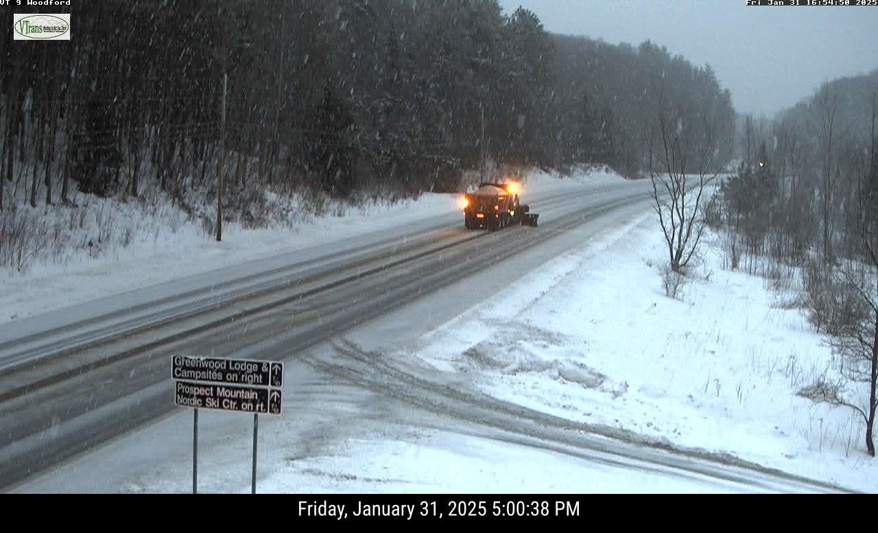
The trouble comes from a small storm that will send some wet snow our way. It will slowly spread northward across the state today.  And I do mean slowly. It'll start around Bennington early this afternoon and not make to places like Burlington, St. Johnsbury and St. Albans until early this evening. 

Also, the further north you go the less snow will fall.

Far southern Vermont - Bennington and Windham counties - are under a winter weather advisory this afternoon and overnight. That's because the initial thump of snow could briefly come down pretty hard this afternoon. And later, toward evening, there could be some light sleet and freezing rain.

Snow accumulation in the winter weather advisory zone will be two to five inches, with the highest totals in the southern Green Mountains.

That harder thump of snow, as noted, will slowly head north, but tend to weaken as it does so. We'll still see a good two inches of fairly wet snow in many places all the north almost to Route 2.  Some of the central Vermont Green Mountains might see three or four inches. 

Central Vermont might see some slippery roads for today's afternoon commute. 

The intensity of the snow will continue to fade as it reaches northern Vermont this evening. Places way up north like St. Albans and Newport will see less than an inch.

Later tonight, all areas could see some patchy freezing drizzle, so there might be a few issues here and  there o the roads first thing tomorrow. 

WEDNESDAY/THURSDAY

I hope Vermont's maple sugarers are ready for this. Both days should hit the low 40s (some upper 30s in the cold spots) with at least partly sunny skies. 

This will start to erode the snow cover nicely, especially on south and west facing slopes that collect the heat of the sun. The March sun is strong enough that I noticed it was melting snow in sunny corners yesterday even though temperatures were only in the low 20s. 

But these two nice days won't complete our transition into our upcoming false spring. 

Some precipitation is coming at us Thursday night and Friday. But, as mentioned yesterday, strong, frigid high pressure will be temporarily building up in northern Quebec. That will probably result in mixed precipitation. 

Exactly how that plays out is still in question. But whatever comes out of the sky doesn't look torrential. It'll probably be heaviest south. More details to come.  

WARM WEEKEND

It still looks like it'll get into the upper 40s and low 50s Saturday through Monday. It also looks like we'll get some rain Saturday. Again, nothing torrential, but still.

The rapid thawing and rain will send water flowing into our iced up rivers. The ice will start to shift and move. This is when we'll need to keep an eye out for ice jams that could cause some local flooding. 

It's only mid-March, so the warm weather won't last forever. It's hard to say how long the mild spell will last. But don't worry, more winter is inevitable. Meanwhile, enjoy the upcoming mild spell. 


Thursday, January 8, 2026

Thursday Morning Vermont Update: Windy Thaw Friday, But Icy Risk By Saturday Night

After the overnight snow, it got quite foggy here in 
St. Albans, Vermont yesterday. Low clouds and fog
this morning are forecast to break up for some
sun. Then we have to messy storms to deal with. 
 I hope you enjoyed the dense fog amid the fresh snow yesterday in Vermont. Most places received between 1.5 and 4.5 inches of snow. 

There were, as usual, a few hot spots of deeper snow. Chelsea had six inches and nearby Tunbridge clocked in at 5.5 inches. Shrewsbury, high up in Rutland County clocked in with 5.4 inches. 

For some reason, the area around Burlington also got a little more than most people, with about five inches. 

Despite the patches of flurries and low clouds and fog and maybe even a few drops of freezing drizzle this morning, today is going to be a nice one. Eventually. I hope. Meteorologists are insisting some sunshine should break out this afternoon and temperatures should rise into the mid-30s for the most part.

Enjoy it, because it's going to turn nasty again.

FRIDAY

The first wave of annoying weather will come through tomorrow. It'll be especially bothersome for winter sports types who want to keep the snow around.

 Light rain will start in the morning and continue through the day. There might be a few pockets of freezing rain to start the day east of the Green Mountains, but it won't be widespread and won't last long. 

West of the Green Mountains, south winds will also pick up on Friday, gusting as high as 40 mph. 

Most of us - even those of you in the high elevations - should get into the 40s.  A couple spots might threaten the 50 degree mark. 

We're only going to get maybe a tenth to a quarter inch of rain out of this, so the flood threat is pretty low. There might be some rises and rivers and streams. We'll have to watch for some ice breaking up in those rivers, because of the threat of ice jams. 

The snow is deep enough in high elevations so that you'll only lose some of it. The bulk of it should remain in place. 

But overall, the threat is fairly low, since the rain will be light. A cold front will drop temperatures into the upper 20s to low 30s Friday night, which would virtually shut off the thawing.

SATURDAY/SUNDAY

There are two storms with this supposed January thaw, the one we talked about on Friday and another Saturday into Sunday. The forecast for the second storm keeps getting colder.  

Forecasts from a couple days ago suggested this second storm would be mostly in the form of rain. As of this morning, we're not so sure. 

Each round of computer models have been trending colder with the second storm. Not cold enough to give us a nice "recovery" snowstorm after the Friday thaw, unfortunately. Instead, we're looking at another dose of mixed precipitation. 

The Friday storm will flop a weak cold front down from Quebec, giving us slightly colder air. The main storm will start to go up to the Great Lakes, as previously forecast. Also, as previously expected, a new storm is scheduled to start forming during the middle of this near the New England coast. 

This will help cut off the movement of warm air northward toward us. 

For now, the forecast calls for mixed precipitation to start Saturday afternoon and go on into the night. It might be a situation of a mix to rain to a mix and snow again on Sunday.

The details of this are still TBA, so stay tuned for updates, especially if you plan to drive anywhere Saturday night. As it stands now the best chances for any snow accumulation would be right near the Canadian border. The best chances for freezing rain would be mainly east of the Green Mountains north of Route 4 and maybe the far northern Champlain Valley. The Adirondacks of New York would also be  at risk for ice.

It still looks like many if not most of us will see an interval of plain rain somewhere in the middle of all that. But we'll need to pay attention to any further shifts toward a colder forecast. 

Whatever happens Saturday night and Sunday, we have some good news for those who hate intense cold.

A return to Arctic weather has been postponed a bit. The first half of next week should be relatively mild with highs mostly in the 28 to 36 degree range. Somewhat colder than average air should then arrive for the second half of next week. But even that shouldn't be too intense.

The real frigid air is now looking like it might not get here until around January 19 or 20. That date is so far away that I expect the forecast will get some revisions before we get to those dates.   

Tuesday, January 6, 2026

In Vermont: More Snow, A Little Ice, Eventually The Thaw, Then A Wintry Surprise?

The next little storm is due tonight. Expect another
two or three inches north, with much less south due
to freezing rain and sleet mixing in, especially
near the Massachusetts border. 
 I've got an early appointment today, so I'll just do a quick morning weather situation report as we're in a pretty active weather pattern at the moment. 

I don't have a lot of totals from  yesterday's snow, but it appears some places in northern Vermont overachieved slightly. Burlington came in with 2.9 inches of new snow.

 Here in St. Albans, we had 2.0 inches, perfectly in line with National Weather Service forecasts ahead of the event. 

Those figures were near the upper range of what was expected. It was a really fluffy snow, so it'll be pretty easy to clean up.  Roads might still be a little iffy on the roads this morning, which is partly why I'm getting an early start. 

NEXT STORM

The next storm - still a modest one but enough to cause a little trouble - is hot on the heels of yesterday's light snow. 

Hot is sort of the operative word, even if it is an exaggeration. Temperatures were in the teens and low 20s early this morning, giving us the balmiest morning since December 29. OK, I get that it's not exactly warm, but we'll take what we can get.

After a day that gets us to near 30 degrees, again, the warmest since December 29.

The snow will arrive this evening. For most of us, I think we'll squeeze in the afternoon commute before it starts, as the National Weather Service office is projecting a start time of around 8 or 9 p.m for most of us. It should be over by mid-morning Wednesday.

In Vermont's southernmost two counties, a winter weather advisory is up because those areas are expecting a mix of snow, sleet and freezing rain. 

The further north you go in Vermont, the more likely it is that this will be just snow. Amounts will be only two or three inches up there. Because it will be a little warmer, tonight's snow won't be quite as feather-like as the stuff we're cleaning up this morning.

There's no weather alerts in Vermont other than in the far south. For those of us north of Bennington and Windham counties, the National Weather Service in South Burlington stated this morning: "If confidence in freezing rain or heavier snow over a large are increases, weather weather advisories may be issued." 

NEXT STORMS

The weather will quiet down and warm up Wednesday and Thursday  ahead of the next storms. Highs both days should get well into the 30s, so it will be the beginning of our thaw. Not much of a thaw, but whatever.

It still looks like we'll have two in quick succession. The first, on Friday, is the core of our brief January thaw. It'll rain and get up into the 40s, with a couple places maybe threatening 50 degrees. At this point, the rain looks like it will probably not be heavy enough, and the snow melt not extensive enough to set off any real flooding. 

There's new questions about the second, stronger system on Saturday. Earlier we thought the second storm would consist of more rain. Now, we're not so sure. Some computer models still keep the storm mostly rain, at least until the tail end of it.

Other models shift the storm a little further east, bringing in the chilly air earlier. That could set the stage for some freezing rain and snow 

As always, we'll know more as we get closer to the event. 

Sunday, November 9, 2025

First Snow Of The Season For Vermont Valley. A Very Yucky Weather Sunday

Henry the Weather dog, a native of southern Texas and
possibly Mexico, on Sunday experienced the first snowfall
he's ever seen outside his home in St. Albans, Vermont.
He was not particularly impressed, as the 
expression on his face indicates,
 The break of dawn revealed the first dusting of snow of the season outside mil St. Albans, Vermont home.

Snow was falling across much of the state this morning. It's not amounting to much, but it's a reminder that winter is on our doorstep.

It's going to be a miserable Sunday, I must say.  Hey, at least Saturday was OK, with a decent amount of sunshine in most of Vermont. So we got half an outdoor weekend. 

Today, the snow and sleet will gradually change to rain in most places later this morning and this afternoon. 

An exception is over in northern New York, where cold northeast winds will keep the precipitation today and tonight mostly snow, sleet and freezing rain. The ugly weather there has prompted a winter weather advisory. 

Things won't be bad enough in Vermont to trigger any advisories, at least for today. We will see some snow, sleet and maybe spotty freezing rain around the Green Mountain State today, but it won't fall that heavily. 

The ground is still warm, so most of the snow this morning was melting as it hit road pavement. Traffic cameras around the state early this morning showed dustings of snow on the grass and trees, but mostly just wet pavement. There were some slick spots, though, so slow it down if you're out there this morning. 

Air temperatures were near the freezing point, so it won't take much of a warmup to ensure that roads, at least in low elevations stay pretty clear.  

Spoiler: We won't see much of a warmup today. Highs will barely make it to 40 degrees. Most of the warming will be aloft, so even as temperatures stay cold near the surface, the warm air aloft will keep things in Vermont wet and not white this afternoon. 

A sign of all this was already happening in Burlington early this morning. The city got their first trace of snow of the season at around 6 a.m. with a temperature of 34 degrees. By 7 p.m., it was down to 33 degrees but the light snow had switched to light rain. 

There will probably be some back and forth with the rain, sleet and snow this morning before it settles on rain this afternoon. 

MONDAY/TUESDAY

As colder air comes in behind the storm system tomorrow, rain should change to snow across most of the state. For most of us, it will be just light snow and snow showers. Roads could get slick toward the end of the day as temperatures go below freezing, especially after dark. 

Late season spoilage in St. Albans, Vermont as snow
fell on some leaves still stubbornly 
clinging to this tree, 

The snow showers will continue on Tuesday with gusty northwest winds and daytime temperatures barely above freezing for most of us - and below freezing in the higher elevations north. 

Snowfall in the valleys will be modest. For instance, The National Weather Service is forecasting about a half inch of snow in St. Albans today, and then a storm total of 1.7 inches by Wednesday morning. 

Most lower elevations in Vermont will only see an inch or less of snow by late Tuesday. Some areas north and mountains will see a few inches. 

Rain and melted snow across the Green Mountain State today through early Wednesday should amount to about a half inch south and three quarters of an inch north. The bulk of the precipitation will come between now and Monday evening. 

Luckily, we're not being introduced to winter by a full blown blizzard. We're being eased into it with light snow and a mix. 

During the rest of the week we'll see more light rain and snow showers and an annoying overcast, but nothing scary.  

After this storm, our next shot at potentially decent precipitation would come next Monday or so. It's way too soon to figure out how much, and whether it would be rain or snow or a mix. 

Sunday, February 16, 2025

Vermont Sunday Evening Update: Storm Briefly Got Better Behaved, But Blizzardy Night, Strong Monday Winds Due

Getting pretty snowed in at my house in St. Albans,
Vermont after today's snowstorm. 
As we got into the late afternoon, our big storm got slightly better behaved. 

Temporarily. 

ASSESSING THIS AFTERNOON

Winds along the western slopes of the Green Mountains diminished as we headed into the mid and late afternoon. That was expected. 

Not much sleet infiltrated northern and parts of central Vermont, so this turned into a mostly snow event. Here in St. Albans, sleet mixed with the snow for about a half hour early this afternoon, but otherwise it was a pure snowstorm. 

As of 5 p.m. 9.5 inches snow had accumulated here in St. Albans. There's now about 20 inches of snow on the ground here, which is the most I've seen in several years. 

We were correct that the northwest corner of Vermont would be the big snow winner. Highgate Center has so far reported 14 inches of snow. Alburgh reports a foot of snow. 

With all the snow in Burlington, the city reached a milestone of sorts today. All winter, snowfall was running behind normal.  As of late this afternoon, Burlington has had 59.4 inches of snow, which is nearly two inches more than normal for this date. 

Also, Burlington was just 0.3 inches of snow away from making this February become the 10th snowiest on record. 

Judging from this traffic cam grab shortly before 5 pm.
Sunday of Route 108 in Stowe, the line of cars coming
off the mountain suggests a lot of people braved the
storm to go skiing and riding today. 
You can see how the easterly downslope winds on the western side of the Green Mountains suppresses precipitation. North Shrewsbury and Underhill, on those western slopes only had five or six inches of snow as of late afternoon. 

They'll at least partly make up for the snow deficit tonight and Monday as strong west winds will encourage snow showers on the western slopes. 

Gusty winds earlier today that blew the snow around even away from the western slopes diminished, so it became a more gentle snowstorm in northern Vermont. It kept accumulating and the roads stayed miserable, but at least it wasn't especially scary.  

In southern Vermont there was a good amount of sleet and freezing rain but the freezing rain didn't seem to be as widespread as feared. 

As of late afternoon, power outages in Vermont were extremely few and far between. There was never more than 122 outages at any one time, and as of 4 p.m. everybody had electricity.  I'm pleasantly surprised by this. 

The southwest corner of Vermont even managed to have a thaw of sorts. It got as warm as 37 degrees in Bennington. 

However, pretty much everyone else stayed below freezing. That was also expected.

THIS EVENING/TONIGHT

Any lingering sleet or freezing rain in southern Vermont should get flushed out soon if it hasn't already. 

The colder air aloft is moving in. It got into northwestern Vermont a little early, and it's slightly ahead of schedule as it moves eastward and southeastern over the Green Mountain State. Colder air aloft ensures snow, not schmutz.  

Traffic cams showed sleet was turning to snow around White River Junction shortly before 5 p.m., and we know that trend will continue. 

Traffic cam image from shortly before 5 p.m. shows
very heavy snow up in Alburgh, Vermont. The 
northwest corner of the state, including Alburgh
were the big winners of the snow sweepstakes today 

The snowfall rate might intensify for awhile this evening as the cold air begins to move in and squeeze more moisture out the clouds.  But the snow will turn more showery later tonight and through the early morning hours 

This evening through dawn tomorrow, it looks like southeast Vermont will see less than an inch of additional snow. Southwest Vermont looks to get one to three inches.

 Northern Vermont is in for another two to five inches, with locally high amounts in the Green Mountains, and possibly near the Canadian border

Winds will be increasing late tonight as temperatures plunge, so blowing snow will become a problem. Which sets the stage for Monday. 

MONDAY

In some respects, Monday might actually be the worst day of this storm.  There won't be much additional snow. A dusting from snow showers in the valleys, a couple inches in the Green Mountains, maybe several inches in the northern Greens. 

But gawd, the wind! Not to mention the cold. 

Bennington and Windham counties are under a high wind warning for gusts as high as 65 mph on Monday. Windsor County has its own high wind warning for gusts reaching 60 mph. 

Elsewhere in Vermont, we're under a wind advisory for gusts to 50 mph. Those gusts might actually be a little stronger than that on the eastern slopes of the Green Mountains. The west to northwest winds will gain momentum as the descend those eastern slopes. 

Monday might well be the day we see the power outages with all that wind. That might be especially true in southern Vermont, where the winds will be a little stronger and there is some ice on the trees.

The lack of sleet and freezing rain today in much of northern Vermont, and the additional snow tonight makes the winds especially problematic. 

Gusty winds in open areas will create ground blizzard conditions, where you can't see hardly anything in front of you. Also, there's now a LOT of snow on the ground. Most of it powdery. It'll blow around. 

I think a lot of north/south oriented local roads in open areas, especially in the Champlain Valley, will drift in easily. You can get drifts several feet deep in a surprisingly short amount of time with these winds.

I don't think the drive to work Monday morning will be fun for anybody. Build in extra time to clear the snow from your car, and to deal with slow going on the streets and highways. 

The Monday winds will also create a horrible wind chill. Highs will only be in the teens, so wind chills will easily be below zero. 

TUESDAY AND BEYOND

Winds will only slowly diminish and it will stay much colder than normal Tuesday and Wednesday. 

If you're sick of storms, we're going to get a break. A pretty strong storm will pass far to out southeast on Thursday, and we don't expect anything from that. 

It's going to be a cold week. But average temperatures are rising as we head toward March. This is uncertain, but starting about a week from now, we might have several days with highs in the 30s in the valleys. That would settle the deep snow just a little. Those 30s are also normal for the closing days of February and the opening of March. 


Friday, January 31, 2025

Some Kinda Tricky Weather This Evening, Overnight In Vermont, Especially South

A Vermont State snowplow was caught on a traffic cam
around 5 p.m. today as wet snow fell on Route 9 in
Woodford.  About a half hour before this photo
was taken, the road appeared to be just wet, 
highlighting the rapidly changing road
conditions this evening in southern Vermont. 
 A storm is scooting by to Vermont's south early tonight as another blast of at least semi-Arctic air is poised to drop down on us from Quebec.  

The combination of these two things should give you a heads up if you're planning on driving in the state or surrounding areas tonight, especially in southern Vermont. 

Most valleys managed to get above freezing today. Filtered sunshine north of Route 2 made for a rather pleasant day. 

The further south you went, the worse the weather got. 

 There's been light mixed precipitation in southern Vermont all afternoon, and conditions will get a little thornier as we go through the evening. 

That's because the cold air is just beginning to advance. And the bulk of the precipitation and its most northward extent is coming this evening.

A winter weather advisory is up and running in Bennington and Windham counties - the southernmost part of the state - until 4 a.m. Saturday.  A mix of light rain, sleet, freezing rain and snow was in the process of turning to all snow as darkness fell. These areas can expect two to six inches of snow. 

Central Vermont - places like Rutland, Middlebury, Montpelier and St. Johnsbury  - can expect about 1.5 to as much as three inches of new snow this evening. 

One to four inches of snow is in the forecast overnight
in the southern two thirds of Vermont, with maybe a 
little more than that in high elevations south.
Very little snow is in the card for near the 
Canadian border. Rapidly falling temperatures
tonight will make the wet snow on roads in
southern Vermont freeze, so it'll be tough going. 
I noticed that rain that had been falling in Bennington and Rutland and a few other places in southern Vermont had switched to wet snow as of 5 p.m.  

The wet snow combined with water on the roads across southern Vermont will tend to freeze up soon, making roads dangerous. 

I saw that starting to happen on traffic cams in higher elevations of the bottom half of Vermont already as of 5 p.m.  

North of Route 2, amounts will drop off sharply, but it's a little hard to tell where the cut off between light snow and no snow is going to be. Places up by the Canadian border might not get anything at all. 

If you don't have to travel to the southern half of Vermont tonight, I wouldn't bother. The road crews and salt shakers are out, but there's only so much they can do when temperatures crash into the single number and teens overnight. 

Saturday will be another cold day as the temperature roller coaster continues. That roller coaster of suddenly warm/suddenly cold weather will continue all week. I'll have more on that in a post sometime tomorrow, as we do also face a couple of storm chances as well. 

Tuesday, November 21, 2023

Vermont Forecast Still Schmutzy For Tonight, Wednesday Morning

Our familiar National Weather Service/South Burlington
snow prediction map has most of the accumulation
along and east of the Green Mountains tonight
and early Wednesday.
Vermont is still on for weather designed by Sasha Royale Paine Diaz (sound it out) tonight and early Wednesday. 

The good news is it looks like many of us will be at least mostly out of the woods by mid to late morning Wednesday, so people who need to can get on with their travel plans 

It does look like the eastern slopes of the Green Mountains from at least Warren south to the Massachusetts border are in for a White Thanksgiving. 

Those areas can expect three to locally as much as six inches of snow tonight and very early Wednesday before things change over to a cold rain before tapering off. 

Most Vermont ski areas should get a few inches of new natural powder. If I had to pick a ski area that will get the most snow, I'd guess Okemo, near Ludlow. 

The strip along Route 7 from Bennington all the way up to Swanton looks to get off fairly lightly. Those lower elevation areas, including the Champlain Valley can expect a burst of snow tonight, followed by a little mix after midnight and hopefully just plain rain by or even a little before dawn. 

THE SET UP

As expected, this morning was cold. Vermont's first zero degree temperature of the season popped up before dawn today in perennial cold spot Island Pond, in the Northeast Kingdom.  That kind of temperature there isn't all that weird for the third week of November.

Most of the rest of us were in the teens, with colder towns in the single numbers. The low in Burlington was 18 degrees not odd for Thanksgiving week but still the chilliest temperature since March 12. Winter is at least sort of here, for sure. 

We had a rare bit of sun Monday afternoon and today is starting off crystal clear. But satellite images show clouds on our doorstep, and the sun will fade behind those clouds later this morning and afternoon.

Timing wise, the National Weather Service office in South Burlington has snow starting between 8 and 10 p.m. this evening south and west of Interstate 89, and by midnight for most of the rest of the state.

Road conditions will deteriorate pretty quickly in the hours before midnight. So if you're driving somewhere today, try to get there by 8 p.m. at the latest. 

WEDNESDAY

As noted, the "luckiest" people in Vermont will be those in low elevations west of the Green Mountains. There, only an inch or two of snow will fall, and at this point, it looks like temperatures will be above freezing with rain by 6 a.m. That bodes well for the morning commute, though there still will be slush and icy patches to watch out for. 

Also, be careful as conditions can unexpectedly change. There's always the chance the warmer air could be delayed, making a mess of things even in the Champlain Valley. 

Along and east of the Green Mountains, snow and mixed precipitation should continue at least into mid-morning Wednesday.  Travel will be difficult and annoying, and not really recommended in those areas. If you delay your trip some until, say noon, you'll be much better off and less stressed. 

By the way, wind, rain and visibility problems will probably cause at least a few flight delays in the Northeast Wednesday, so check your airline to see if you're actually taking off when you're supposed to. 

Rain and lingering mixed precipitation in the mountains will slowly taper off Wednesday afternoon and evening. 

Thanksgiving's weather is actually the pick of the week. Of course it's November, so you can't expect much. Still, we'll have hints of sun and seasonable afternoon temperatures in the 37 to 45 degree range, so that's not bad. 

The weekend is looking rather quiet and chilly at this point. 


Thursday, March 23, 2023

Will Brief Vermont Spring Yield Back To Winter?

Somewhere beneath this snowbank and snow drifts in 
St. Albans, Vermont, a perennial garden awaits 
spring weather to bloom again. Given the forecast
for the next week or two, that wait will go
on for awhile yet. 
Most of Vermont had a nice warm spring day Wednesday, although, as explained yesterday, the northern Champlain Valley kind of missed out on that. 

Today, spring rains are falling across Vermont.  Not a nice day, but hey, spring-ish, right?  

So does that mean we're over the winter weather? Uh, no.

There's always flashbacks to winter well into April, sometimes in May in Vermont, so it's no surprise that more snow or a mix is in the forecast.  Winter is being a little more persistent than it has in recent years, I guess. 

THE WEEKEND

We're still looking at a storm that looks as if it will produce a mix of slush, snow, ice and yuck Saturday and Sunday. This, by no means will be anything as big as the snowstorm we had mid-month. But it will still cause a few problems. And like most storms this time of year, it's kind of unpredictable.

The current thinking is we'll be cruising along late Saturday morning or early afternoon with temperatures above freezing - at least in the valleys  - when the initial burst of precipitation arrives. Oh, goody, rain, right?

Probably wrong. The arriving storm will bring a surge of deep moisture that will collide with relatively dry air over us. As the snow arrives aloft at first, it will evaporate into the dry air, cooling it.  Then as moisture continues to flow in, the now cooler air will be chilly enough for snow, not rain. 

Sometime on Saturday, we could see a pretty heavy burst of snow which could at least temporarily slicken the roads. Though most of the snow accumulation will happen on either grassy surfaces or on existing snowpack. 

The National Weather Service in South Burlington says they're thinking that more warm, wet air will continue to flow in Saturday night. That would change the snow back to rain, or rain and a little sleet in the valleys. Mountains would continue to get a an ugly mix of snow, sleet, freezing rain and perhaps a bit of rain. 

Vermont Agency of Transportation traffic cam along
Interstate 89 in Williston this morning shows us 
what we have to put up with in the odd season between
winter and spring: Fading snow, brown grass, 
mud and roadside litter that accumulated all winter. 

Projected accumulations are so, so subject to change I almost don't want to mention it.  But people like early estimates, so here we go.  I imagine a lot of valleys could get one to three inches of glop, mostly from that initial burst of snow Saturday afternoon or evening.  

The early guess is some of the mountains would get two to six inches of schmutzy snow. 

Those of you (like me!) with travel plans on Sunday should be OK.  I imagine there will be some lingering issues in mid and high elevations in the morning, which should get cleared up. At this point, with fingers crossed, main roads in the valleys should be just wet Sunday morning and through the day, as scattered, light rain showers continue through the day. 

MIDWEEK STORM?

Some of you might have seen some breathless posts on social media of a possible bigger snowstorm next Wednesday or so. 

Let's seriously underline the word "possible."  Yes, some of the computer models suggest a decent snowstorm for Vermont that day. But a lot of other models either take the storm out to sea so that it entirely misses us. Or they give us a bit of light rain and snow.  We won't know for a few days how this will play out. 

Unfortunately for people chomping at the bit for spring, it looks like it will be reluctant in these parts. Long range forecasts call for generally below normal temperatures and odds slightly tilted toward above normal precipitation. That would mean more chances of snow to delay the daffodils even more. 

Thursday, March 2, 2023

Pesky Questions Remain About Weekend Snow In Vermont

The National Weather Service in South Burlington took
a first crack at forecasting Friday night and Saturday's
snowfall. There's a high chance these predictions will
change one way or another, especially in
northern Vermont. 
We know a snowfall is coming to Vermont Friday night and Saturday. Some of us could get quite a bit of it. 

The National Weather Service offices in South Burlington and Albany are confident enough on this that they've issued winter storm watches for all of Vermont Friday night and Saturday. 

The question now is?  Does anybody get a huge dump?  Does anybody sort of miss out and end up with something that's not that big a deal?

I'm kind of surprised that as of Thursday morning, the computer models, at least, don't have a good handle on this.   

At this point, forecasts are slightly leaning toward more snow in central and southern Vermont and a little less far north.  Note I said slightly leaning. There's still a decent chance northern areas could share in a big snowstorm. But if that happens, does southern Vermont lose out, at least somewhat?

The incoming storm is a little like the last one that came through on Tuesday. Except stronger. 

The basic scenario is the same as what happened on Tuesday, though. The main first storm moves up toward Buffalo, New York by later Friday night. Meanwhile, a new storm gets going just south of southern New England, and scoots eastward out to sea on Saturday.  

If the original storm that ends up near Buffalo fades quickly like some computer models suggest, then northern areas will miss out on a lot of the snow. That's because dry air from Quebec would squelch snowfall near the Canadian border. The coastal storm would then dump snow on southern Vermont. 

If that original storm near Buffalo powers through into Quebec, then northern areas get more snow that expected. That's what happened on Tuesday, but just because it happened once, doesn't mean it will happen again.  Underhill this scenario, southern Vermont would be more at risk for mixed precipitation instead of just snow. 

So now that I have explanations/excuses out of the way, here's what we know: 

1. Be prepared for snow, possibly heavy Friday night, going into at least Saturday morning.  The snow should start after Friday afternoon's commute, so you should be fine there. 

2. Although the snow won't be super soggy, it will be fairly heavy and wet. Strong winds aloft could shred the snow into small dense flakes. Also,  temperatures on Saturday near 32 degrees will make the snow kind of dense. A wild card is still the chance of sleet of freezing rain in far southern Vermont. It's possible we'll see power outages in spots, but we don't know yet how extensive they might be. 

3. The best chances of seeing close to a foot of snow would probably be in central Vermont, with the least chances up near the Canadian border. Expect the forecast to change somewhat one way or another as we get closer to the storm. 

4. The storm will be out of our hair on Sunday, and we'll have rather quiet weather, with temperatures near or just a little below normal heading in much of next week. 

By the way, normal highs this time of year are in the 30s, with upper 30s in the Champlain Valley and valleys of southern Vermont.  Normal lows are in the mid teens to low 20s. 

Tuesday, February 21, 2023

Storm Update: Winter Storm Watch Now Up For Vermont; Among Two Dozen States Under Alerts

The National Weather Service office in South Burlington
has taken its first crack at how much snow they
expect from the storm starting Wednesday night.
This map shows most places seeing six to 12 inches,
with less in far southern Vermont due to mixed
precipitation. Expect adjustments to this forecast
in the next day or two. 
 Just a quick update this morning on our looming winter storm. 

The National Weather Service in South Burlington has gone ahead and popped up a winter storm watch. It's in effect from Wednesday evening through late Thursday afternoon for most of Vermont. 

By my count, Vermont is now among 22 states under a winter storm watch, warning or blizzard warning. This stretches from Oregon and Washington to Maine. 

Before we get to the main event, a smaller storm will trigger valley rain showers and mountain snow showers this afternoon, trending toward all snow this evening. 

 There could be brief, heavy snow squalls harassing us in a few spots.  Accumulations will be mostly less than an inch in the valleys, with maybe a few inches way up near the Green Mountain summits.

After a quiet and increasingly cloudy Wednesday, we'll start getting into the main show Wednesday night. 

A warm front separating record warm air well to the south from seasonably cold winter air over us and to our north sets the stage of this thing. The warm front extended this morning all the way west to Iowa. 

Rushes of warm, wet air running up and over this colder air are triggering the winter weather.  Some places will be hit harder than others. Minneapolis, for instance, is bracing for a paralyzing storm that could well be one its largest in history. They're expecting perhaps 20 inches of snow with winds gusting to over 35 mph. 

Don't try to go to Minneapolis this week, kiddos!

It doesn't look like it will be that bad here in Vermont, but it looks like we'll still take a pretty good hit. 

A storm will run west to east along the warm front Wednesday night and Thursday. The clash of warm air vs cold air will be so strong over us Wednesday night and early Thursday that we will have a good burst of heavy snow.  There's even a chance we could hear a rumble or two of thunder. Yes, thundersnow!

Current forecasts have most of us receiving six to 12 inches of snow, but that forecast will surely be refined up or downward in some areas, depending on where things set up.

A huge complication with this storm is a band of freezing rain and sleet that will set up from northern Illinois all the way to somewhere in New England. 

Southern Michigan, southern Ontario and parts of western New York seem set up for a damaging ice storm with this thing. 

Once again, it probably won't be as bad in Vermont, but ice will still be a danger. Especially in far southern Vermont.  Some forecasts call for isolated ice amounts as much as a quarter inch. At that point, you begin to run into a little tree damage and some power outages.

Sleet could extend as far north as Route 2 on Thursday.  Not sure on that yet. By Thursday afternoon, the precipitation won't be coming down as heavily as it did earlier.  Again, expect some adjustments to this forecast. 

It will be colder than we've gotten used to during this storm, especially in northern Vermont. Temperatures Wednesday night and Thursday will barely make it to around 20 in northern Vermont. Not a big deal for late February, but colder than it's been.

An Arctic cold front and another wave of low pressure will bring possibly heavier snow showers Thursday night.  This will also put us in a deep freeze for Friday and early Saturday.  It'll probably get a little below zero Friday night and stay nippy Saturday.

Like the even more intense cold wave earlier this month, this will soon go away. By Sunday afternoon, it should be in the low 30s, which is about normal for late February. 

Thursday, February 9, 2023

Vermont Storm Update: Careful On Roads Higher Elevations/North Now Into Evening

 
Interstate 89 in Brookfield was looking pretty slick in
the mid-afternoon today as the onset of the storm today
has brought snow and mixed precipitation. Some 
spots might have slick roads into this evening. 
Warmer, lower elevations should just see rain

 UPDATE 4 PM THURSDAY

Today's storm, at least the first part of it, is continuing to make fools of forecasters.

Heavy snow has now extended into valleys in northern Vermont, and it's starting to accumulate.

I'm still pretty sure this will eventually go back to rain, but during the evening commute, expect slush on the roads, which will make things a little dicey even in the Banana Belt Champlain Valley.

PREVIOUS DISCUSSION

The precipitation has arrived, as promised in Vermont this afternoon. 

In some mid and high elevations of central and northern Vermont, the initial burst is in the form of wet snow, and the roads are getting slick in spots.  

Vermont Agency of Transportation web cams show snow-covered roads in places like Interstate 89 in Brookfield, Vermont 108 in Stowe, Route 302 in Topsham and other places.

In the valleys and in most higher elevations in southern Vermont, this is coming down with a cold rain with a very minimal mix of sleet and snow. 

Today's precipitation arrived  in St. Albans early this afternoon
as a cold rain, as expected. Then unexpectedly, around 3:30
it switched to a heavy wet snow. 
When the precipitation is heavier, we have seen bursts of wet snow even in the low elevations, but it doesn't seem to be accumulating.. 

Here in St. Albans, it's been rain, with a few hints of sleet and wet snowflakes mixed in from time to time.  

At least until about 3:30 p.m., when it unexpectedly flipped to a heavy, wet snow that started to accumulate. A slushy accumulation, but an accumulation.  

Since the atmosphere is warming, places that are getting rain will keep seeing rain as we go into the evening. Those of you seeing snow will see a transition to mixed precipitation this evening, then rain later on. 

You probably will encounter slow going and slippery roads in some areas into this evening. 

Kind Of A Springlike Storm Coming In Today

Snow is starting to melt again and this wedge of snow
stubbornly clung to our St. Albans, Vermont  house as it
slowly slid off the roof. That big wedge broke off soon
 after this photo was taken, and there was no harm done to
the eaves or roofs. Snow should continue to melt
as a mostly rain storm comes in later today. 
 Yesterday's nice afternoon weather is over, and clouds were rapidly thickening up across Vermont today, and for most of us it's going to be a wet afternoon and evening. 

And in some places, slushy, and a little bit icy in a few spots.  

The storm system that's coming in is going to our west, so that inevitably means mixed precipitation. 

Usually in February, however, this type of storm runs into a buzzsaw of cold air sitting over northern New England. The result would be a burst of snow, then a mix, then a little drizzle switching back to snow in the end. 

This time, there is precious little cold air to be found. There probably will be a little burst of snow in the high elevations and Northeast Kingdom to start. That could leave behind an inch or two of wet snow before a changeover to rain. 

During the transition it still looks like the spine of the Green Mountains and the cold hollows east of those mountains, should have some freezing rain later this afternoon and evening. It will be spotty, but enough to make the roads there a hazard.

Which is why the National Weather Service is maintaining a winter weather advisory for the Green Mountains and eastern Vermont north of White River Junction. 

In the Champlain Valley and valleys in southern Vermont, there might be a little wet snow and sleet when the storm starts today, but it won't amount to much. 

The rain could come down pretty hard for awhile late this afternoon and evening, so there might be a little street flooding where storm drains are clogged with ice. We won't see any widespread flooding though. 

This really is the kind of storm we'd expect to see in Vermont in the second half of March, not before Valentine's Day in February. But that's the kind of winter we've had.

Temperatures will fall behind the storm Friday, going from the 40s early in the morning to 20s by around dark. Snow showers will dust the western slopes of the Greens and the summits, with maybe one to three inches there. We shouldn't see anything more than a dusting in the Champlain Valley.

After a seasonably cold Saturday, it will warm up again Sunday through at least Thursday. The snow cover has started to melt away in the Champlain Valley and it will mostly continue to do so through the next week, with just a few brief interruptions.

Just like March. I'm only hoping that this March doesn't turn out to be like a normal February. 

Tuesday, February 7, 2023

Potential Mess On Vermont Highways For Today's Evening Commute

Just a little freezing rain caused chaos on Vermont roads,
and underfoot on February 6, 2019. Though things
probably won't be as bad as that this evening, a band
of light mixed precipitation could make the drive
home this evening, um, interesting. 
If you're at school or work this afternoon in Vermont, especially in the Champlain Valley, I'd suggest packing up for the day pretty soon and driving home before a possible rush hour mess arrives.  

A band of light snow, sleet, freezing rain and rain was approaching Vermont as of late afternoon.

Temperatures were a little above freezing in most valleys in Vermont as of 3 p.m. But the dew point, which is how low temperatures have to get to saturate the air, were in the single numbers and low teens.

That means, as precipitation arrives, the added moisture will cool the air, making it closer to the dew points. That, in turn, assures we'll receive mixed precipitation. Although there might be some snow, temperatures a few thousand feet up will probably remain above 32 degrees. So it's a mix.

Plus, pavement temperatures are still really low after that Arctic outbreak Friday and Saturday. Last night was quite cold, too, so that assures the surface of roads is pretty damn cold. 

Whatever comes out of the sky won't be heavy and won't last all that long. But a little dab will do ya. 

It takes just a tiny amount of precipitation -- the water equivalent of just 0.01 inches -  to potentially make things slippery. I remember on February, 6, 2019, some freezing rain hit at the evening rush hour in the Champlain Valley. It wasn't much, but it caused tons of slide-offs and crashes. People were stuck on Interstate 89 in and near Burlington for four hours or more. 

This time, it's looking like we'll have a quick hit of mostly snow and sleet, and not as much freezing rain as that 2019 episode. Accumulations should be an inch or two at most, but again, it doesn't take much.

So things might not be quite that dramatic this evening, but it's still an issue. The National Weather Service office in South Burlington has issued a special weather statement warning of this evening's risk. 

The reason I said people in the Champlain Valley should consider driving home before things go south is that this band of ugly stuff is due to hit between 5 and 7 p.m. or so.  In the eastern half of Vermont, the schmutz will come through probably between 6 and 8 p.m., giving people more time to escape the dungeon of work. 

Still, anyone driving around Vermont this evening should either reconsider their plan or be vewy, vewy careful, as Elmer Fudd might say. 

Things should be quiet on Wednesday, though there still might be some ice here and there on the pavement in the morning. Especially if you're not on the main roads.

It's looking like at least parts of Vermont could have renewed freezing rain problems Thursday and Thursday night. I'll have more updates on that in a subsequent post. 


Wednesday, January 25, 2023

Vermont Storm Has Arrived; Stay Home If You Can Tonight

As I write this shortly around 5 p.m. Wednesday, snow is ramping up as expected across Vermont. 

Vermont Agency of Transportation web cam along 
Interstate 89 in Colchester at around 5:20 p.ml shows
traffic backing up due to slide offs and accidents.
Snow is expected to intensify further this evening. 

There was an interesting little band of snow that formed over northern Vermont late this afternoon. There was a pretty steep contrast between temperatures along the Canadian border compared to along Route 2 a little to the south. This was essentially a mini warm front that touched off an initial burst of snow. 

The main show at around 4:30 p.m. was in southern Vermont and advancing north pretty fast. Honestly, I hope you're home by now, as road conditions are deteriorating pretty quickly. Even ahead of this intense band of snow we have plenty of reports of traffic crashes. 

The heaviest burst of snow will probably come between now and midnight, with the later version the further north you go.

It seems like in general, the forecasted warm push of air keeps getting a little stronger. Compared to this morning's forecast, it looks like there will be a little less snow than originally predicted in southern and central Vermont, and perhaps a bit more than earlier predicted in far northern Vermont. The bad news is that means there will probably be a little more ice accumulating in central Vermont than originally thought.

The National Weather Service is still going with a dump of six to 12 inches up the spine of the Green Mountains, and along the eastern slopes. 

In the Northeast Kingdom, Champlain Valley, and the valleys of western Vermont, forecasters are still expecting three to seven inches of snow, with the least in low elevations of southwest Vermont. 

I suppose this is a fairness issue of sorts? Areas of far northern Vermont that missed out on the bulk o the last two storms will partly make up for that with somewhat heavier snow totals tonight. 

As of 4:30 p.m., the snow was falling only lightly to moderately in most of the state, but for a couple or few hours, it will really come down hard this evening. It'll snow at a rate of  one an to two inches per hour in many places, which is too fast for our crack team of state snow plow drivers to keep up with. Stay home. It's really not worth going out there tonight. 

That's especially true as we get into later tonight. Schmutz, in the form of sleet and freezing rain, will also come down heavily for a time tonight, especially south and central. 

The bulk of this storm will be within this initial big thump of snow, ice and rain this evening and tonight. There has been thundersnow in places from Indiana to southern Ontario. I doubt we will see thundersnow in Vermont, but the chances of it happening are not zero this evening.

The National Weather Service in South Burlington has 
slightly reduced expected snow accumulation in Vermont
tonight and tomorrow because more of a mix is expected.
Snowfall totals in the northern Champlain Valley 
have increased a little bit. 
Speaking of electricity, I can't guarantee your power will stay on tonight. Between the existing snow loads on trees, the fact that the snow will keep getting wetter and heavier as the night goes on, and then it will go over to sleet and freezing rain, that's not a great recipe for the power lines.

The strongest risk for overnight power outages is in southern and central Vermont, especially along and near the east slopes of the Greens. Winds overnight could get pretty gusty on the west slopes of the Green Mountains as well, which would expand the problem. 

Green Mountain Power tweeted: "Stay safe #vt! We are prepared for the difficult forecast. With some areas having wet snow on trees, there could be potential for damage. Crews will response as soon as safely possible!" 

A dry punch of air aloft between say, 2 and 10 a.m. Thursday will make the precipitation spottier, lighter, but still annoying. Anything that comes down will be a mix of sleet, freezing rain or a cold, non-freezing rain.

That won't last long. The atmosphere over us will cool off as the day wears on, so anything that comes out of the sky during the afternoon will be snow. It looks like the western slopes and summits of the Green Mountains, and parts of the Northeast Kingdom, should receive a few inches of snow out of that little backlash.

Most of the Champlain Valley should receive maybe an inch or two of additional snowfall. Temperature will slump back below freezing in the afternoon and evening, so slush and water on the roads and sidewalks will freeze.

Expect another round of busy hospital emergency rooms as ice underfoot will lead to plenty of people falling and hurting themselves.

Winds from the northwest will turn gusty Thursday afternoon and evening, too. So yeah, Thursday looks like a miserable winter day.

In the warmer valleys of Vermont, it hasn't gotten below zero yet this winter. That might or might not change in the coming week. Stay tuned!

Snow And Schmutz Storm Still Due To Harass Vermont Today Into Tomorrow

This morning's National Weather Service forecast map.
Hasn't changed much since yesterday. Orange areas 
get the most snow, eight or more inches. 
We're still gearing up for a rather messy storm, one that will harass anyone trying to drive anywhere between late this afternoon and later Thursday. 

Most of us here in Vermont should see a net gain in snow depth on the ground, but many of us will see a little sleet, freezing rain or even rain during the middle of the event. 

The overall forecast hasn't changed much since yesterday, but there are some subtle differences that will matter to us. 

TIMING

First of all, the timing of this storm is turning into an issue. It looks like it will come in a little earlier this afternoon than original forecasts indicated. That's a problem for many of you who drove to work or school this morning. 

Main roads were perfect this morning. Not so much later today. The snow is expected to begin in far southern Vermont early this afternoon, mid-afternoon around Rutland and Windsor counties and late afternoon in most of the rest of central and northern Vermont.   

Once the snow starts, it will ramp up quickly and come down hard. The snow is riding a surge of warm, moist air, and there's pretty cold air to the north. At least at first. That temperature contrast will force that surge of air to go up and over the cold air. That's a recipe for a quick thump of heavy snow, lasting a few hours. 

Since that burst of snow will start landing on pavement during the afternoon and evening commute, that's bad. It seems every time a storm is scheduled like this, you end up with long traffic jams on the interstates, lots of slide offs, and just general road chaos. 

If you can sneak out and get home before it starts snowing, that would be great. The fewer cars on the roads this afternoon and evening the better. I'm grateful I can get my errands done this morning out there, and stay put at home this afternoon and tonight. 

This initial thump of snow tonight will be the main part of any accumulations. The eastern slopes of the Green Mountains still look like they'll do best, with a half a foot to locally a foot of snow. The mountains will block moisture from the Champlain Valley and Northeast Kingdom, so those places should see just four to six inches of new snow.

ICE AND SCHMUTZ

Another big issue is this blast of warm air aloft is a little stronger than earlier forecasts indicated. Overnight and into Thursday morning there should be a mix of a little lingering snow, but also sleet, freezing rain and even areas of just plain, cold rain. 

Most of Vermont should get a thin glaze of sleet and 
freezing rain with this storm (yellow shading). I'm a
bit worried about the red shading in far southern
Vermont, which means the ice on already snow loaded
trees could contribute to power outages. 

Luckily, this precipitation won't come down really hard, as the best moisture will have passed us by when this mix happens. But most of us should see a bit of a glaze of ice on the snow, and this will also affect drive time Thursday morning. 

In terms of power outages, I'm worried mostly about southern Vermont. There's already a pretty good snow load on the trees. Additional snow will make it worse. And the most freezing rain in the state looks like it will happen in some of the mid and higher elevations of far southern Vermont. 

This could set the stage for more power outages. Which southern Vermont in particular has had quite enough of with storms over the past five weeks. 

Thursday morning will feature light mix, a little rain, fog and just general ugliness and gloom.

As that's happening, a secondary storm will form along the coast and take over. This one could cause some heavy rain and flooding in eastern New England, but not here in Vermont. 

While the storm develops and moves toward Canada, cooler air will be drawn southward, so everything changes to snow. It'll mostly be light stuff, but with falling temperatures, wet roads freezing and more snow being added, Thursday afternoon drive time won't be a picnic either. 

Most of us will only get an inch or two of snow out of this last gasp of the storm, though a good few to several inches could pile up in the central and northern Green Mountains. 

I'm not going to get into a forecast beyond Thursday night here, as this is quite enough. A bit of a spoiler though, is we will be in a colder, and still somewhat active weather pattern after this storm blows by. 

Tuesday, January 24, 2023

Tuesday Evening Storm Update: NWS Slightly Increases Expected Snow, Ice Amounts

The forecast snow accumulation map from the National
Weather Service in South Burlington  has slightly
increased expected snow totals from the upcoming storm. 
 The new late afternoon forecasts from the National Weather Service in South Burlington are kind of steady as she goes for tomorrow night's storm. 

However, they have increased snow and ice totals a bit since this morning. 

Before we get into that, do note there was a cold front in southern Quebec as of 5 p.m. It's coming south into Vermont with a band of snow showers. Some of these might be briefly heavy. Temperatures will drop with these, too.

So road conditions might quickly deteriorate in some areas this evening. Keep an eye on that if you're driving around. Those pesky winter cold fronts! 

On to the bigger storm now. 

A winter storm warning covers all of Vermont except a good chunk of the Northeast Kingdom, the Champlain Valley and the western half of Rutland County.  Within the winter storm warning zone, five to 10 inches of snow should fall with this. At least in general. A few places, especially up in the Green Mountains and upper eastern slopes of those mountains could easily get a little more than that. 

A winter storm warning means a storm dumping at least seven inches of snow is occurring or imminent. In this case it's imminent, since it won't start until tomorrow afternoon.

Those areas not under the winter storm warning are covered by a winter weather advisory. Those areas should expect four to seven inches of snow. 

This storm still looks messy and wet, and that makes me wonder about a renewed round of power outages. 

As of late this afternoon there were still a few outages in southeastern Vermont lingering from Monday's storm. I'm guessing those should largely be repaired by tomorrow, but then this new storm comes in. 

Luckily, at the onset, temperatures will likely be solidly below freezing in most areas, so the initial snow shouldn't be too wet and heavy. Then again, trees in southern and central Vermont are still heavily weighed down with snow, so even this more powdery snow could create problems.

You'll notice tomorrow afternoon that the summits of the mountains will begin to look blurry. That's snow falling. At first, the snow will evaporate on the way down, so that's why you'll see signs of snow at the summits but not in the valleys.

But soon enough, the snow will hit the valley floors, probably mid to late afternoon south and late afternoon to early evening north. Give or take. 

Plan on a possibly exciting drive home in the snow late afternoon or evening Wednesday. The first thump of snow will come in quick and hard. For a few hours, the snow could come down at a rate of one to two inches of snow per hour. The snow will get wetter and heavier as time goes on. Not a good night to be out and about. 

Then, overnight, it will warm up and this storm has a lot of warm, moist air to work with. As the night goes on, we'll probably see a schmutz of wet snow, freezing rain and sleet, and even rain, work south to north into at least central Vermont. 

The heaviest snow will be on the east slopes of the Green Mountains, as moisture will be forced up the slopes of the hills. When that happens, moisture gets squeezed out of the atmosphere, and precipitation gets heavier.

In the Northeast Kingdom and western slopes of the Greens, the mountains will block some of the moisture, which is why less snow will fall there. By the way, winds could get pretty gusty at times overnight on the west slopes of the Greens. 

This still looks like it will not be anything like that huge storm on December 23. But it could be enough to risk a few additional power problems. 

Late at night and early morning Thursday, a tongue of drier and warmer air aloft will tend to taper things off to drizzle, freezing drizzle or a bit of sleet.

Winds will turn west and northwest during the day Sunday. That will usher in colder air at all levels of the atmosphere. So any mix will change to snow. Most of that snow will hit the western slopes of the Green Mountains and the Northeast Kingdom, areas that will have been "cheated" out of snow in the earlier phase of the storm. 

Near Lake Champlain, it might not snow all that much Thursday afternoon and night, so that area will probably have some of the lowest snow totals with this storm.

It'll probably get kind of windy during the day Thursday and Thursday night, so there might be a few problems with blowing snow. 

The above is the current forecast scenario for this storm. Expect changes, and as those changes do occur, I'll update with subsequent posts. 

TEXAS TORNADOES

I have to put in a word about the rough weather this same storm has been causing near Houston today,.

What looks to have been a rather powerful, long lasting tornado swept through largely industrial and commercial areas east of downtown Houston. 

This area is rife with oil refineries and chemical plants. But I'm sure a big tornado going through someplace like that is just fine. 😬

Shell Deer Park Chemical in Texas tweeted out, "We're currently experiencing an incident due to severe weather. We're taking steps to minimize any noise, light and smoke associated with this flaring activity. This is being handled within the boundaries of the facility. There is no threat to the community."

I'm uh, reassured?

This Texas tornado stuff is breaking news and will of course need updates. The dangerous weather was spreading into Louisiana and had its sights on southern Mississippi, Alabama and the Florida Panhandle tonight. 

Monday, January 23, 2023

After Today's Snowstorm, A Complicated, Messy Vermont Forecast Rest Of Week

Preliminary snow totals from today's storm in Vermont.
Notice the stripe of heavier snow from Rutland to 
Orange counties. They over-performed, but
southeastern Vermont received somewhat 
less snow than earlier forecasts indicated. 
 Today's snow is over, except for some light snow showers in the mountains, but we're certainly not done with the complicated, active, wintry weather this week. 

The surprising part of the departing storm was that relatively narrow band of heavier snow from Rutland to Orange counties in Vermont. 

Within that band of heavier snow, the peak of it was an much narrower band of 10 to 11 inches extending along a string of towns starting in West Rutland, where my brother-in-law measured 11 inches. 

This band then went northeastward to Pittsford, Chittenden, Pittsfield, then on up to Braintree, Randolph, Newbury and Topsham, then on into northern New Hampshire. 

Power outages from the wet snow in southern Vermont remained near their peak for the day as of 5 p.m, with just under 10,000 homes and businesses still without power.

That situation should improve overnight, but I'm guessing not everybody will get power back until at least sometime tomorrow. And tomorrow might not be the nicest day ever. Let's take the week one day at a time. 

TUESDAY

The good news for people out and about is there won't be much snow. And what comes down will be scattered. The bad news is the timing of any bursts of snow will be terrible. 

In the heart of a band of particularly heavy
snow today in south-central Vermont,
my brother-in-law measured 11 inches
of snow in West Rutland. That's 
the second highest total I've seen
in Vermont from this storm, after 
11.5 inches near Braintree.
Snow showers could happen anywhere, at any time during Tuesday, but they shouldn't be enough to worry about. Until late afternoon or early evenings especially north. 

A cold front will come through around that time. The set up might be akin to summer thunderstorms. It helps in the summer to have some sunshine to help destabilize the air before a line of storms comes through. That set up makes the storms stronger.  

It'll be similar tomorrow. If the sun shines a fair amount midday, that'll help destabilize the air ahead of an approaching cold front. If that happens, we could get not thunderstorms, but some pretty good snow squalls. 

These would hit at about the time of the evening commute. Snow won't accumulate much, since snow squalls are so brief. But they'd cut visibility to zero for a short time on the highways, and the pavement will turn from dry and clear to snow covered and icy in a flash.

WEDNESDAY 

Quiet and a little colder with thickening clouds as the next storm approaches. 

WEDNESDAY NIGHT

Overall, this is a pretty intense storm. It will cause trouble from Texas to southeastern Canada. We're included, as it appears we'll get messy here in the Green Mountain State. 

For starters, possibly strong tornadoes are possible near and a little south of Houston, Texas around midday. Then the tornadoes will spread along the immediate Gulf Coast from Louisiana to the Florida Panhandle in the evening. 

Meanwhile, a stripe of snow will develop from New Mexico, across northern Texas then through the mid-Mississippi Valley, then the southern Great Lakes, and eventually into our neck of the woods. But for us, it's more complicated than just snow. 

There's quite a few complications that make the Vermont storm forecast tricky. Since the storm is strong, high winds aloft could "shadow" western slopes of the Green Mountains from getting a lot of snow. Also, there's a risk of strong winds along the western slopes. It won't be nearly as bad as that blockbuster wind storm on December 23, but it is something to consider. 

It looks like there will be an initial thump of snow Wednesday night, which could accumulate to a few or several inches statewide, except perhaps those western slopes. Then we get into Thursday. 

THURSDAY

The forecast is still uncertain, but it looks like a push of warmer,  and somewhat drier air aloft will change everything over to a mix or possibly even rain in the toastiest valleys. The precipitation will be fairly light, and only last several hours, but it could be a mess. 

Precipitation will probably flip back to snow later in the day, but it's unclear how much any particular place will get. 

This forecast will need to be updates, with details added as we get closer to the event. 

BEYOND THAT

The long-advertised change in the weather pattern is ongoing. It's looking like we in Vermont will gradually shift to temperatures that start our warmer than average, then turn about normal, then perhaps a little colder than average in the final days of January and the beginning of February. 

Remarkably, it hasn't been below zero yet this winter around Burlington, Vermont. That could well change in the final days of January or early February. 

The weather pattern will remain active, with frequent chances of snow. But it doesn't look like we'll see anything huge for a few days after Thursday.