
 |
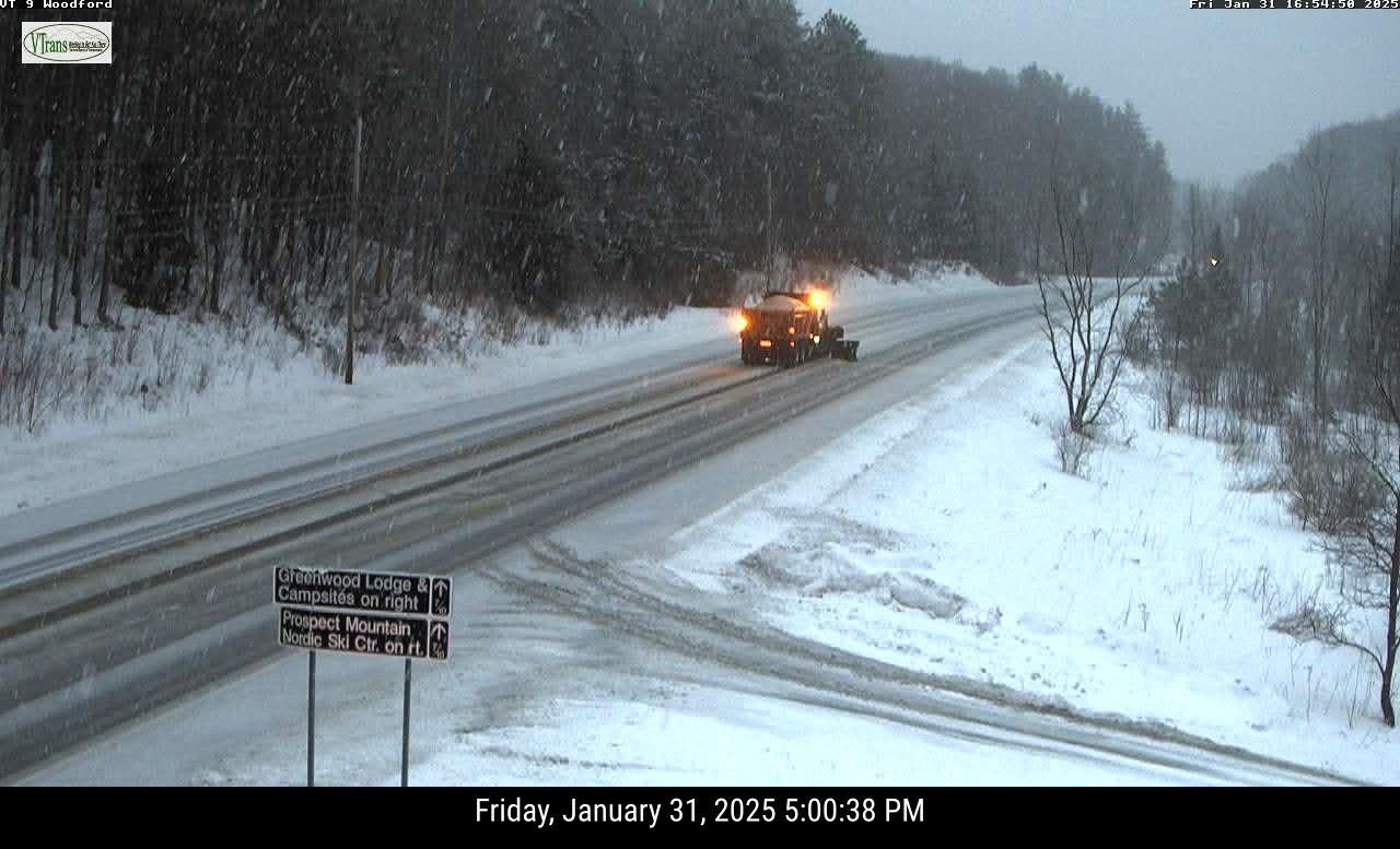
| A Vermont State snowplow was caught on a traffic cam around 5 p.m. today as wet snow fell on Route 9 in Woodford. About a half hour before this photo was taken, the road appeared to be just wet, highlighting the rapidly changing road conditions this evening in southern Vermont. |
The combination of these two things should give you a heads up if you're planning on driving in the state or surrounding areas tonight, especially in southern Vermont.
Most valleys managed to get above freezing today. Filtered sunshine north of Route 2 made for a rather pleasant day.
The further south you went, the worse the weather got.
There's been light mixed precipitation in southern Vermont all afternoon, and conditions will get a little thornier as we go through the evening.
That's because the cold air is just beginning to advance. And the bulk of the precipitation and its most northward extent is coming this evening.
A winter weather advisory is up and running in Bennington and Windham counties - the southernmost part of the state - until 4 a.m. Saturday. A mix of light rain, sleet, freezing rain and snow was in the process of turning to all snow as darkness fell. These areas can expect two to six inches of snow.
Central Vermont - places like Rutland, Middlebury, Montpelier and St. Johnsbury - can expect about 1.5 to as much as three inches of new snow this evening.
 |
| One to four inches of snow is in the forecast overnight in the southern two thirds of Vermont, with maybe a little more than that in high elevations south. Very little snow is in the card for near the Canadian border. Rapidly falling temperatures tonight will make the wet snow on roads in southern Vermont freeze, so it'll be tough going. |
The wet snow combined with water on the roads across southern Vermont will tend to freeze up soon, making roads dangerous.
I saw that starting to happen on traffic cams in higher elevations of the bottom half of Vermont already as of 5 p.m.
North of Route 2, amounts will drop off sharply, but it's a little hard to tell where the cut off between light snow and no snow is going to be. Places up by the Canadian border might not get anything at all.
If you don't have to travel to the southern half of Vermont tonight, I wouldn't bother. The road crews and salt shakers are out, but there's only so much they can do when temperatures crash into the single number and teens overnight.
Saturday will be another cold day as the temperature roller coaster continues. That roller coaster of suddenly warm/suddenly cold weather will continue all week. I'll have more on that in a post sometime tomorrow, as we do also face a couple of storm chances as well.
No comments:
Post a Comment