Monday, February 28, 2022

Huge Australian Floods Kill At Least 7, Major Damage Around Brisbane

Just  one of many flooded neighborhoods in 
Queensland, Australia as record heavy rains hit the area. 
 Australia is having yet another tough go with the weather, this time coming in the form of in some cases record breaking floods that have so far killed at least eight people.  

The flooding in Brisbane was just slightly under the levels of  a 2011 inundation that was then described as a once in a century flood.  Other areas in the region had record flooding 

According to the Associated Press:

"Police warned downtown Brisbane businesses along the river waterfront to evacuate after a pontoon carrying a crane broke from its moorings upstream and began riding the floodwaters toward them.

Multiple emergency flood alerts were in pace for Brisbane suburbs, where 2,145 homes and 2,356 businesses were submerged on Monday. Another 10,827 properties were partially flooded above the floorboards."

The Brisbane River was just two feet below the record crest established in 2011.

In some ways though, this flood is worse than 2011 because the Brisbane River rose more slowly then, allowing better warnings and more time to evacuate and move property. This time, a tremendous amount of rain in a short period of time made the Brisbane and other rivers rise rapidly, notes the Associated Press.

Some areas are experiencing record flooding this time around. The downtown of Lismore in Australia was completely inundated and 15,000 people had been evacuated, the AP reported. 

Video on social media showed storefronts in Lismores downtowns completely under water with water lapping at second floors A McDonald's was completely under water except for the tall sign in front of the restaurant. 

Though the rain was tapering off today around Brisbane, residents of Sydney, also on the Australia's east coast but further south, were warned to expect severe storms and flooding. 

Australia has been violently lurching between destructive floods and severe droughts and wildfires in recent years. Though local weather patterns contribute to this, climate change is making matters worse and more extreme. 

Videos. If you don't see the videos displayed below, click on the hyperlinks in the introductions to each one. 

News video from Australian Broadcasting:


More video from The Guardian


And a news report from the hard hit town of Linsmore. Reminds me of Houston during Harvey back in 2017


March Starts Tomorrow, But Spring Is Still (Kinda) Far Off

Yesterday's snow squall lumbering into St. Albans, Vermont.
Nothing that dramatic for the next few days, but it will
stay cold. 
 After the excitement of yesterday's intense snow squalls, we're back to the winter doldrums this morning here in Vermont.  

Wind chill advisories are up for parts of the state, since temperatures at dawn were at or just barely above zero. Plus, lingering northwest breezes have wind chills near 20 below in some areas.

Despite a fair amount of sunshine, it's going to be way colder than normal today. It's on average in the mid-30s during the afternoon this time of year, but it'll be a good 20 degrees below that.  Tonight will also get down below zero in many areas. 

March won't be coming in like a lion, but more like a polar bear. 

A little storm is still expected to come through Tuesday to help us welcome March with a general one to three inch snowfall. Maybe a little less than that in parts of the Champlain Valley.  Mountains, especially north, could pick up two to five new inches of fluff from this thing.

Typical of early March, questions then arise. Once we get toward the end of winter and toward spring, forecasts tend to get a little iffier with the change of seasons.   On Thursday, another little system either hits us directly with another one to three inches of snow, or swings by the south and just misses.  Take your pick at this point.

We do know it will stay colder than normal all week.

The questions get bigger over the weekend with something of a pattern change. The National Weather Service at this point sees two possible scenarios. One of them is a warm front coming through with a solid thaw and a quick changeover to rain on Sunday.  The other has the warm front struggling against colder air not wanting to dislodge, resulting in another icy mess.

I guess we just stay tuned on that one.


Sunday, February 27, 2022

Wild Snow Squalls Sweep Through Vermont Sunday

Intense snow squall slamming into Route 36 (Fairfield Hill
Road) in St. Albans this afternoon. 
 Well, that was intense. 

As of late afternoon, the entire northern two thirds of Vermont had been hit by an intense line of snow squalls, and as of this writing at around 5 p.m.  the squall line was remaining just as intense as it plunged into southern Vermont. 

My brother-in-law just sent me a photo of super heavy snow in West Rutland, Vermont as of 5 p.m. 

This was one of the most powerful and widespread line of snow squalls I've seen in years in Vermont. The only snow squall I've seen in recent years this wild was a more localized one that went through St. Albans, Vermont way out of season last April 22.

Today's snow squalls were quite brief in any one location and only left less than an inch of snow. But they demonstrated the utility of the National Weather Service's decision to issue snow squall warnings when such weather threatens.  These things were very dangerous if you were out on the roads. 

This was the second time in eight days NWS Burlington was forced to issue snow squall warnings. Similar squalls hit on February 19.

Kudos to the National Weather Service office in South Burlington with their predictions for this. The meteorologists there picked up on this late last week, and at that point began to include the possibility in their forecasts.

By this morning, the South Burlington NWS office had put out a special weather statement saying snow squalls were likely this afternoon.  Their forecasts this morning were exactly spot on for the intensity, timing and location of today's snow squalls. 

Today's snow squalls were not accompanied by phone alerts, like on February 19. As VTDigger explains, the National Weather Service issues targeted warnings, but ran into some technological hiccups. So Vermont Emergency Management picked up the slack, which prompted those phone alerts.

Today, it looks like the National Weather Service didn't encounter any technological problems, so they relied on their tried and true alert system when they issues snow squall warnings today. Your phone thusly didn't buzz for the warnings unless you'd already set it up to do so.

The warnings were certainly warranted this afternoon. The line of storms resembled solid walls of snow as they approached, and created instant whiteouts.  I haven't yet heard of any major crashes due to these snow squalls, but of course it takes time for reports to come out. 

That vertical feature you see in the clouds is a wall of 
snow from an intense snow squall rolling into 
St. Albans, Vermont Sunday afternoon.


Social media in Vermont lit up with images of zero visibility, strong gusty winds and swirling snow.  For what it's worth, you can see my YouTube video of how things went in St. Albans, Vermont today. 

The squall was fascinating as it approached. It came so fast that on video it looked like time lapse, but it was not. They just moved quickly.

So quickly that hardly any snow accumulated. The squall was in and out of St. Albans within 10 minutes. It was so windy it was impossible to measure the accumulation, but it was certainly a half inch or less.  That probably was typical statewide.

Except for southern and eastern Vermont, the snow squalls are done for the day, though there might be a few more snow showers to contend with.

Winds behind the line of snow squalls are gusty from the northwest, so blowing snow is a problem. I imagine this is especially an issue near Lake Champlain. From my perch on a hill in St. Albans, I could see massive amounts of blowing snow on the frozen lake late this afternoon. I'm sure there are local white outs on roads on the islands and near the Vermont shore of Lake Champlain.

Snow squalls like today's can happen anytime from late fall through winter and into spring,   but I have a feeling that today's squalls, and those eight days ago could perversely be a sign of spring. The sun's angle is rising toward the new season.  

The sun's warmth can add instability to the air, and that could have been a factor in the squalls' intensity.

It'll be a cold, wintry week. No big storms are in the offing.  An Alberta Clipper is forecast to give us a small amount of snow Tuesday, but no snow squalls are anticipated with that one. Another disturbance Thursday could give us some squalls, but that's very uncertain. 

Video:

Click on this hyperlink if you don't see the image of the video below. If you do see the image, click on the red arrow, then the YouTube logo for best viewing of the snow squall in St. Albans. 


Another Gusty, Squally Vermont Day

 A heavy snow squall in Burlington, Vermont a few
years ago. Potentially dangerous snow squalls are in
the forecast for Vermont today. 
That light, powdery snow was already starting to blow around pretty well in exposed areas, especially in the Champlain Valley as we get into another gusty, squally changeable winter day. 

Moisture streaming off Lake Ontario was helping to produce some light snow over northern New York and northern Vermont this morning, but that won't amount to much, except for places right near that lake.

The big trouble this morning will be that blowing snow because of the south to southwest winds. Those winds will be increasing al morning, gusting to 40 mph in many areas. Not just the Champlain Valley.  

Be ready for sudden changes in visibility, and icy, slippery, snowy patches on roads where the snow is blowing. This can take you by surprise. You're cruising along at 50 mph on dry pavement and then you're on ice and you car does not have the skills on ice that Nathan Chen has.

As advertised for the past couple of days, snow squalls are a threat this afternoon as a strong cold front comes through. Much like a little over a week ago, you might find your phone buzzing with snow squall alerts.

These snow squalls will be brief, but many will pack a punch. If possible, stay home this afternoon, even as any heavy snow we get will last for perhaps 20 minutes in any one spot and only accumulate an inch or two.  Or, pay attention to the snow squalls.  If you get a warning of one, stay put until it passes and the roads crews get a chance to clear things up.  

If you're driving and get a snow squall warning, get off the highway, especially the interstates, and wait it out in a safe place. The snow squall might be an excellent opportunity to park your car on the way back from the ski slopes and grab a bite to eat. 

At the very least, slow down dramatically and make sure your headlights are on if you drive into a squall. 

Not everyone will get a squall and some will strike harder than others.  The National Weather Service in South Burlington has already seen fit to issue a special weather statement, alerting us to this afternoon's squall risks.

The NWS in South Burlington 'says the squalls will come at us northwest to southeast. They'll hit the Champlain Valley between about 2 and 6 p.m. and be ripping through central and northeast Vermont between 3 and 7 p.m. 

Behind the front and the squalls, winds will stay strong for several hours, but from the west and northwest, not south. That will change the nature of how the snow blows, and will cause drifts and bad patches on the roads in different areas than this morning.

Temperatures will also be crashing this evening, so salt on the roads will become less and less effective.

THE WEEK AHEAD

Forecasts are consistent for a wintry week, even as we head into spring. Well, meteorological spring. 

That's the period March 1 through May 31. That way, climatologists and other scientists have an easier time managing seasonal weather statistics, since they all begin at the first day of the month. Since December, January and February are the coldest months of the year, it makes sense to conclude meteorological winter on February 28 and start a new season March 1.

Although this first week of meteorological spring in Vermont will be more like winter. Temperatures should stay solidly below normal through Friday. In the valleys highs temperatures in first week of March should be in the mid-30s with lows in the teens.

Most days will be about 10 degrees colder than that. At least we won't have any record lows, so that's good.

Two weak systems coming in from the west, one on Tuesday, one on Thursday, should spread light snow over Vermont, but no biggie.

There are signs of a warmup and possibly inclement weather next weekend, but all that is uncertain

Saturday, February 26, 2022

Snowstorm Cleanup Today. Next Up, Of Course, More Wind, Snow Squalls

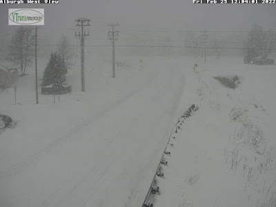
Vermont Agency of Transportation web cam along snowy
Route 78 in Alburgh at dawn today. You can see a little
sea smoke from Lake Champlain in the background
I could hear the snow plows cleaning up around St. Albans, Vermont as dawn broke after yesterday's snowstorm.  

If you're on your way to the ski slopes this morning, do keep in mind we're starting off cold with pretty much everybody in Vermont within a few degrees either side of 0 degrees.

 So, salt isn't working great on the roads to start the day.  The black ice that caused some big crashes yesterday is still there. 

As the sun comes up and temperatures rise into the 20s this afternoon, road conditions will improve nicely. For now. More on that in minute.

SNOW TOTALS

Final snow totals are coming in. The big winners seem to be in parts of Washington and Orange counties, where many places were at or near a foot of new snow. The most I've seen so far is 13.2 inches in high elevation East Barre and a foot at Moretown.  

The northern Champlain Valley did well, too. My total in St. Albans worked out to an even 10 inches. Since the snow was super light and fluffy that 10 inches had compacted down to eight inches by this morning.

The big losers, if you will, were in southern Vermont, where less snow fell than expected.  Shrewsbury, usually a high elevation snow belt town in eastern Rutland County had a middling 6.5 inches. In Vermont's two southernmost counties, where some favored places were expecting at least a foot of snow, the most I saw was 9.3 inches in Brattleboro.

High elevation southern Vermont towns that often score big with snowstorms, like Woodford, Winhall, Readsboro and Athens, picked up six to 8.5 inches of snow. Decent, but not wild.

We're still behind normal for snowfall this winter, despite a February that for most of the state was a bit snowier than average.

For the season, Burlington now has 55.5 inches of the snow for the season to date.  That's 8.3 inches less than normal for this point in the winter. 

CRASHES

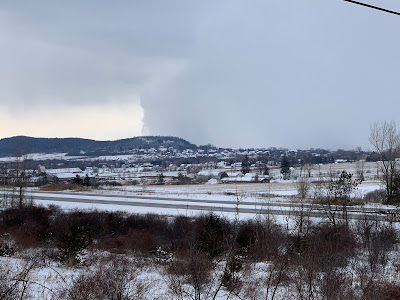
A blue dawn in St. Albans, Vermont this morning
with the fresh snowy reflecting the 
deep blue sky overhead

Also as noted yesterday, there seemed to be more highway crashes than usual for a Vermont snowstorm, especially one that lacked sleet or freezing rain.  Part of it was overconfidence among motorists who are "used to" driving in the snow. 

Another big part was the temperatures. Readings stayed mostly in the teens all day.  It was a cold storm, one too cold for salt to work very well. 

Plus, at the height of the storm, snow was accumulating faster than plow crews could handle.  No fault of the plow drivers, but snowfall rates of one to two inches an hour are not something you can get on top of.

The worst crash was that Interstate 89 pileup Friday afternoon northbound in Milton. This was one of the biggest and worst pileups I can remember in Vermont.  One person died, and a few others had non life threatening injuries. At least 30 vehicles were involved, and the northbound lanes of the Interstate were shut down for something like seven hours. That caused a lot of traffic disruptions during the snowy afternoon commute in much of Chittenden County. 

We had reports of several other crashes and road closures throughout Vermont Friday.  One rollover crash happened right in front of my house in St. Albans. The driver was not seriously injured.

We have more snow and hazardous travel worries on Sunday. 

WIND AND SQUALLS

As noted, today is going to be a gorgeous, if somewhat chilly day for late February, but things go south again Sunday. 

Gusty winds will keep increasing starting overnight actually and getting stronger as Sunday morning wears on. The new snow is incredibly powdery with a low water content, which means it will blow around super easily. 

Winds could gust as high as 40 mph in the Champlain Valley by early afternoon, if not before.  Exposed areas will have whiteout conditions in the blowing snow.

Speaking of whiteouts, snow squalls are still in the forecast for Sunday afternoon and evening.  Another sharp cold front will be diving in from the northwest.  It has enough energy with it to create some pretty powerful snow squalls as it comes through. 

Those squalls can be instantly blinding on the roads, and they are arguably the most dangerous kind of winter weather hazard out there. At least for motorists. The initial snowflakes with the squalls might melt on contact with the road, but then quickly freeze, adding a layer of black ice to the whiteout conditions. 

Black and white. Not good when you're talking about driving around in the winter. 

Strong northwest winds Sunday night will also keep the snow blowing around. Since the winds will be out of a different direction than the morning's gusts, it'll be that much easier for snow to blow around and drift. 

NEXT WEEK

We're getting into the first week of March, and as you know, that month can either be springlike or very wintry.

It looks like Vermont is taking the wintry option for the opening days of March.  It should remain solidly below freezing all week, at a time of year when temperatures often poke upward at least into the mid-30s. 

It doesn't look like there will be any big storms. A little thing coming through Tuesday night or Wednesday will probably lay down a dusting of snow, but it won't be a big deal. The next shot of any snow, rain, ice or schmutz looks like it might come along a little over a week from now. 


Friday, February 25, 2022

Friday Evening Vermont Storm Report: Serious Crashes, North Over-Performs, South Under-Performs

That blur you see in the center right of this photo is a car
that was skidding off Route 36 in St Albans by
my house and landing on its side in a ditch. The driver
was not seriously injured. 
 Today's snowstorm wasn't nearly as "well-behaved" as I thought it would be. 

The worst part of it was car crashes. As of late this afternoon, Interstate 89 northbound between Colchester and Georgia, Vermont was closed due to what sounds like a horrific crash in Milton.  

WPTZ reports at least one person is dead and multiple vehicles were involved. A coach bus was on its way to pick up stranded people, which means there has to be quite a few. No further details were available as of this writing.

Elsewhere, Route 78 in Swanton was closed earlier this afternoon due to a tractor trailer crash.  One lane of Interstate 91 in Hartford was closed for a time due to another crash.  On my road in St. Albans, a steep section of Route 36, I watched earlier this afternoon as a car lost control slid off the road, became airborne, then landed on its side in a ditch.

I helped the driver out of the upended car and he did not appear to be seriously injured. 

My theory is the snow was dry and people felt safer on that type of snow. It was so powdery that it was blowing off well traveled roads like the Interstates. Unfortunately, before the snow could blow off the roads, pressure from tires driving over it created a very thin layer of black ice,

If you plan on driving anywhere in Vermont this evening, don't. But if you must, be extra cautious, even as the snow tapers off.

Vermont Agency of Transportation web cam showed a 
snow-free Route 78 in Alburgh around 7 a.m. today.....
The other aspect of this storm that made it not as well behaved as it could have been was the distribution of snow accumulations. Totals aren't final yet, as many areas of Vermont still have an inch or two to go.  

But it appears southern Vermont got quite a bit less snow than forecast. Northern Vermont got about as much as forecast, except for the northern Champlain Valley.  Franklin and northern Grand Isle counties seemed to hit the jackpot.  

There, totals were closing in on ten inches by early evening. As of 5:45 p.m., my yard in St. Albans had received 9.5 inches of snow. Swanton reported 9.5 inches as of 2 p.m., when it was still snowing at a good clip there. Swanton probably ended up with close to a foot. 

Elsewhere in the north, amounts were clustered tightly around 6 to 8 inches as of 4 p.m, so the predicted snowfall of 7 to 10 inches of snow will verify. 

In far southern Vermont, 8.5 inches of snow was reported at Winhall and a little over six inches was reported at Readsboro and Landgrove as of late afternoon. They'll probably pick up only another inch or so of snow, so those predictions of a foot of snow might not happen. Except maybe up toward favored locations around Ludlow, Mount Holly and Shrewsbury. We'll see. 

It looks like the burst of snow this morning in southern Vermont didn't last as long as forecast. Meanwhile, in the north, especially in the upper Champlain Valley and adjacent New York, the heavy snow began earlier than forecast. The heavy stuff was forecast to blow in around 11 a.m, but it was already snowing hard at 8 a.m. The Champlain Valley snow got lighter at around 4 p.m., which was about the time that was expected to happen. 

Snow is still expected to gradually wind down over the next few hours. It'll be over by midnight at the latest. 

We're still going to have a perfect winter day tomorrow, with sunshine, coldish but not frigid temperatures and light winds. 

Sunday is looking problematic.  

....and that same stretch of Route 78 in Alburgh looking
much, much different shortly before 1 p.m. today. 

The first problem Sunday will be wind, especially in the Champlain Valley. The snow that fell today is remarkably light and fluffy. It won't take much wind to blow it around. 

Winds are now expected to gust to 40 mph in the valley.  That will cause blinding ground blizzards in exposed locations, and surprisingly deep drifts on roads

I expect they might actually close the Route 2 causeway between Colchester and South Hero, as there will be vast amounts of powdery snow blowing off the ice covered surface of Lake Champlain. 

The other problem Sunday is a rising chance of brief but heavy snow squalls. First of all, the squalls cut visibility to zero very abruptly, making the chances of highway pileups pretty high. Additionally, temperatures are expected to rise to between 30 and 35 degrees ahead of the likely squalls.

So the first flakes that fall in the squall will melt on the highways. But rapidly falling temperatures will instantly freeze that water, and the blinding snow will accumulate on top of that. So when you hit the brakes when the visibility disappears, you won't stop. You'll just slide into the wreck ahead of you. 

I'll update this as we get closer to the event. 

"Well-Behaved" Snowstorm Is Here For Your Friday. - A Very Snowy Day

The National Weather Service snowfall map, last updated
early this morning. Still a general 6-12 inch storm, but totals
bumped up ever so slightly in northern areas
compared to previous forecasts. 
 UPDATE: 8 a.m. 

Even well behaved storms can surprise a little bit.  A burst of heavy snow has come into the Champlain Valley as of shortly after 7 a.m.  Burlington and St. Albans had heavy snow falling at times.

This heavy snow is earlier than forecast. Though the snow might lighten up for a time this morning, it is still expected to come down pretty heavily again late this morning and this afternoon.

This morning's commute in the Champlain Valley is probably even a little worse than earlier expected.

PREVIOUS DISCUSSION

Snow started to fall here in earnest around my place in St. Albans, Vermont at around 6 a.m. setting the stage for a  very snowy Friday.  

It was only snowing quite lightly outside my window early this morning. There's even been a few brief breaks with no snow falling. The main show for me is later this morning and afternoon.

Southern Vermont is the early winner.

Overall, forecasts are very much steady with six to 12 inches of snow expected.  The deeper snow, and the somewhat higher water content snow is in southern Vermont. Everybody gets powdery snow out of this, but the fluff factor up north will be greatest.

The snow did arrive about an hour later than anticipated in most of Vermont, because the initial flakes evaporated in very dry air on the way down.  But those early flakes moistened up the air, so it was snowing pretty much everywhere in Vermont by 7 a.m.

Driving to work will be a bit of a challenge this morning with the snow. That's especially true in southern Vermont, where the snow started earlier and has accumulated more. The drive home will be even tougher in the north this afternoon, but maybe a little easier down south.

Because of the road conditions, a lot of schools are closed in Vermont today. 

This is essentially a two part storm. Part One is underway now, focusing on southern Vermont this morning.  That snow is more directly tied to the storm center itself. The storm is pushing wet air up the sides of the southern Vermont mountains, and that rising air is unleashing that moisture as pretty heavy snow.  

Vermont Agency of Transportation traffic cam showed heavy
snow falling along Route 9 in the southern Vermont town
of Searsburg at around 6:15 a.m....

That snow will lighten up, but probably not stop, in southern Vermont this afternoon.

Northern Vermont is kind of on the edge of that first wave, which is why snowfall rates aren't exactly impressive for the first part of this morning. 

I'm also detecting some "shadowing" on the west slopes of the central and northern Green Mountains, where the moisture coming in from the south and east is being partly blocked temporarily by the mountain range.

By late morning and this afternoon, the upper level support lagging behind the parent storm should enter the northern half of Vermont.  That will help air rise more vigorously. Rising air leads to precipitation.  In this case, the forecast indicates snow in northern Vermont at a rate of one to two inches an hour.

Such snowfall rates, as I've noted in earlier posts, is impressively heavy.  If anything, forecasts for the amount of snow out of this have been bumped up a little bit in northern Vermont. Where some previous forecasts had called for six to seven inches of snow out of this, forecasts for northern areas now are in the seven to  nine inch range.

We'll go back to a lighter snowfall late this afternoon or early evening, and the snow is forecast to end altogether sometime between 8:30 and 10:30 this evening. 

...but as of 6:15 a.m. the snow hadn't quite reached Route 78
in Alburgh in the northwestern tip of Vermont. That would
change soon as snow began there shortly after this image grab.
Saturday is still forecast to be a stunningly beautiful day for playing in the snow with sunshine, light winds and comfortable temperatures in the 20s.

Sunday is looking a little tricky, though. South to southwest winds will pick up, especially in the Champlain Valley.  That light and fluffy snow on the ground will blow around, causing drifts and local problems with visibility. 

On exposed areas of the Champlain Islands, snow blowing off the frozen lake could really cause some whiteouts.

Speaking of whiteouts, the National Weather Service is telling us snow squalls are a good possibility during the midday and afternoon Sunday.  Our phones might be buzzing with snow squall alerts like they were last Saturday. 

Keep those squalls in your travel plans, as you don't want to be on the highway when one of those hits. Visibility goes to zero quickly and the chances of a crash go up exponentially during those things. 


Thursday, February 24, 2022

Steady As She Goes With Friday Vermont Snowstorm

The National Weather  Service in South Burlington has been
really consistent with their snowfall prediction maps. This
one, issued late Thursday afternoon, is remarkably similar
to previous forecast maps. Vermont gets a general 6 to 12
inch snowstorm, with the most down south. 
 Forecasts have stayed remarkably consistent with the snowstorm Vermont is anticipating Friday. 

All the predictions keep pointing to a general 6 to 12 inch snowfall, with a gradient from north to south, with the far southern Green Mountains still expected to pick up the most snow.  

There's a lot of things about this storm that are "traditional," in that they are so typical and familiar to anyone who has lived in Vermont a few years. There will also probably be a few surprising things. 

One of the familiar aspects with this storm was the bright, cold weather today.  The calm before the storm weather is totally typical of a Vermont snowfall.  The chill the clear blue skies brought us today means there's plenty of cold air available to keep this as a snowstorm, with no mix.

High pressure to our north and northwest will continue to assure us of that chilly air for the storm. 

The size of the storm is pretty average for a Vermont winter.  How many times can you remember a forecast of 6 to 12 inches of snow?  Too many to count, at least for me. 

If there's anything odd about this upcoming storm, it will be that'll define itself as a quick hitter. The focus will be a brief, but hard thump of snow we'll probably get.  

The National Weather Service in South Burlington says there will be a three to six hour window during the day in which the snow will really come down. That brief window will make up the bulk of the snow.

The snow will start around 2 a.m. Friday in the southwestern corner of Vermont and will spread northeastward, hitting the Northeast Kingdom by 7 a.m. 

That means the morning commute will have its issues, and we'll have to watch out for school closures. Especially given what's predicted during the day.  

The National Weather Service also released a map
depicting when the snow will start. Most of us will
start seeing snow before dawn Friday. 

Except along south and east facing slopes of the Green Mountains, I still think the snowfall rates for the first few hours of the storm won't be impressive.

But a clue as to what might happen today occurred in northern Arkansas and southern Missouri today. They had thunderstorms with freezing rain, sleet and hail. 

 That is indication there was an impressive area of rising and spinning air. The more vigorous what meteorologists call a vorticity maximum, the heavier the precipitation.

The National Weather Service in South Burlington is thinking this feature will go right over us roughly between 9 a.m. and 4 p.m. Friday.  That's true even as the storm center itself passes to our south. The storm track south of use ensures we'll stay cold enough for snow as the best conditions for heavy precipitation passes through. 

We won't get anything nearly as dramatic as what happened in Arkansas. Sorry, thundersnow is unlikely. But that's when the snow will come down really, really hard across most of the area. 

Snow will come down at a rate of one to two inches per hour, or even a little more in a few spots. That's awfully heavy snow.   I know Vermont state and municipal snow plow drivers are really, really good.  Even so, they won't be able to keep up with that. Expect super challenging driving conditions during the day Friday.

One aspect of this storm that's pretty unpredictable is the chance an especially heavy band of snow setting up somewhere over Vermont.  If this snow band sets up anywhere in Vermont, a few places will "overachieve" and get more snow than expected. 

With temperatures expected to barely make it to 20 degrees for most of us tomorrow, the snow will be fairly light and fluffy. It won't be like those storms where when you shovel, it feels like you're moving wet cement. It'll be Champagne powder, essentially.  Especially in colder northern Vermont. 

Once that atmospheric feature we're watching goes through, we'll revert back to light snow, which will end overnight Friday. Don't expect much additional accumulation after sunset.

Saturday will probably be the nicest winter day of the year, even better than the Saturday after the last big storm in early February.

Unlike early this month, the entire state will share in the snow.  (The last time, southern Vermont had a lot of sleet and freezing rain). Also, Saturday will be slightly warmer than that Saturday in early February.  This Saturday will get well up into the 20s for a lot of us. It will be sunny, and the higher late February sun angle will feel really nice. Unlike most days this month, Saturday will feature light winds. 

I have a feeling a LOT of people will call in "sick" from work Saturday to enjoy the powder day. Can't blame 'em.


Climate Change To Bring More Destructive Hurricanes To The Northeast

Flooding from Tropical Storm Irene overwhelming a 
Waitsfield, Vermont farm stand in 2011. If new research
is true, Irene was not a worst case scenario in our 
neck of the woods. 
 Hurricanes need very warm water to survive.  

New England isn't known for its toasty ocean waters. That's why our hurricanes are pretty few and far between, right? 

But the waters off the Northeast United States are getting warmer with climate change, and that's not good news if you lack enthusiasm about hurricanes.  

Of course it takes scientists to determine whether the warmer water will give us New Englanders more tropical trouble. The answer, according to new research, is probably. 

The research suggests that hurricanes that pack a major one-two punch of high storm surges and serious inland flooding will be on the increase. Especially in New England, apparently. 

The hurricanes that are the subject of the research - that combination of storm surges and heavy rains, produce what are regarded as compound floods.  These compound floods are the worst of the worst. In these cases, walls  of water surging in from the oceans combine with surges of water from areas just inland due to extreme rains.

Technically, Hurricane Irene's cataclysmic floods in Vermont and elsewhere in the Northeast wouldn't even quite qualify as such a storm.  Irene did cause extreme inland flooding in Vermont and parts of New York and Massachusetts, but the hurricane's storm surge along the coast was damaging, but not a full-bore catastrophe. 

Instead, think 2017's Hurricane Harvey in Texas.  When it first hit the Texas coast, a large share of its destructive power was its storm surge.  Then, as Harvey slowly wound down, it unleashed unprecedented rains on eastern Texas, including Houston, the nation's fourth largest city. 

We don't want more Harveys, but the research suggests just such a scenario is in our future. 

As NPR reports:

"Scientists at Princeton University and Massachusetts Institute of Technology wanted to know if such storms will happen more frequently in the future. They began by looking backward, to see how frequently hurricanes cause both extreme storm surge and extreme rain. They found that, in the past, such storms have been rare. Along both the Gulf Coast and the East Coast, it has been unlikely that a person would experience such a storm in the course of their lifetime."

However, within a century with climate change factored in, hurricanes that cause these big "compound floods" will be much more frequent, with most people experiencing them within their lifetime. 

The largest increase in risk is in the Northeast and Mid-Atlantic States.  In those areas, a storm that had a less than 0.1 percent chance of happening in any given year would have a 10% chance of occurring in a given year, the researchers found.  

That's actually a huge increase. And also a huge problem because coastal areas from Virginia north are so thickly populated.  A storm of that magnitude would necessitate enormous, potentially chaotic evacuations. And potentially hundreds of billions of dollars in damage in each of these mega storms. 

We're not immune from this here in Vermont. There's no coastline here, obviously, so no storm surges. As we learned in Tropical Storm Irene, though, a hurricane or tropical system wandering into New England can cause horrendous damage way inland, in places like Vermont. Worse, if the research is correct, Irene wasn't even the worst case scenario for the Green Mountain State. 

I also want to see more studies on more middling tropical storms and hurricanes. It stands to follow that destructive, but not cataclysmic tropical storms would also become more common in places like New England.

We've had what I would regard as at least circumstantial evidence that "regular" tropical storms are harassing the Northeast more than they once did.   Tropical Storms Elsa, Henri and Ida all affected Nw England in 2021, so that's three in one year.  Luckily, though the three storms caused damage, they weren't cataclysmic. At least in New England. 

Will New England suffer more hurricane seasons like 1954, when Hurricanes Carol, Edna and Hazel all caused damage in New England? Those compound flood storms in the research I talked about in this post are bad enough. Repeated, somewhat more modest sized hurricanes would cumulatively at least as much damage and trouble. 


Vermont Winter Storm Warning As Snow Forecasts Remain Unchanged

The obligatory snow forecast map from the National Weather
Service in South Burlington. If it verifies everybody in 
Vermont gets at least six inches of snow, with closer
to a foot in the southern third of the state.
 As expected the winter storm watch that had been in effect for Vermont was upgraded to a warning for tomorrow's snowstorm.  

Overall predictions for accumulation are unchanged, with six inches or a little more than that near the Canadian border to near a foot in much of southern Vermont. 

The snow moves in well before dawn in southern Vermont and will spread northward, as is usual in these cases.  The morning commute will be challenging, especially in southern Vermont. During the morning, it might not be snowing all that hard up north, but enough to make the roads slick enough.   

As the National Weather Service in South Burlington explains it, southern Vermont will benefit from its closer proximity to the storm. Lots of moisture will ride up over colder air covering central and northern New England. That air will get even more lift because it will have to rise up and over east and south facing slopes.

Up north, the moisture supply isn't quite as good, but a weather disturbance tagging along with the main storm will add some great lift to the air during the late morning and afternoon.  You want rising air to set off precipitation, so the snow will come down hard from a little before lunch to dinnertime.

The trip home from work will be challenging late Friday afternoon because snow might be coming down at a rate of an inch per hour or more.  At that rate, it's hard to keep up with the plowing.

The snow will be powdery everywhere in Vermont, but even more so up north. The fluff factor will be really high north of Route 2, so that eight inches or so of expected snow will compact down to five or six inches or even less after a few days. 

If you melt the forecasted snow down, it would amount to less than a half inch along and north of Route 2, but more than three quarters of an inch along and south of Route 4. 

At this point, no sleet or freezing rain is expected anywhere in Vermont, including the far south. 

That, of course, is a very good thing. We've had enough ice this winter. 

We're lucky. The storm that is creating our snowy Friday is mainly an ice storm for much of the nation. Sleet and freezing rain has caused oodles of problems across Texas, Oklahoma, Arkansas and on into parts of the Midwest. 

An ice storm warning is up for parts of Pennsylvania tonight due to expected heavy freezing rain. 

Back here in Vermont the snow will end Friday night and it's still looking like a great weekend to go out and play in the snow. 

With a caveat.  We might be setting up for another round of snow squalls on Sunday, like we saw last Saturday.  So if you're out and about, perhaps on the way to or from the ski slopes, you might encounter some whiteouts on the roads, so be aware of that. 

Since we're heading into March next week, thaws are getting easier to come by, but in this case, the snow will last for awhile.  Temperatures are forecast to stay near or below freezing through next Wednesday. 

Wednesday, February 23, 2022

Weird Temperatures A Nationwide Thing Today, Also Update On Our Snowstorm

We're still on track in Vermont for a decent sized snowfall
on Friday. Current forecasts from the National Weather
Service in South Burlington have all of the state receiving
at least six inches of snow, with some southern
Vermont spots getting up to a foot of it. 
 Today turned out to be one of those days in which temperatures were all over the place across the nation. 

Different parts of the United States often have record high and record low temperatures on the same date. 

The contrast between the Northwest and the Northeast today were pretty impressive, though. The changes going on in some places are pretty wild, too. 

We saw that here in Vermont, where, as forecast,   the weather here   is completely different late this afternoon as it was this morning.   

For example, we can start with the tale of two Portlands. 

Normally mild Portland, Oregon was 26 degrees this morning, which was just two degrees shy of the record low for the date. Meanwhile, in Portland, Maine, usually home to much more rugged weather, the record high today was 66 degrees, smashing the old record of 61 degrees and coming within two degrees of the all time record high for the month of February. 

Hartford, Connecticut, had a record high of 70 degrees today but was simultaneously under a winter storm watch for Friday.  Boston also reached 70 degrees. 

The cold in the United States encompasses a far larger area than today's fleeting heat in the Northeast. This is probably the most impressive cold wave this entire winter.  

The cold extends from California to Colorado to the Upper Midwest.  Alerts have been upgraded to a hard freeze warning in California's Central Valley, where record lows are expected tonight and tomorrow night. 

In usually temperate places like Santa Rosa, California, officials have set up warming shelters because of the frigid weather. Frost and freeze warnings extend into the San Francisco Bay area, which is also expecting record low temperatures. 

Up in Washington State, record lows today included 23 degrees in Seattle and 14 in Olympia. Denver, Colorado reached a record low of 7 below.

The worst weather with this cold outbreak today was in northern Texas, Oklahoma and Arkansas.  Thundersnow storms roamed around Oklahoma as temperatures this afternoon held in the teens. Normal highs there this time of year are in the mid-50s. 

In Arkansas, heavy sleet and freezing rain was also accompanied by thunder. The freezing rain will continue into Thursday, which promises lots of damage to trees and power lines. 

This is the the same storm that is going to give us our snowstorm here in Vermont Friday.

VERMONT SET UP

Temperatures, as expected, crashed in the Green Mountain State today.  Here in St. Albans, it was in the mid-50s at 8 a.m. but back below freezing by 12:45 p.m. It took longer to get cold in the rest of Vermont.  Burlington finally dipped below freezing after 4 p.m. Montpelier dropped from the low 50s at 1 p.m. to the 30s at 2 p.m.. 

Flurries have been ongoing here and in much of northern Vermont all afternoon, and we now have a dusting of replacement snow.  We're still on track to receive a bunch more replacement snow. 

It'll stay cold tonight and tomorrow, so all the mud out there will freeze back up. 

While the entire state remains under a winter storm watch, there's only been subtle trends so far in the overall forecast for the storm. The National Weather Service in South Burlington has detected a slight northward trend in the computer guidance for this storm, so that would increase the already good chances that areas of Vermont north of Route 2 will still get a decent amount of snow. That would probably be in the 6 to 9 inch range, which is fine.

Southern Vermont still looks like the winner, especially along the south and east facing slopes, which could clock in with a foot. 

The National Weather Service says we might have to be a bit patient with this storm as it starts. Snowfall during a good portion of Friday morning might be pretty light and wimpy. Then, during the day, especially from late morning to late afternoon,the snow would really come down, if current forecasts hold.

That would mean an inch an hour, so six inches or more could pile up pretty quickly. Speaking of quick the storm is a fast mover, so the snow will quickly taper off Friday night. 


Welcome To Spring! Oops!, It's Gone, Single Digit Cold And A Snowstorm On Our Doorstep.

A rapid snow and ice melt.  Part of my yard in St. Albans
Vermont looked like this late Tuesday afternoon......
 As expected, we awoke to springtime in Vermont this morning. Temperatures for most of us were in the 50s, the brooks were running full and strong and where did the snow that was in our yards yesterday go?  

This spring is very, very brief, as it will be in the 20s by this afternoon, single digits tonight, and -  the piece de resistance - all of Vermont is under a winter storm watch. 

As of 8 a.m. the sharp cold front was on our doorstep.  It was a balmy 56 degrees in Burlington and 59 in Montpelier and Rutland out of ahead of this front. These would be record highs except or the extreme, bizarre February heat wave we had back in 2017 that made today's record highs ridiculously high. 

Temperatures as of 8 a.m. were falling fast everywhere west of Plattsburgh, and we'll get into the crashing temperatures any minute.

There might be a few scattered rain showers as the front comes through, but if there are, they'll hardly amount to anything. In the unstable, cold air behind the front, a few snow showers might crop up but again, don't worry about it.

Flooding is still a threat today as ice jams continue to move about on swollen rivers.  Rainfall was actually a little less than forecast last night, but snow melt really took charge with the runoff into brooks and streams. Route 4 around Woodstock was occasionally under water because of an ice jam on the Ottaquechee River. At last report Route 4 remained open, but there's no guarantees with ice jams. 

After a quiet and cold Thursday we have our snowstorm to talk about.

Before we get into that, can we look at Arkansas and Kentucky again?  Hear me out. All winter, those two states have been buffeted by severe thunderstorms, destructive tornadoes, repeated, often serious flooding and damaging winter storms. 

The worst of seemingly every storm this winter has hit that area.

True to form, the storm that will eventually give us our Friday snowstorm will cause havoc in Arkansas and Kentucky first. Western Kentucky and much of Arkansas, especially the northeastern part of that state, are in for a destructive ice storm over the next couple of days. 

......The same spot in my yard at 7:30 a.m today. That ice
was slick underfoot. I'm glad a lot of it is gone! 

Ice might accumulate up to three quarters or even maybe an inch, which would cause a lot of damage to trees and power lines. Meanwhile, much of Kentucky faces a new round of flooding from this storm. 

The storm will lift northeastward, then jump to the coast south of New England Friday.

SNOWSTORM

Vermont looks as if it will be in the sweet spot for snow, especially southern Vermont.  There, up to a foot could fall.  Northern Vermont will probably see something closer to six inches. That's because the storm will have to overcome some dry air first to get the snow going, and the north will be a little further from the storm, so less moisture will be available.

One wild card: If upper level support is weaker than expected for rising air during the storm in northern Vermont, that would cut the expected accumulation by a lot.  If the storm whiffs anywhere in Vermont, it would be the north. But for now, it looks like areas north of Route 2 should still see a decent six inches or so. 

Generally speaking for most of the rest of Vermont,  expect 6 to 10 inches of snow. Forecasters don't think we'll deal with any freezing rain or sleet, which is a pleasant change considering how this winter has gone. The snow will be powdery, so it won't be all that hard to clean up. 

Snow is forecast to roll in before dawn in southern Vermont and start around the morning commute up north. It'll snow all day, so the trip home Friday evening will be a bit of a chore on the roads, too.

The weekend should be pleasant enough, with highs in the 20s Saturday and maybe low 30s Sunday ahead of an Arctic front.  So if you want to pick a weekend to play in the snow, this would be it. Even if there's just mud and bare ground outside your door today. 


Tuesday, February 22, 2022

Weird Temperature Regime Focus On Storm Tonight, Tomorrow.

I tried to take advantage of today's mild weather to to
do some outdoor work in my St. Albans, Vermont yard,
but it was awfully slick underfoot after a winter of
repeated icy storms. 
6 p.m. UPDATE

That weird temperature contrast across far northern Vermont and New York is creating headaches for forecasts.

The National Weather Service in South Burlington has just issued a new winter weather advisory for western Franklin and Grand Isle counties, Vermont and northeastern New York around Plattsburgh. 

Freezing rain where it stayed cold today right along the Canadian border has taken hold are dealing with freezing rain this evening. 

It also looks like places that were previously warm today, like St. Albans and North Hero, Vermont and Plattsburgh, New York, might suffer from cold air drainage from southern Quebec, which could lead to a few hours of unneeded freezing rain. 

It'll be touch and go as to how far south the cold air gets. St. Albans and Plattsburgh are right on the edge. Plattsburgh was still in the mid 40s at 6 p.m and St. Albans still seemed mild, so fingers crossed for those two towns! 

This won't last long.  Warm air will decisively win out within a few hours and temperatures will rise to well above freezing levels later this evening.  

PREVIOUS DISCUSSION

As a rain storm approached Vermont this afternoon, temperatures were, well, weird. 

Which makes for a challenging evening forecast near the Canadian border, though most of us are going to avoid ice. A good thing really. 

As the rain has been moving in late this afternoon, a really extreme temperature contrast has set up along the Canadian border.

At my place in St. Albans, in northwestern Vermont, temperatures have been in the mid-40s all afternoon. Only about 12 miles to my north, in Highgate, temperatures never got past 35 degrees, and it was 32 degrees there as the rain was starting, so a bit of freezing rain is in the offing there. 

At 1 p.m., it was 45 degrees in Burlington and just 34 across the pond in Plattsburgh. But two hours later, Plattsburgh was even warmer than Burlington at 49 degrees. Meanwhile, an ice storm was underway in far northwestern New York with temperatures in the low 20s. Montreal was just 19 degrees at 4 p.m., where freezing rain had just started. It's going to be a lovely commute up there in Montreal this afternoon.

It looks like places that are already warm will stay that way overnight, so if you've seen temperatures in the upper 30s to upper 40s  this afternoon, the risk of any freezing rain this evening is very low. 

In the cold spots, sorry, but you're in for at least a few icy patches.

Since the main storm center is still expected to go by to our west, even the places that are coldest late this afternoon will shoot up into the upper 40s and low 50s overnight A couple places in Vermont could approach 60 degrees as temperatures rise overnight.

Again, that's not exactly the way it's supposed to work, but oh well. 

The forecasted amount of rain hasn't changed since this morning, and the rain alone wouldn't be enough to cause much flooding. But he very warm overnight temperatures will melt snow pretty rapidly, so the flood watch is still in effect. Any flood problems that crop up overnight and tomorrow will mostly be caused by ice jams shifting in the rivers

Tomorrow will be another backwards temperature day.  It'll basically be spring when you wake up.  We'll have hints of sun and temperatures will be close to 50 degrees for many of us.  By afternoon, behind a sharp cold front, it will be winter. 

An example of how sharp the temperature fall will be comes from the forecast for Montpelier.  The National Weather Service expects a temperature there of 57 degrees at 10 a.m. and 27 degrees at 7 p.m. 

Any time you get temperature contrasts, chances are you'll also get wind.  Depending upon how temperature inversions play out overnight, it could get pretty windy in high elevations and the Champlain Valley.

I think the strongest south winds in the Champlain Valley will come late tonight or early tomorrow morning,  after the burst of rain ends and we get firmly, briefly into the warm air. 

Behind the cold front tomorrow, west and northwest winds will also get strong and gusty.

SNOWSTORM?

With all the weather happening tonight and tomorrow, Friday's weather is getting short shrift. 

Signs are increasing that we might have a really decent snowstorm on our hands. Early guesses are five to 10 inches, with possibly more in the high elevations of southern Vermont.  The good news is that it appears it will be just snow. No ice, no mix, no rain, no schumtz. Just snow. 

This will replace a lot of the snow we've lost in last week's thaw and the one overnight. And it will cover up the ice that is on the ground from all those mixed storms we've had this weird winter. 

It'll stay cold for several days at least after this expected snowstorm, so you'll have time to play in it. 

We'll have more on that snow in the tomorrow and Thursday 

Madagascar Is A Hurricane Magnet This Winter

Satellite view of the fourth cyclone to hit 
Madagascar this winter. 
 Madagascar, the island nation off the east coast of Africa, has been hit by three deadly, destructive cyclones this winter. 

Today, a fourth cyclone will strike Madagascar.

Cyclones - which are what hurricanes are called in the Indian Ocean - occasionally strike Madagascar, but this is ridiculous. 

The newest cyclone is named Emnati. It was the equivalent of a category 4 hurricane on Sunday, weakened only a little Monday when it encountered slightly cooler water temperatures, and the storm went through an eyewall replacement cycle, notes Yale Climate Connections. 

The warmer the water, the more likely a hurricane or cyclone will maintain its strength or get more powerful.  Hurricanes often go through eyewall replacement cycles, in which the ring of powerful thunderstorms surrounding the eye of the storm fall apart, only to be replaced by a new ring of scary storms.

During the eyewall replacement cycle, hurricanes usually get weaker, but once the cycle is complete, they can get stronger again.  If this cycle completes itself, Cyclone Emnati would maintain a Category 3 strength, as water temperatures near the Madagascar coast are at 82 degrees, warm enough to make a hurricane happy. 

Category 3 storms have winds of 111 to 130 mph and storm surges of 9 to 12 feet above normal tide levels.  If this cyclone maintains at least Category 2 strength, with winds up to 110 mph, that would make four Category 2 or stronger storms this year. 

I'm getting into the niceties here of hurricanes and cyclones, when in this case, it doesn't really matter of Cyclone Emnati is a category one, two or three.

Yale Climate Connections notes that there is a very slight silver lining to this particular cyclone. Unlike the other three cyclones this season, Emnati is expected to hit southern Madagascar.

The earlier cyclones hit further north, and southern Madagascar is having a drought.  Cyclone Emnati will bring beneficial rains, but it will be too much too quickly. 

There's been a lot of deforestation in recent years and decades on the island and this makes floods worse. The denuded, steep slopes there can't hold onto water nearly as well without trees, so that causes great gushes of water and mud in heavy rains, like what is expected from Enmati. 

Although this is a terrible cyclone year for Madagascar, it so far hasn't broken the record. In 1975 five named storms and three tropical depressions hit the island, says Yale Climate Connections.  

It is also unclear whether climate change is influencing this busy storm year in Madagascar. 

Rain, Ice Jams, Temperature Swings, Snow And Wind Stay Consistently In Vermont Forecast

Rain and thawing overnight in Vermont could move
ice around or cause ice jams, as was the case in this
scene near Enosburg in January, 2018
Forecasts haven't changed much overnight for the active weather we're expecting today through the rest of the week.  

So if you're in Vermont, be prepared for rain, freezing rain in some spots, gusty winds in other spots, wildly fluctuating temperatures and a mid-sized snowfall to cap it all off at the end of the week. 

Yesterday's weak cold front did drop most of us in central and northern Vermont overnight and this morning. For those of us west of the Green Mountains, this won't be a problem.  The front is starting to work back north and south winds should bring temperatures above freezing by the time rain arrives this afternoon.

The cold air in eastern Vermont will be tougher to scour out, so some of the rain will freeze on impact this afternoon and evening.  This is going to be tricky for those of you out driving in that area.  Some spots will be above freezing, and just a short distance away, it won't. So you'll be cruising along on wet pavement and suddenly you're on a skating rink.  

Just assume everything you're driving on later today in eastern Vermont is ice, and act accordingly.  Once again the freezing rain won't be enough to cause much damage to trees and power lines.

This isn't a blockbuster rain storm. The National Weather Service is expected a quarter to three quarters of an inch of rain, the least in generally in the Champlain Valley. A few spots in southern Vermont could get nearly an inch of rain. 

Normally, a rain storm of this size wouldn't raise flood alarms. But, since rivers are running kind of high from last week, and there's still potentially dangerous ice jams still lurking out there, and snow melt will be added to the mix, that's enough to keep the flood watch going from tonight through late Wednesday.

Those ice jams can cause some very sudden, damaging floods, as we saw along the Ausable River in the Adirondacks last Friday, so it's something to keep your eye out on. 

The storm last Thursday and Friday turned much of 
my driveway into an ice rink.  Either I hope the thaw tonight
melts it some, or I invite Nathan Chen over for a visit. 

Temperatures will do the opposite of what they're supposed to do tonight and Wednesday. They'll keep going up overnight, and they'll peak in the morning, at about the time we usually have our low temperatures for the day.  Then they'll fall during the day, so the afternoon will turn decidedly colder. 

When you leave for work amid springlike conditions tomorrow morning, remember winter will have returned by the time you come home in the evening. 

It's been a very windy month, so let's have those strong gusts continue!  Overnight, parts of the Champlain Valley could have south winds gusting to 40 mph.  Once the cold front comes through tomorrow, we'll have gusts of 30 to 40 mph from the northwest, with the highest winds in eastern Vermont. 

If you're bummed about the snow melting away, we still have a little good news. After a quiet and cold Thursday, that mid-sized snowfall is still expected to scoot through on Friday with a few to several inches of snow. At this point, the deepest accumulations look like they'll be in southern Vermont. 

ELSEWHERE

At least one tornado touched down in Arkansas last night amid the severe weather in the South. More severe storms, and possibly a tornado or two, are possible in Kentucky, Tennessee and Mississippi today. 

Flooding is a big issue today, especially in and around Kentucky. 

The area around Mayfield, Kentucky can't catch a break. The town was all but destroyed by a tornado in December, then was hit by substantial flooding earlier this month, and is now under a new flash flood warning as I write this at 8 in the morning.  

Flood watches today extend from Missouri to Vermont.

Further north snow, wind and bitter cold have enveloped much of the Plains and Midwest. Blizzard conditions shut down Interstate 29 and other highways in North Dakota on Monday.  Wind chills were as low as 50 below in North Dakota this morning. 

Meanwhile, in central Michigan, an ice storm is threatening to bring down trees and power lines and is making travel next to impossible. 

In California,  freeze warnings are up in the agricultural Central Valley, where overnight lows could challenge records.  Crop damage is inevitable with this cold outbreak. 

So you see, the weather is going to be a bit challenging here in Vermont the next few days, but not as bad as in a lot of other places in the nation. 


Monday, February 21, 2022

December Throwback: Wild Tornado Video

The incredibly narrow main circulation of a tornado on
 December 15, 2021 in Columbus, Nebraska. Hard to see
but the main circulation is roughly from the hood of the 
car across the street to the end of the driveway on the left
The tornado's forward speed was also a remarkable 
80 mph, nearly three times that of a typical twister.
 Just because it's fun to look at super interesting weather events after we've had a chance to catch our breaths, its time to really look at some weird stuff from a couple months ago. 

Back in December, there was a really weird severe weather outbreak in the middle of the nation.  

Record warmth, strong damaging non-thunderstorm winds and an incredibly powerful cold front combined forces on the 15th of that month. 

As the Weather Channel notes, an incredible 99 tornadoes spun up in an unprecedented derecho that extended from Kansas to Wisconsin.  These tornadoes were weaker than some of the super-destructive ones that hit in and around Kentucky a week earlier.

But the fact there were so many, an so far north is off the charts. Two months later, I still can't get over how odd that December 15 outbreak was.  Up until that day, Minnesota had never seen a tornado in December. That day there were 20 of them. 

Iowa had 44 tornadoes, the most of any day in that state's history.  Remember, tornadoes are exceedingly rare in Iowa in December.  The vast majority of Iowa tornadoes happen in the spring or summer. 

The tornadoes sprung up along the line of storms that comprised the derecho. These type of spin up tornadoes tend to spin up quickly, never get super strong, then quickly fall apart. That's not to minimize these tornadoes. They are still very dangerous and can cause a lot of damage. Most of the tornadoes that spin up along squall lines and derechos are EF-0, EF-1, or EF-2, which have wind speeds of 65 to 157 mph. 

The reason I'm bringing all this up is I recently stumbled upon a video taken in Columbus Nebraska by Maritza Moya Garcia.

The spin up tornadoes along squall lines like this are usually quite narrow, and this video demonstrates how tiny but powerful they can be.  As the video opens, the neighborhood is already getting well into the circulation of the tornado.   A screen door flies off the house across the street, and the large tree across the street begins to sway dramatically.

Then, 15 seconds into the tornado's real core arrives. It's amazingly small, roughly the width of a driveway.  It smacks into the house and moves on. You might have to rewind the video to see it clearly as it's incredibly sudden. 

Luckily, it appears the house is not seriously damaged, but you can see how that core abruptly tears limbs from the tree in the front yard.

Another aspect of this is how fast the forward speed of the tornado was.  It was zipping through the neighborhood at 80 mph, which is incredibly fast for a tornado.  The forward speed of most of the tornadoes in this outbreak were about that fast.  This is also incredible, as the average forward speed of a tornado is roughly 30 mph.

The tornado in the video looks like it caused EF-0 or possibly EF-1 level damage in the videographer's neighborhood, which would indicate wind speeds of up to 112 mph. The tornado ended up doing damage rated at EF-2 in Columbus, Nebraska, probably after it passed the videographer's location. An EF-2 tornado has winds of 113 to 157 mph. 

If you're on a mobile phone especially, you might not see the video, below. So instead, click on this hyperlink.

Otherwise, click on the image below. For best viewing, click on the right arrow, then on the YouTube logo.