Showing posts with label accumulation. Show all posts

Tuesday, April 7, 2026

April Snow Over-Performed In Vermont Today, Oddly Frigid Night Tonight Before Spring Returns

Back to the middle of winter early this evening in 
St. Albans, Vermont after a day-long snowfall. Small
dark splotches on ground in foreground are 
daffodil shoots coming up. 
As expected, it was a snowy one in much of Vermont today. It seemed the most persistent snow was over the Champlain Valley and the central and northern Green Mountains. 

Had this snow come through at night, several areas in the Champlain Valley and elsewhere in northern as Vermont would have had perhaps two to five inches of snow.  

Almost all the snow today hit during daylight hours. Though it was below freezing out there when it was snowing, enough heat came through the clouds from the high angled April sun that some of the snow melted as more while was falling from the sky. 

If you measured on pavement or bare ground, there was little if any snow, because of that solar radiation. This was good, because main roads, especially in low elevations, stayed pretty much just wet. Roads today weren't as bad as they could have been, but I did see some slick spots out there.

On grassy services and elevated decks, the snow piled up. On Facebook, people in such disparate places in Vermont as Milton and Jamaica reported to the National Weather Service they had two or three inches of fresh snow on their decks. 

Still, this snow turned out to be a bit on an over-performer, especially for this time of year.  Some mid and high elevations really got some serious accumulation. Walden, Vermont reports 4.9 inches of new snow. About 3.5 inches of new snow graced Camels Hump State Park. 

Here in St. Albans, I measured 1.4 inches of new snow on my deck as of 6 p.m. It was still snowing a little at the time, but it was tapering off and I don't anticipate much additional accumulation. Either here or anywhere else in Vermont. 

In Burlington, the National Weather Service reported 1.6 inches of new snow so far today. That's nowhere near the record, because a large snowstorm hit on this date in 1974, dumping 7.3 inches of snow on Burlington. 

We escaped anything like that, so I guess we were lucky, but it still looks like the middle of winter out there. At least in the Champlain Valley and northern Greens. 

Southern Vermont got their inch or so of snow early this morning, and ended up getting very little during the day. I noticed areas east of the Green Mountains south of Route 2 appear to have gotten little or no snow, too.

 TONIGHT

Now, there's snow on the ground in most of northern Vermont and New York, It's really unlikely to melt before sunset. Satellite imagery early this evening showed the disturbance causing the snow is moving out and clearing skies were moving in from the north and west. 

Those skies should be pretty clear by a few hours after sunset. Winds will go light and variable, so the stag is set for one of the coldest April nights in a decade, or more than a generation, depending on how things work out. 

The last time Burlington had an April temperature as cold or colder than what's anticipated tonight was in 2016 when it hit 14 degrees.  The last time it was colder than that was 10 degrees in April, 1995. 

It doesn't look like much snow accumulated around Montpelier today, but they still have an excellent shot of reaching a record low of 14 by morning. 

I'll  have updates, of course, tomorrow morning. 


Thursday, February 19, 2026

Another Snowfall On The Way In A Relentless Vermont Winter

Latest snowfall prediction map for Friday's storm
Most of the snow will come in a hard thump
Friday afternoon and evening. Lighter snow
will come later Friday night and Saturday,
which is included in this prediction map
It hasn't come close to being the coldest winter on record in Vermont. It's not the snowiest one either. None of our winter storms have been especially huge or historic. 

But this winter has been relentless and long, with no real sign of a let up. Other parts of the United States have had tough weather, too, but most places haven't endured it for months like we have in northern New England.  

Some parts of Vermont established a snow cover around November 10 and the ground has been white since. WCAX reports that this year through February 18 has had the most consistent snowpack in Burlington since 2004. 

The snow will be on the ground for quite awhile yet, too.  Another snowstorm is coming Friday, and there might be more after that. 

Let's get into the details:

TODAY

This morning started cold once again, with temperatures in the single numbers and low teens. I notice Lake Eden, Vermont was at 2 below early today. Far southern Vermont, in places like Bennington and Brattleboro, stayed in the low 20s due to cloud cover. 

But, as last minute, adjusted forecasts late Wednesday afternoon indicated, those areas didn't get any snow, or if they did, it was just flurries.

The sun angle now is as high as it was around the third week in October. So when the sun is out, it can make a difference this time of year. Sure enough, temperatures should climb into the 30s, with maybe a couple upper 20s in the far northern Champlain Valley and near 40 in some southern Vermont valleys

But this will be a quick interlude until the next round of winter weather. 

FRIDAY

Like several storms we've seen this winter, we'll see a quick thump of pretty heavy snow, followed by a long period of light snow and flurries. Also, like many storms this winter, the timing will be atrocious. 

A storm heading into the Great Lakes will push a warm front toward us tomorrow. That will create a band of heavy snow that will push into Vermont during the afternoon. Most of the storm's expected accumulation will come during the first several hours of the storm, roughly from mid to late afternoon to late evening. 

This means it will arrive just in time for the Friday afternoon rush hour. 

Even worse, the snow will start out wet and heavy. It might even briefly mix with rain in the warmer valleys at the start.  Wet snow is often worse than powdery snow on the highway because car tires quickly compact wet snow into slippery ice. 

I'd suggest trying to work from home tomorrow if you can. And get your errands done before afternoon hits. 

The wet snow could also cause a few scattered power outages, but I don't believe this will be enough to cause widespread problems in that regard. 

The snow will turn much lighter and more powdery as it continues overnight Friday and into Saturday. During that time, the original storm will fade as a new storm takes shape near the New England coast. That storm will race eastward out to sea while strengthening 

The most snow will probably fall in the southern and central Green Mountains of Vermont and the east slopes of the Adirondacks of New York. In both those places,  a winter storm watch is up for an expected four to nine inches of snow.

The National Weather Service will probably issue a winter weather advisory for the rest of the region. Most of us will get three to seven inches of snow, if forecasts hold. All but one or two inches of that snow should fall in the first six or seven hours of the storm on Friday. 

AFTER THIS STORM

After the light snow tapers off Saturday, we have a period of seasonable late winter weather coming to Vermont. 

There's one literally big thing to watch out for, though. A powerful nor'easter will quickly form off the Mid-Atlantic coast Sunday night and head to a position southeast of New England Monday.

As of this morning, computer models have been pushing the storm a little further northwest than previous forecasts suggested. It's beginning to look like the nor'easter  could bring coastal flooding, high winds and heavy precipitation to coastal New England. That is, if this northwest trend in the storm path continues .

If the current projected path of the storm pans out, southeast Vermont could see a little snow from this. 

There's plenty of time to watch this, so we'll update as necessary.

After that, the next chance of snow is next Wednesday. I don't see any signs of a huge warmup or major thaw for the next 10 days at least.  Your yard is going to be covered in snow for a long time yet. 


Wednesday, February 11, 2026

Thump Of Vermont Snow Long Gone, Light Snow To Continue; Arctic Air Disappears

Traffic got backed up on Interstate 89 southbound
in Colchester due probably to lingering snow and slush
on the road causing a slide off or two. More light
snow is expected for the rest of today. 
 Last night's storm is mostly over in Vermont, aside from a bit of last hurrah coming this afternoon and evening. 

But the effects still linger. For instance, I noticed Interstate 89 near Milton was a parking lot for awhile this morning due to slide offs or crashes or, whatever went on along that slushy stretch of highway. 

The traffic trouble along the Interstate looks like it improved by around 8 a.m., but I'm sure there will be trouble here and there.

Traffic cams as of 8 a.m. were showing most roads across Vermont were slushy. Some were still snow covered.  A little light snow was still falling around the state, but that bigger thump of snow from last night is long gone. 

Judging by preliminary reports, it looks like accumulations were in line with expectations. Burlington reports 4.1 inches of snow so far.  My  place here in St. Albans had received 3.8 inches of new snow as of 8 a.m. and it was still snowing lightly.  Most of the few reports that have come across so far seem to be in the three to five inch range.

As I mentioned last evening, the bulk of the snow was driven by a surge of warm air coming from the west in tandem with the storm system itself.  As expected, nobody to my knowledge in Vermont got above freezing, like places western New York did. 

But the warm air aloft over performed a bit. Some areas in eastern New York and Vermont had a little freezing rain or drizzle after the band of heavy snow passed by after 10 p.m. last night. There was a thin ice layer in the snow outside my door when I checked this morning. I also notice Burlington reported a little freezing rain around 2 a.m. today. 

REST OF THE DAY

Any risk of freezing rain or sleet is definitely over. As expected, the original storm that came in from the west is fading or has gone away in favor of a new storm off the Maine coast. Because of this, winds have shifted into the north. 

As we go through the day, that offshore storm will get a little better at pulling moisture from the North Atlantic, southwestward across Quebec, then southward down on northern New England. 

That means the snow will pick up a little in intensity this afternoon and early evening, at least in some parts of Vermont. 

This will deposit another one to three inches of snow in most of northern Vermont, and along the Green Mountains all the way down to the Massachusetts border. The Connecticut River valley and valleys in southwest Vermont will see less than an inch. 

All this is basically a heads up that chances are, you'll hit some snow covered or slippery roads once again on your trip home from work or school today. 

THURSDAY AND BEYOND 

The weather actually looks boring for the next several days. Which means it'll be the peak of awesomeness for people who want to go outside and enjoy winter. This might have been the "crown of winter" storm, in the valleys at least. Crown of winter storms are the ones that bring the deepest snow cover of the winter. They usually come shortly before a thaw that starts to reduce the snow pack. 

We're having a decent snow year, especially in the mountains. In the valleys, it's OK, too. Through yesterday, Burlington has had 62 inches of snow for the season, which is 8.5 inches ahead of normal for the date. 

There's lots of snow outside to play in, and for once temperatures will be comfortable enough to enjoy it Daytime highs should be in the mid-20s to low 30s daily Thursday through Sunday. 

That's the sweet spot: Mild enough to not kill yourself from frostbite, chilly enough to keep the snow nice and powdery and sweet. The only bummer is that last night's snow buried some absolutely perfect smooth skating ice on Lake Champlain. 

If you're a winter lover,  all good things must come to an end. If you hate your fuel bills, all bad things must come to an end. 

By that I mean our long stretch of below freezing temperatures will probably concluded on Monday.  Q

As of yesterday, Burlington had been through 19 consecutive days in which the temperature stayed below freezing. That's the longest such spell since a 27 day stretch in January an February, 2015. I'll  have more on this in a separate post. 

It looks like a small pocket of fairly cold air will sweep down from James Bay to somewhere near Maine by early Sunday morning. We'll be on the western edge of that, so Vermont will actually just have some average February weather that day with highs in the 20s to near 30.

But that's OK, because that pocket of cold air will kick off a new storm that will hit Canada's Atlantic provinces. 

Meanwhile, another storm will be developing Sunday in the southeast U.S.  Earlier this week, we thought that storm might come up the coast to give us another slap of snow or mixed precipitation. 

It turns out that newer  Canadian storm will probably deflect that southeast U.S. storm to our south.  We originally thought that southern storm might spread some snow or ice our way Sunday and Monday. Now, it tentatively looks like we're in the clear with that one.  We'll keep you posted if there are any changes, but for now, don't worry about it.

It's a little too soon to know how far above freezing it'll get next week and how long that would last.  Early guesses are the next shot at any substantial precipitation after day won't come along until at least the middle of next week. 

Tuesday, February 10, 2026

Big Snow Thump Hitting Vermont This Evening

At 4 p.m., Interstate 89 in Williston the pavement was dry
and it wasn't snowing yet, but..........
 As expected a burst of snow was moving into Vermont as I wrote this around 4:30 p.m. The roads should start getting snow covered and slick, if they aren't already.  


 If  you weren't home by 4 p.m. in western Vermont and if you're not home by 5 p.m. in the Connecticut Valley,  you'll deal with the snowy roads. 

The overall forecast hasn't changed much since the morning  Which means it will get worse as we head into the evening as the heaviest band of snow will come through west to east. During the peak of this, snow will come down at a rate of one to one and a half inches per hour. 

At that rate, the plows won't be great at keeping up with the snow, so it might not be worth it to wait the snow out before going home. Unless you want to wait until 9 or 10 or 11 tonight before driving home.  By then, it probably won't  be snowing as hard. 

Since this storm means road conditions will go from great to bad pretty quickly, I think some people might be caught off guard. Which is why for the next few hours, you might get stuck behind some slide offs and wrecks and fender benders and people whose vehicles have bald tires. 

Though this will storm will be poorly timed and fairly intense while people are driving home for the day, this is no blockbuster. 

By 5 p.m., that same stretch of Interstate was getting 
covered with snow and traffic was starting to back up

Considering this is a rather fluffy snow, and will only amount to 3 to 6 inches of new snow for most of us. The mountains might get a bit more. We're basically just getting our snow cover freshened up a bit. 

Our evening burst of snow in Vermont is being created in large part by a squirt of warm air that is approaching us, drawn northward by an Alberta clipper storm heading in from the west and northwest.

 It got up to near 40 degrees in Buffalo, New York today and 55 in Pittsburgh, Pennsylvania today. The abrupt shove of warm air is rising up and over a mass of chillier air. Moisture in the rising air condenses and falls out of the sky as snow

Hence the thump of snow we're getting. 

That warm air west of us will get cut off at the pass before it can ever make it to Vermont. 

 The storm that's helping cause this snow is still going to fade away over northern Vermont, or nearby overnight. A new storm will takes its place off the Maine coast. That'll ensure the winds shift to the north before the warm air can get here. It'll shunt that hint of spring to our south instead. 

During the period early tomorrow morning when the original storm is fading and the new one off the coast of Maine hasn't gotten its act together yet, we'll see a lull I'm the snowfall.  It might even stop for awhile in the morning. You might still want to get an early start tomorrow morning as roads could still be on the iffy side. 

The snow will probably blossom out again a little bit tomorrow afternoon and evening, mostly across northern Vermont. By then, the storm off the coast of Maine will have matured.  That storm will be strong enough to pull some moist air down from the North Atlantic Ocean via Quebec. You'll probably be driving around on some snow a slush in many areas tomorrow afternoon and evening, too.

By contrast, southeastern Vermont will probably be mostly done with this storm by tomorrow morning. 

We are also done with the subzero cold for at least a week, and probably longer than that. Above freezing temperatures might arrive as soon as this Sunday. I'll have more on that in  my morning report. 

Monday, January 26, 2026

Vermont Snow Finally Winding Down. More Than A Foot Many Places. Long Cold Spell To Continue

The view out my home office window in St. Albans,
Vermont as getting increasingly blocked by snow 
after todays snowstorm. 
As you surely noticed if you live here, it snowed lightly all day in Vermont, adding to the totals we talked about this morning. 

The snow has an incredible fluff factor, so seemingly, we had a lot more snow.  As the next few days go by, though, the snow that piled up should settle by several inches. 

Especially since, after this evening, very little if any new snow is on the way until at least next Saturday, and possibly beyond that. 

But the snow we have is sure as hell not going to melt. We have a lot more cold air coming. More on that in a minute. 

It's beginning to look like northern Vermont might have gotten a little more snow than the south, which is opposite of what was forecast. The following won't be final totals, since it was still snowing in most of Vermont. 

But so far, the biggest totals I've seen are 19 inches in Waterbury Center, 18 inches in Walden, 16 inches in Morrisville and 15 inches in Danville. 

As of 1 p.m in Burlington, they had collected 13.5 inches. And it kept snowing after that. Here where I am in St. Albans, I'm lagging behind a lot of places. As of 4:30 p.m, the storm total measurement was up to 10.2 inches. 

Even if you didn't like dealing with all the snow and the frigid temperatures, we in Vermont should thank our lucky stars. Of all the states affected by the huge winter storm that thrashed the U.S., Vermont was one of the few places where the storm probably did more good than harm. 

It's giving a great boost to the winter sports industry and tourism. And it's just a bit more water than will melt into the ground come spring. It'll help the growing season get off to a good start. 

LOOKING AHEAD

This snow isn't going to last much longer, if it hasn't already quit by the time you read this. Most of us should be done with it by 8 p.m. or so. If not sooner. 

Of course, if you're driving home from work or wherever this evening, the roads are still covered in snow statewide Obviously, take it slow. 

Since it's staying cold, the roads won't be pristine tomorrow morning, either. You'll need a little extra time to get to work because we'll still have snow on the roads. 

COLD WEATHER

We are by no means in the most intense cold wave on record here in Vermont, but it looks like it will turn out to be one of the longest lasting ones in quite a long time. 

The temperature fell below 20 degrees this past Friday in Burlington. If current forecasts holds, it won't make it to 20 again until maybe a week from now. I don't have time this afternoon, but by tomorrow morning I'll look up when the last time that happened. 

Overnight lows will stay near zero each night. Below zero in a lot of places. The cold should tend to intensify a bit Thursday, Friday and Saturday, when temperatures could go well below zero at night. 

At least it doesn't look as bad as Friday and Saturday, when some places got into the 20s below. 

By the way, I had wondered if anybody in Vermont made it to 30 below Saturday night. As far as I can tell, the answer is no, But East Haven got down to 29 below, so close. 

As I mentioned this morning, I'm hearing some buzz about a possible nor'easter toward next Sunday. and/or Monday Some of the computer models do suggest such a storm. So far at least, it seems the forecasts are trending too far east to give us much more than a worsening wind chill from north winds.

That prediction can become wildly different one way or another by the end of the week, so as always, we'll update as needed  

Tuesday, December 2, 2025

Midway Through Snowstorm, Roads Are A Mess, Crashes Increasing In Vermont

Interstate 89 near Exit 16 in Colchester definitely
looked worse at noon today than it did when I '
posted a photo of the same location at around
7 a.m. this morning. There's been quite a few
crashes. Let's be careful out there! 
It's early afternoon now, and we're midway through our Vermont snowstorm. 

The snow isn't just hitting us, of course. Roads have been a mess from the Midwest to the central Appalachians and on into New England.  

One dramatic crash was down in West Virginia where a tractor trailer crashed and was left hanging off a bridge in Mason County. The driver was rescued. 

So far the storm has caused one death, out in Missouri yesterday when the beginnings of the storms snarled traffic around St. Louis. One meteorologists there said it was the worst weather-related traffic snarl he's seen in decades.

Now the storm is in New England, and causing its own traffic trouble here. There's plenty of examples here in Vermont. 

Up here in St Albans, the city police department said one its cruisers was hit by another car on a snowy road while responding to another crash. 

Some of the various examples I've seen in Vermont at different times this morning included a crash that dropped northbound Interstate 89 in Williston down to one lane for a time. Route 7 in Ferrisburgh was closed for awhile due to a crash; Route 103 in Chester was also closed for a time due to a snow-related crash, and Route 11 in Londonderry was reduced to one lane, also due to a crash. 

Shelburne Road near the on ramp to Interstate 189 was closed due to a crash around noon, too, so that must have been a real mess. 

All the traffic cams I've seen in Vermont over the past hour show snow covered roads. In other words, be careful out there folks. 

As of 12:30 p.m., it was snowing at a pretty good clip statewide. So far, as of noon, most places had maybe two to three inches of snow. It seems like there was a zone of heavier snow near and north of the Worcester range in north central Vermont. 

Total accumulation is still forecast to be the same as forecast this morning. Although far northwest Vermont might get a bit more than originally forecast. For instance, older forecasts had St. Albans receiving three inches, but now that's been bumped up to four inches. 

The snow will continue coming down at a good pace well into the afternoon.  The snow will start to diminish after 3 p.m. in far northwest Vermont.  That snow shut down will steadily move southeastward across Vermont in the very late afternoon and evening. 

It'll finally conk out in far southeast Vermont before midnight. 

Flurries might linger, but once the steady snow shuts down where you live, you'll hardly get any additional accumulation. You can start shoveling at that point. 

Even after the snow ends, it will take time to clean up the roads, so be careful driving back home tonight. In the Champlain Valley, where snow will be tapering off as darkness falls, I don't anticipate any kind of traffic nightmare like we had during that big snow on November 10. But, expect delays and be patient. 

Since it will still be snowing in southern and eastern Vermont late this afternoon and evening, roads remain lousy down there   

Monday, December 1, 2025

Winter Storm Watches Remain In Vermont/Northeast As Snow Forecast Stays Consistent (For Now)

Latest snow prediction map from the National Weather
Service in South Burlington. In Vermont, it still
generally looks like the further south you go 
tomorrow, the more snow you'll get. 
 Overnight the forecast for our upcoming snow hasn't changed all that much in the the Northeast. 

To catch you up, a storm is forecast to rocket northeastward from the Gulf Coast this evening to near or offshore of Cape Cod tomorrow evening. 

Even if the storm had the perfect track to give the region heavy snow, the accumulations wouldn't be extreme, just because the storm wouldn't hang around long enough to dump much fluff.

So far, the Tuesday forecast has a track that would dump the heaviest snow in a band from northeast Pennsylvania, through central New York, central New England and on to southern Maine. 

So far, it looks like most people in this winter storm watch band would receive a quick six to ten inches of snow, more or less.

That's not a spectacular storm, but a sufficient enough thump to get winter started in places that haven't yet seen that much snow so far this winter.

For us in Vermont, southern parts of the state still seem to be in that band of heaviest snow. The winter storm watch is still in effect for the southern half of the state. 

Later today, I'm guessing at least the southern part of that watch zone might turn into a winter storm warning. I'm suspecting central Vermont might end up with a winter weather advisory, since some places north of Route 4 might not get quite to six inches of snow with this. (Usually, a snowfall of over six inches triggers a winter storm warning, while a winter weather advisory goes up for less than that.)

First guesses -based on subject-to-change National Weather Service forecasts - are for six to eight inches along and south of a line roughly from Rutland to Wells River.  The rest of central Vermont should get three to six inches. Northwest portions of Vermont look to be in the two or three inch range at the moment. 

No promises here, but if the snow predictions are adjusted between now and tomorrow, I think the adjustment might be toward slightly lower amounts. 

The timing of this snow is problematic. It'll start to snow probably around the time of the Tuesday morning commute. That makes me nervous because people leave home when it's not really snowing much but then quickly encounter snow and icy roads.

But they're "late" for work, so it's pedal to the metal despite the road conditions. Which leads to crashes and traffic jams. Which makes everyone late for work - or worse. 

The snow will start to taper off at about the time people are heading home from work or just afterwards.  You can see in the timing how quick this thing is.

AFTER THE SNOW

While Wednesday looks pretty quiet and a kind of on the cold side, we're still seeing trouble on Thursday. That Arctic front we've been talking about still looks to be on schedule. We still think it might come through in the morning. 

The timing might be bad again, as there might be dangerous snow squalls for your morning commute. We'll update you on that. 

We're still sure it will turn terribly cold during the day Thursday and that will last well into Friday. Strong northwest winds and crashing temperatures will make Thursday afternoon and evening miserable. By Friday morning, most of us will probably be with a few degrees of zero. Which is a little earlier in the season than we're used to. 

The cold will let up by the weekend, but temperatures will still remain below normal.

Winter is here. 


Wednesday, November 5, 2025

Winter Comes To Vermont, Or At Least A Foretaste, In Very Active Weather Pattern

A blustery November day yesterday in St. Albans,
Vermont with shafts of bright sun and dark clouds,
and a day long chilly, gusty wind. More
wind, cold rain and even snow is in the 
Vermont forecast for the next several days. 
Yesterday afternoon was actually a shade warmer than average, but it really didn't feel like it. 

Temperatures were within a few degrees of 50, and the sun was in and out, at least in the valleys. 

However, a blustery west wind made it feel much colder, especially when the sun went behind a cloud. Those clouds looked dark over the mountains. On the summits of the northern Green Mountains, those clouds were depositing snow showers. 

The sunny, mild first half of autumn is over. Winter is here, or more precisely, pre-winter.

It's that time of year when snow becomes almost a fixture in the forecast, even if the snow that does eventually come doesn't really affect the valleys all that much.   The gusty winds keep howling, the sky is usually gray. And much of the time, when it's not snowing, a cold rain is falling.

That's our fate here in northern New England for at least the next week, probably more as a fast-paced weather pattern keeps spraying us with storms. 

None of the storms will be especially strong. But they will all keep conditions such that it will not be pleasant outside. 

Let's do the details, as it's a very busy forecast:

TODAY

The next in a series of these storms was on our doorstep this morning. Clouds quickly covered the sky by the time the sun rose, and rain is coming. Snow, too. And wind. Especially wind. 

Light rain was on our doorstep as of 7:30 a.m. Some high elevations might start out with a few snowflakes before it goes over to rain.  This initial bit of rain is sort of a warm front, but it's not all that warm of a front. Highs today will stay in the 40s, with a few low 50s south. 

That band of light rain will probably won't last long in any one place come through. It won't rain all day where you are, but it will stay overcast and breezy and dank. Typical November.

Then the core of the storm, and its cold front arrives overnight. The story with this storm will be wind, especially in the few hours when and just after the cold front passes through. 

A wind advisory for gusts of up to 50 mph is in effect for Vermont along and south of Route 2. The highest gusts overnight will be mostly on the eastern slopes of the Green Mountains. 

In far southern Vermont, a more serious high wind warning is in effect for gusts as high as 60 mph. It looks like a blast of wind will move down New York's Mohawk Valley, then rush through central and southern New England. Areas along Route 9 from Bennington to Brattleboro look like they will be caught up in this.

Far northern Vermont won't escape the wind. But the expected gusts as high as 45 mph don't quite trigger a wind advisory. 

This storm won't be particularly wet, but anything helps due to the lingering drought. 

Rainfall will be light in the southern valleys with this one, maybe amounting to only a tenth of an inch there. Precipitation amounts will range up to about a half inch in the north. 

Precipitation will be heavier in the mountains, and some of it will come down as snow, especially at the summits. Rain and melted snow along the west slopes of the Green Mountains could range up to an inch. 

By mid-morning Thursday, that snow might accumulate to a slushy coating at elevations as low as 1,500 feet or so. The National Weather Service is going with one to four inches between 2,000 and 3,000 feet, and as much as four to eight inches at the summits of the northern Green Mountains. 

Mount Mansfield already had seven inches of snow at the summit as of late yesterday afternoon, so they're off to a fast start. 

As precipitation ends, winds will remain gusty from the northwest all day. Thursday will be much like yesterday, except colder, with highs only within a few degrees either side of 40. That will be the coldest day so far this year. 

BEYOND THURSDAY

Even colder weather is on its way, though.  But it will wait until Sunday night or Monday to get here. 

Before that, another, smaller storm will blow through Friday and Friday night with light rain and maybe a bit more mountain snow. 

The rapid fire spray of storms continues after that.  A somewhat stronger storm than the one Friday is forecast to blow in on Sunday with more light to perhaps moderate rain, and a some more mountain snow. 

A blast of wintry air should come in behind Sunday's storm. By Monday and Tuesday, high temperatures will only be in the 30s, and some towns in the north and hills might not get above freezing either day. 

Sunday, April 27, 2025

Vermont Snow Over-Performed Today. So Did The Evening Return To Spring

A wintry spring scene today in St. Albans, Vermont. 
 I was on to something Saturday evening and I should have stuck with it even more.

I said in an afternoon post that sometimes, the weather situation we were finding ourselves in could surprise with the extent of the snow we could face today.  

Sure enough, the snow in northern Vermont today was more widespread and briefly heavier than many had forecasted. 

It snowed for more than three hours here at my roughly 675 foot elevation here in St. Albans, Vermont. It occasionally snowed hard, accumulating to a total of 0.3 inches and at least temporarily smushing down my daffodils. 

All the flowers recovered when the snow quickly melted by mid-afternoon and the sun made an early evening appearance. 

Snowflakes made their way as far south as Burlington. Web cams in mid and high elevations of Vermont showed heavy snow with perhaps a good two or three inches of snow. It looked like some of the heavier snow bands produced rates of an inch per hours, which is pretty good. 

Looks like the Sunday snow killed this patch of 
daffodils in St. Albans, Vermont, but when the 
snow melted and the sun came out late in the day
these flowers recovered very nicely.
By late afternoon and early evening today, the contrast in weather across Vermont and eastern New York is stunning. 

As of 5 p.m. it was still snowing and raining with temperatures in the 30s in most of northern east of the Green Mountains and north of Route 2. 

In Highgate, one of the first weather stations to see the late date clearing, the temperature went from a chilly 38 degrees at noon to a reasonable 52 degrees at 5 p.m. 

Usually, the high temperatures for the day is in the late afternoon, but at least in western Vermont out highs will come just before sunset. I wouldn't be surprised if the northwests tip of the state reaches 60 degrees.

Sunday's snow was by no means the biggest snow on record for so late in the season. Not even close.  

The most memorable in recent memory was on April 27-28, 2010, when more  when 10 to 20 inches of wet snow hit many areas north of Route 2.  Spring leaf out was much more advanced that year than it is this year.

So leafed out trees collapsed under the weight of the heavy snow, causing widespread power outages and tree damage. Glad we didn't have to put up with that today!

Historically, huge snowstorms have occurred much later than today's trifling snow. On May 20, 1892, high elevations of south central Vermont had up to 30 inches of snow with nearly a foot in the valleys. 

As we said in previous forecast, as of this evening, the snow is ending and we're back to our regularly scheduled spring. 

Thursday, January 9, 2025

Vermont Snow Keeps Piling Up In Some Spots, But Other Areas Remain Strangely Snow-Free

Traffic cam grab shows wintry travel along 
Interstate 89 in Colchester early this afternoon.
Now that we're into January, it's a tale of two very different types of winter in Vermont. 

 It's occasionally looked vaguely blizzardy and definitely cold out there the past couple of days in some parts of Vermont. Even the Champlain Valley has been getting some snow, even if it's nothing huge. 

In the Champlain Valley, the lake has been pretty efficient at adding snow to make things whiter than they otherwise would be. 

At 1 p.m. today, Burlington was actually reporting a period of heavy snow, even as the snow just lightly falling almost everywhere else. 

Other areas are completely snow free, with drab, brown bare ground instead of the usually winter white surroundings.  

For most of us, it never snowed hard, and it's just been rounds of snow, blowing snow, iffy road conditions and gradually accumulating snow.

The snow cover remains thin for many of us, or even non-existent. Traffic cameras are showing pretty much no snow on the ground at all on the Connecticut River valley floor from Brattleboro all the way up to Thetford.

You have to hit Newbury along Interstate 91 to see a snow cover. 

The lowest elevations of southwest Vermont, like Bennington and Fair Haven, have barely a dusting on the ground. Go up slightly in elevation, though, and the snow cover is fresh and consistent, if not super deep. 

At about the same time as the above photo, it's not even
looking like winter on Route 4 in Fair Haven.
Shrewsbury, in the heart of the eastern Rutland County snow belt, usually has TONS of snow on the ground. As of this morning, the snow cover there was just six inches.

Head north to higher elevations in and near the Green Mountains, though, and there's some real snow on the ground.  There's 22 inches of snow on the ground in Montgomery, and 18 inches in Westfield. Greensboro has 14 inches. 

Further south, along the slopes of the Green Mountains, there's a decent amount of snow, too. Huntington is enjoying a 14-inch deep snow cover. Starksboro has a foot. 

And all this doesn't include what has fallen this morning and afternoon

OUTLOOK

Not much more snow is on the way, but there will continue to be some minor accumulations in the coming days up in high elevations, especially in the northern Green Mountains. 

The snow should finally taper off in the northern mountains tonight or very early tomorrow.  A little light snow might come through Saturday, which affords the best opportunity for southern Vermont valleys to receive a dusting of snow. Just a dusting. 

Most of the meager snowfall we might get over the next week, though, will probably hit mostly in the northern Greens again. 

There's no sign of any decent storm of snow or anything else around Vermont until at least January 19.  

Saturday, December 21, 2024

Vermont Lake Effect Snow Develops In Champlain Valley; Up to 6 Inches Snow Possible

National Weather Service radar this morning showed
two lake effect snow bands coming off of Lake 
Champlain. One was hitting an area in and around
Colchester and Milton, while another stronger one
was in southern Chittenden County and 
in Addison County. 
 As mentioned in a post earlier today, it's still snowing a little across Vermont. 

But in the Champlain Valley of Vermont, especially in Addison County and the southern half of Chittenden County, something of a lake effect snowstorm has blossomed this morning. A winter weather advisory has been issued or those two counties. 

Areas along the Route 7 corridor from near the shores of the lake to the western slopes of the Green Mountains in this area can expect a storm total of up to six inches of snow.

There was actually two  snow bands coming off Lake Champlain this morning. One, was coming in from east of Grand Isle into Milton, Colchester and Burlington  

The second, stronger band was focusing on places like Charlotte, Shelburne and Ferrisburgh and nearby areas. 

So far 5.7 inches of snow had fallen at the National Weather Service office in South Burlington,  as of mid-morning and I'd say half or more of that was lake effect. 

These  pales in comparison to some of those epic storms you see off the Great Lakes. But it does show Lake Champlain is capable of creating its own little snowstorms.  Especially after a warm autumn when the contrast between lake and water temperature is great, and there's no ice on the lake.

Drier air moving in this afternoon should weaken and eventually end these snow bands. 

Wednesday, December 18, 2024

Little Storm Is In Vermont This Evening, Cold Rain Valleys, Snow Up On Hills

About as dank and dark as you can get this time of
year, as a snow-free landscape drinks up a chilly
drizzle Wednesday afternoon in St. Albans, Vermont.
We might end up with a little snow overnight to
brighten things up, but no blockbuster. 
Our little storm is here in Vermont late this afternoon. The valleys were getting a cold, November-like rain, and that rain was mixing with snow in mid elevations, and it was snowing up at the ski areas.  

Which is good.

This won't be an incredible storm by any stretch of the imagination. There's not even any kind of winter weather advisories out there. 

That's mostly because most of Vermont's populated areas are in valleys, where little snow will accumulate tonight. 

Still, during bursts of heavier precipitation this evening, the rain will tend to change to snow, and in southern Vermont, you could get a quick inch within an hour the heavier bands of snow.  I imagine the National Weather Service office in South Burlington will issue a special weather statement this evening to warn us the roads kinda suck. 

Road conditions were already just starting to get worse in higher elevations as of 5 p.m. Traffic cameras were showing it snowing fairly hard in high spots like Route 17 in Buels Gore and Route 4 in Mendon. Those conditions will gradually get lower and lower in elevation as the evening wears on. 

Temperatures were gradually cooling enough for the slow transition to snow to happen. I noticed that between 4 and 5 p.m., both Newport and Montpelier, Vermont flipped from rain to snow, though temperatures in both communities were still above freezing. 

In the end, most of us will see one to three inches of snow, with maybe even less than that near Lake Champlain and the warmer valleys of southwest and southeast Vermont. Some of the ski areas could still clock in with six inches of snow with this. 

Unlike what I pessimistically said this morning, if tonight doesn't give you a white Christmas, there are some other subtle chances coming up of seeing snow covered ground by the time Santa's sleigh lands.

We're still looking at a dusting of snow Friday and Saturday as the weather turns frigid. And it now looks like we might see some sort of weak weather system Christmas Eve and part of Christmas Day. We don't know if that will bring us snow or mixed precipitation, and if so,  how much. 

But it's something to keep an eye on, since many of us will be traveling that day. 

Sunday, December 8, 2024

Vermont Snow Keeps Coming, But Snow Lovers Will HATE This Forecast

As dawn broke, gusty winds, snow and blowing snow
greeted early risers in St. Albans, Vermont. The state
got another installment of snow overnight. 
As forecast, another round of snow came through Vermont last night and early today, depositing a few inches of additional snow on what has surprisingly turned out to be a good start to the snow season, at least in higher elevations. 

Unfortunately for snow lovers, it won't last. More on that in a moment.  

For now, it's wintertime out there. Enjoy!

The first round of snow finally really whitened what had been the bare central and southern Champlain Valley. 

By Saturday, Burlington had accumulated 4.9 inches of snow. It was pure fluff, with just over a tenth of an inch of water equivalent, so I'm sure that quickly packed down to a couple inches or so by evening. 

The next round of snow last night was marginally richer in moisture content, but stronger winds put much of the Champlain Valley in a "shadow" much like we saw last Wednesday.  Southwest winds blocked moisture for coming down into the Champlain Valley, so probably an inch or less fell in most places south of Milton. 

But the moisture was able to skip over the Burlington area and blanket the rest of Vermont - including the far northern Champlain Valley in a few to several inches of snow.  i 

It was actually rather blizzardy here in St. Albans, Vermont very early Sunday with moderate snow, plenty of blowing snow and winds gusting to roughly 35 mph. I would have hated to be on the roads.

New snow total reports from overnight are sparse so far.  Marshfield reported 5.5 inches of new snow overnight. Five inches was reported in Waterbury Center, West Newbury and Morrisville. Swanton clocked in with four inches.  The snow was difficult to measure here in St. Albans due to the wind, but a close guess would be a little under three inches.

In the mountains, the snow cover is becoming kind of impressive for this early in the season after a very slow start. As of yesterday, there was 35 inches of snow on the ground near the top of Mount Mansfield. On average, about 18 inches of snow would grace that mountain snow stake this time of year.

More snow fell up there  overnight, as we know. Jay Peak says 55 inches of snow fell there in the seven days ending Saturday. 

That catches us up to today. Now what? The spoiler is, no rest for the weary.  Let's take it day by day.

TODAY:

 The snow should exit Vermont soon, if it hasn't already. We'll be left with a mild, cloudy day, and there will probably be a few patches of very light drizzle or sprinkles around. In the valleys, it'll turn the snow into something wetter and better to create ammunition for snowball fights and construction material for snowmen and snow sculptures. 

MONDAY:

The next little system comes at us from the southwest. Not a big storm, but enough to screw things up for us a little. Light snow will break out in the afternoon, and there could be a mix with some freezing rain toward evening and overnight. 

Not great for the evening commute, but that's what we're stuck with.

TUESDAY: 

The relative calm before the main event. It'll be cloudy and mild, with maybe a little rain here and there, no biggie

WEDNESDAY:

Here's the part that will make snow lovers despise the forecast. Don't hate me, I'm just the messenger! 

It still looks like one or two very wet waves of low pressure will move northward along a stalled front in the Northeast, sending boatloads of rain into New England, including Vermont. 

Rain and melted snow forecast for next seven days.
Anything in purple is at least 1.5 inches of rain or'water
equivalent. Much of this will be rain up here in Vermont.

Despite the ongoing drought, flooding is a real possibility. Unless forecasts change, the best chance of any flooding would be in eastern Massachusetts, New Hampshire and Maine, where up to three inches of rain could come down in a short period of time.

But initial forecasts bring one to two inches of rain to Vermont. Combined with snow melt, this could cause local flooding problems. You might remember we had a similar storm in mid-December last year - heavy rain and melting snow that caused some destructive flooding. 

The early guess is this year won't be another repeat of last December, thank goodness. There's far less soil moisture, so where the ground isn't frozen it can absorb water.  Main rivers wouldn't cause too many problems, as they're running pretty low from this autumn's drought. 

But still, keep an eye on this, because we could have some local problems with small streams, or water flowing into basements. Especially in areas where the ground is frozen so water can't soak in readily. And areas with a lot of snow on the ground that will melt. Plus, we've had a lot of experience lately with storms that tend to "over-achieve" and be more intense than forecast. 

Nature will throw a bone to snow lovers as it does appear the rain will change to snow Wednesday night. It's too soon to say whether anybody will pick up a lot of snow, or just a dusting. But my initial guess is we will end the midweek storm in most of Vermont with less snow than when we started. 

THURSDAY/ONWARD

It will turn seasonably cold after the midweek storm, but of course forecasts are questionable beyond a few days, so I won't get into what will happen late in the week and next weekend. It's just too soon to call, but if I had to guess, I'd say nothing that exciting would happen in the weather department a week from now. 


Sunday, October 27, 2024

Snow Maybe Even On Vermont Valley Floors Tonight, Maybe Icy Spots On A Few Roads?

The National Weather Service is predicting a bit of snow
in Vermont tonight, even on valley floors. 
 We just might have our first real bout with winter in Vermont tonight. 

True, it won't be much of a bout, but there could be a little snow accumulation. Even on some valley floors. 

The whole thing is a little jab to remind us winter is on the way, despite the never ending summer we've kind of had this autumn

Tonight's expected snow will be unlike our lovely snoliage we had in mid-October, which missed valleys but dumped up to a foot of snow on the summits.

Nobody in Vermont will get much snow tonight, but valley floors in central and northern Vermont could see a thin dusting to a half inch, while the highest elevations will clock in with up to two inches.

THE SETUP

If you went outside today, you know how blustery and chilly it was. Temperatures were only in the 40s to near 50, and winds gusting to 30 mph made it feel chillier.

Those broken clouds you saw all day were thickening up late this afternoon, and some sprinkles were already coming down in spots. Those sprinkles were snow flurries in the mountains. I already noticed a dusting of snow on the ground in the traffic cams along high elevation Route 242 in Westfield.

A disturbance is coming in from the west, which is adding to the moisture in the air. That will increase the showers this evening. The air is too dry to produce anything heavy, but most places in the northern half of Vermont will see things get damp.

Meanwhile, a new cold front is pressing in from southern Quebec. The chilly air with this thing will change the rain to snow in many places, including valleys. 

You'll actually need to watch it if you're driving tonight, especially in high elevations. It's going to get below freezing pretty fast later tonight, and there could actually be a couple icy patches here and there. 

It's a reminder to get your snow tires on if you haven't already. 

Screen grab from a traffic camera along high elevation
Route 242 in Westfield, Vermont late this afternoon
showed a bit of snow on the ground already.

Skies will clear in the pre-dawn hours, and we'll have the coldest morning of the autumn so far. Everybody will be in the 20s. A hard freeze. It's probably not worth trying to rescue anything still growing in the garden this time. 

There might even be some upper teens in the cold hollows of the north. 

IN PERSPECTIVE 

The National Weather Service in South Burlington is actually going with an uncertain forecast of 0.2 inches of snow in Burlington. If that happens, it will be the first measurable October snow there since 2011, when 0.1 inch fell on October 30 that year.

If Burlington gets just a trace, that will be a little late, since the average date of the first flurries there is October 15. Still, with our recent run of warm autumns, if Burlington gets a few snow flurries tonight, that will be the first October snow since 2020.

OUTLOOK

This bout with quote, unquote winter won't last long. Monday will turn out to be a bright, sunshiny day with much lighter winds. Highs will only be in the 40s, which is definitely cooler than average for this time of year. But the sun and lack of wind will make it feel nicer than it did today.

After another cold night Monday night, a sharp warm up is in store and we might be looking at record warmth by Wednesday and Thursday. 

More on that in a post I'm planning to write up Monday morning. 


Wednesday, October 16, 2024

Wednesday Evening Vermont Update: As Freeze Looms, Deep Snow "Snoliage" Gorgeous, Tourists, Not So Much

Snoliage near Stowe, Vermont this morning. 
 As more reports came in from the mountains of Vermont and New York today, the snow amounts on the summits seemed more and more impressive. 

Especially for October. 

The summit of Jay Peak had a good foot of snow. At Underhill State Park, Vermont, at a 3,300 foot elevation on the upper slopes of Mount Mansfield, 11 inches was measured. Across the pond, at a spot very close to the summit of Whiteface Mountain, the snow was 15 inches deep.

Snow amounts diminished rapidly as you went downhill in elevation. But the snow extended down the slopes far enough to offer a treat to the leap peepers rampaging through Vermont. 

I headed up to Smuggler's Notch and Stowe this morning to check out the snoliage, and everything was predictably stunning with the colored leaves and white snow. There's video proof at the bottom of this post you can check out. 

OH, THOSE TOURISTS

Most of the tourists were happy and great, but some of them made it obvious why some Vermonters roll their eyes at out of state leaf peepers.

What the hell, the dumber variety of tourists give us all a bit of a bemused chuckle. 

There's plenty of pull-offs along Route 108 through Smugglers Notch to stop and take photos. Also the Smuggler's Notch and Stowe ski areas have large parking lots where you can stop, get out of your car and admire the mountains and snow and leaves around you.  

I had to shake my head and laugh, though at the behavior of some tourists. At no fewer than three entrances to large ski area parking lots, tourists pulled their vehicles over across the entrances so that nobody else could enter the parking lots - which each had room for at least 100 cars. 

Some people honked horns trying to get in, but the tourists who blocked the entrances pretended not to hear them.  

Snoliage near Smuggler's Notch, Vermont this morning. 

On a particularly winding part of Route 108 through the notch, somebody stopped in the middle of the road on a blind corner to take pictures. I stopped in time. 

The guy by the stopped SUV kept waving me to go around him, ignoring the fact that there was a line of traffic in the opposite lane coming through. What, he wanted to see a head on collision?

On another blind corner, another SUV parked in the middle of the opposite lane, facing the wrong way.  That held up about two dozen  cars while the two occupants of that stopped car frolicked in the snow on the side of the road. 

At another spot, a car with three young women got stuck in the snow in a pull-off.  Myself and three or four other men tried to help. There was only about three inches of slush beneath the car but whatevs. Her car had bald tires, but what the hell, we were up to the challenge of getting them out and on their way.

And a challenge it was!  We'd clear snow from around her tires, tell the woman to keep her wheels straight and then gradually hit the gas going backwards to get out. She repeatedly turned the wheel sharply and gunned it. 

So yeah, it took awhile. 

At one point, I cleared snow from around the tires with my bare hands, causing one of my fingers to bleed just a tiny bit. As we finally freed the car, I noticed a little of my blood was left on the hood of the car. I can't decide whether I hope the young women notice or don't notice.

Also, at a trailhead, I spotted a woman setting off on an apparent hike in shorts. It was about 35 degrees with a gusty winds. Hope she wasn't going far! 

But the vast majority of the tourists playing in the snow seemed happy, normal and considerate, so that was great. I got there early, and hightailed it out of the Stowe/Smugglers Notch area as traffic really began to pick up late in the morning. It must have been an absolute zoo there this afternoon. 

FROSTY NIGHT

The frost advisory in the Champlain Valley for tonight and early Thursday was upgraded to a freeze warning in most of that area, as temperatures are forecast to get to or a little below freezing. Finish your emergency frost harvest from your garden this evening.

That said, the frost and freeze is conditional on whether it clears up overnight. Clear, calm nights this time of year is how you get frosts and freezes. 

Dry air coming in from the northwest should clear up the thick, low clouds that were over much of Vermont late this afternoon. But there's a chance an inversion could keep them in place.  If that happens, it won't get as cold as forecast.

But if clouds keep your garden from turning into frozen mush tonight, you're not out of the woods. Sure,  it'll be a little warmer under sunshine Thursday and even warmer Friday. But the dry air coming in ensures clear, calm weather Thursday and Friday nights. That opens everyone up to more freezing temperatures, especially Thursday night. 

The literally bright side of all this is, with sunny skies tomorrow, the snow capped mountains and the fall foliage should continue to make the scenery absolutely sublime. 

Let's just hope the tourists behave. 

Video: Snoliage scenes around Stowe and Smugglers Notch, Vermont today. Click on this link to view, or if you see the image below click on that.


Friday, April 5, 2024

A Snowy Vermont Hangover As Epic April Winter Storm Clean Up Begins

 As anticipated, more snow fell overnight in Vermont, but not nearly as heavily as it did yesterday. 

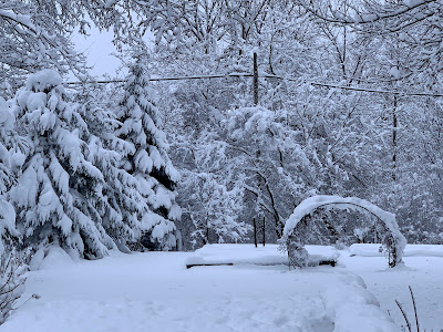
The fresh springtime beauty of April in Vermont, as 
seen this morning in St. Albans, Vermont. 
I'm still awaiting final snow totals, but I'm still convinced this is easily among the top three or four April snowstorms in the Vermont record books.   

As of midnight, Burlington had received an even 10 inches, its fourth snowiest April day on record.  With that even 10 inches, April, 2024 in  Burlington is now tied with 1904 as the 10 snowiest April on record. 

The National Weather Service no new snow fell there overnight, so 10 inches looks like the final total.

What makes this storm wild is that Burlington is actually kind of on the low end of total snowfall with this storm.  So far, I've seen numerous towns statewide report totals in the 14 to 17 inch range.

Here in St. Albans, Vermont, we had another inch of snow overnight, so my storm total is 14.0 inches. I doubt I'll see any real additional accumulation here. That will be more limited to the mountains. More on that below in the forecast section of this post 

The highest totals I've seen so far are 24 inches at a 1,450-foot elevation in Moretown;  23 inches at a 1,950 foot elevations in Killington, 21 inches in Underhill and Eden; 20 inches in Brookfield and Stowe; and 19 inches in Belmont and Chelsea. 

Electricity

After dropping from a peak of 33,000 outages to around 20,000 by evening, the number of Vermont homes and businesses without power leveled off at around 15,000 to 17,000 overnight. 

Looks like this cedar tree in my St. Albans,
Vermont yard didn't make it through the 14
inches of wet, heavy snow. 
The outages remain statewide, with reports from Pownal on the Massachusetts border to Newport on the Canadian border. 

There might be a few new outages today. That's mostly because snow loaded trees could spring back upward as the snow falls off amid thawing temperatures. Those could take a few new power lines.

However, as the day progresses, a blitz by repair crews should overwhelm those new outages and we'll see  power restored to more and more people. 

It might be hard for Vermont to get help from neighboring states with restoring power. It looks like electricity was still out for close to 100,000 New Hampshire residents early this morning. Central Maine Power also reported about 100,000 outages there as dawn broke today. Late last night, 67,000 customers were without electricity in Quebec.

I still wonder whether everyone in Vermont will have their power back by Monday. Most people certainly will, but some remote areas might still have issues.

Roads

Driving conditions are understandably much better than they were yesterday. Interstates 89 and 91 looked fine this morning on traffic cams. Other main highways in valleys looked good, too. High elevation roads, and many back roads will probably remain in iffy shape at best today. 

There's still probably fallen branches and such on some back roads this morning. Those that have been cleared of snow are becoming mud bogs again. That muddy state of affairs should continue as the heavy snow begins to melt over the next several days. 

Today

In the valleys, a tiny bit of melting will start, while the Green Mountains continue to collect snow.

It's interesting in these spring snow events how often the temperature stays locked in at 33 degrees.  All but one of the 25 hourly reports from the Burlington International Airport between 6 a.m. Thursday and 7 a.m. today were at 33. The exception was 4 p.m. yesterday, when it snuck up to 34 degrees.  

A "Sword of Damocles" snow buildup this 
morning over my front door. It threatened to
smush my poor weather observing dog Jackson
when he went out to take snow measurements
so I later hacked away at the snow to make it safer.

With far less precipitation falling, the high angle spring sunshine should send a little heat through eh clouds to get the valleys well into the 30s today. That's still quite chilly for this time of year, but better than yesterday. 

That big old lumbering nor'easter is still there, just off the coast of Maine, sending plenty of clouds and precipitation our way. 

Much of the light stuff that comes down in the valleys today will be cold rain drops. Elevations above roughly 1,500 feet should stay snow. 

Snow showers should continue tonight. Those valley raindrops should change make to snow showers in most places.

By dawn Saturday, valleys will have less than an inch of new snow. The Green Mountain spine will take up an additional two to five inches of snow between now and Saturday morning, with locally higher amounts on some central and northern peaks. 

This is a bonanza for winter sports enthusiasts who finally have their shot at snowy fun after a dismal winter. This is the second time this spring you have lots of snow to play in.

You need to be really careful in the back country, though. Steep terrain in the Green Mountains, Adirondacks and especially the White Mountains are now prone to avalanches.

In Vermont, there was lingering hard packed snow up high from the late March storm, plus previous storms. This storm started as sleet, which can be thought of as millions of little casters for the deep snow that fell yesterday to roll on.

The result is a great chance of snow slides on steep slopes, you know, places like Smugglers Notch and Underhill State Park.  The National Weather Service in South Burlington put out an advisory on this issue earlier today. 

 If you're at a ski resort, stick to marked trails and resist the temptation to go back country. Even if avalanches are not a problem there, getting stuck in the cold deep snow certainly is. The marked trails at Vermont ski areas are safe for you to enjoy. 

Saturday will not be a particularly pleasant day, either. Forecasters are still sticking with clouds, light valley rain showers and a little snow up high. It'll be a couple degrees warmer than today, though. 

We'll probably break back into the sun Sunday, but it still will be a little cool for this time of year with highs in the 40s. 

Eclipse day is still looking at least partly clear. If we do get clouds, chances are they will be high and thin, meaning you can still see the celestial show through those clouds. 

I'll have more on all this snow and eclipse and excitement in upcoming posts, as this one is long enough for now! 


Thursday, February 15, 2024

Vermont Storm Update: Some Of Us To Get A Decent Dump Of Snow

The National Weather Service snow prediction map
updated this morning shows an increase in accumulation
from previous forecasts. The exception is the central
and southern Champlain Valley, where forecasts
are similar to the prior ones. 
 That little storm forecast to zip through Vermont tonight and early Friday isn't looking quite as little as it did.  

Some parts of Vermont and adjacent New York now seem to be in line to get at least a moderate sized snowstorm. Forecast accumulations for most - but not all of Vermont - have been increased a bit. 

THE SETUP

This storm still won't have a huge amount of  moisture to work with, but it will be very efficient at working with what it has.  

However, it will have a bit more moisture in the air to manufacture snowflakes than first thought, so that has boosted the expected snow amounts.

The reason there's more moisture is odd: It's because we've had such a warm winter. 

Large sections of the Great Lakes are usually largely frozen by now. This is the time of year when ice there usually peaks.

But now, those lakes are pretty much ice-free.  Just 4 percent of the Great Lakes had ice cover as of this morning   That's a legacy of a remarkably warm winter.

The approaching storm is moving west to east across these open Great Lakes, so it will pick up moisture evaporating from the lakes as it passes by.

The result will be heavier snow, especially in New York just downwind from the lakes, and along the spine of the Green Mountains.  

The mountains will force that moist air upward, which will help increase snow totals. 

We're looking at six to 10 inches of fluff along the central and northern Green Mountains with four to six inches across most of the rest of northern Vermont. 

The Adirondacks might block some of the moisture coming off the Great Lakes with this storm, reducing totals to 2.5 to 4 inches in the southern and central Champlain Valley. That's in line with previous forecasts.  

Everyone will get snow, though.  The Great Lakes moisture is just a piece of what's going on.  The storm will be very good at creating lift in the atmosphere, which can really help dump a lot of snow. 

TIMING/EFFECTS

The National Weather Service office in South Burlington has snow beginning by 8 p.m. this evening roughly south and west of Interstate 89.  It will spread through the rest of the state by 10 p.m. or so.

So you should be safe on the roads coming home from work tonight, unless you have stay late at the office. 

Road conditions will pretty quickly deteriorate as the evening wears on. The highways and streets should remain pretty snow covered overnight and well into Friday morning. 

The  bulk of the snow should taper off by dawn in southern Vermont and by mid-morning up north. Snow showers and flurries will probably continue all day here and there, mostly in the mountains. 

Since it will be a fairly fluffy snow, cleanup shouldn't be too bad. It also doesn't look like we have to worry about any mix with ice or rain with this storm. 

Smaller disturbances riding a northwest to southeast flow of air this weekend and early next week should bring lighter bouts of snow off and on through about Monday. 

It's a warm winter though, so you can't expect much.  Another thaw is beginning to take shape by the middle of next week, but it shouldn't be nearly as warm or as long lasting as the "false spring" we went through last week and weekend. 

Wednesday, January 17, 2024

Another Over-Performing Snow In (Most) Of Vermont, With Little Dustings Yet To Come

Looking clean and snowy in St. Albans, Vermont
this morning.
 For all but the northwestern corner of Vermont, Tuesday snowstorm either lived up to expectations, or in many cases over-performed.  

The forecast called for four to six inches of snow, generally statewide, with perhaps a bit less in the northwestern tip of the state.

That happened, but there were also many reports of snow in the seven, eight or nine inch range. 

The big winner so far in the Vermont snow sweepstakes is West Rutland, of all places, with 11 inches. Not sure what's going on there, as that town is not usually a snowbelt town. West Rutland was among the hardest hit by Sunday's snow squalls, too,

Elsewhere, big winners were Shrewsbury and Orange, each reporting 10 inches of new snow.

Far northwestern Vermont missed out. In the Champlain Islands, roughly three inches of snow was forecast. Up in Alburgh, they only saw 1.5 inches. Here at my perch in St. Albans, I saw 3.2 inches, roughly an inch less than forecast, but still within the range offered by forecasters in advance of the storm.

The official storm total in Burlington was 5.0 inches. Believe it or not, that brings the month's total to 16.2 inches so far. That's actually about five inches above normal for the month to date, which is surprising.

The month has also been much warmer than normal, so the snow that fell in Burlington tended to melt. Yesterday was the first cooler than average day this January. Even then, it was only a half a degree below normal.

LOOKING AHEAD

Chances are, Burlington will end January with near to slightly below average snowfall for the month, since very little snow is forecast for quite awhile.

That doesn't mean it won't snow in Vermont. Another epic round of lake effect snow squalls is gathering force in northwest New York, on the shores of Lake Ontario. 

Visible satellite photo from this morning shows fresh
snow cover northwest of a sharp line from western North
Carolina to eastern New Jersey. 

The famous Tug Hill Plateau snow belt out there expects about three feet of new snow, on top of the three feet or so they got over the weekend. 

Much like Sunday morning, the snow band coming off of Lake Ontario will be so strong at times that it will deposit a little snow on the central and northern Green Mountains. 

 It won't amount to much. Except the remnants of those snow squalls will probably enhance the famous Jay Cloud and dump a little extra snow on them. 

We're still up for the first Arctic blast, mostly Thursday night through Sunday morning. It's still not looking extreme, but it will be a fairly windy one. That means wind chills will be an issue, especially Friday through Saturday. 

A little bit of super light snow might mix in with the chill in spots Saturday. There might also be some small accumulations from lake effect snow on the eastern shores of Lake Champlain, probably in areas south of Burlington.

That big warmup that's been in the forecast for next week will probably get delayed by a day or two. A fast moving, cold high pressure system zipping eastward across northern Quebec roughly around next Tuesday will keep cold-ish, but not frigid air over us for an extra day or so.