Sunday, March 31, 2024

Vermont Weather Week Ahead: A Big Winter Storm? In April?

 This should we an interesting weather week for the nation as a whole and here in Vermont. 

This is just one of many depictions of how a huge
storm would affect us in Vermont later this
week. This map shows an enormous
nor'easter centered just off Cape Cod. We
could get a lot of snow and/or rain out of this.
For the U.S., it's another everything but the kitchen sink deal. And maybe the kitchen sink, too.  

The storm has already set off heavy snow in some of the mountains of the West, and even a few severe thunderstorms for parts of California.

The developing storm is threatening to set off more wildfires in New Mexico, western Texas, parts of Colorado and western Oklahoma as the system sends dry, warm winds through the region.

A large severe weather outbreak will start today to an extent in Missouri and Illinois. Then the threat grows larger Monday and Tuesday through a much more expansive area in the Midwest and Southeast.

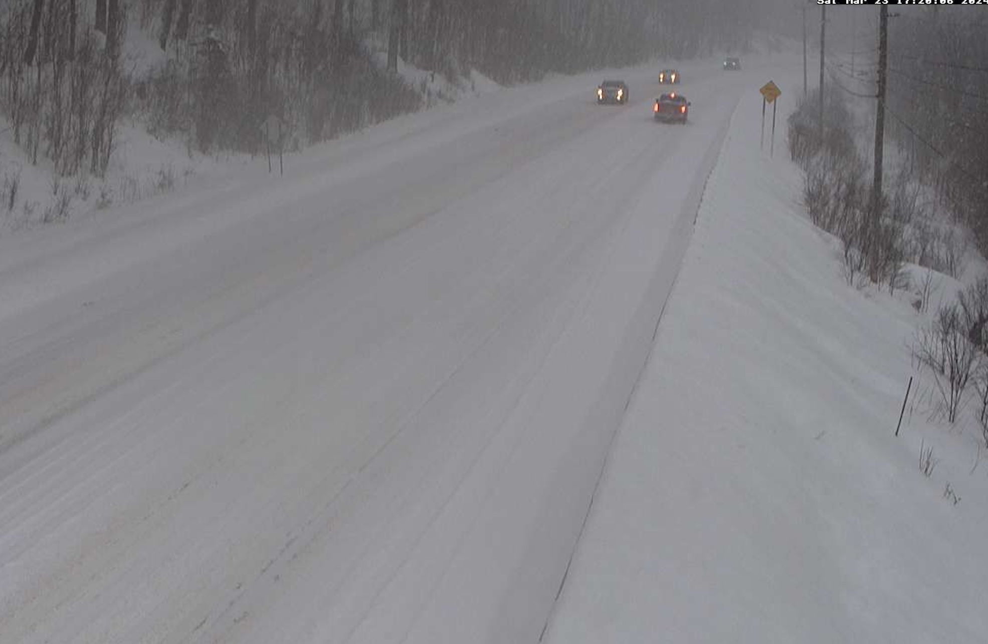
Flooding is also a threat in parts of the south and east. Some areas will get heavy snow out of this, which is where Vermont and other parts of the Northeast come in. 

VERMONT STORM

The storm in question looks like it will be pretty large, powerful and slow moving, so it'll have a chance to give quite a bit of weather to the Northeast. 

Some areas, especially the higher elevations could get a ton of new snow out of this, but the devil of course is always in the details. 

The easy part will be to go through the calm before the storm, so we'll do that first

Today

Not bad for an early Easter! Clouds from a weak overnight disturbance were clearing out this morning and we should have a largely sunny, seasonable day. Expect highs in the 40s, with a few warmer valleys touching 50 degrees

Monday

An initial disturbance, the opening salvo of this big storm, is the piece producing the potential severe weather in Missouri today. It'll pass by to our south tomorrow, sending some clouds our way. It'll be cloudiest south with even a chance of a light shower. There should be at least some sun north. Another seasonable day with 40s to around 50, warmest north.

Tuesday

Here it comes. Starting here, the forecast is subject to HUGE changes. A storm this big and complex is sure to provide quite a few surprises. 

It does seem as if this storm will be bigger and more powerful than your average early April system. We don't know yet who gets the most rain, the most snow, and precisely how long it will last.

We'll give the broad brush here, and I note future posts in this here blog thingy will highlight changes  to the forecast I lay out there. This initial crack at the forecast is just to give you a general idea of what will happen.  

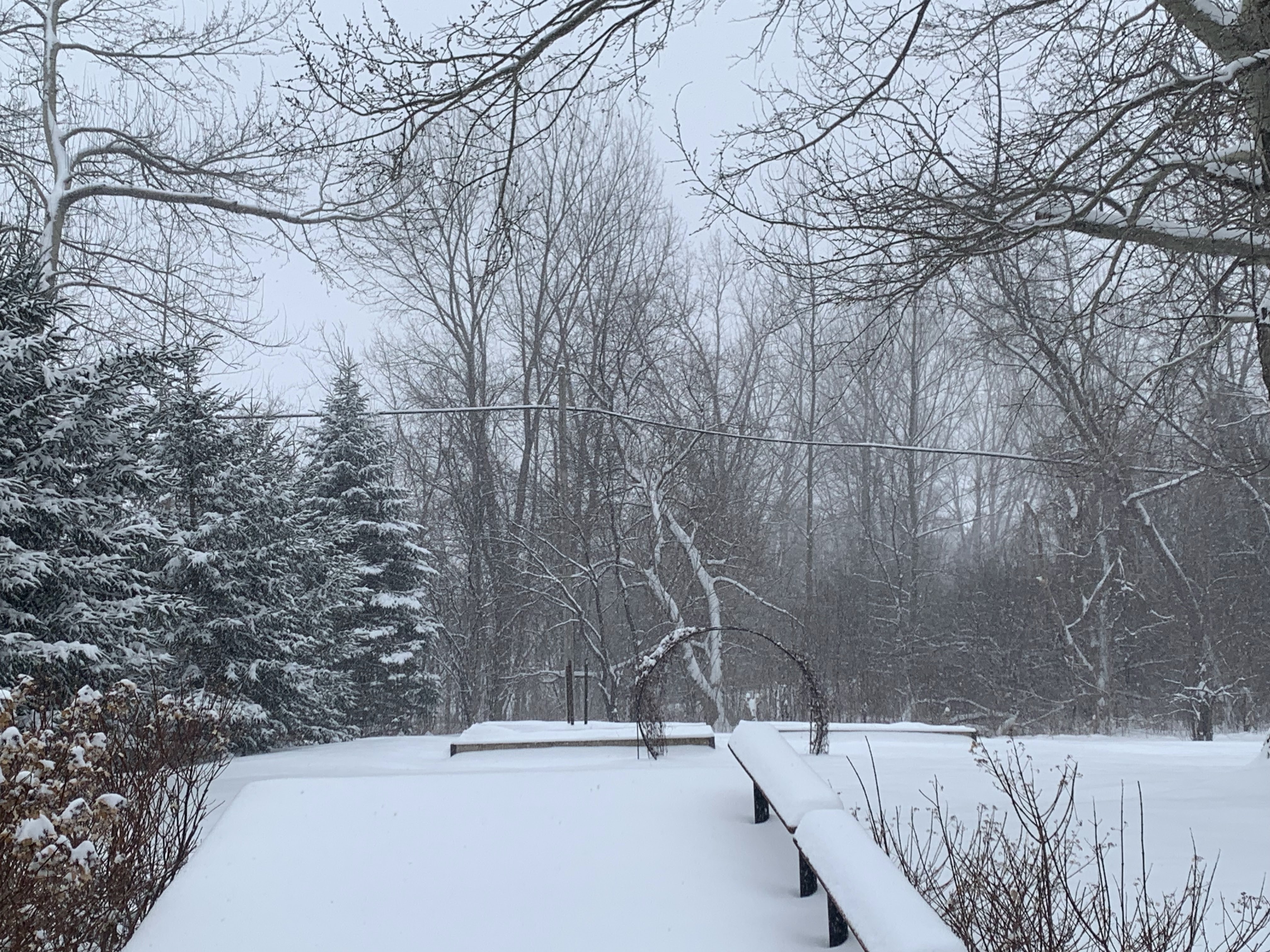
My perennial gardens in St. Albans, Vermont showing
signs of springtime life this Easter Sunday morning,
but these plants could well be buried in 
snow by midweek. 

In the end, I think virtually everyone in Vermont will see some snow. Some of us will only get a little. Some of us could really get clobbered,

Anyway, clouds thicken and lower Tuesday and rain will break out. The storm will end up somewhere near Lake Erie overnight Tuesday. At that point, the early read on this is valleys in Vermont will be getting rain, while it will already be snowing in the mountains. 

Then it gets even more interesting.....

Wednesday

The main storm center near Lake Erie will begin to fade out as a new storm gets going on the Mid-Atlantic coast and moves northward, becoming a strong nor'easter centered near southeastern New England by Wednesday night. 

This arrangement feeds plenty of moisture inland through New England and also allows temperatures to cool well away from the coast. That's us.

This would allow at least a mix of rain and snow in the valleys and probably all snow up high.  Depending on the path of the storm, I already see a potential for over a foot in some high elevations of Vermont. If that happens, I don't know where yet. It depends on whether the storm is a little inland or a little off the coast. 

Inland would give most of Vermont a lot of snow. Offshore would favor mostly southern parts of the state. 

Thursday

The storm seems like it might want to pretty much stall somewhere near eastern New England or just offshore Thursday. If that happens, the storm for Vermont would turn into one of those wrap-around storms. 

That could bring a lot of snow to the western slopes and summits of the Greens, but not much additional snow to southeastern Vermont. We'll see how it plays out. 

Friday-Weekend

The storm as it stands now would slowly drift eastward and weaken somewhat, so snow and maybe valley rains would slowly diminish. Timing of this is a big question mark. Will the precipitation end fairly quickly, or linger through the weekend?

Eclipse Day Monday

The storm should be out of our hair by then, which is great news. But it's still way too soon if it will actually be clear out so we can actually see this once in a lifetime event. 

Long range forecasts - at least at the ,moment - do not have any large scale storms near Vermont at the time the eclipse rolls around. But it only takes a weak weather disturbance to make our skies overcast. It's way too soon as of this Easter morning to know if anything will cloud our skies on eclipse day. 

Keep praying to the weather gods for a clear April 8! 


Saturday, March 30, 2024

Is Climate Change Making Days Longer, Slowing Earth's Rotation?

 Apparently, Earth is spinning more slowly than it used to because of climate change.

Earth's rotation has slowed down ever so slightly, due
to, believe it or not, climate change.
It's definitely not slow enough for you to notice it, though. 

It does turn out that melting ice from glaciers and ice caps and such are messing up the Earth's rotation just a little bit.  

According to Nature.com:

"An analysis published in Nature ......has predicted that melting ice caps are slowing Earth's rotation to such an extent that the next leap second - the mechanism used since 1972 to reconcile official time from atomic clocks with that based on Earth's unstable speed of rotation - will be delayed by three years.

'Enough ice has melted to move sea level enough that we can actually see the rate of the Earth's rotation has been affected,' says Duncan Agnew, a geophysicist at the Scripps Institution of Oceanography in La Jolla, California and author of the study."

This is all being looked into by metrologists, who are scientists who study measurements, not to be confused with meteorologists, who study weather. 

Precision timing via atomic clocks means every once in awhile adjustments need to be made to match the Earth's rotation. 

Probably due to changes in the Earth's core, the planet's rate of rotation had been increasing a little since the 1970s or so. That has made those occasional leap seconds necessary.

The world-wide bodies that keep track of this sort of thing had scheduled a "leap second" in 2026.  But since the Earth's rotation is now that itty bitty bit slower than it used to be, the leap second has been postponed to 2029.

You wouldn't think Earth's rotation slowing by such a minuscule amount would matter to you and me, but it turns out it does.

Nature.com explains: 

"A delayed leap second would be welcome by metrologists. Leap seconds are a 'big problem' already, because in a society that is increasingly based on precise timing, they lead to major failures in computing systems, says Elizabeth Dooley, who heads the time and frequency division at the National Institute of Standards and Technology in Boulder, Colorado. "

So, in this case, climate change is doing people a favor, for a change. Obviously the bad greatly outweighs the good, but I suppose there's a bright side to everything.

For now anyway. 

If the Earth's rotation slows enough to require a negative skipped second rather than one being added, it would create a nightmare. There's no accounting for it in all the existing computer codes, so nobody is sure how to make a negative second work.

We should also probably explain why melting glaciers and such are making the Earth's rotation slow down. To understand, it try to think of Earth as a figure skater. 

Nature.com gets into it:

"Data from satellites mapping Earth's gravity show that since the early 1990s, the planet has become less spherical and more flattened, as ice from Greenland and Antarctica has melted and moved mass away from the poles toward the Equator.

Just as a spinning ice skater slows down by extending their arms away from their body (and speeds up by pulling them in), this flow of water away from Earth's axis of rotation slows the planet's spin."

Climate change is why metrologists are worries about "negative leap seconds."  As more and more ice melts from Greenland and Antarctica, the Earth's slowdown will probably continue. 

Scientists plan to eliminate leap seconds in 2035 in favor of much less frequent leap minutes. Leap seconds are just not worth the trouble. 


March Winds Often Extend Into April In Vermont

Gusty winds, very common in Vermont during March and 
April, usually don't cause damage like this, but we are
in the midsts of a windy time of year. 
It was a breezy to windy Friday and Friday night here in Vermont, and we'll have more of the same today.  

Gust have been in the 30 to 40 mph range in many spots. We'll keep seeing those gusts to at least 30 mph through today.

It's the season of wind in the Green Mountain State.

March winds are a familiar trope here and elsewhere. The month has a gusty reputation. April is often another hold on to your hat month.

Usually, the winds of March and the first half of April cause little harm in Vermont. But things can get out of control.

A few of Vermont's most damaging wind storms have hit in the early spring.  

These include a nor'easter that caused widespread damage in Rutland County in April, 2007.  Other damaging wind storms have hit Vermont in March and April, such as in April, 1977 and in April, 2018

There are scientific reasons for all this.   Big storm systems common this time of year are one reason. Stronger spring sun is another. 

STORMS

Strong low pressure systems - storms - commonly cross the United States this time of year. 

A very typical storm track is one in which a storm forms somewhere in the lee of the Rockies, grows powerful and heads toward the Great Lakes and eventually to Canada.  You often have blizzards to the north of these storms with severe thunderstorms with strong winds and tornadoes to the south. 

As these storms head into the Great Lakes and Canada they drag their cold fronts to the Atlantic Seaboard. Often, new storms for along these cold fronts and become nor'easters, which produce more wind. 

A powerful storm is forecast to perform the above scenario next week.  A big storm will cross the nation, causing all kinds of trouble. It will end in the U.S. as a big lumbering nor'easter in New England by later Wednesday and Thursday. 

Vermont's gusty winds yesterday and today and because a previous storm gave birth to a nor'easter, which became powerful in the Canadian Maritimes. A squeeze play between that storm and high pressure in southern Canada. 

SUNSHINE

In the early spring, the weather pattern is active, making for strong winds higher in the atmosphere.  The jet stream hasn't lost much of its wintertime power by the time March and April roll around.

The stronger late March and April sun is much better at heating the ground than the lame low angle sun of winter. 

This springtime warmth heats the ground, which warms the lower atmosphere. Warm air is lighter than cold air, so that heated air rises, creating updrafts. These updrafts displace the airflow higher up, where the winds are stronger. That causes some downdrafts that "grab" that high speed air up above, and bring to the surface, all the while gaining momentum. What goes up, must come down, as the saying goes.

So you have those early spring days with weird gusts between calm moments.  This also causes the familiar extremely changeable spring weather.

You've surely noticed spring days in which the sun feels warm, ,but then billowy clouds appear. Some of the clouds approach, and create cold wind gusts that really drop the temperature.  Your warm sunny spring day suddenly becomes chilly as hell. 

You're feeling the process of those updrafts "grabbing" pieces of that windy, cold air aloft and delivering it to you.

 As we head toward summer, the jet stream relaxes and pulls northward toward Canada. The jet stream fuels those strong spring storms.  Without that influence, those powerful spring storms get much weaker and less windy by later in May and June. 

The jet stream's retreat also means there's not much wind aloft to "grab" and bring to the surface, so those gusty spring days turn into placid summer afternoons. 

In Vermont's immediate future, the fitful breezes today will tend to diminish until that next storm arrives Tuesday and Wednesday, possibly for an extended stay.   

Expect more breezy and windy days well into April.

Friday, March 29, 2024

Well-Intentioned Caution Has QAnon Wing Of The GOP Fighting Fictitious "Chemtrails"

 Here, we go again.

Protecting the public or chemtrail lunacy? 
Sometimes shady lawmakers going after geo-engineering.
Not sure if public safety is the motive, or whether
catering to conspiracy-minded 
constituents is behind this.  
Some well intentioned caution is making the conspiracy theorists go into a tizzy again. This time it's back to the old "chemtrail" theme. 

GOP lawmakers in Pennsylvania and Tennessee, and probably a few other places have latched on to the the idea of banning the release of chemicals from aircraft to modify the weather. 

It's a little tough to figure out if those proposing this type of legislation have honest public safety goals, or if they've signed on to this chemtrail stupidity.  

To review, chem trails aren't a thing, despite the intense blowback I'm going to receive on social media when the wing nuts read this post. 

Like most wacky conspiracies, this one starts with a whiff of actual fact. As Raw Story explains:

"The false belief that condensation trails left by high flying aircraft are actually trails of chemicals released by the government for nefarious reasons has become conflated with techniques being explored to reduce the amount of solar radiation absorbed by the atmosphere."

Specifically, some scientists are beginning to looking into a field of research known as geo engineering. 

Says the Washington Post: 

"Scientists have suggested that spraying sulfur particles into the atmosphere could help reflect sunlight, cooling the planet, though the technology remains controversial and untested, as researchers worry about potential unintended consequences."

There are reasonable calls to more closely regulate climate modification schemes through federal laws and/or rule making. Which makes sense 

To be clear, nobody is taking planes up in the air to spray boatloads of sulfur Mostly because not enough is known about this idea to try it. 

However, some believers think this sulfur spraying is ongoing and widespread, despite the lack of evidence that it is happening. Of course people will believe anything. 

The legislation or proposed legislation in Tennessee and Pennsylvania expressly deal with weather and  climate, and not the wackadoodle claims of extreme chemtrail conspiracy theorists.

For instance, the Tennessee bill prohibits the release of chemicals "with the express purpose of affecting temperature, weather or the intensity of sunlight."

At first glance, that sounds reasonable enough. Since we don't know whether we'd see unpleasant side effects from geo engineering to combat climate change, maybe we should hold off on any large scale atmospheric experiments. 

If you read between the lines of interviews with Tennessee lawmakers pushing the legislation, it seems like they're trying to have it both ways: Show intelligent concern over geo engineering, while giving a tacit nod to constituents who are into the chemtrail conspiracy theories. 

In Pennsylvania, State Sen Doug. Mastriano, who was the GOP gubernatorial candidate there he wants legislation because of a supposed proliferation of weather modification patents "owned by a combination of Federal Government Agencies, Non-Government Organized and large multinational corporations."

But apparently there's more to Mastriano's motivation than just that, 

Pennsylvania Capital-Star notes Mastriano has gone beyond just scientific concerns and has embraced the chemtrail conspiracy.

"In a November Facebook post with a photo of condensation trails in the sky above Chambersburg, Mastriano wrote, 'I have legislation to stop this.... Normal contrails dissolve/evaporate within 30-90 seconds.'"

Au contraire!, contrail man.  The water vapor in condensation trails often freeze, and depending on wind conditions, can linger in the sky for many  minutes or even hours. 

Some of the wackier types are conflating this climate geoengineering idea with this conspiracy theory over chemtrails.

As WaPo explains:

"The risk experts say, is that discussion of such unfounded claims may get in the way of real public discussion about solar geo engineering research. At the moment, chemtrails accusations interact and meld with concerns over legitimate academic research, creating more confusion and blocking further scientific research."

The chemtrail conspiracy crowd seems like it might be behind the scenes with the proposals in Pennsylvania and Tennessee and maybe elsewhere. Sort of a back door way of trying to "legitimize" their odd beliefs.

I'm all for being careful not to harm people when science is being done. Let's just not succumb to the conspiracy theorists among us.  

A First Heads Up: Some Sort Of Nasty Storm To Affect Vermont, Many Others Next Week

This is just one depiction of how an anticipated large
storm would look on weather maps next 
Wednesday morning. There are still TONS of 
scenarios with this future storm and things 
could end up much different than this map shows. 
 Meteorologists are already raising the alarm at least to some extent of a strong storm that will affect large swaths of the United States. 

The biggest concern is the risk of tornadoes and severe weather from the southern and central Plains, Midwest and Southeast.

It's too early to say exactly how the storm will evolve, so we don't quite know the extent and precise locations of the severe weather. But it could be widespread.

Before that happens, the storm is already creating a flood and wind threat in California over the weekend, and promises a snowstorm from the Sierra Nevada range and in parts of the Rockies. 

The storm's strong winds are prompting a renewed fire risk in and near the already hard hit Texas panhandle. 

We in Vermont won't have to worry about tornadoes with this thing, of course. But depending on the track of what will be a complex storm, we could see a lot of rain or even a lot of snow in a storm that at the moment looks like it will linger around us for at least three days. 

It'll be a fairly cold storm for this time of year, which raises that possibility of snow.  I'll emphasize right now that we don't yet know whether snow will just be an issue for the mountain tops, or whether it might hit mid-elevation towns or even valleys. 

We also don't know whether it would produce enough rain to set off any flooding. All we know is broad-brush stuff.  I guess this is just a heads up in case you were counting on fair weather during the middle of next week.

You ain't going to get it.

We'll know quite a bit more about how this storm will evolve by around Sunday. 

ECLIPSE EFFECTS?

Oddly a best case scenario would be if the storm slows down or stalls near New England or just off the coast for a few days.  Sure, that would keep us under an overcast, with gusty, cold winds and some rain and snow into the start of next weekend. You know, nearly a full week of crappy weather. 

But the timing would be such that it would move out just in time to clear skies by Monday, April 8, eclipse day.

That scenario at this point is just wishcasting on my part. Wishcasting, for the uninitiated, is forecasting weather that you want, and not necessarily the weather you're going to get.  

The reality is as of today nobody can give you an eclipse day forecast that would be any more accurate that the flip of a coin. We gotta wait.

NEXT UP

Before we get to next week's storm and the eclipse a week and a half or so from now, we have this weekend looming.

And the weather will be.....OK.

The storm system that soaked eastern New England yesterday is consolidating and blowing up in the Canadian Maritimes.

This will cause some stiff northwest winds later today through Saturday. The strongest winds might come tonight with gusts to 40 mph or so. Gusts will reach 30 to 35 mph today and Saturday.

That's not windy enough to cause any real problems. It'll just be a couple of bad days to rake leaves or wear hats outdoors, that's all.  Save your Easter bonnet for the actual holiday on Sunday when winds should be a little lighter. 

Often a weather setup like this would also make us unusually cold.  There might be some snow showers Saturday night and early Sunday morning, but they won't be a big deal. We'll have a mix of sun and clouds in general today through Sunday. 

The storm up in Canada isn't grabbing much cold air, so temperatures will be close to normal - 40s for most of us, with maybe a spot 50 in the warmest valleys, with lows in the 20s to low 30s.   

Thursday, March 28, 2024

Springtime Means Snow Melts Fast In Vermont

 Well, that was quick.

My St. Albans, Vermont yard, late afternoon this
past Monday........
For most areas of Vermont, all that snow we saw this past Saturday is done already. Or at least greatly diminished.  

Here in St. Albans, which only saw six inches of snow Saturday, it was completely gone by early Wednesday afternoon. 

You can find a lingering snowbank here and there where plows shoved the accumulation into piles, but that's it.

Most other places in Vermont had just patches of snow left.  In general, four to 12 inches of snow remained Wednesday in places hardest hit by Saturday's storm. High elevations, where it's colder, are hanging on to more snow. 

I'm impressed by how much the snow compacted and partly melted in spots where the snow was deepest. Both West Windsor and Shrewsbury received more than 30 inches of snow Saturday, but in both towns, the snow depth on the ground Wednesday was just 12 inches, according to data from the National Weather Service in South Burlington. 

The high sun angle of March really helped to erode the snow, too.  Bright sunshine Sunday and Monday really chewed up the snow.  Some of it evaporated into the dry air instead of running off because the humidity was so low.

Some weather stations in Vermont calculated the water equivalent of the snow remaining on the ground. Due to a lack of heavy rains the meltdown has been orderly, with no flooding 

......same exact view less than 48 hours later. That snow
disappeared FAST! 
West Rutland had something like 20 inches of snow Saturday. If you melted it down that day, you'd have something like a little  under two inches of rain. By Wednesday, the remaining snow on the ground there contained just 0.9 inches of water. 

Vermont is having a close miss today that could have led to flooding had the weather pattern shifted just a bit. 

Another in a series of soggy storms is making its way through eastern New England today. 

A flood watch is up today for Rhode Island, the eastern  half of Massachusetts, the southeastern half of New Hampshire and most of Maine due to this heavy rain.

Some of that rain is venturing into mostly southeastern Vermont today, but it won't be heavy enough to cause any real issues there.

Just because the snow is gone, or rapidly disappearing in Vermont right now doesn't mean we're completely done with it. 

Some sort of possibly substantial storm seems like it wants to arrive this coming Tuesday or Wednesday. It's way too soon if that one will be mostly rain, or whether some of us see accumulating snow. 

We'll know more by Sunday.  Just note in all my years in Vermont, I can't recall any April where didn't snow in Vermont. In a few Aprils, like in 1974, 1975, 1983, 2000, even many low elevations had more than a foot of snow. 

Wednesday, March 27, 2024

Quick Weather Weird Update: Odd Vermont/NY Temperature Contrast Continued Today

Weird and big temperature contrasts continued Wednesday
as this National Weather Service map indicates. At 2 pm
Wednesday, it was in the 60s in much of northern
New York, but only in the upper 30s in parts of
Vermonts Connecticut River Valley.
 Yesterday I posted about a weird Vermont temperature contrast that had been expected yesterday with high temperatures only in the 30s in southeastern Vermont to near 60 in the northwest tip of the state.

The actual contrast did develop, but it wasn't as extreme as forecast, because clouds from the east came in later than expected.  

Today made up for it. It goes to show how important sunshine is once spring hits to boost temperatures. 

A tongue of clear skies worked into northern New York late this morning and afternoon. The sunshine briefly appeared in the Champlain Valley, too. So it was another topsy turvy day. 

Under the sunshine, it was in the low to mid 60s in New York's St. Lawrence Valley. In perennial cold spot Saranac Lake, New York, in the Adirondacks, it was 59 degrees.

Here in Vermont, we reached some pleasant low and mid 50s in the central and northern Champlain Valley. But the further south and east you got, the colder dirt got. By the time you were in the lower Connecticut Valley, you were lucky if it was as "warm" as 40s degrees.

This state of affairs will continue - sort of.  Temperatures are forecast to even out. But rain traveling along a slow cold front will drench southeastern Vermont with a half inch to an inch of rain. In the far northwest, it might not rain at all. If it does, it'll probably be less than a tenth of an inch. 

A storm off the coast Friday will make it windy everywhere in Vermont. But as it stands now, it looks like western Vermont will see no precipitation, while a little snow might dust the Connecticut River Valley. That's an uncertain forecast, but something to keep an eye on. 

Eclipse Day Vermont Weather Still Unknown, But Possible Trend Emerging

The path of the eclipse over Vermont on April 8.
Pray hard for clear skies especially between
3:25 and 3:31 p.m. that day. 
April 8 Total Eclipse of the Sun eclipse day in Vermont is fast approaching, as it's only about a week and a half away or so.  

Some of the long range forecasts are now covering that day with supposed hints of what kind of weather will come that day.  Which gets people asking, will we actually see the sky on Eclipse Day, or will everything be hidden by clouds? 

I wouldn't get too excited about those April 8 weather forecasts just yet.   

Weather predictions more than, say, five days out are notoriously unreliable. You might start to pick up trends in the weather pattern 10 or 11 days out, but that doesn't tell you exactly what the weather will be on April 8.

As of today, then, my official Vermont forecast for April 8 is:

"Cloudy, unless it's partly cloudy or clear. Chance of rain, snow, sleet, freezing rain, drizzle, freezing drizzle, sleet, hail, fog, showers, thunderstorms or none or some or all of the above. If the wind blows, it will come out of a direction. Or directions. Highs in the upper 20s to low 80s."

So yeah, not terribly helpful.  It just demonstrates we'll have to wait for better updates much closer to the event. It'll be awhile yet before we see a reliable April 8 forecast. 

FORECAST TRENDS

I did say I'm seeing trends in the long range forecast, take them with a Peterbilt sized grain of salt, but here goes, just for fun.

Most - but not all - of the  computer models have a dip in the jet stream somewhere near the Northeast, which implied unsettled weather and a high risk of clouds. 

What we don't know is whether said clouds will be overhead, or obscure where the sun is in the sky between 3:25 and 3:31 p.m April 8. That's when the total eclipse will be occurring. 

The computer models - to nobody's surprise - have not yet come up with a location of the dip in the jet stream. It could be overhead, or maybe off the coast, or over the Great Lakes. 

This is a random weather map I found on the Internet,
but this would be a best case scenario for 
Eclipse Day, April 8 in Vermont. 

We certainly don't know where any particular weather fronts will be at 3:30 p.m. on April 8. 

 It could be bad timing, with rain and showers going on at the time of the eclipse. Or we could be between weather fronts with mostly clear skies greeting us. 

The best case scenario that we should pray for is that a cold front comes through sometimes on April 7, followed by crisp, dry  high pressure from southern Canada. 

That high should either be overhead, or just a short distance to the north or west of Vermont at eclipse time.  If  that happens, it probably won't be particularly warm, but who cares? All we want is clear skies. Such a scenario would definitely keep clouds to a minimum.

High pressure just to our east would be fine, too, but that scenario gives us the risk of some high, thin clouds. You'd still see the eclipse, but maybe not through perfectly clear skies. 

There are several worst case scenarios. Probably the most depressing would be a nor'easter in or very near New England. Or a strong warm front approaching from our south, which would give us a thick overcast and possibly heavy precipitation. 

The odds are still stacked in favor of clouds. But we knew that already.  On average, there's a 70 percent chance of cloudy or mostly cloudy skies on any April 8 in Vermont.  

Cloudy Vermont seems to always miss out on the best celestial events, as clear skies seem to come only when nothing exciting is going on in the skies. Keep hoping the Weather Gods bless the Green Mountain State just this once. 

Tuesday, March 26, 2024

UN Says 2023 Global Heating Was "Red Alert" But Is the Message Too Doom And Gloom?

"Red Alert."

The UN's World Meteorological Organization called
climate change in 2023 a "red alert" but is dire
messaging the best way to encourage the public
to take action on climate change?
That's the conclusion of the World Meteorological Organization regarding the effects of climate change in 2023. 

The annual WMO Global Climate report is essentially the last word reviewing the crazy weather and climate events of 2023. 

 Records were smashed last year for the amount of greenhouse gases in the atmosphere,  land and water temperatures, and the melting of glaciers and sea ice. 

 "'Earth's issuing a distress call,' U.N. Secretary-General Antonio Guterres said. 'The latest State of the Global Climate report shows a planet on the brink. Fossil fuel pollution is sending climate chaos off the charts.'"

 The Associate Press writes:

"WMO said the impacts of heat waves, floods, droughts, wildfires and tropical cyclones, exacerbated by climate change, was felt in lives and livelihoods on every continent in 2023.

'This list of record-smashing events is truly distressing, though not a surprise given the steady drumbeat of extreme events over the past year, said University of Arizona climate scientist Kathy Jacobs, who also wasn't involved in the WMO report.

 'The full cost of climate change accelerated events across sectors and regions has never been calculated in a meaningful way, but the cost to biodiversity and to the quality of future generations is incalculable.'"

Other quick takeaways in the WMO report: 

--- Extreme weather is undermining socio-economic development around the world

--- The cost of climate inaction is higher than the cost of climate action

--- The increasing pace of transitions to renewable energy does provide hope. 

 The United Nations' goal of holding the extent of climate change to within 1.5 degrees Celsius above the pre-industrial average.  It's unclear whether that goal is even attainable. 

The 13 consecutive months through February averaged a bit more than that 1.5 degree threshold.  El Nino worked in concert with climate change to boost global temperatures to that level. 

As La Nina takes hold as expected later this year, the world will probably cool a tiny bit to a level below that 1.5 degrees. So it's not yet a permanent change. But at the pace we're switching to renewables, it looks like we'll blow past UN goal within a couple decades - so much for that idea

GLOOM/DOOM NOT HELPFUL?

The UN World Meteorological Organization report was released with a serious gloom and doom vibe, but was that really a good idea?   

According to Resilience.org, not really. 

"It turns out that critics are right to worry that doom and gloom can demoralize the public into inaction. We found that this strategy had no effect on policy support or climate beliefs. 

And doom and gloom even backfired when it came to more effortful behavior. When faced with the enormous stakes of the climate crisis, personal actions - and perhaps even policy change  - can seem futile. People withdraw or disengage.

Doom and gloom messaging is great for social media clicks, the research shows, but not for motivating people.  

Potential audiences and societies in general are complex, so there's no one way to communicate about climate change and what people can do about it.  Different people responded differently to a variety of climate messages. The response varies country to country. 

Resilience.org continues:  "Sadly, we did not find a silver bullet for spurring climate action. But our research found several messages that moved the needle on climate change beliefs and actions. We suspect that similar lessons apply to other issues, from strengthening democracy to public health. In fact, we were recently part of a similar project designed to reduce affective polarization and found that several messages either didn't work or backfired. " 

However, framing messaging through a moral or ethical lens seems to be the most effective. 

Topsy-Turvy In Vermont: Spring Northwest, Winter Southeast

The National Weather Service office in South Burlington
released this map of forecast highs today and it is 
weird. Highs will be as chilly as 36 in Springfield
in the southeast to as high as 58 in the northwest,
up around St. Albans. 
Usually this time of year, the chilliest early spring air is in northwestern Vermont, which makes sense, as that part of the state is closer to those cold fronts that sneak down from Canada.  

Southeastern Vermont tends to be a little more springlike, with generally clearer skies,  a lower chance of snow or ice and warmer temperatures than most of the rest of the state.

Things are totally backwards now.

Southern Vermont is still deep in snow cover from that mega-snow on Saturday, with more than two feet in many spots.  

Up in northwest Vermont, the four to six inches of snow that fell Saturday is disappearing fast. Bare patches in the snow up there today will rapidly expand.  

Today, the backward trend continues with a huge temperature difference between southeast and northwest.  If you like spring, go to the great not-so-white north. 

If  you're down in places like Brattleboro or Springfield, the best you'll do for afternoon highs today will be the mid and upper 30s, definitely on the cool side for late March. An overcast will add to the chill. 

If you're in places like Alburgh, Swanton or Highgate in the northwestern tip of Vermont, temperatures could get close to 60 degrees this afternoon, with quite a bit of sunshine. Springtime balminess for sure.  

In between those two extremes, there will be a gradient with 50s northwest,  and 40s in central Vermont. 

It gets worse. Southern and eastern Vermont will probably see a little freezing drizzle tonight. I suppose a few raindrops could come down late tonight up in the northern Champlain Valley, but they won't freeze

So yes, it's very strange.  

THE REASON

The snow was already starting to disappear from my
St. Albans, Vermont yard late yesterday afternoon, and
a warm day to day will get rid of much more.
Meanwhile, the deep snow in southeastern Vermont
will stay mostly intact amid much cooler readings. 
The cause of today's weirdness is cold high pressure way up in eastern Quebec and Newfoundland and a storm far off the Mid-Atlantic coast.  That combination is creating a feed of cold, wet low level air heading westward into New England. 

The air is damp enough to yield some fog and drizzle, which will turn to freezing drizzle in many areas east of the Greens tonight as temperatures drop. 

It's even a little worse in neighboring New Hampshire where a winter weather advisory is up for tonight for freezing drizzle.  

This flow of chilly dank air will be hitting a road block in the form of the Green Mountains. This is low level cold air we're dealing with, mostly confined to the lowest few thousand feet of the atmosphere. 

Cold air is more dense than warm air, so it tends to stay low. There's not enough of an east wind to really lift the air up and over the mountains. 

Besides, any cool air that does make it over the crest of the Greens would flow downhill on the west slopes. Air flowing downhill compresses, and that tends to make the air warmer and drier.  If you're west of the Green Mountains you'll probably see a bank of clouds peeking over the ridge tops from the east, but not really coming much further west than that. At least for awhile.

As the east winds persist, some of those clouds from the east will eventually win over later today, slowly blotting out the sun further and further west.  Also, high clouds from a storm well to our west and an approaching, dying cold front will filter the sun as the afternoon wears on up in "tropical" northwest Vermont. 

BEYOND TONIGHT

The cooler weather in southeastern Vermont will at least temporarily slow the snow melt. That snow will refrigerate things, keeping temperatures slightly cooler than they otherwise would be even after this chilly east wind dies out. 

Meanwhile, any sun we get in the coming days will heat the increasingly bare ground, and then the air in the northwest.

Even so, the temperature contrast will diminish. It'll be in the low 50s northwest tomorrow and in the upper 40s to near 50 southeast.

Thursday is a wild card, though. A new storm along the East Coast might create a new northwest to southeast weird contrast in Vermont Thursday and Thursday night. 

 The path of the storm is still really open to question, with various models giving the Green Mountain State anything from absolutely nothing to a total soaker with possible snow. 

There's a chance we could have another situation in which northwestern Vermont is quiet and mild, while the southeast has a cold rain or even wet snow. 

Very unsure on this one, so stay tuned.

By the weekend, things should go back to how it should be: Forecasters expect near normal temperatures, which afternoon highs little cooler in northern Vermont than in the south.

As it should be, for a change.  

Monday, March 25, 2024

This And That: A Vermont Spring Milestone, And Weird Weather Elsewhere

Animal tracks in the snow last evening in my
St. Albans, Vermont yard. Looks like they had been
sculpted by wind and sun during the day. 
 It was cold out there in Vermont this morning, as expected. 

But look at it this way, it'll very likely be a long time before you see weather this cold again.   

Temperatures were in the teens this morning, with some single digits in the cold hollows. It was below zero in some of the cold hollows Sunday morning. 

Unless something incredibly strange happens in April, these are the coldest temperatures you'll see until November or December. 

Don't get your spring mood on just yet. It's hard to do anyway with all the snow on the ground in most of Vermont. 

 Also, it pretty much always snows in late March and April. We probably won't have any more mega-snows, but I pretty much guarantee you'll see snow again before spring really arrives. 

Since the weather is quiet out there in Vermont today, I found some this and that weird things to talk about  elsewhere.

Kansas County Everything

Last evening, portions of a county in northwest Kansas managed to find themselves under a tornado warning, a blizzard warning and a dust storm advisory. The tornado threat arrived ahead of a cold front. Radar images definitely showed rotation in a severe thunderstorm, but it's unclear whether the tornado actually touched down not far from Oakley, Kansas.

The big thunderstorm's strong winds stirred up the dust.  Following the cold front, strong north winds and snow developed the blizzard later at night and this morning. 

The temperature in Oakley went from 69 degree Sunday afternoon to 24 degrees with a wind chill of 6 above early this morning. 

Talk about wait a minute and the weather will change. I don't think I want to live in northwest Kansas. Too much going on. 

Cuban Supercell

Supercell thunderstorms, those persistent, intense, big hail producing, usually rotating and sometimes tornado-producing storms, are a fixture in the United States Plains and Midwest the spring and early summer. They're common in other parts of the world too.

But not Cuba. However, a persistent supercell swept across parts or the island Friday night, surely causing wind and hail damage. However, we have no confirmed reports. Supercells are extremely rare in Cuba but they've happened before.

In 2019, a supercell spawned a tornado in Havana that killed 3 people and left extensive damage. Another strong tornado hit parts of Cuba back in 1940.

Friday night's storms also created rotating thunderstorms that threatened the Florida Keys with a risk of tornadoes, but none are known to have touched down. 

Heat Index Of 144 Degrees?

Rio de Janeiro, Brazil is a hot city. You know, the famed beaches and all?

But recently, a section of Rio had a seemingly impossible 144 degree heat index.   The heat index takes into account both the heat and humidity  to give you a sense of how hot it feels.

A heat index that high is obviously extremely dangerous, and heat waves can cause multiple deaths, but I have no news as to what happened in and around Rio with this torrid weather. 

Much of Brazil, including Rio de Janeiro have had months of record breaking heat due to a combination of El Nino and climate change. 


Sunday, March 24, 2024

Last Word On Mega-Snow In Vermont This Weekend: Up to 33 Inches

 I hope you got outside in Vermont today but it was a perfect winter day. 

Final snowfall map from the National Weather 
Service in South Burlington. Click on the map
to make it bigger and easier to read. 
Yes, I know, it's spring, but you take what you can get. Even though temperatures were only in the 30s at best, it felt warm with the high angle March sun.  

For awhile today, in the early afternoon, it was only 33 degrees here in St. Albans, but the winds were light and the sun was strong. I was comfortably outdoors shoveling snow in pants and a black t-shirt. No jacket. 

 Central and southern Vermont spent the day digging out from the deep snow from yesterday. Of three sibling in the Green Mountain State, I'm the only one who had an easy time of it. 

One sister in Shrewsbury came up with a final total of 32 inches - nearly three feet. Another sister in low elevation West Rutland came up with 22 inches. As for me, I had an easy-peasy six inches. 

In Vermont, I counted no fewer than 21 towns that got at least two feet of snow. Most of those were in Windsor County, with Rutland County running a strong second in the snowfall derby.

The highest total was 33.1 inches in West Windsor. 

The clear skies today helped us see a very cool satellite photo. 

Satellite photo today shows lots of snow in Vermont 
and adjacent states, but nothing in most of southern New
England. Bare ground in the St. Lawrence Valley of
southern Quebec and Ontario, too. 
The storm missed those locations. 
Thick snow cover was visible in the satellite photo across most of New York and virtually all of Vermont, New Hampshire and Maine. 

You can see the snow ended in bare ground in Massachusetts a very little bit south of the Vermont and New Hampshire borders. 

You can also see a stripe bare ground in the St. Lawrence Valley of Ontario and Quebec, just northwest of New York State. 

The storm missed that area. Snow is on the ground north of the St. Lawrence Valley. That's mostly this winter's snow that hasn't melted yet. 

FORECAST UPDATE

The fresh snow still looks like we are going to have a bitterly cold Monday morning for this time of year. Temperatures will really start to crash right around sunset. 

The cold hollows of the Northeast Kingdom, and I suspect at least a couple mountain valleys in buried Windsor and Rutland counties could go below zero tonight. The rest of us will stay in the single numbers and teens. 

Warmer air this week will melt a lot of the snow, especially northwest. 

Northwestern areas will be the warmest for at least two reasons. There's less snow there, so the sun will heat the ground a little better. Bare spots will be already opening up in that neck of the woods tomorrow. 

Eastern Vermont and maybe to a lesser extent in Rutland and Bennington counties, should stay somewhat cooler - in the upper 30s to mid 40s Tuesday through Thursday, as a chilly southeast wind from the Atlantic Ocean blows in. 

The Green Mountains will block a lot of that chill, so the Champlain Valley should get to near 50 degrees at least daily Tuesday through Thursday. In what will be the snow-free St. Lawrence Valley in northwest New York, temperatures near 60 are possible. 

We still don't know if an ocean storm late in the week will completely miss our area or bring in a little rain.  So far, little or no rain is in the forecast. As I said this morning, I don't see an immediate threat of flooding from the snowmelt. 

Big Midwest Storm Deserves Attention Now That New England Storm Has Cleared

Said it before and will say it again, when the National 
Weather Service home page is this colorful there's a
big storm out there. Sure enough a large storm is
beginning to clobber the middle of the U.S. 
 A huge storm that will have impacts at least as large as the one that just hit Vermont and the rest of new England, is ramping up in the nation's middle.   

Spoiler: We're not getting another big snowstorm in Vermont with this one

The big middle of the nation system is a classic, and pretty typical spring storm, but we shouldn't minimize it. This type of storm really causes a wide variety of nasty weather. Everything but the kitchen sink, really. 

A huge area from Montana to Wisconsin and south to western Kansas is under winter storm or blizzard warnings. 

Especially in North Dakota, Minnesota and Wisconsin, this huge spring snowstorm comes after a "Year Without A Winter." in which little snow fell and temperatures almost constantly thawed. 

Blizzard warnings are up for western Kansas, much of Nebraska and central South Dakota, with winds up to 50 mph north and 65 in Kansas. 

To the south of that, high winds and a big fire risk has returned to western and northern Texas, and parts of New Mexico and Oklahoma.  Winds will gust to 65 mph today amid very dry, warm conditions.  Blowing dust will be a big problem, too. 

This time of year, the type of storm hitting the middle of the nation often spins off some severe weather and tornadoes.

Such is the case this time, though the severe risk isn't as high or widespread as some storms have been this time of year. Still, people in some places in the central Plains and south had better keep an eye to the skies. 

A few severe thunderstorms and a couple tornadoes could hit later today in parts of Kansas, Oklahoma and north-central Kansas. A part of northwest Kansas could have giant hail or a tornado this afternoon and evening, and a blizzard late tonight and tomorrow. Go figure. 

Tomorrow, the severe weather and tornadoes shifts to Louisiana, Mississippi and Arkansas. Flooding is possible in the same region tomorrow, too.

Another typical aspect of this massive spring storm is its cold front, powerful in the Plains, will gradually lose steam. By the time it arrives here in Vermont and the rest of New England later Wednesday, it'll just have a few light showers with it. 

Also typical of this spring situation is that a new storm will probably form along the weak cold front somewhere near the Southeast or Mid-Atlantic coast. That storm will strengthen some, but it's still too soon to figure out whether it will come west enough to cause a lot of rain or other precipitation here in Vermont. 


That Was Easily One Of Vermont's Biggest Spring Snowstorms On Record

Well, that was fun.

Since we've already been able to get in and out of
our driveway in St. Albans, Vermont, since we only
got six inches of snow, I should probably just
let the spring sun melt the snow off the
driveway instead of shoveling it. 
Saturday's weather was easily one of the biggest spring snowstorms on record.  

South central Vermont took the brunt of it, with many reports of over 20 inches of snow. 

 So far, Woodstock  is wining the snow total derby with 28 inches. Ludlow is close behind with 27.3 inches. 

Shrewsbury is also close with  26 inches, and that was measured a few hours before it stopped snowing. We're awaiting an update. 

Some towns at lower elevations had surprisingly high amounts. Depending on where you measured in town, West Rutland had between 19 and 22 inches. Two feet of new snow covered Chester and Norwich. 

Overall, the storm was colder and a little further south than forecast. Those big snow totals happened in a region where some mix with rain was anticipated, which would have held down snow totals. But the rain ended up being confined to far southern Vermont. 

.Up in central Vermont, about a foot of snow came down. In the Champlain Valley it was close to a foot down near Middlebury, around eight inches in and near Burlington and four to six inches up in Franklin County.

This morning's traffic cam of Route 9 in Searsburg,
Vermont shows a tractor trailer rig in the ditch. 
Even where there was those lower snow totals, it was fairly impressive for this time of year. Burlington reported 8.6 inches of new snow, a record for the date. 

The National Weather Service office in South Burlington said there have only been five snowstorms with greater totals later in the season than this.k

In David Ludlum'sVermont Weather Book, I could find only a few examples of snowstorms this big or larger around this time of year and later. Most of them happened a long, long time ago.

They were on March 26, 1847, March 28, 1919, April 1, 1807, April 2-5, 1975,  and arguably April 6-7, 1982 in far southern Vermont. There might  have been couple others I missed. But you get the point.

It was a wet storm, too. Melt down the snow in Montpelier and you get 1.14 inches of rain, making Saturday the "wettest" March 23 on record there. 

Melted snow at Lebanon, NH/White River Junction Vermont was two inches. Melt down the snow, freezing rain and such in Bennington and you also get two inches.   

The fact the storm was colder than anticipated minimized power outages. Prior to the storm, I was yelling and screaming about how the power would go out. In the end, Vermont outages peaked at under 2,000.

Freezing rain did coat trees roughly along Route 9 from Bennington to Brattleboro and on into New Hampshire. The freezing rain was worse in the Granite State and in Maine, causing trees and power lines to fail there

TODAY

With fresh snow pack, temperatures plunged early this morning as skies cleared. It wasn't so bad in Vermont, because it didn't clear up until early this morning -- mostly low to mid teens with a few upper single numbers. 

But in New York, which had more hours of starry skies, it got really, really cold for this late in the season.  Plattsburgh bottomed out at just 1 above zero, a record low for the date. Saranac Lake got down to minus 5. Glens Falls saw minus 3.

It goes to show how a deep snow cover can chill the air. Especially when it's clear at night. 

All this snow will help keep us somewhat refrigerated for the next few days. But it will still thaw and melt coming up. It is spring, after all.

Today should only get into the low to mid 30s in most valleys, which is about 10 degrees colder than average.  But it will feel fantastic for outdoor sports and playing in the snow. Just bring sunglasses, as I've mentioned before. The high sun angle this time of year on fresh snow makes things absolutely blinding.

There might be a few clouds around today but a fair amount of sun, too.

In the back country, there's an avalanche warning for the White Mountains of New Hampshire. I still think we could see at least some small avalanches in steep back country of Vermont, too. 

Tonight, with clear skies and that fresh snow cover, it'll get really cold again. Some spots in the Northeast Kingdom could go below zero. Most of us will be between 5 and 15 above. 

Then the thaw begins

THE UPCOMING WEEK

You'll probably hear news of a new huge storm today through Tuesday.  It's true a huge storm in the middle of the nation is going to cause everything from a blizzard to wildfires to possible tornadoes. But that storm won't really be our problem here in Vermont. 

More on that in a sec.

The nice thing about cleaning  up after a snowstorm this late in the season is you don't have to be that picky. 

The snow won't last long. It will melt pretty quickly. All you have to do is clear it away enough to get out and about. You don't have to do a complete job because the spring sun will do that for you.

That said, it won't be as warm as it otherwise would be. All this snow on the ground is reflecting the warmth of sunlight back to space.  There might be some spot 50 degree readings Tuesday and Wednesday, but most of us will stay in the 40s.

That big storm I mentioned in the middle of the nation will head up through the Great Lakes and then to Hudson Bay, Canada by later Wednesday.

The storm will swing a weakening cold front through Vermont Wednesday night with a few sprinkles.

A new storm might form along the front and move northeastward, giving New England some rain and possibly mountain snow Thursday or Friday, but it's too soon to figure out whether or how much precipitation we'll get. 

Saturday, March 23, 2024

Saturday Evening Vermont Big Snowstorm Update: Over-Performing South, Under-Performing Far Northwest

Total snow in and near Vermont as of about 3 p.m.
These aren't the final totals as more snow was falling.
Notice the large area of south central Vermont
with the deepest snow. 
 Well, today's storm has been something in south-central Vermont as some totals in that region will probably end up going over two feet.  For that region, this is one of the largest late season/spring snowstorms on record.   

As of late afternoon, Ludlow had already reported 22 inches, White River Junction 20 inches and North Hartland, 19.  It was still snowing hard in those regions, too.

In the rest of northern Vermont, except the northwestern part of the state north of Burlington, it looks like this one will work out as advertised, with most of these areas looking in line to see 10 to 18 inches. 

The bust zone was the northern Champlain Valley. Dry air aloft limited snowfall, and also created very small snowflakes that did not accumulate readily.  As of 6 p.m. St. Albans had only received 6.1 inches of snow, and precipitation was just about to end there.

We'll have final snow totals tomorrow. 

EFFECTS

Not surprisingly, the roads in Vermont and surrounding areas have been awful all day, with lots of slide offs and crashes reported, 'natch.

Screen grab of traffic camera along Route 4 in
Mendon Saturday afternoon. Not easy going. 
Some sections of roads had to temporarily close. For instance, Route 12 near Rowell Hill Road in Berlin had to close for a time due to several accidents. Route 117 near Jericho closed for a time as well due to a crash. A snowplow in Bradford reportedly went off the road. 

One big break was the fact the snow wasn't as wet and heavy as forecasters thought it would be. 

As of 5:30 p.m today there were pretty much no power outages in Vermont. A few might crop up this evening, but we won't have that 10,000+ outage mess we've repeatedly had since last fall. We caught a break there. 

NEXT UP

The snow will end northwest to southeast this evening, so the last places to see the snow quit will be the ones that already have seen the most snow.  

By midnight, the snow will be out of our hair. It will be another blustery and cold night, with some blowing snow around. 

Just a mellow snowfall in St. Albans, with just 6.1 inches
new snow as of 6 p.m. 
Roads should remain snow covered and slippery well into the night. It'll take awhile even after the snow tapers off to clear them. Road crews have been out all day. They'll also need a break overnight before hitting the snow again early Sunday morning.

Expect TONS of traffic on the way to the ski areas Sunday morning. People have been waiting all winter fora storm like this, so the resorts are going to be absolute zoos on Sunday. 

Like I mentioned this morning, backcountry skiers, riders and hikers ought to be careful. I wouldn't be surprised to see at least a couple small avalanches on steep slopes up in the Green Mountains. 

It IS going to be a gorgeous day to go out and either play in the snow or clear it out. Highs will be in the low to mid 30s for most of us. That's chilly for late March. But the high sun angle and light winds will make it feel warmer.  

Sunday is going to be absolutely blinding, too. That high sun angle reflecting off that fresh, deep snow is going to be stunningly bright. Sunglasses are absolutely de rigueur on Sunday. 

A couple public service announcements: If you have a fire hydrant near your house, dig it out and clear away the snow at least a couple feet away from it.  Also, if you have people nearby who are old or ill or disabled, and you're healthy, help them clear the snow. Good deed for the day, right?

Beyond Sunday

It's going to take time for the snow to melt, since there's so much of it in most of Vermont now. But met it will, because it is spring after all.Highs Monday should reach the low 40s. Tuesday through Thursday will be even warmer, with some low 50s popping up in the warmer valleys. 

So it's a return to mud season.

I still don't see an immediate threat of flooding, unless some sort of storm takes us by surprise. The forecast for the next week is fairly dry, with only some showers around Wednesday or Thursday.  We're lucky there's no very wet, very warm storm in our near future. 

That's especially good since it's already been a very wet March. Through 4:30 p.m. today, Burlington had 3.86 inches of rain and melted snow this month. If it stopped now, it would still be the fifth wettest March on record. 


Early Afternoon Vermont Storm Update: Slamming Southern, Central Vermont, Northwest Nothingburger?

While much of Vermont is being blasted by a LOT of 
snow that will pile up to 12-24 inches, the northwest
corner of Vermont is getting basically nothing.
Just 3.7 inches in St. Albans as of 1 p.m. so
this will be the bust zone in this storm, as
it looks now. 
 The snow has really come down this morning and early afternoon across parts of southern and central Vermont while the northwest corner of the state seems to be largely missing out on the excitement.  

As of early afternoon, 14.5 inches of new snow was reported in Shrewsbury, and several amounts of around a foot were reported near and south of Route 4.  I still won't be at all surprised if a few places see two feet of snow. 

The snow was really getting going in northern Vermont, with up to nine inches reported so far. A band of especially heavy snow looked like it was setting up in a band southwest to northeast across central Vermont. 

The storm so far is a dud in the northwest corner of Vermont up by St. Albans and points north and west. In St. Albans, only 3.7 inches of snow had accumulated by 1 p.m. and only light snow was falling. It appeared the western edge of the snow was approaching the northwest tip of Vermont.

 If the continues during the early and mid afternoon and it's looking like it might, snow totals in the northern Champlain islands and western Franklin County will be under six inches, not even justifying the winter storm warning that's in effect.

We'll know by late afternoon if this bust comes true. 

Meanwhile, further south, the snow blasts on. 

Rain and a mix was creeping into far southern Vermont as expected. It was raining in Bennington with a temperature of 35 degrees as of 1 p.m, but you didn't have to go far north to hit heavy snow. Northern Bennington and Windham counties were still in the snow. 

So far, the snow in most places hasn't been as wet and heavy as expected. We still didn't have any power outages to report as of 1 p.m. That means things probably won't be as bad as first thought, thought I still expect power outage issues later this afternoon. 

Saturday Morning: Vermont Winter Storm In Progress, Some Changes To Forecast For Rest Of Storm

The final snow forecast issued just before it really started
The sweet spot for the heaviest snow looks like it will
go from central Vermont on up into the
Northeast Kingdom. A bit less south with a rain
mix, and the far northwest, away from the best moisture.
I t was snowing pretty much statewide as expected as dawn broke this morning, and everyone from Readsboro on the Massachusetts border to Derby Line on the Canadian border is getting a nice dump of snow.   

 Since last evening, there's been a few adjustments to the forecast going through today, but the general idea we've been hanging onto for the past couple days still holds: 

Much of Vermont will see a foot or more of snow, which means a good portion of us will have the biggest snowstorm of the winter.

Never mind that it's spring. 

DETAILS AND CHANGES

It was mostly light snow in Vermont between about 1 and 5 a.m. when things started up, but after that, the intensity of the snow started to pick up. Again, as expected.   It should come down pretty hard most of the day.  It'll probably lighten up to an extent in the far northwest this afternoon, but you get the idea. 

Early this morning, temperatures were still in the 20s. That's good, because the snow coming down now is mostly pretty powdery, the kind that tends to harmless blow off of trees and power lines before causing too much trouble. 

As of 6:30 a.m. VTOutages.org reported a grand total of one home without power in the entire state, in the town of Sandgate, in western Bennington County. Lucky them! 

Clearly, the  early portion of the storm isn't causing much in the way of power problems.  The snow will turn wetter and heavier this afternoon mostly in the southern half of the state, so that's when we'll start to see power lines and tree branches snap.  

Complicating things down in southern Vermont is the continued chances of rain, freezing rain and sleet late this morning and this afternoon. Mixed precipitation worked into far southern Vermont early this morning but the forces of cold from the north temporarily beat that back.  Bennington had switched back to snow as of 6 a.m.

But it's March, so the warm air will come north again.  It still looks like the mix or brief changeover will get as far as Route 4 or just a tiny bit past that. The further you work your way south, the more mix and rain you'll see this afternoon. 

That mix and the wet nature of the snow, are the electricity killers this afternoon.  Will this be yet another in a long string of storms since November that each cut power to more than 10,000 Vermonters? Maybe! 

Wintry look for sure in St. Albans, Vermont this morning. 
In northern Vermont, especially north of Route 2, this won't be as much of a problem, as temperatures will probably hold below freezing all day. 

The powdery stuff coming down early this morning will turn more dense and a little wetter this afternoon, but it won't quite be the wet cement you're seeing further south. 

There probably will be a few power outages today in the northern half of the state but I'm guessing it  won't be an enormous problem there.  

Road conditions will stay lousy all day. Road crews are out, and they'll stay out all day. But there's only so much you can do when it's snowing as hard as it will today. 

Snow Totals

Forecast total snow amounts continue to tick downward slightly in far northwestern Vermont with a grand total now expected to be around 10 inches there. The deepest moisture will just barely clip that part of the state. 

The sweet spot for snow in Vermont will be sandwiched between the mixed precipitation in the south and the slightly drier air in the northwest. That means an area from the central Green Mountains to the high elevations east of Barre and then up the northern Connecticut River Valley and Northeast Kingdom should get the most.

There, at least a foot will pile up, with many places seeing 18 inches. I wouldn't be surprised if we see a couple two foot totals in this part of the state.

Totals over a foot should extend possibly as far south as Manchester and Springfield, despite some brief rain or mix this afternoon.

Some parts of southern Rutland and Windsor counties had already picked up six to eight inches of snow as of 8 a.m. Most places were in the two to four inch range as of 8 p.m. but it's early in the storm. 

Down toward Bennington and Brattleboro, only about four to eight inches is on the table. The mountains east of Bennington will probably do better than that, though. 

How It Ends

Snow will end west to east this evening, being mostly out of hair by midnight. By morning, skies should be partly clear, with no snow.

Sunday won't be the bluebird day I originally hoped for. There will be some sun and breaks in the clouds, but also some flurries as moisture lingers. Still a gorgeous day to hit the slopes or play in the snow. You'll still need those sunglasses as it will be incredibly bright out there with the high sun angle. 

One thing to watch out for: I wouldn't be surprised if there are some snow slides and maybe avalanches in steep back country. I noticed there's an avalanche watch in effect for the White Mountains of New Hanpshire, especially near Mount Washington and the rest of the Presidential Range.

Here in Vermont, those heavy mountain snows of the past week, plus today's big storm that all came with wildly varying temperatures and lots of wind, has surely made the snow unstable in some steep terrain in the Green Mountains and Adirondacks.  The back country is super tempting after all this snow, but watch your back! 

It's still going to warm up during the week, peaking at temperatures close to 50 in some spots Wednesday. You might hear news of another big winter storm in the northern Plains and western Great Lakes and start to shudder. At least if you want spring to return. 

But you can relax. That storm will go by far to our west. We'll probably just get some light rain showers out of that one between Wednesday night and Friday. No biggie.