 |
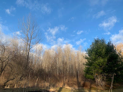
| Springtime blue skies over St. Albans, Vermont late Thursday afternoon. |
I took advantage of that to brave the mud and inspect the oddly early spring yard.
Everything is a full month ahead of schedule. All the daffodils were starting to come up. So were the sedum, irises and day lilies. And other stuff. Some of the trees are budding. The lawn showed hints of green.
My walk through the yard would have been about average for April 7. But it was only March 7.
I've seen spring get ahead of itself with disconcerting frequency in recent years. , But never this far in advance. Pretty scary if you ask me.
The gardens will advance a little more today and tomorrow, which isn't good. Sunshine and highs in the low 50s is - once again - typical for early April. But it's only early March. Saturday could crack 50 also before the noticeable storm comes in for the weekend.
Video: My prematurely spring garden and yard filmed yesterday, March 7 in St. Albans, Vermont. Normally, it should look like it does in this video a month later, around April 7. Click on this link to view, or if you see the image below click on that.
Scroll down below the video for news and forecasts of a wintry interruption to this springtime weirdness. Spoiler: Some of us could get a lot of snow.
STORM FORECAST
The expected weekend and early week storm will be an interruption to this bizarre early spring. But it will be a typical March storm.
A lot of snow could pile up in the mountains. But valleys will see a good deal of rain. Especially west of the Green Mountains.
Of course, the fine details of the storm are still being established, but our broad brush outlook is becoming clearer.
Like most storms of this type, we'll have an initial big thump of precipitation Saturday night and Sunday morning. Warmer valleys west should have mostly or completely a cold rain with this stage of the game.
Eastern Vermont lowlands are on the cusp, so a mix of rain and snow is looking like a good bet.
This will depend greatly on your elevation. It'll be one of those storms in which your house might get mostly rain, but drive up the hill and gain a couple hundred feet of elevation and it's deep snow.
Higher elevations above 2,000 should get a good thump of wet snow.
This will be a problem. First of all, especially just before the onset of rain and snow Saturday afternoon and evening, downslope winds along the western slopes of the Green Mountains could create some power line trouble.
Then that high elevation wet snow will weigh down the trees. Winds will continue to be gusty, so the combination could create more power outages.
All this moisture won't help the back roads any. Some dirt roads are closed to traffic because the mud is so thick. Rivers will be running high after the minor flooding yesterday, and a few could rise toward bankful again if we get more rain than snow.
Sunday
On Sunday, the rain and snow will become more showery as what is known as a dry slot moves in. That's when a storm's circulation pulls in drier air from the west, which goes south of the storm then rockets northward as a narrow "slot" of lighter precipitation.
Because precipitation will be lighter, snow levels will rise, so places that were getting snow might see some light rain showers. Also, the higher March sun angle will help warm things up just a bit during the day.
Then the part of the storm that develops into a strong coastal storm will take over. Lots of moisture on northwest winds will swing in, and make it colder. Almost everyone should see snow showers Sunday night and probably a good part of Monday as those winds blow.
The Champlain Valley and lower Connecticut Valley probably won't get much out of this. But the Green Mountains, especially from about Killington north, could really get a big dump out of Storm Part II Sunday night and Monday.
Next Week
Any snow that accumulates in the valleys should quickly melt as we warm up again. By Wednesday and Thursday, highs will be flirting with a springlike 50 degrees once again. That's at least ten degrees warmer than average for this time of year.
By the way, garden plants are not advanced quite enough to be damaged by Sunday's storm. I just worry about cold snaps later in the spring when the plants and tree blooms are more mature.


No comments:
Post a Comment