 |
| It's getting to be that time of year. Widespread severe weather possible in the middle of the nation today. especially in Arkansas and eastern Oklahoma. |
Right on schedule, depending on where you were Wednesday, you saw tornadoes, large hail, wildfires, high winds, and snowstorms.
Arguably, the most exciting weather Monday was a least one tornado in Kansas and some large, surely damaging hail hitting populated areas around Kansas City.
Shawnee, a western suburb of Kansas City, reported baseball sized hail. A picturesque dusk tornado caused some damage southwest of Topeka.
The tornado and severe thunderstorm threat will actually worsen today. Tornadoes are possible today through a broad stretch of the Mississippi Valley, especially in Arkansas and eastern Oklahoma.
Meanwhile, the Denver area is having one of its biggest snowstorms in years. Most of the major highway mountain passes west of Denver are closed because as much as three feet of snow is expected in those areas. Denver itself is forecast to receive 10 to 18 inches of heavy, wet snow, with amounts closer to two feet in the western suburbs.
On top of all that, wildfires burned in parts of Oklahoma and Texas Wednesday. Today, most of California is bracing for high winds.
So, is all this awfulness coming to the Green Mountain State?
The short answer is no, with details below.
VERMONT
We will blessedly miss out on the big headline weather here in Vermont. Unsettled, yes but nothing scary in the near future.
It's going to be quite warm again today, in what has been an incredibly warm month. If March stopped now, it would be a tie for the fourth warmest March on record in Burlington. You'd think we'd be in line for having one of the top few warmest Marches on record, since the second half of the month is usually quite a bit warmer than the beginning days.
 |
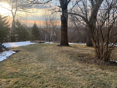
| By late afternoon Wednesday, warm weather had melted most of Sunday and Monday's snow off my St. Albans, Vermont yard. |
That might end up being true, but it's not a slam dunk. That's because the weather pattern is changing toward a cooler one.
Not ridiculously cold, but cooler than it's been. The pattern shift could drive down the average temperature for the month.
Before we get there, we have some mild weather to get through. Today will get into the 50s in many areas once again. That's a good 10 to 15 degrees warmer than average for this time of year.
Tonight and early tomorrow, it looks like a decent slug of rain will come through. Most of us should see somewhere in the neighborhood of a half inch of rain. That's enough to keep waterways high and mud season going full steam ahead. But it won't be enough to set off any flooding.
It'll stay mild-ish through the weekend, with more showers due Sunday. Again, not a blinding downpour, just showers.
The Sunday showers will come along with a cold front that will introduce our chillier air. High temperatures should hold in the 30s for at least the first half of next week, and possibly beyond. Lows will be in the upper teens and low 20s.
That's not awful for March, but it's cooler than we've gotten used to. We'll probably also have a little snow mixed in there as well. But again, nothing crazy.
And remember that completely non-sensical American weather model I referred to yesterday? The one that depicted a gigantic storm along the East Coast around March 26? Yeah, the latest run shows weak low pressure and scattered mostly light rains in the East that day.
Told ya!

No comments:
Post a Comment