 |
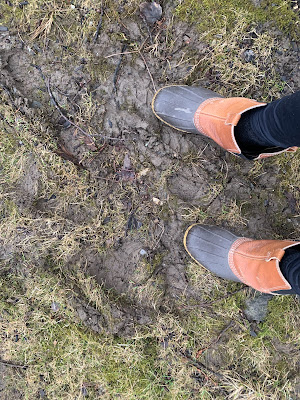
| It's really muddy underfoot in Vermont at the moment, and it's going to get worse today and tonight with an expected soaking rain, |
It's the haves and have nots, as some areas have seen near record temperatures, while other areas have been a little closer to normal. And those warm and cooler areas keep shifting around.
On Sunday, southeastern Vermont basked in temperatures in the upper 50s to near 60, while northwestern Vermont, under low clouds and fog, struggled into the low 40s.
Monday, it was the opposite. Northwestern Vermont was enjoying spring, with a record high of 60 degrees in Burlington. It was eastern and southeastern Vermont's turn to stay in the 40s.
Yesterday, as a storm clipped the region, the northwest was warm again. New York's St. Lawrence Valley had record highs in the mid and upper 60s.
Northwest Vermont was relatively balmy in the 50s. Meanwhile some sections of southeast Vermont struggled to reach 40 under a pretty steady rain.
We have one more day of this today. Northwestern areas will be coolish but still mild for this time of year - in the 40s. But it could be near 60 in and around Brattleboro today.
Just had to mention it because such four days in a row of warm temperatures bouncing around the region is just stupid odd.
STORMINESS
Now for the meat of this post.
We've certainly gotten into a more active weather pattern and we'll have some more interesting weather to watch over the next several days.
The first one went by yesterday, mostly hitting southern and eastern Vermont. Springfield had 0.75 inches and nearly a half inch fell as far northwest as Montpelier. But Burlington, on the fringes of the storm, only saw 0.07 inches.
A heavier soaker is due today statewide. A slow moving cold front is sinking slowly southeastward through Vermont today. Meanwhile, a wet storm is moving northward along the Atlantic Coast and should be in southern New England by tonight.
Usually, this is a great setup for a lot of snow in Vermont, but there's no cold air to be had. Which means rain. And it is a soaker. Especially south and east of a line from roughly Middlebury to Newport, where an inch to an inch and a half of rain should come down by late tonight.
North and west of that line, we'll see a good three quarters of an inch of rain, so it will still be quite a wet day and evening. Rain is slowly working southward, and it might take until late morning to get as far south as Route 2. It should stay mostly dry until sometime this afternoon in southern Vermont.
NOAA's Weather Prediction Center has Vermont in a marginal risk for some flooding, the lowest of four alert levels. If any flooding does occur - which is very iffy - it'll just be ponding of water in low spots, maybe a hint of urban street flooding, but nothing too serious.
However, Vermont's back roads are already mud season quagmires and all this rain will just make the situation that much worse. If you can avoid gravel and dirt roads, please avoid them.
Southeastern New England is at great risk for flooding with this, especially in and around Rhode Island.
WEEKEND STORM
Another quite noticeable storm is due around here Saturday night and Sunday. It'll be a little colder, so snow becomes a question mark. At this point, it looks like low elevations should have mostly rain during the bulk of the storm Saturday night and Sunday.
Early indications are we should have almost as much precipitation from the weekend storm as we will with the one we're dealing with today.
It's possible mid and high elevations could see some heavy, wet snow, which would bring another round of power outages. We'll keep an eye on that.
Behind the storm, it will turn windy and somewhat colder Sunday night through Monday night. I expect quite a few snow showers by then. Valleys might see some accumulation and mountains could get a few inches more.
There's still a lot of question marks as to who gets snow and how much with this storm, so stay tuned.
It's only early March, so of course more snow is inevitable. In fact, we're going into a somewhat cooler pattern, so there will be several chance of snow between Sunday and I'd say at least to the first day of astronomical spring on March 19 and probably beyond.

No comments:
Post a Comment