Thursday, November 30, 2023

El Nino Is Weird This Time. Will That Create More Weird Weather Surprises?

Map shows areas of oceans warmer or cooler than normal.
Orange areas are on the warm side. That stripe of warmth
west of South America is normal for an El Nino. The
warmth in the northern Pacific, though, might be
disrupting the "normal" El Nino weather pattern. 
As you keep reading in this here blog thingy, I keep mentioning the current El Nino that is helping boost global temperatures to record heights. It's working hand in hand with climate change. 

We're heading into winter, and you'd expect a typical El Nino pattern to take hold. More often than not, that means a rather mild November, December and possibly January here in the Northeast. 

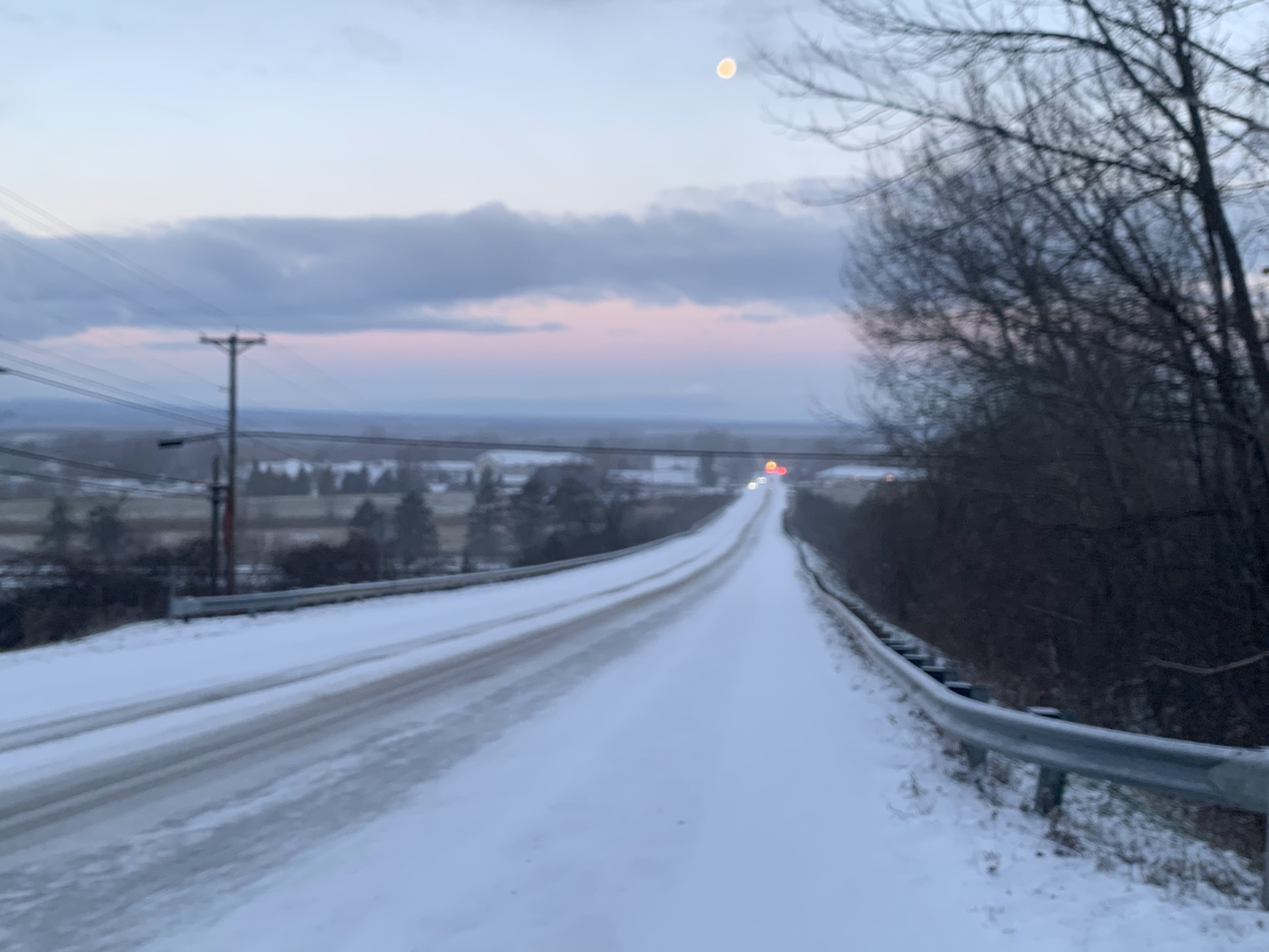
Instead, it's been a rather chilly November here in Vermont. Not anywhere close to record cold, but it's still been on the nippy side. 

El Ninos, especially when they're pretty strong like this one,  tend to turbo-charge storminess, too. Not always, but often. Larger storms normally start to ramp up in November and continue on into the winter. Sometimes, El Nino helps storms get even stronger. 

So far, with the exception of the surprise big snowstorm in parts of Vermont early Monday and an intense storm in Florida earlier this month, the weather has been remarkably docile across the United States so far.  

In the colder months of the year, El Nino tends to make the South stormy, and those storms sometimes roar northeastward up the East Coast, though they often pass south of New England, and their impacts frequently miss places like Vermont and New Hampshire. 

Experts are honing in on one factor that has made at least early winter a bit odd. El Ninos always make the Pacific Ocean off the west coast of South American unusually warm, and that's their case this time. 

However, currently, there's also a big patch of oddly toasty water in the west-central and northwestern Pacific Ocean. This pattern increased the rainfall there, which in turn pretty much literally steers the thunder from wannabe storms that typically crash into the West Coast.

Those storms then travel roughly west to east across the southern and sometimes eastern United States.  Those storms are missing due to the warm northwest Pacific, so the weather has overall been pretty quiet the past few weeks in most of the United States. 

According to reports, scientists believe climate change is probably at least partly responsible for the warmth in the western and northwestern Pacific. 

Scientists told the Washington Post they still believe the weather pattern will evolve into something more typical of an El Nino. That means increased storminess in California and across the South. It could also mean a warm December after all in the northern United States, including possibly here in New England. 

There are already some signs of that trend. The latest National Weather Service Climate Prediction Center outlooks are leaning warm across most of the United States for the first two weeks of December.

Many, but certainly not all forecasts for this winter point to a somewhat harsher late winter with possible bouts of Arctic cold later in January and February. 

But who knows, really? Each major El Nino winter here in Vermont had its differences. The winter of 1997-98 featured arguably Vermont's worst ice storm in history, but was otherwise close to normal. The El Nino continued into the winter of 1998-99 and we had an exceptionally warm winter,.

Another El Nino winter, 2009-2010 was a rather snowy and a bit on the cold side, Finally, the last winter with a big El Nino, 2015-16, was the warmest winter on record in Vermont. 

Given all that, I'll stick by the winter prediction I made weeks ago: I'll tell you in March, because the only way we'll know how the winter of 2023-24 turns out is waiting until it's over.  

Wednesday, November 29, 2023

After Wild Ride In Vermont, Quieter Thank Goodness. Same Goes For Scotland

View out the plane window on approach to Edinburgh,
Scotland today. Notice the background landscape is
not that different from the hills in Vermont. The seacoast
in the foreground doesn't look that much different from the
Lake Champlain shore in Burlington. 
 EDINBURGH, SCOTLAND - Just arrived at my temporary perch in Scotland, will I will be staying for the next eight days ago.  

It was a challenging trip from Newark, New Jersey to Edinburgh, and we arrived more than seven hours later than scheduled. It wasn't weather problems. 

It was just a cargo door that malfunctioned, then we were moved to another plane, but they didn't re-scan the luggage correctly, and that took time to fix, and then the flight crew ran out of hours so they had to find another crew.

Sigh. But we made it! We just arrived at our hotel.   The city at first glance is, as advertised, gorgeous.  We're too tired to explore today. It's 3:40 p.m here and already getting dark. Edinburgh is as far north as north-central Quebec, so we're up there.

Back in Vermont, there were weather challenges once again last evening, I'm told. For a time it was really puking snow along the western slopes of the Green Mountains and the summits. 

It turned into a real mess when a few inches of snow fell along Interstate 89 between Williston and Waterbury, with a good three inches piling up in short order. Meanwhile, at the National Weather Service office in South Burlington, they just barely mustered a trace. 

The sudden onslaught of snow along Interstate 89 caused a ton of slide offs and such.  A section of the interstate between Williston and Richmond closed for a time. 

Some of the higher snow totals from this latest in a what has amounted to a series of surprise snowfalls this week include 6.0 inches in Montgomery,  4.8 inches in Jeffersonville, 4.1 inches in Huntington, 4.0 inches in Johnson and 3.6 inches in the Nashville section of Jonesville. 

The weather here in Edinburgh looks like it will be similar to that of Vermont over the next couple days. (I noticed while the plane was coming in for a landing that the landscape outside of Edinburgh is similar to that of Vermont. There's snow covered hills, no snow on the ground in Edinburgh proper, and an overcast sky. Temperatures are hovering just barely above freezing. 

Same in Vermont. Highs today under cloudy skies should be barely into the 30s. It'll be a little warmer tomorrow over in the Green Mountain State.

For Vermonters, the next shot at precipitation is on Friday and especially Friday night. This could be another mess like on Monday, except rain or snow should be lighter than it was on Monday. The fast flow aloft will probably shear apart the oncoming storm somewhat, so at this stage it looks like the risk of a few inches of wet snow again in the high elevations, and perhaps more rain in the warmer valleys. 

Stay tuned, as things could change, as they certainly did on Monday.  

The forecast beyond Friday still looks clear as mud, as a continued fast flow aloft will throw all kinds of weather disturbances at us. But I still have no idea whether any of these will be fairly substantial, or just the usual snow and rain showers.

At least it won't be that cold. Temperatures should be near normal - highs in the 30s to around 40.

As I mentioned earlier, since I'm way over in Scotland, some of my posts will come in at odd times, and might not be as consistent as usual. My apologies, but as you might understand, I want to explore this beautiful city whilst I'm here. (Notice the UK affectation in that sentence already!)

Tuesday, November 28, 2023

Snow Squalls/Snow Showers Cause Havoc In Parts Of The Northeast Today

The first snow flurries of the season in New York City
Tuesday afternoon, as seen from a plane on 
approach to Newark Airport. 
 I'm on a layover in Newark, and it's snowing out there. Just a bit. 

The first snow flurries of the season hit the New York City metro area today. They caused no trouble and delighted people in the region looking for snow. 

It's been a record 652 or more days since New York City has had more than an inch of snow. That's nearly two years. The previous longest stretch without an inch of snow there was 383 days in 1997-98.

Elsewhere, the snow showers and snow squalls turned out to be problematic. Even in Vermont. 

The National Weather Service office in South Burlington put out an alert this afternoon, saying snow showers and snow squalls could cause sudden problems on the roads. That risk will continue to through this evening's commute. 

On Route 4 in Killington, Vermont a bus and vehicle collided, killing the driver of the vehicle and injuring one of two people on the bus. It's unclear if weather had anything to do with the crash, but heavy snow showers were moving through Rutland County at the time, and a photo of the crash aftermath showed heavy snow falling. 

Other crashes have been reported in Vermont today due to slipper roads. 

Elsewhere in the Northeast, 20 vehicles got caught up in a pileup during snow squalls in Ohio. 

Lake effect snows have been cranking in western New York, with nearly two feet reported south of Buffalo. The Tug Hill Plateau east of Lake Ontario received similar amounts. 

The snow showers and snow squalls throughout the Northeast are expected to mostly taper off tonight. That includes here in Vermont. 

The next chance of any accumulating snow in Vermont will come along Friday, but at this point, that storm looks like it could be mostly rain, and probably not that big. 

Meanwhile, as I sit in Newark airport, the snow flurries have stopped for now. On to Edinburgh! 

Traveling Man Might Make Blog Post Inconsistent, Oddly Timed

 Hi!  


Just a note here that I will be traveling overseas through December 9.  

As a result, blog posts might be somewhat less frequent through that period.  They will also probably appear at odd times.

However, you probably will see some updates and reports from my destination, which will become apparent to you in the coming days. 

I appreciate the patience and greatly appreciate all the people who check out this blog. Love to all!!! 

Winter Still Toying With Vermont, Bits And Pieces Of Travel Trouble

A heavy early morning snow shower iced up the road
in front of my St. Albans, Vermont house, but
shortly after, blue sky and the moon appeared. This
kind of changeable early winter weather
should last all day. 
 I awoke to another surprise heavy snow this morning in St. Albans, Vermont. 

In this case, it was just a pretty hefty snow shower that passed by quickly, leaving partly cloudy skies and a dawn view of the moon in its wake. 

But the snow showers definitely left behind a half inch ofd new snow and some very slick roads, making conditions pretty hazardous for some on their morning commute. 

You'll want to take some extra time getting to work this morning especially if it snowed where you are. 

The snow showers were hit and miss. Some areas were still fine, others a mess between 7 and 8 this morning. That state of affairs should last all day. 

A weather disturbance and cold front is instigating the snow showers.  They could hit anywhere anytime today, but the best chance is this afternoon and in central and northern Vermont, and the entire Green Mountain range. 

Some of the snow showers, like the ones in St. Albans early today, will be on the heavy side. But they're racing along and should be pretty brief.  Which means total accumulations will be an inch or less. The exception to this will be an area along and north of Route 2 from east of Burlington into New Hampshire, which could pick up one to three inches. 

The Connecticut Valley of southeastern Vermont should see pretty much nothing at all. Meanwhile, the Green Mountains, especially from Killington north, should see two to as much as six inches out of this. 

All this will make things unpredictable on the roads all day. Things will be fine one minute then they won't. Or, you'll be blissfully traveling along a snow-free road, only to encounter the next minute some low visibility snow, and ice under your tires. 

This state of affairs should last through today's evening commute, so beware. 

The rest of the week looks fairly quiet, but there are signs of some modest storminess Friday and perhaps something a little more substantial early next week. But the weather pattern is especially hard to predict right now, so any forecast beyond a couple days is suspect. 

Just wait it out and check forecasts as they're updated. 

Monday, November 27, 2023

Vermont Recovering From Surprise Snowstorm; More Minor Winter Weather Still Coming

Breaks of blue sky appeared in the sky over St. Albans,
Vermont after last night's wet snow and rain, but the
darker clouds hinted at a few more snow showers in our future.
Vermont is still recovering from the surprise, rather poorly forecast snowstorm from last night.  

Temperatures were above freezing statewide this afternoon, so that the slush on plowed roads melted away. 

More snow accumulation reports came in during the day, and those totals were pretty impressive for a storm that was forecast to produce just a trace to four inches of snow. 

The highest snow totals I found were at pretty high elevations - near 1,500 feet above sea level. A spot in Northfield, elevation 1,400 feet, reported 12.5 inches. Another spot in Hyde Park, elevation 1,600 feet, had 12 inches. Other reports included 11 inches in Albany and 10 inches in Sheffield, both in the Northeast Kingdom. 

Elevation made a huge difference. Valleys in central Vermont had closer to four to six inches. Here in the Champlain Valley, downtown St Albans had absolutely no snow this morning. My place, just 300 feet higher in elevations, had an inch.

Actual snow totals from last night's storm. Map from
National Weather Service/South Burlington. Lots of'
8-12 inch reports. 
An inch of snow normally melts quickly when temperatures reach 40 degrees. But the snow was so dense that much of it remained in my yard as darkness fell. 

Vermont electric utilities have been working all day, and will be working into the night to restore power to the thousands of people who lost power due to the heavy, wet snow. At the peaks this morning, nearly 34,000 homes and businesses had no electricity.

As of 5 p.m. today, that number was down to a little under 10,000.

More wintry weather is on the way, but it shouldn't be anything extreme. At least locally. f

An impressive band of lake effect snow, laced with lightning strikes, was slamming areas downwind of Lake Erie a little south of Buffalo, New York. An even more impressive snow band was just organizing late this afternoon off of Lake Ontario, which will dump at much as two feet of snow in the notoriously snowy Tug Hill Plateau. 

The remnants of those lake effect storms will drift into Vermont late tonight and especially tomorrow as snow showers. A weak disturbance coming through in the afternoon will probably make the Vermont snow showers a little more widespread. 

This was the forecast for last night's storm. It REALLY
overperformed. 
The bottom line is you'll still need to be a bit careful driving to and from work tomorrow. In the morning, water from today's snow melt will freeze on pavement, leading to some icy patches.

 In the afternoon and evening, snow showers will produce light accumulations in many spots. It doesn't take much to make roads slippery, so even a dusting or a half inch of snow could cause problems. 

Some summits and western slopes of the central and northern Green Mountains could receive two to four inches of additional snow tomorrow.  The ski areas are off to a pretty good start. 

EDITOR'S NOTE

I will be traveling overseas between tomorrow and December 9. I'll do a post tomorrow morning, but after that, posts might not appear consistently every day and might appear at odd times, or hours you're not used to. I appreciate your patience! 


Botched Vermont Forecast: "Rain Storm" Turn Into Snowy Mess

 Boy, forecasters got this storm wrong. That "rain" out there in Vermont this morning is looking awfully white. 

Route 100 near Warren, Vermont
overnight. Photo via Facebook by
Enrique Melendez. 
Instead of a mostly rain event, heavy wet snow clogged highways throughout Vermont along with widespread power outages. The commute to work that was supposed to be easy was a mess for many people.  

Now that we woke up unpleasantly surprised, the storm is mostly over. 

The National Weather Service in South Burlington, when it became apparent that this was a snowy surprise, last night issued a winter weather advisory for northern Vermont away from Lake Champlain. 

In hindsight, it probably should have been a winter storm warning. As of 7 a.m. this morning 34,000 homes and businesses across Vermont had no electricity. This is yet another big hit for the state's electric utilities, who have suffered widespread storm damage with increasing frequency in recent years.

Many roads and highways were closed by fallen trees and power lines and stuck cars. 

 I have no clue whether climate change helped intensify last night's storm, but other storms that have causes widespread power failures in Vermont in the past decade were probably turbo-charged at least a bit by climate change. 

Snowfall totals from overnight are pretty impressive. Especially considering it was a heavy, wet snow that doesn't pile up as readily as powdery stuff. 

We don't have a complete list of totals yet, but I see reports of 9.5 inches in Calais, Duxbury and East Warren; 9.0 inches in Cabot and Standard; 8.0 inches in Waterbury Center and 7.5 inches in Worcester.

Even parts of the Champlain Valley, which were forecast to receive absolutely no snow, got at least a little.  There's a good inch of new snow on the ground here in St. Albans. However, most of the snow in the valley was mixed with a drenching rain. Places around Burlington and right near the lake got little or no snow, while the eastern Champlain Valley near the foothills of the Green Mountains got buried. 

The only bright spot to this episode is that Vermont ski areas got an unexpected but welcome dump of snow. 

WHAT WENT WRONG?

This was one of the most spectacularly wrongly forecast storm in Vermont I can remember in recent memory. And wrong with consequences. The expectation of  harmless, moderate cold rain, mixed with a little snow at mid and high elevations, turned into a dangerous winter storm. (At least in terms of power outages, tree damage and horrible road conditions).

The storm was an example of when temperatures are marginal, anything can happen. Forecasters believed temperatures would be just above freezing through most o the storm. The computer models, and meteorologists who examined them, suggested that a few inches of snow would fall on mountain summits. 

Also, areas at and above 1,500 feet would see one to three inches of snow before a likely changeover to rain.  Temperatures were expected to be around 34 degrees or even a tad higher through a thick layer of the atmosphere, from valleys to mountains and even above that. 

However, temperatures stayed just a couple degrees cooler than forecast.  Usually, if a meteorologist predicts an overnight low of 40 degrees and it turns out to be 38 instead, it's still regarded as an accurate forecast. 

But when a storm is ongoing, and the forecast is off by two degrees while readings are close to freezing, you can have real problems, as we did last night. 

Being a Monday morning quarterback, I can now see one clue ahead of the storm that might have let us know it was going to be a snowstorm, not a rain storm. 

In last evening's update, I noted predicted precipitation amounts would be a little higher than previously thought. It turns out that was a trend I'm sure many meteorologists wish they'd latched onto.    

t turns out precipitation rates and amounts were much heavier than forecast. When temperatures are marginal, as they were last night, heavier precipitation can cool the air a little, ensuring it lands on the ground as wet snow instead of rain

A for-example. Burlington was expected to receive the lighter amounts of rain compared to other parts of the state, maybe a third of an inch or so. Instead, rain, mixed with snow at times came down really hard at times, amounting to a storm total of 1.28 inches. A little more than half of that fell in just a two-hour period, which is an impressive precipitation rate for this time of year. 

 Elsewhere in Vermont, rain and melted snow was only a little more than forecast, but it might have been enough to help keep things mostly snow instead of mostly rain. 

Temperatures still remained near 32 or 33 degrees throughout the storm, which created a wet snow that was so destructive to trees and power lines.  And it made the snow that much more difficult to clear away. 

This whole episode is proof that although weather forecasting has gotten better in recent years and decades, we can sometimes really be taken by surprise. 

GOING FORWARD

Since weather forecasts around here are usually quite good, we're writing last night off as a bad moment. What happens next seems to be a little more straight forward.

The heavy precipitation has left Vermont, and we have scattered areas of light rain, snow and drizzle left behind. 

Temperatures in the 35 to 42 degree range late this morning and afternoon will help melt remaining slush on roads. However, temperatures will dip below freezing this evening and overnight. Remaining water on roads and driveways and such will freeze, making for some patchy slick spots tomorrow morning. 

Light snow showers will add to all that. Accumulations will be light, if they happen at all. But those snow showers might add to the overall annoyance. 

The next chance of any real snow or rain will come along Friday or Saturday, but it's too soon to tell whether that will be another nasty storm or just another nothing burger. 


a can't say whether

Sunday, November 26, 2023

Sunday Evening Vermont Update: Heavier Precipitation, But Still Mostly Rain

We're going to have a cold rain in the Champlain Valley of
Vermont later tonight. Although clouds were increasing this
afternoon, a burst of sun toward sunset gave us a 
golden glow before we got into tonight's chilly rain. 
In checking out the updates from the National Weather Service in South Burlington late Sunday afternoon, there's some changes in the storm forecast tonight and Monday morning, but most people won't really notice the difference. 

We will have mostly a cold rain, as planned. 

This is still going to be mostly a cold, miserable rain overnight and Monday morning. 

It could start off as snow, especially at elevations above 1,500 feet above sea level before midnight tonight, but it will quickly go over to rain, except maybe at the mountain summits, where it might take a bit longer for the changeover.

Rainfall will be a little heavier than I mentioned this morning, The latest projections have the Champlain Valley receiving maybe a little over a third of an inch of rain, most of central Vermont seeing a half to two thirds of an inch, and southeastern Vermont seeing perhaps an inch of rain.

So kinda of a soaker but not the end of the world. 

Another thing I noticed is this icky weather looks like it wants to blast out of here pretty quickly on Monday. 

Monday afternoon might be sort of nice by late November standards, especially west of the Green Mountains. Temperatures will be in the low 40s, there might be glimpses of sun, and winds will only be sort of blustery.  

It will still get cold again Monday night and Tuesday with snow showers. Nothing to get excited about in Vermont. Just a coating in Vermont. The remnants of heavy lake affect snow showers in New York should make it into the Green Mountain State but those will only dust the mountains. At least it will be cold enough for ski resorts to keep making snow after a brief interruption overnight and a good chunk of Monday. 

The rest of the upcoming week looks rather bland with clouds, risks of light snow showers here and there, and temperatures about where they're supposed to be this time of year. That means highs in the 30s to around 40 and lows in the upper teens and 20s.

We're stuck in a sort of pre-winter. If you like big weather drama in Vermont, you're pretty much out of luck of the time being. 

Another Close But No Cigar Shot At Real Snow Here In Vermont

The snow forecast from the National Weather Service
in South Burlington for tonight and Monday is 
looking pretty paltry as warm-ish air will keep things
as mostly rain in the valleys. 
 Yet another modest storm is on Vermont's doorstep for tonight and Monday. But as it looks now, this one will bring little snow to the Green Mountain State, but provide a cold rain for many. 

It's a case of the weather systems almost getting their act together to give us a big dump of snow but not quite. 

There is a coastal low - a developing nor'easter  - at play. Yay for snow lovers, right? Those tend to give us decent early snowstorms this time of year. 

Not this time, folks. The storm will probably take somewhat of an inland track through Rhode Island or Connecticut, then eastern Massachusetts and coastal Maine. 

That path would bring a will bring a little warm air northward, which would cut down on snow totals,

More importantly with this event, there's another storm north of the Great Lakes that will block cold air from feeding into the coastal storm, so we in Vermont will probably be too warm for any heavy snows.

That said, temperatures are marginal, so it's always possible the mountains could get more snow than forecast.

Right now, the National Weather Service in South Burlington is telling us mixed snow and rain will move in early tonight in the valleys then change to a plain, cold rain with little if any accumulation Up around 1,500 feet, you might get one or two inches. Summits might see three to five inches. But even up there, it might go over to rain for awhile.

That said, if temperatures turn out to be a degree or two colder than forecast, then snow totals in many areas might surprise some people. It doesn't look like it's in the cards now, but it's something to keep an eye on. 

Even then, this won't be any kind of blockbuster as over all precipitation amounts should be light. Rain and melted snow will probably amount to only a quarter to a half inch, with maybe a little more than that in southeastern Vermont. 

It may be sort of semi-winter outside, but our hibiscus
tree that we brought indoors for the winter last month is
still cranking out tons of springlike blooms, Brightens
up the house a little during the dark days of late November,

Once the coastal storm gets by us Monday afternoon and the storm north of the Great Lakes moves east, the floodgates will open for the colder air to blast into Vermont.

 But by then, the deeper moisture will have passed us by, leaving us with just snow showers, with maybe a bit of additional accumulation in the mountains Monday afternoon into Tuesday. 

Northwest winds will be gusty by Monday afternoon as temperatures start to fall, That will leave us with typical blustery, cloudy late November weather with a few snowflakes in the air through maybe Wednesday. 

Also in the close but not cigar lane with this storm, areas relatively close to Vermont will see their share of snow and winter weather, 

 Northern New Hampshire is under a winter weather advisory for one to three inches of snow in the valleys and six inches above 1,500 feet. 

The cold winds behind the storm will also produce the first big lake effect snows of the season off of Lakes Erie and Ontario in New York.  Up to 15 inches of snow is in the forecast from these south of Buffalo, New York, and 20 or more inches in the Tug Hill Plateau snow belt east of Lake Ontario. 

I like to get away and travel every once in awhile, but it always stings a bit when I'm out of Vermont and I miss a big weather event, like the epic pre-Christmas wind storm last December.

I'm greatly looking forward to another trip away from Vermont that starts Tuesday, and it looks like I will only miss out on bland early December weather.  I will of course be occasionally posting while I'm away from a temporary location I will announce soon. 

Saturday, November 25, 2023

An Ominous Climate Threshold Was Reached Last Friday

Red line is shows how far daily temperatures on Earth
were above the pre-industrial average so far this year.
At the end you can see us hit 2 degrees Celsius
above that historic average. The squiggles below
the red line are all the other years since the 1940s.
Click on the chart to make it bigger and easier to see.
 Last Friday, November 17, was the mildest day of the month here in Vermont.

It certainly didn't set any records for warmth, but it was a nice balmy interlude in what has been a somewhat chilly month. 

Worldwide, though, November 17 was an ominously warm day. For the first time, sensitive instruments saw that the day was 2.07 degrees Celsius warmer than the 1850-1900 average for Earth. 

It was the first known day that global warmth was more than two degrees Celsius above that largely pre-industrial average.

It also appears as if last Saturday was also 2 degrees Celsius above the what normal was 150 or so years ago. 

The reason all this is disconcerting is because the established goal is to keep Earth's temperature from exceeding 1.5 degrees above pre-industrial levels. So you can see how climate scientists are really bummed about last Friday. 

It was only one day, of course.  We're back below the 2 degree departure from normal, but we as a planet are still running very hot. 

As CNN reports: 

"The threshold was crossed just temporarily, and does not mean that the world is at a permanent state of warming above 2 degrees, but it is a symptom of a planet getting steadily hotter and hotter, and moving towards a longer-term situation where climate crisis impacts will be difficult - in some cases impossible - to reverse."

We are also experiencing an El Nino. That is boosting Earth's temperatures even beyond what climate change has done. It's a one-two punch, causing this year, and probably next to reach record highs for the entire world. Already, each month June through October were the world's warmest on record, and it's beginning to look like November will do the same. 

When El Nino ends, the world will cool off a little. Probably to a point near or even a little below that 1.5 degree danger threshold. That will be temporary, and the world will keep heating up and stay past that 1.5 degree goal. 

The U.N. and other policy makers had made it a policy to try and keep the world from warming more than 1.5 degrees Celsius above pre-industrial levels. The scientists said humans and ecosystems would struggle to adapt to that much warming. 

We are apparently already in that struggle. Also, as CNN reports, projections indicate we will fall far short of limits to fossil fuel emissions that would keep the world's temperatures cooler than 2 degree Celsius warming scientists say we should avoid. 

Current projections are that we will be consistently 1.5 degrees warmer than the pre-Industrial Age next decade, and 2 degrees above that level in the 2040s and 2050s. However, some scientists are worried climate change is accelerating, and those warm temperatures could come sooner. 


Friday, November 24, 2023

Vermont Floods Threatened Cherished Snowmobiling And Winter Sports, But Repairs Saved The Season

A still from a YouTube video by Pat Moore shows
this summer's destruction around Okemo Mountain
in Ludlow, Vermont. Repairs were made in 
time for this winter's ski season. 
 Now that much of Vermont has a snow cover, I'm sure lots of people are chomping at the bit for snowmobile season. Also skiing and snowboarding. 

Due to this past summer's horrific floods, the snowmobile season for the winter of 2023-24 could have been curtailed quite a bit. However, volunteers saved the day, er, the winter. 

The Vermont Association of Snow Travelers reported at least $2 million in flood damage to parts of its 4,500 mile network of trails. 

As WPTZ reports, however, at least 90 percent of the damage has been repaired in time for winter. Jim Fay, president of VAST's board of directors, told the television station: 

"Volunteers are spending hours on end, during the week, on weekends, getting stuff brought back up, and we're in good shape."

Fay said volunteers are using personal equipment and hiring local construction companies and paying out of pocket to fix trails "They're going above and beyond," Fay said. 

Two VAST suspension bridges over the Winooski River, one in East Montpelier and the other in Waterbury, were severely damaged and will remain out of commission through this winter. VAST is working with FEMA to obtain funding for those repairs. 

Some Vermont ski areas suffered flood damage, but it wasn't enough to disrupt this winter's ski season.

In hard-hit Ludlow, Okemo had to close for summer activities for a couple weeks due to damage, mostly in town and not so much on the slopes.

Okemo's slopes did suffer some minor erosion damage, but that has long since been fixed.  Some buildings suffered water damage, but that, too has been repaired. 

As of Thanksgiving, only 12 of Okemo's 129 trails were open for skiing and riding, but that's only because it's early in the season.. As snow making and natural snow (hopefully!) pile up, Okemo will expand its offerings. 

Killington, the "Beast of the East" also suffered some flood damage in July, and was forced to curtail some summer operations for awhile.

Two base lodges, Bear Mountain and Skyeship, were heavily damaged, WPTZ reported.  Those buildings weren't used in the summer, and have since been repaired for winter. Some ski trails were also damaged, but have since been fixed and will be used as usual this winter.

Infrastructure in hard hit ski towns - like roads, sewers, electricity and such - have long since been restored and won't be an issue for people visiting during ski season. However, some favorite restaurants and shops have not yet reopened.  

All these tourism-related businesses are of course completely tied to Vermont's economic health. If tourists are discouraged from visiting Vermont  because of flood damage - or fears that the destruction would harm their experience - we all suffer. 

I haven't found data on how the summer flood affected the autumn foliage tourism season. But I do know the floods dented Vermont's summer figures. 

Vermont Business Magazine at the end of August reported tax revenue in most categories fell short in July, the first month of the state's fiscal year. 

The target for rooms and meals tax revenue in July was $14.3 million, but actual revenue was $13.5 million. That's not a crash, but it fell short. Other revenue streams that were less related to the flooding also fell short.

So, bottom line, we'd better hope we see a lot of winter visitors to Vermont.  We'd also better hope for big dumps of mountain snow this winter. That's a tall order in a winter in which El Nino is raging and climate change isn't helping. 

I'm among legions of Vermonters who don't like shoveling snow in the winter. But I don't know about you, but I"m completely willing to take one for the team. 

Thursday, November 23, 2023

Canadian Wildfire Season Mercifully Ends After Unprecedented Burn Year

Chart shows the monthly trend line in acreage burned in
Canadian wildfires. Pink line is 2023. All the
other lines are yearly fire activity since 2000,
 Winter has pretty much set in for most of Canada, so after so many months of conflagrations, the nation isn't burning anymore.  

You've noticed the change here in Vermont. This November, whenever the wind shifts into the north, we don't get wildfire smoke anymore. That's definitely a change from what we experienced from May to early October.  And it's fortunate, since winds have been from the north and northwest most of this month. 

The Canadian fire stats are pretty wild, per the Washington Post:

"About 45.7 million acres have burned in 2023, surpassing the previous high of 17.5 million acres based on records dating back to 1983, according to the Canadian Interagency Forest Fire Center." 

The total acreage burned is about the same as the annual totals from 2015 to 2022 combined. If all the burned land was combined, it would entirely cover North Dakota, with about 200,000 additional acres in say, South Dakota.

Obviously, Canada is a huge nation. As such, you'd normally expect in any given year that parts of Canada might be hot and dry, while others would be cool and wet. Somehow, almost all of Canada managed to be hot and dry by their standards for much of the year. 

On the west coast, British Columbia saw 7 million acres burn this year, which is more than double the previous record. In eastern Canada, 12.8 acres burned in Quebec, also double the previous record for that province. 

In small sized Nova Scotia, 62,000 acres burned, which was six times the old record.

Some of the fire-ravaged areas also experienced extreme weather whiplash.  Parts of Nova Scotia were devastated by fires in May. Those same areas endured severe flooding in July and August. 

Traffic makes its way along Interstate 89
in Georgia, Vermont on June 25 through smoke and haze from
Canadian wildfires. Canada had by far its worst 
fire season on record. 
It's hard to say whether fires are a steeply accelerating crisis in Canada. We know that trend in wildfires has been increasing in the (former) Great White North, as the nation has turned warmer and sometimes drier with climate change. 

However, 2023 was simply unimaginable, until it happened.

I have to wonder whether 2024 will be a bad year, too.  El Nino is in full force, which tends to make Canada as a whole warmer and drier than usual. Combined with climate change, it could be another bad year. 

Another bad fire year in Canada would of course be bad for the United States, too.  Vast areas of the continental U.S. choked on repeated smoke and pollution episodes from those Canadian fires. That surely had health effects for millions of people. 

Thankfully, right now, most of Canada is snow covered, and will remain that way through at least March and much of April, 2024.  The first fires of the season in Canada usually start in May and taper off in September. 

Wednesday, November 22, 2023

Vermont Storm Assessment And Forecast: It Was Well Predicted. Coming UP: Lots Of Cold, Not Much Storminess

This is the forecast of snowfall of the storm we just had,
issued less than 24 hours before it started. The southeastern
third of Vermont was expected to get roughly four inches of snow
with much less in western Vermont.....
The snow and schmutz we had last night and early this morning is over, leaving behind a low overcast, fog, and drizzle. 

The snow and sleet on the ground is slowly melting. But enough snow fell in eastern Vermont to guarantee a white Thanksgiving. 

Who knows whether there will be a white Christmas, but at least one holiday is snowy for some of us. 

The forecast location of the heaviest snow was spot on. The heaviest snow was expected along and east of the Green Mountains from Route 2 south. That's exactly what happened. 

Total snowfall, though, was a little more than forecast. The zone of heaviest snow was expected to bring three to five inches. However, several places received six inches, or at least close to it. I saw quite a few reports of more than five inches.

A map of actual snowfall from this storm from the 
National Weather Service office in South Burlington.
The location of the heaviest snow was spot on, but 
the amount of snow was a little heavier than forecast.
The snow winners seem to be 6.3 inches in Maidstone, up in the Northeast Kingdom and 6.0 in Ascutney, in southeastern Vermont. 

It really does look like the summits in the Green Mountains have established a snow cover for the winter. Before the storm, the top of Mount Mansfield had three inches on the ground.

 Several inches of additional snow covered the mountain in this storm. The weather is expected to stay fairly cold for the next week or two, so get used to snow covered mountains. Yay!

Going forward, there's not much exciting weather to talk about. Thanksgiving Day will probably be the warmest of the next week and a half at least. But it won't be that warm, as highs will probably only make it to the low 40s at best. 

Small disturbances from the northwest will keep us in a regime of continued colder than normal weather with minor episodes of snow showers. Winter is here. For now,.

For those who are not quite ready for winter, there's hints of warmer weather starting around the second week of December. However, these long range forecasts are notoriously iffy, so don't count on it! 

Wednesday Vermont Storm Update: Mostly Rain Now, But Still Icy

Looks like roughly an inch accumulation in St.
Albans, Vermont. Unlike in much of Vermont
the stuff on the ground is almost entirely sleet,
with very little snow mixed in. 
 As of 6 a.m. the snow, sleet and freezing rain that we had overnight in Vermont had mostly turned to a plain, cold rain in most areas, but that doesn't mean it's all perfect on the roads out there. 

The National Weather Service office in South Burlington points out that road surface temperatures in many areas is still below freezing. 

Which means, if it's raining and 33 or 34 degrees out there, that rain might still be creating icy roads. Especially on bridges and overpasses.

Some snow and mixed precipitation was still ongoing up in the Northeast Kingdom. 

The winter weather advisory for Vermont away from the Champlain Valley remains in effect until 1 p.m. due that lingering ice. 

Road crews are out. The Vermont Agency of Transportation plow finder map looked pretty busy as of 6 a.m. with an army of trucks across the state. One of their plows just passed my house ten minutes ago. (I live along a state highway).

The rain we're getting this morning will gradually taper off, and temperatures will climb a few more degrees by afternoon.  Road conditions will continue to improve this morning.  If you have Thanksgiving travel plans, I'd still caution against getting an early start.

Wait until mid morning at least and roads that were iffy at daybreak will be much better by then. 

It's a little early to see snow reports, as there aren't many to come by.  At least in some areas, there was more sleet and a little more freezing rain than expected and a little less snow. Here in St. Albans, aside from some snow at the onset of precipitation after 7 p.m. last night, all of the precipitation was sleet with a little freezing rain. 

Points east and south did have more in the way of snow, as expected. Through midnight, Burlington reported 2.4 inches of new snow.  So far, the big winner is Ascutney, in southeastern Vermont with six inches. East Barre reported 4.9 inches and Waterbury Center 4.5.

My early reading on this was forecasts before the storm were pretty accurate, with the most snow in the east slopes of the Green Mountains in central and southern Vermont. Though a changeover to rain was mercifully a bit earlier than expected. 

All in all, it was a typical November nuisance storm. 

The rest of today won't be nice, but at least it will be pretty harmless. By afternoon, overcast, sprinkles and patchy drizzle will rule.  

Thanksgiving Day looks quiet and seasonable, with maybe even some sun.  But winter is still being an insistent early bird. 

Friday looks quite cold behind a cold front. Snow showers could mess with the roads again, so Black Friday shoppers ought to be aware of that. Highs then will only make it into the 20s to maybe near 30. Temperatures for much of Vermont will probably remain below freezing until sometime on Sunday. 

The next storm risk is Sunday night or Monday. It's not looking huge, but there's not a lot of consensus yet on exactly what will happen. Stay tuned on that one! 


Tuesday, November 21, 2023

Tuesday Evening Vermont Storm Update: Only Subtle Changes, Crappy Weather Tonight, Wednesday A.M..

A halo around the sun as clouds increased ahead of tonight
storm. Photo taken a little after noon, Colchester, Vermont. 
 All the updated forecasts are in as of 5:15 p.m. Tuesday and we in Vermont are still in for a messy, but modest sized storm.  

The bad road conditions will affect you only if your timing is bad. If you're on the highways between, say 8 or 9 this evening and mid-morning Wednesday, you're kinda screwed. After that, it shouldn't be so awful.

I'm sure you noticed today the sky steadily went from sunny to a dark overcast by afternoon. By 5 p.m. weather radar is lit up with what appears to be precipitation falling in much of Vermont already. 

But that's virga, which is rain or snow that evaporates before hitting the ground. As is typical with a storm this time of year, it's running up against some very dry air. Snow comes out of the clouds, but evaporates in that static cling type of atmosphere.

Eventually, that evaporating snow will moisten the air, and the precipitation will then hit the ground. In Vermont, that will hit probably a little after 8 p.m. this evening in the Champlain Valley and the rest of extreme western parts of the state, and make it to the Northeast Kingdom before midnight.

FORECAST ADJUSTMENTS

The National Weather Service in South Burlington has only made minor changes to the forecast as of this evening. The onset of snow looks to be just a tiny bit earlier than this morning's forecast.

Total snow accumulation along the eastern slopes and summits of the Green Mountains in central and southern Vermont have been pulled back just a tiny bit. 

The big winners down there could see four or five inches of snow. The rest of Vermont along and east of the Green Mountains looks like they'll see 1.5 to 3 inches of snow. Low elevations of southwestern Vermont will probably see one to two inches. The Champlain Valley will get two inches or less.

There will be an interval of sleet and freezing rain thrown in overnight and early Wednesday, just to make things interesting. That's bad for the roads, but it won't be nearly enough to mess with trees and power lines. 

I'm still thinking the morning commute in the Champlain Valley might not be all that annoying. Unless something unexpected happens, I suspect it will be a little above freezing with a cold, non-freezing rain after 6 a.m. 

It'll still be schmutz elsewhere, with mixed precipitation lingering until mid morning. So you'll want to plan your trips to happen Wednesday afternoon or evening. 

Thanksgiving Day still looks great by November standards. We'll have clouds and some hints of sun, with temperatures getting up to the low 40s. Not great, but not terrible, right?

I do see some potential issues for you Black Friday enthusiasts. Another cold front should come through late Thursday night or very early Friday.  That'll drop temperatures, yield some snow showers and perhaps create some areas of slick roads as you make your way to the cold, dark, windy parking lots of the big box stores before dawn Friday. 

(Editor's note: Is it really worth it to get up that early on a Friday to shop amid too-aggressive crowds?)

Anyway, colder than average weather is forecast to continue for the foreseeable future, at least into early December. The weather pattern doesn't really favor big storms, but you never know if a surprise will pop up. 

The next chance of any kind of snow after Friday morning is Monday, but I have no clue whether it will be noticeable or nothing burger flurries. 

Vermont Forecast Still Schmutzy For Tonight, Wednesday Morning

Our familiar National Weather Service/South Burlington
snow prediction map has most of the accumulation
along and east of the Green Mountains tonight
and early Wednesday.
Vermont is still on for weather designed by Sasha Royale Paine Diaz (sound it out) tonight and early Wednesday. 

The good news is it looks like many of us will be at least mostly out of the woods by mid to late morning Wednesday, so people who need to can get on with their travel plans 

It does look like the eastern slopes of the Green Mountains from at least Warren south to the Massachusetts border are in for a White Thanksgiving. 

Those areas can expect three to locally as much as six inches of snow tonight and very early Wednesday before things change over to a cold rain before tapering off. 

Most Vermont ski areas should get a few inches of new natural powder. If I had to pick a ski area that will get the most snow, I'd guess Okemo, near Ludlow. 

The strip along Route 7 from Bennington all the way up to Swanton looks to get off fairly lightly. Those lower elevation areas, including the Champlain Valley can expect a burst of snow tonight, followed by a little mix after midnight and hopefully just plain rain by or even a little before dawn. 

THE SET UP

As expected, this morning was cold. Vermont's first zero degree temperature of the season popped up before dawn today in perennial cold spot Island Pond, in the Northeast Kingdom.  That kind of temperature there isn't all that weird for the third week of November.

Most of the rest of us were in the teens, with colder towns in the single numbers. The low in Burlington was 18 degrees not odd for Thanksgiving week but still the chilliest temperature since March 12. Winter is at least sort of here, for sure. 

We had a rare bit of sun Monday afternoon and today is starting off crystal clear. But satellite images show clouds on our doorstep, and the sun will fade behind those clouds later this morning and afternoon.

Timing wise, the National Weather Service office in South Burlington has snow starting between 8 and 10 p.m. this evening south and west of Interstate 89, and by midnight for most of the rest of the state.

Road conditions will deteriorate pretty quickly in the hours before midnight. So if you're driving somewhere today, try to get there by 8 p.m. at the latest. 

WEDNESDAY

As noted, the "luckiest" people in Vermont will be those in low elevations west of the Green Mountains. There, only an inch or two of snow will fall, and at this point, it looks like temperatures will be above freezing with rain by 6 a.m. That bodes well for the morning commute, though there still will be slush and icy patches to watch out for. 

Also, be careful as conditions can unexpectedly change. There's always the chance the warmer air could be delayed, making a mess of things even in the Champlain Valley. 

Along and east of the Green Mountains, snow and mixed precipitation should continue at least into mid-morning Wednesday.  Travel will be difficult and annoying, and not really recommended in those areas. If you delay your trip some until, say noon, you'll be much better off and less stressed. 

By the way, wind, rain and visibility problems will probably cause at least a few flight delays in the Northeast Wednesday, so check your airline to see if you're actually taking off when you're supposed to. 

Rain and lingering mixed precipitation in the mountains will slowly taper off Wednesday afternoon and evening. 

Thanksgiving's weather is actually the pick of the week. Of course it's November, so you can't expect much. Still, we'll have hints of sun and seasonable afternoon temperatures in the 37 to 45 degree range, so that's not bad. 

The weekend is looking rather quiet and chilly at this point. 


Monday, November 20, 2023

Quick Monday Update: Cold Today, Still Messy Vermont Tuesday/Wednesday

The sun was out as a fairly heavy snow shower approached
St. Albans, Vermont Sunday afternoon. The snow 
shower was brief and left only a dusting of 
snow on the ground. 

UPDATE 5 PM TUESDAY

Winter weather advisories have been posted for Tuesday night and Wednesday morning for areas of Vermont and New York outside the Champlain Valley.

We should see enough snow and mixed precipitation in those areas to really slicken up the roads over Tuesday into Wednesday morning.

The Champlain Valley is also in line for some snow and mixed precipitation, but that will fairly quickly change over to rain late Tuesday night or very early 
Wednesday morning, at least as it looks now. 

There still might be some icky roads in spots even in the Champlain Valley through early Wednesday, so be careful. I'd still advise postponing road trips to later Wednesday morning or afternoon. By then, almost everybody will be just seeing plain rain, and it will be tapering off slowly during the afternoon. 

By the way, this same storm system appears to be creating a tornado outbreak in Louisiana and Mississippi this evening.  There's been very little severe weather in the South this autumn. However, when there's an El Nino, severe weather outbreaks become common in the South. Let's hope tonight's dangerous weather down there is not the start of a trend. 

PREVIOUS DISCUSSION

 I'll just to a quick update today on the upcoming Vermont messy weather, with a lot more details to come in a post tomorrow morning. 

First of all, Sunday was classic Vermont November, wasn't it? The sun would come out, then we'd get a snow shower, more sun, then more snow. With blustery northwest winds blowing the entire time.

A few of Sunday's  snow showers were relatively heavy. Not snow squalls, but enough to leave a dusting of snow in many spots. 

 Snow showers continued mostly in the northern third of Vermont overnight, so there might be some slick spots this Monday morning on the roads.

 It looked like the snow is probably accumulating a little along the western slopes and summits of the Green Mountains early this morning.  

Eventually, today will be cold and dry as previously advertised. The bad stuff comes in Tuesday night and Wednesday. 

I think this will be one of those situations where we'll be telling you right through the event to expect the unexpected.

Broadly, we know snow Tuesday night will mix with and change to sleet, freezing rain and then rain overnight and Wednesday.

When and where the changeover happens will always be tricky. Even during the storm Wednesday morning things will probably be changing quickly from one hazard to another.  The timing of any changeovers will depend on location, and especially elevation. 

I'm guessing the "safest" place early Wednesday will be the Champlain Valley, but even there, roads will probably have their winter issues. 

This won't be a tremendously big storm. But of course those smaller storms are often the ones to watch out for.  It lulls people into thinking it's not that bad out - until they hit that patch of ice. 

At this point snow accumulations will probably be a dusting to four inches. There will be light accumulations of ice here and there. Total precipitation - rain and melted snow and ice, looks to be a moderate third to a half inch, maybe a little more in southern Vermont. 

I'm sticking to what I said yesterday. If you need to travel somewhere on Wednesday, the best bet is to delay it to later in the morning or afternoon.  By then, you're more likely to encounter just rain instead of snow and ice. 

Quiet weather is still in the cards for Thanksgiving Day. 

Confirmed: World Had Hottest October On Record By Wide Margin

 As promised, we now have NOAA's latest temperatures check on the world, this one for October. As I've hinted at previously, October indeed was the hottest on record. 

The National Centers for Environmental Information tell us that October was nearly 0.5 degrees Fahrenheit warmer than the previous warmest in 2015. Half a degree doesn't sound like much, but that's a hugely wide margin when you take in the entire world's data. 

Wildly remarkably, October was the fifth consecutive month to break the record for the world's hottest. 

If you are under 47 years old, you've never seen a global October that was cooler than the 20th century average. The long trend of climate change continues, and has accelerated, at least temporarily.  

The warmest areas relative to average were the Arctic north of Canada and Alaska; most of Siberia and Mongolia, southern Europe, central South America, southeastern Canada and New England. 

 One relatively cool spot on Earth in October was much of Antarctica (which is a good thing, considering how worried we are about massive ice melt down there).

 The only other sort of coolish areas were a part of northern Scandinavia, a small patch of the Indian Ocean southwest of Indonesia, a tiny spot in central Australia and southeastern Montana. That's about it. And those areas were only slightly cooler than the long temp average. 

I've already seen climatologists start to analyze November so far.  While global temperatures aren't trending quite as far above normal as they did in October, November still seems to be in line to become the warmest on record.

This year is so far the warmest on record, according to NCEI. We now have a greater than 99 percent chance of this year being the hottest on record. That would surpass 2016, which came during the last big El Nino.

El Ninos, as I've mentioned so many times I feel like I'm living the movie "Groundhog Day," boosts global temperatures. El Nino works in conjunction with climate change to break many record high temperatures across the Globe. 

Since El Nino is expected to last at least through the winter, expect more global - and local - high temperature records in the coming months. 

Sunday, November 19, 2023

The Vermont Week Ahead: November Annoyances Continue

Norway maple leaves, some still green remarkably remain
on trees in Burlington, Vermont Saturday. Warm nights 
this autumn have kept the foliage on these trees much,
much later than normal. 
Although it's been a relatively chilly Vermont November so far, I'm still struck by the lack of nighttime cold.  

So far this season in Burlington, the coldest it's gotten is 29 degrees.  

The normal low this time of year is 31 degrees, so you'd think we would have had nights colder than the upper 20s by now. For perspective record lows this time of year are in the single digits above zero.

The result is, in more urban areas of Vermont anyway, a few leaves have stuck to some trees.  

Norway maples usually lose their leaves pretty much last of all the trees except larches and Bartlett pears.  But the Norway maple leaves have in the past always been gone by early November. 

Yesterday was November 18 and the leaves are still hanging on, at least around Burlington.  I've never seen anything close to this before. Another albeit minor sign of climate change, maybe?

In any event, this week should get rid of those leaves once and for all. A pretty good cold front today will eventually plunge temperatures into the teens to maybe near 20 by Tuesday morning, so that will bring us toward winter. 

The whole week is setting up to be fairly wintry, as we remain stuck in a cold weather pattern. I don't see any epic storms coming our way, but there will be trouble from time to time. 

Let's break it down day by day.

TODAY: 

I, and the National Weather Service office in South Burlington, noticed some buzz on social media last night of the possibility of snow squalls today, which can be dangerous. 

It ain't going to happen. Take the snow squalls off your schedule today and don't worry about it. It was just the usual social media clickbait and fake news. 

With a cold front coming through today and a generally unstable environment, there's a decent chance of seeing some snow showers around. But they won't be heavy, and might mix with rain in warmer valleys. 

The favored western slopes of the central and northern Green Mountains might see a couple inches out of this, but most of us will see a dusting at best. 

MONDAY:

A cold one to start getting rid of those pesky yellow Norway maple leaves clinging to the trees, preventing you from raking the lawn. If you're in central or northern Vermont, I doubt the temperature will get above freezing all day. For many of us, it will be the first such day of the winter season.  Aside from a few mountain flurries in the morning, we might actually see some sun in the afternoon. Yippee! 

Monday night will be cold for this time of year, as mentioned, with temperatures bottoming out in those teens. Maybe some single numbers in the coldest hollows.

TUESDAY:

Quiet and cold in advance of a messy storm. Increasing clouds, highs in the 30s

TUESDAY NIGHT AND WEDNESDAY

The mess of the week, just in time for Thanksgiving travel.  The forecast details will become clear in the next day or two. But for now, expect a messy mix of wintry crap coming out of the sky overnight Tuesday and likely into Wednesday morning.

Obviously, that means roads could be kind of nasty in the morning.  At this point, it's looking like it might go over to rain in most spots Wednesday afternoon. So if you can delay your trip until then, that might be a good idea.

THANKSGIVING:

Back to quiet and cold with snow showers around. Unless Wednesday's storm somehow gets hung up nearby, there shouldn't be enough so to cause travel trouble.

BLACK FRIDAY

Sorry, but Black Friday is a day I distain.  If you want to wait in a cold, blustery parking lot hours for dawn to grab those so called door buster deals, knock yourself out. Perhaps literally, the way some people behave on Black Friday. In any event, no storms seem likely on Friday. Just snow flurries to give you a bit of holiday cheer of sorts. 

Remember the further out the forecast, the more likely it will change. Expect the forecast for later in the week, especially Wednesday through Friday, to get some updates. 

Saturday, November 18, 2023

Google's AI Weather Forecasting Model Might Improve Forecasts

Old fart that I am, I tend toward skepticism with AI, or to spell it out, Artificial Intelligence.

Google's GraphCast AI weather forecasting model
performs better than current weather models,
according to studies. 
I know that's where we're going and there's certain benefits to the technology, but don't get me started on the downsides. 

However, if I must focus on the positive,  Google has developed some AI technology consisting of a weather forecasting model that experts say could vastly improve predictions. 

For years now,  it seems like every time there's a storm, you hear about the American model and the European model disagreeing on the track and intensity of expected bad weather. Both are computer models of course, with the European model arguably the better of the two.

According to studies, the AI weather forecasting model from Google is a big improvement over these old school models. I guess all roads lead to Google these days. 

According to the Washington Post: 

"Google DeepMind's AI model, named "GraphCast," was trained on nearly 40 years of historical data and can make a 10-day forecast at six-hour intervals for locations spread around the globe in less than a minute on a computer the size of a small box. 

It takes a traditional model an hour or more on a supercomputer the size of a school bus to accomplish the same feat. GraphCast as more accurate than the European model on more than 90 percent of the weather variables evaluated."

GraphCast is actually one of several AI weather forecasting models under development. Government agencies world wide are looking into AI models because they are fast, efficient and can save money. 

As the Washington Post explains, current models like the American and European make forecasts based on really complex mathematical equations that would make anybody's head spin. These models are expensive because they require tons and TONS of computing power.

The AI models work differently. They suck up pretty much all the historical weather data available, then generate forecasts by looking at current conditions and figuring out what will happen next based on that historical data.

In a sense, AI weather forecasting models are old school.  In addition to relying on computer models, many human meteorologists often compare historical weather events to what's going on now to help them predict what the weather will be like tomorrow. 

One question about AI and weather forecasting is its ability to forecast extreme events.  There are not many super wild weather events from the past from which AI can "learn" about and then project into the future.  

This is especially true in our age of climate change, considering that we're seeing more and more record storms, record temperatures and weird storm behavior. 

However, GraphCast performed well in these event. Says the Washington Post: 

"GraphCast reduced cyclone forecast track errors by around 10 to 15 miles at lead time of two to four days, improved forecasts of water vapor associated with atmospheric rivers by 10 to 25 percent, and provided more precise forecasts of extreme heat and cold five to 10 days ahead of time."

However, questions remain as to whether GraphCast and other AI models can accurately forecast small scale weather trouble, like severe thunderstorms, tornadoes and localized flash floods. We also don't know how well AI does with larger storms that produce heavy precipitation in one area, but light rain or snowfall just miles away. 

That's particularly important here in Vermont. The most dangerous weather in the Green Mountain State include flash floods roaring out of the mountains;  downslope winds during winter storms that can be destructive in one town and no big deal the next; and nor'easters that can dump a couple feet of snow in say, Ludlow, but just a few inches up the road in Rutland.  

The Washington Post also cautions that AI isn't going to replace traditional computer models, or human meteorologists for that matter. At least not right away. Traditional models offer the initial conditions that AI uses to project the future. Also, the old computer models are still necessary to "teach" AI how to interpret historical weather. 

Also, it'll take real-life meteorologists to transmit what AI is telling us what will happen into the Plain English we need to know whether to take an umbrella with us tomorrow.  

 Some of the headlines are already overblown on the idea of AI "replacing" meteorologists. The headline about GraphCast Tuesday in Gizmodo was "Google's New AI Weatherman Will Leave Forecasters In The Dust."

Read the actual Gizmodo article and you discover, not quite. As that article states, "The study authors say their work is meant to work alongside the standard systems meteorologists rely on."

So AI isn't going to chase away your favorite meteorologists like Al Roker, Jim Cantore, Ginger Zee or local Vermont favorites like Gary Sadowski, Tyler Jankowski or Mark Breen.   

If it all works out, AI will be another tool these meteorologists use to give us their most accurate forecasts.  I'd hate to see our forecasts just coming from some sterile machine.  I need the human touch when I'm being told how much snow I'm going to have to shovel from my driveway. 

I just hope the bean counters at major media outlets don't think they can fully replace humans. Because they can't.