 |
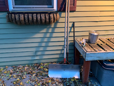
| Much to my husband's chagrin (He doesn't want to deal with winter) I set out our snow shovel on our deck in anticipation of a messy snow/sleet/ice event Thursday morning. |
We're still looking a quick pre-dawn burst of snow crossing the state from southwest to northeast, mostly just before or around dawn. We're still probably in for an inch or so of snow, give or take, but it will quickly transition to sleet and freezing rain.
As mentioned this morning, that's just in time for tomorrow's morning commute. So it will be a mess. The scenario I outlined this morning still looks likely. In many areas, relatively warm ground temperatures will keep many main roads just wet or slushy. But certain cold spots and definitely bridges and overpasses will ice over.
That will surprise people driving along at full speed, only to encounter icy bridges and get into a mess. If you want an illustration of how this works, click on this link for a video of wet "safe" roads and icy bridges causing several pileups in Wisconsin on November 1.
As always in these mixed precipitation events, results may vary. It will either be a little worse or a little better than current forecasts. Plus, things will be very different from one town to another. The eventual transition to a non-freezing cold rain or drizzle might be quick in some spots, especially in some parts of the Champlain Valley.
But the freezing schmutz could last longer in some areas. You never know exactly where, so take care on the roads,
Bottom line: It still looks like you'll need to plan extra time to get to your destination if you have to go anywhere tomorrow morning. The Interstate 89 corridor in Vermont might be a particular mess. That's because that's basically the main highway in the major population and employment areas of the state. And there are few alternative routes.
One crash can gum up a long stretch of the Interstate.
 |
| Increasing cloudiness Wednesday afternoon over St. Albans, Vermont in advance of tomorrow's messy mixed precipitation morning commute. |
So bosses: If your employees show up late to work and they blame the weather, cut them some slack.
I still suspect there might be some school closures or opening delays, so check in the morning to see if your kid is lucky enough to get out of Thursday's math test.
We're still looking at it warming up just enough Thursday afternoon to lose the ice but still have an absolutely miserable day, typical of November.
Temperatures will barely make it to 40 in the warmer spots. Overcast, light rain and drizzle will be absolutely, ahem, lovely in the afternoon. Gusts to 35 mph or so, especially in the Champlain Valley, will add to the chill.
After this fun little episode, the weather looks like it will go quiet again. We won't have gorgeous weather. In fact, it will be a little colder than normal through the weekend.
There are signs that next week might be a little warmer. Not spectacularly so, but enough to feel a little better than Thursday will.

No comments:
Post a Comment