Showing posts with label changeable. Show all posts

Friday, March 13, 2026

Friday Vermont Forecast. Some Snow Later Today Through Saturday; Large, Windy Storm Monday

We're back to the snowfall prediction maps from the 
National Weather Service. Through tomorrow,
the valleys should generally get about two inche
of snow, maybe a little less in spots, The Green
Mountains and southern Adirondacks, and
New Hampshire's White Mountains should
do great, with perhaps 4 to 7 inches. 
We watched the temperatures yesterday fall down through the 30s, and for many of us, it was below freezing by late afternoon or evening. 

This was nothing unusual for mid March, but it was a reality check after the record warm temperatures earlier in the week. 

Burlington did end up tying the record high for the date at 63 degrees yesterday. That came just after midnight very early in the day before a cold front arrived. 

Some of us got a dusting of snow last evening to remind us what time of year it is. We were still getting flurries here in St. Albans, Vermont early this morning. 

Ahead, we have one small storm first, and then one very large storm to deal with here in Vermont. Aside for a brief excursion into balmy weather Monday, it's going to be relatively wintry for awhile. 

I know, I know, but it's only March. Spring will get here eventually. 

Let's get into the details:

TODAY/SATURDAY

We've got our small storm to deal with first. It's coming in from the west and will pester us from this afternoon through much of tomorrow. 

This one will be mostly snow. But the good news for those of you who are tired of snow is accumulations should be pretty limited in the valleys. The Champlain and Connecticut River Valleys should only see 0.5 to 2 inches. Even so, the wet snow could come briefly heavily this evening, so watch it on the roads. 

The mountains look to get much more, perhaps four to as many as eight inches. That will refresh ski resort slopes a bit after our huge thaw. There is a winter weather advisory from this afternoon to tomorrow afternoon in the southern and central Green Mountains.  

High temperatures both today and tomorrow will be in the 30s, so not far from normal for this time of year. That means the snow will mostly be on the wet side. They call this kind of snow sugar snow under the belief it adds moisture for the maple trees to produce more sap.

We should also have gusty winds at time as this storm passes through. 

BIG STORM

NOAA forecast map for Monday shows a powerful
storm centered over Michigan. This storm will 
give us a quick squirt of warm air and rain
Monday, followed by sharply colder air
We should also have a lot of wind with this storm.
The next storm will stir up a huge amount of trouble in the eastern half of the nation.  It'll start developing in the central Plains Saturday night, get to about Iowa Saturday night and the heat up into the central Great Lakes, strengthening all the while. 

It'll be a powerhouse with widespread high winds from the eastern Rockies to the East Coast. The system cause another severe storm and tornado risk in the Midwest Sunday and in the southeast Monday. A blizzard will unfold north and west of the storm track.

For us in Vermont, the storm will mean a brief period of mixed precipitation, a lot of wind, a brief zoom of temperatures up to 60 degrees or so Monday, along with rain, then an abrupt, sharp drop in temperature down to winter levels again

If we have any mixed precipitation it would be fairly light and occur Sunday night, at least the way it looks now. South winds would really ramp up Sunday night, too.

That warm air will engulf us Monday, but be short-lived as a powerful cold front comes in from the west. We're unsure on the timing of that front, but early guesses place it in Vermont early Monday evening, give or take.

That would leave us with temperatures rapidly crashing to below freezing, a quick changeover to snow showers, and strong winds from the north.

As always, we'll update this one as we get closer to the event. 

Wednesday, March 11, 2026

Ice Jams, Flood Risk, Record Heat, Freezing Rain, Rain, Snow, Wind, Storms. Vermont March Weather Rolls On

Another view of an ice jam backing up water along the 
Missisquoi River in Enosburg Tuesday. The ice
jam closed Boston Post Road near Route 105.
Vermont is still  under a flood watch through
tomorrow
Mark Twain once said, "In the spring, I have counted 136 different kinds of weather inside of 24  hours."

He was referring to New England when he said it. I'd guess he might have been in Vermont in March when he came up with that gem. 

A day after we had a hottest for so early in the season warm spell in the Green Mountain State. temperatures this morning were in the low to mid 30s. 

As forecast, there were a couple drops of freezing rain in extreme northwest Vermont.  We weren't expecting much and there was even less freezing rain than the trifle we thought we'd get.

Before we move on, we should gaze back at the record highs, and how we are re-writing weather records in the age of climate change. March records have really shifted. Before 1990, Burlington had never reached 70 degrees earlier in the season than March 20.

Now with yesterday's 73 degrees - the warmest for so early in the season - it's been in the 70s eight times on or before March 20 since 1990. Six of those occasions have been since 2012.  

This isn't just a Vermont thing. Hundreds of record highs were set over the past few days in the central and eastern U.S. New York City reached 80 degrees, the earliest on record it's been that warm there.

Another record heat wave is set to begin next week in the western U.S. 

The switch to hot weather out West means we in Vermont will probably not be seeing more record high temperatures for awhile. 

A southward dip in the jet stream over eastern North America will keep colder weather and storminess in our neck of the woods for next couple of weeks. 

Let's get into the details:

TODAY

Eventually - later this morning or early this afternoon - the wind should swing back from a southerly direction, and that will pump temperatures back up in  to the 50s for most of us west of the Green Mountains. It'll probably stay in the mid and upper 40s east of the Greens. 

The good news is forecasters have cut back on the amount of rain we should expect between now and tomorrow morning. Don't celebrate too much, since we should still see enough rain, combined with snow melt and the last of the ice jams to keep us under a risk of flooding.  

The Otter Creek in Center Rutland is forecast to go into minor flood stage tomorrow. Other Vermont rivers are expected to get close to flood stage. And remember, these river level forecasts are iffy. Just a little extra rain, or a little extra snowmelt can make a big difference in how high the water gets.\

We should see some scattered showers, maybe even an isolated rumble of thunder here and there today. Much of the time should be dry, especially south and east. The rain should fill in to become more widespread later this afternoon and during the first half of tonight. 

THURSDAY

The sharp cold front will come in from the west mostly before dawn tomorrow, and that will send us back into winter. Temperatures will stay steady near the freezing point, or slowly fall during the day. Gusty winds will make it feel colder. At least the cold will shut off the snow melt and end the threat of flooding.

We could see some snow showers, but accumulations won't be anything to really worry about.

FRIDAY SATURDAY

A relatively small storm should come in from the west. We could get a couple inches of wet snow out of this later Friday into Saturday morning  By March, temperatures can be marginal between rain and snow. We'll want to take a closer look at this when we get closer. 

SUNDAY/MONDAY

A larger storm is looming for the end of the weekend and start of next week.  This far ahead, it's hard to tell exactly what that means for us. For now, meteorologists are going with a period of snow and mixed precipitation Sunday, followed by a brief squirt of warm, windy, showery weather Monday, followed cold north winds and some snow Monday night and Tuesday. 

Since that storm is several days away, don't be surprised if the forecast for how it plays out changes big time. 

The cold wave next week looks pretty sharp and intense, even if it does't last all that long.  But we are possibly looking at a couple days with highs in the 20s and lows in the single numbers. Our false spring will definitely be over by then! 

After that cold wave, as usual, the weather forecast gets  really uncertain. But that's OK, we have more than enough on our plate for now. 


Tuesday, March 10, 2026

Tuesday Evening Vermont Weather Update: Shockingly Warm Today, Still Expected Yo-Yo Temperatures Now Through Thursday

Henry the Weather Dog on Tuesday got to do something
he hasn't really been able to do since October: Bask in the
warm sun. You can sort of see him smiling there
he was so happy 
The warmth in Vermont and surrounding areas really over-performed today, didn't it? 

It felt almost like summer. Henry the Weather Dog was able to bask in the warm sun for the first time since October. He was one happy camper!

I think some compressional warming ahead of the cold front that entered northern Vermont this afternoon helped boost the temperatures. The front, as it pushed southward, sort of squeezed the air, i.e. compressing it. When air compresses it tends to warm up. 

Whatever caused it, things were incredibly balmy.  Burlington reached 73 degrees, according to preliminary data. That  shatters the previous record high of 63 set in 2002. It's also the hottest temperature for so early in the season. Those "so early" or "so late" in the season record highs are especially hard to achieve. But Burlington managed it today. 

Other record highs include 63 degrees in Plattsburgh, NY; 71 degrees (wow!) in St. Johnsbury (old record was 64 in 2016);  and 67 in Montpelier, old record 60 in 2016). 

 Rutland and Springfield got up to at least 70 degrees, Bennington was at least 73 degrees. So much for my prediction this morning that there was just a chance a place or two in Vermont might reach 70.  Instead it was pretty widespread. 

The temperatures I listed are not final figures, so they might be updated later.  

COLDER AIR

I mentioned the cold front. Once it arrives it means business. Highgate was one of the first Vermont towns to see the cold front. They got up to 66 degrees at around 1:30 and were down to 51 buy 5 p.m. Burlington dropped ten degrees to 59 in the hour ending at 5 p.m. 

In most of central and northern Vermont, temperatures will bottom out in the 30s, and it'll get below freezing in some spots north of Route 2.  The northern Champlain Valley has the best shot at going below freezing. 

A winter weather advisory is still in effect for Grand Isle County late tonight and tomorrow morning for the risk of light freezing rain.  There could be some icy spots on the roads tomorrow morning there. And perhaps elsewhere in far northern Vermont. 

At least Vermont will miss out on the worst of this ice storm. Far northwest New York, southern Quebec from Ottawa to Montreal to Sherbrooke, northern and Central Maine and even northern Michigan

 WEDNESDAY

A large ice jam was still holding firm along the Missisquoi
River in Enosburg as of late this morning. 
Ice jams and regular flooding are a threat through
Thursday with more snow melt and expected rain. 
It does look like our storm will go by to our northwest, which means winds should shift to southerly during the day tomorrow. 

Highs should get into the 50s in western Vermont, maybe even low 60s southwest. The warmer air will have a bit of a harder time getting into eastern Vermont, but it will be above freezing. 

It probably won't rain much during the day except in the northwest. But today's warmth, lingering ice jams, snow melt and that rain will keep the risk of flooding going into Thursday. 

I noticed late this morning a large ice jam was holding pretty firm on the Missisquoi River in Enosburg , and it was causing minor flooding. 

Thursday will turn sharply colder and windy. And an active weather pattern will continue afterward. I'll have much more on that in tomorrow morning's post. 


Wednesday, February 25, 2026

Winter Just Doesn't Want To Quit In Vermont, Rest Of Northeast

Our house in St. Albans, Vermont is awash in snow, and 
the gardens out front won't be blooming anytime 
soon judging from this scene taken this morning. 
Unlike many recent winters, it's the end of February and we do not yet have any real signs of spring here in Vermont or the rest of the Northeast. 

Even when an extended forecast offers a hint of warm weather a week or two out, that always seems to be snatched away at the last minute and it stays cold. 

Here in Vermont it snowed again this morning. Not much, just enough to be annoying. We has 0.4 inches here in St. Albans as of 8 a.m.  

Temperatures across Vermont were mostly in the teens as of 8 a.m. but the warm front causing this morning's snow should blow through, bringing many valleys to readings a little above freezing this afternoon. 

That "warmth" won't last long.

A cold front is coming toward us late this afternoon. If this were summer, I'd be yelling about the risk of severe thunderstorms. But it's winter, so the cold front will crank out a bunch of snow showers and a few snow squalls here and there. Those would be the winter substitute for strong thunderstorms.

We won't get much snow this evening, with  most of us getting another inch or less. But the rapidly changing weather and falling temperatures around those expected snow squalls mean you might see some unpleasant, icy surprises on the roads on the way home late this afternoon and evening. 

THURSDAY/FRIDAY

The cold front is a little stronger than we thought it would be (of course!) so they've subtracted a few degrees from previous forecasts. It'll only get into the 20s to around 30 tomorrow and it''ll be back down in the single numbers tomorrow night. 

After a chilly start, Friday will be nice enough in the afternoon with sunshine and temperatures in the 30s, with some upper 20s in high elevations and some corners of the Northeast Kingdom.

By the way, the blizzard zone near New York and far southern New England are getting an unwanted burst of a couple inches of snow this morning. They also might get nicked by a weak storm Thursday night, and possibly another few inches of snow next Monday.

I'll have an update on the areas hit by the blizzard in a post later today.

ARCTIC FRONT

It still looks like we have one warmish day, or maybe part of a warmish part of a day when we get to Saturday. By then, another cold front will be approaching us. Ahead of that front, we'll get a brief squirt of mild air that might get us into the 40s.

However, some of the models are speeding up an approaching Arctic cold front, so I wonder whether it will stay mild all day in the north. It's possible the mild air could get pushed out before the day is over on Saturday. We shall see!

What's definite, though, is behind this front is really cold air. March will start with frigid January weather. Temperatures will be at least 20 degrees below normal. Highs Sunday and Monday will only be in the teens, with maybe a couple low 20s south. Overnight lows Monday and Tuesday nights will get below zero again, like we haven't had enough of that already. 

It'll warm back up a little toward the middle of next week. Long range forecasts are suggesting a bonafide thaw once we get a week into March. I'm not trusting that forecast yet, since so many hints of warmth in extended forecasts disappeared as forecasts were updated.

Meanwhile, enjoyVermont's forever winter.  

Wednesday, April 30, 2025

Severe Weather Once Again Evades Vermont, Many Others Aren't So Lucky

Storm damage near Pittsburgh, PA on Tuesday.
Severe storms caused lots of damage from Texas
to New York, but spared us in Vermont. 
 Tuesday was another wild day for weather across much of the United States.

Sure enough, as expected, destructive weather struck in a broad band from Texas to New York.  

Vermont once again escaped the rough storms, but the weather nonetheless got a little interesting in the Green Mountain state. 

More on that in a bit.

NATIONAL STORMS

It seemed like the bad weather had plenty of targets on Tuesday. 

Tornadoes and straight line winds of up to 100 mph, mixed with baseball sized hail in parts of central Texas, That must have been fun.

 Winds were almost as strong near Springfield and Branson, Missouri with  straight line winds of 91 mph, along with embedded tornadoes. 

Lots of property damaged there, too. 

A particularly intense band of storms originated in eastern Indiana, crossed southern Ohio and then through western and central Pennsylvania, causing all sorts of damage, with trees into homes and buildings, on cars and across roads and power lines. 

The storm was particularly intense around Pittsburgh, with two storm-related deaths reported in the region. Winds gusted to 71.3 mph at the Pittsburgh airport, the third strongest wind gust on record there. 

Roofs were torn off some Pittsburgh businesses and dozens of homes suffered damage when trees fell on them. 

The storms blustered all the way into central and northern New York. Winds gusted to 77 mph in Rome, New York. Severe thunderstorm warnings blared as far north as Massena, in the northwest tip of the state.

Today, it looks like north Texas, including Dallas-Fort Worth, and parts of Oklahoma are at risk for tornadoes, severe storms and huge hailstones today. 

Though severe storms and possible tornadoes are expected over the next few days over scattered parts of the U.S., any kind of immense new outbreak of tornadoes will likely wait until at least next week.

However, serious flooding, which has been a scourge since winter in parts of the Midwest, seems to be making a comeback this week. 

Flooding has been hitting Oklahoma for days, and that will continue through today and at least tomorrow. At least two people have died in recent days in the flooding. A section of a major interstate highway in Oklahoma City was closed by flooding.  Flash flood warnings were flashing through much of the state this morning. 

Oklahoma City has had 11 inches of rain this month, compared to a normal of 3.5 inches. 

Neighboring Arkansas, which has had severe floods this spring, is bracing for more. 

VERMONT EFFECTS

The sky looked volatile as showers and thunderstorms
approached St. Albans, Vermont Tuesday evening,
but the storms were not severe. 
The weather played out in Vermont just as expected Tuesday, except many spots ended up a little warmer than forecast. We had our first true taste of summer. 

Burlington got to 83 degrees, just two degrees shy of the record for the date. 

It was the first 80 degree reading of the year and the warmest it's been since September 18, 2024.  Montpelier reached 82 degrees and Springfield, Vermont got to a toasty 86 degree. 

As expected, the storms that eventually arrived from New York and into Vermont last evening weakened, though a few managed to stay fairly strong in northern Vermont, which again, was predicted.

A gusty storm with a torrential downpour blasted through St. Albans shortly after 10 p.m.  The National Weather Service had warned that this storm could contain 50 mph winds. I don't see any reports of damage, though, so this wasn't severe. 

The storms are over, skies are clearing and are temporary summer is definitely over. At least for awhile. 

Today will feel completely different than Tuesday.  The air will be fresh and cool, maybe even downright chilly in spots.  A steady north wind will make it feel nippier, too.

The growing season has started in the Champlain Valley, so a frost advisory is up overnight and early Thursday in the Champlain Valley. Elsewhere in Vermont, it will be even colder than the Champlain Valley, with lows in the 20s in many spots far north. But the growing season isn't officially underway there, so no advisories. 

The next storm system comes along Friday and, of course, Saturday. It's actually two storms. Neither will be that strong, but will spread showers our way. 

The first one will arrive Thursday night and Friday.  Friday will be warm and a bit humid, which means a couple thunderstorms might get thrown in. But they won't be severe. 

It looks like a cold front will come through later Friday and a second storm will form along it and move northward for Saturday, which would give us our seventh rainy Saturday in a row.  It's a little early to figure out exactly how Saturday will turn out, but the rain then looks more likely the further south and east you go in Vermont. 

A potentially drier weather pattern could start next week. But that will be complicated by a stalled weather pattern.   This stuck weather pattern looks like it will keep a storm spinning off the New England coast. It's unclear how close it will get to us.   

Depending on what happens, next week could prove mild and sunny, or cool and showery. So that's no help. Stay tuned, I guess!

Friday, February 28, 2025

The Vermont Weather Roller Coaster Is On An Extreme Trip

Our by now very familiar snow forecast map from the
National Weather Service office in South Burlington.
This one depicts the mostly 2 or 3 inches of snow
we expect from a snowfall tonight and Saturday
morning. More snow in the mountains as 
usual with this one. 
Around 5 a.m. this morning, it was still above freezing in most of Vermont after an overnight thaw. 

By dawn, things were quite different. 

Temperatures across the northern part of the state were crashing through the 20s, and those trends were soon to follow south. 

It's another backwards day, with high temperatures when they're supposed to be at lowest, and low temperatures in the afternoon when they're supposed to be at their highest. 

We're going to see a lot of huge temperature gyrations over the next few days. 

I'd watch it on some of the roads during this morning's commute. A few snow showers accompanied the blast of colder air this morning, so there will be a slick spot or two here and there. It might not be as widespread as Thursday's mess on the roads, but it's an issue. I noticed a pretty good snow squall in Addison and Washington counties around 6:15 a.m. today, for instance. 

Gusty winds this morning will make it feel colder, but those readings will level off in the teens and 20s this afternoon. 

Things will continue with the temperatures doing the opposite of what they should tonight and tomorrow.

THE CLIPPER

Tonight, a fast moving storm - known as one of those infamous Alberta Clippers - will come in from the west, giving us a burst of snow, then rising temperatures overnight. Maybe even a few rain showers as temperatures sneak above freezing for most of us by tomorrow morning. That will be followed by an even bigger temperature crash during Saturday afternoon.

Most of us will get a decent but short burst of snow overnight, lasting no more than six hours and depositing maybe two or three inches of snow in the valleys and up to five or six in the mountains That should hit between about 8 p.m. and 1 a.m., give or take. 

Just as the snow will last only a few hours, the "thaw" Saturday will only last about that long.  Most of us will start getting above freezing early Saturday morning, but those temperatures should start to crash by early afternoon.  Backwards again, as it normally keeps getting warmer through the early and mid afternoon. Not on Saturday!

Those falling temperatures will be accompanied by snow showers, and a few scattered snow squalls. So once again on Saturday afternoon, you could get caught on some iffy Vermont roads and highways if you're out there during the day. 

THE COLD WAVE

I know this is hitting March, when you start to expect to see  the strength of cold waves starting to wane. But this one could be among the strongest this winter. Which isn't saying a whole lot, since we never did see anything worse than 20s below this winter. 

This time we'll eventually see lows in the single numbers below zero in the warmer banana belt towns and teens below elsewhere. Those frigid temperatures should hit early Monday morning. 

Before we get there, we'll wake up Sunday morning with readings pretty close to 0 degrees. We'll only make it into the teens at best Sunday afternoon.  At least the sun will come out. 

The cold snap will be short-lived, as is usually the case with March bouts of winter weather. Monday will remain unseasonably cold with highs near 20.  But temperatures won't drop much Monday night, and most of us will be back above freezing Tuesday afternoon. 

We're still watching a storm for midweek that looks like it wants to produce rain and temperatures in the 40s.  For now anyway, forecasters have backed off on the amount of rain we'll get from it. But we'll still need to keep tabs on whether enough thawing and rain will come to set off any flooding or river ice jams.  

Saturday, February 1, 2025

Roller Coaster Vermont Weather Getting Even More Roller Coaster-y

Traffic camera picked up a winter wonderland with
nice dawn colors after last night's snow along 
Route 7 in Shaftsbury, Vermont this morning. 
 Friday evening's snow in southern and central Vermont is heading out, and now we're faced with more up and down weather.  Cold to warm to cold again. With even bigger extremes than we've seen. 

That tired cliche where if you don't like the weather in Vermont it will change in a minute seems to be especially true lately. 

As of early this morning, snow totals from last night are hard to come by as reports haven't really come in yet. I do see 5.2 inches in Norwich, down in Windsor County and 4.5 inches in Landgrave, which is in far southern Vermont. 

Roads were still slick in spots across central and southern Vermont early this morning, so take care on the highways. 

It was nice to see southern Vermont get the snow for a change. For the past month, any snow we have gotten has been mostly focused on the central and northern Green Mountains. 

Route 302 in Topsham was still pretty snow covered
as of 7:30 this morning so take care on the roads
in central and southern Vermont until things
are cleaned up after last night's snow.
The Friday evening snow made it as far north as Route 2, as Burlington reported 1.1 inches of snow last evening. 

Further north, here in St. Albans Friday's snow completely missed us, though we were getting a few flurries early today due to the frigid air blasting in from Quebec. 

In the Champlain Valley, there's still enough ice-free water on the lake to help produce some lake affect snows in parts of Chittenden and Franklin counties this morning.

 A few places could get one to three inches of fluff before that ends probably by noon or so. 

BRIEFLY FRIGID, AGAIN

Temperatures that were in the 30s in many places Friday afternoon were in the low and mid teens just before dawn today. Those readings will either stay steady or slowly fall through the day, even as the sun comes out in many areas this afternoon. 

That sets us up for what will for many of us be the coldest night of the winter so far. Which really isn't saying much since most of us have never been colder than the single numbers to teens below zero so far this season, which isn't all that wild. The record low in Burlington Sunday is 25 below, and we'll get nowhere near that. 

Even so, tonight, clear skies, light winds, Arctic air and snow cover will ensure it gets plenty cold.  The National Weather Service in South Burlington is going with an expected low of about 6 below in Burlington, to the low teens below in many areas, and low 20s below in the cold hollows of the Northeast Kingdom. 

All that's no where near record cold, but it will feel plenty nippy. 

SUNDAY/MONDAY

Only one to three inches of snow are expected in our
next round Sunday night, with a brief that likely
for many of us on Monday. 
Then we go back uphill on the roller coaster. We'll warm up cold again Sunday, meaning the temperatures will rocket upward but a stiff south wind will make it feel frigid. Especially in the first half of the day before readings get too warm. 

By late afternoon, most of us will be in the 20s.  Which means it will be a whopping 30 to 40 degrees warmer than it was at the start of the day. 

A warm front passing through Sunday night will give us a burst of light snow, with most of us getting one to three inches. A little less than that perhaps in the Champlain Valley. 

We'll have some "wrong way" temperatures overnight Sunday into early Monday as temperatures stay steady in the 20s or slowly rise toward the low 30s.

That brings us to Monday, and a brief thaw. Warmer valleys get into the low 40s with some light rain showers around. That'll be one peak in our roller coaster ride as those temperatures rocket downward again by Tuesday. 

TUESDAY-FRIDAY

The Tuesday cold snap won't be as bad as tonight's but by Tuesday night, we should be back down in the single numbers above zero, with a few places in minus territory.

But fear not! The temperature goes right back up again.  We can't have more than 12 hours of one type of weather before things switch again, right?

There's still a lot of questions about the next warm up and storm Wednesday to Thursday. But it has the potential to be bigger than these piddling little things we've had for the past month.  Preliminary forecasts have it going by to our northwest.

That would be a snow to rain scenario with a thaw. If it gets really warm and rains a lot, we could have trouble with a bit of flooding, actually. 

We have much more ice on rivers this winter than we did the previous two. That means ice jams are more likely this year during thaws. That'll be something to watch. If not next week then later in the winter or early spring.  

I wouldn't worry too much yet. It might not rain much, or the storm track will shift and it might end up being a little colder than the forecasts right now are saying. Some forecasts depict a weaker storm passing to our south, which would give us light snow instead of a thawing rain. 

Given our roller coaster weather pattern, that late week warmth probably won't last long. Chances are we'll be in the deep freeze again next Friday or Saturday. 

Wednesday, December 6, 2023

Scotland Trip Is Ending; Photos Show Edinburgh's Fitful Weather.

After some brief sun, a rain squall approaches Edinburgh's
Royal Mile at around 3:30 p.m. November 30,
just before sunset. 
EDINBURGH, SCOTLAND - My time in this beautiful, small nation has come to an end. 

One of the things I've got left is photos showing the beauty of the area, and the fitful, inclement, but sometimes sunny, cold weather the region sees in December. 

Days are incredibly short in Edinburgh, since it's so far north. Sunrise in early December is around 8:25 a.m., and it sets around 3:40 p.m. 

But we made the most of it, enjoying the brisk outdoors while traipsing around the shops and pubs and historic buildings.

This post is just a sampling of scenic/weather photos, since it's such a beautiful place. 

Click on the pics to make them bigger and easier to see

Typical overcast day this time of year in Edinburgh

A brief bright spot in the Edinburgh overcast

Late afternoon on a rare clear, but very cold day by
Edinburgh standards on December 1, Highs that day
were in the mid-20s, normal for the season is low 40s.

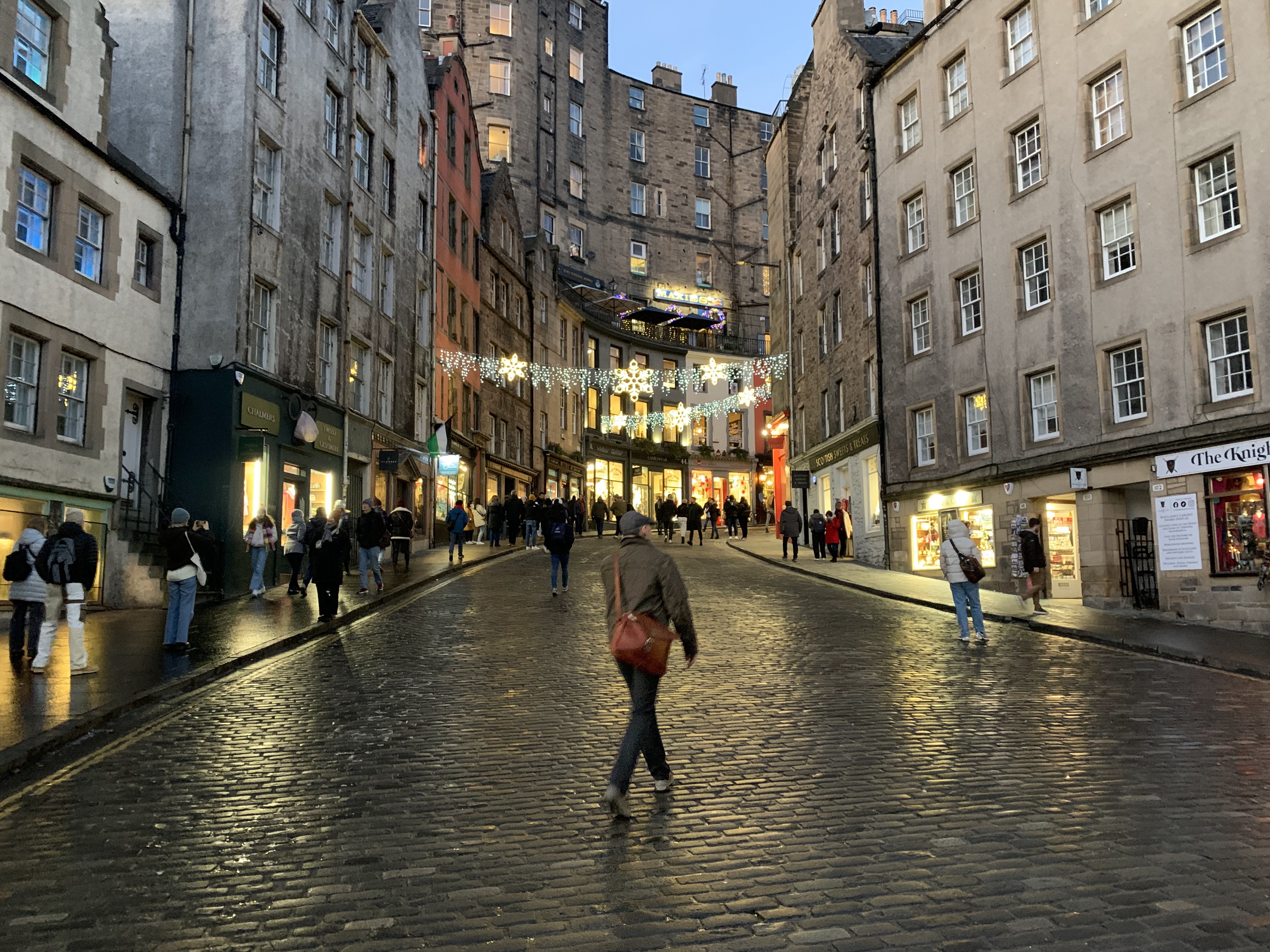
Shop and Christmas lights brighten a Edinburgh street
as darkness falls at around 4 p.m,


Back to a hazy Edinburgh overcast on December 2.

A hint of a rainbow on a changeable, gusty day along
the North Sea in North Berwick, Scotland, December 3.

Frosty day in Edinburgh, December 6.

Another rare treat of sunshine, but it was cold again
in Edinburgh, December 6

Tuesday, November 28, 2023

Winter Still Toying With Vermont, Bits And Pieces Of Travel Trouble

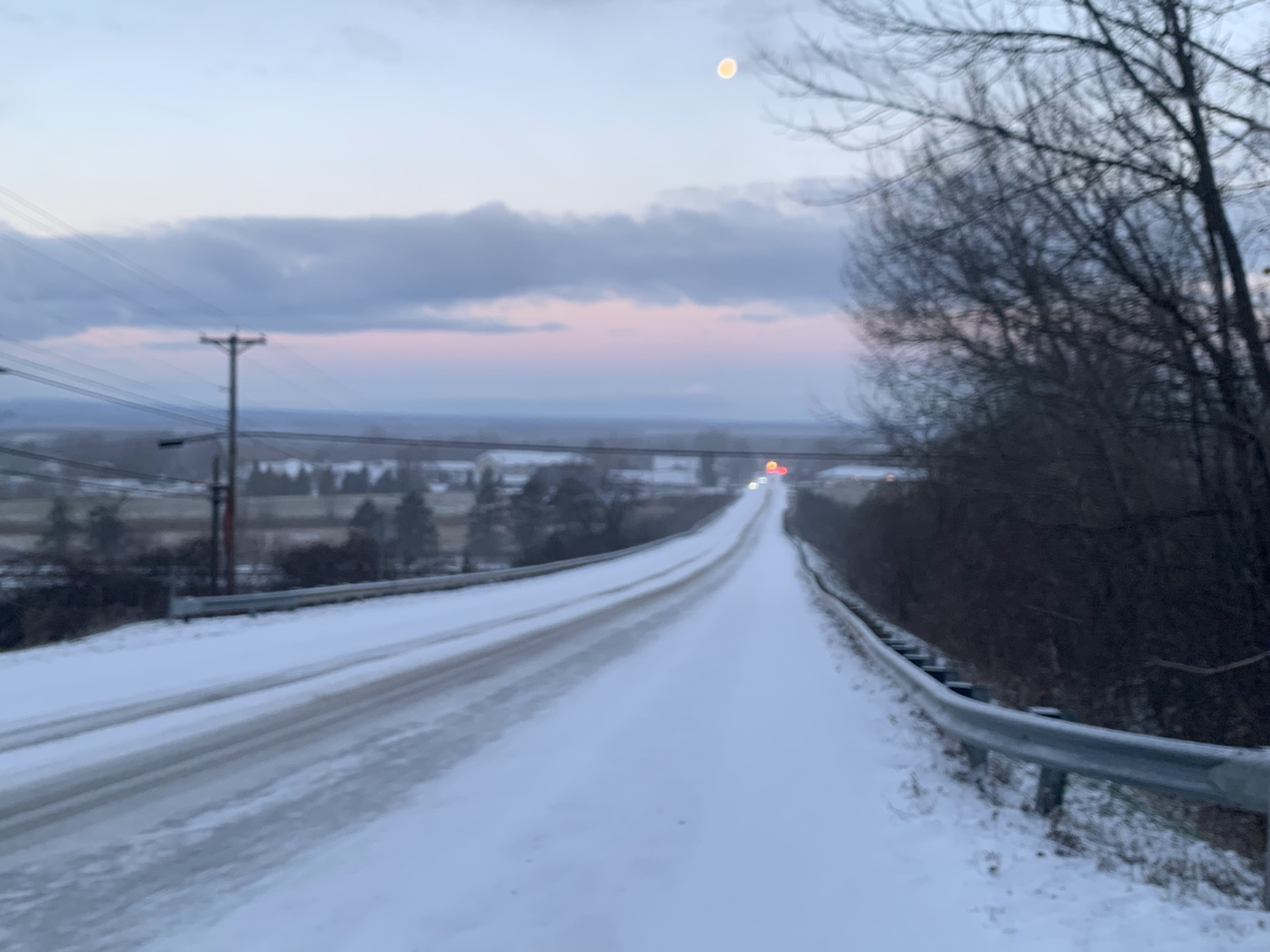
A heavy early morning snow shower iced up the road
in front of my St. Albans, Vermont house, but
shortly after, blue sky and the moon appeared. This
kind of changeable early winter weather
should last all day. 
 I awoke to another surprise heavy snow this morning in St. Albans, Vermont. 

In this case, it was just a pretty hefty snow shower that passed by quickly, leaving partly cloudy skies and a dawn view of the moon in its wake. 

But the snow showers definitely left behind a half inch ofd new snow and some very slick roads, making conditions pretty hazardous for some on their morning commute. 

You'll want to take some extra time getting to work this morning especially if it snowed where you are. 

The snow showers were hit and miss. Some areas were still fine, others a mess between 7 and 8 this morning. That state of affairs should last all day. 

A weather disturbance and cold front is instigating the snow showers.  They could hit anywhere anytime today, but the best chance is this afternoon and in central and northern Vermont, and the entire Green Mountain range. 

Some of the snow showers, like the ones in St. Albans early today, will be on the heavy side. But they're racing along and should be pretty brief.  Which means total accumulations will be an inch or less. The exception to this will be an area along and north of Route 2 from east of Burlington into New Hampshire, which could pick up one to three inches. 

The Connecticut Valley of southeastern Vermont should see pretty much nothing at all. Meanwhile, the Green Mountains, especially from Killington north, should see two to as much as six inches out of this. 

All this will make things unpredictable on the roads all day. Things will be fine one minute then they won't. Or, you'll be blissfully traveling along a snow-free road, only to encounter the next minute some low visibility snow, and ice under your tires. 

This state of affairs should last through today's evening commute, so beware. 

The rest of the week looks fairly quiet, but there are signs of some modest storminess Friday and perhaps something a little more substantial early next week. But the weather pattern is especially hard to predict right now, so any forecast beyond a couple days is suspect. 

Just wait it out and check forecasts as they're updated. 

Sunday, August 27, 2023

Vermont Weather Stays Weird, But At Least We're Staying Safe

Big, billowy clouds boil up east of Burlington,
Vermont Saturday. 
 Ever have someone in your life who can just never make up their mind?

Oh, I want to this, no, that, let's go back to Plan A.  What about Plan C?  It can get frustrating.

Which was the personality of the weather in Vermont Saturday. 

Moisture and instability in the air, along with some weak disturbances in the atmosphere, created a fairly unique set up over us, with lots of small downpours, narrow, towering clouds and breaks of sunshine.

So one minute it's sunny and warm, the next minute there's a drizzle, then a downpour, then the sun is back out, only to repeat this cycle over and over again. 

A classic if you don't like the weather in Vermont, wait a minute and it'll change type of day. 

At least the sky was pretty, with those billowing clouds, rainbows, shafts of sunlight, interesting shadows. And bonus: After the summer we've had, none of these frequent storms were strong enough to cause damage or create flooding. 

As is normally the case with these types of showers and garden variety storms, they died down after sunset. For most of us. But for some reason, downpours continued until almost 11 p.m. in Franklin County, Vermont. 

I don't see reports yet from places that were particularly bullseye by the late storms, but I do see Fletcher and Swanton, both on the edges of the heavier downpours reported a half foot three quarter of an inch of rain Saturday.

Rainbow over St. Albans, Vermont Saturday. 
Today, Sunday, was supposed to be nice, but it's not starting out that way.  We're getting toward autumn, and it's going to get harder and harder for temperature inversions to break as the sun angle gradually diminishes. 

A temperature inversion is a layer of warmer air above cooler air. This often traps moisture, and for us, means a low, gray overcast. The sun will eventually destabilize the air, making it mix up and down and break up the inversion, and thus the clouds. 

A weaker sun means it takes longer. That's part of what's been happening today.  Mid-morning satellite pictures show Vermont is cloudy, but surrounded by sunshine in Quebec and much of the rest of the Northeast.

So, the clouds should break, and we should end up with a partly sunny, nice enough afternoon. I hope. 

Tomorrow looks pretty nice, too.

The next storm system comes in Tuesday night and Wednesday, with another batch of showers. Again, those won't cause any real problems. 

Fairly strong high pressure expected to build in by Thursday over us should do a great job of keeping future Hurricane Idalia well to our south, so that won't be a bother. 

Beyond that, I'm seeing hints of drier and warmer air. We'll see if that pans out. 

Tuesday, May 2, 2023

Vermont Dodges Worst Of Storm, But Gets Interesting Weather Nonetheless

A downpour mixed with pea-sized hail drenches my
St. Albans gardens late Monday afternoon as the 
sun began to reappear at the tail end of the shower.
 Some wild weather happened Sunday and Monday in much of the eastern United States and Great Lakes region. But Vermont was spared the worst of it. The weather, however, did get interesting.

I'll have highlights of the weather extremes in other parts of the nation in another post later this morning or this afternoon. Some wild and weird things happened in a lot of places. But I figured I should give the Green Mountain State update first. 

Vermont got part of the heavy rain Monday morning that New Hampshire and Maine received, but by the time it got here, it was not quite as torrential. 

More than two inches of rain fell in parts of southeastern Vermont, which caused some flooding Little Ascutney Road near Route 106, and near Rockingham.  Throughout the rest of Vermont, rivers are running high and fast, so are best avoided.

Burlington had its wettest May 1 on record, with 0.88 inches of rain. That beat the old record of 0.76 inches in 2017. This wasn't exactly the wettest day ever, but still fairly impressive. 

The main weather front with this storm system swept by to our north by Monday afternoon. The sun tried to come out, but very cold air associated with this storm lurked several thousand feet above us. 

The result was kind of a weird Monday late afternoon and evening for many Vermonters, including here in St. Albans. The sun and cold upper air caused clouds to billow upward and tower into some pretty strong showers. A downpour would sweep in, mixed with quite a bit of pea-sized hail. Then the sun would return and it would become pleasantly warm. 

Then, soon enough, dark clouds would return, the temperature would drop precipitously, and more downpours and hail would blow through.  The hail wasn't nearly big enough to cause any damage. The event just made for interesting weather and skies. 

To be honest, it really was beautiful, if inclement. 

We're kind of doing it again today. 

Between the storms: One downpour mixed with hail
had departed, giving St. Albans an interval of warm
sun early Monday evening. Then, as seen here,
another storm approached, eventually giving us
another downpour mixed with small hail. 

Weather disturbances are pinwheeling around the main stalled low pressure system to our northwest. One strongish disturbance was moving north and northeastward through Vermont today. 

As this happens, peeks of morning sun are succumbing to dark clouds and rain. As this happened dramatic rainbows appeared in the northwestern skies in Rutland County. 

It was raining pretty heavily in parts of west-central Vermont and adjacent eastern New York as of around 8 a.m. That band was gradually creeping northward as of 8:30 this morning. 

So, we have a cool day ahead of us with showers. Some might be briefly heavy. We could easily also see some small hail again, as it's still cold overhead. That would allow any hail stones that form to make it to the ground.

None of the hail will be big enough to harm your garden or anything like that. It will be more of another conversation piece. 

It's rinse and repeat tomorrow. However, the rain showers won't be quite as widespread, long-lasting or as relatively heavy as today. Still, the strongest cells could create a rumble of thunder and a bit of hail.

The trend line is good. Thursday will also bring the risk of showers, and it will remain cool, but those showers will continue to decrease.

As we head into the weekend, Friday through Sunday and into early next week, the sunshine will increase day by day, chances of showers become small and temperatures will warm up nicely. 

Early signs point to highs in the pleasant 60s by Saturday and into the low 70s possibly by Sunday an next week. Such temperatures aren't odd for May, but they will still be quite welcome after this cool, showery and odd week of weather.  


Sunday, April 2, 2023

Wild Satellite Photo Shows A Odd, Sometime Violent Weather Day In The Northeast

Satellite photo of the Northeast taken after 1 pm 
Saturday features a dry slot and a squall line, among
other things. Click on the photo to make it bigger
and easier to pick out features.
 It really did turn out to be a Dug Nap kind of weird weather day Saturday here in Vermont, as expected. 

Things were pretty weird and wild throughout the Northeast for that matter. The satellite photos help tell the story. 

The first visible satellite image in this post was taken shortly after 1 p.m. Saturday. Click on it to make it bigger and easier to see the features. 

Up here in Vermont, you see clouds to our east, which was the cold, rainy spell we had in the morning. As you can see, skies had abruptly cleared after that and temperatures shot upwards.

The mostly clear skies were something called a dry slot.  The center of the big storm was over the Great Lakes, and you can see some of its clouds in the far left of the photo.

The storm was strong enough to pull a plume of warm, dry air up from the southwest into its circulation, and that tongue of spring-like air reached us here in Vermont. Temperatures got as high as 68 in Burlington, and 69 in Bennington, the warmest weather since mid-November. 

The dull patchy white you see in the photo in the Adirondacks and east of Vermont's Champlain Valley is the still-reasonably deep snow cover lingering. 

You can also see trouble brewing in this satellite photo. Above the warm layer of air, the storm was cooling the upper atmosphere. The contrast was making the air unstable.  The result was that patch of bright white clouds over western New York and central Pennsylvania.  That was a squall line of thunderstorms,. It was causing a lot of damage when the satellite photo was taken. 

SQUALL LINE ADVANCES

Satellite photo around 6 p.m. Saturday. A nasty squall
line of thunderstorms and possible tornadoes is
 seen approaching New Jersey and Delaware. Up here
in Vermont, just a smattering of tame showers,. 
The second satellite photo in this post was taken at around 6 p.m. Saturday. Again, click on the image to make it bigger and easier to see. 

That collection of severe thunderstorms that was in Pennsylvania in this photo is now a squall line extending from south of Albany, New York to western Virginia. 

If you look close, you can see individual thunderstorms in that line. A lot of them had supercell characteristics, many were rotating and some had at least the potential to produce tornadoes. Several tornado warnings popped up as this line passed through, especially in New Jersey and Delaware. 

So far, the National Weather Service office in Mount Holly, New Jersey has confirmed four tornadoes in New Jersey and one in Bridgeville, Delaware. It's possible more might be confirmed.

The Bridgeville tornado claimed one life.  As you can imagine, it's very rare to have a tornado tragedy like that in the Mid-Atlantic states at the end of March. 

 New Jersey has now already had five tornadoes this year, including one in February. New Jersey doesn't have that many tornadoes, and when they do, it's almost always between May and September,    

A whopping 248 reports of thunderstorm wind damage came in yesterday, mostly in Ohio, western New York, Pennsylvania, New Jersey and Delaware 

Up here in Vermont, things weren't nearly as dramatic. Some fairly hefty thunderstorms passed through far southern parts of the state, but no real damage was done. 

If you look closely at the satellite pic, you see some bubbly little clouds scattered around Vermont. Those were convective showers, touched off by more modest instability than further south. 

After the cold front came through in the evening, Vermont abruptly lost its brief taste of spring. Light rain showers sprang up, and changed to snow flurries in a few places. Burlington went from 61 degrees at 7 p.m. to 50 at 8 p.m. then down to 39 by midnight. 

Today's weather, though bright, was typical of the first half of March. But don't worry, it's April. We're not guaranteed super warm weather, but it'll be at least reasonable through this week.


Wednesday, October 21, 2020

WIndshield Wiper Weather Front Keeps Moving Back And Forth Over Vermont

Fading yellow leaves try to compete with the gloom 
over St. Albans, Vermont this morning. The state
has been in a weather battleground lately, creating lots of 
clouds and frequent rains. 
 You've probably noticed here in Vermont, especially the further northwest  you go, that we've had a lot of clouds and bouts of rain lately. The forecast calls for more of the same.  

We're in a classic weather battleground.  Off to the west, winter is on the march, unleashing cold air onto the northern Plains.  

There was a surprise snowstorm in part of Iowa two days ago. Another snowstorm, less of a surprise, but bigger, dumped more than six inches of snow on parts of Minnesota. Minneapolis had its second snowiest October day on record, with 7.4 inches. 

A third snowstorm has prompted winter storm watches from Montana, through parts of the Dakotas and Minnesota Thursday and Friday. 

Meanwhile, the Atlantic Ocean off the East Coast is unusually warm, and a toasty ridge of high pressure holds sway out there, just north of Hurricane Epsilon. (Don't worry, Epsilon is not headed toward the United States.

We're caught in the middle between the cold out west and the heat to the east. 

This being later in autumn, the cold air keeps trying to win out, sending cold fronts crashing in with bouts of showers and bursts of chilly air that don't last long.

That's because the warm air is fighting back, flinging those cold fronts back north as warm fronts. Then the cold tries again. On and on it goes. 

Basically, the same weather front keeps going back and forth over us.  One such set up hit last week before  a more decisive cold front came through Friday. 

This week is even more changeable, The front came north as a warm front Sunday, back south over us a cold front Monday, back to our north Monday night, then south through us again yesterday,and then back north today. 

That's why it's been windshield wipering back and forth between warm and humid-ish, and chilly and damp.  It's almost impossible to decide how to dress for the day, other than to bring an umbrella or rain jacket. 

And it goes on.  The front goes back south of us tonight, giving us a sunny break Thursday.  Then back north Friday, then south through us Saturday.  I think we're getting hit be the same cold/warm front almost a dozen times, at least it seems.

The chilly air wins out by Sunday.  But we're still near this battleground.  The weather front between the cold air to the west and the hot air to the east will set back up for the first part of next week. It'll take a position somewhere along the East Coast. Storms riding along this front will bring us even more rain. 

It might even start as a period of snow in the mountains Sunday night. 

This is all very gloomy, of course, because the sun has gotten scarce. But this has been a good month to continue easing the drought. The drought isn't over yet, but it is decaying with all these rain storms.

Rainfall for October will end up above normal for most of New England, including Vermont. 

We do know the cold air will eventually win out and the snows will really fly.  We just don't know when or to what extent.


Friday, October 16, 2020

Glorious To Gloomy: That's Autumn In Vermont For Ya!

Gorgeous weather yesterday lit up the foliage around
my yard in St. Albans, Vermont and even made my
frosted and fading perennial beds look colorful
Thursday's weather in Vermont was as glorious as can be: Temperatures soared well into the 70s, and bright sunshine lit up the lingering fall foliage.  

Sure, it was windy in some places, especially the Champlain Valley, but who cares? It was gorgeous.

Autumn weather turns on a dime in New England, and sure enough, the character of today will be the polar opposite of Thursday. 

Expect it to be gray and dark, with occasional rain.  The air will stay chilly and damp all day.  Temperatures will stay stuck near 50 degrees all day. 

 We're rapidly heading into the cloudiest time of year, so expect more of this in the coming days and weeks.

A slow moving cold front came into Vermont last night, and is lingering in New England. Meanwhile, a storm system will move northward along the front.  This will keep the rain going, and it looks to be heavy at times in eastern Vermont, and into New Hampshire and Maine. 

That's a good thing, since the worst of this year's drought is in those neighborhoods. 

Recent rains have diminished the drought conditions somewhat in eastern Vermont, according to the latest U.S. Drought Monitor.  Things are steady in western Vermont, where it's not quite as dry to begin with. Today's rains will help a little more. 

We've actually gotten a little wetter to the point where the heaviest rain in eastern Vermont will probably cause streams and rivers to rise abruptly. I really doubt there will be any flooding to speak of, and even if there is it will be quite minor.  But at least the rivers are now able to respond to rain. Ground water has gotten a bit better, even if we still have a ways to go to bring that moisture up to reasonable levels. 

Since we're getting well into autumn now, the chances increase that some precipitation in Vermont would be snow, especially near the tail end of some storms.  Sure enough, the mountain summits in and around Vermont should see at least a couple inches of snow out of this.  Valley locations are safe from the snow. 

Although the sunshine will come back off and on over the next several days, the weather pattern is staying active, so expect more bouts with clouds and rain nearly every day through at least the next week.  

Tomorrow, Saturday, does look rather sunny in the afternoon after the early morning rain and mountain summit snow clear out. Don't expect those warm temperatures we had yesterday, though.  Daytime readings will stay in the relatively chilly 50s.