Showing posts with label snow squalls. Show all posts

Wednesday, February 25, 2026

Winter Just Doesn't Want To Quit In Vermont, Rest Of Northeast

Our house in St. Albans, Vermont is awash in snow, and 
the gardens out front won't be blooming anytime 
soon judging from this scene taken this morning. 
Unlike many recent winters, it's the end of February and we do not yet have any real signs of spring here in Vermont or the rest of the Northeast. 

Even when an extended forecast offers a hint of warm weather a week or two out, that always seems to be snatched away at the last minute and it stays cold. 

Here in Vermont it snowed again this morning. Not much, just enough to be annoying. We has 0.4 inches here in St. Albans as of 8 a.m.  

Temperatures across Vermont were mostly in the teens as of 8 a.m. but the warm front causing this morning's snow should blow through, bringing many valleys to readings a little above freezing this afternoon. 

That "warmth" won't last long.

A cold front is coming toward us late this afternoon. If this were summer, I'd be yelling about the risk of severe thunderstorms. But it's winter, so the cold front will crank out a bunch of snow showers and a few snow squalls here and there. Those would be the winter substitute for strong thunderstorms.

We won't get much snow this evening, with  most of us getting another inch or less. But the rapidly changing weather and falling temperatures around those expected snow squalls mean you might see some unpleasant, icy surprises on the roads on the way home late this afternoon and evening. 

THURSDAY/FRIDAY

The cold front is a little stronger than we thought it would be (of course!) so they've subtracted a few degrees from previous forecasts. It'll only get into the 20s to around 30 tomorrow and it''ll be back down in the single numbers tomorrow night. 

After a chilly start, Friday will be nice enough in the afternoon with sunshine and temperatures in the 30s, with some upper 20s in high elevations and some corners of the Northeast Kingdom.

By the way, the blizzard zone near New York and far southern New England are getting an unwanted burst of a couple inches of snow this morning. They also might get nicked by a weak storm Thursday night, and possibly another few inches of snow next Monday.

I'll have an update on the areas hit by the blizzard in a post later today.

ARCTIC FRONT

It still looks like we have one warmish day, or maybe part of a warmish part of a day when we get to Saturday. By then, another cold front will be approaching us. Ahead of that front, we'll get a brief squirt of mild air that might get us into the 40s.

However, some of the models are speeding up an approaching Arctic cold front, so I wonder whether it will stay mild all day in the north. It's possible the mild air could get pushed out before the day is over on Saturday. We shall see!

What's definite, though, is behind this front is really cold air. March will start with frigid January weather. Temperatures will be at least 20 degrees below normal. Highs Sunday and Monday will only be in the teens, with maybe a couple low 20s south. Overnight lows Monday and Tuesday nights will get below zero again, like we haven't had enough of that already. 

It'll warm back up a little toward the middle of next week. Long range forecasts are suggesting a bonafide thaw once we get a week into March. I'm not trusting that forecast yet, since so many hints of warmth in extended forecasts disappeared as forecasts were updated.

Meanwhile, enjoyVermont's forever winter.  

Friday, January 23, 2026

Today's The Start Of Our Nation's Snowy, Icy Nightmare; Arctic Air Already Established

Weather channel map shows enormous area under the
gun for freezing rain in the Southeast. Pink
and purple areas to get freezing rain, with the
worst hit areas in dark purple.
It was close to 30 below with wind chills of near 50 below early this morning in northern Minnesota. That frigid air continues to race south and east, setting the stage for one of the most widespread winter storms to hit the U.S. in recent memory. 

Of course it won't be 20 below in places like Oxford, Mississippi or Waxahachie, Texas, or Hazard, Kentucky, Lumberton, North Carolina, Frederick, Maryland, or probably even Harmonyville, Vermont.

But all those places will easily be cold enough to endure lots of snow, lots of ice, and lots of brutally cold weather for the next few days. 

Media reports say at least 170 million Americans are under some kind of winter weather alert. That includes all 643,000 or so people who live here in Vermont. 

The first snowflakes and first icy raindrops have just started falling in the South and the effect are already being felt. Governors in a dozen states have declared emergencies. Natural gas prices have surged by 60 percent as people crank the heat off to ward off the icy or blizzardy chill. 

The most dangerous part of this storm is the expected freezing rain from Texas to the Southeast U.S. coast. 

This will cover a much larger area than most ice storms. Most of the areas at risk for the heaviest ice are heavily forested. That means lots of power outages as some of these trees collapse under the weight o the ice. 

Typically, if one area is hit by an ice storm, utility companies rush in from other states to help rebuild the power grid. That's going to be a more difficult this time because such a huge region is under the gun with freezing rain. 

Utility crews from further north in the expected snow zone are probably going to help. I hope some of them are staging in the southern freezing rain area now so they won't have to fight their way through heavy snow to get there. 

The heavy snow zone is itself enormous. Everybody in a broad band from northern Texas, Oklahoma and Kansas northeastward through New England will get at least six inches of snow. A number of places are in for more than a foot. 

It's also going to be dangerous after the storm. I mentioned Oxford, Mississippi. They're expecting an inch of ice, more than enough to bring down lots of trees and power lines. Unlike many southern winter storms, it's going to stay cold well after the storm in Oxford and most other places in the South. Overnight lows in Oxford are forecast to be in the single digits early next week.

There's almost too much to watch across the nation as this storm unfolds. But it's going to be an interesting few days. 

VERMONT EFFECTS

The snow squalls, the intense cold and our share of the big U.S. winter storm are all on tap for Vermont.

Snow Squalls

Another look at the brief but intense snow squall in
Burlington, Vermont yesterday. Photo is when the 
intensity was just starting to decline. 
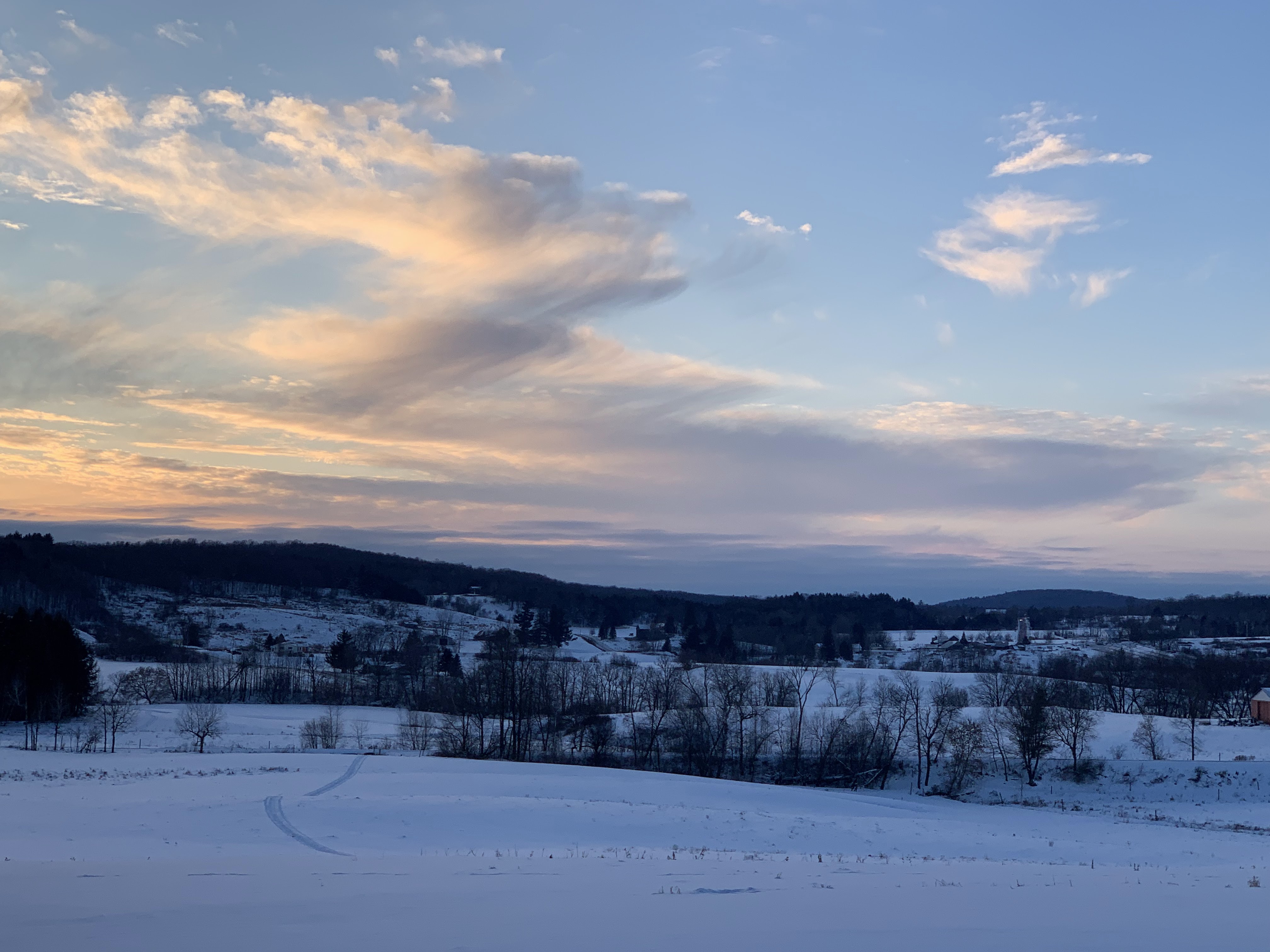
Those impressive snow squalls yesterday here and there in Vermont brought zero visibility and winds to 45 mph in some spots yesterday. 

More snow squalls are in the works today as that Arctic cold front approaches. Already, as of 8:30 a.m. one narrow band of fairly heavy snow was entering the northwestern corner of Vermont. Another such band was in Rutland County.

We'll see more of this through the day. Some of the squalls might even hit after the front passes and while temperatures are dropping. So in that respect, these could be more dangerous than those that hit Thursday. 

It was warm enough Thursday for the snow to quickly melt off the roads once the squalls departed. Today will be colder, so the road conditions won't improve as fast. And of course if you're caught in one of those squalls on the road, good luck seeing anything in front of you. 

Nobody will get much snow out of this. Most places will see an inch or less. It's just that in some places, all that snow will come down in something like 10 minutes. 

Intense Cold

After peaking late this morning or early afternoon close to 20 degrees, temperatures will crash as stiff northwest winds pick up. The worst of it will be tonight and the first half of Saturday with the lowest temperatures and the strongest winds. Those are the hours when our extreme cold warning is in effect. 

It still looks like actual temperatures will go below zero this evening and bottom out early tomorrow morning in the upper single numbers to upper teens below zero. Wind chills will be in the 20 to 40 below range. 

It still looks like highs tomorrow will only make it to about zero. A little below that in the north, and little above that in southern valleys. 

Usually in a cold wave like this the second night is even colder. We originally thought that would be the case Saturday night. But that massive storm will start clouding us up by then.  Northern areas will probably be a little colder than Friday morning, but with less wind.

Southern Vermont, where the clouds will arrive first, might be a little warmer Sunday morning than Saturday morning. Don't break out the Hawaiian shirts, though. It will still be below zero

The Storm

As we suspected last evening would happen, the winter storm watch that was in effect for southern Vermont has bee extended through the state all the way to the Canadian border.  The computer model keep pushing the storm a little north, and also frigid, dry high pressure north.

The high pressure is important. If it was centered close to us, moisture coming up this way would get eaten up by the dry air, and we'd get little snow. If the high is further north in Quebec, the moisture would have an easier time invading, so we'd get more snow. 

The computer models are disagreeing on exactly how much snow we'll get Sunday into Monday. Early guesses have five or six inches near the Canadian border to over a foot near the Massachusetts border.

Don't take that as gospel. There will be adjustments.

We can tell you that we know southern Vermont will get more snow than the north. We don't have to worry about sleet and freezing rain. And this will be an unusually cold snow storm. 

Temperatures during the event will be in the single numbers and low teens. It will probably be a pretty fluffy snow. None of that wet, heavy crap we've often gotten in recent winters. 

Cleanup after the storm in Vermont isn't going to go great either. Temperatures will be low enough after the storm so that salt won't work great on the roads.

Actually cleanup won't be easy anywhere because there's a nationwide shortage of road salt. Until now, it hasn't been a particularly cold winter in the U.S., but there's been a lot of icy storms. Salt is in short supply. 

Or even nonexistent in some communities.

The City of Vergennes posted on Facebook yesterday that it is entirely out of salt.  Rutland is almost out of salt, too. So is Monkton and West Rutland. And probably some other Vermont towns. 

The salt shortage is hitting the entire state. The Vermont Department of Motor Vehicles has temporarily waived driving hour limits for salt delivery drivers until the end of the month because of the high demand. 

It'll stay cold all of next week, though not as cold as tomorrow. Still, highs in the low to  mid teens and lows near zero don't sound like fun.

The weather pattern over the next two weeks tends to favor more nor'easters. It's hard to tell whether any of them will come close enough to Vermont to give us more snow, so we'll just have to wait and see. 


Wednesday, January 21, 2026

Quick Wednesday Evening Vermont Weather Update, Squalls, Then Very Cold, Then More Snow?

Snow squalls like this one approaching St. Albans,
Vermont in February, 2022 are possible Thursday and
Friday afternoons. Note in the background
the sudden transition from 
nothing to torrential snowfall.
Since the weather is getting very exciting once again, I figure some more frequent updates should be in the cards here. 

There's a series of things we need to look out for here in Vermont over the next few days:  

Scattered snow squalls tomorrow and Friday, bitter cold Friday night into Sunday at least, and then effects from that giant southern and central U.S. storm. 

THIS EVENING

Some light snow is working its way northeastward through the state this evening. It won't last long, but the expected inch or less of snow will be just enough to make the roads iffy tonight. 

SNOW SQUALLS

Quite a few snow showers and some snow squalls are on the agenda for both tomorrow and Friday afternoon and evening. It's impossible know when and where the squalls might hit this far in advance.

Just be ready for fast changing conditions on the roads if you're out and about tomorrow afternoon and evening, and Friday afternoon and evening. One minute you're in clear air on a dry highway, next minute you're in a whiteout on icy roads. 

It won't hurt to listen for snow squall warnings from the National Weather Service. If your area goes under one, it's probably best to postpone travel until the snow squall passes.

Each day, the snow showers will deposit an inch or less of snow on most of us. The heaviest squalls might leave up to two inches, and the Green Mountains could get a two day total of 2 to 5 inches.

BITTER COLD

The National Weather Service has issued an extreme cold watch from Friday evening until Saturday afternoon. We'll see rapidly falling temperatures to below zero with gusty northwest winds. Wind chills could reach 30 below. It would probably be best to reschedule outdoor activities during that period.

It'll remain at or below zero Friday night through at least late morning Sunday. The extreme cold watch expires Saturday afternoon because winds will turn light.

MORE SNOW?

A lot of the computer models are insisting on bringing some snow from that expected vast winter storm in the southern, central and eastern United States up into Vermont. 

I'll have a complete update tomorrow morning. 

Tuesday, January 20, 2026

SUNY Oswego Webs Cam Spectacularly Shows How Changeable Snow Squall Season Is

An intense snows squall slams into the campus of 
SUNY/Oswego on Monday. See the series of photos
at the bottom of this post to watch how the
squalls unfolded. 
I occasionally checked in with State University of New York/Oswego web cams on Monday, watching dramatic views of how fast the weather changes in the winter on the shores of Lake Ontario.

The photos in this post kind of go back and forth a little between two SUNY/Oswego web cams. One   web cam is at Hart Hall, which offers stunning late afternoon views of the lake. The other at Shineman Center is equally as good. 

In the series of photos below, you'll see a large snow squall approach. I believe this dark cloud was a snow squall along a cold front, or a trough line ahead of a cold front. 

The main band of lake effect snow formed a short time later and continued pummeling the lakeshore northeast of Oswego overnight and this morning. 

The squall in our series of photos was almost certainly enhanced by moisture from Lake Ontario. The part of the series from when the wall of snow seems to be at the edge of campus to when visibility drops to near zero came within about five minutes or less. 

Once that squall goes by, it clears up dramatically. But you can see new snow squalls starting to form. The new line of snow squalls, as mentioned, are the ones pummeling areas mostly a little south of Watertown, and a little north of Oswego today. Total accumulation in New York's notoriously snowy Tug Hill region could be up to four feet. 

In this morning's SUNY/Oswego web cams, you can just barely see the heavy lake affect snow band in the distance, on the extreme right edge of the camera's view.  

The cam grabs I have in this video cover about an hour and 15 minute period. The series of photos are below. You can click on individual images to make them bigger and easier to see.  Enjoy!


Wednesday, December 3, 2025

Snow Squalls To Screw Up Thursday Morning Vermont Commute, Long Cold Spell Still On Tap

Inside a St. Albans, Vermont snow squall in 2021.
At least some places in Vermont will have scenes
like this tomorrow morning 
The snow squall risk for Thursday we've been talking about all week still looks to be on schedule for tomorrow morning. 

That Arctic cold front  is expected to collide with a lake affect snow band that will be oriented southwest to northwest over northwest New York. This will at least temporarily add oomph to an already strong cold front. 

That means there's an excellent chance of snow showers and - very likely - snow squalls tomorrow morning. 

The timing of this is everything, since a lot of people will be headed to work or school when this blast of snow comes through. 

Sometime during the morning commute, this expected line of snow squalls will basically travel down Interstate 89 to Montpelier and beyond. The squalls will affect most of the rest of Vermont as well, but I'm highlighting the Interstate as it's the main travel corridor in Vermont. 

Plus, since Interstate 89 is a high speed highway, a sudden blast of near-whiteout conditions hitting fairly fast moving cars is a recipe for trouble. 

The goal might be to get to work or school before the squalls hit, or postpone travel until an hour or two after they pass. But pinning down the exact timing is tough. 

We have a general idea. As of late this afternoon, the guess is the line would hit St. Albans around 5 or 6 a.m., then make it down to Burlington and surrounding communities a little after 6 to around 7 a.m., give or take. By 9 or 10 a.m., the squalls might be somewhere in central Vermont, maybe Montpelier. 

Different computer models have different timing for the band of snow squalls. Two of the models I checked out late this afternoon has the line of snow squalls up by St. Albans at 6 a.m. Another has it between St.Albans and Burlington at that hour. Another computer model is fastest with the line, bringing it through Burlington and a little past Burlington by 6 a.m.

You'll want to listen for snow squall warnings from the National Weather Service tomorrow morning to get an idea of where they are. Snow squall warnings are very much like severe thunderstorm warnings in the summer. Each warning covers a relatively small area, like one county or parts of adjacent counties. 

Even after the potential squalls go by, we're not out of the woods. There will still be some more snow showers for awhile. Though not as intense as snow squalls, they'll still cut visibility, and strong northwest winds will blow the snow around. 

PLUNGING TEMPERATURES

NOAA's 6 to10 day outlook, issued today,
places the greatest chance of colder 
than normal temperatures right over us. 
It feels too early for this, but forget about it getting above freezing for long while. 

Perhaps even in the banana belt towns in southern Vermont and the Champlain Valley. Normal highs in Burlington are in the mid to perhaps upper 30s this time of year. 

We won't see anything like that for at least 10 days, maybe more, I think. 

The initial temperature plunge coming up tomorrow and tomorrow night will arguably be the worst of the lot. 

It'll he near 30 degrees early tomorrow before the Arctic front hits. Temperatures will plunged through the 20s and teens during the days as blustery northwest winds drop the wind chill below zero for most of us. 

It still looks like Friday morning will dawn with temperatures within a few degrees either side of zero. 

This sounds like a load of fun, doesn't it?

After a cold Friday, it'll actually warm up a little Saturday. Compared to Friday, it will be tropical heat, as we might make it into the low 30s.

Then, it's another Arctic blast for early next week. And it looks like it wants to stay nippy at least into the middle of the month. NOAA's longer range forecasts indicate the spot in the nation with the greatest chance of below normal temperatures is right here in New England.   

I'm only bringing this up to jinx it. Maybe if I tout a long range forecast like this, we'll get some unexpected warmth. Just don't bet your next paycheck,on that. 

There will be occasional chances of snow, and whatever falls would obviously stick. But unless there's some sort of surprise, I don't see any big dumps on the horizon. 

Quick Wednesday Morning Update: Snow Totals From Tuesday, Squalls Thursday, Then Bitter Cold

Traffic cam shot of snowy Route 7 in Shaftsbury 
Vermont Tuesday. That part of Vermont generally
got the most snow out of yesterday's storm. 
 I've got some very early appointments today, so just a brief update to start the day on yesterday's snow, and what's coming next. 

The snowfall yesterday pretty much matched the forecast with the most falling in southern Vermont. The Northeast Kingdom did well, too.

The highest totals I've seen so far are 10.6 inches in Manchester Center; 8.7 inches in Arlington; 8.5 inches in Landgrave, and 8 inches in Pawlet.

Northeast Kingdom totals included 8.6 inches in Lyndonville and several reports in the 6.5 to 7.3 inch range. 

In the Champlain Valley, it was mostly three to six inches, about as expected. Central Vermont generally had five or six inches. Again, that's pretty close to what the National Weather Service had forecast 

It stopped snowing hours ago, but it's cold out there this morning - mostly in the teens. I'm sure there are some slick spots on the roads. I can hear the scraping outside of state plow trucks trying to finish cleaning up. 

Today will be the calm before the next storm. It will be winter cold today, with everyone except maybe a few people in southern Vermont valleys staying below freezing

ARCTIC FRONT

We're still looking at that terrible cold front coming at us tomorrow morning with its band of snow squalls. The National Weather Service in South Burlington remains worried about tomorrow morning's commute in the Champlain Valley. 

It was bad enough with the gentle snow we had yesterday. There's a good chance this front will barrel in with a band of snow squalls.  These would cause abrupt, almost whiteout conditions, a quick one to two inches of snow and gusts to 30 mph. 

Yeah, I'm staying put at home tomorrow morning. I'll just huddle under blankets with Henry the Weather Dog. 

We're still looking at the timing of these, but so far, it looks like these might come through the Champlain Valley at between 7 and 9 a.m. or so.  The rest of Vermont might get these squalls, too, but at least they would come through between mid-morning and early afternoon, when the roads are a bit less busy. 

Winter is here with a vengeance, and it's not easing up anytime soon. I would say at least half of Vermont will be below zero by early Friday morning, and the rest of us will be damn close to it. 

I don't see any big storms on the horizon at this point. But I do see repeated cold fronts with reinforcing shots of nasty cold air at least through most of next week, if to beyond that. 


Friday, February 7, 2025

The Snow Keeps Coming In Vermont, Squalls Early Today; Southern Half Of State Takes The Brunt This Weekend

A snow squall blasts through St. Albans, Vermont around
7 a.m. today.  The day started with a series of snow
squall warnings across northern Vermont. 
 Early this morning, snow squall warnings were once again flying across northern Vermont before and  around dawn today as yet another disturbance came through. 

The alerts were accurate, as just seconds after my phone blared with a snow squall warning, visibility outside my St. Albans, Vermont house dropped to zero.

The intense squalls in Franklin County really made a mess when they came through around 7 a.m 

We saw lots of slide offs and accidents, Even worse, there was a report of a school bus that went off the road and was on its side in Enosburgh.  Early reports indicate there were 10 students plus the driver on the bus and there was a least one injury. 

The snow squalls were brief enough to add only about an inch to our slowly growing snow cover,   

The snow keeps adding up in relatively small doses, but with a lack of major thaws, it's now looking like a true Vermont winter in many parts of the state. Some places in northern Vermont have around two feet of snow on the ground.  

Not all places look super wintry yet. A  few southern Vermont valleys still don't have much snow on the ground, but that looks like it will change soon. More on that in a bit.

Thursday's snow amounted to only two to five inches, but as noted yesterday, the timing of it made it disruptive.

One little interesting tidbit out of Burlington.  The snow there melted down to the equivalent of 0.27 inches of "rain" there.  That really isn't much, but it still made Thursday Burlington's "wettest" day since December 11, when downpours deposited 1.74 inches. 

Just goes to show how this winter has featured frequent, but tiny snowfalls.  

Anyway, let's move on to what's happening next around Vermont.

TODAY

You're going to want to build in a little extra time to get to work or school this morning. The snow showers and snow squalls are part of a cold front that's coming through. 

Overnight and early this morning, temperatures actually managed to get slightly above freezing in the warmer valleys, like in Burlington, Rutland and Springfield.  The cold front is dropping temperatures so water on the road is freezing, and the snow squalls will add a coating of snow to everything.

It comes on fast. Burlington was fine at 5 a.m. with flurries, but at 6 a.m. they reported heavy snow with almost zero visibility as a snow squall passed through there. These squalls won't last long in any particular place, but they'll leave their mark 

So yeah, the roads won't be so great in many place. Especially north. 

For the rest of the day, it actually won't be all that cold behind the front, as temperatures settle into the 20s for the rest of the day. But it's going to be windy, with a few lingering snow showers.  A wind advisory is up for much of southern Vermont and virtually all of northern New York where winds could gust to 50 mph.

Elsewhere winds will gust to 40 mph or more in many spots, especially this morning and early afternoon. You'll want to watch out on the roads, still especially north/south oriented ones.  The strong west winds will blow the snow onto those roads, and create some potential big drifts. 

SATURDAY 

The quiet before the storm. Some clouds, tending to thicken up in the later afternoon. Some sun, maybe, too. Also, we can't rule out an inconsequential snow shower or two especially early in the day. Seasonable temperatures. No biggie.

SATURDAY NIGHT/SUNDAY

This will be when the next quick hitting storm blows through. Trends keep sending that storm well to our south. That means northern Vermont shouldn't expect too much out of this. 

A first best guess on snowfall amounts expected in the 
next storm Saturday night and Sunday morning. This'
map is really, really subject to change between
now and Saturday afternoon.

This storm will be absolutely racing eastward, big time. Current projection have it around Kentucky Saturday afternoon, south of Long Island, New York before dawn Sunday, and way out south of Nova Scotia by late Sunday afternoon. 

So, the storm won't have time to deposit all that much snow, since its visit will be so short. 

Still, southern Vermont looks destined to see a short, sharp burst of heavy snow overnight Saturday and early Sunday. 

If current projections hold areas south of Route 4 could see six or seven inches of snow, while central Vermont gets into the three to five inch range. If you're way up by the Canadian border, you might see two inches and even that could be generous. 

That said, if the trends keep pushing the storm south, almost everybody in Vermont gets less snow than I outlined here.  If it takes an unexpected jog to the north, we get more. 

The storm will be outta here by Sunday afternoon. 

NEXT WEEK

The spray of fast moving, modest sized storm will continue to blast roughly west to east across the nation.  Some of them will affect us, some might not. 

Anything beyond Sunday is guesswork, but here's an early read on what will happen. But don't hold me to it. 

One storm scoots by far to our south Tuesday night, and we get nothing but light snow showers from an unrelated disturbance passing over us. Another storm looks like it could hit us with some snow next Thursday, but that storm looks pretty small, at least from this vantage point. 

Beyond that, additional storms might blow through, or near us every other day through the third week of the month.  It's impossible to say how any of these might affect us, but the overall trend so far is to keep northern New England on the chilly side. 

Unless there's a surprise, I don't expect a big snow melt down anytime soon.  And, chances are, the snow cover could keep building up.  After a slow, dry start, it's turning out to be a decent winter sports season after all.


Wednesday, January 29, 2025

Vermont Weather Remains Busy, Snowy, Squally With "Wrong Way" Temperatures

Traffic cam of Route 2 on the Causeway between Milton
and South Hero looks windblown, as you can see
on the Lake Champlain ice next to the road. 
 A peaceful light snow was falling across much of Vermont early this morning, as expected. 

Of course, the roads are iffy with that snow, so once again, you'll need to take care driving to school or work.  Much like yesterday, after those early morning snow squalls we had, there's some school closings and quite a few delayed openings, so check your local listings.

Temperatures overnight went the wrong way, and that trend of weird temperature swings will continue for the next several days.  It'll seem like one moment it's frigid, the next balmy. For the next few days, it will be as if winter is really angry, keeps storming out of the room and then coming back in to yell, "OH, AND ANOTHER THING!"

That's life in a Vermont winter, I guess. 

TODAY

As the snow moved in overnight, temperatures slowly rose, instead of falling like they should before dawn. At daybreak, it was mostly in the teens, except low 20s west. So still kinda chilly this morning. 

Those temperatures keep rising for awhile this morning, peaking in the mid and upper 20s north and 30s south by around noon. 

At that point, things get more interesting. The storm is bringing an Arctic cold front with by very late morning or early afternoon. The result: Everybody in the state will face snow showers, blowing snow and crashing temperatures this afternoon. 

Snowing pretty hard this morning along Route 
105 in Berkshire, Vermont on this traffic cam

Similar to early Tuesday, such an abrupt cold front can create dangerous snow squalls. Tuesday's squalls focused o the north, and the weakened somewhat by the time they hit southern Vermont. 

Today will be different, with the squalls most likely in the south, mostly south of a line roughly from Middlebury to Wells River,  The National Weather Service in Burlington says they are less likely north of Route 2.   . 

It'll get gusty everywhere, with the strongest winds in the southern half of Vermont, so the blowing snow will probably be worse there. 

The snow showers will continue all day statewide into the early evening, so unlike your drive home Tuesday, today's will be tricky, too. 

Total predicted snowfall hasn't changed much since yesterday. Pretty much everybody gets two to five inches, including what already fell overnight. Most of the ski resorts should see at least six inches of new fluff.

TOMORROW/FRIDAY

Expected snowfall between this morning and 
Saturday morning. Doesn't include what we got
overnight, but does include predicted snowfall
today and Friday. 
We get a brief break in the snow, but it'll be cold.  We'll start out windy and nippy in the morning with temperatures within a few degrees of 0.  The wind will diminish as clouds increase during the day and it gets up to about 20 degrees, so better by afternoon.

Breaking the rules again, temperatures will keep heading slowly upward Thursday night instead of falling like they're supposed to. 

Friday, it'll be warm again with a little snow. Temperatures should get into the 30s.  The pattern this winter has been for light, fluffy snowfalls. Friday will be a little different. 

We probably won't get much snow, as current forecasts call for maybe one or two inches. But it'll be a wetter, heavier snow than we've gotten used to lately.  

The exact path of Friday's little event is still questionable, so expect some shifts in the forecast.

The temperature roller coaster will continue, though, as we go back in the deep freeze Saturday. (Highs in the low teens, morning readings within a couple degrees of zero. Sunday warms up again, and that continues on Monday when it might actually rain for awhile instead of snow. Then, next Tuesday, it gets pretty cold again. 

On and on it goes. 

Tuesday, January 28, 2025

Tuesday Evening Vermont Snow Update: Pretty Decent Dump In Mountains As Wide Temperature Swings Continue

This isn't saying much, but Wednesday could bring
Vermont and many surrounding areas the biggest
snow in weeks. Don't get too excited, as valleys should
see two to five inches, with up to eight inches up
in the Green Mountains. Western Adirondacks could
see up to a foot of new snow. 
Vermont and surrounding areas are about to get hit by the biggest snowfall in weeks, but don't worry this won't be a mega storm by any stretch of the imagination. But it does deserve a Tuesday evening update. 

The Alberta Clipper doesn't have huge amounts of moisture to work with, but it will be pretty damn efficient at grabbing what water it can from the atmosphere and dumping it on us as snow.

Roads will be iffy tomorrow and there could also be some problems with blowing snow and - once again - a few heavier snow squalls. 

THE DETAILS

In general, valleys can expect two to five inches of new snow, with locally more. Mountains will see several inches of new snow. I wouldn't be at all surprised to see many ski resorts in the Green Mountain State clock in with a good six inches of fresh fluff by later Wednesday night. 

The National Weather Service has posted a winter weather advisory for the entire length of the Green Mountains, with three to six inches expected. The advisory runs from later tonight into Wednesday evening. 

In the far southern Green Mountains in eastern Bennington and western Windham counties, there's a full fledged winter storm warning for an expected six to nine inches of snow, mainly above 1,500 feet in elevation. Gusty winds would blow the snow around too. 

The central and western Adirondacks and to an extent the White Mountains of New Hampshire look like they will be the big winners with this storm. Both those areas should see at least eight inches of snow, with some totals going over a foot in the western Adirondacks.

The water content of the snow will be low, so expect fluff. Melt the snow down, and you'll get the equivalent of a quarter to a half inch of rain for most of us, with a little less than that in the Champlain Valley.

The snow should start for most of us before dawn.  It'll be a light, steady snow for the first half of the day as temperatures climb into the 20s for most of us in the north, with 30s in the low elevations south. 

But during the afternoon, another sharp cold front comes in. That means more scattered heavier snow showers, maybe a snow squall here and there, blowing snow and temperatures once again heading toward the cellar.

So, you're going to deal with messy roads during the morning commute and afternoon one as well. The morning mess will be more widespread. Toward evening, most of the snow showers will be focused on the  Green Mountains and across much of northern Vermont. 

TEMPERATURE SWINGS

I'll get into more details in tomorrow mornings post, but the big up and down swings in temperature are going to keep going for at least the next week. 

If you like variety every day will be different for awhile. 

Thursday looks cold and blustery.  Friday looks warm enough at this point to get above freezing in some places, with rain drops mixing with snow showers. Then Saturday and Saturday night look damn cold, with highs near 10 and lows below zero. Sunday and Monday warm right back up again at least into the low 30s, then it's back to the icebox next Tuesday. 


Heads Up Vermont: This Morning's Commute Might Be A Slog. Wednesday Might Not Be Much Better

National Weather Service radar at around 5 a.m. today.
The green is fairly heavy snow. That smudge of dark green
and yellow southeast of Burlington is an intense snow
squall. The purple outline depicts a snow squall
warning that was in effect at the time of this radar image.
A line of ferocious snow squalls swept southeastward through northern and central Vermont this morning, dropping a quick inch or two of snow and turning wet or slushy roads into ice skating rinks just in time for your drive to work this morning. 

The squalls will keep heading into southern Vermont by around 7 or 8 p.m., so that part of the state will deal with poor visibility and rapid changes in road conditions.

The squalls might weaken just a tad by the time they reach southern Vermont, but will still be dangerous. 

Meanwhile, the aftereffects of the squalls will be the main problem north of Route 4. Temperatures just after midnight were a little above freezing in many areas. The initial bits of snow just ahead of the snow squalls melted into water on many roads.

Then the snow squalls hit with rapidly falling temperatures and heavy, wind driven, blinding bursts of snow. That water on the roads froze, then snow fell on top of it.

The snow squalls were moving fast enough to only leave an inch or two of new snow in most areas, but that was more than enough to make the roads slick. 

I noticed road crews were out here in St. Albans shortly after the worst of the squall had passed and I'm sure that will be true everywhere else in Vermont.  But there's only so much they can do with crashing temperatures. 

Main roads might improve some through the morning commute, but they won't be entirely cleaned up.

Take it easy, take it slow early this morning. 

This Afternoon

The good news is the snow showers will be out of here this afternoon and roads should be in pretty good shape. Expect a cold day. As noted, we already had our high temperatures for the day. It'll stay in the teens all day if we're lucky and a stiff north wind will make it feel like it's below zero.

But there's no rest for the weary.  Tomorrow's trip to and from work won't be fun either.

Wednesday.

National Weather Service snowfall forecast through 
Thursday morning. Almost all the snow predicted is
from an Alberta clipper storm coming through on
Wednesday. Most of us can expect two to four
inches of fluff on of this one. 

We're on a temperature roller coaster as several quick weather systems come through with snow or even something else possible on Friday. But we're getting ahead of ourselves.  

The crash in temperatures will halt later this evening as an Alberta clipper comes in with clouds and snow. 

Alberta clippers are those fast moving storms that come in northwest to southeast from near Alberta, through or north of the Great Lakes then into our neck of the woods.  

Temperatures will moderate into the 20s tomorrow, but it will also snow pretty much all day. 

The snow will get here before dawn, and it will still be on the cold side in the morning. 

Even though the snow will be coming down lightly, it will still stick effectively to the roads. The plows will be out but it'll be a slow commute once again. The trip home in the evening will feature light snow, too, so even that won't be so great. 

Most of us can expect about two to four inches of fluff out of Wednesday's system, with a little more than that in the mountains. 

Behind this little snowfall, the temperatures will crash once again, getting down to near or even a little below zero by Thursday morning

Thursday And Beyond

The roller coaster continues big time. A break in the weather comes Thursday afternoon as sunshine returns (hopefully) and temperatures mostly stay in the teens. It looks like temperatures will actually start to rise overnight Thursday ahead of our next quick hitter. 

Friday is a wild card.  Another Alberta Clipper will be coming in from the west, while what was the rain storm that tamped down the Southern California wildfires lurks to our south and heads east toward the Atlantic Ocean,

The Friday Alberta clipper might suppress the wetter, southern storm to our south so that it misses us. Or, the clipper  might help draw the southern storm closer to us, giving us somewhat heavier precipitation.

 We don't know yet. Friday will probably be warmer again, possibly near freezing. But we don't know whether we'll see just a little snow and a few raindrops or a somewhat more substantial storm.

Watch this space for updates.

Then, once again, temperatures get frigid again Friday night and Saturday. Then, rinse and repeat as yet another Alberta Clipper comes in next Sunday and Monday with another modest warm up and probably another couple inches of snow. 

I did say in yesterday's post that the weather pattern around here was finally getting a little more exciting, and all this is your proof.

Monday, January 13, 2025

Heads Up, Vermont: Burst Of Poorly Timed Snow Could Mean Commute Headaches Again

A pleasant late snow covered late afternoon Sunday
near Fairfield, Vermont. More light snow will add
to that blanket of white this week. 
Last week's light but persistent snow in northern and central Vermont caused havoc on the roads, prompting Vermont State Police to issue press releases telling people to slow the hell down. 

Well, we face another week of that sort of thing. 

Timing is the issue, as the snow might surprise or at least annoy commuters.  

The trouble starts today. There was a little light snow overnight in northern Vermont, so there were a few slick spots this morning,

However, just in time for the trip home late this afternoon and evening, heavier snow showers and a few snow squalls plan to roam northern New York and Vermont, especially western parts of the state. 

It won't be everywhere, and the exact timing is hard to divine as of this morning. But just be prepared for the possibility. They could arrive anytime this afternoon. They also will be hit and miss, with some towns in northern Vermont seeing  a quick inch of snow in a squall, with two towns over seeing pretty much nothing 

A nearly full moon rises late Sunday afternoon over
a Fairfield, Vermont farm. 
What makes this evening's situation potentially worse is that temperatures in the warmer valleys will probably sneak up to near or a little above freezing.

 So when it starts snowing, the roads will get wet. As the squalls intensify, the wet roads will quickly freeze, then get covered with a thin layer of snow. 

When that  happens, it takes people by surprise. You're cruising on dry or wet roads at 65 mph in the Interstate and suddenly, you're going that fast on a skating rink.  That sort of thing tends to end poorly.

Then we get to Tuesday.

Again, the day will start not bad, but by afternoon and evening, a new round of snow showers should move in. Just in time for the evening commute. It'll be a little colder than today, so the snow will stick to the roads until they are plowed and treated. And even that won't last long as more light snow ill continue to come down

More slow going, more slide offs, more idiots causing accidents. 

Sigh.

The light snow and snow showers will last through Tuesday night and into Wednesday at least. 

Just like last week, most of us won't get much new snow out of this, with northern Vermont mostly seeing one to four inches by Wednesday night. The central and northern Green Mountains will once again win the snow jackpot with many mountains seeing six inches or more.

And, once again, the big snow loser will be the lower Connecticut River Valley, where either nothing or a dusting is in the cards. 

Thursday, March 21, 2024

Weird, Stormy, Snowy Vermont Wednesday Yields To Frigid Thursday, Then Winter Storm

Heavy snow falling in downtown St. Albans, Vermont
late Thursday afternoon. 
Thursday was quite the exciting weather day in Vermont with those snow squalls. Now, today, we're suddenly taken back to midwinter. By Friday night and Saturday we could well have a major snowstorm. Five days from now we hit full time spring weather again. 

March keeps us Vermonters on our toes, doesn't it! 

We'll break it all down piece by piece below, starting with some info on what happened Thursday. 

SQUALLY THURSDAY

That snow really came down hard for awhile, didn't it. Pretty much all of us in Vermont shared in the excitement Wednesday, some more than others. 

The heaviest snow came along and just ahead of a  cold front, so it was a fairly wet snow. That was good, as there wasn't much blowing snow. That prevented visibility from getting even worse on the highways.

Plenty of Vermont towns saw  two to six inches, much of it coming in three hours or less. Marshfield reported 3.5 inches in two hours. Hinesburg had 2.9 inches in three hours, according to reports collected by the National Weather Service in South Burlington. 

The highest snow total I've seen so far is 8.3 inches at an 1,100 foot elevation in Underhill. 

There was indeed thunder snow here and there. A noted a strike on a lightning detector map somewhere near Milton Wednesday aftenoon. 

A line of snow thunderstorms moved across far southern Vermont, too. Bennington reported a thunderstorm with snow at around 6 p.m.  Near high elevations Readsboro, Mitch, or @VermontsterWx on X captured on film what pretty much amounted to a severe or nearly severe thunderstorm.

Mitch's video shows lightning, thunder, heavy snow and definitely strong winds. 

High elevation have really seen the snow pile up this week. Jay Peak reports 21 inches of new snow since Sunday. 

The snow depth atop Mount Mansfield went from 61 inches a week ago, to 81 inches as of 5 p.m. Thursday. It kept snowing on Mount Mansfield after 5 p.m. so there's even more now. And perhaps a LOT more in the forecast, as you'll see further down intros post

Thursday truly was a weather geek's party day, that's for sure. 

COLD WEATHER

Was looking rather blizzardy and frigid Thursday 
morning in St. Albans, Vermont. 
Temperatures plunged last night and the winds picked up even more.   Temperature continued to fall this morning even after sunrise That's a testimony to the strength of this blast of cold air. 

By 8 a.m. pretty much all of us were in the teens to around 20.  Wind chills were in the single digits. 

There were still quite a few snow showers around northern Vermont, but those will wane during the day. 

The cold will hang tough, as we stay in the 20s to around 30 all day with those gusty northwest winds. 

Tonight will be wintry for sure. Lows will be in the single numbers and teens. Pretty close to average for mid-January. 

Friday will also be much colder than normal for this time of year. But at least the winds will be lighter, and some of us will get up near the freezing point in the afternoon

WINTER STORM WATCH

I've prattled on a lot here already, since there's so much to talk about. But there's an elephant in the room that must be discussed. Or at least the elephant will be here shortly.

Said pachyderm is the now-likely snowstorm in Vermont, due Friday night and Saturday.  The National Weather Service has issued a winter storm watch for all but the southernmost two counties in Vermont. Though I suspect that the National Weather Service in Albany, NY, which covers Bennington and Windham Counties, might issue one later. 

The watch goes from Friday evening through Saturday night.  

National Weather Service in South Burlington with
an early snow forecast for Saturday's expected storm.
Predictions will change one way or another 
between now and then. 

For now, the National Weather Service is forecasting five to eight inches of snow for most of us between Friday evening and late Saturday night. 

However, there might well be some big adjustments in the snow totals either up or down.  You can see the uncertainty in the forecasts. 

For instance, the National Weather Service in South Burlington is - for now - forecasting 6.3 inches of snow in Montpelier. But there's a 10 percent chance it could be as little as three inches and a 10 percent chance it could be as much as 18 inches. 

The computer models still haven't figured out how much moisture will feed into Vermont, which will have a huge impact on how much snow we get. 

As of Thursday morning the scariest computer model is the European, which brings about 1.2 to 2.4 inches of precipitation to Vermont. That would translate to more than a foot of wet snow. The American model is less dire, and more in line with the five to eight inch scenario.

This could also mix with or change to a cold rain in spots, especially south. 

This storm forecast will need tons of updates in the next day or so. Stay tuned! 

This belated winter siege should end next week as temperatures warm up pretty drastically after Monday. 


Wednesday, March 20, 2024

Horribly Timed Snow Squalls Slamming Vermont Late Today

Heavy snow in downtown St. Albans, Vermont
this afternoon.
 An intense line of snow squalls lumbered through the Champlain Valley of Vermont late this afternoon, snarling traffic and causing crashes throughout the region.  

It's not entirely over for Vermont as of 5:45 p.m. The squalls have been showing a slow forward motion, and were entering central parts of the state. And southwestern Vermont as well. Expect trouble on the roads to spread east for the rest of the evening. 

Pretty much all roads were backed up in Chittenden County at rush hour.  A large wrecker trying to retrieve an excavator that went into a ditch along Interstate 89 between Burlington and Winooski before the start of the squalls is complicating things further. 

The late afternoon squalls intensified and expanded as they moved out of New York state into Vermont. They ran into a temperature contrast. It was in the 30s most of the day in northern New York, but it reached the 40s in Vermont. 

The intersection of Main and Lake streets in St. Albans,
Vermont late this afternoon. 
This helped destabilize the air, allowing the squalls and heavy snow showers to blossom.  There was even at least one lightning strike north of Burlington during all this. 

On radar and especially visible satellite, the snow squalls really looked like a line of severe summer thunderstorms. 

The evening squalls weren't even the only ones. Another line of snow squall swept across northern and central Vermont mid-morning. Those caused their own issues, including crashes and slide offs along Interstate 89 in and near Williston. That mucked up traffic too. 

Even as the snow squalls diminish in western Vermont, colder air is moving in. Roads that were just wet will probably freeze as temperatures plunge. 

Overnight, snow showers will become lighter and more scattered, but snow will continue to pile up in the high elevations

From Facebook: Traffic crashes and tie ups along Interstate
89 between Williston and Richmond after the first
batch of snow squalls blew through this morning. 
Total snow accumulation should be one to three inches in most valley locations with this. Up to six inches is likely in the mountains. 

Snow totals from the valleys might seem inflated, but they really aren't. The Burlington area had about an inch of snow from the morning squalls.

 That melted, then another couple inches arrived late this afternoon, so that counts as something like three inches. (Final totals aren't in yet).

It will be quite cold for this time of year Thursday, with highs for many of us in the 20s. We're still watching a potential winter storm for Friday night and Saturday. I'll have more on that in tomorrow morning's post.   

As for this evening, stay in if you can. If you must drive, slow down, and expect delays. Some of those delays might be pretty long. Grab a tankful of gas before you get too far in case you're stuck for a couple hours out there. 

Slick spots on the roads will last into Thursday morning, too, so be aware of that. 


Vermont Snow Squalls Even Thunder Possible Later Today; Storm Chances For Saturday Tick Up

A towering cloud producing a heavy snow squall as
seen looking west from St. Albans, Vermont on 
February 19, 2022. Similar scenes are definitely
possible today, with the risk of locally blinding
squalls and possibly even thunder snow. 
It could be an interesting afternoon and early evening in parts of Vermont today as we gear up for the possibility of a few snow squalls and even possibly thunder snow. 

Meanwhile, the chances of seeing at least a few inches of wet snow Friday night and Saturday have begun to increase, it seems. More on that in a bit. First, today.

BURSTS OF SNOW

I told you the other day how as we get toward spring, we start seeing more convective showers - those clouds that billow higher into the sky and produce warm season thunderstorms. We had some of those Sunday and to a lesser extent Tuesday afternoon.

Today, a strong disturbance is going to goose the atmosphere's ability to produce those brief heavy storms. 

The set up is much like those cold fronts we see in the summer that bump up against warm, humid air. Those are the ones that give us occasional outbreaks of strong to severe, but scattered afternoon and evening thunderstorms. 

Much like those summer events, showers are coming through this morning in advance of the afternoon excitement. 

 Of course, it's much colder than it is in the summer, so it's mostly snow showers we're seeing. They won't amount to all that much, though in some favored places, they could deposit an inch or so of snow. Then - again - much like on those summer storm days -   the sun will at least partly break out during the midday to help destabilize the atmosphere. 

Then a cold front will approach, probably firing up a broken line of snow showers and squalls toward mid to late afternoon.

It'll be above freezing by then across most of Vermont. Many valleys will be near 40 degrees. Even so, these will be mostly snow, not rain. There's plenty of cold air aloft, and the bursts of snow will draw cold, gusty winds from up high down to where we are, so it will be snow.

These will also be hit and miss, as is usual with these kinds of things. Some places will see blinding snow squalls with fairly strong gusty winds and maybe even a rumble of thunder. Other places will see just the usual snow showers, no biggie. 

The heavier squalls and possible thunder could happen anywhere in Vermont. The National Weather Service in South Burlington gives the zone between Route 2 and Route 4 a slight edge at having the vest chances all this happening. 

Be prepared this afternoon and evening for those snow squalls. They can cut visibility on the highways from great to zero in seconds flat. That's how you get those highway pileups. The squalls take motorists by surprise.

Also, roads will go from dry to wet to icy and snow covered in a flash, too. 

THEN COLD, THEN SNOWSTORM?

Temperatures are still forecast to crash to far below freezing tonight, with snow showers continuing, especially up in the mountains. Total accumulations will be at most two inches in the valleys, with many places seeing an inch or less.

The entire Green Mountain chain, and much of the Northeast Kingdom, should expect two to as much as six inches out of this little spell. Some northern summits, think Jay Peak, could get more than six inches. 

Temperatures should stay below freezing for most of us from this evening, then all day tomorrow and on into Friday. 

Remember how I told you yesterday the computer models were all squabbling over what would happen with a potential storm Saturday?  It looks like they're starting to negotiate a peace agreement, but they're not quite there yet. 

There is a growing consensus there will be some type of storm in the Northeast on Saturday. Its potential path seems favorable to snow in Vermont. 

We still don't know how much, but a few to several inches is definitely possible. It's a late season thing, so it'll probably be wet and heavy stuff. If there's a lot of it, we could be dealing with power outages again. 

If there is a lot of snow, early guesses place the most snow in central and southeastern Vermont, but that's still something of a question mark. Stay tuned!

Our week of winter will then last into Sunday, then it looks like we start returning to spring around next Monday or Tuesday.


Sunday, February 18, 2024

More Scattershot Snow In Vermont, And Very Snow Weirdness Elsewhere

Morning sun cuts through snow flurries Sunday morning
in St. Albans, Vermont. Snow squalls are possible in
the area this evening. 
The flurried to death weekend in Vermont continues this morning as light snow is dusting northern parts of the state.  

The morning snow is mostly the remnants of lake affect snow bands coming off of Lake Ontario. 

 It looks as if the moisture from those snow bands will keep the snow going off an on in the central and northern Green Mountains today. A couple spots up there could earn a couple bonus inches of snow today, while the valleys just get a dusting. 

The excitement comes this evening, when that speeding little storm from Canada zips by just to our north, dragging a pretty dynamic cold front through. 

Here's how it's setting up: 

It was pretty cold this morning, since we had a period of clear skies over a snow cover for  change. Burlington got below 10 degrees for the first time since January 22. Though the low of 9 degrees above was still only a little cooler than average for this time of year.

Right after dawn, especially in the Champlain Valley, south winds began to blow and that is quickly boosting temperatures that will top out close to 30 degrees. A little moisture will pool in the air too, ahead of that cold front. 

The front will produce a quick shift in the wind to the northwest. The shift helps set up converging air. When air converges, you get lift. If it's cold enough, it'll snow.

That's what's going to  happen with this cold front. Not much snow, and it will be in and out of any given spot quickly. But the clash is intense enough that we might see some dangerous snow squalls. 

If you're on the roads this evening in northern Vermont, especially after 7 p.m. be prepared for whiteouts, roads that will rapidly ice up with a quick inch or two of accumulation.

Not everyone will get a squall, but many areas could. At the moment, the timing looks like they''ll come into the International border by 8 p.m. or so and make it to Route 2 by 10 p.m. or so.

After the squalls blow through, that will be pretty much it for any snow in Vermont until Friday at the earliest.

WEIRD SNOWS 

A small storm, similar to the one that hit Vermont Thursday night, raced west to east from the Midwest to New Jersey and then off the coast Friday night and early Saturday. 

Snow Band

Most people got light snow. But a very narrow band - perhaps 10 to 15 miles wide at most extending from north of Harrisburg, Pennsylvania through central New Jersey. 

A narrow band of snow in Pennsylvania and New Jersey
dumped as much as a foot of snow in a few hours in while 
areas immediately to the north and south just 
got a couple inches. 
Up to 14 inches of snow fell in that narrow band, with as much as five inches in an hour. Areas to the immediate north and south of the snow band just got a couple inches. 

The band was so narrow that by some estimates, four inches of snow fell on north side of Allentown, Pennsylvania while the south side of that city was buried beneath a foot of fresh powder. 

It would have been interesting if the snow band cut right across New York City.

It came close, dumping half a foot or more on the southern edges of the city.  Tottenville, on the southern tip of Staten Island, reported 10 inches,  but Central Park in Manhattan reported just 2.0 inches.

The storm appeared to create a stalled, west to east weather front for a few hours. It was those converging winds again, like our expected snow squall front. In the case of this storm in Pennsylvania and New York, there was a lot more moisture to work with than Vermont has. And the front stayed put for a few hours, allowing the snow to pile up.

Denver Snow Oddity

Further west, there's an odd timing issue with this winter's snow in Denver, Colorado. So far this winter, they've had 26.4 inches of snow. Of that 23.2 inches, or 88 percent of it all, has fallen on Friday, Saturday or Sunday. 

The local joke is whatever controls the snow out there this winter is secretly a school administrator.