 |
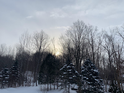
| Morning sun cuts through snow flurries Sunday morning in St. Albans, Vermont. Snow squalls are possible in the area this evening. |
The morning snow is mostly the remnants of lake affect snow bands coming off of Lake Ontario.
It looks as if the moisture from those snow bands will keep the snow going off an on in the central and northern Green Mountains today. A couple spots up there could earn a couple bonus inches of snow today, while the valleys just get a dusting.
The excitement comes this evening, when that speeding little storm from Canada zips by just to our north, dragging a pretty dynamic cold front through.
Here's how it's setting up:
It was pretty cold this morning, since we had a period of clear skies over a snow cover for change. Burlington got below 10 degrees for the first time since January 22. Though the low of 9 degrees above was still only a little cooler than average for this time of year.
Right after dawn, especially in the Champlain Valley, south winds began to blow and that is quickly boosting temperatures that will top out close to 30 degrees. A little moisture will pool in the air too, ahead of that cold front.
The front will produce a quick shift in the wind to the northwest. The shift helps set up converging air. When air converges, you get lift. If it's cold enough, it'll snow.
That's what's going to happen with this cold front. Not much snow, and it will be in and out of any given spot quickly. But the clash is intense enough that we might see some dangerous snow squalls.
If you're on the roads this evening in northern Vermont, especially after 7 p.m. be prepared for whiteouts, roads that will rapidly ice up with a quick inch or two of accumulation.
Not everyone will get a squall, but many areas could. At the moment, the timing looks like they''ll come into the International border by 8 p.m. or so and make it to Route 2 by 10 p.m. or so.
After the squalls blow through, that will be pretty much it for any snow in Vermont until Friday at the earliest.
WEIRD SNOWS
A small storm, similar to the one that hit Vermont Thursday night, raced west to east from the Midwest to New Jersey and then off the coast Friday night and early Saturday.
Snow Band
Most people got light snow. But a very narrow band - perhaps 10 to 15 miles wide at most extending from north of Harrisburg, Pennsylvania through central New Jersey.
 |
| A narrow band of snow in Pennsylvania and New Jersey dumped as much as a foot of snow in a few hours in while areas immediately to the north and south just got a couple inches. |
The band was so narrow that by some estimates, four inches of snow fell on north side of Allentown, Pennsylvania while the south side of that city was buried beneath a foot of fresh powder.
It would have been interesting if the snow band cut right across New York City.
It came close, dumping half a foot or more on the southern edges of the city. Tottenville, on the southern tip of Staten Island, reported 10 inches, but Central Park in Manhattan reported just 2.0 inches.
The storm appeared to create a stalled, west to east weather front for a few hours. It was those converging winds again, like our expected snow squall front. In the case of this storm in Pennsylvania and New York, there was a lot more moisture to work with than Vermont has. And the front stayed put for a few hours, allowing the snow to pile up.
Denver Snow Oddity
Further west, there's an odd timing issue with this winter's snow in Denver, Colorado. So far this winter, they've had 26.4 inches of snow. Of that 23.2 inches, or 88 percent of it all, has fallen on Friday, Saturday or Sunday.
The local joke is whatever controls the snow out there this winter is secretly a school administrator.

No comments:
Post a Comment