
 |
| The forecast for snow Tuesday in Vermont has been scaled way back as this National Weather Service forecast map issued early today indicates. |
Last evening, we were looking for clarity as to which way this storm would go. We did get some more forecast clarity this morning, though it's still not perfect.
That emerging agreement on the storm has forecasters backing way off on expected snow totals in southern Vermont. In northern and central Vermont, it's pretty much down to a whiff, so the snow drought continues up there.
Computer models overnight kept nudging the expected path of the storm southward, so now it's going to track fairly well south of New England, at least as things look this Monday morning.
The updated forecasts from the National Weather Service have no snow Tuesday pretty much from Route 4 north. Southern Vermont still gets some under this scenario, and a winter storm watch is still hanging on in Bennington and Windham counties. But even there, expected snow has been scaled way back, down to the three to seven inch range.
I suppose there's still a chance the storm could unexpectedly wobble back north a bit to envelop more of Vermont in at least a little snow, but for now, I'm not holding my breath.
Snowfall so far this season in Burlington stands at 27.9 inches, right around half of what would have normally fallen by this point in the winter.
In the warmer valleys of Vermont, like near Lake Champlain, the thaw grinds on. By late this afternoon, it will have been continuously above freezing in Burlington since Thursday morning. That's a long time for February. Not a record long time, but still impressive.
It'll finally go below freezing this evening, though overnight lows in the 20s are still on the warm side. Highs under the clouds Tuesday will be mild, too - in the low to mid 30s.
Those of you who want a dusting of snow to brighten up the surroundings might get a little Tuesday night with some spotty snow showers around.
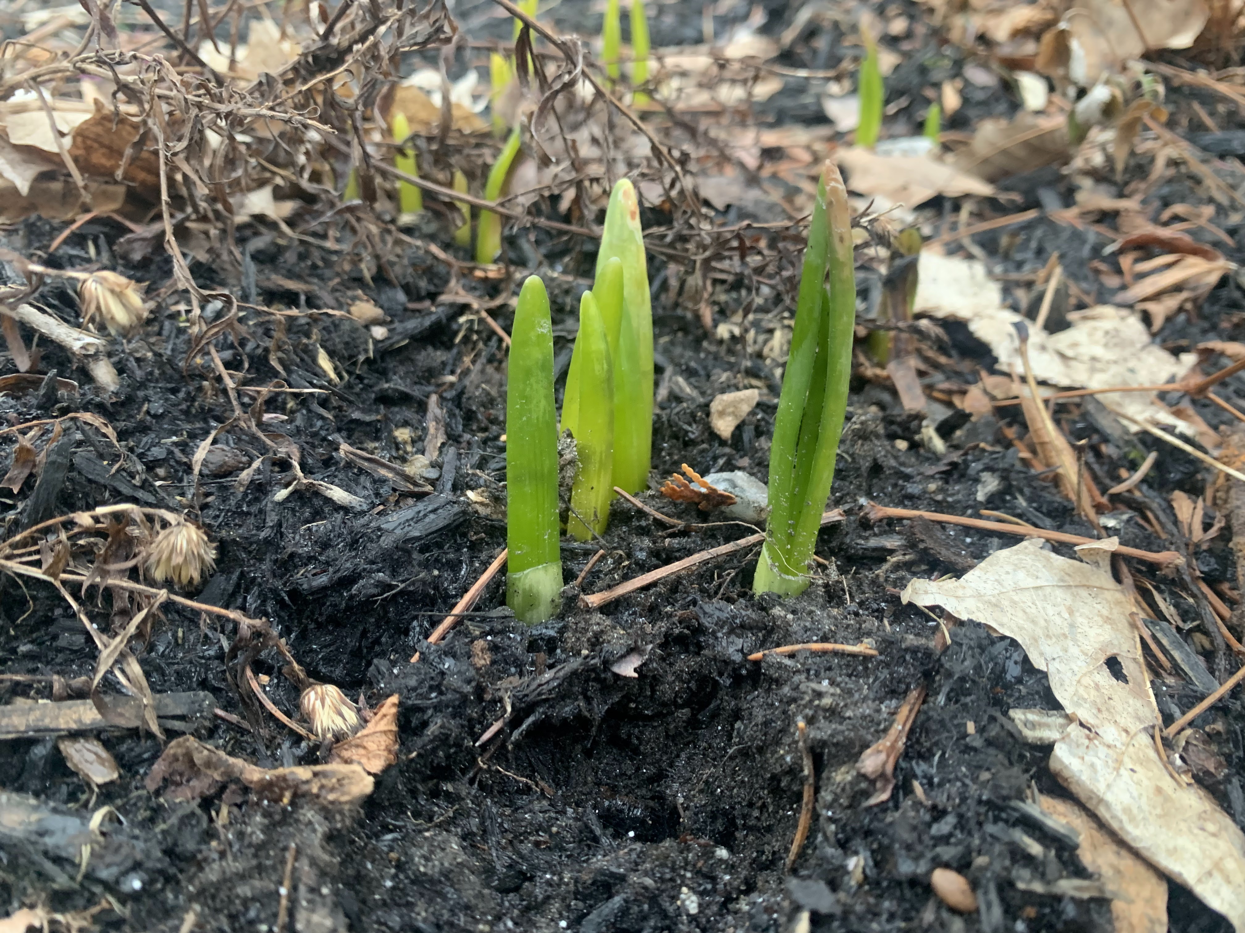 |
| Yep, daffodils emerging in my St. Albans, Vermont gardens after this latest big warm spell. This never used to happen, but in recent winters, I've gotten daffodil shoots way before spring and way before they're "supposed" to appear. |
If you want at least a thin but more widespread snow cover, your best chance is Thursday night. It's beginning to look like a weak storm might lay down a path of one to four inches of new snow Thursday night and early Friday.
Long range forecasts past Tuesday still show relatively chilly conditions settling in starting Wednesday and probably lasting for at least a good ten days. It's not looking extremely cold in those long range forecasts, but nippy enough.
It still hasn't gotten to zero or below in Burlington yet this winter. The only other winter we won't have gotten this far into February without a zero was in 2001-02, which never did reach zero. The first zero of 2015-16 was on February 12 that year.
There appears to be some potential for a couple subzero days even in the Champlain Valley before the end of this month.
Winter is not over, despite what it has felt like in recent days.
No comments:
Post a Comment