 |
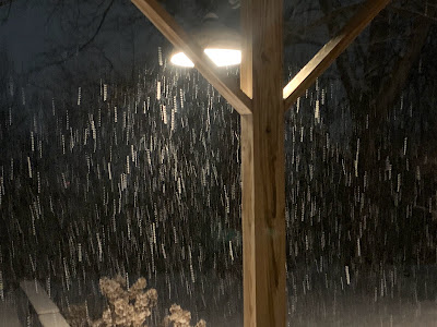
| Snow really began to fall in earnest around 9 p.m. Thursday continued into this morning around St. Albans, Vermont. Close to 4 inches accumulated by 7 a.m. |
I was up to 3.8 inches in St. Albans as of 6:30 a.m. Reports from the central and southern Champlain Valley were in the two inch range. I saw a report 5.8 inches in Albany, Vermont and 4.1 inches in Waterbury Center.
It was still snowing in many places before and after dawn. As of 8 a.m., roads were slick still in many places. But where the snow has turned to flurries or ended altogether, those roads were improving.
.One last area of general light snow from this fast moving storm came through northwestern Vermont before and around dawn, so that kept road conditions iffy in the northern Champlain Valley.
Meanwhile, the steadiest snow was aligning itself along the northern and central Green Mountains and that's where most of the fun will be today. Up there, the snow showers should last all day, which is why they're total amounts still look like they'll be in the six to 10 inch range, with maybe some spot amounts a little higher than that near the summits.
As anticipated, the snow is light and fluffy. Winds will get increasingly brisk this morning, so a lot of that will blow around. Some of it will blow back onto the roads, so you'll need to watch out for that all day. You'll be cruising along on clear pavement, then all of a sudden you're in a wind-prone area and the road in that spot is snowy and icy. So anticipate that if you're driving around anytime today.
The strongest winds will be in southern Vermont, where winds could gust to 40 mph.
Another little storm, very similar to the one we had, is now zipping along, heading from Missouri to eventually the Mid-Atlantic coast. It will go by too far south of Vermont to affect us, but you'll probably hear about several inches of snow in a stripe from central Illinois to Washington DC and New Jersey by tomorrow morning.
For us in Vermont, we'll just keep getting flurried to death today through Monday. Temperatures will be pretty close to normal for this time of year.
In the valleys, there won't be much additional snow over the weekend - probably an inch or less in most places. But a few inches will probably gradually pile up in the mountains, which is nice for the ski industry.
There is a risk for some snow squalls on Sunday, so we'll keep an eye on that. And it's still looking warm-ish for the middle and end of next week, which could thaw some of our new snow away.

No comments:
Post a Comment