
 |
| Buds on a lilac bush on my St. Albans, Vermont property already beginning to swell at the end of February amid record warmth. Some of the lawn looks suspiciously green, too. |
The weather keeps running off the rails after yesterday's record warmth. The character of it changes today, before things get wild this evening.
Tuesday was a delightful, sunny spring day in the Green Mountain State, never mind that it's February. The record high of 65 in Burlington would have been normal for May 5, the time of year when flowers and buds are bursting into green.
Of course, a lot of plants in local gardens are starting to poke up, which is way too early.
Record highs are inevitable today. By 8 a.m. today, Burlington was already up to 56 degrees, just three degree shy of the record high for the date.
A burst of rain showers might or might not delay the inevitable record high, but a break in the rain this afternoon should ensure record highs once again across Vermont. Burlington should get into the 60s for the second day in a row, and might even exceed Tuesday's ridiculous high temperature. Temperatures in the 50s will be widespread in "cooler" areas of the sate.
You should see south winds picking up through the day, too, as that powerful cold front approaches this evening. By afternoon, winds will be gusting to 40 or even 50 mph in some spots.
A wind advisory kicks in across Vermont at 1 p.m today and lasts until 7 a.m. Thursday. That covers the gusty south winds ahead of our big cold front, the gusts along the front and the rushes of wind behind the front as the cold air works in.
Drama Hour
The drama should really hit when the cold front comes through. It still looks like it will arrive roughly at 6 p.m give or take in the Champlain Valley, and 7 p.m. or a little after in eastern Vermont. Again, give or take.
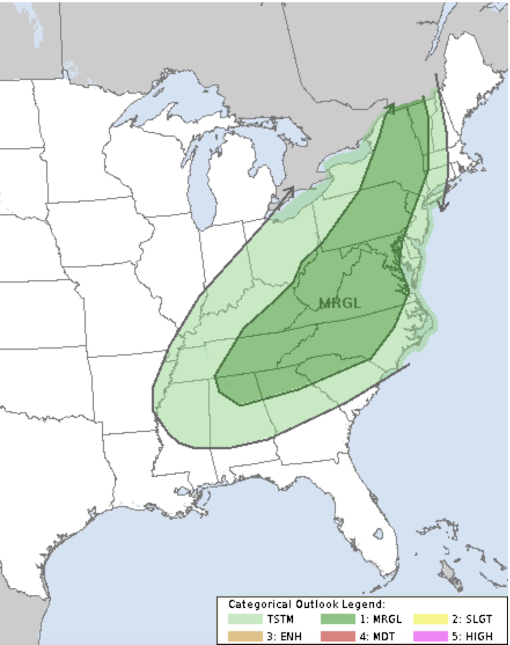 |
| NOAA's Storm Prediction Center still has much of Vermont and the eastern U.S. in a marginal risk zone for severe thunderstorms today. |
The front will bring a narrow band of torrential rains and possible thunderstorms, and a big surge of wind.
NOAA's Storm Prediction Center still has most of Vermont under a marginal risk of severe thunderstorms with this. Some bursts of winds with this could be damaging. You might see little or no lightning with these storms, so they'll mean business.
You might want to stay off the roads as this comes through due to the blinding rain and gusts of wind. Or at least take it easy.
The flood watch remains in effect, too, mostly along and west of the Green Mountains. The combination of rapid snowmelt from the mountains today and those downpours along the cold front should get rivers rising pretty fast.
It'll be a minor flood, but still, watch out this evening and overnight for water on low-lying roads, and in urban areas during and just after the evening downpours.
This time, it won't be a disaster. Downtown Montpelier, Johnson and other flood-prone communities are pretty safe this time, except for those low elevation roads near rivers. Some steep back roads could suffer some erosion. And if there are any culverts still clogged by ice, that could cause a couple problems, too
Spring Ends Temporarily
Behind the front, we'll see rapidly falling temperatures and still some strong, gusty west winds. By late this evening, it'll start to go below freezing. It doesn't look like there will be much snow at the tail end of this. Maybe a half inch in the valleys, an inch or two in the mountains.
But that water will freeze hard and fast, especially since temperatures will crash into the teens by dawn or earlier. You'll be dealing with icy sidewalks and untreated roadways and driveways tomorrow morning, that's for sure.
For just one day Thursday, we'll have winter weather with sunshine, temperatures holding near 20 all day with gusty winds keeping wind chills near zero. Then that ends as quickly as it began.
Spring Comes Back
The oddly warm weather we've had all winter comes back to make March come in like a lamb. Sure, it'll be chilly at dawn, Friday, March 1. But it will be in the 40s by afternoon. After that, it looks like much of Vermont will see a good five consecutive days with highs in the 50s - very warm and very strange for early March.
No comments:
Post a Comment