Showing posts with label totals. Show all posts

Sunday, February 9, 2025

Latest Vermont Storm Behaved As Expected; Busy Pattern Ahead, No Rest For The Storm-Weary

The sun emerges as the last of the overnight snowflakes
fall in St. Albans, Vermont this morning. We only 
received 2.1 inches of new snow, but there's plenty
of reports of near eight inches in southern Vermont. 
 The snow in Vermont was just tapering off as of 8 a.m. this morning, and glimpses of blue sky were visible through the last remaining snowflakes in the air. 

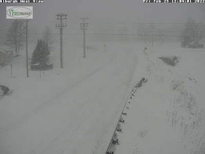
Road crews are busily clearing the highways, though most of them remained snow-covered and slippery as of 8 a.m. They'll keep improving through the morning. 

I noticed on traffic cams the roads near ski areas seemed particularly busy. No surprise there, given the great conditions the past few weeks of winter weather have provided. 

As promised, the snow focused on southern Vermont, though everybody got some. 

Snow reports were just coming in, but the six-inch plus totals look pretty widespread all the way to central Vermont. The biggest totals I've seen so far are 9 inches in Tunbridge, and 8.5 inches in West Addison. I saw quite a few eight inch totals in southern Vermont. 

Lighter snow fell roughly in line with expectations further north. I measured just 2.1 inches here in St. Albans. Burlington looks like it will come in with about 2.5 inches of new snow. It also looks like the Northeast Kingdom got about two to as much as three inches of snow. 

TODAY

Traffic cam caught a line of vehicles following a 
Vermont state snowplow up Route 108 in Stowe.
I bet ski resorts in the state are anticipating
a very busy Sunday. 
As promised earlier, we have a nice one coming up.  It won't be wall to wall sunshine as clouds seem like they want to hang around most of the day. But it will be bright and the sun will be out off and on. Bring those shades!  

Even better, we're starting off today relatively mild and will stay that way.  It was near 20 degrees for pretty much all of us early this morning and we'll make it into the upper 20s this afternoon, and the wind will stay pretty light. 

A few extra snow showers or flurries might appear later this afternoon and evening, but they'll just make the air seem that much prettier. 

EARLY WEEK

Back to the relatively quiet and cold weather we've seen all winter, at least between our mid-sized storms. It will be a little chillier than average for this time of year, with highs in the teens to low 20s, and lows in the single numbers. Cold spots go below zero again.

There will be hints of snow here and there, especially on Tuesday when a couple of weak reinforcing cold fronts come down from Quebec and blow through here. That'll set off some snow showers. We might have to watch Tuesday afternoon and evening for some heavier snow showers that could mess with the afternoon commute. We'll see and update as needed.

THURSDAY STORM

This one is already giving headaches to Vermont meteorologists.  It's actually two storms coming at us at once. One of the storms will go by just to our northwest, the other will scoot by to our south across lower New England in tandem with the more northern one. 

The question is, which of the two will be stronger. If the northern one flexes its muscles, it'll get warmer and might we'll  have to deal with a snow to freezing rain and schmutz scenario. As of this morning, the stronger northern storm is beginning to look more likely. 

If trends reverse and the southern storm wins out, it'll just snow. 

It's too soon to say how much of anything we might get out of the Thursday thing, so I guess we'll wait on updates for this one, too.

Yet another storm looks like it will sweep by next Sunday. It's too soon to say whether that one will hit us in Vermont, or go by too far to the south to give us much of anything. It's a waiting game to find out what's going on with all these storms, I guess. 

Meanwhile, live in the day. Don't worry about the rest of the week.  Just go out and play in the really beautiful snow out there today. 

Friday, January 24, 2025

The Final Word: Gulf Coast Snow Update: Revised Snowfall Totals, More News

You'll never see this again. A view Tuesday in
New Orleans, Louisiana. 
The weird, once in a lifetime snow is quickly melting away along the Gulf Coast, and the pace of the thaw will pick up in the coming days as more normal weather returns.  

The snow was obviously an incredible novelty, but there is of course sad news associated with it. At least 11 deaths have been attributed to the snow and accompanying cold snap. 

Us weather geeks are still amazed as snow totals are finalized. If anything, some of them have been revised upward. 

The total in the Florida towns of Milton and Jay are now set at 10 inches even,  more than double the old record for the biggest snowstorm on record for the entire state. 

Grand Coteau, Louisiana reported 13.4 inches, and may have been the snowiest place in the United States Tuesday. It's possible one or two towns near the Great Lakes had more in lake effect snow, but that's uncertain. 

Babbie, Alabama reported 11 inches.  The eight inches in New Orleans was confirmed as a record, as was the 9 inches in Lafayette, Louisiana. 

Mobile, Alabama had a record snowfall of 7.5 inches. 

Skies cleared Tuesday night in places along the Gulf Coast from about Mobile westward.  Clear skies, relatively light winds and a snow cover almost always cause remarkably low temperatures. 

Acadiana, Louisiana reached 2 degrees above zero, for an all-time record low. The town is just 30 miles from the Gulf of Mexico. 

Two locations a little outside of Lafayette got down to 1 below.   That was about the same as Burlington, Vermont, which got down to 2 below that morning. 

Lafayette itself had an all time record low of 4 above. That was a full 14 degrees colder than the old record for the date and an incredible 40 degrees below the normal low for the dates.

Lake Charles bottomed out at 6 degrees. 

Mobile had record low of 6 above.  Only the great cold wave of 1899 was worse, as it got to minus one on that occasion. 

The only way to build a snowman or snow woman
in New Orleans. Photo via Fox Weather 
reporter Brandy Campbell. 

The strength of this cold wave was not the most intense ever along the Gulf Coast. But never before were there several inches of snow on the ground under mostly clear skies during a cold snap near the beaches.

The result was all-time record lows, not even seen back in the day - 1800s to 1930s when they began keeping records in a world that had not experience global warming yet due to our fossil fuel consumption.  

It proves that under the right conditions - which happened in this case - you can get incredible frigid spells. Just not as frequently as we once had. 

Obviously, road travel was nearly impossible along the Gulf Coast with the snow. 

But oddly, at least to me, it was Atlanta that suffered the most chaos from the storm.  They didn't get all that much snow, at least compared to cities closer to the coast. 

Also, though Atlanta isn't particularly used to or well equipped for winter storms, such weather isn't exactly unheard of there. 

The Atlanta area only got an inch or two of snow Tuesday. But it hit in the afternoon.  The snow initially melted on many roads then froze into a solid, slick sheet of ice.  People were stranded on highways overnight and at least hundreds of cars slid off roads. It was a mess. 

The storm that caused all this moved off the southeast coast Tuesday night and began an incredibly fast race across the Atlantic Ocean. It also strengthened mightily to become Storm Eowyn, which is expected to be one of the worst windstorms on record for Ireland and Scotland. 

While all this was going on and not to be outdone, while the South was blizzardy, so too, was the more traditional snow belts along near the Great Lakes this week.  Over three days ending Wednesday morning, Adams and Barnes Corners, New York each reported 40 inches of new snow. 

VIDEOS:

Who knew? Turns out people in New Orleans are really good at building snowmen, despite their lack of experience with winter weather. Check out some examples. Click on this link to view, or if you see the image below, click on that. 


Tourists are drawn to the white sand beaches along the Gulf Coast in Florida.  A once in a life time experience was the new, white snow beaches there. Click on this link to view or if you see image below, click on that. 


Practically everyone in the Deep South got outside to enjoy the snow, including these nuns in a snowball fight in Metairie, Louisiana. Again, click on the link to view or if you see the image below, click on that. 


Another big snowball fight, this one in, (checks notes) Jackson Square, New Orleans. One more time, click on this link to view or if the image is visible below, click on that. 


Monday, January 20, 2025

Nor'easter Zips Away, Leaving New England To Deal With Cold Winter Winds

The snow was over and the sun was out early this 
morning in Vermont. But it's cold, so it's hard to 
get all the snow and slush off the roads. Salt isn't
working great. This is Route 100 in Ludlow 
around 8 a.m. today on a traffic cam grab.
 Our nor'easter from last night, true to form zipped on past and is pretty much out of our hair as of this morning. 

It pretty much played out as expected, though there were a few twists and minor surprises involved with it. 

Once it got its act together, the storm seemed even a little more dynamic than I might have expected. It provided northeast New Jersey and the New York City area the spectacle of thunder snow, which is always fun. 

Apparently the extra oomph the storm had allowed it to overcome the dry Arctic air flooding in from the northwest. 

Which meant even the northern Champlain Valley managed to see a little fluffy snow.  Here at my place in St. Albans, Vermont, I collected 1.9  inches of basically feathers. 

It was early when I was writing this, so far I haven't seen a lot of snow reports coming in. Far southern Vermont got the most, as expected. 6.5 inches was reported in Readsboro with 6.1 at Woodford State Park. 

The National Weather Service office in South Burlington said there might have been some extra moisture off of Lake Champlain that added a little to the snowfall in Addison County, but we didn't have reports from the area as o 7:30 a,m

COMING UP

As long planned, it's cold out there. 

It seems the core of this massive Arctic outbreak is hitting the middle of the nation and then the Deep South, so we're sort of being just clipped by it here in Vermont and the rest of New England. 

Almost all of the nation from the Rockies east are under cold weather advisories or cold weather warnings. (So far, we haven't quite met the criteria for such an alert in Vermont yet).

A bizarre winter storm is still expected starting later today and going into at least Tuesday along the Gulf Coast. 

As expected, far southern Vermont got the most snow,
with reports of around six inches or a little more. Early
morning revealed a winter wonderland along
Route 9 in Searsburg in this traffic cam grab.

Even though we're not getting the worst of it here in the Great White North of Vermont, it's so cold your home thermostat will probably give you the middle finger, and it will stay that way through Thursday morning. 

Temperatures in Vermont a little before dawn were mostly in the single numbers above zero to around 10 degrees. The sun is coming out very nicely in most areas, but that won't heat us up. It actually won't get any warmer than it was early this morning.

If you're ignoring the frigid inauguration in Washington DC today and instead heading up to ski at a resort for end of the long Martin Luther King Day weekend, first of all, you're nuts.

But if you insist, note the wind chills up in the mountains today will be in the 20s to perhaps 30s below zero. You really better be wearing the right clothes if you do this.  

 Tonight starts a three-night string in which most of us get below zero. This won't be anywhere near record cold, of course.  Record lows this time of year are in the 20s below in the Champlain Valley and many places elsewhere in Vermont have been known to get into the 30s below in the past.

Instead, this time, it'll be 0 to 5 below in the Champlain Valley the next three nights and in the 5 to 15  below elsewhere. 

Daytime "highs" will be 5 to 15 above today through Wednesday. 

The timing of this cold snap is very typical. On average, the coldest weather of the winter hits around a month after the winter solstice, and that's where we are now.  It's all uphill from here, but don't get too optimistic. We can get some really bitter air, colder than the current blast, right into mid-March. 

Still, we have at least a temporary warming trend coming up, as readings will rise to pretty average levels by Thursday afternoon and beyond. 

By Sunday, current forecasts have it turning hazy, hot and humid, at least compared to the weather we're having early this week. By that I mean afternoon temperatures by Sunday could reach the low 30s. 

Plus, the days are getting longer. Sunset this afternoon is a good half hour later that it was at the winter solstice in December. 

Spring hasn't sprung, but we're getting there, and it will hit faster than you'd think. 

Tuesday, December 24, 2024

Final Word On Vermont Snow, Now For A Quiet Christmas Aside From Bit Of Unpleasant Evening Freezing Drizzle

Map from National Weather Service in South Burlington
depicts how much snow fell in last nights small storm
Click on the map to make it bigger and easier to see,
 The snow ended earlier today as expected, leaving us with a dull Christmas Eve forecast and a little fog. 

Don't worry about the fog, at least in terms of what Santa's doing. Rudolph the Red Nose Reindeer managed to find his way through fog and mist way worse than this .

However, a bit of freezing drizzle is coming out of that fog across parts of northern and central Vermont this evening, so that could create some unexpected slick spots on the roads this evening,

There's a few flurries mixed in, too.

Do be careful out there! 

The National Weather Service in South Burlington has given us its full list of snowfall reports.  Aside from under-performing in Chittenden County, the forecast proved pretty accurate.

The big winner with this storm was Potsdam, in northwestern New York, with a foot of snow. Nearby Hannawa had 10 inches. 

In Vermont, the snow sweepstakes winner was a tie between Lincoln and Newport Center, with eight inches. Charlotte came in the losing end, with just an inch of fresh powder. The National Weather Service office in South Burlington only managed 1.5 inches of new snow.

For comparison's sake, this is the forecast from 
a few hours before the snow actually started.
Pretty close to reality, actually
One aspect of the forecast for Christmas Day through Friday is whether we'll see any sun. Strong high pressure nearby favors sun. But that strong temperature inversion we've been talking about might trap in a layer of low clouds. 

I'm still thinking that many areas might see a low overcast through the week, but that's not guaranteed. If it does clear out at night, temperatures Christmas night and the next night could get near zero.

Mountaintops still look like they'll poke up above any low overcast. Due to the inversion, mountain tops might well be warmer than the valleys during the next few days. 

We're still watching for the risk of some air pollution trapped beneath the inversion, too. We'll update you if there's any air quality alerts.

Eventually, that stalled, strong high pressure will move off to the east, opening us for storminess toward Sunday. It's still early to say what will happen with that, but odds at the moment favor rain to dampen the enthusiasm of winter sports fans. 

But it's still just the beginning of winter. Even if some rain sets back our snow fun, there's plenty of opportunity for the white fluff to come back in January, February and March. And, ugh. Maybe April 

Tuesday, December 19, 2023

Tuesday Evening Vermont Flood Update: Rivers Receding, Cleanup Begins, Disaster Declaration, Maybe?

The Lamoille River at Fairfax Falls near Cambridge,
Vermont rages amid snow flurries on Tuesday. 
Assessments of Monday's flooding are coming in, and the bottom line seems to look like this:

This flood was quite damaging, and caused a huge boatload of headaches. But the rain stopped just in time to prevent things from going completely off the rails as they did in July.

 The best news is that there have been no reports of deaths or serious injuries. 

Honestly, I think had it rained like it did for another two, three maybe four hours on Monday, we would have had another July. 

LATEST UPDATES

As evening drew close today, roads were reopening, though a few remain closed. The flood crests on the larger rivers had emptied into Lake Champlain or the Connecticut River, or were getting close to that point. 

For those who suffered flood damage again this time, or came close to it, this event was mostly an emotional, and sometimes physical trauma. 

"Seeing homes and businesses surrounded by water again is heartbreaking," Vermont Gov. Phil Scott said during a Tuesday afternoon press briefing. "I can't imagine the toll the has on anyone."

 Lots of Vermont municipalities, businesses and homeowners had close calls with Monday's flood, and they still brought headaches. There's plenty of examples. 

From Vermont Public:  

"In Londonderry, the West River got close to Mike and Tammy's Main Street Deli but didn't cause widespread damage like this summer. 

The Winooski River, at major flood stage, rages past
buildings in Winooski, Vermont on Tuesday. 
Store owner Tammy Clough says the staff still had to move everything up off the floor Monday, and then move it back down in time to open up Tuesday morning. 'I'm exhaused, but what are you going to do,' Clough said. 'I was exhausted before yesterday. What are you going to do? We all just pull together and get it done.'"

Vermont Public also reported the Johnson Post Office just reopened last week having recently completed repairs from the July flood. It got flooded again, but not as badly as in July.  They hope to reopen fairly quickly.  

Most of the flooding in Johnson was confined to basements, despite the Lamolle River reaching its fourth highest crest on record, Some houses in Johnson and elsewhere affected by this week's flooding had not yet been re-occupied since the July inundations.

Judging from the comments from state officials at this afternoon's presser about the flood, it looks like Vermont will be angling for another federal disaster declaration with this latest storm. 

State officials urged people who suffered fresh flood damage to take pictures, note everything that was damaged and save receipts. They should then report these damages online to vermont211.org.

That information will help state officials aggregate damage estimates to report to FEMA and other federal agencies.  

Meanwhile, state and local officials are cleaning up streets, unclogging culverts and catch basins to prepare for the next big rainstorm, whenever that might hit. (Spoiler: Nothing coming through Christmas Day at least).

Flood warnings remained in effect along several Vermont rivers, but they were all receding. The flood warnings should be all gone by tomorrow. 

RAINFALL TOTALS AND FORECAST

Map of rainfall from the storm in Vermont and northern
New York from the National Weather Service office
in South Burlington. Heaviest rainfall as across
southeastern and central Vermont. Click on the 
map to make it bigger and easier to se. 
The National Weather Service office in South Burlington compiled a comprehensive list and map of rainfall totals across Vermont and surrounding areas from this storm. 

The heaviest rain fell in and around Brattleboro, with more than four inches there. Other reports include 4.27 inches in Quechee, 4.17 in West Bridgewater and 3.96 inches in Worcester. 

Overall, the heaviest rain fell precisely where the National Weather Service office in South Burlington predicted it would. Same with the lighter totals in far northern Vermont and in a pocket around central Rutland County. 

 It's just that the rainfall totals were somewhat higher than predicted. That, and a lot of snow melt, made the flooding worse than anticipated.  

The weather forecast remains quiet through Christmas and quite possibly beyond. The snow showers today didn't amount to much, if you got them at all. Some spots in northern Vermont saw a dusting to an inch. 

Tomorrow will be seasonable and dry. Wednesday and Thursday look kind of on the chilly side and dry, followed by a warming trend for the Christmas weekend. There might be a bit of very light snow Saturday, but that's about it. 

Our next shot at any kind of storminess is at least a week away. 


Sunday, October 8, 2023

What A Super Soaker, Especially New York; Flooding Minimal Though

Traffic slogs through heavy rain and deep puddles 
during Saturday's storm in St. Albans, Vermont. 
 That was one impressive soaker in western Vermont and eastern New York Saturday.

Many areas in this region had more than a month's worth of rain in a single day.  Thank goodness northern New York and most of western Vermont  had a two-week dry spell before the storm hit. That prevented any serious flooding.  

The stats are impressive, though. As of 4 a.m. Plattsburgh, New York had a storm total of 4.09 inches of rain. Of that, 3.94 inches of that rain came down on Plattsburgh on Saturday. That made it Plattsburgh's wettest day on record, though those records only go back to 1945.

In Vermont, Burlington saw 2.95 inches of rain with this storm. Of that 2.8 inches fell on Saturday. That made it the third wettest October day on record, and those records go back to the 1880s, so that's quite a long time. 

By the way, the second wettest October day on record in Burlington was pretty recent: On October 31, 2019, with 3.3 inches of rain.   In that instance, there was a lot of destructive flooding in central and northern Vermont, along with wind damage.

Some other impressive rain totals from Saturday's storm include 4.95 inches in Orwell, 4.83 inches in Port Henry, New York and 3.9 inches in Vergennes. There were plenty of three inch plus totals across the western half of Vermont.

National Weather Service in South Burlington issued
this map showing Saturday's rain by far the heaviest
in eastern New York and parts of western Vermont. 
Eastern Vermont got off with just one to two inches.  The storm system causing the heavy rain had stalled in eastern New York for much of Saturday, focusing heavy rain there for most of the day. 

The cold front then pushed east in the evening, spreading rain across the rest of Vermont. But it didn't linger long enough to produce the incredible totals west of the Green Mountains. 

NEXT UP

Things have settled down this morning. It's chilly and blustery with lots of clouds, and a few breaks of sunshine. Scattered showers will continue all day, but they'll be light and brief. 

The exception will be out by the shores of lakes Erie and Ontario. The first lake effect precipitation of the season is happening today. .That can only happen if the air flowing over the lakes is colder than the lake water.  

It is too warm for those epic lake effect snows, so it's coming down as heavy rain south of Watertown, New York.  In that area, a flood warning is in effect today. 

There's also lightning and thunder in spots near the lakes. On top of that, there were dozens of waterspouts on Lake Erie on Saturday. Waterspouts are pretty common on the Great Lakes during the autumn, but Saturday was really a super producer. 

Back here in Vermont, the whole week will be like that. Not bad, not great. Clouds, sun, always the risk of a quick shower, cool but not frigid weather. (Lows mostly in the upper 30s and 40s, highs in the 50s to near 60). In other words, typical October. 

There could be a nor-easter type storm toward next Sunday, but the computer models are still wildly disagreeing on the strength, path or even the very existence of that potential storm. The word "nor'easter is scary for those of you not ready for snow. Don't worry, even if the storm happens, it'll be too warm for snow, except on the mountain tops in a worst case scenario.

Instead of throwing out more guesses on that potential storm, we'll update as needed later this week.  

Monday, June 19, 2023

One Last Vermont Rain Update

National Weather Service office in South Burlington
released this map Sunday, showing how much
rain fell over six days ending early Sunday. 
Areas that needed the rain most in general
got the most rain, which is nice. 
 The National Weather Service updated their rundown of the six day rainy spell we just had. 

The map is in this post. Click on it to make it bigger and easier to see. 

As is normal with summer rainfall, totals were really variable, but everybody got a good soaking. Some spots that got bullseyed by thunderstorms Thursday and Friday did really well.

 I saw a 5.28 inch total in eastern Rutland County, and a few places in north-central Vermont that had over four inches. 

In general the heaviest rain hit where it was most needed, in that north-central Vermont area. That's where the U.S. Drought Monitor has been regarding as the driest area of the Green Mountain State, and the area that needed the most rain. 

As I noted yesterday, aside from isolated showers Monday and Tuesday, we're dry through Friday.  There are hints that it might end up raining hard again, at least in spots, this coming Saturday and Sunday.

But that's a long way off, so that forecast is subject to change. 

Despite all the rain we just had, it really wouldn't hurt to see more.  One rainy week can't entirely wipe out the effects of a dry spring. 

Friday, February 25, 2022

Friday Evening Vermont Storm Report: Serious Crashes, North Over-Performs, South Under-Performs

That blur you see in the center right of this photo is a car
that was skidding off Route 36 in St Albans by
my house and landing on its side in a ditch. The driver
was not seriously injured. 
 Today's snowstorm wasn't nearly as "well-behaved" as I thought it would be. 

The worst part of it was car crashes. As of late this afternoon, Interstate 89 northbound between Colchester and Georgia, Vermont was closed due to what sounds like a horrific crash in Milton.  

WPTZ reports at least one person is dead and multiple vehicles were involved. A coach bus was on its way to pick up stranded people, which means there has to be quite a few. No further details were available as of this writing.

Elsewhere, Route 78 in Swanton was closed earlier this afternoon due to a tractor trailer crash.  One lane of Interstate 91 in Hartford was closed for a time due to another crash.  On my road in St. Albans, a steep section of Route 36, I watched earlier this afternoon as a car lost control slid off the road, became airborne, then landed on its side in a ditch.

I helped the driver out of the upended car and he did not appear to be seriously injured. 

My theory is the snow was dry and people felt safer on that type of snow. It was so powdery that it was blowing off well traveled roads like the Interstates. Unfortunately, before the snow could blow off the roads, pressure from tires driving over it created a very thin layer of black ice,

If you plan on driving anywhere in Vermont this evening, don't. But if you must, be extra cautious, even as the snow tapers off.

Vermont Agency of Transportation web cam showed a 
snow-free Route 78 in Alburgh around 7 a.m. today.....
The other aspect of this storm that made it not as well behaved as it could have been was the distribution of snow accumulations. Totals aren't final yet, as many areas of Vermont still have an inch or two to go.  

But it appears southern Vermont got quite a bit less snow than forecast. Northern Vermont got about as much as forecast, except for the northern Champlain Valley.  Franklin and northern Grand Isle counties seemed to hit the jackpot.  

There, totals were closing in on ten inches by early evening. As of 5:45 p.m., my yard in St. Albans had received 9.5 inches of snow. Swanton reported 9.5 inches as of 2 p.m., when it was still snowing at a good clip there. Swanton probably ended up with close to a foot. 

Elsewhere in the north, amounts were clustered tightly around 6 to 8 inches as of 4 p.m, so the predicted snowfall of 7 to 10 inches of snow will verify. 

In far southern Vermont, 8.5 inches of snow was reported at Winhall and a little over six inches was reported at Readsboro and Landgrove as of late afternoon. They'll probably pick up only another inch or so of snow, so those predictions of a foot of snow might not happen. Except maybe up toward favored locations around Ludlow, Mount Holly and Shrewsbury. We'll see. 

It looks like the burst of snow this morning in southern Vermont didn't last as long as forecast. Meanwhile, in the north, especially in the upper Champlain Valley and adjacent New York, the heavy snow began earlier than forecast. The heavy stuff was forecast to blow in around 11 a.m, but it was already snowing hard at 8 a.m. The Champlain Valley snow got lighter at around 4 p.m., which was about the time that was expected to happen. 

Snow is still expected to gradually wind down over the next few hours. It'll be over by midnight at the latest. 

We're still going to have a perfect winter day tomorrow, with sunshine, coldish but not frigid temperatures and light winds. 

Sunday is looking problematic.  

....and that same stretch of Route 78 in Alburgh looking
much, much different shortly before 1 p.m. today. 

The first problem Sunday will be wind, especially in the Champlain Valley. The snow that fell today is remarkably light and fluffy. It won't take much wind to blow it around. 

Winds are now expected to gust to 40 mph in the valley.  That will cause blinding ground blizzards in exposed locations, and surprisingly deep drifts on roads

I expect they might actually close the Route 2 causeway between Colchester and South Hero, as there will be vast amounts of powdery snow blowing off the ice covered surface of Lake Champlain. 

The other problem Sunday is a rising chance of brief but heavy snow squalls. First of all, the squalls cut visibility to zero very abruptly, making the chances of highway pileups pretty high. Additionally, temperatures are expected to rise to between 30 and 35 degrees ahead of the likely squalls.

So the first flakes that fall in the squall will melt on the highways. But rapidly falling temperatures will instantly freeze that water, and the blinding snow will accumulate on top of that. So when you hit the brakes when the visibility disappears, you won't stop. You'll just slide into the wreck ahead of you. 

I'll update this as we get closer to the event. 

Saturday, January 8, 2022

That Bit Of Snow Was Nice, But Watch Out For Ice Sunday, Arctic Blast After That

This morning dawned clear and cold in St. Albans, 
Vermont with temperatures near 0 degrees. That's a
foretaste of some bitter Arctic air due here early next week.
 I suppose you could say the snow in Vermont over-performed a bit Friday, which is nice.  

I'm saying that because several places got more snow than forecast. But that's not saying much.  The forecast had said most places would get an inch or two, with locally up to four inches.

A number of places got around three inches of snow.  Rutland for some reason was a hot spot with a little over five inches of fluff. Stowe wasn't far behind with five inches. Looks like about two inches at my St. Albans, Vermont hacienda. 

Places along the coast fared much better with the snow. Several towns in eastern Massachusetts and Rhode Island received a foot of snow, with Blue Hill, Massachusetts topping them all with 15 inches. Amounts of six to 10 inches were common in New Jersey, the New York City metro area and Long Island. 

Most of that snow was light and fluffy, though, because conditions aloft supported that kind of snow, temperatures at the surface were several degrees below freezing and there wasn't much wind to wreck the structure of snowflakes. 

Next up, another potential freezing rain nightmare for much of the Northeast Sunday, followed by that well-advertised Arctic blast. 

Ahead of the first of two cold fronts, winds several thousand feet overhead will be screaming from the southwest. That will warm a layer of the atmosphere aloft to above freezing. Those wind gusts and warm air won't be able to mix down to the surface all that well, so large swaths of Pennsylvania, New York and southwestern New England are under winter weather advisories for light freezing rain Sunday. 

There won't be much, but it will be enough to glaze the roads. It's a recipe for highway pileups. There's not much traffic on Sundays, so people might unwisely edge their speeds up. Then they won't be able to stop when there's a spin out in front of them, so there could be chain reaction crashes. 

 Given the bad track record of winter weather calamities on the roads in much of the nation this month, I'm a bit pessimistic.

Up here in Vermont, we'll get little precipitation with the cold fronts. Currently, only the two southernmost counties of the Green Mountain State are under winter weather advisories. But expect slick spots just about anywhere in the state on the roads tomorrow. 

Then we get into the Arctic air after the cold front blows by on Sunday night. Monday will start off cold, then a second front will drop temperatures further. 

By Monday night, it will be miserable.  More often than not, Vermont's coldest winter nights come on clear, calm nights.  This time, exceptionally cold air aloft will keep us frigid despite clouds and wind that would otherwise keep us a bit warmer. 

Those north winds will cause dangerous wind chills Monday through Tuesday, so watch it!

Tuesday still looks like it will be one of those zero degree days for highs. 

The Arctic blast looks to be a quick hitter. It'll be well below zero Tuesday night again, despite the core of the coldest air departing to our east. By Wednesday afternoon, it will be OK - teens and low 20s - then we get into average January air after that. (20s to around 30).

Sunday, December 19, 2021

Vermont Snowstorm Over, Remarkably Uniform Snow Totals

As the snowstorm got underway Saturday, my trusty
weather watching assistants, Jackson, left, and Tonks,
kept very close tabs on the storm's progress in
St. Albans, Vermont.
The now mostly departed snowstorm from yesterday and last night in Vermont seems to have left a remarkably even blanket of snow across the Green Mountain State.  

Pretty much all of the many reports I've seen this morning put snow totals between five and nine inches, in line with forecasts prior to the storm.

 So kudos to the National Weather Service in South Burlington and all the other meteorologists in Vermont for the accurate forecast.

Because of terrain influences and an often sharp boundary between deep moisture and very little, most snowstorms in Vermont leave a hugely variable amount of snow. One storm last December deposited just two or three inches of snow in the Champlain Valley and up to 40 inches in southern Vermont.

So, the only unusual thing about this storm was its uniformity. As storms go, this one was really well behaved.

Road crews were still cleaning up as of dawn this morning, so there will be slick spots on the roads. The storm managed to cause a handful of scattered power outages in eastern Vermont, where the snow was apparently a bit wetter, but I'm sure that will get fixed up really quickly.

During the day, wind gusts of over 20 mph might cause some blowing and drifting, but it won't be anything extreme.

The week ahead continues to look somewhat chilly, occasionally windy, but with no big snowstorms.

Something seems like it wants to come along for Christmas weekend, but nobody has any idea yet what kind of precipitation it might bring, and how much. Could be minor, could be one that has some impacts.

Stay tuned, and meanwhile, enjoy the snow!