
Showing posts with label pretty. Show all posts

Tuesday, May 2, 2023

Vermont Dodges Worst Of Storm, But Gets Interesting Weather Nonetheless

A downpour mixed with pea-sized hail drenches my
St. Albans gardens late Monday afternoon as the 
sun began to reappear at the tail end of the shower.
 Some wild weather happened Sunday and Monday in much of the eastern United States and Great Lakes region. But Vermont was spared the worst of it. The weather, however, did get interesting.

I'll have highlights of the weather extremes in other parts of the nation in another post later this morning or this afternoon. Some wild and weird things happened in a lot of places. But I figured I should give the Green Mountain State update first. 

Vermont got part of the heavy rain Monday morning that New Hampshire and Maine received, but by the time it got here, it was not quite as torrential. 

More than two inches of rain fell in parts of southeastern Vermont, which caused some flooding Little Ascutney Road near Route 106, and near Rockingham.  Throughout the rest of Vermont, rivers are running high and fast, so are best avoided.

Burlington had its wettest May 1 on record, with 0.88 inches of rain. That beat the old record of 0.76 inches in 2017. This wasn't exactly the wettest day ever, but still fairly impressive. 

The main weather front with this storm system swept by to our north by Monday afternoon. The sun tried to come out, but very cold air associated with this storm lurked several thousand feet above us. 

The result was kind of a weird Monday late afternoon and evening for many Vermonters, including here in St. Albans. The sun and cold upper air caused clouds to billow upward and tower into some pretty strong showers. A downpour would sweep in, mixed with quite a bit of pea-sized hail. Then the sun would return and it would become pleasantly warm. 

Then, soon enough, dark clouds would return, the temperature would drop precipitously, and more downpours and hail would blow through.  The hail wasn't nearly big enough to cause any damage. The event just made for interesting weather and skies. 

To be honest, it really was beautiful, if inclement. 

We're kind of doing it again today. 
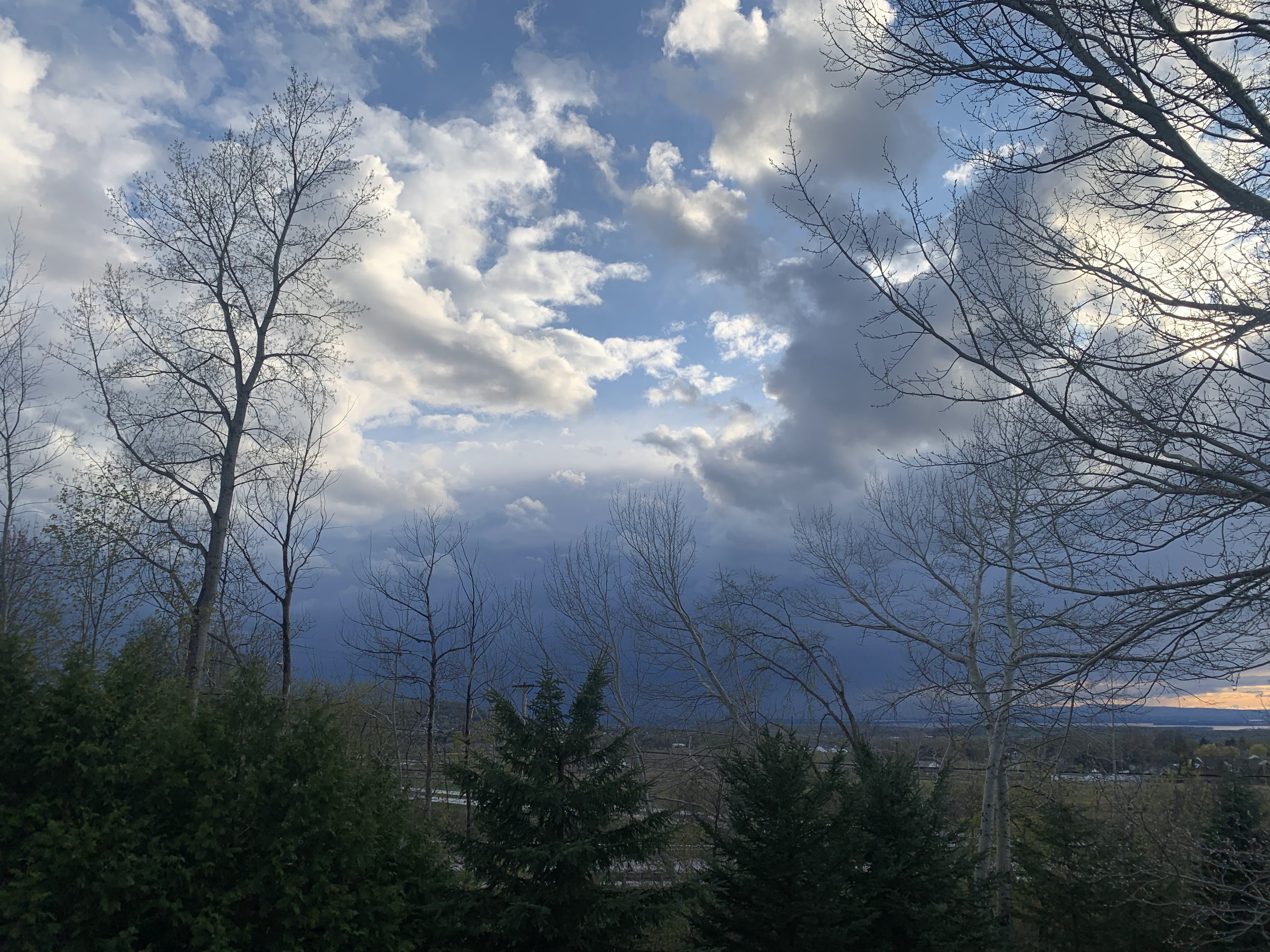
Between the storms: One downpour mixed with hail
had departed, giving St. Albans an interval of warm
sun early Monday evening. Then, as seen here,
another storm approached, eventually giving us
another downpour mixed with small hail. 

Weather disturbances are pinwheeling around the main stalled low pressure system to our northwest. One strongish disturbance was moving north and northeastward through Vermont today. 

As this happens, peeks of morning sun are succumbing to dark clouds and rain. As this happened dramatic rainbows appeared in the northwestern skies in Rutland County. 

It was raining pretty heavily in parts of west-central Vermont and adjacent eastern New York as of around 8 a.m. That band was gradually creeping northward as of 8:30 this morning. 

So, we have a cool day ahead of us with showers. Some might be briefly heavy. We could easily also see some small hail again, as it's still cold overhead. That would allow any hail stones that form to make it to the ground.

None of the hail will be big enough to harm your garden or anything like that. It will be more of another conversation piece. 

It's rinse and repeat tomorrow. However, the rain showers won't be quite as widespread, long-lasting or as relatively heavy as today. Still, the strongest cells could create a rumble of thunder and a bit of hail.

The trend line is good. Thursday will also bring the risk of showers, and it will remain cool, but those showers will continue to decrease.

As we head into the weekend, Friday through Sunday and into early next week, the sunshine will increase day by day, chances of showers become small and temperatures will warm up nicely. 

Early signs point to highs in the pleasant 60s by Saturday and into the low 70s possibly by Sunday an next week. Such temperatures aren't odd for May, but they will still be quite welcome after this cool, showery and odd week of weather.  


Monday, April 24, 2023

Gloomy Days Are Still Really Pretty In A Vermont Spring

Wet flowers and spring leaves in a rainy St. Albans,
Vermont garden on Sunday 
As forecast, Sunday was a washout in Vermont. 

A steady, soaking rain fell all day. We kind of needed it, as the middle of the month was so warm and dry. 

Of course, a rainy Sunday meant outdoor activities were pretty much not going to happen.  Or maybe they could, in a limited sense anyway. 

Unlike in, say, November or March, a rainy day when everything is sprouting for spring isn't all that gloomy. As you can see in a couple photos in this post and the video below, there are pops of color everywhere. 

I've intentionally planted a lot of perennials around my St. Albans, Vermont house that bloom early in spring. After a long winter, I need some green and some bright colors. This year is not disappointing. 

Emerging sugar maple leaves on a rainy Sunday in
St. Albans, Vermont. 
It's way ahead of schedule. Leaves are sprouting on most of the trees already.  You usually don't see that until we start getting into the second week in May. 

Sure, the poplars are early birds and spring to life at the end of April. But not the sugar maples and beeches. They're usually smart enough to wait until May. But not in this warm spring.

I got a good idea of how ahead we are this year when one of those "memories" posts came up on Facebook. 

 It showed my gardens on April 23, 2018.  My gardens are bigger now than they were then, but I still had a fair number of daffodils. 

But on this date in 2018, the shoots were barely out of the ground. There were no daffodil blossoms to be found. And the trees in the background of the photo were as leafless as they would be in January. 

As long as we don't get a hard freeze, I'm OK with this early spring.  Like I said, I need some life and nature around the house. 

Rainy day garden in St. Albans, Vermont. 
It does look like the pace of spring will slow down for awhile.  Remember, in one of yesterday's posts in this here blog thingy, I said that we're in for a long stretch of mostly cool, showery, weather. 

That remains true. Although we might get a bit of a break from the showers toward Friday and Saturday, there's no super warm air in the forecast for the foreseeable future. 

This cooler weather, and the more leisurely pace of spring, will let us savor the season all the more. 

Maybe the cooler weather will also postpone the black flies, which would be nice

I've got my video ready for you. Hope you like the rainy garden tour. 

Click on this link to view, or if you see the image below, click on that. 


Tuesday, December 28, 2021

Cool, Classic Gravity Waves Over Delaware Coast Monday

Clouds showing well defined gravity waves over
Bethany Beach, Delaware on Monday. 
 I'm on a getaway and spending a few days on the Delaware coast. We arrived in Bethany Beach Monday under gray skies that spit bits of rain.  

But even the gloomy sky was interesting.

A warm front to the south Delaware set up what are known as gravity waves in the atmosphere. Winds aloft from the south were forced to ride up and over the warm front, which sort of acted as a block to the wind flow.

The set up was kind of like how water flows over a submerged rock in a fast-flowing river. Have you ever noticed when the water in that river flows over that rock, there's a series of waves in the water that continue well past the rock?

The rock set up that series of repeating waves. A blockage in the atmosphere, be it a mountain or a weather front, can do the same thing. So you have waves in sky, Up where we live in Vermont, gravity waves are very common as air flows over mountains. 

The gravity waves I saw in Bethany Beach were a little different than I'm used to seeing because the space between the peaks and valleys of the waves, so to speak, was longer than what I see in mountainous Vermont. The Bethany Beach sky wasn't super unusual, but new to me. 

By the way,the air has to be rather stable in general to support gravity waves. By stable, I mean the temperature in the atmosphere does not increase very fast with height, or at all. If the air were unstable, with temperatures cooling quickly with height, there wouldn't be waves. As the air starts to go up over the blockage, it would keep going up instead of sinking again.  In that case, you'd end up with a band of showers and thunderstorms.

The warm front ended up going through, leaving us in Bethany Beach to enjoy a partly sunny, unseasonably warm Tuesday.

Here's the video of those neat gravity wave skies over coastal Delaware. As always, many people on mobile devices will need to click on this hyperlink to see it. To see the video clearly, click on the arrow, then the YouTube logo. 

Otherwise, here's the video:


Tuesday, August 24, 2021

Henri's Outer Edges Made For Photogenic Skies Over Northwest Vermont

Pure tropical air ahead of Henri created some Miami-like
skies over Colchester Vermont Saturday evening. 
Hurricane/Tropical Storm Henri's approach and passage through southern New England, and the pure tropical air it brought north to Vermont, made this probably the prettiest such system to affect northern Vermont.  

Even if that effect was slight to say the least.

Still, the sky over northwestern Vermont because of Henri were spectacular.

The haze from western wildfires was routed by the clean, but oppressive pure tropical air.  The sky Sunday afternoon was some of the bluest I can remember.  

Dying rain bands from Henri produced nothing more than the lightest sprinkle, but created some gorgeous rainbows on two evenings in a row. 

Mid-level cloudiness associated with Henri also created some gorgeous patterns in the sky Monday morning, and prompted a gorgeous orange sunset Monday evening. 

I took photos, and a few of them are in this post. Scroll down to see them all.  Enjoy! 

By Sunday afternoon, the sky turned perhaps the deepest blue
I've ever seen, thanks to pristine, but very humid air
brought in part by Henri straight from the Caribbean. 

Toward Sunday evening, the dying remains of an outer rainband
from Henri, created a delicate pattern and a complex sky over
St. Albans, Vermont.


That dying rain band then produced a lovely rainbow. Here
you can see a dragonfly scooting by in front of the rainbow.

Mid-level clouds from Henri created these beautiful 
patterns in the sky over Burlington, Vermont Monday morning.

Another rainbow, fainter than the night before, with no
actual rain, from Henri's remains as viewed from 
St. Albans, Vermont Monday evening


As Henri began to depart southern New England Monday
evening, it threw out a nice sunset
over St. Albans, Vermont