Showing posts with label Saturday. Show all posts

Thursday, August 27, 2026

Vermont Severe Storm Risk, Possible Local Flash Flood Issue, Too.

Areas in dark green and yellow have chances of severe
thunderstorms today. Areas in yellow have a somewhat
greater chance of severe storms than in the
dark green areas. 
We're in for another active day of weather across  Vermont today, but as always, there will be winners and losers. 

A handful of places could get too much wind, too much hail, too much rain, too much lightning. A few other places won't get the rain they need. 

We'll have a storm risk all day, but the big hours to watch will between 3 and 8 p.m. All of Vermont has at least a small risk of isolated severe storms. The best chance of severe storms will be west of the Green Mountains from Middlebury south. 

But, again, anyone in Vermont and surrounding areas could have a severe storm today. 

A warm front is working northward through Vermont this morning. That front could touch off some scattered showers and thunderstorms later this morning. I noticed on radar a few small downpours near Glens Falls, New York heading northeastward toward Vermont as of 8 a.m. today.

You'll notice the humidity increase rapidly this morning and early this afternoon as we get the ingredients in place for this afternoon's expected rough weather. 

The storms will probably come through in lines or clusters, with damaging winds the main threat.   There is a very, very low chance that one or two storms could start rotating enough to produce a brief spin up tornado.  It's been that kind of summer. 

Another issue is the risk of local flash flooding. The ground is dry enough so that a few downpours shouldn't cause any issues. However, we could get some "training" storms, the ones that line up and go one right after another over the same spot, like boxcars moving along a train track. 

If there is any flash flooding, it will be in pretty small local areas. Nothing widespread with this. The best chance of local flooding should be in the southern half of Vermont. As an early guess, I'd be tempted to especially watch Rutland and Windsor counties. But we can't completely rule out some water mischief in the north, either.

So, we have the usual advice. It's probably not the best day to head out onto the lake or go hiking in the Green Mountains. Pay attention to the sky. Dark clouds gathering to the west? Rumbles of thunder? That's your cue to get indoors. 

As always, the National Weather Service will issue warnings and advisories as needed, and the local TV stations will cut in to broadcasting to provide updates if parts of the state are under threat of a bad storm. 

This probably won't be the most extensive severe weather outbreak ever, or even the most extensive one of this stormy summer. But it is something to take seriously if severe weather threatens.  

FRIDAY

The actual cold front should go through tomorrow morning, with not much fanfare. There could be some showers in the morning. The front might be slow enough so that it could squeak out a weak thunderstorm in southeast Vermont, but no biggie.  Then some clearing and more refreshing air arrive in the afternoon and evening. 

SATURDAY

Another winning weather Saturday is in the cards. Dawn will break cool, with temperatures within a few degrees either side of 50.  A lot of river valleys will be pretty foggy, too. But the fog will burn off to sunny skies with afternoon highs in the 70s. The humidity will stay at refreshing levels, too,

SUNDAY AND BEYOND

It looks like we'll be in a zone Sunday afternoon and into the week where a weather front will either windshield wiper back and forth, north to south and back north again for a few days. Or it will stall sort of near us. 

That make it hard to forecast this far in advance. Suffice it to say we'll have daily shower chances Sunday through Tuesday at least.

Interestingly, NOAA's six to ten day weather outlook, issued every day in mid afternoon, has swung decided warm and wet for the opening days of September. It's a long range forecast, so things could change. But it does point toward the chance of some weird late season severe weather to open up the first few days of the new month. 


Thursday, September 4, 2025

Probably The Biggest, Worst Fire Risk Of The Year Today In Vermont

If this National Weather Service forecast rainfall
map comes true, that will be great. Two weather
fronts will come through by Saturday night.
Combined, they might produce roughly an
inch of rain in Vermont. But the wetter of
the two fronts is on Saturday and the heavier
rain might or might not pan out. 
Sometimes a nice day can be a bit dangerous, too. 

Today in Vermont we'll deal with bright sun most of the day, rock bottom humidity, and a gusty breeze which will feel great. But those very conditions will give the Green Mountain State probably its highest risk of brush and forest fires of the year. 

Winds have already picked up in the Champlain Valley and that will follow soon in the rest of the state. By afternoon, winds will gust to 25 mph in much of the state and over 35 mph in the Champlain Valley.  

At the same time as the winds peak this afternoon, the relative humidity will dip down to around 30 percent. A dry, arid, windy day. You know what that means, and so does the National Weather Service office in South Burlington. 

Just read their special weather statement for today: "If any fires were to start, the weather and fuel conditions could cause fires to quickly get out of control and be careful to contain." 

Even places that got a decent wet down last weekend are at risk.  Last Friday and Saturday, we received 0.55 inches of rain here in St. Albans, By Wednesday, everything underfoot was super dry again, and plants were trying to wilt again.  

Today's not the day for your backyard campfire near or in the woods, carelessly flicking your cigarette out the car window or setting off fireworks. 

SOME RAIN RELIEF

The good news is at least some rain is on the way. And quickly. 

If God forbid any fires start today in the Vermont woods, or in neighboring states or southern Quebec, enough rain will come tonight to start controlling the blazes. 

Clouds should start to fairly abruptly obscure the sun late this afternoon in western Vermont and evening in the east. Rain should start maybe two or four hours after the clouds arrive. 

Tonight's rain comes courtesy of the first of two cold fronts coming at us. This first one will be fairly strong in New York State, giving areas from the Adirondacks west a good half inch or more of rain. 

By the time the front makes it into Vermont, it will be weakening, like so many weather systems have this dry summer. Expect maybe a third of an inch of rain in the Champlain Valley and northern Green Mountains and a quarter inch or less (probably less most places) elsewhere in Vermont. 

The rain will be lightest in the driest parts of the Green Mountain State, so that's not good. The new weekly U.S. Drought Monitor comes out later today which would have updates on how Vermont is doing with its dry conditions. I hope to post an update sometime between later today and tomorrow morning. 

A SECOND SHOT?

We still have one more shot at another dose of rain Saturday. We hope. 

The rain from the first front should clear out early Friday and we should have another partly sunny, warm day, with highs well into the 70s to around 80.

Then the next front comes along. There is still hope this second front will be wetter than the first, but there's still discrepancies in various models. Which means it's still iffy. 

But if this morning's forecast holds, this second front could dump a half inch to as much as an inch of rain on much of the Green Mountain State. If that happens, it would be fantastic. It's too bad the rain would hit on Saturday, but we'll have to take it when we get it.

The second front has more moisture along it and a bigger temperature gradient than the first, which is why we hope the rain is heavier with Saturday front. 

As the National Weather Service in South Burlington explains the stronger front and the fact it's passing through during the day makes forecasting the high temperatures Saturday much more tricky than for most days. 

If it comes through early, it would be a cool day. If it's later than expected, it'll be warm. For now, they're going for highs barely near 70 northwest to the low 80s south and east. 

RAIN SHUTS OFF AGAIN

After Saturday, the rain will go away for a good long while again. So,  unfortunately, the hoped-for rain over the next couple of day is not a shift toward wetter weather pattern. It looks like only sprinkles or very light rain showers will come through on a few days through at least the middle of the month. 

The only hope is that long range forecasts are a little less accurate, so we can just hope for a wet surprise later this month. But it's nothing we can count on. 

It will be a cooler weather pattern, too. At least for most of next week. We're heading deeper into September so the chances of warm days are dwindling. It'll stay pleasant enough, with highs in the 60s and low or even mid 70s most of next week. But we'll probably have very few super warm, summer days until, well, next summer.  

Saturday, June 28, 2025

Saturday Morning Vermont Weather Update: Flood Threat Disappears Amid Odd Weather Pattern

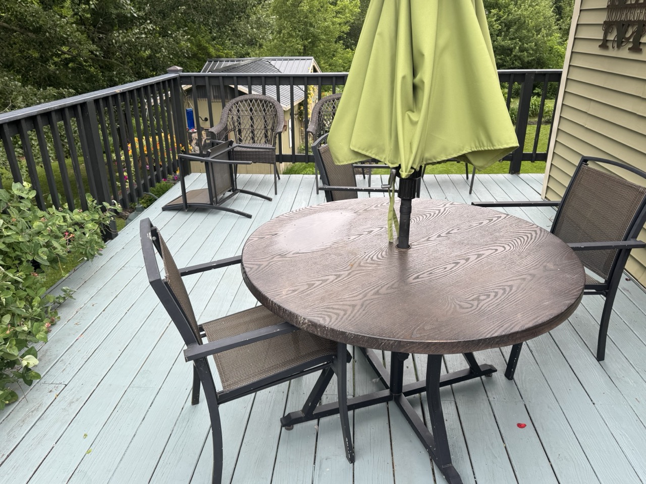
Unexpected wind gusts of over 40 mph overnight sent
some of our deck furniture askew, and, not shown
here, knocked over a few plants. We're still expecting
showers today, but rainfall will be much 
less than originally expected. 
Aside from some unexpected winds in the Champlain Valley of Vermont and New York and rains mostly limited to near the Canadian border overnight, the weather might not have seemed all that weird to you overnight and early this morning. 

But from a meteorological standpoint, it got strange. 

The unexpected overnight gusts were a symptom of the odd conditions overhead.  Before you get nervous, our "weird weather" does not mean anything scary for everybody just living their lives today. 

Most of us are still expected some showers today. But trends on rainfall amounts keep dropping. 

 A few days ago we were worried about flash flooding in northern Vermont today.  Now, the chances of such an event are pretty much nil.  So that's good news.

THE WEIRDNESS

It was supposed to grow increasingly humid overnight as south winds drew wetter air northward.  But a funny thing happened to that on the way moment.   Something called a low level jet got cranking a few thousand feet overhead last night. A low level jet is a ribbon of higher speed air, in this case created by a storm system over Ontario.

As the National Weather Service explains it, that high level wind was able to mix downward, especially into the Champlain Valley, which created overnight gusts as high as 45 mph. That's pretty unusual for late June. Even weirder, that gusty air that was pulled down from aloft is quite dry.

So instead of increasing humidity, the air got super dry for this time of year, especially in the Champlain Valley. The dew point, a rough measure of the humidity in the air, dropped from the mid-50s yesterday afternoon to around 40 degrees before dawn today.   That's super low for summer.

The dry air evaporated showers coming in from the west, so there was little or no rain in Vermont, except for those of us near the Canadian border.  

The expected conveyer belt of showers and some storms did move west to east across southern Quebec and far northern Vermont overnight.  The heaviest stuff was in Quebec, but places right near the border in Vermont probably got a half inch to three quarters of an inch of rain, based on radar estimates.

Here in St. Albans, I have been on the southern edge of the activity and had picked up 0.31 inches of rain through 6:30 a.m today. 

REST OF TODAY

The showers that have been trying to come out of New York and drying up before reaching Vermont will probably finally overcome the dry air and drop a little rain on places like Burlington, ensuring that we do officially end up with the 28th weekend in a row with at least a trace of precipitation 

However, the showers will not amount to much. There might be a local downpour here or there in Vermont today especially in southern Vermont where the more humid air will reach. But this system, which we originally thought would have some real oomph, is turning out to be very, very, well, "meh."

So, it'll be a mixed sort of day. We'll have an ever-present risk of showers, but there will be dry periods in between.

After such a wet May and what had  looked like was going to be a wet June, it's actually getting sort of dry in northern Vermont.  For instance, through yesterday, Burlington has had only about two inches of rain so far this month, which is roughly half of normal. 

We're still far from any drought worries, but I kinda want the rain to get a little more consistent for the rest of the summer.  

Without overdoing it, of course. We don't need any more flooding, which is why I'm relieved today's weather system turned out so blah. 

It's been much wetter this month in southern parts of the state than in the north, so no dryness worries there!  

LOOKING AHEAD

Sunday still looks like we'll have a lovely summer day in Vermont. Chamber of Commerce weather, really, with highs within a few degrees of 80 with blue skies dotted by a few clouds here and there for the pictures. Humidity looks like it will be fairly reasonable, too.

We're still looking at a quick squirt of hot, humid air Monday, which will take afternoon temperatures into the mid 80s in the "cool" spots and low 90s in the Champlain and lower Connecticut River valleys, and lowlands of southwest Vermont.

It still looks like some showers and storms will come through Tuesday, but at this point rainfall doesn't look like it will be all that impressive. We might have to be on the lookout for some strong storms that day, so we'll watch that.

As we head through the rest of next week,  we should have some pretty uneventful weather, and it might be slightly on the cool side by the time we hit the Fourth of July.  

Thursday, June 5, 2025

Vermont June Beginning To Follow May's Wet Reputation, Except Much Warmer

It's the season of irises and Korean lilacs in St. Albans,
Vermont as we hit early June.  Peonies are budding,
and should get more drinks of water as an unsettled
weather pattern continues. For the first time in years,
we're into June and I haven't had to water the 
gardens yet this season. 
 Picking up where we left off in May, there's June rain chances in Vermont coming almost every day for the next week, starting today. 

True, we've had a couple sunny, lovely if smoky days (those darn Canadian wildfires again). We're now going to be harassed by a series of weather systems. 

At least it won't be particularly chilly under these rain storms.  It'll range from vaguely coolish and definitely damp to warm and humid during this upcoming period of unsettled weather. 

We'll do it day by day here again. Note that the forecast will get more iffy the further we go into the future, as there's greater opportunity for predictions to shift as more information comes in.

TODAY

We're still dealing with a weak cold front bumping into to warm, and now increasingly humid air over Vermont.  Showers and thunderstorms are still expected to blossom today.  A few strong ones could pop up this afternoon.  

The National Weather Service office in South Burlington says those storms could happen anywhere in Vermont this afternoon. But as of this morning's forecast, the stronger cells are most likely in central and south central Vermont. 

In far northwest Vermont, the cold front might come through early enough in the afternoon so there's only a short window before 3 p.m. in which a strong storm could get going there. Unless the front slows down, then the risk would last a bit longer.

The slow moving cold front will probably not even make into southeastern Vermont today, so the chances of  storms there is lower there. But still possible.

For now, NOAA's Storm Prediction Center still has all of Vermont (along with most of New York, New  Hampshire and Maine) in a marginal risk zone for severe thunderstorms. That means a  few isolated thunderstorms  could become severe, with damaging winds.

Even storms that aren't technically severe can pack a punch with gusty winds, torrential rain and lightning, so beware of that. 

This will be hit and miss. I think most places in central Vermont should see at least some rain today. A few unlucky places that get hit by more than one downpour could see very local, minor flooding. It'll be more hit and miss in northwest Vermont, and especially hit and mis in the southeast.

Oh, and it will be uncomfortably warm and humid today, too, so take it easy.

FRIDAY

The further north you go in Vermont Friday, the better off you'll be. Today's cold front will stall over or near southern Vermont. A ripple of low pressure, just a little disturbance, really, will make more showers and a few thunderstorms pick back up again by afternoon. At least in southern Vermont. 

After maybe some morning sun clouds and a chance of showers will work their way north during the afternoon. I'm not sure whether  the showers will make it all the way north past Route 2. So the northern third of Vermont cold eke out a decent Friday. 

SATURDAY

As I've said a zillion times before in 2025, if it's Saturday in Vermont, it will rain. Everybody in the state from Alburgh to Guilford and from Canaan to Pownal stands an excellent chance of seeing at least some rain on Saturday. 

Computer models are continuing to struggle with who gets the most rain. They're agreeing with each other a bit more than they did yesterday, so that's a good trend, I guess. We'll definitely have a better idea of what's going on by tomorrow.

Early indications are the heavier rain would stay over southern and central Vermont, but we still have no guarantee on that. There's even a chance - just a chance - that we could have periods of dry weather on Saturday in some areas.

But don't count on it.  There's also a risk there could be some heavy rains in some areas with this. We don't know exactly if and where yet. But it's something to watch in case we have to worry about some minor flooding again. 

It'll be cool on Saturday under the clouds, but not as bad as last Saturday's washout.  Highs should be in the mid and upper 60s, with some low 70s possible in areas that get lucky enough in which the rain stops for awhile. 

More details on Saturday's mess coming in tomorrow morning's post. 

BEYOND SATURDAY

The weather pattern should stay active into next week, with frequent disturbances coming through. It's too early to tell when exactly it will rain next week and how hard. But count on frequent chances of showers and maybe thunderstorms. 

At this point, Sunday at least looks better than Saturday. We might even get through the day with no rain at all. Yippee! 

MORE PHANTOM HURRICANES

As it has done for more than a week now, the American computer forecasting model keeps spitting hurricanes about ten days to two weeks from the date the computer forecast is released. As I've noted before, it's a quirk of the model, these storms won't happen.

I'm bringing it up again, because the American model from overnight really had too much to drink at happy hour yesterday and brings a powerful hurricane into Florida then races it right north up to Vermont with flooding rains around June 19.

I'm sure this WILL NOT HAPPEN!  This morning's subsequent run of the American model that just came in does not have any signs of that hurricane, so I guess the computer system sobered up.

I'm only bringing this up because some people on social media like to highlight "scaricanes" to power clicks and views. Which unnecessarily frightens people, And cries "wolf" so many times that people will ignore real dangers when and if they arise. 

Your best bet if you're worried about hurricanes and floods and such in Vermont, go to the National Hurricane Center and the National Weather Service office in South Burlington for actual reality. I'll do my best as I always do to forward their messaging to this here blog thingy. 


Wednesday, June 4, 2025

Vermont's Fate Rest Of Week: Smoke, Heat, Then Storms And (Obviously!) A Rainy Saturday

Visible satellite photo of the Northeast U.S. and part of
southeast Canada at around 4 p.m, Tuesday That hazy
wispy stuff you see stretching from Quebec
through New York and western Vermont and down
off the Mid-Atlantic coast is smoke from 
Canadian forest fires.
A variety pack of weather awaits Vermont during the next few days, but spoiler: You know what Saturday's going to bring!  If you've lived through Saturdays in Vermont this year, you know the wet drill. 

Before that, we have a bunch of stuff to consider

SMOKE

Smoke from Canadian wildfires blew into Vermont as expected Tuesday, or more accurately, over Vermont.

Most of the smoke that turns the sky a sad bluish, yellowish gray and made the sunshine copper colored was high overhead, where we don't breathe.

Some smoke has made it down to the valleys where we live, but not much. Air quality in Vermont was still considered good this morning, though flirting with "moderate" in the north. 

Moderate means the air is still relatively clean, but there's enough stuff like particulates to bother people who are especially sensitive to pollution. 

The smokiness seems to be peaking this morning in Vermont. It looks like it will thin out a little mid to late afternoon, but not entirely go away. It'll still be hazy all day. 

HEAT

Today will be the hottest day of the year so far. You wouldn't think so in eastern Vermont early this morning, as temperatures there were in the 40s. But the Champlain Valley was in the 60s at dawn, and it'll go up sharply from there,

Pretty much everybody will be in the 80s this afternoon.  A few of the hottest spots might touch 90, though the smoke might dim the sun just enough to make us fall short. The National Weather Service is going with a 90 degree high in Burlington today, which would be the first such reading of the year. 

Humidity should be tolerable most of the day, but start to rise this evening. It'll be the first truly muggy night of the summer tonight, with most of us just getting down into the 60s. 

It'll be almost as hot tomorrow, with highs in the 80s, maybe near 90 again this time in the southeastern Vermont valleys. It will be more humid than today, so it will feel worse. And of course, summertime humidity often leads to.....

THUNDERSTORMS

An approaching weak cold front pushing into the heat and humidity will be enough to touch off some showers and thunderstorms in the afternoon and evening. This will be a hit and miss, winners and losers sort of situation. 

Most of us have about a 50/50 shot at seeing an afternoon thunderstorm. Some of us will get absolutely nothing, others will get pretty blasted. Others will have close misses or experience the edges of showers and storms. 

Given the heat and humidity, a couple storms might turn out to be strong to severe. A small minority of Vermont towns could get hit by damaging winds, small hail and torrential downpours. 

NOAA's Storm Prediction Center currently  has all of Vermont and surrounding areas in a marginal risk of severe storms on Thursday. That's a level one out of five alert tiers, and means there could be isolated instances of severe storms.

Only a few areas will see torrential downpours, and the storms will be moving right along instead of lingering over a particular spot, so the chances of flash flooding seem pretty low to me right now.

If things come together more than we think now, there could be slightly more numerous possibly strong storms on Thursday than currently forecast, but we'll wait for updates tomorrow morning.

FRIDAY

That weak cold front will limp into Vermont and stall over us or nearby.  Not sure exactly where yet, but we'll still have a chance of showers, Especially near where the front hangs up.  It'll be a little cooler, too, but still a bit on the warm side. We're calling in mid 70s to around 80 for now.

SATURDAY

It looks like we'll make it Vermont's 11th Saturday in a row with rain.  The entire state has a really good chance of seeing raindrops. It's now a question of whether it will be light and scattered or heavy, Even maybe heavy enough for a flood risk 

Before you panic, we don't even know whether it will rain torrentially anywhere,  That stalled front will be around....somewhere. 

A small storm will ride southwest to northeast along the front, which should produce the band of heavier rain. But the computer models as of this morning were all over the place with exactly where that might be. The area of downpours could be focused near Montreal, Or near New York City. Or someplace in between.

Since Vermont is - duh! between Montreal and New York, that does open the possibility that part of the Green Mountain State could see some torrents on Saturday. I guess we'll have to stay tuned to see where this goes. 


Friday, May 30, 2025

Updates On Vermont's Very Soggy Saturday, The Return Of Summer, And "Phantom Hurricanes" That Might Not Be Entirely Phantom

National Weather Service forecast map for Saturday's
rain. Dark green indicates at least an inch of rain. Yellow
means at least 1.5 inches. 
A little more rain than expected fell in northwest Vermont Thursday. Not enough to make a difference, really, but some of us were surprised by brief heavier evening showers. But at least parts of the Champlain Valley were treated to a spectacular rainbow just before sunset. 

The rest of Vermont had very little rain yesterday, as expected,

Today is the calm before the next soggy storm. Most of us woke up to cloudy skies this morning. There were even a a few showers near the Canadian border. (It rained briefly here in St. Albans, Vermont shortly after 8 a.m. today).

But you will see more and more breaks in the overcast as the day wears on.  I suppose there could be a couple more showers, but they'd be light and isolated, No biggie.

SATURDAY:

Our soggy Saturday nor'easter is still on schedule. 

I mentioned in yesterday's post that the forecast track of the storm was "windshield wipering" back and forth between a track northward right along the New England coast, or more inland going northward across New Hampshire.

The forecasters yesterday were leaning slightly toward a more eastern track, though some models were still insisting on a more inland path.  An eastern path would have meant a little less rain in Vermont.

As of this morning, it's looking like the forecasts for the nor'easter to go right up through central New Hampshire on Saturday were the correct ones. 

That means expected rainfall totals in Vermont have gone back up. Right now - and this could still change a little - almost everybody in the Green Mountain State except maybe the immediate central and northern Champlain Valley will receive at least an inch of rain.

Cities like Burlington and St. Albans would still get a soaking with at least three quarters of an inch. Elsewhere in Vermont, some places will get an inch and a half, and I wouldn't be surprised if a couple spot clocked in at a little over two inches.

Flash flood guidance this morning says it would take 2 to 2.5 inches of rain within six hours to begin to produce flash flooding. However, it will probably take a good 12 hours or more tomorrow for even those few spots in Vermont to receive two inches of rain. 

So flooding is very unlikely in Vermont. 

NOAA's Weather Prediction Center does put central and eastern Vermont  - along with most of New Hampshire and Maine -in a zone with a marginal risk of flooding on Saturday.  In this case, I think that just means there could be minor ponding on roads.

 Rivers and brooks and streams across Vermont will definitely rise and become swift again even if they don't go into flood stage. That means kayaking and such on them will be dangerous for at least a few days. Fishing enthusiasts should be careful not to fall in. 

Saturday's storm will add water to the already very damp Vermont soil, which could help set us up for flash flooding later if we get a lot of torrential thunderstorms in June.   Of course, we have no idea yet whether that will happen or not, so just put that on the back burner for now. 

SUMMER TREND

Sunday is June 1, the start of meteorological summer. For ease of record keeping, most climatologists regard summer as the period from June 1 through August 31,

As previously mentioned,  the first day of June will not feel like summer at all. Sunday will feature mostly cloudy skies, temperatures in the 50s to near 60, breezy north winds and maybe a few light showers. Brrrrr!  

There could even be a little snow again atop Mount Washington, New Hampshire.  I think the summits of the Green Mountains might be just a wee bit too warm for snow on Sunday. But not by much.  

But don't worry! Summer is on its way. And soon. 

We'll start a sharp warming trend beginning Monday. By mid to late week, we're up in the 80s for afternoon highs, and you'll start to feel the humidity in the air.  We might also start to see summer time afternoon and evening thunderstorms Thursday, but that's less certain. 

PHANTOM HURRICANES

This morning's GFS (American) computer models
shows a powerful hurricane hitting the Gulf 
Coast on or around June 10. I virtually guarantee
this WON'T happen, but the models MIGHT
be sniffing out some possible tropical
activity in the Gulf of Caribbean toward
the middle of the month. We'll see. 
For the past several days, I've noticed the American computer model known as the GFS keeps indicating hurricanes popping up toward the end of its forecast range, usually two weeks in advance. 

Sometimes these forecast hurricanes are near Florida, other times in the Gulf of Mexico, sometimes near Texas, sometimes going up the East Coast, like yesterday morning's run. 

This morning it has a powerful hurricane hitting Biloxi Mississippi on June 10, then dumping another epic flood on Helene-ravaged North Carolina.

Relax. It's not going to happen.  These GFS "phantom hurricanes" is a quirk of the American computer modeling. In late May and June especially, it keeps coming up with these "phantom" hurricanes  in the final days of its two week predictions. 

Still, it's a reminder that the hurricane season official starts on Sunday. And since the model has been so consistently popping off hurricanes in recent model runs, it's an indication that the models might be sniffing out some sort of tropical storm development somewhere in the Caribbean or Gulf of Mexico around mid-June.

If a tropical storm forms - a big if - it's very likely it wouldn't be an enormous hurricane, like the cataclysmic Helene or Milton last year. But it's possible - not definite - we could see some sort of soggy tropical storm or even Category 1 hurricane menace somewhere along the southern U.S. coast.

This sort of thing has happened before in June. In fact, Tropical Storm Agnes in June, 1972 ended up unleashing one of the worst floods and most deadly floods on record in much of Pennsylvania, New York, Virginia and Maryland.   There's no reason a damaging June tropical storm couldn't happen again.   

Wednesday, May 28, 2025

ANOTHER Out Of Season Nor'easter About To Strike Vermont/New England. On Saturday, Of Course!

Forecast weather map for Saturday shows 
another rare May nor'easter over New England
the second one this month. Only two 
percent of all nor'easters hit in May, at least usually
Historically, only about two percent of all nor'easters strike New England in May.  Nor'easters are creatures of the winter.  

However, we're about to be hit by the second nor'easter this month. Go figure.

This one will come through Saturday, which of course will by far make Saturday in Vermont the wettest, gloomiest day of this week. It will also be the tenth Saturday in a row with rain.  It's a Vermont tradition!

BEFORE WE GET THERE

Today will be the last truly nice day for awhile, but most of the upcoming days, with the exception of Saturday, won't be a total loss.

It got up to 82 degrees in Burlington yesterday. Summer warmth, but the humidity was rock-bottom low, so it felt pleasant. 

We'll do it again today, with highs at similar levels. Sunshine will tend to fade behind high clouds this afternoon, but it will still be a wonderful day to get outdoors.

Tomorrow, not so much. It should be cooler under a lot of clouds. Showers will roam around Vermont, especially in the afternoon. They won't be heavy, only depositing maybe a tenth to at most a quarter inch of rain.

With the clouds, it'll be noticeably cooler, rising up to only the 65 to 72 degree range.

Friday looks better. At least there will be some sun.  There is a risk of showers, but they should be light and won't last all day, Temperatures should pop back up into the 70s for many of us

SATURDAY NOR'EASTER

Then we get into Saturday. Our nor'easter. If current forecasts hold, it'll pretty much rain all day. It could come down hard at times. It very likely won't be enough to cause flooding, but it will keep our ground super saturated. If there's any flooding, it would be very widely scattered and quite minor. Definitely no big flash floods and damage like we had on Saturday, May 17 with those severe thunderstorms.

We won't even hear thunder with this nor'easter

If this were winter, the storm would take a perfect track to give us a huge snowstorm, But it's the very end of May, so rain it is!  Unlike last week's nor'easter, it won't even be cold enough on mountain summits for snow.

Still, it will be cold for this time of year for us valley dwellers, with highs only near 60.   

This nor'easter will also be "better" than the last one for another reason. It won't linger around obnoxiously for days like last week's storm did. It'll zip on through, and be pretty much out of our hair by later Saturday night. 

BEYOND SATURDAY.

The nor'easter will be somewhere around central Quebec Sunday, whipping chilly north winds and showers down on us during the day. So it will be quite a chilly first day of June, with highs only in the upper 50s and low 60s.  Those showers should be light, but perhaps frequent, though it won't rain all day. 

The storm will be further north Monday, but still close enough to keep it chilly for June and give us the risk of some scattered light showers.

But after that, the nor'easter will be a memory. Forecasts of course are iffy in the long term, so we can't get into specifics. But it does look like we're in for a dramatic warm up starting Tuesday and continuing on for the rest of the week. 

Friday, April 25, 2025

Yet Another Wet Saturday In Vermont. And Did Someone Say Snow?

The sun appears amid a downpour Thursday evening at the
tail end of a thunderstorm that hit far northern Vermont.
Speaking of rain, yet another rainy Saturday is 
in the cards for the Green Mountain State
If you think you've been dodging rain drops every Saturday lately,  you're right 

This Saturday will be the sixth consecutive one with at least some precipitation.  This one will be a real soaker, but still, it probably won't rain all day. We hope. 

THURSDAY THUNDER

We'll get to the forecast details in a second, but I want to acknowledge Thursday's weather in Vermont, which in some places proved kind of interesting. 

During a nice long interval of sunshine Thursday afternoon, Burlington topped 70 degrees for the first time this month and for the first time since March 20.

That sunshine helped destabilize the air ahead of a disturbance coming in from west and northwest late in the afternoon. 

The result was the expected hit and miss showers and rumbles of thunder. In Franklin County, Vermont, here in St Albans, we got a solid thunderstorm with a good downpour, several lightning strikes and peals of thunder and wind gusts to 25 mph or so.

Definitely not severe, but it was a nice brief spring storm for this fan of thunderstorms. 

Many places did miss out. Burlington only saw a trace of rain and no thunder. 

WET FORECAST

Up next, our next storm, which will be a decent soaker, as mentioned. 

Aside from perhaps a few sprinkles, we should be OK today at least until late afternoon or early evening, when a few showers might arrive. 

The main show is tonight and a good chunk of Saturday. That's when most of the steady rain will come through. You might hear an occasional heavier downpour on the roof and maybe even a rumble of thunder later tonight and the first half of Saturday. 

Showers will probably continue all day, but in the afternoon, there might be gaps here and there in which it stops raining or a time.  So, maybe not a complete washout, but close. 

Rainfall with this thing will amount to anywhere from a half inch to an inch of rain.  That's not nearly enough to cause any flooding worries whatsoever, but it will make things a bit muddy underfoot. 

The rain and clouds will hold temperatures down into the 55 to 65 degree range for most of us. So kinda seasonable, really. 

This will be the sixth Saturday in a row with at least some rain and/or snow in Vermont. Also, at least a trace of rain or snow has fallen each weekend since mid-December.  I guess things really do go in regular patterns, sometime. 

COLD DAMP SHOT AND SNOW?

The storm's cold front will come through later in the day and it will cool off quickly during the evening as a result. The original hope was that the storm would move right along, leaving us with a bright, breezy and cool Sunday.

But nope!

The damn thing is going to linger near Maine and Nova Scotia during the day, throwing back clouds, cold winds and rain showers back into Vermont for a good chunk of Sunday. And it will get cold enough for snow up in the mountains. 

Granted, it's the end of April, so we can't expect much out of this. But the Green Mountain summits should see one to three inches of snow. A few snowflakes might even make it down into valley floors Sunday morning, but we won't see any accumulation. 

It will be a raw, gusty day, with many of us not even making it to 50 degrees for a high. Some places over 1,500 feet of elevation in northern Vermont could stay in the 30s all day.  

QUICK TURNAROUND

Sunday's chill does not mean spring is pre-empted. It will just be an annoying interruption.  We're still expecting highs back to near 70 Monday and in the 70s Tuesday. 

The overall trend for the first half of May is beginning to trend toward the cool side, but we don't know for sure it that's entire accurate quite yet.  We also don't know yet if "cool" means just "not quite summer" or whether it means "whatever happened to spring."

We'll keep you posted as always. 


Friday, April 11, 2025

Friday Evening Vermont Snow Update: Yes, An Update, As Forecast More Wintry Than This Morning

Snowfall mostly in southern and central Vermont looks
like it will be more widespread and a little heavier
than forecasts had indicated this morning. 
 Vermont - at least a sizable chunk of it, looks like it's going to be snowier than originally thought on Saturday. 

Winter weather advisories have been posted for basically the southern half of Vermont excluding the western parts of Addison and Rutland counties. 

Essentially a band of precipitation that I mentioned in this morning's post that we know will move south to north over Vermont will have more oomph that first thought. 

That means the snow and rain will be heavier that expected in southern Vermont and will have more staying power than originally thought as it works its way north. 

Heavier precipitation tends to cool the air, so the marginal temperatures we're expecting means some parts of southern Vermont are in for quite a bit of late season snow.

Who gets how much will depend on elevation. Valley towns in southern Vermont like Bennington, Brattleboro and Springfield will probably see about two inches of wet snow. It'll be hard for snow to accumulate in the valleys. 

It'll be snowing hard enough, but the sun angle this time of year is the same as it is in late August. Some of the heat will penetrate the clouds and melt some of the snow as it melts.

It might be a different story though in the slightly colder southern Green Mountains. Those areas could see six inches of snow in spots, or even a little more than that. Some roads will be slick across southern Vermont, especially in the morning before the sun can really come up.

Since this will be a wet and heavy snow, I wouldn't be surprised if there are a few power outages as well. 

The snow will tend to lighten up and mix with rain in southern Vermont during the afternoon. 

Meanwhile, the snow will continue to make its way further north than this morning's forecasts suggested. High elevations as far north as Stowe could see two to four inches of wet snow, while valleys away from the Champlain Valley could see a slushy coating to as much as an inch. 

There's a big caveat here. If the trends in forecasting meteorologists saw this afternoon continue on that path, central and northern Vermont could actually see a little more snow than what I'm outlining here.

This morning, I said that the northern Champlain Valley might get no rain at all. Since this push of precipitation has more oomph than expected, now it looks like it will probably rain at least a little, so Saturday won't be a nice day 

The bulk of the precipitation will hit northwest areas in the afternoon, when it's warmest. Plus, rainfall rates won't be that impressive, so folks in Burlington and St. Albans very likely won't see any kind of changeover to snow.

Unless this little stormy episode continues to surprise. 

Sunday is looking much better, as skies will start to clear, at least in western Vermont. Eastern Vermont might stay cloudy with a risk of a few light showers. At least it will be warmer, with highs near 50 east and in the 50s west.

That should start to melt Saturday's snow in a hurry.  

Saturday, July 6, 2024

Quick Saturday Afternoon Vermont Update: A Few Storms Could Cause Wind/Water Issues

 We'll need to be on the lookout for some storms in Vermont today that could stir up some trouble in a few spots.   

Radar image shortly after 1 p.m. today. Persistent line
of storms could cause local flooding. Other storms
developing could cause isolated instances of
damaging winds and torrential downpours. 

As is usual in these cases, most of us will be fine, but a few of us in the Green Mountain State could be dealing with strong storms or local flooding. 

NOAA's Storm Prediction Center has upgraded Vermont and surrounding areas from just regular scattered storms to the chance of isolated strong to severe storms during this afternoon and evening.  

A few of the storms developing this afternoon might create some downbursts with small areas of damaging winds. There's no way to tell in advance exactly where this might happen. Just be alert for possible warnings. Especially if you're out on a boat or something like that.

The risk of storms goes from now (1 p.m. as I write this), to about sunset, give or take.

The other threat is local flooding. Especially in areas where the heaviest rain fell this morning. That's roughly on a line from roughly Rutland County to half way between White River Junction and St. Johnsbury.

When these storms moved into northern New Hampshire, they prompted flash flood watches, so you know they left a lot of rain.

If some towns -  mostly the ones that got the biggest downpours this morning -could see some local flash floods if a couple more storms hit these areas.

As of 1 p.m. I was watching a narrow line of storms from about Middlebury to Montpelier to Barton that were sort of training one after the other. So far, no trouble from these, but if they persist, we'll need to keep an eye on some gullywashers and erosion in a couple spots.

The National Weather Service has issued a special weather statement on these storms, so you know they're keeping a wary eye on this patch of trouble for the afternoon. 

As you can tell by the extremely humid, "air you can wear" feel to the outdoors today, the storms have plenty of moisture to work with to unleash some torrents. 

Other storms were developing in western Rutland County, and I'm sure several other areas will see downpours and lightning this afternoon.

Not everybody will have a storm, but those who do should really notice them. 

Tomorrow will stay warm and humid, but at least any storms will be isolated at best.

Saturday, March 23, 2024

Saturday Evening Vermont Big Snowstorm Update: Over-Performing South, Under-Performing Far Northwest

Total snow in and near Vermont as of about 3 p.m.
These aren't the final totals as more snow was falling.
Notice the large area of south central Vermont
with the deepest snow. 
 Well, today's storm has been something in south-central Vermont as some totals in that region will probably end up going over two feet.  For that region, this is one of the largest late season/spring snowstorms on record.   

As of late afternoon, Ludlow had already reported 22 inches, White River Junction 20 inches and North Hartland, 19.  It was still snowing hard in those regions, too.

In the rest of northern Vermont, except the northwestern part of the state north of Burlington, it looks like this one will work out as advertised, with most of these areas looking in line to see 10 to 18 inches. 

The bust zone was the northern Champlain Valley. Dry air aloft limited snowfall, and also created very small snowflakes that did not accumulate readily.  As of 6 p.m. St. Albans had only received 6.1 inches of snow, and precipitation was just about to end there.

We'll have final snow totals tomorrow. 

EFFECTS

Not surprisingly, the roads in Vermont and surrounding areas have been awful all day, with lots of slide offs and crashes reported, 'natch.

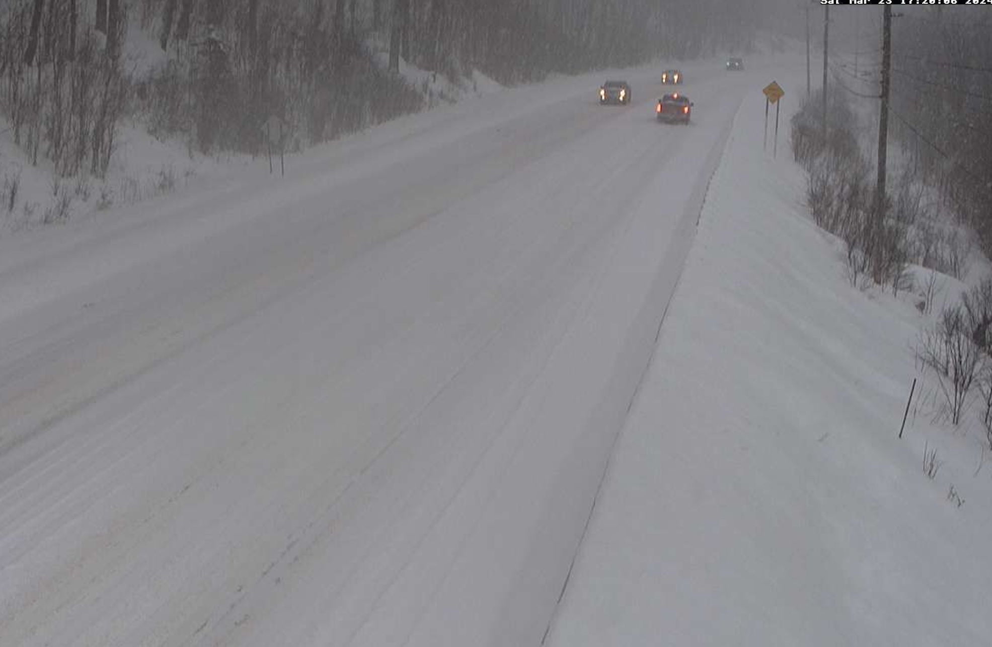
Screen grab of traffic camera along Route 4 in
Mendon Saturday afternoon. Not easy going. 
Some sections of roads had to temporarily close. For instance, Route 12 near Rowell Hill Road in Berlin had to close for a time due to several accidents. Route 117 near Jericho closed for a time as well due to a crash. A snowplow in Bradford reportedly went off the road. 

One big break was the fact the snow wasn't as wet and heavy as forecasters thought it would be. 

As of 5:30 p.m today there were pretty much no power outages in Vermont. A few might crop up this evening, but we won't have that 10,000+ outage mess we've repeatedly had since last fall. We caught a break there. 

NEXT UP

The snow will end northwest to southeast this evening, so the last places to see the snow quit will be the ones that already have seen the most snow.  

By midnight, the snow will be out of our hair. It will be another blustery and cold night, with some blowing snow around. 

Just a mellow snowfall in St. Albans, with just 6.1 inches
new snow as of 6 p.m. 
Roads should remain snow covered and slippery well into the night. It'll take awhile even after the snow tapers off to clear them. Road crews have been out all day. They'll also need a break overnight before hitting the snow again early Sunday morning.

Expect TONS of traffic on the way to the ski areas Sunday morning. People have been waiting all winter fora storm like this, so the resorts are going to be absolute zoos on Sunday. 

Like I mentioned this morning, backcountry skiers, riders and hikers ought to be careful. I wouldn't be surprised to see at least a couple small avalanches on steep slopes up in the Green Mountains. 

It IS going to be a gorgeous day to go out and either play in the snow or clear it out. Highs will be in the low to mid 30s for most of us. That's chilly for late March. But the high sun angle and light winds will make it feel warmer.  

Sunday is going to be absolutely blinding, too. That high sun angle reflecting off that fresh, deep snow is going to be stunningly bright. Sunglasses are absolutely de rigueur on Sunday. 

A couple public service announcements: If you have a fire hydrant near your house, dig it out and clear away the snow at least a couple feet away from it.  Also, if you have people nearby who are old or ill or disabled, and you're healthy, help them clear the snow. Good deed for the day, right?

Beyond Sunday

It's going to take time for the snow to melt, since there's so much of it in most of Vermont now. But met it will, because it is spring after all.Highs Monday should reach the low 40s. Tuesday through Thursday will be even warmer, with some low 50s popping up in the warmer valleys. 

So it's a return to mud season.

I still don't see an immediate threat of flooding, unless some sort of storm takes us by surprise. The forecast for the next week is fairly dry, with only some showers around Wednesday or Thursday.  We're lucky there's no very wet, very warm storm in our near future. 

That's especially good since it's already been a very wet March. Through 4:30 p.m. today, Burlington had 3.86 inches of rain and melted snow this month. If it stopped now, it would still be the fifth wettest March on record. 


Friday, March 22, 2024

Biggest Snowstorm Of Year Looms For Parts Of Vermont, Power Outage, Travel Threat

Now that it's spring, it's time for a major, disruptive winter storm.

This morning's National Weather Service snow forecast map.
Virtually all of Vermont north of Route 4 is now 
expecting at least a foot of snow out of this. 
Saturday is going to be a real mess. 
 Oh joy!   

As expected, the winter storm watch has been upgraded to a winter storm warning for everybody in Vermont except Bennington and Windham counties in far southern parts of the state

THE HEADLINES:

---  This might be the biggest snowstorm of the year, with more than a foot likely for the vast majority of towns from about Route 4 north to the Canadian border.

----- Road conditions will be awful Saturday and travel is not recommended at all.  

---- We could see a large number of power outages again, especially as the snow becomes wetter and heavier by late morning and afternoon. 

------ Snow will probably mix with or change to rain, sleet and maybe some freezing rain Saturday from roughly Route 4 southward.

----- The forecast has a very high bust potential one way or another.  Expect surprises, and results may vary. The mix with rain in southern Vermont is a big wildcard. 

THE DETAILS

Forecasted snow amounts have further increased since the predictions from last night and yesterday morning. Most places in central and northern Vermont should expect at least a foot of snow. A few favored locations, especially in the mountains could close in on two feet of snow. 

Everything is coming together for a big storm, as plenty of moisture will flood in off the Atlantic Ocean to sock New England with TONS of precipitation. 

Southern New England is looking at a flood threat. Northern New England is "lucky" enough to stay cold enough for mostly or all snow. 

The Effects

This will all start as snow after midnight tonight statewide. It won't take long before it starts coming down really hard, like an inch or even locally two inches per hour. That's a pace at which it's hard for plow crews to keep up with it. 

Expect crappy road conditions all day Saturday.  They're even saying travel would be virtually impossible at some times and some areas. Today ought to be your traditional milk and bread panic day, or booze buying day if you're into that. You'll want to hunker down and stay home tomorrow. 

Oh, and make sure you stock up today on LED candles and flashlights and stuff too, if you don't already have them.  Power outages are inevitable. We just don't yet know how extensive they'll be. 

The snow will start out fairly powdery before dawn, but then turn wetter and heavier as the day wears on. This will be a statewide issue by afternoon.  Many of us will start to hear branches break, and power flicker and/or go off. 

Just how wet and heavy the snow becomes will determine how bad the power outages get. Be prepared, just in case. 

This will also be "heart attack" snow, hard to shovel away.  Do it slowly during and after the storm, or better yet, hire your local high school student athlete to clear the snow for you.  This is the type of stuff that will clog snow blowers. 

I'm being Captain Obvious here, but it needs to be said: Shut off the snow blower when it clogs, wait for all the parts to stop moving, then use a tool or broomstick to unclog. Keep your hands to yourself and don't fondle the snow blower, please. That is if you want to keep your hands attached to your arms for future use. 

Anyway, this will be a day long affair, with the heavy snow lasting probably into the evening north of Route 4.  It probably won't be a matter of waiting for conditions to improve. In most places, they probably won't.

This storm will hit just as hard in northern New Hampshire and much of Maine, and parts of southern Quebec, too, so it won't be easy to escape this.  

South of Route 4, the National Weather Service is still forecasting a mix with or more likely a change to rain. There could also be pockets of sleet and freezing rain to make things even more fun.  This will all hold accumulations there down to six inches or less.

And you'll have an awful slush fest on your hands. Which will probably harden like cement when temperatures fall Saturday night. 

Bust Potential

As always with this storms, we're going to have surprises.  The National Weather Service is confident there will be a lot of snow, but the definition of "a lot" is iffy here. There's a more than 90 percent chance of at least six inches of snow north of Route 4, so the confidence is high there. 

The chances for at least a foot of snow go down to between 50 and 65 percent north of Middlebury and Thetford. 

The big questions are whether the rain will poke further north than forecast. That would cut down accumulations in central Vermont. 

 Or, less likely, the storm might not phase up as expected, so the moisture feed could be disrupted and we'll get less. 

The National Weather Service forecast map you see on this post isn't gospel.  It's a general idea of what is expected as of Friday morning. Expect adjustments to the forecast today and tonight. And when the storm is over, chances are you'll have somewhat less or somewhat more snow than what's depicted. 

The Big Thaw

This being spring, not all the snow will stick around forever. Sunday will be a big powder day on the ski slopes, though the sun might soften the snow and make it a little slushy in places where the sun really hits. The high sun angle of late March can really heat things up, even if the air stays cold. 

It will be a bright, sunny day to start clearing snow. That high sun angle will cause a LOT of reflectivity. It will be blinding out there, so definitely bring the sunglasses.

It'll only get into the 30s in most low elevations Sunday, so there won't be huge melting. It'll just start in sunny corners. 

The deep snow cover, mostly clear skies and light winds will make temperatures crash Sunday night, with readings easily dropping to near 10 or even under that in many places.

The rest of the week looks seasonably warm, with daytime temperatures getting well into the 40s. The thaw will start, at least in the valleys. 

With all the snow the mountains have gotten in the past week, and the snow we're going to see tomorrow, the flood potential goes up.  If it gets really warm and rains heavily in the next week or two, we're in for a bit of trouble.

At this point it seems that chances favor a gradual melt with not a huge amount of rain, so that's good news.  Rain showers are in the forecast for Wednesday and Thursday and possibly Friday.  There's a lot of uncertainty in the forecast. For the time being, I'm unimpressed by the expected rainfall totals, which is a good thing if you don't want high water.

But, we'll just get through this big snowstorm and worry about that later.

Saturday, January 13, 2024

Early Saturday Afternoon Update: Power Outages Rampant In Vermont With Today's Windstorm, New Areas Hit

A fallen tree blocks Cochran Road in Jonesville/Richmond
this morning. Jonesville and Bolton were apparently
among the hardest hit areas of Vermont with this
windstorm. Gust have since diminished. 
 As expected, this morning's windstorm caused a new round of big havoc across much of Vermont, downing tons of trees and powerlines. 

Power outages peaked at just under 29,000, which is impressive for sure and more than the number who lost electricity in Wednesday's storm.

The storm slammed some areas that were not so badly hit. Orange County, was hit hard, as were Addison, Chittenden and Rutland counties.

A whopping wind gust of 86 mph was reported by the WPTZ mobile weather unit near Middlebury.

In Rutland County, damaging winds extended well west of the Green Mountains, something that was hinted at in prior forecasts.

My sister Lynn reported strong winds and tree damage near her West Rutland home. Trees and wires were down even further west in Castleton. 

The area around Jonesville, Bolton and Jericho were hard hit by downslope winds. I was in Jonesville this morning and saw numerous trees down.  This was also an example of how localized these downslope winds can be.

Just three miles to the west of Jonesville in Richmond Village, winds were much lighter and I saw no damage there. 

High wind warnings should expire early this afternoon as winds have diminished. It looks like repair crews are taking advantage of the lighter winds, as the number out outages had declined to about 23,600 as of 12:30 p.m., says VTOutages.org 

Rain was falling across most of Vermont this afternoon, so it's not the most pleasant storm clean up in the world. Temperatures will slowly fall for the rest of the afternoon, so I think we'll see more and more instances of snow mixing in.

However, the precipitation will also be getting more showery, so any snow that does accumulate toward evening will be no big deal. And mostly limited to the mountains. 

By the way, snowfall during the storm last night was pretty unimpressive. I've seen a few reports of three or four inches in some mid and higher elevations, but that's about it.  

Sunday is going to be a gusty, cold, cloudy day with snow showers around, especially north. So it will be another unpleasant day for cleanup, I'm afraid.

I'll have storm updates if warranted later today. Stay safe out there, folks!  


Saturday, December 30, 2023

Some Vermont Roads Surprisingly Icy This Saturday Evening

A truck makes its way across a somewhat icy parking lot
in St. Albans, Vermont late Saturday afternoon. Light
freezing drizzle and snow flurries have slickened
roads this evening across parts of the state
 Just a little bit of freezing drizzle and snow flurries have left many northern Vermont roads surprisingly icy late this Saturday afternoon and evening. 

So much for my thoughts this morning that it was smooth sailing this weekend. 

Driving home from work at around 4:45 p.m., Interstate 89 was perfectly fine heading north from Burlington until I hit the Lamoille Bridge in Milton. 

There was a minor accident at the bridge, and the road all the way north to St. Albans was icy. 

Vermont State salt shaker trucks are out, but it'll take time to make everything safe. I'm sure many other roads across mostly northern and central Vermont are iffy at best. 

Accumulations are minimal.  Here in St. Albans, it looks like we got 0.2 inches of snow, mixed with a little glaze. 

So just be careful overnight, 

The rest of the quiet forecast I described this morning remains intact. Any flurries will end by morning, except maybe on the mountaintops.

I'm not sure how much it will clear up tomorrow, but there's a shot of some sun in the afternoon, .New Year's Eve night still looks partly to mostly cloudy and kinda mild for this time of year. 

Not warm, by any means. but temperatures should be between 18 and 28 at midnight. Not bad, considering how many New Year's Eves have been below zero.

No precipitation is in the forecast, except for maybe some lake effect snow flurries near Lake Champlain. 

So for now, just be careful out on the roads tonight. No drinking and driving, please. 

Saturday, August 12, 2023

For Once, Vermont To (Mostly) Miss Out On Rough Weather Today

For once, it looks like the roughest weather with the 
latest storm system to  swing through later today
will be suppressed south and west of Vermont
today. Though we might see a strongish storm
or two, lots of storms and even possible
tornadoes seem in the cards in the yellow
and especially orange areas of this map.
 It's not necessarily going to be the nicest Saturday ever in Vermont today, but at least the stars are aligning so that the roughest weather is going to miss us for the most part. 

The latest in what seems like a zillion storm systems is swinging through the Northeast.  Like pretty much all of them, somebody is going to have a weather challenge today. 

It looks like yet another severe weather outbreak is looming for much central, southern and western New York and much of Pennsylvania today.  There might even be a couple more tornadoes in that neck of the woods. 

The best atmospheric dynamics for bad weather is going to get squashed to Vermont's south and west.  

Yes,  showers and a few storms are a good bet, especially later today and this evening. There could even be a rogue strong to borderline severe one, especially in southwest Vermont. 

This one is generally a close miss.

Most of us around here will see garden variety stuff.  

By now, Vermonters understandably get jumpy when it starts to rain really hard, after all the flash flooding we've had this summer. Some of the storms today and this evening will indeed contain heavy downpours. 

But these storms will be zipping right along, so not all that much rain will fall in any particular spot. I imagine the worst downpours this evening could cause things like minor driveway washouts or a little erosion on the edges of some gravel roads.  But it won't be anything catastrophic or scary. 

Rainfall in Vermont will be super variable with some of us getting hardly anything worth mentioning and some of us probably clocking in at nearly an inch of rain.  However, best guess is a manageable quarter to half inch for most of us. 

So yeah, work rain and maybe lightning into your Saturday plans, especially the later we go into the afternoon and evening. For once, though, you can pretty much relax about disaster planning.  

.  

Sunday, April 2, 2023

Wild Satellite Photo Shows A Odd, Sometime Violent Weather Day In The Northeast

Satellite photo of the Northeast taken after 1 pm 
Saturday features a dry slot and a squall line, among
other things. Click on the photo to make it bigger
and easier to pick out features.
 It really did turn out to be a Dug Nap kind of weird weather day Saturday here in Vermont, as expected. 

Things were pretty weird and wild throughout the Northeast for that matter. The satellite photos help tell the story. 

The first visible satellite image in this post was taken shortly after 1 p.m. Saturday. Click on it to make it bigger and easier to see the features. 

Up here in Vermont, you see clouds to our east, which was the cold, rainy spell we had in the morning. As you can see, skies had abruptly cleared after that and temperatures shot upwards.

The mostly clear skies were something called a dry slot.  The center of the big storm was over the Great Lakes, and you can see some of its clouds in the far left of the photo.

The storm was strong enough to pull a plume of warm, dry air up from the southwest into its circulation, and that tongue of spring-like air reached us here in Vermont. Temperatures got as high as 68 in Burlington, and 69 in Bennington, the warmest weather since mid-November. 

The dull patchy white you see in the photo in the Adirondacks and east of Vermont's Champlain Valley is the still-reasonably deep snow cover lingering. 

You can also see trouble brewing in this satellite photo. Above the warm layer of air, the storm was cooling the upper atmosphere. The contrast was making the air unstable.  The result was that patch of bright white clouds over western New York and central Pennsylvania.  That was a squall line of thunderstorms,. It was causing a lot of damage when the satellite photo was taken. 

SQUALL LINE ADVANCES

Satellite photo around 6 p.m. Saturday. A nasty squall
line of thunderstorms and possible tornadoes is
 seen approaching New Jersey and Delaware. Up here
in Vermont, just a smattering of tame showers,. 
The second satellite photo in this post was taken at around 6 p.m. Saturday. Again, click on the image to make it bigger and easier to see. 

That collection of severe thunderstorms that was in Pennsylvania in this photo is now a squall line extending from south of Albany, New York to western Virginia. 

If you look close, you can see individual thunderstorms in that line. A lot of them had supercell characteristics, many were rotating and some had at least the potential to produce tornadoes. Several tornado warnings popped up as this line passed through, especially in New Jersey and Delaware. 

So far, the National Weather Service office in Mount Holly, New Jersey has confirmed four tornadoes in New Jersey and one in Bridgeville, Delaware. It's possible more might be confirmed.

The Bridgeville tornado claimed one life.  As you can imagine, it's very rare to have a tornado tragedy like that in the Mid-Atlantic states at the end of March. 

 New Jersey has now already had five tornadoes this year, including one in February. New Jersey doesn't have that many tornadoes, and when they do, it's almost always between May and September,    

A whopping 248 reports of thunderstorm wind damage came in yesterday, mostly in Ohio, western New York, Pennsylvania, New Jersey and Delaware 

Up here in Vermont, things weren't nearly as dramatic. Some fairly hefty thunderstorms passed through far southern parts of the state, but no real damage was done. 

If you look closely at the satellite pic, you see some bubbly little clouds scattered around Vermont. Those were convective showers, touched off by more modest instability than further south. 

After the cold front came through in the evening, Vermont abruptly lost its brief taste of spring. Light rain showers sprang up, and changed to snow flurries in a few places. Burlington went from 61 degrees at 7 p.m. to 50 at 8 p.m. then down to 39 by midnight. 

Today's weather, though bright, was typical of the first half of March. But don't worry, it's April. We're not guaranteed super warm weather, but it'll be at least reasonable through this week.


Saturday, May 21, 2022

Hot, Noisy Weekend In Vermont, Then Spring Returns

A long skinny zone from Texas to Maine, including
Vermont, has some risk of severe thunderstorms later today.
 The forecast has only undergone some minor changes for this weekend, so expect a lot of sweat and a fair amount of noise from the weather here in the Green Mountain State.

We still have a heat advisory for the low elevations of western and southeastern Vermont. I have questions as to whether it will get as hot as forecast, especially in northwestern Vermont. 

Debris clouds from storms that developed in the Great Lakes, Ontario and western Quebec are moving through.  These clouds might not fully clear out, and that would keep the temperatures down a little for the day.

Still, it will be very warm and oppressively muggy. 

Meanwhile, NOAA's Storm Prediction Center has bumped us up from a marginal to slight risk of severe storms today and this evening. That's level 2 of a five point scale of risk. 

As described over the past couple of days, we're still looking at both the instability that would encourage strong storms and the cap, or warm layer of air aloft, which would squelch them. Which of the two will win?

It's looking like the result of this tug and war in the atmosphere will be hit or miss storms. Where storms can get going this afternoon, they'll quickly become strong. I think, but don't guarantee, that the afternoon storms, if they develop, will be few and far between. But again, those isolated storms could easily pack a punch.

Additional storms expected to form in New York this afternoon could arrive in Vermont this evening, again in hit or miss fashion. Those evening boomers, I suspect, will be somewhat more widespread, especially in northern Vermont. Again, though, hit and miss, not everybody gets rocked. 

The main threat from any storms later today will be strong, straight line winds and hail up to the size of a quarter.   Since it's so humid, some storms could have briefly torrential rain.  There is a very, very low, but not zero risk of a quick spin up tornado, but I'm really doubting that, to be honest.

 We can only keep an eye on things and see how they develop. 

The severe storm risk is more limited to
our neck of the woods Sunday. 
Tonight's not going to be great for sleeping. First, it will be muggy and sticky. We could also see a few thunderstorms roam through here and there to wake you up if you do manage to sleep. 

Tomorrow's still a day to watch.  Still no guarantees, but conditions do seem favorable for a line of strong storms to bust through in the afternoon as a cold front comes in. Some of the storms could be strong to severe, with - again - damaging straight line winds the main threat. 

There could be hail, and again, a very, very, low risk of a quick spin up twister along the line of storms, but again, doubtful. (You never know, though, right, Charlestown, New Hampshire?).

Sunday afternoon's storms, at least some of them, could also contain torrential rain. But the storms will be zipping right along, so it won't rain hard for long in any one place, so I'm not too worried about flash flooding. 

NOAA's Storm Prediction Center still has us in a low risk (Level 2 of 5) for severe storms on Sunday.

We turn cooler and springlike again for the first half of the week.  We'll have to watch the second half of the week, as there's some (very uncertain) potential for some heavy rains.