Showing posts with label early. Show all posts

Friday, March 8, 2024

Vermont Garden A Month Ahead Of Schedule W/Video. Brief Winter Interruption Due

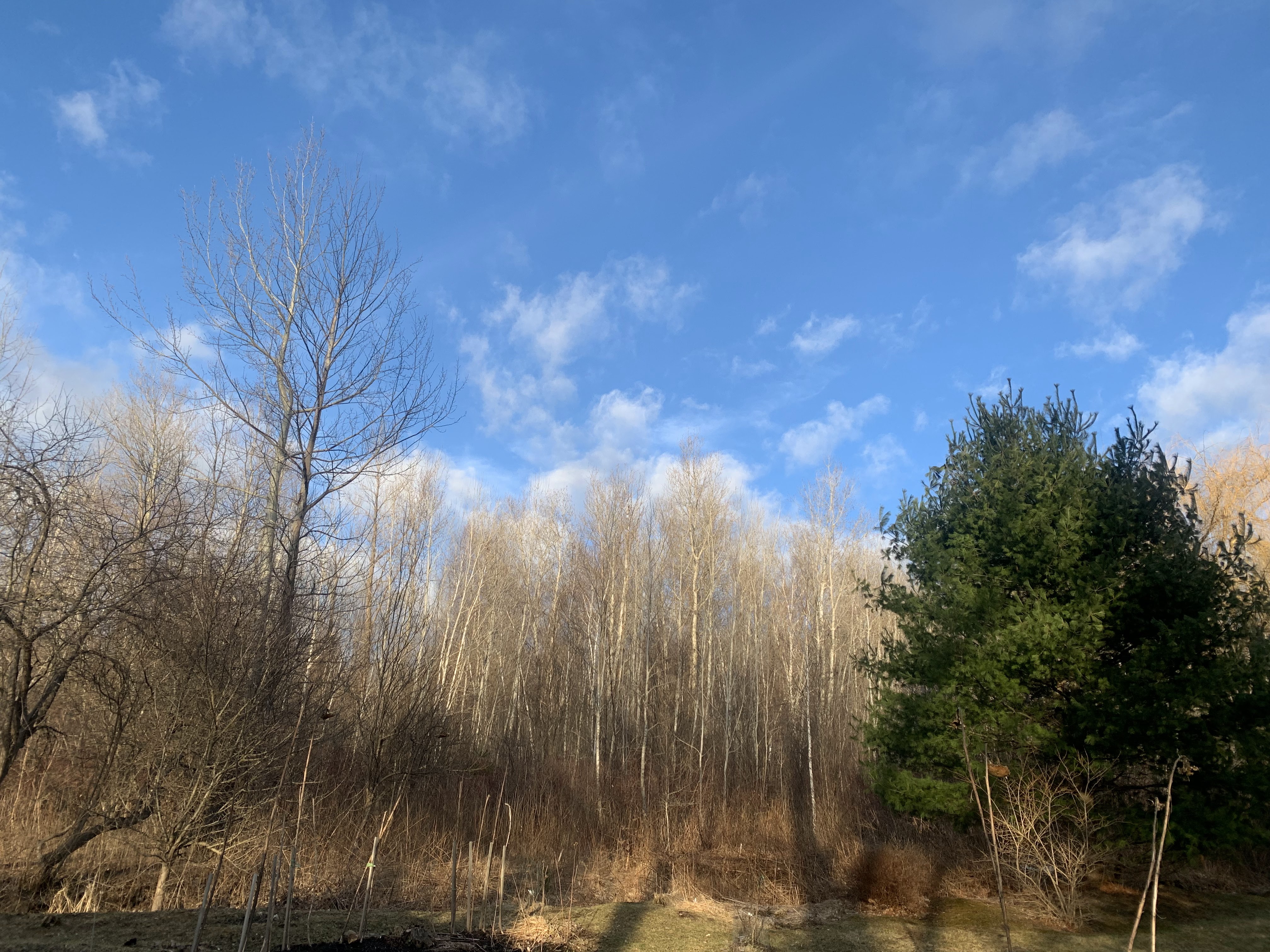
Springtime blue skies over St. Albans, Vermont
late Thursday afternoon. 
 Skies cleared late Thursday afternoon here in St. Albans, Vermont.

I took advantage of that to brave the mud and inspect the oddly early spring yard.  

Everything is a full month ahead of schedule. All the daffodils were starting to come up. So were the sedum, irises and day lilies. And other stuff. Some of the trees are budding. The lawn showed hints of green. 

My walk through the yard would have been about average for April 7.  But it was only March 7.  

I've seen spring get ahead of itself with disconcerting frequency in recent years. , But never this far in advance.  Pretty scary if you ask me.

The gardens will advance a little more today and tomorrow, which isn't good. Sunshine and highs in the low 50s is - once again - typical for early April.  But it's only early March. Saturday could crack 50 also before the noticeable storm comes in for the weekend. 

Video: My prematurely spring garden and yard  filmed yesterday, March 7 in St. Albans, Vermont. Normally, it should look like it does in this video a month later, around April 7.  Click on this link to view, or if you see the image below click on that. 

Scroll down below the video for news and forecasts of a wintry interruption to this springtime weirdness. Spoiler: Some of us could get a lot of snow.


STORM FORECAST

The expected weekend and early week storm will be an interruption to this bizarre early spring. But it will be a typical March storm. 

A lot of snow could pile up in the mountains. But valleys will see a good deal of rain. Especially west of the Green Mountains. 

Of course, the fine details of the storm are still being established, but our broad brush outlook is becoming clearer.  

The National Weather Service in South Burlington has
taken a first crack at expected snow accumulation
Saturday night through Monday morning. This will
be adjusted as we get closer to the storm, but you
can see this will be an elevation storm, with
the mountains getting a real dump, and the 
valleys, not so much. 

Like most storms of this type, we'll have an initial big thump of precipitation Saturday night and Sunday morning. Warmer valleys west should have mostly or completely a cold rain with this stage of the game. 

Eastern Vermont lowlands are on the cusp, so a mix of rain and snow is looking like a good bet.  

This will depend greatly on your elevation. It'll be one of those storms in which your house might get mostly rain, but drive up the hill and gain a couple hundred feet of elevation and it's deep snow.

Higher elevations above 2,000 should get a good thump of wet snow.

This will be a problem. First of all, especially just before the onset of rain and snow Saturday afternoon and evening, downslope winds along the western slopes of the Green Mountains could create some power line trouble.

Then that high elevation wet snow will weigh down the trees. Winds will continue to be gusty, so the combination could create more power outages. 

All this moisture won't help the back roads any. Some dirt roads are closed to traffic because the mud is so thick.  Rivers will be running high after the minor flooding yesterday, and a few could rise toward bankful again if we get more rain than snow. 

Sunday

On Sunday, the rain and snow will become more showery as what is known as a dry slot moves in. That's when a storm's circulation pulls in drier air from the west, which goes south of the storm then rockets northward as a narrow "slot" of lighter precipitation.

Because precipitation will be lighter, snow levels will rise, so places that were getting snow might see some light rain showers. Also, the higher March sun angle will help warm things up just a bit during the day. 

Then the part of the storm that develops into a strong coastal storm will take over. Lots of moisture on northwest winds will swing in, and make it colder. Almost everyone should see snow showers Sunday night and probably a good part of Monday as those winds blow. 

The Champlain Valley and lower Connecticut Valley probably won't get much out of this. But the Green Mountains, especially from about Killington north, could really get a big dump out of Storm Part II Sunday night and Monday. 

 Next Week

Any snow that accumulates in the valleys should quickly melt as we warm up again. By Wednesday and Thursday, highs will be flirting with a springlike 50 degrees once again. That's at least ten degrees warmer than average for this time of year. 

By the way, garden plants are not advanced quite enough to be damaged by Sunday's storm.  I just worry about cold snaps later in the spring when the plants and tree blooms are more mature. 

Monday, March 4, 2024

Spring Leaf Out Way Too Early In Much Of Nation, Sets Stage For Frost Destruction Later

National Phenology Map as of Saturday. Dark red
shows areas that leaves are starting to appear on some
shrubs, nearly three weeks ahead of scheduled. 
 Spring is arriving way too early in most of the United States, forced that way by unseasonable, record breaking high temperatures. 

The National Phenology Network tracks the first early leaf out and blooming of plants and shrubs that typical start to turn green early. 

Based on their index, spring is more than  two weeks early in large parts of the Midwest and Middle Atlantic States. 

Here are the rules of the game, according to the National Phenology Network:

"The First Leaf Index is based on the leaf out of lilacs and honeysuckles, which are among the first plants to show their leaves in the spring. This index is associated with the first leafing of early spring shrubs and other plants

The First Bloom Index is based on the flowering of lilacs ad honeysuckles. This index is associated with blooming of early spring shrubs and leaf out of deciduous trees."

In some areas of Missouri, Kansas, southern Illinois and places near Cincinnati, the first hints of leaves have just appeared, roughly three weeks ahead of schedule. 

That's about the northern extent of this early leaf out as of this past weekend, but warm weather in the coming days might nudge this definition of spring even further north. 

In Washington DC, they are predicting an early cherry blossom season, too. The National Park Service is predicting peak bloom from around March 23-26, while the Washington Post predicts March 19-23.  Either way, it's still earlier than the normal peak, which is around April 1. 

The blooms have been early most of the time in recent years. 

This whole early spring blooming in much of the U.S. is potentially bad news.   The early flowering of fruit trees and other crops leave them prone to late season frosts and freezes,

After early season record breaking warmth in 2012 and 2017 harsh freezes hit, causing immense damage to crops in the South and Midwest. The 2017 freeze alone caused $1.2 billion in damage. 

Here in Vermont the early part of last spring was incredibly warm, leading to a late season freeze that caused devastation in many apple orchards, vineyards and fruit growing farm.


Sunday, March 19, 2023

Cherry Blossoms, Now A Gorgeous, Sign Of Climate Change

UPDATE:

A past peak cherry tree bloom in Washington DC. This
year's is among the earliest on record. Same is
true with cherry blossoms in Japan
The cherry blossoms in Washington DC look like they 99 percent survived the frosty weather in the area over the past couple of days. 

Cherry blossoms start to die and turn brown when the temperature gets down to 28 degrees.

The temperature at nearby Reagan Airport got as low as 29 degrees. So it was a really close shave, but the blossoms managed to squeak through

The weather is turning warmer in Washington, and temperatures are expected to remain far above freezing for at least the next week.  

Peak bloom is expected during the second half of this week. 
 
PREVIOUS DISCUSSION

A beloved harbinger of spring is extraordinarily early once again in two nations on opposite sides of the world. 

Cherry blossoms are out this year earlier than ever before  - or close to it - in Japan and Washington DC 

Cherry blossoms are already blooming in Tokyo, tying records set in 2020 and 2021 for earliest blooms since at least 1953. 

In Kyoto, Japan, the cherry blossoms might peak on March 26 or earlier. If that happens, it will be the earliest peak bloom there in at least 1,200 years. 

Meanwhile, in Washington DC, cherry blossoms are running at a near record early pace as well.

According to this March 7 report in the Washington Post:

"On Tuesday, the National Park Service declared the blossoms reached Stage 3 out of 6, known as "extension of florets." At this stage, the buds encasing the flowers begin to expand. March 7 marks the second-earliest date the buds have reached this stage since records began in 2004."

Since then, the blossoms continued to progress, and are heading toward peak bloom far ahead of schedule, despite weather that has not been as abnormally warm like it was in January through the opening days of March. 

As far north as Central Park in New York City, an early variety of cherry is blooming. No word on how this weekend's cold weather has affected those blossoms. 

Climate change is contributing to the warm winters and the premature springs that create these early blooms. The trouble is, it's just mid-March. Climate change or not, we can still see some brutal, blossom killing cold snaps.

As it is, Washington DC is having a chilly weekend, and early blossoms are at risk of being damaged or destroyed if it gets too cold. It got down to 29 degrees at Reagan National Airport this morning, and the expect low in Washington Monday morning is 28 degrees.  

Central Park Conservatory reports some early varieties of
cherry blossoms are already blooming in New York City. 

Those temperatures could damage some early blossoms, but many more would survive. But real trouble hits if it gets any colder than that. 

March, 2017 was another year in which Washington's cherry trees bloomed almost two weeks earlier than normal. Then, from March 11 to 17, Washington DC endured seven mornings in a row in the 20s, with temperatures dipping to as low as 22 degrees.

 Half of the city's cherry blossoms were killed just before they would have fully bloomed, the first time in the then-105 year history of spring cherry trees near the Tidal Basin.   

Washington's cherry trees face other log term threats due to climate change. Sea level rise is causing higher water in the Tidal Basin. This can make salt infiltrate the ground where the cherry trees are, eventually killing the roots, and thus the trees.

This isn't an imminent problem but it's one that will be an increasing threat in the coming decades. 


Thursday, March 24, 2022

Feeling The Season Way Ahead Of Schedule Agaiin

Really early for this. Yesterday, March 23, I got to work 
expanding a perennial bed while daffodil shoots 
were poking up nearby. Springs in general do seem
to come a lot earlier than they used to.
 This is anecdotal, but honestly, spring keeps coming so much earlier than I remember as a kid in Vermont. 

The setbacks to the season seem harsher as a result, but there's no denying spring ain't what it used to be  - like in my childhood memories of spring in Vermont during the 1960s and 1970s. 

I was out in my yard in St. Albans, Vermont yesterday. What I was seeing was probably what right about April 10 looked like a few decades ago. It certainly didn't seem like March 23. 

Lots of early perennials were poking up, some already two inches or so tall.  The yard was completely free of snow and the grass in protected corners seemed to have a new sheen of green.  Robins were engaging in ongoing turf wars. The ooze from mud season was just starting to ease a bit. I was actually able to begin work on expanding one of my flower beds. 

I have no illusions it will just be flowers and butterflies and warm breezes through the rest of the season.  Brief excursions back into winter are inevitable, and are in the forecast. (Mondays lows should be in the low teens, highs in the 20s. Brrr!) 

Some springs are, and will always be warmer or colder, earlier or later than others. We'll even have a daily record low temperature here and there, though those are, and will be more rare than record highs. 

Spring, in general, is warmer and earlier than it once was.

I might eat my words, but we'll probably never again have an April like 1972, when only five nights in Burlington stayed above freezing and it got as low as 2 above, still the coldest reading for April on record.. (For comparison, so far this March, nine nights remained above freezing in Burlington).

We also, thankfully, probably will never have a May like 1966, when 11 of the first 14 days of the month saw subfreezing temperatures. 

I wonder, though, what the next weirdly warm spring month will look like.  Will we outdo March, 2012, when we had a week of temperatures in the 70s and low 80s? 

Will we someday have some of the first leaves on the trees in early April?  When I was a kid, the first trees to turn green didn't do so until early May. Now, that usually happens around the third week of April, at least in the banana belt Champlain Valley. 

Sometimes, global warming is referred to as "global weirding."  The extremes get, well, more extreme, or at least more odd.  We've certainly seen that in recent Vermont springs.

In late February, 2017, we saw temperatures in western Vermont reach the low 70s, far higher than anyone had seen so early in the season.  Then, two weeks later, the Pi Day Blizzard dumped close to three feet of snow on those same "mild" towns. 

On April 9, 2019, I saw trees around my  yard sag under the weight of freezing rain. In 2020, another warm spring was interrupted by a snowy Mother's Day.

Last year, spring was way early, with flowers blooming all around my yard on April 20.  By April 21 and 22, five inches of snow had smushed the flowers into the ground and blinding snow squalls swirled around my house.  Two days later, it was warm, snow-free, as if nothing wintry ever happened.

All these changes of course have far broader implications than me just saying "Gee whiz'" to myself in the gardens. 

This is another screwed up maple sugaring season. It started early, but I'm not sure all sugarmakers were ready for it in February.  Then a long warm spell last week probably at least deteriorated the quality of the season, at least for some producers.

Early springs lead to premature blooming of apple trees and grape vines and such. Those crops end up vulnerable to late frosts, which still regularly interrupt these milder springs. 

I've always been particularly in tune with nature, the change of seasons, how the landscape changes day to day.   At the risk of having my Vermont card revoked, winter isn't necessarily my favorite season. The honors go to spring.

The weird springs give me mixed emotions, but most of those emotions are tinged with misgivings. Sure, who doesn't love hints of greenery in a Vermont garden in mid-March?  But then you worry the flowers are coming up too soon, and will get wrecked, like my too-early lilacs did during last April's brief snow and cold.

Flowers around my house are the least of anyone's worries, including mine. Climate change is now affecting everyone.  It will hit is harder in the years to come. How hard is too hard?


Sunday, April 11, 2021

Spring Is Indeed VERY Early In Vermont This Year

This map from the National Phenology Network shows the 
progression of spring leaf out.  The darker the red, 
the earlier than normal leaf out is. It's reached
Vermont's Champlain Valley a good two weeks
earlier than normal this year. Blue shades
much further south indicate a slightly later than
normal spring leaf out in February and March.
In my yard in St. Albas, Vermont, daffodils have been blooming for several days now. 

In the woods, wild honeysuckle is starting to leaf out.  So are my lilacs. After a warm night, I woke up Saturday morning to find my forsythia suddenly in full bloom.  

This is way earlier than I can remember plants blooming in northern Vermont.  It's been a warm spring so far, and the outdoor plants are showing it. 

It turns out, the progression of spring leaf out and blooming is a pretty intensely studied subject. It's called phenology. 

An organization called the National Phenology Network tracks the first leaves and first blooms of the season as these signs of spring work their way northward through the United States.

The Phenology Network tracks what they call first leaf out and first bloom in the United States. The First Leaf Index is based on the leaf out of lilac and honeysuckles, which are pretty much the first plants to show leaves in the spring. 

My observation that the honeysuckles and lilacs around my property starting showing leaves in the past few days exactly matches the data and the Phenology Network.  This leaf out in Vermont is a good 20 days earlier than normal, according to this network.  That is way, way, faster than normal. It's probably close to a record, an the Phenology Network agrees it is indeed, close to, but not quite unprecedented.   

The National Phenology Network as of this morning was only showing leaf out in the Champlain Valley,  the valley along Route 7 between Rutland and Bennington  and the far southeastern Vermont.  It hasn't reached the rest of Vermont yet. However, forecasts call for slightly cooler than recent, but still warmer than normal weather in the Green Mountain State all week, so we'll get some northern progression. 

Lilac leaves have already appeared on my St. Albans,
Vermont property, much earlier than normal 
It's always interesting to follow the progression of spring from late January along the Gulf Coast and then northward.  

Spring was early on the Gulf Coast. Then, in a band from northern Texas and Oklahoma to the Carolinas, it was late, reflecting that nasty February cold snap.  From there on northward, it's been an early spring so far. 

The National Phenology Network also follows another index call the spring bloom, defined as when honeysuckle and lilac start to bloom.  

We're nowhere near that in Vermont, yet, but that line is progressing northward earlier than normal as well. As of Saturday, the spring bloom line had gotten as far north as Washington DC.

With climate change, you would expect spring leaf out to be coming along earlier and earlier. In most of the nation, since the 1950s anyway, that is indeed happening,  with most places seeing spring come four to eight days earlier than in the days of Elvis Presley. 

Interestingly, however, in the southeastern quarter of the nation, spring leaf out and bloom has been trending slower.  This year's data also fits this pattern. 

Spring bloom is a little more mixed with the timing,  but also shows the southeast trending a little late in recent decades, while the most of the north is a little early. 

In any event, as long as harsh frosts manage to stay away - an iffy proposition - we do get to enjoy a spring in Vermont that has blessedly come weeks ahead of schedule in 2021.