Showing posts with label blizzard. Show all posts

Tuesday, March 18, 2025

Mega-Storm That Killed 42 Finally Gone, New Storm Causing New Trouble. We'll See Effects Here In Vermont, Too

Video still from storm chaser Aaron Rigsby shows the
capriciousness of tornadoes. Home in foreground
was destroyed by an Arkansas tornado last weekend
while the house next door looks fine. 
 The last vestiges of that enormous, super-destructive and deadly storm departed the Northeast Monday, leaving some flooding in New England and Quebec, but otherwise finishing up its rampage. 

The U.S. death toll from tornadoes, wildfires and dust storms generated by the super storm has risen to 42.   

So far, a total of at least 132 tornadoes have been counted from the Midwest to the East Coast, and more assessments are being done. 

A total of 400 homes in Oklahoma alone were destroyed or damaged in wildfires over the past few days. 

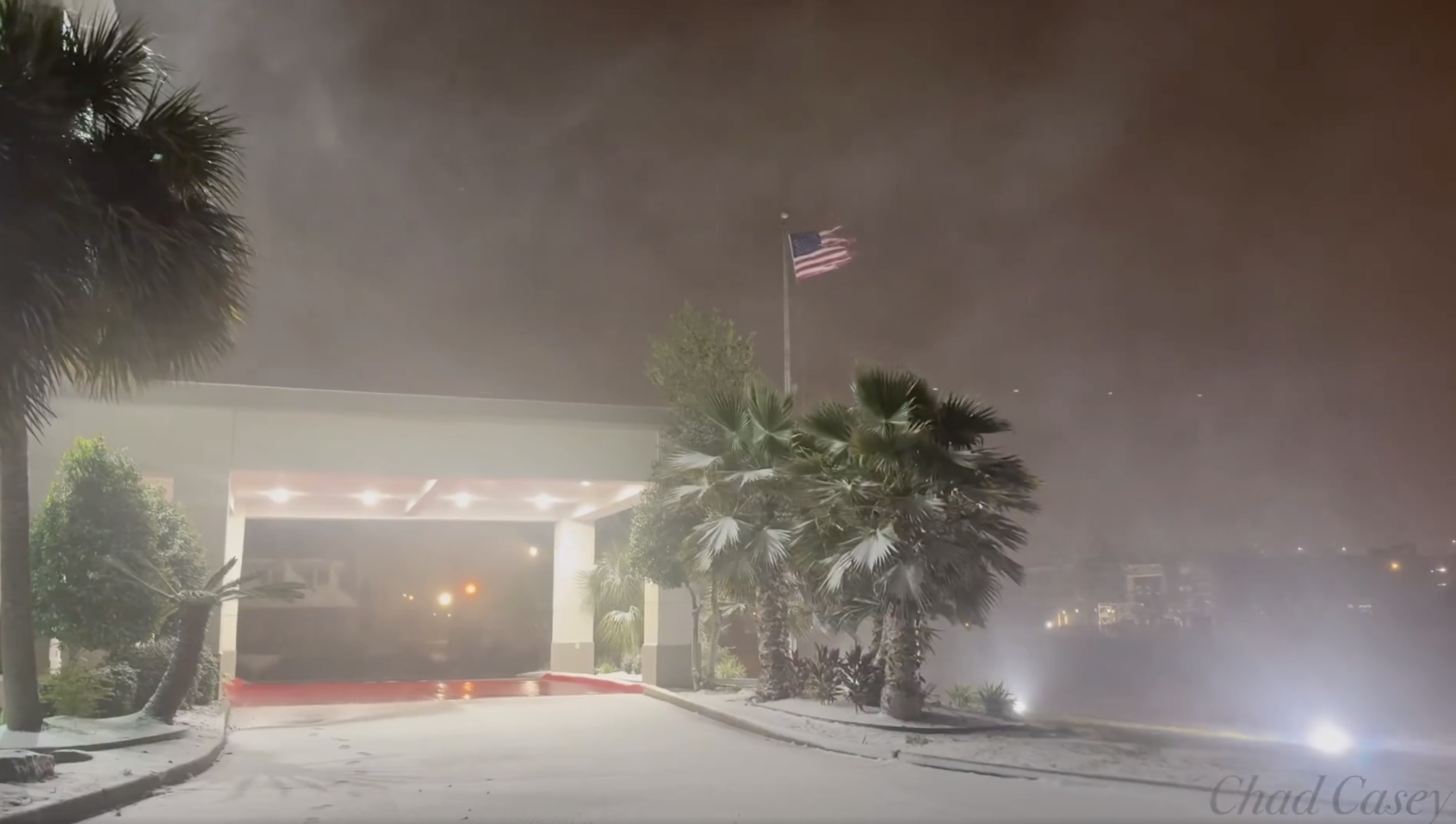
Wildfires are still burning in the Plains, and now a new storm is about to cause new trouble.

NEWEST HAVOC

The latest storm won't be as strong or as widespread and likely not as destructive of the last one. But it's still causing problems already.

The central and southern Plains are taking the brunt of it again. Places that were under fire weather alerts for dry air and strong winds yesterday and today are also now under blizzard warnings for tonight and Wednesday. 

To give you an idea of the extremes going on in the Midwest, the forecast for Lincoln, Nebraska calls for dry air and a high of 80 degrees today. There could be wildfires in the region.

By Wednesday morning's commute time, Lincoln will be at or below freezing with blizzard conditions and wind gusts as high as 65 mph. Then, by Thursday, everything will be hunky dory again in Lincoln with sunshine and a  high near 50. 

That blizzard warning actually extents from western Kansas, through Nebraska, northwester western Iowa and into southern Minnesota. 

Further south, things are even more dangerous.

Another bout of hot, strong, dry winds are forecast in New Mexico, western Kansas and especially in Oklahoma and western Texas. This region can expect more wind damage, more blinding dust storms and more nearly impossible to control wildfires. 

Even after the storm departs tomorrow, strong winds and dry air should continue over western Texas, New Mexico and Oklahoma through at least Saturday, continuing the wildfire siege there.  

 Thankfully, this new storm does not look like it will manage to produce another major tornado outbreak.  Some severe thunderstorms seem likely in parts of Illinois and Indiana tomorrow, but if there are any tornadoes at all, they should be few and far between and not as strong as those over the weekend. 

VERMONT EFFECTS

High water continues to recede this morning across Vermont, though a few roads in low lying areas are likely still closed due to continued flooding. 

Will that little nor'easter depicted on this
forecast map for Friday morning give
Vermont a late season forecast, or will
it miss?  Computer models disagree.
After a frosty morning, we still have another weird March heat wave in the forecast, but it won't be as extreme as we saw over the weekend.  Still, highs should get into the 60s Wednesday and Thursday. 

Then the weather potentially gets weird again. 

The cold front will slow down to allow a storm to form in the Mid-Atlantic states. And turn into a nor'easter. 

It'll cool off rapidly Thursday night behind the front as the nor'easter approaches, so rain should change to snow.  The question remains: Will we get a lot of heavy, wet snow with this, or just a little. 

It depends on its exact path, as to how much of anything we get. If the storm goes a little more inland, it'll be mostly rain with a little snow at the end. 

 Or it could put Vermont in the sweet spot for a burst of heavy snow late Thursday or Friday. Or, the storm could go far enough east so moderate rain with the cold front just ends as a little bit of light snow.

For what it's worth, earlier runs of the American computer model had the storm smacking us pretty good early Friday. This morning's run of the same computer model  has it missing entirely. Basically the computer models are still all over the place with this one, so stay tuned. 

Time will tell, but it could be an interesting storm.  

On the bright side, so far, no new flooding is expected Thursday night and Friday.  There won't be enough rain to send rivers into flood stage. And if it snows, that won't cause much in the way of flooding. 

Watch this space for updates. We probably won't know a lot of details with this until we get well into Wednesday and Thursday.  


Wednesday, March 5, 2025

Destructive, Wide-Ranging U.S. Storm To Finally Wind Down Thursday.

Texas Storm Chasers posted this photo of tornado damage
in Irving, Texas on Tuesday.
Just as expected, an enormous windbag of a storm has caused havoc this week from the Rocky Mountains to the East Coast. 

Two people were reported dead in Mississippi as the severe storms rolled through Tuesday.  Po wer was out to more than 400,000 homes and businesses in several states across the South and Midwest.

The storm disrupted Mardi Gras, or at least tried to, in New Orleans Tuesday as the city was under a tornado watch and high wind warning. The National Weather Service had warned revelers to be careful, in part because winds could topple Mardi Gras floats. 

Some of the biggest parades were held earlier than scheduled and shortened to avoid the worst of the weather. 

No tornadoes struck near New Orleans, but the city endured downpours and gusts as high as 53 mph

Minnesota traffic cameras showed miserable 
conditions this morning as blizzards hit swaths
of the Midwest, part of a large storm hitting
huge parts of the nation
At least seven tornadoes were reported in Oklahoma, northwest Louisiana and possibly Texas on Tuesday. Tuesday's tornado count will likely rise as damage is analyzed. A few more tornadoes are possible today in the Southeast.  There's even a very low, but not zero chance of a brief twister as far northwest as Pittsburgh, Pennsylvania today.

In Texas, the larger problem was brush fires. One brush fire amid the 50 mph winds destroyed 10 buildings, while another south of San Antonio destroyed 17 structures, including nine homes.

The strong winds also blew clouds of dust from West Texas into cities like Austin and Dallas, sharply cutting visibility and prompting air quality alerts. 

Further north, blizzards struck parts of the Plains and Midwest. While snow totals were not extraordinary, but still substantial in spots. Areas near Minneapolis-St. Paul were closing in on a foot of new snow this morning. 

The wind has been extraordinary, though.    Gusts commonly reached between 50 and 70 mph. Hugoton, in western Kansas, had a gust to 93 mph. 

The storm was forecast to move off into Canada today, while throwing a flood threat at sections of New England and New York as a parting shot. 

Videos

Footage of fast-moving wildfires in Bexar County, Texas, near San Antonio, with winds gusting to at least 50 mph. Click on this link to view, or if you see the image below, click on that. 

Kind of a happy post, really, but this one is costumed characters at the New Orleans Mardi Gras deal with strong winds amid the party. Click on this link to view, or if you see the image below, click on that.  


Thursday, February 20, 2025

Think It's Snowy In Vermont? Let's Take A Quick Trip To Montreal

Montreal is a mess after two storms within four days
dumped 30 inches of snow on the city. Snow removal
has been slow because of the volume of the snowfall
and people are getting frustrated.
 We spent a lot of time over the past several days talking about all the snow here in Vermont, but if you really want snow, we should talk about Montreal. 

And other large sections of Quebec and Ontario. 

Two storms between Thursday and Sunday dumped nearly 30 inches of snow on Montreal. 

It was the largest amount of snow on record for such a short period of time.  The city had 40 percent of its normal annual snowfall within five days. 

Montrea[ had full blizzard conditions, which are common further north in Quebec but rare in southern parts of the province. Winds around Montreal Sunday and Monday gusted from 35 to as high as 55 mph, whipping the snow into tremendous drifts. 

Sunday's storm was slightly larger than Thursdays, depositing about 16 inches of snow on Montreal and 21 inches in Mirabel. 

Sunday's storm was the fourth largest snowfall on record in Montreal. Thursday's storm was tenth largest.  (Montreal's biggest snowstorm dropped 18 inches of snow on the city on December 27, 2012.

At least one death was reported due to the storm.  A 57-year old ma was found dead inside a snow-covered car with its engine running, Global News reports.

 It's likely the snow blocked the car's exhaust, backing deadly carbon monoxide back into the car where the man was sitting.

In Chateauguay, Quebec, just south of Montreal, a 13-year old girl was in critical condition after she was found unresponsive beneath a collapsed snowbank.  A snow tunnel must have collapsed. 

Montreal has a reputation as being at least somewhat  efficient at snow removal, but this threw the city for a loop. Schools were canceled Monday and the city told anyone who was able to work from home to do so. 

Quiet weather starting Tuesday has allowed Montreal to get the cleanup going in earnest, but officials said it could take to early next week to get all the sidewalks plowed. On Tuesday, only six percent of rte snow had been cleared from Montreal streets. So yeah, this will take awhile.

As of midweek, city streets were still treacherous. Snowbanks made street parking virtually impossible.  Adding to the chaos, pedestrians were walking in the streets because sidewalks were still blocked by snow. 

If you're contemplating a quick trip up to Montreal, I'd wait more than a week before doing it. 

The huge volume of snow is making it hard to get rid of it all. Montreal has these big snow blowers that filled one large 45-foot truck every minute to be hauled to a snow dump. The city either dumps snow into sewer chutes, where it mixes with warmer wastewater, melts, and is then treated by the city's wastewater system. Or it's deposited at dumps, including an old quarry, where the snow gradually melts in the summer. 

 Far away from Montreal, and well northeast of Quebec City, an avalanche swept across a highway and trapping cars. However, everyone escape unscathed. 

Toronto was also reeling from the dual snowstorms.  Main roads there are clear, but like Montreal, Toronto has to load snow on trucks and haul it away, which is taking forever given the 21 inches of snow that fell on Toronto in the dual storms. 

The slow pace of snow clearing in Toronto is frustration residents, much like in Montreal. 

It's unclear if the weather had anything to do with the plane crash in Toronto Monday in which a plane with 80 people on board crashed and flipped over when trying to land.  Twenty-one people were hurt, but miraculously no deaths were reported. 

The plane landed amid blowing snow and strong winds, but pilots are trained to take off and land in such conditions, so it could well have been a mechanical problem. 

Much like here in Vermont, the snow machine as shut off for now in most of southern Quebec and Ontario. Only very light snows are expected in Toronto and Montreal over the next week. In both cities, high temperatures next Monday through Wednesday could rise to levels slightly above freezing. 

Videos:

 Scenes from the Montreal blizzard. Click on this link to view or if you see the image below, click on that. 


News report shows how chaotic things looked in Montreal. Again, click on the link or if you see image below click on that:


Judging from this video, it looks like Ottawa, Canada is very efficient at removing near 30 inches of snow from city streets. Click on this link to view or if you see image below, click on that. 

 
A walk through a Montreal neighborhood Wednesday morning shows how chaotic things still are in the city. Click on this link or if you see the image below click on that. 


Sunday, February 16, 2025

Deadly Storm Causes Catastrophic Floods, Tornadoes, Winds, Widespread Damage

Flooding in Kentucky killed at least eight people over the
weekend as an intense winter storm spread havoc to
most places in the central and eastern U.S. 
 The storm affecting us in Vermont also as expected caused deadly havoc in other parts of the nation as moves coast to coast. 

At least eight deaths have been reported in Kentucky due to the flooding. The death toll could rise as flooding is still ongoing as of this afternoon. 

All of Kentucky was under a flood warning this morning, as was much of West Virginia and parts of Ohio, Indiana and Tennessee.

To add insult to injury. snow fell in much of Kentucky Sunday as flood waters continued to swirl. Louisville suffered widespread flooding Saturday. Sunday morning, snow swept into the city, helping to cause on a highway in the city. 

On Sunday, a levee along the Obion River failed near the town of Rives, rapidly flooding the town and forcing hasty water rescues. 

Mudslides were reported in eastern Kentucky, and a rockslide temporarily shut down Interstate 69 in Dawson Springs, Kentucky. 

Damaging floods also extended into western Virginia. 

 Also, depending on where you were in West Virginia, you might be under a flood warning, a blizzard warning or possibly both. 

Further south, tornadoes and severe weather were the issue. 

Atlanta's Hartsfield-Jackson International Airport reported a gust to 69 mph during the early morning storms.   At least one death was reported in Atlanta where a tree fell on a house. 

Two confirmed tornadoes were reported near Monticello, Georgia, southeast of Atlanta. 

A remarkably huge area is under high wind warnings or wind advisories. They extended this morning from Mississippi and Florida all the way through New England. 

As of late afternoon, at least 310,000 power outages were reported, mostly in Virginia, Georgia, Alabama and West Virginia 

Meanwhile, intense cold was plunging southward through the Plains. 

Parts of North Dakota were expecting three consecutive nights in the minus 30s, with wind chills in the 50s below zero. 

Frigid temperatures are plunging south into Texas. Extreme cold weather watches for expected wind chills below zero are in effect as far south as central Texas. 

In the snowy, icy Northeast, a blizzard warning was in effect for the mountains of south central Pennsylvania where heavy snow was forecast to combine with winds up to 65 mph. A blizzard warning was also up in the northwest corner of New York around Massena. 

I'll have an update on the storm in Vermont very late this afternoon or early evening. 

Tuesday, January 21, 2025

An Absolutely Bonkers Winter Storm Is Striking Gulf Coast. Blizzard Warning In Coastal Louisiana!

Screen grab of video showing strong winds, snow and
blowing snow early today in Lake Charles, Louisiana,
which is, of all things under a blizzard warning.
 The National Weather Service home page weather map had things today I don't think I've ever seen before. 

Winter storm warnings are up from far southern Texas all the way across the entire Gulf Coast to the Big Bend area of Florida. Forecasts for the winter storm intensity have gone way up since I first reported on this storm on Sunday.

A blizzard warning, of all things, is in effect right along the Gulf Coast in extreme northeastern Texas and southwestern Louisiana, including the cities of Port Arthur and Lake Charles.

I'm certainly used to seeing tropical hurricanes come ashore in this area, but a blizzard?

The criteria for a blizzard warning in the Deep South is different than for places like, say, North Dakota, but this is still impressive. 

The Louisiana blizzard zone is getting bands of heavy snow and blowing snow with gusts of at least 35 mph, so that's an impressive winter storm. Total snowfall will run the four to eight inch range in that area today.

The area under the blizzard warning normally has a high temperature in the low to mid 60s this time of year with lows in 40s. It would be like Vermont having a full-blown blizzard in mid-May. 

We'll have plenty of for-examples of how bizarre this has gotten on the Gulf Coast today. I'm already seeing a few. 

Port Isabel, Texas, a near-tropical city along the southern Texas Gulf Coast right on the border with Mexico early this morning, had arguably worse winter weather than we're currently having in Vermont. At 5 a.m. it was 36 degrees, light snow with north winds of 36 gusting to 52 mph and a wind chill of 22 degrees. 

Normally, this time of year, Port Isabel has highs in the upper 60s and lows in the mid 50s. 

A wild National Weather Service home page this morning.
All that pink you see on the Gulf Coast is
all winter storm warnings 
Five or six inches of snow is forecast for New Orleans. That would make it easily the biggest snowstorm there since eight inches fell in February, 1895. The modern record for deepest snow in New Orleans is 2.7 inches in December, 1963. 

Pensacola, on Florida's Panhandle near the Alabama border, is anticipating two to four inches of snow today, with the possibility of five inches. The biggest snowstorm on record in Florida is four inches, so we might be rewriting history here.  

Winter storm warnings in Florida extend as far south as Gainesville, where freezing rain, sleet and snow could collapse trees and power lines. 

The winter storm is expected to continue today and tomorrow on up the coastlines of Georgia, South Carolina and North Carolina

DANGEROUS

This winter storm is obviously quite the novelty, but it's extremely dangerous. 

To be Captain Obvious here, the Gulf Coast isn't built for winter storms. They're much better at handling full-fledged hurricanes than this type of weather. 

The six inches or more of snow that could fall in Louisiana could collapse roofs, since they're not built for snow loads like they are here in New England. 

The Deep South isn't used to such cold weather, either.  Pipes aren't insulated, so they'll freeze.  The epic freeze in Texas in February, 2021 caused billions of dollars in damage as frozen pipes burst, flooding homes, condos and commercial buildings. 

Snow on the ground makes frigid nights even colder. A snow-covered Deep South could end up with record temperatures in the single numbers and teens tonight or tomorrow night. 

Travel is - or will soon be - impossible in the Gulf Coast winter storm zone. It's not exactly like they have armies of snow plows and sanders to clear the roads. People there also understandably have no clue how to drive in the snow.

As of the pre-dawn hours, Houston freeways were already an icy disaster and parts of Interstate 10 in Louisiana were already closed. 

Airports are shutting down in the region, too.

The governors of Florida, Georgia, Louisiana, Mississippi and Alabama have all declared states of emergency because of this weird storm.  

The silver lining to this storm is the weather along the Gulf of Mexico should return to normal by the end of the week. Which is good, because they'll have to wait for the snow and ice to melt before anything can be done about the situation. 

Daytime temperatures should rise into the 40s by Wednesday. By Sunday, New Orleans expects a high temperature of 65, Houston should get to 68, and Pensacola is anticipating a Sunday high of 62.

Thursday, December 5, 2024

Alberta Clipper Makes Things Super Intense Near Great Lakes; Here In Vermont Part 2 Coming Later Today

Forecast for additional accumulation around Vermont
for this Alberta Clipper. More than six inches in
some of the mountains, but little in the Champlain Valley
Still, travel should get tricky again later today.
 I think we ought to start this post in Erie, Pennsylvania, which is taking the cake for some of the most intense lake effect scariness of this whole episode, that's lasted nearly a week now. 

Erie County, Pennsylvania, home to nearly a million people, has had three to four feet of snow since Friday. It's gotten to the point where buildings are starting to collapse.

 Interstate 90 through that region has been closed intermittently, and when it opens, it keeps becoming the scene of multi-vehicle pileups.

Now, today, Erie County is under a blizzard warning. Another 10 to 20 inches of snow is forecast from more lake effect snows. Winds could gust to 50 mph, or even 65 mph closer to the lake today. The National Weather Service says travel will become impossible today. 

There's concern more homes and buildings could collapse under the weight of the snow. Trial by snow indeed! 

A blizzard warning is also up for the mountains of West Virginia and the extreme western tip of Maryland, too.

Meanwhile other areas around the Great Lakes, including Michigan, Ohio, New York and Ontario up in Canada are also being blinded by lake effect squalls this morning. That state of affairs will continue all day. 

What a mess!

VERMONT EFFECTS:

Here in Vermont, things are much more reasonable than they are around the Great Lakes.

The first round of snow came through overnight as expected. Much of the Champlain Valley was "shadowed" by the Adirondacks. Moisture was captured by those mountains, so little snow fell in places like Burlington. 

For the first time this season, my yard in St. Albans, Vermont
looked truely wintry after a little more than two
inches of new snow last night. 

The far northern part of the Champlain Valley did escape that shadow, as I measured 2.4 inches of new snow at my place in St. Albans.

Also as expected, the snow picked up again in the Green Mountains, with mostly two or three inch reports so far. 

There was a lull in the activity this morning as some dry air has worked its way into our Alberta Clipper ahead of its cold front. 

 Most main roads toward the tail end of this morning's commute looked like they were in pretty good shape, according to traffic cameras set up around the state.

Temperatures should creep up to slightly above freezing in the broader valleys later this morning, which will help melt remaining slush of the highways. 

But Round 2 is coming.

The clipper's cold front will come through this afternoon with batches of snow showers, some of them locally heavy, dropping temperatures quickly below freezing. Winds will pick up, so there should be plenty of blowing snow later today and tonight, too

Today's evening commute is probably going to be on the tricky side in many areas.

Just like last night, the Champlain Valley probably won't see much additional snow. Many spots there should see less than an inch. But it doesn't take much snow to ice up the roads if temperatures are falling below freezing. Take your time headed home this evening. 

Elsewhere, a few inches of snow should pile up overnight, with a good six or more inches up at the ski areas on top of what has already fallen. It should be a noisy night, too with winds gusting to 40 mph in the valleys and more than that in the mountains.

On the bright side, it should be a great early season ski weekend before the warmer air inevitably arrives next week.

Bits of snow will fall Saturday and Sunday as weak disturbances slip through. It might get warm enough for rain drops in the Champlain Valley Sunday afternoon.

A modest, warm storm should give us mostly light rain Monday and Tuesday before the forecast gets questionable again.  We don't know whether a second storm will come up the East Coast Thursday or not. And if it does, we don't know yet whether enough cold air will blow in to give us snow instead of rain. 

So if you're looking ahead toward a week from now, keep guessing. We'll figure that out within a few days from now.  

Sunday, December 1, 2024

Update: Widespread Lake Effect Snows Piled Up Big Time

Intense lake effect snow squalls stalled traffic along
Interstate 90 in Ripley, New York. 
 I don't know if the Great Lakes effect snowstorms this weekend were the biggest on record, but damn, they were pretty big. And awfully widespread. 

After a warm autumn, all of the lakes are warm, and the first big cold push of the season really cranked that snow, starting Thursday and going through today. g

The heavy snow covered shorelines from Michigan to New York, and included lots of amazing totals

Some of the biggest totals by state so far include: 

New York: 46 inches at Barnes Corners and Copenhagen

Pennsylvania 42.3 inches at North East

Ohio: 39 inches at Ashtabula,

Michigan: 34 inches at Otsego Lake State Park.

Mind you, this was at 10 a.m. Sunday. It was still snowing at a good clip in many locations this afternoon. 

 Parts of Canada weren't immune.  Highway 11, a major thoroughfare north of Toronto, was shut down by blinding snow squalls that dumped two feet of snow within a day and a half. 

The storms caused havoc on Friday and over the weekend in some of the hardest hit towns. The New York State Thruway was shut down roughly between Buffalo and the Pennsylvania line Friday, and hundreds of vehicles were stranded overnight along the highway. 

The snow squalls were so intense they were punctuated by thunder and lightning, and waterspouts were reported offshore of Buffalo over Lake Erie.

Not much snow fell in Buffalo, which was north of the main band of snow, but the Buffalo Bills' stadium in Orchard Park, south of Buffalo, was buried by at least 20 inches of snow.  The Bills requested help from fans to help shovel out the stand-in time for the game today. 

Erie, Pennsylvania endured its biggest snowstorm on record over the weekend with 31 inches, with possibly another foot on the way. After a brief break in the snow Saturday afternoon and evening heavy snow returned to Erie again Sunday. 

It's getting bad enough there that people were up on roofs shoveling, fearful the weight would be too much for some homes and buildings. 

The snow is becoming somewhat lighter and more scattered near the Great Lakes starting tonight and into the first half of the week. But an Arctic cold front due later in the week is likely to restart the intense squalls again. 

Vermont Effects

Radar image from the National Weather Service in 
South Burlington shortly after 10 a.m. today shows
a band of snow from Lake Ontario fading in the
Adirondacks, then getting reinvigorated over 
northern Lake Champlain. A narrow area around
Swanton and Highgate had briefly heavy snow,
The bands of lake effect snow were powerful enough Friday through Sunday to them to make it all the way to Vermont, but in a much milder fashion than seen in western New York. 

Sunday morning, the Lake Ontario band picked up some additional moisture from northern Lake Champlain. That was enough to reinvigorate the snow for awhile to dump two or three inches in a narrow zone around Swanton and Highgate. Meanwhile, in nearby St. Albans, there was barely a dusting of new snow.

The Lake Ontario snow bands also graced the northern Green Mountains. Jay Peak reported 15 inches of new snow between Friday morning and Sunday morning. 

Snow showers through the first half of the week should add some light accumulations to the higher elevations, but likely an inch or less in the valleys. 

Video:

This shows how localized these lake effect snow squalls are Television station WGRZ did a time lapse video of a drive from downtown Buffalo, New York to the suburbs to the south. 

Buffalo was a bit too far north this time to get the squalls. Downtown streets were clear of snow, green grass in parks had absolutely no snow. Drive a few miles and it was a practically a blizzard. You can see the thick snow squalls as the driver approached the snow zone. Click on this link to view, or if you see the image below, click on that. 


Various scenes from the storm from the Associated Press, including the city of Erie, Pennsylvania buried beneath the snow. Again, click on this link to view, or if you see the image below, click on that.


Tuesday, November 19, 2024

First Major West Coast Atmosphere River Getting Their Wet Season Off To A Doozy Of A Start

We've entered the season in which pretty big storms come off the Pacific Ocean and hit various parts of the West Coast, sometimes intensely, sometimes not.  
Satellite view shows the strong "bomb" cyclone centered off
the Washington and British Columbia coast this afternoon.
It's the comma shaped thing on the right hand side of the 
image. Part of the atmospheric river is visible as that
long white streak heading west from the storm

The first major storm of the season looks like quite a doozy. What is known as a bomb cyclone will team up with an atmospheric river .

A bomb cyclone is a storm that's intensifying super fast. A storm is a center of lower air pressure. In general, the lower the air pressure in a storm, the stronger it is.

 Technically, if the air pressure in a storm drops by 24 millibars within 24 hours, the storm is a bomb. 

Bomb storms are often dangerous they are simply strong and getting stronger. You can plan on a lot of wind and precipitation if you're hit with a bomb cyclone, and that will be the case with this "bomb"

This storm could be the most intense in the region since at least the 1940s. 

 An atmospheric river is a long narrow corridor of deep moisture.  When one of these comes a shore, a 200 to 400 mile wide band,

So we have a strong storm and a stronger than usual atmospheric river. The result is a West Coast mess that started today. 

THE RESULT

Between this afternoon and Sunday evening, ten to as much as 15 inches of rain to northwestern California and southwestern Oregon. 

NOAA's Weather Prediction Center says that by Thursday, there's a high risk of dangerous flooding in parts of northwestern California. High risk flood alerts from NOAA happen only about four times a year and it's exceedingly rare for them to be issued three days before the event, as this one was.

High risk days account for two-fifths of all U.S flood deaths and at least 80 percent of all flood damage. So this is serious. 

Emergency managers are especially worried about mudslides and debris flows, especially on slopes that suffered wildfires in recent years.

The storm is accompanied by those high winds. Many neighborhoods are pretty heavily forested, which means trees could fall on houses. People are being warned to stay in interior rooms on the lowest floors of their homes because of this risk, 

Those winds tonight could gust to 70 mph, with possible 85 mph gusts near the beaches. 

Ten to as much as 20 inches of rain could
fall in the yellow shaded area of 
northwest California and southwest
Oregon over the next several days. 
The rough weather extends all the way to Washington and British Columbia. High winds are expected even in the big cities of Seattle, Tacoma and Vancouver, Canada. 

Blizzard warnings are up for Washington's Cascade mountains, 

Previous to this storm, some strong systems have hit British Columbia, and sideswiped Washington State with some decent rains. But points further south have had just small introductory systems to introduce the rainy season.  

This will be a real slap of reality and could be the start of a rough winter on the West Coast, especially roughly from San Francisco north.  There's a La Nina weather pattern, albeit a weak one, and that often cause extra storminess in the Pacific Northwest

WEST COAST STORM AND VERMONT

The West Coast storminess is unrelated to the super welcome precipitation that we're expecting starting Thursday. That one got energy from a previous storm that came ashore from the Pacific a few days ago. 

Despite the power of what's hitting the West this week, I so far see few signs of that storm spawning anything extreme in our neck of the woods.   

One piece of that atmosphere river should come through New England in about a week as a modest system with light precipitation. After that, the weather pattern seems like it could be active for us, but that's uncertain.  

Monday, March 25, 2024

This And That: A Vermont Spring Milestone, And Weird Weather Elsewhere

Animal tracks in the snow last evening in my
St. Albans, Vermont yard. Looks like they had been
sculpted by wind and sun during the day. 
 It was cold out there in Vermont this morning, as expected. 

But look at it this way, it'll very likely be a long time before you see weather this cold again.   

Temperatures were in the teens this morning, with some single digits in the cold hollows. It was below zero in some of the cold hollows Sunday morning. 

Unless something incredibly strange happens in April, these are the coldest temperatures you'll see until November or December. 

Don't get your spring mood on just yet. It's hard to do anyway with all the snow on the ground in most of Vermont. 

 Also, it pretty much always snows in late March and April. We probably won't have any more mega-snows, but I pretty much guarantee you'll see snow again before spring really arrives. 

Since the weather is quiet out there in Vermont today, I found some this and that weird things to talk about  elsewhere.

Kansas County Everything

Last evening, portions of a county in northwest Kansas managed to find themselves under a tornado warning, a blizzard warning and a dust storm advisory. The tornado threat arrived ahead of a cold front. Radar images definitely showed rotation in a severe thunderstorm, but it's unclear whether the tornado actually touched down not far from Oakley, Kansas.

The big thunderstorm's strong winds stirred up the dust.  Following the cold front, strong north winds and snow developed the blizzard later at night and this morning. 

The temperature in Oakley went from 69 degree Sunday afternoon to 24 degrees with a wind chill of 6 above early this morning. 

Talk about wait a minute and the weather will change. I don't think I want to live in northwest Kansas. Too much going on. 

Cuban Supercell

Supercell thunderstorms, those persistent, intense, big hail producing, usually rotating and sometimes tornado-producing storms, are a fixture in the United States Plains and Midwest the spring and early summer. They're common in other parts of the world too.

But not Cuba. However, a persistent supercell swept across parts or the island Friday night, surely causing wind and hail damage. However, we have no confirmed reports. Supercells are extremely rare in Cuba but they've happened before.

In 2019, a supercell spawned a tornado in Havana that killed 3 people and left extensive damage. Another strong tornado hit parts of Cuba back in 1940.

Friday night's storms also created rotating thunderstorms that threatened the Florida Keys with a risk of tornadoes, but none are known to have touched down. 

Heat Index Of 144 Degrees?

Rio de Janeiro, Brazil is a hot city. You know, the famed beaches and all?

But recently, a section of Rio had a seemingly impossible 144 degree heat index.   The heat index takes into account both the heat and humidity  to give you a sense of how hot it feels.

A heat index that high is obviously extremely dangerous, and heat waves can cause multiple deaths, but I have no news as to what happened in and around Rio with this torrid weather. 

Much of Brazil, including Rio de Janeiro have had months of record breaking heat due to a combination of El Nino and climate change. 


Sunday, March 24, 2024

Big Midwest Storm Deserves Attention Now That New England Storm Has Cleared

Said it before and will say it again, when the National 
Weather Service home page is this colorful there's a
big storm out there. Sure enough a large storm is
beginning to clobber the middle of the U.S. 
 A huge storm that will have impacts at least as large as the one that just hit Vermont and the rest of new England, is ramping up in the nation's middle.   

Spoiler: We're not getting another big snowstorm in Vermont with this one

The big middle of the nation system is a classic, and pretty typical spring storm, but we shouldn't minimize it. This type of storm really causes a wide variety of nasty weather. Everything but the kitchen sink, really. 

A huge area from Montana to Wisconsin and south to western Kansas is under winter storm or blizzard warnings. 

Especially in North Dakota, Minnesota and Wisconsin, this huge spring snowstorm comes after a "Year Without A Winter." in which little snow fell and temperatures almost constantly thawed. 

Blizzard warnings are up for western Kansas, much of Nebraska and central South Dakota, with winds up to 50 mph north and 65 in Kansas. 

To the south of that, high winds and a big fire risk has returned to western and northern Texas, and parts of New Mexico and Oklahoma.  Winds will gust to 65 mph today amid very dry, warm conditions.  Blowing dust will be a big problem, too. 

This time of year, the type of storm hitting the middle of the nation often spins off some severe weather and tornadoes.

Such is the case this time, though the severe risk isn't as high or widespread as some storms have been this time of year. Still, people in some places in the central Plains and south had better keep an eye to the skies. 

A few severe thunderstorms and a couple tornadoes could hit later today in parts of Kansas, Oklahoma and north-central Kansas. A part of northwest Kansas could have giant hail or a tornado this afternoon and evening, and a blizzard late tonight and tomorrow. Go figure. 

Tomorrow, the severe weather and tornadoes shifts to Louisiana, Mississippi and Arkansas. Flooding is possible in the same region tomorrow, too.

Another typical aspect of this massive spring storm is its cold front, powerful in the Plains, will gradually lose steam. By the time it arrives here in Vermont and the rest of New England later Wednesday, it'll just have a few light showers with it. 

Also typical of this spring situation is that a new storm will probably form along the weak cold front somewhere near the Southeast or Mid-Atlantic coast. That storm will strengthen some, but it's still too soon to figure out whether it will come west enough to cause a lot of rain or other precipitation here in Vermont. 


Saturday, March 2, 2024

California Blizzard, Texas Wildfires Northeastern/Vermont Heat All Interconnected

Enormous Texas wildfires, along with huge California
blizzard and eastern U.S. record warmth, are all
interconnected in one big weather pattern 
 Those huge Texas wildfires that's been in the news have gotten ridiculously large.

So much so, that it is the largest wildfire in Texas history. 

There's been plenty of weather excitement going on lately in the United States, and that state of affairs looks like it will go on for the next few days. 

Between an extreme blizzard in California's Sierra Nevada mountains, winter storms and high winds in the Rockies, some of the worst wildfires in Texas history, and record warmth in the Great Lakes and Northeast, it's an impressive weather pattern. 

Let's break down the news first, then tie it all together:

BLIZZARD

The blizzard in the Sierra Nevada is extreme even by their standards, where snowstorms dumping several feet of snow are fairly common. 

In this case, the long lasting storm is dumping up to 10 feet of snow, with wind gusts of 70 mph in populated areas, and gusts to 115 mph or more in the mountains. 

This is life threatening. For instance, people were warned in advance not to travel through the blizzard area, and sure enough most roads, including Interstate 80 in the region are shut down. People are reportedly trapped on Interstate 80. I'm not sure why.  Forecasters and the media have been advertising this blizzard on blast for days.   

Yosemite National Park shut down due to the storm. 

Power outages loom, and there's also an extreme avalanche danger. Snow is falling at times at rates of up to six inches per hour, and winds are combining to create highly unstable snow.  Thundersnow is also possible. 

The storm is powerful enough to affect lower elevations. A rare tornado touched down Friday about 20 miles northwest of Fresno, damaging an elementary school and toppling trees. 

High winds and heavy snow are also extending through a large area in several Rocky Mountain states.

WILDFIRES

Texas and other parts of the southern and central Plains are still dealing with horrible wildfires.

The largest and worst of the blazes, dubbed the Smokehouse fire, had covered 1 million acres by Friday. That's about 1/6th the side of Vermont. 

The fire had killed two people, destroyed perhaps dozens of homes and killed thousands of livestock. 

On Thursday a little snow and rain tamed the fire a bit, but it covered such a large area there was no way firefighters could put the whole thing out.  The Smokehouse Fire was only 15% contained by Friday afternoon. 

Now, the fire weather is back. For both today and Sunday, the Texas Panhandle will be warm, windy and super dry.  Those are perfect conditions for fires to spread. And also allow new fires to spring up and quickly get out of hand. 

The dangerous weather conditions might get a little tamer during the early week, but still be sufficient for fires to rage on. Then, forecasters said, it could get worse again by the end of the week.  

RECORD WARMTH

After a brief shot of winter weather, record warmth has made, or is making a comeback in the Plains, Great Lakes region and the Northeast. 

Temperatures should be back up into the low 70s in Chicago Sunday and Monday.   Minneapolis is expecting a high of 72 degrees on Sunday, which would be the city's earliest 70 degree reading on record. 

High temperatures in Minnesota and Wisconsin Sunday and Monday could break records for the date by a whopping 10 degrees, 

Buffalo, New York, known for its blizzards, is expecting a high near 70 on Monday. 

Here in Vermont, we might have some record highs tomorrow if skies clear fast enough, though that's iffy. . Record highs are also expected in the Green Mountain State Monday and possibly Tuesday. The forecast high in Burlington Monday is 61 degrees, which would be the third day within a week in which it makes it to 60 degrees or better.

TYING IT TOGETHER

Weather patterns are usually intertwined and the current situation is not much different. There's a big southward dip in the jet stream near the West Coast. This is allowing moisture streaming in from the central Pacific Ocean to mix with chilly air from the Gulf of Alaska, then slam headlong into California, and especially the Sierra Nevada range. 

The pattern is pretty persistent, which is part of the reason why the blizzard is lasting so long out there. The jet stream is pretty powerful out that way, too, which is why storminess is punching well inland through the Rockies.

From there, the jet stream curves northeastward again, forming a big northward bulge in the eastern United States and southern Canada.

This has pulled the storminess - in general - just north of Texas. That opens the door for warm, super dry and strong winds to blow in from the Desert Southwest into the Texas Panhandle. That, in turn led to the wildfires.

The jet stream kept heading north, allowing very warm air to surge northward into the Midwest, Great Lakes, Northeast and southeastern Canada.

Although the warmth has been occasionally interrupted by cold fronts attached to the storms passing north of Texas than on up toward the western Great Lakes, the weather pattern has allowed the warmth to keep surging back in to the eastern U.S. 

The overall weather pattern isn't that unusual for this time of year. However, the strength of the California storm, the intensity of the Texas fires and the heat in the East is very, very odd. 

I don't know if I can tie the California storms to climate change.  Also wildfires do occur in Texas this time of year, but the intensity of the winds and the near record warmth when the fires broke out is definitely odd.

The warm temperatures in the Midwest, Northeast and southeast Canada are insane. This weather pattern would have produced balmy temperatures with or without climate change. But I have to think the margin by which record highs are being broken, and the sheer number of record highs has to be climate influenced.

This weather pattern will break down eventually. In fact here in Vermont it looks like it will turn cooler later next week, but it will still be relatively mild. 

For millions of Americans, though, late February and early March will certainly be remembered for a long time. For Texans in particular, those memories will be painful.  n


Wednesday, January 10, 2024

Vermont Damage Was Part Of Widespread Disruption From Varied, Destructive Wide-Ranging U.S. Storm

Satellite view of the massive storm on Tuesday.
Its cloud cover enveloped at least two thirds
of the continental U.S. and a large
part of southern Canada. 
 The giant storm that has affected huge swaths of the United States behaved pretty much as forecast, but that's cold comfort to the people who suffered loss, damage and inconvenience.  

Sure, the storm was bad enough here in Vermont. But a lot of people had it even worse. 

The storm spun off a wide variety of weather, including deadly tornadoes in the Southeast, a blizzard in the Midwest, flooding along the East Coast, widespread flight delays and power outages. 

The storm was so varied, and so widespread, affecting so many people that it was likely to become the first weather/climate disaster of 2024 to cause more than $1 billion in damage. 

CNN reported 900,000 homes and businesses without power across the eastern United States. Additionally, 1,300 flights were canceled due to bad weather. 

Fifteen tornado reports came in from the Florida Panhandle, southern Alabama and parts of Georgia and South Carolina. It appears the tornadoes killed two people - the first tornado fatalities of the year. Other storms caused widespread wind destruction from central Florida to North Carolina.

The storm created an atmospheric river that curled in from the Atlantic Ocean and slammed much of the eastern United States with flooding. Two to five inches of rain combined with snow melt caused widespread flooding from Maryland to Maine. 

High water in Providence, Rhode Island and surrounding areas closed highways, flooded businesses and forced evacuations. 

In Connecticut, parts of two towns along the Yantic River were evacuated after a dam partly collapsed. Several people were rescued from flooded homes and businesses.  At least two rivers in New Jersey were above major flood stage on Wednesday. 

In coastal cities, high tides blocked some of the runoff from heavy rains from flowing into the oceans. Annapolis, Maryland had its third worst flood on record last hight. 

Basically the same issue hit Hampton Beach, New Hampshire. Strong onshore winds blocked high runoff caused by heavy rains. The water backed up through the resort town 

The problem in the Midwest was snow and cold. Parts of Iowa, Nebraska and eastern South Dakota saw 12 to 15 inches of snow Tuesday.  

The next large storm that is sure to cause more damage across the United States was already causing big problems in the Pacific Northwest. The Cascade Mountains were under a blizzard warning for the first time since 2012.

Large waves crashed into the Washington State coastline.

This new storm is likely to cause largely the same problems as the last one. It'll spin off a  new snowstorm that  is forecast to hit parts of the Midwest; another severe storm and tornado outbreak is likely in the Southeast, and the Northeast is gearing up for more heavy rain and strong winds Friday and Saturday.

El Nino, teaming up with climate change, is giving the United States a challenging winter. 

Sunday, December 24, 2023

A Little Travel Trouble In Vermont This Morning, Big Time Mess In Plains

It was sprinkling and barely above freezing in St. Albans,
Vermont when I took this photo, but that break in the
cloud hinted that it would stop by afternoon.
 There was a teeny, tiny bit of freezing rain and schmutz in Vermont overnight. Meanwhile, a nasty storm is brewing for Christmas in the middle of the nation. Let's take Vermont first

VERMONT GLAZE

But even the lightest of icing can cause real trouble, and that was the case early this morning in the Green Mountain State and in adjacent New York and New Hampshire. 

 Most places around the region received a trace to 0.05 inches of precipitation overnight, which is a trifle. 

But that's enough to really ice up the pavement, and such was the case overnight and early this morning. 

The VT Roads group on Facebook was reporting widespread glare ice on northern and central Vermont roads overnight. There were a few crashes and incidents here and there, including a vehicle going into a ditch near the Fairfax Dam on Route 104, and other slide offs in Milton, Westford and other towns. 

Things were starting to improve as of 7:30 a.m. Sunday.  Some roads have been treated,  Other roads in the warmer valleys were just wet as of 7 a.m. But untreated roads statewide, along with driveways and sidewalks are glare ice. 

Scattered areas of very light sprinkles of rain, freezing rain, sleet and snow were still around Vermont as of 8 a.m. and that will continue to some extent most of the morning. I'd postpone doing any driving or walking this morning until after 10 or 11 a.m., when temperatures in most areas should be above freezing. 

We don't expect any travel trouble for the rest of the Christmas holiday in Vermont after this morning but I can't say the same for other parts of the nation.

BLIZZARDS AND FOG, OH MY

Last Christmas gave the nation a travel meltdown as a massive pre-Christmas storm fouled up airline flights pretty much from coast to coast. You might remember the Southwest airlines mess last Christmas holiday. They canceled thousands of flights and stranded 2 million or so travelers, sometimes for days. 

This year isn't nearly as bad, but there is travel trouble to talk about.

The biggest problem looks to be around swaths of Nebraska and South Dakota, where blizzard warnings are up for Christmas Day and on Tuesday.   On Christmas, only emergency travel is recommended as seven to 15 inches of expected new snow will be propelled by winds as high as 55 mph. 

In the eastern half of the blizzard zone, some freezing rain could be mixed in at times, which would make things really fun. If there is freezing rain, it's most likely in eastern South Dakota and western Minnesota.

Elsewhere, dense fog was an issue around the Great Lakes this morning. I'm sure that's delaying or canceling a few flights. 

It could be worse. As of 8 a.m. Flight Aware reported 96 cancellations within, into or out of the United States. Chicago Midway was the worst, with 13 percent of flights canceled and 11 percent delayed. Visibility was down to a quarter to a half mile overnight at Midway, which explains the flight trouble.

The fog around the Great Lakes is forecast to at least partly lift during the day. 

Overall, though, it could have been worse.  Some Christmas holidays are a lot stormier.

Friday, March 31, 2023

Rare High Risk Tornado Alert In Midwest as Wild Weather Hits Much Of Nation

The map on the home page of the National Weather Service
is getting colorful again, which means there's a wide
variety of weather hazards in the nation today. 
 UPDATE 1:15 PM

NOAA's Storm Prediction Center has issued a rare high risk alert for two areas in the nation's middle, as fears grow of violent, exceedingly dangerous and long lasting tornadoes.

The high risk zones center in one area near the Iowa/Illinois border and another one in northern Mississippi, southwestern Tennessee and eastern Arkansas 

High risk alerts like this are rare and basically a hair on fire alarm that powerful, deadly tornadoes are likely,

This is the first high risk tornado alert NOAA has issued since March, 2021. On average, a high risk alert is issued  two or three times a year, but some years  have none and a few years can have as many as six. 

A "Particularly Dangerous Tornado Watch has been issued for parts of Iowa, Illinois and Missouri, and one will probably be issues soon further south. Numerous supercells were poised to erupt in Iowa as of this writing. 

Also, the moderate risk area, the second highest severe weather alert, has been greatly expanded to include a broad area centered on the mid-Mississippi Valley. 
Pink areas are high risk areas today for violent, long-lasting
tornadoes. It's the first high risk alert since March 2021.
The red area is moderate risk for dangerous tornadoes and
severe weather, level four out of five levels of risk.
That's an unusually large area to be under moderate risk 

It's going to be a dangerous, potentially deadly afternoon and evening across the nation's middle.  We can only hope the strongest tornadoes stay in very rural areas and avoid cities and towns. 


PREVIOUS DISCUSSION

A classic spring storm is bringing a huge variety of sometimes dangerous weather to much of the United States today. 

The biggest threat continues to be the possibility of some large, long lasting and intense tornadoes. The most likely targets for this are Iowa, western Illinois, and a big circle centered just about on Memphis, Tennessee.

There could be other tornadoes between these two higher danger areas, too.  I would say anybody who lives in the highest tornado danger area today and live in mobile homes or other comparatively weak structures should just move out today and hang out in someplace safer until the threat passes tonight. 

Large hail and destructive straight line winds in this region will get at some people who are fortunate to miss any tornadoes. I'm hoping we don't have a death toll like we had in Mississippi last Friday. 

Elsewhere, it's not quite as dangerous but still hair-raising. Outside the tornado risk zone, I'd give South Dakota the nod for the worst place to be today. 

This was the earlier severe weather outlook from this morning
showing only two patches of moderate risk, which is level
four out of five. Compared to the new map, you can see
how much worse things have gotten. 
The eastern half of South Dakota, except for the far southeastern corner, is under a blizzard warning today into tomorrow morning. Up to a foot of snow with gusts up to 55 mph are expected. 

To make matters worse, parts of the blizzard zone are in an ice storm warning, too.  Freezing rain threatens to pile up on trees and wires enough to make them break just before the blizzard conditions hit with those winds. Power outages and tree damage look to be pretty inevitable. 

Well south of this zone, strong, dry winds threaten to set off grass and rangeland fires in vast areas of Kansas, Oklahoma, Texas and western Missouri. 

Humidity will be in the bone-dry 10 to 20 percent range today as winds gust to over 50 mph. Meanwhile, flooding looks to be a problem in parts of the South today. 

Wind advisories and warnings cover probably a quarter of the nation from New Mexico to Pennsylvania. 

As you'll see in a separate post this morning that here in Vermont, the weather will be wonky as heck for the next couple of days. But at least it won't be super dangerous, so we can count our blessings. 


Monday, December 26, 2022

Buffalo Blizzard Now A Full-Blown Tragedy. Why Did So Many People Die?

Snowbound neighborhood in Cheektowaga, New York
following the deadly Christmas weekend blizzard.
Photo by John Waller via AP.
 The death toll from the extreme blizzard in and around Buffalo was up to at least 27 as of late Monday morning.  The toll is likely to rise. 

Stephen Marth of Spectrum News 1 BUF said in a tweet 20 people are so far are known to have died in the city of Buffalo, six more in Erie County and another in Niagara County. 

Not everyone who died were caught in cars out in the open. Some died of heart attacks while trying to clear snow. Others died of other causes because rescue workers could not reach them. At least one died when a heater vent became clogged with snow

Officials say they are almost certain this terrible death toll will rise.

Now, the speculation, and the finger pointing, is already beginning as to why this blizzard was so fatal.

Weather forecasts prior to the blizzard were as dire as they get. The forecast discussion from the National Weather Service office in Buffalo issued at 1:38 a.m. Wednesday, December 21 read in part: 

"As if the very real threat for damage producing winds were not enough....there will also be the risk of a prolonged, paralyzing heavy lake effect snow event. The very strong to damaging winds, blowing and drifting snow with localized blizzard conditions followed by a rapid flash freeze."

Note that this is two full days before the crap really hit the fan in Buffalo. 

The 6:32 Wednesday forecast discussion said, "a once in a generation winter storm to slam the region heading into and THROUGH the Christmas weekend."

The NWS office in Buffalo first released a winter storm watch at 2:20 p.m. Tuesday, December 20, so that's giving nearly a three day warning. That warning said in part, "Travel for the holiday weekend, including Friday, could be very difficult to impossible at times."  The watch also included an alert for possible tree and power line damage, and dangerously low wind chills. "

At 3:54 a.m. December 22, the Buffalo National Weather Service office issued a blizzard warning. That's a good 30 hours in advance of when blizzard conditions began in Buffalo. So people had a long lead time to prepare, with strident wording to get light a fire under residents' butts. 

This might be Monday morning quarterbacking, but a travel ban in Erie County, which is the area that includes Buffalo, did not go into effect until 9:30 a.m. December 23. By then, perhaps thousands of people had already driven to work, shopping or errands. 

Those people ended having to attempt a drive home in zero visibility blizzard conditions, and many of them got stuck.  Soon, things got so bad that emergency vehicles got stuck.  Nobody could rescue anyone who was in trouble. 

Buffalo is by no means out of the woods.  The Washington Post today reports that 10,000 people in the region still had no power as of Monday.  Electrical substations are damaged, including one that is inaccessible for now due to 18-foot tall snow drifts. 

People stuck in shelters and nursing homes are reportedly running out of food, the Washington Post reports. Many streets remain completely blocked, and the airport will remain closed to at least Monday.

Another four to eight inches of snow is in the forecast for Buffalo through tomorrow. At least 49.1 inches of snow have fallen in Buffalo since the storm started.

Yet another danger lurks in Buffalo:  Temperatures are expected to rise into the 50s by next weekend, and rain should break out. That raises the risk of flooding. 

Overall, the death toll nationwide from the storm stood at 49, according to the Associated Press. That includes one person in Castleton, Vermont, who was killed by a falling tree on Thursday. 

Canada was hard hit by the storm as well.

About 380,000 people in Quebec lost power at the height of the storm, mostly from damage caused by high winds. 

The northern edge of the Buffalo blizzard reached into Canadian shorelines along Lake Erie, dumping feet of snow and blocking roads for days.