
 |
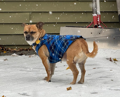
| Henry the Weather dog, a native of southern Texas and possibly Mexico, on Sunday experienced the first snowfall he's ever seen outside his home in St. Albans, Vermont. He was not particularly impressed, as the expression on his face indicates, |
Snow was falling across much of the state this morning. It's not amounting to much, but it's a reminder that winter is on our doorstep.
It's going to be a miserable Sunday, I must say. Hey, at least Saturday was OK, with a decent amount of sunshine in most of Vermont. So we got half an outdoor weekend.
Today, the snow and sleet will gradually change to rain in most places later this morning and this afternoon.
An exception is over in northern New York, where cold northeast winds will keep the precipitation today and tonight mostly snow, sleet and freezing rain. The ugly weather there has prompted a winter weather advisory.
Things won't be bad enough in Vermont to trigger any advisories, at least for today. We will see some snow, sleet and maybe spotty freezing rain around the Green Mountain State today, but it won't fall that heavily.
The ground is still warm, so most of the snow this morning was melting as it hit road pavement. Traffic cameras around the state early this morning showed dustings of snow on the grass and trees, but mostly just wet pavement. There were some slick spots, though, so slow it down if you're out there this morning.
Air temperatures were near the freezing point, so it won't take much of a warmup to ensure that roads, at least in low elevations stay pretty clear.
Spoiler: We won't see much of a warmup today. Highs will barely make it to 40 degrees. Most of the warming will be aloft, so even as temperatures stay cold near the surface, the warm air aloft will keep things in Vermont wet and not white this afternoon.
A sign of all this was already happening in Burlington early this morning. The city got their first trace of snow of the season at around 6 a.m. with a temperature of 34 degrees. By 7 p.m., it was down to 33 degrees but the light snow had switched to light rain.
There will probably be some back and forth with the rain, sleet and snow this morning before it settles on rain this afternoon.
MONDAY/TUESDAY
As colder air comes in behind the storm system tomorrow, rain should change to snow across most of the state. For most of us, it will be just light snow and snow showers. Roads could get slick toward the end of the day as temperatures go below freezing, especially after dark.
 |
| Late season spoilage in St. Albans, Vermont as snow fell on some leaves still stubbornly clinging to this tree, |
The snow showers will continue on Tuesday with gusty northwest winds and daytime temperatures barely above freezing for most of us - and below freezing in the higher elevations north.
Snowfall in the valleys will be modest. For instance, The National Weather Service is forecasting about a half inch of snow in St. Albans today, and then a storm total of 1.7 inches by Wednesday morning.
Most lower elevations in Vermont will only see an inch or less of snow by late Tuesday. Some areas north and mountains will see a few inches.
Rain and melted snow across the Green Mountain State today through early Wednesday should amount to about a half inch south and three quarters of an inch north. The bulk of the precipitation will come between now and Monday evening.
Luckily, we're not being introduced to winter by a full blown blizzard. We're being eased into it with light snow and a mix.
During the rest of the week we'll see more light rain and snow showers and an annoying overcast, but nothing scary.
After this storm, our next shot at potentially decent precipitation would come next Monday or so. It's way too soon to figure out how much, and whether it would be rain or snow or a mix.
No comments:
Post a Comment