Showing posts with label flood threat. Show all posts

Sunday, August 24, 2025

Burning Man Falls Victim To Extreme Weather, Again

A person at Burning Man Saturday during an intense
dust storm that wrecked encampments that were being
built. Photo via Facebook from Chris Pietsch.
 Burning Man, that big quirky festival that takes place every year on an (almost always dry desert   lake bed in Nevada, is once again having trouble with the weather. 

Which makes sense, when you put about 70,000 thousand people out in the middle of the northwestern Nevada desert during monsoon season. 

The event hadn't even gotten under way yet, but the weather has messed things up Saturday as crews were setting things up.  

The electronic dance and culture site EDM Identity, which is covering Burning Man, reports:

"According to sources on site, heavy gusts bent metal support poles on structures of theme camps like Pink Hear, BRC Snow Club, Disco Lips and the Black Rock City Municipal Airport. The Burning Man Project did not immediately respond to an email asking if anyone had been injured as a result of the windstorm, or if any camps will be forced to rethink what they offer to this year's attendees.

Many have reported that yurts have been completely destroyed by the windstorm. In some photos, large slabs of reflective foam used to build them can be seen in piles at the trash fence lining the perimeter of the event site."

The dust storms at Burning Man on Saturday were caused by outflow from thunderstorms that had developed over the Sierra Nevada mountains.  The storms dumped pretty much no rain on the site itself, so the problem was the blinding dust and winds that demonstrably were able to damage flimsy structures. 

The weather problems might not be over for Burning Man.  Heat and uncharacteristic humidity for the desert region could create more thunderstorms that threaten to produce flash flooding. Even a tenth of an inch of rain could turn the dry lakebed where Burning Man is held into a mud pit. 

A risk of flash floods in the region in and around the Burning Man continues at least through Wednesday. 

That's what happened in 2023, when an inch of rain fell during the festival in an area that only gets five to six inches of rain per year. The fine, dusty silt on the lake bed turned to deep mud, so nobody could drive out when the festival ended. 

The crowd had to wait a couple days until things dried out, and had to conserve food and water until exit paths were established. 

Also in 2023, climate protesters blocked the road leading to the event before it started, causing enormous traffic jams. While the demonstrators made everybody sit in idling vehicles and burn more fossil fuels, they did have a point: All this traveling to the desert isn't great for the environment or Earth's climate.

Though the event isn't exactly the main cause of the climate crisis. But as if to underscore the risk of a warming world. The 2022 edition of Burning Man really burned participates with record heat.  

Video:

The dust storm at Burning Man the day before it officially started. I dunno, this does NOT look like fun. Click on this link to view, or if you see image below, click on that.


Friday, July 11, 2025

For 3rd July 10 In A Row, Vermont Suffers Through Damaging Floods, More Trouble Ahead?

Thunderstorms developing near Lake Champlain 
caused falling rain and sunshine to mix in
interesting patterns, as seen from St. Albans, Vermont
Thursday. Though this storm was picturesque,
other storms elsewhere in Vermont caused a lot
of flood damage for the third July 10 in a row. 
 Yes, incredibly, as you might have already heard, for the third July 10 in a row, Vermont suffered through damaging flooding. 

The worst of the trouble this time was up in the Northeast Kingdom, with reports of water in homes, swift water rescue teams rushing a respond, roads closed, and four to five inches of rain in spots. 

Other flooding was reported in parts of Addison County. 

At least one swift water rescue was reported along Calendar Brook Road in Sutton.  They were there to "assist the residents of one  home cut off by floodwater," according to a Vermont Emergency Management statement, as VTDigger reported. 

Other rescue teams were staged around the state just in case. 

Barton and Orleans, and other Northeast Kingdoms communities have now suffered flood damage for the third July 10 in a row. That has to be incredibly disheartening. 

Damage reports from Thursday were a dime a dozen.  Sheffield Road was washed out in Sutton. School Street in West Burke was under water. Route 114 was closed due to a culvert washout in East Haven. Part of Route 58 in Orleans was washed out.

A number of local town roads in the Northeast Kingdom were either damaged or closed or both by washouts and flooding. 

Rainfall amounts in parts of the Northeast Kingdom were impressive to say the least. West Burke reported 5.07 inches, Sutton saw 4.92 inches. Down in Addison County, 4.32 inches fell in New Haven, where at least one road was closed by flooding. 

The storms this time were hit and miss. Parts of northwest and southern Vermont saw almost no rain. Burlington reported just 0.02 inches. Montpelier reported a tame 0.26 inches, which had to be a relief compared to the more than six inches of rain Montpelier endured on July 10-11, 2023, and the more than three inches they had last year. 

 If you want to find a weak silver lining from yesterday, I suppose the trend line is good. Thursday's floods weren't as widespread as last year's. And the floods of 2023 were even worse than in 2024. 

Almost all the damage from yesterday was in limited to the Northeast Kingdom and parts of Addison County. Last year's floods affected most of northern Vermont. The July, 2023 floods affected almost the entire state. 

So each July 10 is better, maybe?

That's cold comfort to anyone who suffered damage yesterday. It was especially distressing to have another July 10 in which the weather radio was crackling with an onslaught of flood and severe storm warnings. 

Still, another bright side was that some towns and cities that were hard hit in 2023 and 2024 like Barre, Montpelier and Johnson, reported little damage from Thursday's storms.  

Severe thunderstorms with powerful winds also roamed parts of the state Thursday. The roof of Middlbury High School was damage by powerful storm winds. Multiple trees crashed to the ground and blocked parts of Route 125 in Middlebury and Weybridge, along with Route 17 in Weybridge. 

Some tree damage was reported in Williamstown and Hyde Park

I don't know whether Thursday's damage qualified Vermont for federal disaster aid. Complicating the picture is the Trump administration is famously withholding disaster funds.  

The flood and storm reports from yesterday are still coming in, so I'll update as warranted throughout this. 

HEAT AND STORMS TO CONTINUE

Much like in the aftermath of the floods of July 2023, and 2024, Vermont is now settling into a weather pattern featuring hot, humid weather accompanied by some risk of additional damaging storms. 

NOAA's Weather Prediction Center, keeps Vermont (and many other parts of the nation) in a marginal risk for more flash flooding Saturday, Sunday and Monday. That's the least dire of four tiers of flood risk, meaning there's a chance of isolated flash floods.

On Saturday, there's only going to be scattered storms here and there, mostly just because the air mass will be warm and humid. At this point I think Saturday's the lowest risk day, and chances are good we'll get through the day with no trouble.

Forecasters are watching the period from Sunday evening into Monday. The air will be very humid, and a weather front will be approaching from the west. (Some are calling it a cold front, but there's nothing cold about it). 

We could see a few scattered instances of downpours heavy enough to cause some localized new flood issues.  Again, nothing widespread, but something to keep an eye on.

Behind this "cold front" on Monday, the air will stay very warm and humid, so that thing is going to be just a thunderstorm trigger and pretty much nothing else. 

A heat ridge will build in the eastern U.S. next week, ensuring Vermont will stay very warm and humid probably at least until the end of next week. 

Check out these forecast daily highs in Burlington Saturday, through Thursday: 87, 89, 85, 90, 92, 92. So yeah, icky,

Vermont will also be near the northern edge of that heat dome. Clusters of thunderstorms often ride along the northern edge of these things. We'll need to be on guard for the risk of perhaps some severe storms or local flash floods again most of next week. 

We don't know for sure about that. If we're lucky, everything will go by to our north. We'll have better forecasts once we get into next week. 

Thursday, June 26, 2025

Heat Is Gone From Vermont. Next, A New Flood Threat?

An early guess  from the National Weather Service as to
how much rain might fall between now and Sunday 
morning. Orange areas would receive two or  more
inches of rain. Note that this forecast will probably
change, perhaps by a lot, so for now take
it with a grain of salt.  
 The heat wave struggled to hang on in Vermont and the rest of New England Wednesday, but was overwhelmed by that cold front from Canada.  

It still got warm in northern Vermont, with highs reaching as high as 86 in Burlington. 

That's far better than the upper 90s of the previous few days, though. And the humidity really crashed. The dew point was an oppressive 70 degrees in Burlington at 7 a.m,. but was a refreshing 57 by 4 p.m. 

Southern and eastern Vermont held on to some of the heat for one more day, though at least it wasn't record breaking. 

Lebanon, New Hampshire, just across the river from White River Junction, reached 94 degrees. It was 92 degrees in Springfield, Vermont Wednesday. 

Today, the heat is suppressed way down south, broiling places like the Mid-Atlantic States and places like West Virginia, Ohio, Indiana and Illinois.

But this "heat dome" isn't done with us. 

No, it's not going to see record heat again up here in Vermont from this thing again. But the heat dome is going to try to push north again. It might not really make it back into the Green Mountain State again. But it'll work in concert with the usual weather disturbances that ride along the northern edge of these things to give Vermont - sigh - a potential flash flood threat.

It's not as if Vermont needs another flood after what we've been through in recent years. But here we go again. Maybe.  The good news is that so far, even if Vermont sees any flooding Saturday, it shouldn't be catastrophic like we saw in the Julys of 2023 and 2024.

We might not end up having any trouble at all.   But the potential is there.  

FLOOD RISK EXPLAINED

 Leading up to the heavier rain that might come in later Friday and Saturday, it look like the weather will get increasingly unsettled, just little hints of what might - or might not be to come. (I'll explain why I'm hedging here in just a bit).

Dying disturbances coming in from the west should cloud us up by this afternoon and spread light showers across much of Vermont. Nothing dangerous here. Just enough to wet the ground a bit.

We'll still be at risk of lighter showers tonight and most of Friday. 

The potential trouble starts Friday night into Saturday.  

As that "heat dome" pushes north a little bit, it''sl shove a warm front toward Vermont. That will vastly increase atmospheric moisture over us. It will also enhance upper level winds over southern Quebec, which tend to add lift to the atmosphere, which encourages heavy rain. 

The contrast between the cooler air to the north and hot, humid air to the south will also sharpen up. All these factors would create what will be a relatively narrow west to east streak of occasionally torrential rains somewhere.  Most like either in southern Quebec and/or across northern New York, northern Vermont and northern New Hampshire.

As of this morning, meteorologists seemed pretty confident about the overall weather setup Friday night and Saturday, but less sure about the precise location of the heavy rain.

Maybe it will stay in southern Quebec, sparing us in Vermont any trouble. Or, it could really hit areas north of Route 2, setting up a potential risk of flash flooding.

Since we Vermonters all have flood PTSD, I'll note again that even if the heaviest rain hits Vermont - fingers majorly crossed - it doesn't look like it would be a catastrophic flood. But still potentially troublesome. And of course all the meteorologists and experts will keep a close eye on this so we don't get any surprises. 

Early guesses are the steep terrain of the northern Green Mountains is the most likely problem spot. Especially up near Jay Peak and surrounding communities.  If torrential rain develops, runoff would cascade down those steep slopes, causing those risky flash floods.

The first rainfall estimates I've seen suggest up to four inches up near Jay Peak, and between two and 2.5 inches in the northern Champlain Valley and Northeast Kingdom, with locally higher amounts.

The far northern Adirondacks and far northern New Hampshire are also at risk of flooding, as noted by NOAA's Weather Prediction Center. 

Take that with a grain of salt for now. Depending on how this sets up, actual amounts could be much less, or a little more than forecasts are now suggesting. Again, it all depends on where that band of heaviest rain would set up. 

The National Weather Service is toying with the idea of maybe issuing a flood watch for northern Vermont. As of this morning, they were holding off for now because the rainfall forecast is still so questionable. 

I'm pretty relaxed central and southern Vermont.  I suppose there could be a surprise, but all signs point to rain south of Route 2, but nothing scary.   

Those rains should start to taper off later Saturday. It looks like it might turn briefly pretty warm and humid toward the beginning of next week, but it won't be anything as torrid as we had a few days ago. 

More showers and storms also seem likely Monday night and Tuesday, but it's too soon to tell how widespread those might be.  

Wednesday, March 12, 2025

Tuesday Vermont Early Season "Heat Wave" Over-Performed, After Quick Cold Shot, Spring Warmth And A Flood Threat Menaces

After a sunny day Tuesday with record warmth, an
approaching cold front brought some menacing
looking clouds, but no rain late in the 
day over St. Albans, Vermont. Those clouds 
only cluttered the sky briefly. 
That was certainly a nice flash of spring in Vermont Tuesday, wasn't it?

Many towns saw highs in the low to even mid 60s, so the one-day heat wave over-performed. High temperatures exceeded what had been forecast. 

Burlington reached 66 degrees, for a new record high for the date. The old record was 64 degrees set in 2021. Tuesday was the warmest day since November 6, 2024.

High temperatures in some other towns included 68 degrees in Bennington and Plattsburgh, New York. Plattsburgh's high was also a record for the date.  Rutland reached 65 degrees. Both Montpelier and St. Johnsbury managed 61 degrees.

Temperatures can occasionally get into the 60s even in January, but that's relatively rare. According to the National Weather Service office in South Burlington, Tuesday's readings in the 60s came a little early than normal

According to the National Weather Service office in South Burlington, the average date for the first 60 of the season is March 27, but the first 60 has occurred as early as January 4, 1950 and as late as April 30, 1972. (Don't get me started about the spring of 1972, the coldest, most awful wintry spring in memory). 

Tuesday's was a windy warmth, as gusts reached as high as 46 mph in Burlington.

Here's a bonus. Though a lot of snow melted, Tuesday's little heat wave was too brief to make us worry about flooding. Sure, a few small creeks got a little rambunctious, but I have no reports of flooding or anything close to it as of this morning.

Now that it's briefly cold again, the runoff from yesterday's snow melt has tapered off, too.

That, however does not mean we're out of trouble. A flood threat is looming in Vermont for this coming weekend and early next week, especially Sunday and Monday.   More on that in a bit. 

TODAY

Back to winter, for one day. It still looks like much of northern Vermont will never make it above freezing today. Some clouds will increase, and there might be a couple snowflakes in the mountains of central and southern Vermont. No biggie, though. 

THURSDAY/FRIDAY

A warm up starts again. Southerly winds and at least some sunshine will boost temperatures well into the 40s.  A few low 50s might pop up in the warmest valleys. Friday should get well into the 50s in many Vermont towns. 

The sun setting on Tuesday over St. Albans, Vermont
on a day that brought record highs in the 60s.

Then the heat and the trouble really start after that. 

First off, it turns out last week's thaw and ice jams did cause some damage in Vermont. The Crossett Brook Middle School in Duxbury, Vermont suffered flooding and was forced to close for several days. The nearby Crossest Brook developed an ice jam that diverted water toward electrical vaults in back of the school.

The vaults were damaged enough to divert some of the water behind the ice jam into the school. Several classrooms and offices were flooded by several inches of water, WCAX reported. 

This is the second time in eight months the school was flooded.  The school was damaged when the Crossett Brook flooded during our disastrous flood of July 10-11, 2024.

Which leads me to the next flood threat.  New damage last week to the school was caused in part by an unstable river bank and damage left from the last summer's event. 

THE WEEKEND

It's going to turn very warm this weekend. By Sunday, temperatures will be well into the 60s. Possibly 70 if any place gets a little sunshine. 

These would normally be record high temperatures, but Sunday's weather comes on the anniversary of a bonkers March heat wave in 1990 that brought Vermont temperatures into the upper 70s. 

Unlike the 1990 hot spell, which hit with little snow on the ground and was not accompanied by rain, there's a flood threat for sure this weekend. 

Yesterday's brief hot spell came amid very dry air. Snow does not melt as rapidly. in dry air even if it's super warm,  like it was on Tuesday. 

Snow does melt faster when it's humid. Dew points, a measure of how humid it feels, could go all the way into the 50s by Sunday.  That's awfully high for March. Additionally, nights this weekend will stay well above freezing too, so we won't have any slow downs in the rate of melting.

On top of all that, early guesses bring a half inch to as much as an inch of rain to Vermont Sunday and Sunday night. 

The combination of snow melt and rain could end up being the equivalent of a few to several inches of rain falling on the Green Mountain State.

FLOOD PREP

We don't yet know how bad the flooding will get and which river basins will have it the worst. But I do believe at least some flooding is inevitable. Hard to say if it will be just minor or worse than that. I'd plan on something worse than nuisance flooding, just to be on the safe side with this one. 

The National Weather Service in South Burlington is recommending that people in flood prone areas start working on their flood plans now if not sooner. 

For instance, if your home or business has a lot of stuff stored in the basement and the basement floods when the rivers get high, start moving things out now. (I'm looking at you, cities like Montpelier and Barre).

Rivers could rise rapidly, especially if an ice jam forms. There's still a lot of ice on some sections of Vermont rivers, and there's even a few pre-existing ice jams that could get worse during the thaw.

That means you'll need to be ready to flee really quickly. if the water starts coming up quickly.  Get your to go bags together this week in case bad things happen Sunday. And if bad things don't end up happening, well, you had a good practice run for future events.

Watch this space for updates through the rest of the week and the weekend for any flood threat updates in Vermont.  

Wednesday, March 5, 2025

Rainy, Mild March Vermont Day To Set Off A Bit Of A Flood Threat

Footprints and paw prints in last evening's snow, now
turned to melting slush as today's rainy thaw began
moving into the St. Albans, Vermont area this morning. 
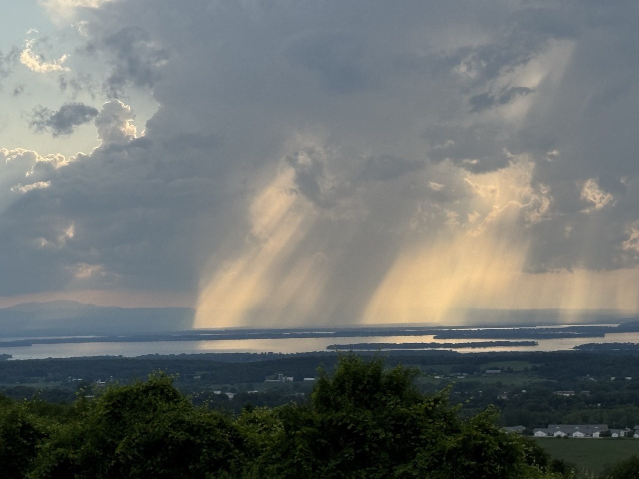
 Welcome to the first truly rainy, mild day of spring, 2025 in Vermont. 

It will indeed rain most of the day statewide, and temperatures in many areas will warm to levels not seen since late December. 

Yes, rain and warm temperatures equals snow melt and a risk of flooding and ice jams. 

However, the conditions of the snow cover before the rains started, and the middling amount of rain in the forecast means this time around, flooding shouldn't be very extensive. 

 Ice jams are possible, of course but unless one forms in a very, very bad spot near a village or town along a river, we should be largely OK.

Knock on wood, there should only be a few scattered ice jams. Take it seriously though. f there is any kind of high water or jammed up ice, it's most likely tonight or tomorrow. 

Also, as we always know in early March, winter is NOT over so of course we'll need to deal with some of those issues coming up.

OK, the big picture is out of the way, let's get into the details:

TODAY

After a burst of snow and a little rain in northern Vermont last evening, things got quiet and warm-ish overnight. It was in the 30s to low 40s and western Vermont as of 6 a.m. but still a little below freezing east of the Green Mountains. 

Meanwhile, rain was moving in from the southwest, and should get through most of the Green Mountain State by mid to late morning. 

Sprinkles of rain have already made it into Vermont as of 7 a.m. but the main bands of it were still just approaching southwest parts of the state. 

There might briefly be a few patches of freezing rain at the start where it's cold in eastern Vermont, but that should resolve itself pretty quickly. The National Weather Service in South Burlington has issued a special weather statement that warns of potential black ice, especially on bridges, overpasses and around curves through this morning's rush hour in central and eastern Vermont. 

There's even a couple of pockets of cold air left in parts of Rutland County, so it could get slick there, too, for a little while this morning. 

The bulk of the rain should come through during the day today and the first half of tonight. Rainfall amounts might be as little as a quarter inch in the far northern Champlain Valley to up to an inch in southern Vermont. 

If there were no snow and ice to melt, that amount of rain we expect is absolutely no big deal. Just a routine amount for any storm system. 

But there is snow and ice to melt. Plenty of it in some areas. Obviously, only some of it will melt in this episode. And especially in high elevations and in eastern Vermont it might take awhile for it to start melting. 

Meteorologists say the snow has to "ripen" first. That means the temperature of the snow cover has to rise enough so that it starts spewing water from melting.  By the time the snowpack "ripens" in areas with deeper snow especially, the bulk of the rain will be over. 

It will stay warm overnight. In fact, high temperatures today in the mid and upper 40s to near 50 probably won't be reached until we get toward evening. Readings will stay at those levels overnight and into Thursday morning. 

The air will have an oddly humid, springlike feel to it, too. Humid air melts snow much more effectively than dry air, so even after most of the rain is over, the snow in many areas will be melting pretty rapidly. 

FLOOD/JAM POTENTIAL

If we have any flooding or ice jams at all in this episode, they are most likely to  happen overnight and through Thursday. 

There is a lot of water in the snow pack. The National Weather Service estimates the amount of water coming out of the snow through melting tonight and Thursday would be the equivalent of 1.5 to two inches of rain in parts of central and southern Vermont. 

That might well be enough to make river levels rise enough to break up the thick ice covering parts of those rivers. The ice starts to flow downstream, hits an obstruction, so the ice just backs up behind that obstruction and voila! You have an ice jam.

These things form quickly, so if you live in a flood-prone area, keep an eye on the river ice and be prepared to skedaddle if you see water backing up behind an ice jam.  You won't have all that much time to deal with it. 

Again, this won't be a widespread problem. But where any of those few ice jams form, it could be locally a very, very big problem. Any river from about the Winooski south in Vermont is at some risk of an ice jam or two. 

Even without ice jams, some rivers, like the Otter Creek, Mad River and Winooski, might get pretty high, and could peak just a little under minor flood stage during and just after this thaw.

In northern Vermont, where it will take longer for the snow to "ripen" only about the equivalent of an inch of rain will ooze out of those big snowbanks through melting. That reduces the chances of ice jams in northern Vermont. 

COLD RETURNS

It's only early March, so the cold will return, though not to the subzero levels we saw Monday morning.

The storm's cold front will come through Thursday afternoon with little precipitation but falling temperatures. Early afternoon will be balmy, and by the time the sun sets, you'll be starting to notice a  chill in the air. 

You'll need to watch it a bit Friday morning. By then, everything will have frozen back up again. Including any standing water left on untreated roads. Light snow showers will add to the back-to-winter scenario.

Snowfall won't amount to much. Most of us will see less than an inch, though the central and northern Green Mountains might pick up one to as much as four inches of new snow between Thursday afternoon and Saturday morning. 

Friday itself will be blustery and cold with temperatures staying at or below freezing. It should stay below freezing all weekend, including during the days. Though banana belt towns in low elevation southern Vermont could poke into the mid 30s both Saturday and Sunday. 

Early guesses are the next week or so should be fairly mellow, with frequent chances of a little snow or even rain later in the week, but nothing heavy.  

Next week will be a bit changeable and unpredictable too. As is typical in March, Vermont will be right near the springtime battleground between mild air to the south and still-wintry air encompassing most of Canada. 

Wednesday, August 7, 2024

Wednesday Evening Vermont Debby/Flood Outlook. Still Reasons To Worry

This afternoon's forecast track for what will then be
former Tropical Storm Debby has it centered right
over Burlington, Vermont at 2 am. Saturday. 
 The forecast trends on how Vermont fares with possible flooding from Tropical Storm Debby's anticipated remnants remain roughly the same. 

There's still plenty of cause for worry, and a few reasons for a bit of cautious optimism in some parts of the state. 

Maybe. 

CHAMBER OF COMMERCE APPROVED

Before we get into that, we should revel in what has been a rare for this summer Chamber of Commerce day we had in Vermont today. 

It was beautifully sunny, of course, with a scattering of fluffy clouds to make it all pretty. The sky was true blue, lacking the wildfire smoke that has been hazing up the atmosphere lately. Temperatures were totally comfortable, with highs in the 70s to around 80 in the warmest spots

Humidity was at rock bottom. If the dew point is in the 50s, that's regarding as comfortable. Dew points this afternoon across Vermont were in the  40s to near 50. Just delightful. 

Tonight will be clear and comfortable. Throw open those windows and let the fresh, cool air reinvigorate you and the air in your house. 

VERMONT DEBBY UPDATES

Now back to our regular Summer of '24 doom and gloom 

That westward trend in the forecasts for the expected path of Debby has stopped, and it is still forecast to go right over Vermont.  (Results may vary, it can still go a little west or a little east of us).

For what it's worth, the latest forecast from the National Hurricane Center puts what will then be former Tropical Storm Debby right smack dab over Burlington, Vermont at 2 a.m. Saturday.

This would still mean the heaviest rain might end up falling up in northwest Vermont and New York. That's not cast in stone, however. We still need to worry about possible flooding in many other parts of the Green Mountain State. 

Tropical Storm Debby, just off the coast of South
Carolina when this satellite photo was taken late
Wednesday afternoon, looks kind of 
disheveled, which is good if you don't want
a powerhouse tropical system menacing the East Coast.

The National Weather Service in South Burlington is holding off just a little while longer while meteorologists there await the latest guidance on whether and where to post flood watches. 

I would rate the chances of seeing a flood watch in at least parts of Vermont appear by tomorrow morning.

With Debby going overhead or just to our west, you'll notice the high humidity surge back in tomorrow night as the first wave of rain arrives. 

 The rain Thursday night will mostly serve to wet everything down pretty good. That's what will help set the stage for the flood potential. 

The westward path might allow breaks in the clouds to form during the day Friday. 

That could well only encourage more torrential thunderstorms to eventually break out, adding to a potential flash flood threat. Thunderstorms near tropical systems often have incredible rainfall rates. 

Often four inches per hour. Luckily none of those torrential storms will last anywhere close to an hour in any one place. But they'll still carry flash flood risks. Especially if a couple or few hit the same spot.

Friday will be a humid, unsettled, tropical day to say the least. 

A tropical storm or former tropical storm passing to the west of Vermont can create some gusty south or southeast winds, much like a winter storm passing to our west can cause those damaging downslope winds. 

I don't expect anything super damaging out of this, as Debby isn't - and won't be - and especially powerful system. But with wet ground, some trees could be prone to uprooting in gusty winds. Nothing widespread, and not nearly as big a threat as the possible floods, but it's something to keep in mind. 

Also - and this isn't in any official forecasts I've seen - the east side of tropical and former tropical systems, once they're inland, can produce tornadoes.  It will be interesting if we get the right conditions for a quick spinup with Debby.  I'll wait for further forecasts to see if that low but non-zero risk indeed develops. 

The heaviest rain looks to come through Friday night, so at this point I'd say the period from late Friday afternoon through Saturday morning is the most likely time to see flooding if we get it. 

Current forecasts give most of Vermont at least one to three inches of rain out of this, with locally higher amounts. 

If the predictions for somewhat lighter rain in eastern Vermont pan out, that's good for two reasons. The first is the soils in the Northeast Kingdom are sopping wet, and a couple sunny days before the storm won't cure that.  

So if less rain falls, that might minimize the flood risk. Again, maybe. IF the heaviest rain stays west. For what it's worth, some models I've seen show a slug or band of very heavy rain moving through north central and northeast Vermont overnight Friday and early Saturday, so those areas are NOT out of the woods yet. 

Another reason to hope the heaviest rain stays west would be to prevent torrents from falling in the headwaters of the Winooski, Lamoille and Mad Rivers.  It would lessen the chance of those waterways going over their banks again 

VAGUE OPTIMISM

My guard is still way up with this storm. I still definitely worry Debby could cause another huge mess in Vermont. But that scenario is still not guaranteed,. If there's no guarantee, there's a little hope 

One reason for a tiny smidge of optimism is Tropical Storm Debby, just off the South Carolina coast late this afternoon, is less organized than some forecasts indicated. So its remnants might be a bit less intense than they otherwise would be.

Debby's remnants will race through here much faster than forecasts were indicating a couple days ago. That gives it less time to dump bucket loads of rain on us.,

The system is now expected to move so fast that we have a shot at a Saturday with fairly decent weather. 

As for whether Vermont suffers big time again, or manages to dodge another bullet, we really won't know until this hits. 

Wednesday, August 18, 2021

Remains Of Fred Could Flood Northeast U.S. Including Parts Of Vermont

Flash flooding is a good bet in the red area of the 
map today.  Yellow areas have a slight risk, and
green areas a marginal risk. Note the slight 
risk edging into Vermont. That flood risk
will continue well into tomorrow in 
southern parts of the Green Mountain State
UPDATE: Flash flood watch in Vermont for because of Ex-Fred has been extended north to roughly a Ferrisburgh -Montpelier - Wells River line.

It looks like pretty heavy rain will fall as far north as Route 2, so that raises the flood risk.,  One to three inches of rain is forecast in the newly extended flash flood watch area.

The watch is in effect Thursday morning to Friday morning. 

I'm a little bit extra worried about Addison County,  northern Rutland County and Orange County.  A band of heavy rain has been moving through that area all morning.

There could even be some minor flooding in this zone through early afternoon when the rain band is expected to weaken

That band has really super saturated the ground there, priming the pump for some potential flash flooding there from Ex-Fred tomorrow..  We'll keep an eye on it.   

PREVIOUS DISCUSSION

The remains of Tropical Storm Fred, as expected, caused a lot of problems as it rolled northeastward through the southern Appalachian chain on Tuesday.  

This storm will continue to cause flooding issues Do note southern Vermont is once again in the flood risk zone because of ex-Fred.

There were no fewer than 13 tornadoes in the Carolinas and Georgia spun up by Fred on Tuesday.   Flash flooding struck the mountain  near the North Carolina/Tennessee border.  

Though details were still sketchy as of this Wednesday morning, there are reports of homes either swept away or damaged by extensive flooding in this area. 

The center of what was Fred was over West Virginia early this morning, and flash flooding was rushing down the steep slopes of West Virginia's mountains this morning. 

The remains of Fred will continue to bring tons of tropical moisture and dump it as torrential downpours today in Pennsylvania and southwestern and central New York. There's even the risk of a few more spin up tornadoes in Pennsylvania and Maryland today, we'll see. 

Today, that Fred-related wet air will focus on Pennsylvania and New York today, where plenty of flash flooding is expected today on already sodden ground.  Then move into southern and central New England tonight, which brings us to what's going to happen in Vermont

VERMONT IMPACTS

Humid air out ahead of Former Fred flooded into Vermont Tuesday causing lots of showers to break out, but none of them were particularly heavy.  

A torrential rain band that caused flash flooding in western New York was continuing to feed into central Vermont this morning in a weaker fashion.  There's no flooding there today, but rainfall has been heavier in that zone.  I'm sure a few spots halfway between Route 4 and Route 2 picked up a half inch or more of rain. There's probably been an inch of rain in a few spots in western Addison County.

The showery state of affairs is continuing this morning, though the showers might temporarily wane somewhat by this afternoon.  Then we start to deal with Ex-Fred.

Forecasting the evolution of former tropical storms that are well inland can be tricky, as a small shift in the expected path could make a big difference. 

But at this point it looks like Ex-Fred will move through central New England late tonight and Thursday, possibly as far north as the southern borders of Vermont and New Hampshire. 

This would spread heavier rain through the southern half of Vermont, and maybe up the Connecticut River Valley toward St. Johnsbury as well. 

Current forecasts call for more than two inches of rain in southern Vermont.  Perhaps much more if things line up correctly.  That would set this part of Vermont up for the third flash flood of the summer. Bennington and Windham counties are already under flash flood watches, given the possibility of up to four inches of rain there. 

Soils down there are still awfully wet, so it wouldn't take all that much precipitation to set off some flooding. 

The amount of rain from Ex-Fred would diminish quite a bit as soon as you get north of Route 2.  That's the current prog, anyway.  Best guess is an inch or a little more of rain south of a Burlington to Newport line.  The far northwest corner of Vermont would see a half inch or even less.

There's always the chance that the heavier rain could work itself further north, which would actually be OK.  Far northern Vermont could still use more rain, though drought conditions have eased a little there. 

This will already be the second time this year that a former tropical system affected Vermont.  Former Hurricane Elsa dumped heavy rain on southeast Vermont in early July, causing some spotty flooding.

There is a low, but not-zero possibility another tropical system might affect Vermont in the near future.  Tropical Storm Henri.  It's buzzing around Bermuda and expected to become a hurricane.  Forecasts have been calling for Henri to turn toward the northeast eventually and pass safely off the New England coast.

However, some forecasts build a ridge of high pressure over southeastern Canada, and that would steer Henri closer to the New England coast. That's still really iffy, so we'll just need to keep an eye on it. 


Thursday, December 24, 2020

Dangerous Eastern United States Storm Hits Today, Vermont Included

Almost any dangerous weather you can imagine is going on with this storm moving into the eastern United States.  
Just one ominous sign of the storm approaching us.
Forecast calls for major flooding along the Otter 
Creek in Rutland County, Vermont. Widespread,
damaging floods are likely today and/or
tomorrow from Pennsylvania to Maine. 

This isn't just minor inconvenience stuff. Some areas are in for some serious, maybe life-threatening floods.  Tornadoes threaten North Carolina. Damaging winds will roar from the Carolinas to Maine. 

It started with a full blown blizzard with zero visibility and winds gusting to more than 60 MPH in the northern Plains yesterday. 

Today and tomorrow bring heavy snow, dangerous floods, damaging winds and even tornadoes, depending upon on where  you are. 

As usual with these large storms, I'll get into the big picture first, and tell you what us Vermonters are in for.

That opening storm salvo, the blizzard in the Dakotas and Minnesota, left a trail of highway pileups ad closed roads.  It was so bad that plows and police wouldn't go out onto the roads. Too dangerous.

The storm center that caused the blizzard has moved into Canada, but the storm's strong cold front extends all the way down to the Gulf Coast. A new storm is forming on that front. This is what will cause the chaos today and tomorrow in the eastern United States. 

This frontal system is developing something of what is called a negative tilt. Most cold fronts are aligned northeast to southwest or directly north to south.  This one is becoming aligned northwest to southeast.

That's a sign of a strong system, and one that's able to bring a boatload of subtropical moisture northward. That flow of moisture is being aided and abetted by strong winds aloft, bringing all this weather north. 

With that negative tilt, the cold front will go through Florida and the Carolinas before it gets to New England. 

The strong, veering winds aloft has eastern North Carolina at risk for tornadoes today. The storm already has a history of producing a few tornadoes in Mississippi. With even stronger dynamics, this system is almost guaranteed to produce at least a couple spinups. 

The orientation of this cold front will help massive amounts of moisture come inland over the Mid-Atlantic States and New England.  That means heavy rain. 

Unfortunately, the heaviest rain will fall precisely where the heaviest snow fell last week. This goes from central Pennsylvania, central New York, southern and central New England and on up into New Hampshire and Maine.

This rain will be accompanied by very warm, humid air, especially for this time of year. Snow melts most rapidly in humid air. So it will go fast.  One to three inches of "rain" will come from the snowmelt, combined with one to four inches of rain from the sky. 

This sets the region I mentioned just above for a serious flood threat.  This won't be just nuisance flooding.  It could get quite serious in some of these areas. 

High winds are also a problem, especially in southern New England, parts of New Hampshire and Maine, and the high elevations throughout the Northeast. 

Incredible winds will be howling just off the surface, roughly 5,000 feet above the surface.  Peak gusts on summits like Mount Washington in New Hampshire, Mount Mansfield in Vermont and Mount Marcy in New York are likely to exceed 100 mph. 

There won't be anything that strong in lower elevations where people actually live, but damaging winds gusts are still a possibility. 

All in all, between the tornadoes, floods and winds, it seems like some sad Christmas tragedies are inevitable.  Totally on brand for the year 2020

VERMONT IMPACTS

Southern Vermont is within the larger target zone from serious flooding with this storm.  The snow pack there is deep.  This part of Vermont will also get the most rain from this storm, likely 1.5 to 2 inches, with locally higher amounts. 

That very warm, humid air I mentioned will also envelope all of the state tonight and the first part of Christmas Day. While it rains. Hard. 

I'm definitely concerned that in southern Vermont, at least, this won't be just another, "Oh, look, there's some water in Farmer Smith's field again."

If you're in a flood prone area, especially from Route 4 south, keep an eye out. Small streams and brooks will be first to go nuts later on tonight.  There's definitely a risk of culverts failing, back roads washing out and water collecting rapidly in basements.  

It seems that Vermont has become more flood prone in recent decades. The most recent serious flood we had was on October 31-November 1, 2019.  I think the upcoming flood will be nearly as bad as that, but will hit an entirely different part of the state. The Halloween storm hit northern Vermont. This one will focus on southern Vermont. 

It's very hard to see flooding when driving when it's dark out, so be very careful, or better yet, don't venture out at all tonight and tomorrow. We're supposed to say home because of Covid anyway. 

I think there will also be a lot of street flooding in towns.  Many roads in flood plains will go under water.  Whatever you do, don't drive into flood waters. That's always a very dangerous move. It's especially true now, when the water will be frigid and nail you with hypothermia almost instantly. 

The flood warnings, initially only in effect for far southern Vermont, have been extended north to about Route 2.  There's less snow further north, but there's enough to melt, combined with the heavy rains, to trigger flooding. 

As Christmas Day wears on the flooding small streams and brooks will feed into the larger rivers.  At this point, Otter Creek in Center Rutland is expected to go into major flood stage, at 13.1 feet. Flood stage is 8 feet.  The expected crest would be the highest since the record highs of Tropical Storm Irene in 2011.

The Walloomsac River in Bennington County is also expected to go into major flood stage, while numerous other rivers in Vermont will probably hit at least moderate flood stage. 

Strong winds are a secondary threat with this storm in Vermont.  It won't be as bad as in southern and coastal New England, but we could seem some gusts as high as 50 mph mix down to the surface from those screaming winds aloft. Scattered power outages are a threat.

Ahead of the cold front in the rain Christmas morning, it will be strangely balmy and, as I said, humid. Lots of us will be in the upper 50s, which is getting close to record highs.  After the cold front passes in the afternoon, the rain will mercifully shut off as temperatures fall through the 40s and 30s. 

The storm will be over by then, and we'll be left once again, fixing damaged roads, culverts, bridges and likely some homes and businesses. 

Not a good forecast, for sure.  It's worth repeating: Totally on brand for 2020.