Showing posts with label New Mexico. Show all posts

Sunday, January 4, 2026

Odd Winter Heat Raising Winter Fire Dangers In Texas, Colorado, Elsewhere

Flames in the Sabine National Forest in eastern Texas.
Numerous wildfires have broken out in eastern Texas
because of oddly dry, warm winter weather. 
Since it's been oddly warm and dry in the southern United States so far this winter, out of season wildfires are breaking out in places from Louisiana to Colorado. 

There's already been a few high fire danger days in Colorado in December. This afternoon, parts of Colorado, along with areas of New Mexico, are seeing a high fire danger due to strong winds, low humidity and drought. 

The fire danger is expected to spread and intensify tomorrow. The Texas panhandle is the highest risk area on Monday. Nearby sections of southeast Colorado, eastern New Mexico and Oklahoma are at risk, too. 

Eastern Texas and parts of Louisiana are also dealing with fires after a winter so far of light precipitation and record high temperatures. 

In just one Texas County, one fire department got 50 calls for outdoor blazes. More calls came in the next day. This despite the fact that many East Texas and western Louisiana counties and parishes are under burn bans. 

East Texas saw about 70 wildfires in the week leading up to New Years Eve.

Wildfires also swept through areas of Oklahoma in December. Fires got so dangerous in Kansas last month that the governor declared a state of emergency. 

It's been dry in Florida, as well. It's usually driest in Florida in April and May, and the state does occasionally get spring wildfires. But so far winter has been pretty arid in the sunshine state, raising fears of winter fires, and ever-more ferocious wildfires in the spring. 

Things could get worse across Texas in the coming days. Dry, warm, windy weather is due most of this week. Some rain might finally arrive in New Mexico and west Texas around Thursday. Record high temperatures and dry weather are expected until Friday, when a little rain might sneak into eastern Texas and Louisiana.  

But that rain doesn't look like much, and it'll stay dry and relatively warm for winter. Up in eastern Colorado and Wyoming, there might be a bit of precipitation late this week, but they'll also revert to dry, warm weather by the weekend. 

Ominously, snow cover in the Colorado Rockies is far below normal, which could set the stage for widespread wildfires this summer. 

CLIMATE CHANGE INFLUENCE 

Winter wildfires have really become more of a thing in recent years. Climate change has brought warmer winter weather. That has allowed some areas of the nation to dry out more. 

Last January brought us the catastrophic Los Angeles area wildfires that caused 30 direct deaths and possibly as many as 440 indirect fatalities

So far this winter, California is relatively safe from wildfires due to some storms that blew through in November and December. 

Another devastating winter wildfire hit the area around Boulder, Colorado toward the end of December, 2001, destroying about 1,000 homes. 

There's essentially no longer a "fire season." With the help of climate change, fire season in the United States starts on January 1 and goes through December 31. 


Saturday, July 12, 2025

U.S. Summer Of Flash Flood Roars On, Flash Flood "Emergencies" Soar; Vermont On Guard For More Potential Trouble

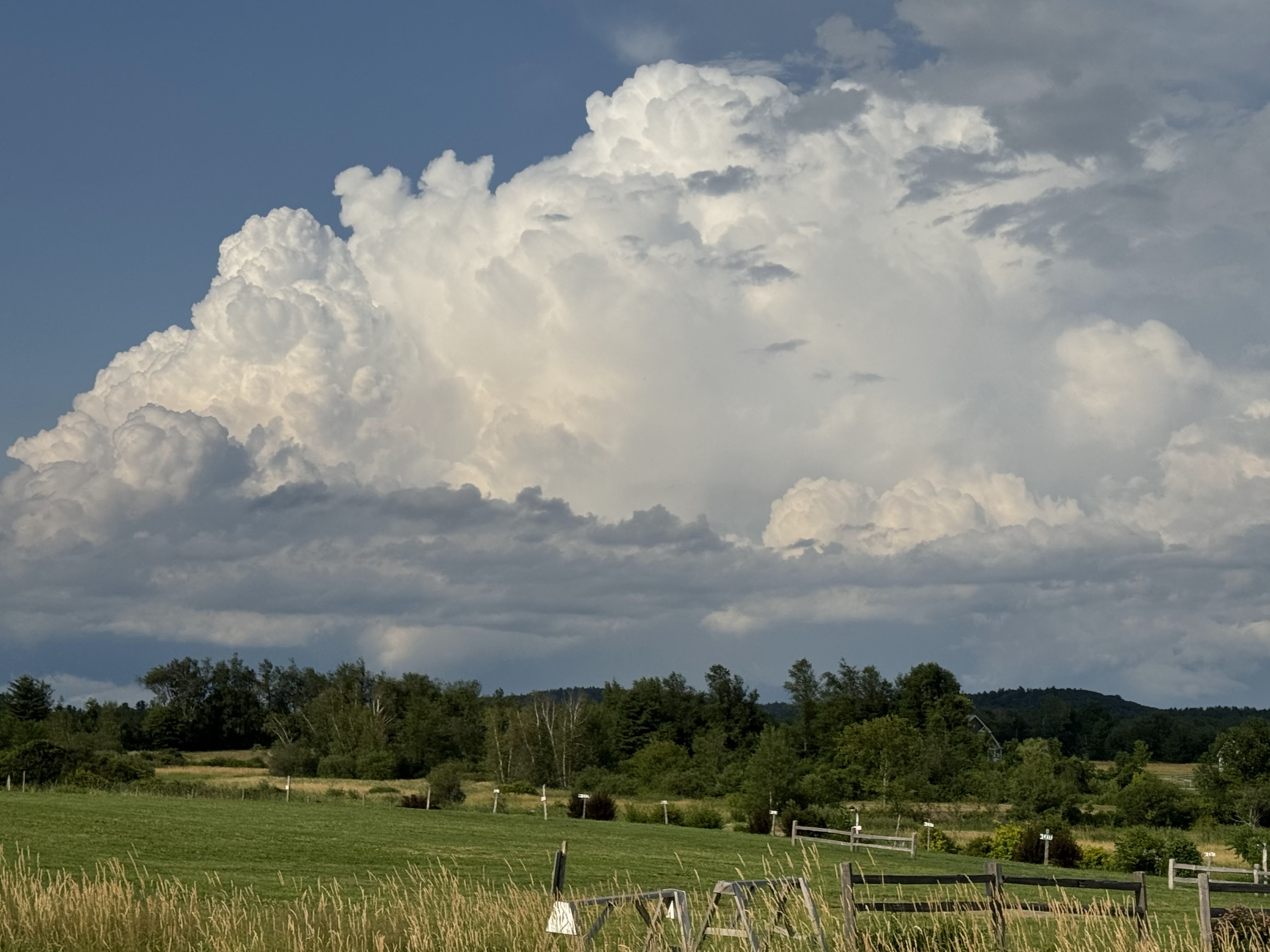
A large severe-warned storm erupts over the northern
Green Mountains on Thursday. If this type of storm
moves slowly enough, flash floods can develop.
There is a minimal risk of flash floods today
and some risk Sunday night and Monday in Vermont. 
Weather alerts that are worded as as "flash flood emergencies" are rare, accounting for maybe one percent of all flash flood warnings. 

All flash floods are dangerous, but when you hear "flash flood emergency" you know you are in deep trouble - and probably deep water. 

When the National Weather Service issues a flash flood emergency, it's a dire warning telling the public that a catastrophic flood with an extreme threat to life and property is either ongoing or about to happen any minute. 

As extreme rains ramp up, in large part due to climate change, those flash flood emergencies are increasing. There were at least 91 such emergencies in 2024, a record high. 

Vermont is not immune from these emergencies. One was declare in the Northeast Kingdom during the July 30, 2024 floods up there. Emergencies were declared in Vermont in the July, 2023 floods as well. No flash flood emergencies were declared in the Northeast Kingdom flash flooding we had this week. 

We don't have figures for this year, but flash flood emergencies have been declared incredibly frequently in recent weeks. Such an emergency was declared in central Texas for the extreme and deadly July 4 weekend floods there. Another flash flood emergency was declared in Ruidoso, New Mexico on Tuesday as walls of water rushed down from wildfire burn scars above town. 

Just yesterday, another flash flood emergency was declared in and around Davenport, Iowa as intense rains flooded streets, homes and businesses there. 

Expect more of this. A humid air mass has enveloped most of the eastern half to two thirds of the United States. Dew points are practically off the charts in some spots. Any little weather disturbance can touch off a big local flood, especially since there's no large scale storms or fronts to move things along. Things are just sitting there. 

Today, huge parts of Texas, New Mexico and Oklahoma are especially prone to flash flooding. In some places in that broad area, significant, big flash floods are possible today. 

VERMONT RISK

Here in Vermont, we're relatively safe, but definitely not off the hook. With high humidity in place and not much wind to move the inevitable thunderstorms around, there's always the risk of a local flood problem. 

This is going to seem like a broken record until the very humid weather pattern breaks down. We've had hotter, more humid summers lately, and that increases the flash flood risk.

You'll probably get sick of me telling you almost daily about a low but real flash flood risk. But it's unavoidable. And of course, we have to stay on our toes with these things. We'll just keep up with the details each day as forecasts develop,

Today

There's a very low but not zero chance of a local problem today, especially in southern Vermont, where thunderstorms might be a little more numerous this afternoon and evening than in the north.  All of Vermont is under a marginal risk for flash floods today, the lowest of four alert levels. 

There's already been a couple isolated storms here and there early today. A flood advisory was in effect early in the day for the northwest corner of New Hampshire near the Vermont border because of overnight storms. A complex of storms, which seemed to be weakening as of 7 a.m. was approach southwest Vermont from New York State. 

Storms will redevelop in hit and miss fashion this afternoon. 

Many places won't see any rain at all, but a few rogue thunderstorms could sit and dump an enormous rain in a short amount of time in one or two spots. That's where you get your isolated flood problems. 

Meanwhile, highs will get well into the 80s to near 90. The 90 degree readings will hit in broader valleys that either don't see a thunderstorm at all or, ,the showers hold off until late in the day. 

Sunday/Monday

The heat and humidity goes on Sunday, with very humid air and highs once again reaching the 80s to near 90.

A couple random thunderstorms could erupt any time Sunday, but most will hold off until Sunday night and Monday. 

We're watching late Sunday into Monday closely.  A weak weather front will slowly approach and then begrudgingly limp through Vermont overnight Sunday and during the day Monday. 

Moisture should really pool ahead of this front, providing a lot of fuel for showers and thunderstorms. With all that wet air, and storms sluggishly moving parallel to the front, we could see some more spot problems with downpours bad enough to once again touch off a few local flash flood problems. 

This is one to watch for future updates. If things speed up, then that reduces the problems. If the front stalls over us, or just barely to the west, that could set off heavier rain.

We're up against another hot, humid week coming up, which means more scattered storms. The approach of a cold front Thursday or Friday will probably grow more storms, so that's the time period to be on alert again after Monday.  

Wednesday, July 9, 2025

Ruidoso, New Mexico Latest Place To Get Slammed By Flash Flood (Again!)

Screen grab from a video showing a 
house being swept downstream during
flash flooding in Ruidoso, New Mexico
Tuesday. The community has been hit
by repeated flash floods and debris
flows and Tuesday's was the worst yet.
The mountain town of Ruidoso, New Mexico once again been ravaged by floods and debris flows Tuesday, killing three people and destroying houses.

The deaths included a brother and sister, ages 4 and 7, continuing another horrible trend we've seen this summer of children frequently falling victims to floods and other disasters,   

Between 50 and 60 people had to be rescued from the swift flowing water

The main river in the area, the Rio Ruidoso, experienced a record high crest of 20.24 feet during the abrupt Tuesday flood. That's five feet higher than the previous record. 

Several homes were flattened or carried downstream. One widely circulated video shows a home racing along in the rapids and smashing into trees. 

Up to 2.5 inches of rain fell on wildfire-revaged hillsides above town, sending the water crashing through the community of about 8,000 people. 

 Moisture from the remnants of last week's Tropical Storm Barry continue to linger over the Southwest, which contributed to the flood in Ruidoso.

 Those Barry remnants were also a key ingredient to the catastrophic, deadly floods in the Texas Hill Country over the weekend. 

Tuesday's flood was the worst in a series of such floods since a June, 2024 wildfire in and near the town left the community vulnerable to these floods.

Per the Washington Post; 

"Last year's fires burned almost a thousand homes and killed two people. They also left Ruidoso and its population of almost 8,000 people particularly vulnerable to flash flooding, with the destruction of trees and a change in soil composition leaving the hillsides less able to absorb rain. Over the weeks that followed the fires, the scenic town was hit with multiple floods."

It's been an extremely month so far for flooding in the United States. The National Weather Service has received more than 300 reports of flooding since Friday. 

Elsewhere, parts of Chicago were swamped by more than five inches of rain in just an hour and a half. Areas just to the west of the Loop got the most, with numerous reports of people being rescued from flooded cars and buildings.

The flood was very localized, with Midway and O'Hare Airports a little to the northeast of the storm reporting less than a tenth of an inch of rain 

 Late this afternoon, a broad swath of the Mid-Atlantic States were under the gun for what could well be a widespread and serious flash flood event. As of 5 p.m. a large area of torrential thunderstorms was moving through West Virginia, Virginia and Maryland, and new flash flood warning were being hastily issued.

I think it was about this time last year I called it the summer of flash floods. This year is even worse in the United States, apparently.  

Tuesday, July 23, 2024

New Mexico Continues To Endure Post Wildfire Flash Floods, Video Shows How Fast They Come

 A  gorgeous area of southern New Mexico can't catch a weather break.  

A motorist wisely turns around as floodwaters surge
across a road in Riuidoso, New Mexico las 
Saturday. The road was dry and clear three minutes earlier.
I told you back on July 4 about Ruidoso, New Mexico, which keeps getting hit by floods after wildfires in the surrounding hills. As of the Fourth of July, the denuded hillsides yielded flash floods and debris flows as downpours hit the area.  

Since then, it's kept getting worse. 

Says the Washington Post:

Ruidoso, a scenic town of nearly 8,000 in southern New Mexico, is now at the mercy of an enduring, double-barreled disaster. Two massive fires broke out last month along the mountains encircling the town, torching more than 25,000 acres, burning nearly a thousand homes and killing two people.

Then, eight times and counting since June 21, including Saturday, floodwaters have cascaded down those same mountainsides into the village."

The trees and shrubs that held the steep hillsides surrounding Ruidoso used to keep the rocks and soil up there in place. The fires removed all that. So now, as Andrew Mangham, a National Weather Service hydrologist told the Washington Post, it's as if giant plastic sheets have been placed over the mountains. 

Those "plastic sheets" are littered with teetering burned tree trunks and piles ash that start sliding downhill at the slightest bit of bad weather. Which means even run of the mill routine summer thunderstorms are setting off the flash floods and big debris flows. 

Flooding this past Saturday was probably the worst yet.   Rain Friday night and early Saturday soaked what little ground was left, then new downpours struck in the afternoon.  Ruidoso officials said prior to Saturday, the highest the water got in one main creek was 12.5 feet. Saturday, it reached 15.5 feet, so that must have damaged homes worse than previous events.

The video in this link shows what it's like, and is really worth watching.  Notice how fast the water comes up and crossed the road. Also notice the road above the water is dry. All the rain that caused this latest wave hit in the hills above. (I'm having you click on the link to the video rather than just display it so they videographer can collect the clicks and views). 

In the initial part of the video, a couple cars make it through, but afterwards, motorists wisely opted to obey the "Turn Around Don't Drown"  rule. The water and debris quickly overruns and cuts around temporary dikes built to protect property.

The video is a cautionary tale for anyone, anywhere demonstrating how suddenly a flash flood goes from not a big deal to big time dangerous.

The videographer of the above, Jesus Figuera, has a whole YouTube channel devoted to what Ruidoso is going through, and it's definitely worth checking out. 

It's monsoon season in the Southwest, which means the area is in for more downpours, and more floods.  It will take years for the hills around Ruidoso to recover enough to hold water and soil in place.


Thursday, July 4, 2024

New Mexico Dealing With Wicked Weather Whiplash. Wildfires And Repeated Floods and Mudslides

Image released by the city of Ruidoso, New Mexico shows
just one example of the damage left behind by
wildfires, followed by debris flows and flash floods.
I'm sure you've seen plenty of posts about weather chaos in the United States this year.

One of the hardest hit and weirdest areas is New Mexico. They're dealing with both wildfires and flash floods. And hangovers from weather/climate disasters from the recent past. 

New Mexico is a classic example of the kind of weather whiplash we've seen in this worsening age of climate change: Weather goes from one extreme to the other, and sometimes back again. 

New Mexico's ground zero this year is Ruidoso, population of about 7,500 that was overrun by wildfires beginning on June 17.  

Two people died in the blazes, and larges swaths of the resort town were leveled.  The only recent good news out of Ruidoso came this week, when 29 people who were listed as unaccounted for have been found alive.

The wildfire destroyed about 1,400 structures, including roughly 500 homes.

The bad news is even before the fires were largely contained, and the day after the worst of the fire damage was done, intense storms swept into town, dumping torrential rains, large hail and even briefly created a tornado threat.

 Then last weekend, it got even worse. A flash flood swept through parts of town Saturday, forcing the evacuation of a number of residents and flooding homes.

An even more intense storm hit Sunday, with up to 4.5 inches of rain near the town. Water and debris flows swept through town, carrying more than a dozen cars away. News video shows plenty of destruction in and around Ruidoso because of the debris flows and flooding. 

One disaster after another. 

This mess wasn't limited To Ruidoso. Albuquerque was also hit Saturday, with much of that city's downtown flooded on Sunday. The basements of the main police station and city hall flooded. 

The city of Las Vegas, New Mexico, population about 13,000, suffered through wildfires two years ago. Flash flooding in the burn scar area in June contaminated the city's water supply, creating a crisis that shuttered businesses, and forced surrounding communities and volunteer groups to shuttle drinking water in.

That crisis in Las Vegas, New Mexico appears to be easing. But a heat wave is probably increasing fire risk. And the heart of monsoon season is also approaching, which could trigger more debris flows and flash floods in thunderstorms. 

Heat waves and monsoon storms have always occurred in New Mexico, of course. But the heat waves in general are getting hotter, the monsoons are at least occasionally getting heavier, and the ever increasing number of burn scars are making even "normal" weather harder to bear.

New Mexico is just one example of the varying ways climate change makes life that much more challenging. 

Tuesday, May 10, 2022

Stunning Wildfires Continue To Spread; Will Be Long Hot Summer

Reporter Anna Padilla of television station
KRQE in Albuquerque posted this photo
on Twitter
last week from a plane
window on approach to the city's airport.
Widespread wildfires were visible below. 
High winds, punishing drought and hot weather continues to spread wildfires in the Southwest.  Another in a long series of spells of high winds, torrid afternoons, practically non-existent humidity and punishing drought is making this year look like another fiery, smoky one for much of the United States.

We shouldn't be seeing so many large and frequent wildfires this time of year in the Southwest, southern Rockies and Plains States.  You almost always see some activity in the late winter and spring, but nothing like this. 

New Mexico is already seeing its second largest wildfire in history with what is called the Calf Canyon fire near the small city of Las Vegas, New Mexico, about 120 miles northeast of Albuquerque.  The Washington Post reports no deaths in the fire so far. But it has destroyed no fewer than 276 structures and force the evacuation of 13,000 people. 

Wildfires in New Mexico as of late April this year burned more acreage than scorched in the entirety of seven of the past eight years, says CNN.

The favorable conditions for fires in the Southwest and Plains has cycled repeatedly since at least February from somewhat elevated for a few days during periods of lighter winds to critical when winds pick up, heat intensifies and the humidity crashes.

During the lulls, crews begin to get a handle on the fires, only to see them rage out of control again when the high winds and heat hit again.

Parts of the Southwest were at extremely critical fire danger levels again Sunday and Monday, which of course encouraged the fires to worsen.  The fire danger is ebbing only slightly today.  The weather is forecast to continue to be favorable for fire weather the rest of the week. 

Winds will taper off in the region late in the week and into the weekend, which will help slow the spread of fires, but the weather will remain hot and dry.  

SIBERIA FIRES

Meanwhile, unseasonable early season heat, dry weather and high winds have launched wildfires much larger than usual for this early in the season. 

At least eight people have died in those fires, according to Reuters. 

Russian soldiers traditionally helped battle these fires, but they're unavailable, preoccupied by the war Putin started in Ukraine. During particularly bad fire years, people from other nations, like Poland, would sometimes help with Russian fires. That's not going to happen this time.

I know we're all hating on Russia nowadays due to that nation's atrocities in Ukraine.  But don't be too quick to get all schadenfreude on them.  The fires are belching incredible amounts of smoke already, and they'll probably contribute to another hazy, smoky summer at times even here in Vermont.

Plus, the fires, especially when they encounter peat bogs, release a tremendous amount of carbon dioxide, which will be yet another bit of a contribution to climate change.   

VERMONT

Though we're not about to get a huge blaze, the wildfire danger in Vermont and the rest of the interior Northeast is high to very high today.

Here in Vermont, we're in the midst of a long dry spell and with low humidity. We haven't fully greened up yet, so intense sunlight is still reaching the forest floor, drying things out further. 

The saving grace is that winds are on the light side, so if a fire starts, it might not spread too fast. It's going to stay quite dry and sunny in Vermont into Saturday before higher humidity and possible showers arrive this coming Sunday. 

So, please, no outdoor burning until it rains, and stop throwing those ciggies from the car windows, please!  

Friday, April 22, 2022

Another Round Of Plains/Rockies Wildfires, Blizzards, Storms

Huge area of the Southwest, in red and especially
pink are at high risk of uncontrollable wildfires todaiy.
While we in Vermont haven't exactly had the nicest spring weather lately, at least it hasn't been as dangerous as it's been in much of the Plains and parts of the Rockies. 

Each round of bad weather seems to get worse and worse, and we have another nasty situation out there today. 

The biggest threat is wildfires. This time, the prime zone for those fires are a little further west that previous iterations.  When NOAA's Storm Prediction Center puts out an "extremely critical fire" alert you know it's serious.

Today's "extremely critical" zone is also much bigger than you typically see, encompassing large chunks of New Mexico and eastern Colorado.

This danger zone includes Denver and Boulder.  People there are probably especially nervous, given how they're just beginning to recover from the fire storm that roared through Boulder suburbs in late December.

That wildfire was the worst in Colorado history, having destroyed around 600 homes. 

Already, large wildfires are burning near Flagstaff and Prescott, Arizona, forcing hundreds of people to evacuate. Other large fires are currently burning in New Mexico.

April is not normally a season for big fires, especially in Colorado. The Front Range area often has snow or cold rains this time of year as storms often develop there and head east, causing severe weather in the Midwest. 

Those storms are forming this year, but going further north than usual, leaving the southern Plains and Colorado and New Mexico parched.

Today, yet another storm is forming, again somewhat north of where they usually go. Temperatures in the fire zone are expected to get into the 80s and 90s, relative humidity will crash to the single digits, winds will gust past 60 mph over ground and vegetation that is at record levels of dryness.'

You see the problem.

Additionally, the storm is setting up a dry line in the central and southern Plains.  As we noted recently, a dry line is pretty common in the spring. It's a sharp north/south boundary between very humid air to the east and hot, very dry air to the west.

Supercell thunderstorms and tornadoes often form along this dry line.  Today, that dry line will start out near the Colorado/Kansas border and push east. What are known as low precipitation, or LP supercells are expected to form.

LP supercells are incredibly dramatic looking, spinning thunderstorms that form striking clouds and sometimes tornadoes. These clouds are so visible because of the lack of rain with them. But LP supercells often spit out quite a few lightning bolts. With the lack of rain and the lightning hitting parched areas, the potential for fire starts is pretty damn big.

DAKOTA BLIZZARD AGAIN

North Dakota is also having an incredibly rough spring. One of the worst blizzards in the state's history struck on April 12-14, and another winter storm hit around April 17. Within that stretch, temperatures his record lows of between zero and 5 above.  

The Dickinson, North Dakota Police Department digging
out from an epic blizzard earlier this month. Another
blizzard is forecast to hit parts of that state this weekend.

Now, another blizzard is set to hit the western part of North Dakota over the weekend with another eight to 15 inches of windblown snow.  The eastern half of the state can expect some heavy rain before precipitation changes to snow. That could cause flooding as runoff from rain and melting snow overwhelms ditches. 

The Red River along the North Dakota/Minnesota border is swelling fast and at least moderate flooding is expected. This will have to be watched carefully.  April, 1997 had similar weather to this year. The Red River in 1997 rose to record levels devastating the city of Grand Forks, North Dakota.

SEVERE WEATHER

Those LP supercells I talked about earlier in this post are expected to become better organized as they move east. Possible tornadoes, destructive straight-line winds and ginormous hail are possible in a stripe from central South Dakota to the Texas panhandle today

Tomorrow, the severe threat moves a little east, involving a stripe that envelops most of Minnesota and extends all the way down to central Texas.

Overall, the severe weather threat today and tomorrow is pretty typical for this time of year. North Dakota often gets blizzards in the spring but this year is quire unusually bad.   The level of fire danger in the southwest is really off the charts for this time of year. 

VERMONT IMPACTS

As is usually the case, we in the Green Mountain State are bystanders to all of this. The weekend will be dry and cool, especially tonight and tomorrow. Everyone will have a frost and freeze tonight, and it'll only get up into the low 50s Saturday afternoon.

Sunday will be a bit warmer. We're still expecting a quick squirt of rather warm air Monday before things turn gloomy again later Monday through at least the middle of next week.