Showing posts with label weather patterns. Show all posts

Wednesday, September 10, 2025

No Atlantic Hurricanes Now At Peak Of Season: How Did We Get So Lucky?

Hurricane Erin is so far the only Atlantic hurricane
this year. We've entered a very odd period of no
tropical storms at what should be the
peak of hurricane season. 
Each year, on September 10, there is usually at least one tropical storm or hurricane somewhere in the Atlantic Ocean.  

After all, today's date is the statistical peak of hurricane season. This year: Crickets.  

For a few days now, the main map on the National Hurricane Center map has stated. "Tropical activity is not expected during the next 7 days."

This is the first September 10 since 2016 without a tropical storm or hurricane. Only a handful of September 10s in the past half century without an Atlantic tropical storm.

This year, the last time there was a tropical storm was the day weak Tropical Storm Fernand died out in the middle of the Atlantic Ocean without hurting anyone. 

The fact there is no hurricane currently in the Atlantic to menace anyone is great news. We've had enough of that in recent years. But meteorologists are sort of scratching their heads as to why there are no tropical systems out there.

Water temperatures where hurricanes would form are well above average. Since hurricanes thrive on warm water, this should encourage these storms. Right now, it's not. 

The problem for hurricanes is probably a large area of stable, dry air over the Atlantic.  You usually get the dry air early in the season but the atmosphere gets more moist by September. So far, that really hasn't happened all that much. 

Hurricane Erin did take advantage of increased moisture last month, but it's gotten dry again. There were concerns a system in the eastern Atlantic could form into a tropical storm a few days ago. But it ran into that dry air and completely fell apart.

We are falling behind normal in a year that was expected to give us slightly more tropical storms and hurricanes than usual. Six named storms have formed this year, which is two fewer than average by September 9. And only one of them strengthened into a hurricane. 

This is the second year on a row there was almost no tropical storm activity near the peak of hurricane season. Last year, there were no named storms between August 13 and September 8, which was the first time since 1967 there was nothing in that period of time. 

Of course, things took a tragic turn afterwards, later in the season with Hurricanes Helene and Milton. 

As of yesterday, we've had 16 days in the Atlantic with no named storms. That looks like it might go to at least 23 days, as nothing is forecast through next Monday. 

There were also quiet periods during peak season in 2020 and 2022. That's leading to speculation that maybe climate change is messing with hurricanes in ways we hadn't realized. We do know that when hurricanes form, they've tended to get stronger as they've been supercharged by extra warm Atlantic waters.

But maybe climate change somehow reduces the number of storms that do form, at least near the peak of the season. We don't really know why.  

One theory is the lapse rate - how fast the air temperature falls as you gain altitude.  The thunderstorms that power developing tropical storms need a steep lapse rate, meaning the temperature decreases sharply with height. 

There generally isn't as big a difference than usual this year between surface temperatures and readings many thousands of feet overhead. Is climate change doing that?  Researchers probably want to look into it. 

\As Bob Henson and Jeff Masters write in Yale Climate Connections, a deep dip in the jet stream that's been contributing to drought here in Vermont would have helped steer tropical storms or hurricanes away from the U.S. over the past couple weeks had they formed. 

Now, the pattern is changing with a northward bulge in the jet stream expected to form over the eastern U.S. and western Atlantic Ocean. If a hurricane were to form over the next couple weeks, that pattern would make it a bit more likely for a tropical storm or hurricane to head toward the United States.

So we should hope the hurricane drought continues. 

Last year, as mentioned, the hurricane season perked up in dramatic fashion after the midseason lull. In 2022 the lull came a little later in the season, after devastating Hurricane Ian.  There were several tropical storms and a couple hurricanes after Ian, but those mostly formed late in the season - October and November. 

I guess all we can do this year is whatever is keeping hurricanes from forming in the Atlantic keeps it up. Then again, up here in drought-stricken Vermont, I wouldn't mind the heavy rainfall from a dying tropical storm.  

Saturday, July 26, 2025

Smoke, Unhealthy Air, Uncertain Forecast, Then Heat, Then Cold Keeps Vermonters On Toes

Hazy skies near sunset last evening as viewed from
St. Albans, Vermont as wildfire smoke started
making another unwelcome visit.. An air quality
alert is in effect for most of Vermont again today 
 The good news is yesterdays' cold front kept some pretty incredible heat out of Vermont. Temperatures of between 95 and 100 degrees got as far north as Massachusetts Thursday. 

Some places, like Baltimore, Maryland (102 de
grees), and Newark and Toms River, New Jersey (both 100 degrees) set record highs for the date. 

High temperatures in Vermont, meanwhile, held mostly near 80 degrees north and to around 90 south, in places like Springfield. 

True, it was awfully humid Thursday. You'd think we'd get some rain. But not really, 

The timing of the front during the morning and early afternoon kept most of us from getting a drenching. 

My area around St. Albans did better with the rain than almost anyone else. I got an unofficial 0.60 inches, because at least three clusters of brief downpours got me. Most places only received one brief shot at rain with the cold front and that's it.  Amounts were a quarter inch or less. Some places in southern Vermont got virtually nothing. 

I notice the forest fire in Fair Haven, Vermont was still burning and slowly spreading as of yesterday in nearly rainless Rutland County. 

SMOKE ATTACK, AGAIN

Somewhat cooler and less humid air arrived in Vermont  last evening. But it came at a price: Smoky air has hit once again. From our friends in Canada, 

Atmospheric conditions unexpectedly forced some of the smoke that was aloft to the ground.  At around 7 arm, this morning, an air quality alert was hastily issued for most of Vermont and it remains in effect until 11 p.m, tonight 

The smoke  mixed with fog to create a smoggy Vermont morning. Some monitoring stations had an air quality index as low as 170. Anything under 150 is unhealthy for everyone, not just people who have pre-existing conditions.  

The fog is burning off this morning. The smoke will slowly thin just a bit as the day wears on but definitely not entirely go away,   

Other than the smoke and haze, we should still eke out a decent Saturday with sunshine filtered by the haze and highs in the 80s. The humidity should stay moderate.

SUNDAY QUESTIONS

I give up on forecasting tomorrow's weather, since the computer generated stuff is so contradictory. The model do not at all have a good handle on where the most rain will set up. And how much will fall.

Suffice it to say it might rain, it might not. 

It does look like southern Vermont could get a period of decent rain in the morning especially. It's still very hard to know how much rain will fall and how far north it will come in Vermont. It''s possible places near the Canadian border get nothing,

But it's all a crap shoot.  Don't be surprised if it rains, don't be surprised if it doesn't. Just be aware it might. 

During the afternoon, there could be enough instability to trigger some more scattered storms, as the humidity will be going up

HOT TO COOL

The increasing humidity Sunday will be a sign of one last gasp of hot, muggy air before the well-advertised weather pattern change arrives.

We'll make a run at 90 degrees again Monday, which might well be the last such hot day for a long while. Depending on how the weather pattern in mid to late August sugars off, it could be the last 90 degree day of 2025. No promises, though. 

The change will start Tuesday with a series of cold fronts that will keep coming through on Wednesday.. It should gradually cool down during the time frame, with highs maybe in the 80s Tuesday, near 80s Wednesday and then down in the 70s by Thursday,

At this point, anyway, the fronts don't look like they'll have much oomph to them, so we're not expecting much rain from them.

This will be all thanks to chilly high pressure from Canada. It will stay cool for several days given how slowly that high will be moving. Current projects have in Canada just north of North Dakota Wednesday, and it'll only make it to about Lake Michigan by Saturday.

That will keep us in cool, dry northwest winds.  We'll have to see, but it might also keep us in the smoke, since some of the air will be coming from the zone in central Canada that is still burning with widespread forest fires. 

Long range forecasts (grain of salt type things) indicate something of a warmup again starting again a week from tomorrow, but it's unclear how warm it will get or how long it would last.  

Tuesday, July 22, 2025

"Corn Sweat" (It's A Thing!) Worsening Midwest Heat Dome This Week

"Corn sweat" is making a spell of heat and super high
humidity in the Midwest even worse. A squirt of that
steamy air is due here in Vermont/New England at
the end of this week. 
The dreaded "heat dome" is taking up residence over the middle of the United States. 

Sinking air under the high pressure will compress the air, heating it up. The hot sun will add to it. Weak winds from the Gulf of Mexico and Atlantic Ocean will turn the air disgustingly humid over wide areas of the Midwest. 

Heat warnings and advisories today extend from South Dakota and Minnesota southward along a roughly 500 mile wide band sort of following the Mississippi River all the way to the Gulf Coast.

The heat index could reach 110 degrees or higher in some areas under the heat alert. It's nasty. 

The actual temperatures generally won't be near record highs, but the dew points, a rough measure of how humid it is and how much moisture is in the air, will be as high as they can get. 

The timing of this heat dome could not be worse, because, something called "corn sweat" will make the humidity in the U.S. agricultural belt even more oppressive and dangerous than it otherwise would be. 

The Washington Post describes it this way: 

 "Like a person breathing, corn exhales water vapor through its leaves - a process called evapotranspiration - which exacerbates humidity in agricultural regions during the summer."

.........According to Iowa state climatologist Justin Glisan, this is the time of the year when humidity contributions from corn sweat are highest - around the time to tasseling and pollination, when the flower emerges from the corn stalk."

Under the corn sweat-saturated heat dome, some areas of the Midwest could see dew points near 80 degrees, something you often see along the Gulf Coast in July, but not nearly as often in places like Illinois or Iowa. But, occasionally, during corn sweat season, it gets that bad. 

The high humidity, aided by this corn sweat, could help add to the long list of destructive flooding events we've had in the U.S. this month. 

Weather disturbances moving along the northern periphery of the heat dome will tap into that incredible reservoir of humidity and touch off the risk of flash flooding in the Great Lakes region over the next two or three days, and possibly in parts of the Northeast toward Friday or Saturday 

VERMONT EFFECTS

This morning was pretty cool, with most of Vermont down in the 40s, as expected. There might have been some upper 30s in a couple spots in the Northeast Kingdom, based on reported readings of 35 degrees in Saranac Lake, New York, and 38 degrees in Whitefield, New Hampshire. The Champlain valley stayed above 50 degrees.

One note to demonstrate how climate change has altered "normal."  In the century ending in the 1980s, Burlington would get into the 40s on at least one or two July nights most years. That began to gradually change in the 1990s.  Including last night, Burlington has not had a July morning under 50 degrees since 2015.

That's not to say it will never be in the 40s on a Burlington July night again,  but climate change has been one factor in keeping summer nights warmer than they once were.   

Today and tonight will remain cool.  More sunshine than yesterday will help boost today's highs well into the 70s. Still a little below normal for this time of year but still nice. Most of us will get down into the 45 to 55 degree range tonight. 

Winds will gradually shift and come from the west and southwest, eventually bringing that hot, and very humid air - aided a little by that corn sweat - into New England Thursday into Friday. 

Wednesday will be warmer, and by Thursday, it's full steam (literally!) ahead with the heat and humidity. It should make it to 90 degrees or more in many Vermont valleys Thursday and possibly Friday.

We'll have to watch the first in a series of weak cold fronts that could touch off some strong thunderstorms either Thursday night or Friday. 

A series of weak cold fronts will continue to gradually temper the heat, though it probably will stay warmer than normal into the early part of next week, 

After that - as we've been saying for days -  that heat dome will shift west, probably keeping New England on the cooler side as we get to August.  

Friday, July 18, 2025

Cool Summer Blast Of Air Relieves Us From Heat, New Weather Pattern Could Keep That Going

Storm damage in Swanton Thursday. The cold front that
caused isolated wind damage in Vermont has
introduced radically cooler, drier air into the state,
a welcome change from recent heat, humidity 
 The expected cold front came through last night as expected, and we woke up to refreshing air

The humidity is gone and we can actually go outside again. 

We lucked out with the severe weather, too.  The thunderstorms didn't really get that bad until they reached Quebec and western Maine. There were tornado warnings in Maine, and damage from those storms will be investigated for possible actual tornadoes,

Flash flooding and wind damage was reported in Quebec, too.

There were only a small handful of minor damage reports in Vermont. Perhaps the worst was a collapsed tree I encountered in Swanton that took down some wires and pulled some siding off a house. Elsewhere, a couple other trees and branches fell in Swanton and Alburgh.  Another tree fell in Royalton. That is apparently it.

Before the storms, we did end up making it to 92 degrees in Burlington Thursday, which gives us more hot weather statistics to chew on.

A heat wave in Burlington is considered three days in a row with 90 or above, so we did that. This is the sixth consecutive year with an official heat wave in Burlington. That ties the record with 1944-49 for the most consecutive years with heat waves. 

It's now been 90 degrees ten times in Burlington so far this year.  We're now up to six consecutive year with ten or more 90 degree days. Before this, there had never been more than four consecutive years with that many 90 degree days,  bad in 1946-1949

WEATHER PATTERN CHANGE

The "heat dome" strong high pressure that created hot weather in the United States, was in the eastern United States, making it easy to get hot up here in Vermont. 

That heat dome looks like it is slowly migrating to the middle of the United States and showing signs of strengthening. That change indicates large parts of the U.S. are in for brutal and long lasting heat.

But likely not for us in Vermont, though it sort of depends upon  how this thing sets up. Most of the time, when the heat dome is in the middle of the nation, it sets up a northwest flow here in New England. 

Usually, that means some squirts of warm, humid air keep trying to work in and often briefly succeed, But that northwest flow also brings in occasional cold fronts that cut that hot air off at the pass.

In the coming week or two or three, we'll need to see to what extent that northwest flow develops. If some lingering high pressure stays in the East, the cold fronts won't zoom through as much and won't bring lots of refreshing air. 

If the heat dome really centers itself over, say the Great Plains, that means the second half of July here in Vermont could be a fair amount cooler than the first.   

The drawback to all this is the northern periphery of these heat domes often have frequent clusters of strong storms and heavy rain. That seems to be inevitable in the coming week or two in the northern Plains and maybe Great Lakes. I'm sure we'll continue to hear of severe weather and flash flooding in those areas of the nation. 

For us here in New England, the storm prospects over the next couple of weeks are iffy. 

 If the northwest flow is steep, the strong storms and heavy rains will pass us by to the south and west, hitting the southeastern Great Lakes and Mid-Atlantic States. We'd be cut off from access to the really humid air and just get lighter showers and thunderstorms as the cold front goes by.

If the northwest flow is more westerly than north, we could share in these heavy bouts of rain storms. Again, we won't 'know until we're until right before each batch of storms develops. All we can do is forecast the short term, which I've got next.

MUCH COOLER FEW DAYS

The cold front that came through last night had an autumnal feel. It was accompanied and followed by gusty winds, which is uncharacteristic of a July front.

Any lingering winds this morning will quickly diminish for a gorgeous day. We'll enjoy sunshine, much cooler highs in the 70s and very low humidity. Dew points will keep crashing into the 40s, which is rock bottom for July. 

Overnight, actual temperatures across Vermont will drop into the very comfortable 50s.  Cooler hollows will be in the 40s. In cold spot Saranac Lake, New York, the forecast low Saturday morning is 39 degrees.

We'll briefly have some return flow of warmer air Saturday. The humidity will stay low, but highs should get into the low 80s in most places across Vermont.  

But a reinforcing cold front is on its way. A weak storm should pass over or near Vermont later Saturday night. Some light rainfall is quite likely. If Burlington sees at least a trace of rain Saturday night, which is almost certain, we will have had 31 consecutive weekends with precipitation, a new record. 

Temperatures will stay cool-ish Sunday then even chillier air will really flood in. Monday will feel downright autumnal. Highs Monday will only be in the 65 to 72 degree range for most of us. Monday night, temperatures for much of Vermont could reach the 40s. 

This could end up being the strongest July cool spell in a decade. By historical standards, this won't be unusual at all but recent Julys have been unusually warm, thanks in large part to climate change. So it will seem odd. 

Tuesday will be on the cool side, too, but it will warm back up and turn more humid again as the week wears on. It probably won't be as bad as recent days, but it will feel like summer again. 

Beyond the end of next week, who knows?


Wednesday, February 5, 2025

Southern U.S. Gets A Break With Early February Record-Smashing Warmth. Won't Last Forever, Though.

Chart from Pivotal Weather shows a "heat dome"
over the southern and central U.S. that has helped
cause widespread record high temperatures
across the southern half of the United States
from Utah to the Carolinas. 
 While we hear in Vermont and most of the northern United States continue to slog through winter, most of the southern U.S. is experiencing an early taste of spring. Or in some cases, summer. 

At least 80 cities mostly but not exclusively in the southwestern United States experienced record highs Monday. 

Faith Ranch, Texas roasted in a summery 93 degree high temperature Monday. Lubbock, Texas was not far behind with 91 degrees. That tied the record for the hottest winter reading on record.

Grand Junction, Colorado also had its hottest winter day, as they got up to 71 degrees. Amarillo, Texas reached a toasty 89 degrees, breaking the record for the date by a big eight degrees. 

Other record highs Monday included 86 in Phoenix, 84 in Oklahoma City, 83 in Houston, 80 in Las Vegas and 70 degrees in Cincinnati.

On Tuesday Salt Lake City reached 69 degrees on Tuesday, tying the record for the hottest February day on record.  Since the month is usually warmer toward the end, you'd expect a monthly record high to be set on the closing days of the month. 

Salt Lake City also had a low temperature Tuesday of 59, the warmest low temperature of any date in February.  Tuesday was also Salt Lake City's third consecutive record high.

Like on Monday, record highs were widespread across the South and parts of the Rocky Mountains on Tuesday. Among those record highs were 57 in Laramie, Wyoming; 82 in Beaumont, Texas; 80 in both Raleigh and Charlotte, North Carolina, and 81 in Greenville-Spartensburg, North Carolina, which also tied the record high for the entire month of February. 

More record highs are expected across the southern half of the United States over the next few days. 

This is a huge turn around from the record snows and cold that hit the Deep South on January 21 and 22. New Iberia, Louisiana, which set an all time record low of 3 above on January 22 is anticipating a humid week through Sunday with highs in the upper 70s to near 80, which are near daily record highs. Overnight readings there should in the low 60s. 

Near record highs are also anticipated in New Orleans this week, a city that received an unprecedented eight inches of snow on January 21 .

The southern warmth has been driven by a storm track that has gone from California east northeast to near New England. The storms have helped brought warmth northward, and helped establish an out-of-season heat dome in the South. 

Anyone north and west of the storm track is missing out on the warmth, which is why it hasn't been particularly mild here in Vermont. 

It is still winter, so the record warmth will slowly become more and more suppressed to the south and east as we go through the next week to ten days. By a week and a half from, chances are the only spot in the continental United States that will be oddly warm is Florida and maybe places like Georgia, South Carolina and Alabama. 

Monday, February 12, 2024

Signs Point Toward El Nino Fading By Summer

Schematic showing basic weather influences of 
El Nino, right, which is expected to fade, and La Nina,
left which some forecasters thing will 
take over later this year. 
El Nino, that periodic warming of the eastern Pacific ocean is still in full swing, disrupting weather patterns around the world and boosting global temperatures on top of already intensifying climate change trends.  

Now, there are signs that El Nino might fade.  That kind of thing is inevitable, as El Nino, or its opposite, La Nina seldom last longer than a year or so.

Already, there are signs that El Nino has already passed its peak, though most observers think its effects will last into April at least. 

NOAA's Climate Prediction Center says there's a 79 percent chance that El Nino will fade to neutral conditions by spring.  Those neutral conditions mean the eastern Pacific is neither particularly hot nor chilly. Just kinda average.

However, Climate Prediction Center forecasters say they're detecting increasing odds we might see a switch to La Nina by summer.  There have been several El Ninos in the past that have recently switched rapidly to the cooler La Nina. So if that happens, this wouldn't be too odd

If the transition to La Nina happens, the explosive rate of global warming we've seen over the past year might slow toward the end of the year. But 2024 still has a very strong chance of beating last year as the world's hottest year on record. 

A sustained La Nina, which is a cooling of those eastern Pacific waters, could conceivably make 2025 and 2026 slightly less hot than this year or last. But because of climate change, those future years should still be among the hottest on record. And contribute to all those record heat waves, droughts and extreme storms the world has been increasingly experiencing our the past recent years and decades. 

A more immediate potential issue for the United States is hurricanes.  El Nino tends to suppress hurricanes in the Atlantic Ocean. Even so there were will more tropical storms and hurricanes than normal in the Atlantic last summer and autumn.

If we do see a La Nina by summer, though, it becomes easier for Atlantic hurricanes to form and become super strong.  That's because unlike in an El Nino, a La Nina features lighter upper level winds. Which means tall thunderstorms that are seeds for tropical storms and hurricanes won't get blown apart before they can organize into hurricanes. 

For us in Vermont, El Ninos more often than not give us warm winters. We've certainly had that this year. We generally have colder winters when there's a La Nina in the Green Mountain State, but of course that doesn't alway happen. Just usually. And climate change is more or less taking some of the sting out of New England winters anyway. 

Of course there's no guarantee we'll see that La Nina by this summer and autumn.  A 55 percent chance of one developing is just a little better than flipping a coin. 

Scientists will continue to monitor the data over the coming months, and adjust forecasts accordingly. 

Saturday, January 6, 2024

What's With Vermont's Balmy Winter Nights?

Jackson the Weather Dog out after dark Friday evening
measuring the meager snow cover and checking out
our little-used snow shovel. The lack of snow cover
has helped lead to warm nights, relative to normal in Vermont.
 Friday morning was the chilliest so far this winter in Burlington, Vermont, dipping down to 13 degrees.

  But chilly is an awfully strong word to describe that temperature.  

Considering that temperature is just about normal for a time of year when temperatures have historically gotten into the 20s below zero.   

Simply put, we haven't had any truly cold mornings this winter.  And won't for a little while at least. 

Remarkably, it hasn't even gotten even into the single numbers above zero in Burlington, never mind below.  I don't recall seeing such sustained warmth so deep into any winter.  

WARM WEATHER PATTERN

There's at least a couple reasons for this dearth of cold nights so far. The first is the general weather pattern, which has been really, really persistent all winter so far. Most of the time, air is making a cross country trip from the Pacific to the Atlantic.  

This is preventing frigid air from making its way down from northern Canada.  It's locked away near the North Pole, kept there by a strong polar vortex up there keeping the truly frigid air close to its heart.  

This state of affairs isn't necessarily permanent. It never is.  

As I've previously noted, some, but not all long range forecasts have the polar vortex weakening or stretching out into an elongated mess.  If that were to happen, it would be easier for bitter air to head south toward the United States. 

The latest long range forecasts (keep that grain of salt handy) have the polar vortex doing that weakening thing, shifting and allowing frigid air to plunge into the western and central parts of Canada and the United States. This would start this coming Wednesday or Thursday. 

This should lead to a volatile weather pattern featuring intense cold in the northwestern United States and lots of storminess across most of the Lower 48.

We should expect a fair amount of storminess in Vermont out of this, but it remains to be seen whether any of that bitter air makes it as far east as New England. We shall see!

NO SNOW COVER 

Another big reason for the warm nights is a lack of snow cover. On any clear night, snow cover helps reflect any lingering heat back up to space, so temperatures crash. If there's a fresh, deep snow cover on a clear, calm winter night, temperatures would really hit rock bottom.

A 2017 article from meteorologists at WCCO in Minnesota helped explain this further

"Snow gives out what's called long-wave radiation. Essentially, it's letting go of whatever heat it nay have and cools the air even more. This is especially true with fresh snow."

Bare ground exposed the air to the warmth of any moisture in the soil. Which means if there's no snow on the ground, it's harder to get colder at night. 

If the forecasts are right, most of Vermont should finally see a decent snow cover by Sunday afternoon.  In the short term, though, that won't lead to any particularly cold nights. Southern Vermont might get a little chilly - single digits above zero, if skies clear Sunday or Monday nights. 

Otherwise the weather pattern has featured cloudy nights, which tend to be warmer. That'll be the case heading into midweek. Plus, the parade of storms is, for now, pumping mild air our way, keeping nighttime temperatures warm. Despite the snow cover, which might end up melting Wednesday depending on how warm it gets during the day,

CLIMATE CHANGE TRENDS 

 Though there are a few years thrown in with a higher number of frigid nights, the trend in subzero temperatures in Vermont is downward, due largely to climate change.   . 

Take last winter for example.   The temperature never got below zero until February 1 in Burlington. It was just one of  small handful of winters that lasted that long without a first zero of the season. 

 I don't know how long we'll last this winter without a zero or below, but this isn't your grandparents' winter. They would have froze their bloomers off on many mornings by the first week in January. 

In the past, most years had their first zero in Burlington sometimes in December, or perhaps early January in the warmest years. 

Only one winter in Burlington, 2001-02 stayed above zero all winter. I doubt we'll repeat that winter, as subzero nights have historically happened as late as March 29 in Burlington. It's still awfully hard to get through a winter without at least one spell of frigid Arctic air. 

But there's still no sign of any major cold for at least a week around here in New England. 

Friday, December 29, 2023

No, Bitter Cold Isn't Coming Anytime Soon, Despite Social Media Click Bait

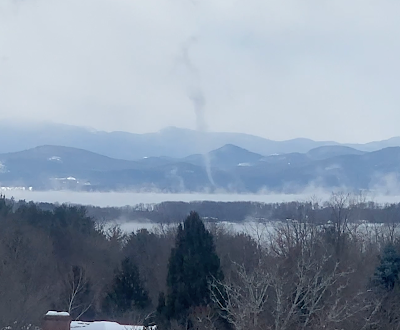
A brief but intense cold wave last February 3 brought steam
devils and funnels over the relatively warm waters of
Lake Champlain. That cold spell hit in an otherwise
warm winter. Despite the hype, there's no 
guarantees on whether it will turn frigid 
later this winter. 
 If you pay attention to any of the click bait weather sites on social media, you'd think we're headed into a new ice age later on in January. 

Oh, we have a sudden stratospheric warming!  The polar vortex is going to go haywire! Incredible cold is going to envelop the Northern Hemisphere for the rest of the winter! We're ALL GONNA DIE!!!!!!

Um, no. Relax, folks. 

For us here in Vermont, and for the rest of the nation for that matter, we probably will see some sharp cold spells in January and February. 

It's winter, after all. Climate change does not prevent subzero cold waves. It just makes them somewhat less likely, 

And honestly, it's incredibly hard to imagine our January will be nearly as much warmer than normal as this December has been. This month will very likely be the second warmest December on record in Burlington. 

THE REALITY

Like all internet hype, there are grains of truth in them and the basic science behind the hype is also fairly accurate. But that doesn't mean a frigid Armageddon.  It just means we'll have interesting weather. Nobody in their right mind is able to tell you what kind of interesting weather we'll see beyond, say New Year's Day.  So we'll have to work with what we have.

To set this up, let's review the basics. First, the polar vortex.  It's a big whirl of cold air in the atmosphere that's always somewhere in or near the Arctic during the colder months. Depending on where the polar vortex is, and how the jet stream is oriented around it, the Arctic air might slip down into Europe, or Asia, or North America. Or it could remain bottled up near the Arctic.

For the most part, the polar vortex has lately been pretty tight and sitting way up there in the far north. That's keeping the bulk of the ridiculously cold air far to our north. That's why it's so warm. 

The jet stream is in the process of reconfiguring itself, so it might get a little colder as we head into the New Year, but it will still be fairly mild. 

The next big thing in the hype machine is that sudden stratospheric warming.  For some reason, in roughly half of all winters, the stratosphere warms up over the far north. It's part of a pattern in which the polar vortex abruptly weakens and gets disorganized. The polar vortex can also stretch out in weird directions and can temporarily relocate it further south. 

When this happens, bitter Arctic air can easily slam southward........somewhere.  Again, could be Europe, could be Asia, could be southern Canada and the United States.

The reason people online are getting the vapors is because there are signs a sudden stratospheric warming might be about to happen.  We're not absolutely sure whether it will happen, but the way signs are pointing, experienced meteorologist wouldn't' be surprised if it does in the next couple of weeks. 

The effects of this on the ground are delayed a bit. So whoever loses the luck of the draw - if anybody - in this, it won't happen until maybe the second half of January into February. 

On top of all this, we have other factors to consider.  We're in a raging El Nino, which keeps the southern end of the jet stream across the U.S. South active. Will a weirded out polar vortex work in concert with El Nino to direct Arctic cold and blizzards into the United States?   Or will El Nino direct any cold air toward Europe?  

The answer? Dunno. 

But wait, there's more! Other complex factors will help determine whether we have any kind of old fashioned Arctic blast later this winter, or will it be another pffft type of season.  

 Will the weather pattern feature a jet stream blowing hard into the West Coast then heading east across America? That could keep us on the warm side. Or maybe a ridge of high pressure will develop over the Rockies and western Canada. That would send cold air plunging our way. Or maybe there will be blocking high pressure in or near Greenland, which could also make us cold and stormy. Another possibility is a ridge of high pressure off the southeast coast, which keep us in New England mild.

Yeah, it's complicated. 

BOTTOM LINE

It's fun to try to read the tea leaves to figure out what the rest of the winter will be like. I plead guilty to that sort of thing. 

Some weather enthusiasts love to imagine epic East Coast blizzards.  That's all well and good. But some of them are wishcasting - defined as forecasting for the kind of weather they want, and not necessarily what will actually happen. 

Basically, don't believe any forecast you hear that's more than five days out. If you wake up on Saturday morning to hear that a blizzard is coming the following Saturday, ignore it until midweek, and then see whether wintry weather is coming or not. 

Chances are, thet blizzard that one computer model run out of of hundreds spit out will go poof, and we'll just have boring January weather instead.  

Wednesday, May 3, 2023

Lousy Stuck Weather Pattern To Unstick, Then A Much Better Stuck Weather Pattern To Hit

A burst of sunlight lights up a landscape of dark clouds
early this morning in St. Albans, Vermont. Our stuck, wet
weather pattern is scheduled to be replaced by 
another stuck, but better weather pattern. 
 Springtime for some reason is peak season for stuck weather patterns. 

The flow in the atmosphere often gets tangled up, and you end up with basically the same weather for days. 

What you end up with is usually luck of the draw. Sometimes, you get stuck in a wet, dreary pattern, other times you're "stuck" with brilliant blue skies in warm temperatures, like we had in mid-April. 

Last week, we were stuck under a showery regime, as low pressure to our northwest kept us unsettled. But at least we had long breaks of partly sunny skies in which we could get things done outside. That pattern untangled last Friday, only to get us stuck in a new spell of wet weather. 

This week's long spell of wet weather has been worse than last week, I suppose. The showers have been more frequent. The sun has been more scant. But we can look on the bright side. The core of the coldest air with this stuck pattern has been off to our south and west, in the Great Lakes and central Appalachians 

Some of those areas got quite a bit of late season snow out of this. In Vermont, we avoided frozen precipitation. Unless you include snow on the mountain peaks and pea sized hail accompanying heavier lower elevation showers. 

Now some good news: Over the next couple of days, this current regime will become unstuck and move on.  Quick on its heels will be another stalled weather pattern that will be.........not bad!

Big high pressure will settle in near Hudson Bay, Canada starting this weekend and continuing through most of next week. Low pressure will stall far off in northeastern Canada.

This will set up a pretty persistent northwest flow of air over us. 

On paper, this looks a bit ominous, but in reality, it won't be hard to take at all. 

In the winter, with this kind of pattern, it can stay pretty cold, with subzero temperatures.  You'd think with this set-up, we'd get some late season freezes and basically an end to spring, with frost-ruined gardens and such. 

NOT  this time, though.  Most of the snow has melted in central Canada and the high pressure isn't from the Arctic. It's pretty mild under that system. 

So, air temperatures through our next stuck weather regime will be pretty close to normal.  That means highs most days will make it into  the 60s, with possibly a 70 degree day or two thrown in for good measure. Lows are forecast to be in the mid 30s to mid 40s. Sure, there might be a touch of frost some nights in the coldest hollows, but that's perfectly normal and fine for this time of year. 

One bonus is there will be a fair amount of sun this weekend and next week. We won't always have crystal clear skies, but we'll definitely see enough sun to keep you - and the garden flowers and the pollinators happy.  

 Little, moisture-starved disturbances and weak cold fronts will keep coming down on us from Quebec during this upcoming regime. That might touch off a few periods of clouds and some widely scattered light showers. But the vast majority of the time will be dry, so you can get out in your yard and enjoy.

It's actually good that we've gotten all this rain and it's so soggy out there. That moisture will help us get through at least a week of mostly dry weather. 

The one negative in all this is the black flies. They are AWFUL this year!!!!!  I'm hoping the northwest breezes that will accompany the weather this weekend and next week will be strong enough to help keep those dreadful little buggers at bay. 


Saturday, February 4, 2023

2022 Lightning Strikes Reveal National Weather....

 When climatologists do deep dives in how a climate might or might not be changing, they look at lightning strikes. 

Lightning activity, or the lack thereof, can tell us where droughts are developing, where droughts are ending and where severe weather is moving, changing or just being weird. 

A weather and environmental monitoring company called Vaisala Xweather compiled an analysis of lightning in the United States in 2022 into an annual report, something the company has done since at least 2015. 

Vaisala said lightning zapped in the United States a total of more than 198 million times in 2022. The state with the most strikes was Texas, with just under 30 million. 

As the Washington Post reports:

"Recently released U.S. lightning data by weather and environmental monitoring company Vaisala Xweather showed portions of the Midwest and Texas - typical lightning hot spots - had a weaker display of activity in 2022 compared to its recent average. The lack of lightning was a signal itself of atypical weather across the country last year, including major drought across the Mississippi River basin."

The Washington Post explains why lightning data is important:

"Lightning detection is like measuring a person's reflexes: The system can appear normal overall, but certain areas may show more signs of struggle than others. That's what happened in 2022. After back to back years of concerning low activity in 2021 and 2020, the total number of lightning strikes was closer to average. Still, pockets of the country showed record low or high activity in ways that left researchers surprised."

Lightning was below average in the Mississippi River basin. Which is bad, because that area receives about half its annual rainfall from thunderstorms.  It was the third consecutive year with below average lightning activity in that region. 

The Mississippi River fell to nearly record low levels in the autumn. Simply measuring rainfall is of course the obvious way to figure out whether you're in a drought. But lightning data can help show what type of rainfall was lacking. 

The dearth of lightning meant that the downpours usually associated with thunderstorms was lacking. Since torrential rains are more likely to flow into rivers, that provides more evidence as to why the Mississippi was so low.  

Other areas had a lot of lightning. 

Florida, due to its geography and climate gets zapped with tons of lightning strikes each year. However, 2022 was an especially busy year for lightning in Florida. They had 33 percent more lightning compared with the 2015-2021 average, says WaPo

Part of the problem was Hurricane Ian, that intense storm that caused $60 billion in damage. 

Hurricanes don't usually produce all that much lightning, but this one did. At its peak, it was producing lightning every three seconds in the hurricane's eyewall. 

The eyewall is a circle of especially intense winds surrounding the calm eye of a hurricane.  

Most of the extra lightning strikes across Florida, though, were just due to a busy summer thunderstorm season that was even more active than usual. 

Another state that saw an increase in lightning over previous years was Arizona. In mid to late summer, humid winds from the Gulf of Mexico and the Pacific Ocean are drawn toward Arizona by low pressure created by summer heat.

That creates what is known as a monsoon season, in which thunderstorms frequently erupt in the Desert Southwest. Contrary to recent years, the Arizona monsoon season was more active than usual

Another very weird lightning hot spot was around Buffalo, New York during their epic Christmas lake effect blizzard. A good 1,0000 lightning strikes were detected during the blizzard over three and a half days, which is more lightning than anyone can recall in such a weather pattern.

Climate change is blamed for just about everything that goes wrong in the weather and elsewhere. However, so far at least, there are no discernible overall trends in lightning frequency in the United States because of climate change.

VERMONT LIGHTNING

Here in Vermont, we don't have a lot of lightning, compared to many other places east of the Rocky Mountains. 

Given the Green Mountain State's relatively small size and fairly low level of thunderstorm activity, we had the four least amount of lightning of all the states and the District of Columbia.

Vaisala detected 62,954 lightning strikes in Vermont during 2022. Only Rhode Island, Hawaii, and the District of Columbia had less lightning during the year. 

Overall, lightning activity during 2022 in Vermont was near or a little below average. In 2021 Vermont saw 71,264 lightning strikes.

Maybe a better way to measure how Vermont and other states rank is lightning density, which Vaisala defines as events per square kilometer. Measured that way, Vermont ranked 43rd in the nation in terms of lightning density. 

For fun, Vaisala nominates the lightning capitals of each state. It's where lightning was detected the most. In Vermont, this year's lightning capital was Danby. In 2021, Vermont's lightning capital was Ripton. So you see it's pretty random. 

Speaking of random, it's interesting that the highest lightning density in Vermont in 2021 was in central parts of the state, with less north and south. In 2022, it was just the opposite, with somewhat higher lightning density south and north, with lesser amounts in central Vermont.  

Sunday, January 22, 2023

Intense Cold In Corners Of China, Russia Are One Big Exception To Generally Warm Global Winter

Reports out of northeastern China (pink and red areas)
indicate parts of the region might have had all
time record low temperatures for the nation.
 It's winter, and it has to be cold somewhere, 

Better elsewhere than here in Vermont, at least as far as I'm concerned. I'm definitely no fan of temperatures far below zero. 

In northeastern China in the past couple of days, the temperature got as low as 63 below zero. I hasten to add that this is not as of yet a confirmed report. 

If the report is true and the measurement is verified as accurate,  this would be the coldest temperature recorded in China any year, anywhere. A few other areas got under 60 below in this intense cold snap.

The deep chill is spreading into adjacent North and South Korea, and on to Japan, but the chill will not set as many records there as it has in China and Russia.

Yep, I mentioned Russia. That's because before the deep cold reached China, it was in part of Russia, namely Siberia.

Around January 18, the temperature reportedly dropped to 81 below in Tongulak, Russia. Now, that's normally a very cold place that often gets into the 50s and 60s below zero in the winter. (I would NOT be able to stand that!)

Still, that 81 below, if verified would be a record low for that town, and the coldest it has reached anywhere in Russia since 1982.

Part of the reason for this intense cold is the polar vortex has been far north and tightly wound for weeks.  That has helped keep the mid-latitudes warm. Often, the polar vortex will stretch, or pieces of it will break off, causing nasty cold spells in Canada, the United States, Russia or parts of Asia.

Of course, those blasts of Arctic air get rid of some of the intense cold in the polar vortex. For weeks now, though, the polar vortex hasn't stretched, wobbled or broken, so the air under it has just been getting colder and colder and colder in the darkness of an Arctic winter. 

Now, the polar vortex is finally showing some signs of instability.  The cold in Siberia and China was probably the first effect of that. 

Meteorologists see signs that parts of the United States, especially northwestern and central parts of the nation, could see some pretty intense cold by in the final days of January and the first few days of February. 

However, we don't know quite yet exactly how cold it will get and how widespread the chill will get.

Now that I've mentioned a possible all time low temperature for a nation, I'm sure some wags or idiots will announce that proves climate change is a hoax.

Um, no. 

The amount of climate change we've had so far definitely tilts things so that the chances of record warmth are greater than that of record cold. But climate change does not entirely get rid of the chances of dramatic dips in temperature. 

One example of the this is the number of nations or territories that experienced all time hottest temperature records compared to the number that saw all time record lows.

Eleven nations and territories saw all time record highs in 2022, while three saw all time record lows. 


Tuesday, December 27, 2022

West Coast Weather Woes Were Overshadowed By Eastern Bomb Cyclone

An icy street in Seattle last week. The ice has since
melted and now Seattle is under a flood watch. 
This is part of a weather pattern change that will
bring warmer, wetter weather to most of the
nation, including Vermont.
 While the eastern two thirds of the United States was swallowed by that bomb cyclone are Arctic blast through the Christmas holiday, the West Coast has been enduring its own weather woes.  

And will continue to do so. Although the news isn't 100 percent bad out there. 

By the way, what happens on the West Coast doesn't stay on the West Coast. We'll see some effects up here in the Northeast/Vermont. More on that in a bit. 

The Pacific Northwest shared in the cold weather as Christmas approached. The problem was, so did a warm front. Warm air rose up and over the frigid conditions around Seattle, so they had a rare ice storm. 

Seattle is a hilly town and social media erupted with videos of vehicles sliding down steep slopes and hitting other obstacles like bumper cars.  People resorted to sliding down hills on their butts because they couldn't walk on the slick ice. Around 15,000 people in the region lost power. 

The warm front eventually moved through and it warmed up nicely, at least west of the Cascades. But that introduced new trouble. It rained, pretty heavily, thanks to an atmospheric river off the Pacific. This came as snow and ice melted, so there's a flood threat now. 

On top of that, coastal King Tides are flooding some spots, and a high wind warning is up today for the Seattle area. The soggy ground will make it easier for winds to topple trees. And there's a risk of landslides.

So it's a mess. 

Further down the coast, Oregon and California are getting rain again, with of course snow in the higher elevations. 

For the mountains, this is more good news. The Sierra Nevada mountains got off to a good start with snowfall earlier this month. This raised hopes that accumulations might be good this winter, which would replenish reservoirs when the snow melts in the spring. 

There were also fears things would go like last year, with an initial burst of precipitation then nothing.  There was a lull in rain and snow in California for the past week or two, but that's over now. 

Over ten inches of rain or water equivalent is forecast in the Sierra Nevada in just the next seven days. This week of storms doesn't solve all of California's drought problems, but it will probably put another small dent in it. 

However, the rain might come down heavy enough in California's lower elevations to create flooding.  Especially in burn scar areas where wildfires eliminated vegetation earlier this year and last year. 

PATTERN CHANGE

The storminess in California is part of a major weather pattern change that is flushing the Arctic air out of the United States.

Pretty much everybody gets to share in the warmer air as the week goes on, including us Vermonters.  High temperatures that have been in the teens and 20s in recent days will rise into the 40s starting Thursday and probably continuing through the New Year's weekend. 

New Year's Eve will feel very different from Christmas Eve. Instead of snow, treacherous roads and rapidly falling temperatures, New Year's Eve looks like it will above freezing temperatures and a risk of rain.

Yes, I said rain. That same new weather pattern that is flooding the nation with relative winter warmth is also bringing storminess. Those storms slamming into the West Coast have to go somewhere. The first storm, due New Year's weekend in the Northeast, doesn't look like it will be any kind of blockbuster like the last one. 

It seems like it will bring inclement, but not extreme conditions.

However, there will be more storms waiting in the wings after that. Going into mid-January, it seems we might have frequent chances of rain, snow, or mixed storms. Stay tuned! 

Monday, December 19, 2022

If You Hate Arctic Weather Some (Uncertain) Light At The End Of The Tunnel

Maybe take it with a bit of  grain of salt, but after the expected
Christmas cold snap this year, the period of time around
New Year could be on the warm side for all of the Lower 48.
 Weather news is filled with horror and dread about the intense Arctic cold snap poised to envelop the eastern two thirds of the nation between now and Christmas.  

And it is dreadful. As noted this morning, wind chills of 50 below will blast the northern Plains, and temperatures will drop well below freezing all the way down to the Gulf Coast. And a big Midwestern blizzard seems to be prepared to throw itself into the mix.   

Weather pundits are calling this potentially the worst December cold snap since an epic one at Christmastime, 1989. 

If you look at forecasts beyond Christmas, though, signs point more and more to the idea that this frigid blast will be mercifully brief.

Then today's daily National Weather Service 8 to 14 day outlook came out. It covers the dates from December 27 through January 2. It shows the entire Lower 48 bathed in warmer than normal temperatures. 

It's quite rare to see all of the Lower 48 in either above or below normal temperatures. Usually, part of the nation is chilly, while other parts are toasty. 

Of course, there's the caveat that these long range forecasts are quite iffy, so there's definitely no guarantee that the days around the New Year holiday will be balmy. Some parts of the United States might end up being on the cool side.  But the forecast is a good sign that the Christmas Arctic blast is not necessarily a sign that the entire winter will be bitter for the U.S. 

Which is good for a lot of reasons. Especially since heating oil and natural gas are expensive and supplies are tight. 

There's another down side to this potentially warm period around the New Year. This same long range forecast issued Monday suggests above normal precipitation for all of the Lower 48 except eastern New England and Texas. 

That suggests a stormy pattern, which would bring its own share of trouble. 

Sunday, July 10, 2022

Parts Of Australia Drown In Floods, Again, Two Years After Mega-Wildfires

Areas around Sydney, Australia are experiencing
serious flooding for the third time in 18 months. 
Sydney, Australia and much of the rest of the southeastern Australia just had another epic flood, the fourth big flood disaster in 18 months.  

The rain just won't stop. As the Washington Post explains, Sydney received 8.6 inches in just four days, and some nearby areas had more than two feet of rain in that time period. 

Sydney has had 70 inches of rain so far this year, and it's only July. If not another drop of rain falls on Sydney through December 31, it will still be their 11th wettest year on record.  

Several atmospheric conditions contributed to Sydney's latest deluge, but climate change surely played a role. It would have been wet without climate change, but warm air holds more moisture, which can supercharge precipitation in storms.

Probably an even bigger factor is the unusually warm ocean temperatures off the coast of southeast Australia. Climate change is heating up the oceans. The relatively warm water fed plenty of extra energy into storms along the Australian coast, leading to the heavy rains. 

Two years ago, much of the same region burned in the worst wildfires in Australian history. In a world of increasing weather extremes, Australia is becoming a poster child for those extremes. 

From the Washington Post:

"'Australia has long been a continent of droughts and flooding rains; having said that, projections indicate that climate change will supercharge this variability,' Chiara Holgate, a researcher with the Australia National University and ARC Center of Excellence for Climate Extremes, said in an email. 'Observations show there's been an increase in the intensity of heavy rainfall events in Australia including the short-duration events, which can be associated with flash flooding."

Enduring a flood that trashes your house is awful, of course, but if it's a once in a lifetime event, most of us can find ways to recover from such a calamity.  It's a lot harder if it happens over and over again. 

As the Washington Post reports:

"For some Sydney residents in historically flood-prone areas, the deluge was the third in four months. 

'Where do you start? Mentally, physically, financially, it destroys you,' Judy White told the Australian Broadcasting Corp. She said she was still cleaning up from the last flood when the waters again inundated her home in the Sydney suburb of Londonderry." 

The same repeat and rinse flooding and disaster fatigue is also true for entire nations. 

Australian floods in February and March cost about $3.35 billion in insured losses, making that disaster the costliest in the nation's history, the Washington Post reports.

So climate change induced disasters are definitely a real drain on the economy.  

The flood waters will recede, people will begin to recover, and then another flood will arrive. Or things will really dry out, and the big bushfires wills start again in Australia. 

Remember, much of this area had some of the most devastating bush fires in Australian history back in 2019-2020.

Australia seems especially prone to climate change driven extremes.  They might be a parable for the reset of us. 

Wednesday, November 10, 2021

Another November Oddity: Lack Of Wind In Vermont

As of this morning, "The Triplets" three large poplar trees
in my yard, still have leaves, well past the time the trees
are usually bare. A lack of wind, in addition to a warm
autumn, has kept leaves on trees.
 In addition to a lot of clouds, November in Vermont tends to be windy.

It's all those deep storm system going through the Great Lakes, which we've said are typical of this time of year. Nor'easters can stir up a lot of wind, too. So can those blasts of chilly air from Canada that become increasingly common about now. 

In the Champlain Valley, strong south winds typically get going ahead of strong, approaching cold fronts. Plus it's just generally breezy as departed storm systems up in Canada swing little disturbances through. 

So far this month, though, we've been lacking in wind here in Vermont. I guess that's part of the reason why leaves are still stubbornly hanging onto a few trees, despite the fact we should be well into stick season.

In Burlington, gusts over 30 mph are very common this time of year, and 40 mph gusts happen fairly frequently, too.  The last time Burlington had a wind gust of 30 mph was on November 1. Since then, only three days have seen gusts over 20 mph.  

Wednesday and the day before, the highest wind speeds in Burlington were 10 mph.  I don't think a lot of trees and power lines blew down yesterday, that's for sure. 

The weather pattern is about to shift into one that is more typical of the season, so the winds will pick up a little bit. 

It'll stay relatively calm today and tomorrow, with top gusts of probably only 15 mph or so. Again, that's really calm for November.

Ahead of a strong weather front late Thursday night and Friday, winds will pick up, finally, probably going over 30 mph in some areas, like the Champlain Valley.  We're not expecting anything strong enough to produce any kind of damage, other than blowing some leaves around.

There's no real sign of any blockbuster storms for the foreseeable future, so the gales of November won't really be visiting Vermont anytime soon. 


Sunday, July 18, 2021

Beneficial Downpours For All Of Vermont Except For Part That Most Needs It

My St. Albans, Vermont gardens looked nice and wet this
morning, but looks are deceiving. Areas near the Canadian
border missed out on most of the beneficial rains. Run your
hands under the thickest foliage, and the soil is still
 dusty. Just 0.1 inches of rain as of 8 a.m. compared to 
1.2 inches just 30 miles south in Burlington.
 Everyone in Vermont was lucky enough overnight to get a soaking, long lasting drenching rain to ease the drought.  

Everyone, that is, except the one part of the state that needed the rain - areas closest to the Canadian border. From my perch in St. Albans - pretty much within sight of Canada - it feels like the drought is permanent. 

As of 7 a.m., Burlington had so far received a nice 1.22 inches of rain. Montpelier was close behind at 1.16 inches.  

I don't have widespread precipitation data yet, but Plattsburgh, New York had received just .0.34 inches of rain and it rapidly tapered off as you head into Franklin County, Vermont.

As of 8 a.m, my very unofficial rain gauge had collected just 0.1 inches of rain.  A little more might fall today, but not much. 

For those of you who want a classic mid-summer hot Sunday, you will be disappointed. Anybody that's still getting a soaking rain this morning will see it diminish into occasional light rain and showers.  A thick overcast, low clouds and fog will linger all day, and temperatures will be well below normal for the season. We'll be lucky to hit 70 degrees.

Plus, a little more rain is due through Wednesday, but really, not all that much. 

I'm not sure why this is happening, why there is such a block on rain along the Canadian border.

I can better explain why most of the Northeast has had such heavy rain this month.  A trough of low pressure seems to have persisted in the Midwest/Great Lakes region.  That, and the Bermuda High off the East Coast, keeps pumping tropical air northward.

That air interacts with weak, nearly stalled weather fronts, and the downpours roar on.

On paper, this weather pattern should have hit the areas of Vermont north of Route 2, too. We should have had plenty of rain.  

As I mentioned a few days ago, there always seems to be a reason why the rain avoids that part of the state. But there's no consistent explanation I can think of.  Maybe somebody smarter than me can provide a Grand Unifying Theory as to why it no longer really rains near the Canadian border?

The weather pattern that brought the record rain to the Northeast shows signs of shifting to a cool, but dry one.  That means the drought will go on, and probably worsen in far northern Vermont, while the rest of the Green Mountain State enjoys the fruits of a wet first half of July. 

At least we didn't get all the flooding that southern New England and the Mid-Atlantic states endure. 


Sunday, April 18, 2021

Not Just Us: Winter Keeps Trying To Crash Spring's Party

The weather pattern is switching to a chilly, potentially
frosty one for the next two weeks at least, so our early
spring looks like it will go on hold, or worse, actually
suffer some damage. We'll see.
 Most of the last of this past week's snow is melting from New England high country today, as spring tries to battle back from that last wintry setback. 

Despite an early spring over much of the nation, winter in the past few days has increasingly tried to crash the party more and more aggressively.  That state of affairs will continue for the next week at least.  

So while spring will continue to try and assert itself, winter is going to win some last chance battles.  The weather pattern has really switched to a cold one for most of the nation east of the Rockies. 

By the way, those at risk for some stinging, damaging frosts and freezes include us here in Vermont, at least eventually. More on that further down in this post. 

Winter's echo began at the end of last week, as we well know. While we were getting our spring snowstorm in Vermont and the rest of New England, parts of Colorado, Wyoming and Nebraska were dealing with their own winter blast. 

Several thousand people lost power around Denver as several inches of wet snow collapsed some trees and wires.  Like here in New England, Colorado has had some pretty good warm spells this spring, so trees were beginning to leaf out. That's bad when there's snow, as the slush accumulates heavily on the leaves, forcing branches to break.

About seven inches of snow accumulated around Denver. That's not even close to their biggest April snow on record, but it was a set back. Wyoming and Nebraska also dealt with snow and slick roads Friday. 

More snow is likely in the Denver metro area Monday as a colder weather pattern settles into the eastern two thirds of the nation.

Believe it or not, a typhoon way out in the western Pacific Ocean near the Philippines is contributing to this weather pattern.  It was a Category 5 as of this weekend, the strongest you can get. As it heads north, it will help disrupt the weather pattern in a way that makes cold snaps more likely in the eastern and central United States. 

In the northern Plains, where temperatures were at record breaking readings as high as 90 degrees or so earlier this month, the early spring buds have been getting nipped by frost in the past few days. 

On Monday and Tuesday, temperatures are forecast to sink into the teens in North Dakota and 20s in South Dakota. A winter storm warning is up for tonight and Monday in South Dakota's Black Hills for more than six inches of snow. 

There will no doubt be frost and freeze warnings in the central and southern Plains and parts of the Midwest in the coming days. 

Freeze watches are already in effect for Monday night as far down as northern Texas and Oklahoma Monday night.  There could even be a little snow and freezing rain in the Texas Panhandle Monday night. 

VERMONT EFFECTS

For us in Vermont, a series of storms and cold fronts will eventually threaten crops and gardens around here. Possible worst case scenario: You know how the trees are starting to green up?  It could possibly get cold enough to wreck those tender new leaves, meaning trees would have to start over, turning a record early spring into a remarkably late one. 

That bad scenario is not cast in stone and probably isn't even likely, but it could definitely happen in the upcoming weather pattern. It's one that will last awhile, too.

The first cold snap will come later Wednesday and Thursday, but this first one doesn't look frigid enough to cause any damage. A nice rainfall looks likely Wednesday. That's a good thing, because despite all the rain and snow in recent days, we still need more. 

Thursday and to a lesser extent Friday look blustery and chilly in Vermont.  Thursday would feature highs not getting out of the 40s with rain and snow showers. Wednesday night through Friday night would get into the low to mid 30s. Most of us will probably touch the freezing mark, but it won't be cold enough long enough to cause any trouble with plants. 

I'm more worried about a second cold front next Sunday.  At this point, that one looks like it could drive some very chilly air into the North Country. It's way too soon to say exactly how cold it would get, but it's possible we could see temperatures fall well into the 20s at night, possibly near 20.

Normally in late April, such temperatures are not that big a deal, because fruit trees, gardens and decorative flowering shrubs aren't usually far enough along by now to be affected by that kind of weather.   

But the warm spring means everything is as far along as they normally are in mid-May.  If the forecast holds, we could see some real agricultural losses, and a disappointing absence this spring of leaves and flowers.

Some weather models overdo anticipated cold snaps this far in advance and that could well be the case here. So what I outlined above is a worst case scenario.  Chances are it won't be that bad. Time will tell. 

The weather pattern does not look like it will turn warm again for the foreseeable future. Those days upon days of temperatures in the 60s ad 70s we experienced aren't coming back through at least early May, I'm afraid.