Showing posts with label air quality alert. Show all posts

Saturday, July 4, 2026

Vermont Goes Out Of The Heat (Sort Of) And Into The Smoke

It was already sort of hazy as of 10 a.m. as he "Hazecam" view
from\the University of Vermont
shows. Note the it's 
hazier on the right side of the photo. That's to the north
and thicker haze and smoke is coming from that direction
for the rest of today. 
 The worst of the heat wave is waning in Vermont now after many places had three 90 degree days in a row. 

One thing I didn't take into consideration, though, when I squawked Friday morning about how much better the weather will be,was the annoying forest fie smoke that's blowing in,   

Here's what's happening: 

TODAY

As expected, a weak cold front is coming through today, from Quebec It's not an impressive front, not at all. No big whoosh of cool, refreshing air.

 Just a trend toward somewhat cooler air and eventually, by late today or tonight, it will no longer be air you can wear. More like run of the mill low-ish, pretty reasonable  humidity.   

We'll still have highs well into the 80s for most of Vermont today, maybe low 80s far north, near 90 warmest valleys south. As we start the day today, the dreaded dew point will start out nasty, in the upper 60s. But it will gradually decline, with that drier air spreading north to south. 

Isolated thunderstorms or showers could accompany this transition, but it won't be anything widespread or dramatic. Most of the showers and storms should be in southern Vermont. 

The problem is this sorta, kinda cooler air is grabbing some smoke and sending it our way.  Some of it's coming from Colorado and other western states. Another big chunk of smoke is coming from a nasty fire burning a little south of James Bay, Canada. 

So, what was supposed to be somewhat refreshing air will have us choking in smoke. It most likely won't be as bad as some of the worst smoke attacks we've had in recent years, but it will be bad enough. 

Nevertheless, an air quality alert is in effect for the northern half of Vermont now through midnight. The smoke starts to come in as soon as the first hint of somewhat less humid air begins to arrive, so it was starting to get hazy and smoky in northern parts of the state early this morning. 

Satellite photos shows the smoke isn't as thick as some past episodes, but it's staying closer to the ground than many other past smoke attacks. 

SUNDAY

The worst of the smoke should be gone, but it will probably remain rather hazy.  It'll still be a nice day, though there should be some extra afternoon clouds. It will also be somewhat less humid. It'll be very warm again, with highs in the 80s. So, unlike what I said yesterday, it won't be a stellar, perfect summer day like last Sunday. But it will still be plenty nice.

MONDAY-THURSDAY

A mostly dry, very warm period. That disturbance we thought would soak southern Vermont Monday looks like it might be going even further south. So at this point, it's looking like only far southern Vermont will get a little wet.

We'll have a slow increase in heat and humidity as we go from Monday to Thursday. It will never get as hot or steamy as it was over the past three days but hot enough. Highs each day will get well into the 80s with some low 90s appearing Wednesday and Thursday.

It's going to be  dry period, despite the kinda high humidity we'll see. There might be isolated showers or storms from time to time but don't bet on it. You'll need to water gardens and plants and things like that. 

Our next shot at substantial rain doesn't come along until next Friday. 

Saturday, July 26, 2025

Smoke, Unhealthy Air, Uncertain Forecast, Then Heat, Then Cold Keeps Vermonters On Toes

Hazy skies near sunset last evening as viewed from
St. Albans, Vermont as wildfire smoke started
making another unwelcome visit.. An air quality
alert is in effect for most of Vermont again today 
 The good news is yesterdays' cold front kept some pretty incredible heat out of Vermont. Temperatures of between 95 and 100 degrees got as far north as Massachusetts Thursday. 

Some places, like Baltimore, Maryland (102 de
grees), and Newark and Toms River, New Jersey (both 100 degrees) set record highs for the date. 

High temperatures in Vermont, meanwhile, held mostly near 80 degrees north and to around 90 south, in places like Springfield. 

True, it was awfully humid Thursday. You'd think we'd get some rain. But not really, 

The timing of the front during the morning and early afternoon kept most of us from getting a drenching. 

My area around St. Albans did better with the rain than almost anyone else. I got an unofficial 0.60 inches, because at least three clusters of brief downpours got me. Most places only received one brief shot at rain with the cold front and that's it.  Amounts were a quarter inch or less. Some places in southern Vermont got virtually nothing. 

I notice the forest fire in Fair Haven, Vermont was still burning and slowly spreading as of yesterday in nearly rainless Rutland County. 

SMOKE ATTACK, AGAIN

Somewhat cooler and less humid air arrived in Vermont  last evening. But it came at a price: Smoky air has hit once again. From our friends in Canada, 

Atmospheric conditions unexpectedly forced some of the smoke that was aloft to the ground.  At around 7 arm, this morning, an air quality alert was hastily issued for most of Vermont and it remains in effect until 11 p.m, tonight 

The smoke  mixed with fog to create a smoggy Vermont morning. Some monitoring stations had an air quality index as low as 170. Anything under 150 is unhealthy for everyone, not just people who have pre-existing conditions.  

The fog is burning off this morning. The smoke will slowly thin just a bit as the day wears on but definitely not entirely go away,   

Other than the smoke and haze, we should still eke out a decent Saturday with sunshine filtered by the haze and highs in the 80s. The humidity should stay moderate.

SUNDAY QUESTIONS

I give up on forecasting tomorrow's weather, since the computer generated stuff is so contradictory. The model do not at all have a good handle on where the most rain will set up. And how much will fall.

Suffice it to say it might rain, it might not. 

It does look like southern Vermont could get a period of decent rain in the morning especially. It's still very hard to know how much rain will fall and how far north it will come in Vermont. It''s possible places near the Canadian border get nothing,

But it's all a crap shoot.  Don't be surprised if it rains, don't be surprised if it doesn't. Just be aware it might. 

During the afternoon, there could be enough instability to trigger some more scattered storms, as the humidity will be going up

HOT TO COOL

The increasing humidity Sunday will be a sign of one last gasp of hot, muggy air before the well-advertised weather pattern change arrives.

We'll make a run at 90 degrees again Monday, which might well be the last such hot day for a long while. Depending on how the weather pattern in mid to late August sugars off, it could be the last 90 degree day of 2025. No promises, though. 

The change will start Tuesday with a series of cold fronts that will keep coming through on Wednesday.. It should gradually cool down during the time frame, with highs maybe in the 80s Tuesday, near 80s Wednesday and then down in the 70s by Thursday,

At this point, anyway, the fronts don't look like they'll have much oomph to them, so we're not expecting much rain from them.

This will be all thanks to chilly high pressure from Canada. It will stay cool for several days given how slowly that high will be moving. Current projects have in Canada just north of North Dakota Wednesday, and it'll only make it to about Lake Michigan by Saturday.

That will keep us in cool, dry northwest winds.  We'll have to see, but it might also keep us in the smoke, since some of the air will be coming from the zone in central Canada that is still burning with widespread forest fires. 

Long range forecasts (grain of salt type things) indicate something of a warmup again starting again a week from tomorrow, but it's unclear how warm it will get or how long it would last.  

Friday, June 6, 2025

Air Quality Alert In NW Vermont, New York

Photo taken near my St. Albans, Vermont looking west
late this morning should include views of Lake Champlain
and the landscape on the New York side of the lake.
But wildfire smoke is obscuring the view. An air
quality alert is in effect for northwestern Vermont
and New York through this evening. 
 When I left for some appointments this morning, I noticed the air seemed awfully hazy this morning, with a hint of stale campfire smoke. 

It turns out smoke from Canadian wildfires is wafting toward the ground a little  more rather than staying overhead a ways  Pollution experts locally have noticed too. An air quality alert is now in effect for northwestern Vermont and northern New York. 

Wind patterns have concentrated the smoke in this area. Plus, forecasts of more and heavier rain south today will tend to clean the air somewhat south and east of Chittenden, Franklin and Grand Isle counties. 

The air quality alert goes until 11 pm. tonight, and I think the air problems will focus through the daylight hours today. If some rains drifts into northwest Vermont this afternoon - and it might. That will help some, but won't solve the problems.

They're advising us not to do much strenuous outdoor exercise. And if you're particularly sensitive to air pollution, especially the small particulates now floating around the in the air, stay inside. Preferably with air purifiers if possible. 

That goes for people with respiratory and heart problems. People who have asthma should follow their asthma action plan and have their quick relief medicine with them if they need to use it in a hurry.  

Fires continue to rage, mostly in central Canada. They will continue to belch smoke across large sections of Canada and the United States for the foreseeable future. 

Friday, August 16, 2024

Air Quality Remains Iffy In Vermont, Weekend Rain Slower In Arriving

A very orange looking sun, made that way by wildfire
smoke in the air, hides behind our trees in St. Albans,
Vermont last evening. Air quality will remain
poor today because of all that smoke. 
 So far, we've gotten through our air quality alerts here in Vermont with just mediocre air. 

The air quality index was in the moderate range early this morning, which for the numbers people is between 50 and 100 on the scale.  

Once you get to 101, you start in with the "unhealthy of sensitive people," which is the point of the current air quality alert. That alert is in effect all day.  

Rutland was getting close to that threshold this morning, with an air quality number at 82.

The air will probably worsen a bit through the day as it often does during daylight hours when we have attack of wildfire smoke, from wherever it's coming from.  (For those who wonder, most of the smoke we're having now took a sort of circuitous route mostly from Alberta, Canada).

We'll have another day of brassy colored sunshine, dimmed by all the smoke in the atmosphere. It will be another sort of humid one.   Showers and storms tended to be pretty few and far between yesterday, at least here in in Vermont. They will be even fewer in numbers today, with almost all of us having no rain.

This state of affair will help boost temperatures well into the 80s, with some upper 80s in the warm spots. Which leads us to the weekend. 

WEEKEND SALVAGEABLE?

That sluggish storminess coming in from the Great Lakes is even more sluggish than first thought. At least here in Vermont, it's looking more and more likely most of us will escape with  no rain.  A few showers might develop, especially the further west you go. But many of us will stay dry. Those who do get any showers will only be in the rain for a short burst or short bursts.

Even Sunday now looks like it won't be a washout. Shower chances are better by then. But they will still be hit and miss. 

The weekend will remain on the humid side, and probably still kind of smoky and hazy. Not hard core Chamber of Commerce weather, but probably good enough.

HINT OF AUTUMN

About this time of year, we start seeing cold fronts that suggest that fall is right around the corner. Right on cue, it looks like that slow, slow system from the Great Lakes will swing a cold front through Monday. 

It's that time of year when you start to see tiny pockets of
fall color amid all the summer greenery in Vermont.
It will also briefly feel like autumn next week.

I have a feeling the front will feel like more an autumnal one.  Summer cold fronts usually give us bands and clusters of sometimes strong thunderstorms, but not usually a general soaking hours-long rain.  

Once we get into autumn, cold fronts start to give us full rainy days. At this point, it's beginning to look like Monday will be that type of day.  

It's a few days away, so things could still change, but Monday could well end up being a rainy "autumn" day. 

 It'll be cooler than it's been under the clouds and rain, but it will probably still feel a little humid, and temperatures should still make it into the 70s.

Behind the front on Tuesday, autumn will be in the air. Highs high not make it out of the 60s.  If that happens in Burlington, it will be the coolest day since June 15.  

I wouldn't exactly rush out to the garden and cover your stuff to ward off frost. It's only going to be vaguely cool. Not frigid. Upper 60s for highs aren't that weird for mid-August. Expected lows Tuesday night in the 45 to 55 degree range aren't odd either. The cool air will just seem out of whack because we've had such hot summers in recent years. 

Besides, it really is still summer, for sure. After the cool weather next Tuesday into early Wednesday, we'll get back into a warming trend. 

Thursday, August 15, 2024

Vermont's Not Great Air Quality About To Get Worse

Smoke and haze from Canadian wildfires obscuring the 
view of Lake Champlain late this afternoon as seen
from St. Albans Hill. An air quality alert is in effect
from midnight tonight to midnight tomorrow night. 
 This afternoon, the Vermont Department of Natural Resources has issued an air quality alert that goes into effect at midnight tonight. It stays in effect until midnight tomorrow night. 

The problem, of course, is that wildfire smoke wafting in from Canada. The air quality index is expected to deteriorate to level orange, which means the air is unhealthy for sensitive groups. 

Well, everybody, frankly. But especially so for people with health issues. Says the Department of Natural Resources:

"People who may be especially sensitive to the effects of elevated levels of pollutants include the very young, older adults, and those with pre-existing respiratory problems such as asthma or heart disease and those working outside.

"People with asthma should follow their asthma action plans and keep quick relief medicine handy."

The sky over Vermont has been really milky looking all day. The blue between the barely-discernible clouds is more of a slate gray color. 

The haze and air quality on the ground wasn't so bad to start the day, but it's been getting thicker all day.  Air quality was considered good this morning and moderate this afternoon, meaning it wasn't terrible, just not great.

The next level is "unhealthy for sensitive groups," which is where we're headed tonight and tomorrow, thus the air quality alert. 

The source of this bad air has taken an odd route. It originated mostly from large wildfires in Alberta. From there, the smoke blew northward into Nunavut, which is in far northern Canada but roughly halfway between the Pacific and Atlantic Oceans.

From there, the smoky air took a sharp right hand turn, heading southward across Hudson Bay and western Quebec and into New England. 

This is the first air quality alert we've had from wildfire smoke this summer, though we've had other hazy days due to this smoke. 

Thanks largely to climate change, these smoky days have gotten more common in recent years. Drought and hotter temperatures, especially in western North America, have gotten worse in recent decades, so fires have followed suit. 

Last year the smoke repeatedly made headlines as Canada had by far its worst wildfire season on record. Smoke from those fires repeatedly triggered dense smog in much of the United States, including Vermont. 

 On the bright side, thunderstorms have been less prevalent in Vermont than expected today. Most of the strong ones have hit New Hampshire, Maine and eastern Massachusetts. 

Tuesday, July 18, 2023

Tuesday Morning In Vermont: Smoke, Murky. Stormy, Flood Threat. You Know The Drill

You're probably sick of flood and storm photos, so 
how about some flowers hanging out in my
 St. Albans, Vermont garden last evening?
At least where I am in northwestern Vermont this morning, dawn came late today.

Between the wildfire smoke choking up the skies and nearby showers and storms, it was a dark start to the day.  Very odd for midsummer. It looked like November, even if the air felt like South Florida in August.  

FLASH FLOOD RISK AGAIN

Those scattered morning showers and storms are a harbinger of more potential trouble to come today.  A flood watch is up once again for all of Vermont. It goes from noon today to late tonight. 

Once again, this will be a hit or miss flash flood threat, kind of like Sunday was.  I don't know if it will be quite extensive as it was a couple days ago, but I few places could see new damage.  If I had to guess, I'd say the Northeast Kingdom slightly edges out other places in Vermont for the greater risk.

That would be bad news, because the NEK, which had been largely spared from the flooding on July 1o and 11, got nailed by flooding Sunday

But I'll emphasize that a problem could happen anywhere late today or tonight. 

The computer models didn't handle this morning's rain well at all.  I saw one model that ran just a few hours ago that showed scarcely any precipitation in Vermont at around 7 am. 

Meanwhile, actual radar at that time was showing patches of heavy rain along Interstate 89 from about Colchester to Waterbury, with other areas of fairly heavy rain in the northern Green Mountains and in the northwestern tip of Vermont. 

All those patches of rain zipped off toward the northeast at a pretty good rate. Which means I doubt they were around long enough in  any one place long enough to cause any issues with flash flooding. However, those showers are once again "pre-soaking" some parts of the state in anticipation of heavy showers and storms later today. 

It does look like there will be a lull in activity later this morning and early this afternoon before more storms fire up.

Again, it's a hit or miss proposition state wide. Almost all of us will see at least some rain this afternoon and evening. . Most of us won't get enough rain to see any property damage. It's just those unlucky few who will find out later they have new damage, or recently repaired washouts are washed out again. 

Just be ready and able to receive flash flood warnings, so you can get out of the way of any water that comes down from the hills.

A very few storms might be borderline severe, with strong gusty winds and hail. Again, these isolated strong storms could happen anywhere, but I think are slightly more possible in northern Vermont. The overall threat for severe storms is low, much lower than those epic storms last Thursday. 

SMOKY DAY AGAIN

Of course,  another issue this morning is that stupid wildfire smoke, still lingering in the air.

The air quality index across Vermont as of 7:30 was mostly in the 130 to 150 range. That's pretty unhealthy. It's smoky and hazy enough this morning where I can't see Lake Champlain from my house. Usually I can see it fine, since it's only about five miles away. So it's murky and polluted out there. 

The air quality alert that's been in effect since yesterday will stay  up at least through midnight tonight. Somewhat better air, but not perfectly pristine conditions, are due starting tomorrow. 

OUTLOOK: NICE, THEN ONE MORE RISKY DAY

After we make it through today, we are actually going to have a couple fairly nice days.  Wednesday and Thursday will feature at least some sunshine.  It will be kind of humid, but not as bad as today. And there will be no rain, or almost no rain anywhere in Vermont both days.

Then we get to Friday. A fairly strong storm system for this time of year will be lurking off to our west. We'll have to watch that one, especially if its forward progress slows down.  There is a chance we could see more heavy rain and flooding by the end of the week. 

It's too soon to provide details on Friday's system, so stay tuned.  

After Friday, there are hints of another reprieve from the stormy weather.  

Monday, June 5, 2023

Air Quality Alerts Cover Vermont, Much Of Northeast Due To Canadian Fires

Satellite photo late this afternoon shows widespread
smoke in the Northeast U.S. and swaths of Canada.
At the time this photo was taken, the smoke was
just beginning to thicken up in Vermont. The milky
stuff in the photo is smoke, the sharper,
whiter stuff is regular old clouds. 
The air quality alert that had been in effect for western Vermont all afternoon has been expanded to cover the entire state. It'll be in effect at least through 9 a.m. Tuesday. 

It's part of a large air pollution problem that now covers all of New England except Maine and eastern New Hampshire. All of New York State is also under an air pollution alert.

Most of the smoke so far today has been flowing southward through New York State, with the eastern extent of the thickest haze near the New York/Vermont border.

Satellite imagery late this afternoon shows a new surge of smoke that will soon cross the Canadian border and eventually engulf all of Vermont. 

The air has been getting increasingly hazy this afternoon, especially in western Vermont, and that trend will continue.  The air quality index has been slowly deteriorating in much of Vermont through the day. 

When we started this morning, the index was around 20, which is great. By around 5 p.m., the air quality index in Burlington was 114, which is in the "unhealthy for sensitive groups" category. If the index goes above 150, which it might, that would mean the air is unhealthy for all of us.

If you have asthma or other issues like that, you'll want to stay inside. With air conditioning or air cleansing devices if they're available.  If  you're really healthy, you might consider postponing your daily 5 to 10 mile run.  It's not good for you, I'm afraid. 

The smoke pollution consists of tiny particles that can lodge in the deepest, tiniest recesses of the lungs. Basically, we're all smoking cigarettes now. 

The air quality alert in Vermont stays in effect through 9 a.m Tuesday. However, forecasters and the Vermont Department of Natural Resources are already guessing they'll have to extend the alerts through Tuesday and possibly Wednesday at least.

The smoke has had another negative effect, besides being unhealthy.  The smoke has suppressed the kind of updrafts you need to generate showers. We desperately need the rain, and the smoke effectively shut off the chances of showers this afternoon and early evening. 

Haze was beginning two get noticeably thicker in
St. Albans, Vermont late this afternoon.

Showers are in the forecast tomorrow. But again, the smoke might suppress the ability of the atmosphere to create those showers.  So yeah, this whole thing is a lose/lose proposition. 

We can partly blame this smoky mess partly on climate change. Yes, there have always been forest fires run eastern and central Canada, and we've always occasionally dealt with smoke from those blazes.

However, much of Canada has seen record high temperatures this spring, along with very dry conditions. This combination has been made more likely with climate change.  You might have noticed recent summers have been getting more smoky in general due to fires in Canada and the western United States.

This trend could keep worsening as the years go by. Some years will still be pretty clean. But chances are rising we'll have to deal with smoke and haze and bad stuff for your lungs more and more as we go through the next years and decades.

Tuesday, July 20, 2021

Update: Yucky Vermont Day: Air Pollution Alert and Severe Thunderstorm Possibilities

A very hazy "view" of St. Albans, Vermont this afternoon.
An air quality alert is in effect for all of the state due
to wildfire smoke coming in from Canada and the the 
western United States.
 An update from this morning's smoky post.

The Vermont Agency of Natural Resources as of this afternoon as issued an air quality alert for all of Vermont. A similar alert is up for all of New York State. 

That smoke is really hindering visibility and creating a hazardous amount of fine particulate matter in the air.

The air is nasty because of wildfire smoke drifting in from massive blazes in Canada and the western United States.

The murky air is, as the ANR puts it, "unhealthy for sensitive groups." They explain:

"Children and older adults, as well as people with heart or lung disease, should reduce prolonged or heavy exercise. Exposure to fine particles such as wood smoke can increase the likelihood of respiratory symptoms in sensitive individuals and aggravate heart or lung disease."

For those of us who are healthy, I'd avoid a lot of outdoor exercise anyway.  The air is not bad enough to make robust people keel over, that's for sure. But the smoke isn't good for you, anyway. 

The air quality index goes from a scale of good, with 0-50; moderate, 50-100; unhealthy for sensitive groups, 101-150 and just plain unhealthy for everyone, above 150.

The air quality in Burlington was at 141 early this afternoon and there were similar readings elsewhere in the state. So we're flirting with unhealthy for everybody. 

There's also a couple worse levels of air quality, including "hazardous" above 300. It won't get that bad, so I guess that's good?

It's also depressing. People come to the Green Mountain State, and we live here because, well, we enjoy looking at the Green Mountains. They're pretty much invisible in this smoke today. 

Large areas of the U.S. including Vermont, are under 
air quality alerts (gray areas) due to wildfire smoke
from western North America.
It's not just us. Air quality alerts are also up for much of the Northeast, and most if Wisconsin and Minnesota due to all this smoke. 

Back here in Vermont, there's still a good chance of developing showers and thunderstorms later this afternoon and this evening. 

Some questions exist as to whether the smoke that's partly blocking the sun will tamp down on instability,and thus the intensity of the storms. 

So far, they're developing despite the haze. 

Just as I was writing this, a severe thunderstorm watch was issued for all of Vermont. One area of concerning storms is up in Ontario, headed this way. There have been reports of extreme wind damage west of Ottawa. 

They could well remain damaging and severe as they cross the border into New York and Vermont later this afternoon and evening. 


A separate cluster of strong storms was headed into southwestern Vermont as of 3 p.m. More storms could develop elsewhere later.    A few might have damaging wind gusts. This won't be a widespread severe weather event, but a few places could get nailed. 

The good thing about these storms, if they develop, is they could wash some of the smoke out of the air, thereby improving air quality. 


Thursday, January 14, 2021

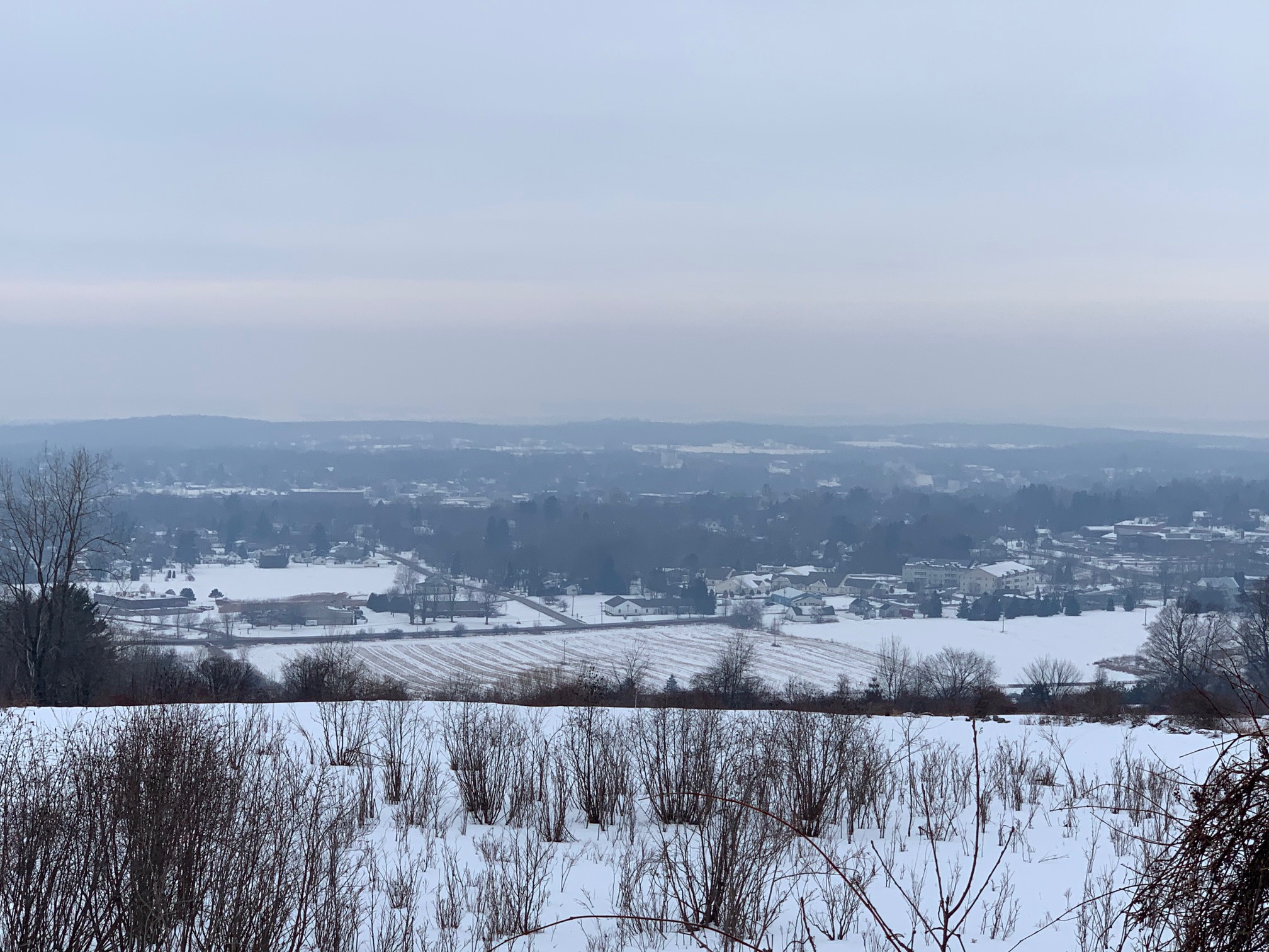
Murky Vermont Weather Is Also Polluted

A murky, somewhat polluted winter day last February in 
St. Albans, Vermont beneath a temperature inversion.
Another inversion is causing some air quality concerns
in Vermont overnight. 
 We have suffered through quite a few days in Vermont so far this month with thick, low overcast, fog, haze and whatnot. 

When you get these calm, dank, depressing spells, sometimes you get another problem. Air pollution, believe it or not. And that's a bit of a problem tonight. 

Much of southern Vermont is under an air quality alert through around 11 a.m. tomorrow.

When there's a temperature inversion, stuff that comes out of tailpipes, chimneys and such gets stuck without being able to blow away.  That's especially true when winds are light, like today.

Remember, a temperature inversion is a layer of warmer air overhead. It's called an inversion because normally it gets colder with height, not warmer. 

Anyway, the inversion acts like a lid, keeping pollutants and fog and stuff trapped beneath that layer of warm air. 

Most of the pollution when there's a Vermont air quality alert in the winter consists of tiny particles that come out of chimneys, wood stoves and the like when we burn wood. 

As today's air quality alert states:

"Children and older adults, as well as people with heart or lung disease, should reduce prolonged or heavy exertion. Exposure to elevated levels of fine particles such as wood smoke can increase the likelihood of respiratory symptoms in sensitive individuals and aggravate heart or lung disease."

These types of air quality alerts happen almost every winter in Vermont, as this is the time of year when inversions tend to persist.   The strong, high sun in the spring and summer tends to easily break up inversions. The sun is still at a low angle now, and not as strong as it will be in a few months. 

The Rutland area is especially prone to this type of air quality problem because the valley is shaped somewhat like a bowl. An inversion puts a lid on this bowl and everybody's wood smoke gets trapped. 

The air quality alert is not in effect for Vermont north of Rutland and Windsor counties. Still, the air quality in the rest of Green Mountain State is not great this evening, so it literally won't kill people who have health problems to take it easy tonight and tomorrow morning. 

As of this evening, air quality was sort of borderline.  An air quality index of over 101 calls for caution among sensitive people. Both Rutland and Burlington were in the low 90s for an AQI as of 5 p.m. today.

Winds will begin to stir during the day Friday, which will likely improve the air quality.