Showing posts with label haze. Show all posts

Monday, June 2, 2025

Canadian Wildfire Smoke Is Back. And It's Coming For Us In Vermont Again

Atmosphere smoke map over Canada and the United
States for midafternoon tomorrow. Map is from
firesmoke.ca  Click on the map to make it
bigger and easier to see. 
Much like two summers ago, Canada is having another horrific wildfire season already.

Though not quite as bad as 2023, it's bad. (I don't think it can get worse than 2023, but who knows?) 

Most of the wildfires so far are in Manitoba, Alberta and Saskatchewan.  More than 25,000 people have been evacuated in the three provinces. 

The fires continue to spread amid hot (for Canada) and dry conditions, so there's no end in sight. 

More than 5,000 people have been evacuated from the interestingly named city of Flin Flon, Manitoba, which is on the Saskatchewan border about 400 miles northwest of Winnipeg. That's the entire community's population. 

Flin Flon has been menaced by wildfires for a week now. As of Sunday, no homes in Flin Flon had burned, but an expected change in wind direction this week could change that, CBS reported. 

Canadian firefighters are being helped by other firefighters from as far away as Alaska, Oregon and Arizona. 

Much of that wildfire smoke has been billowing southward through southern Canada into the United States. 

Air quality alerts were in effect Sunday for south central Canada, and in North Dakota, along with parts of South Dakota, Montana and Minnesota.

An air quality alert continues in effect for much of Minnesota today. 

The smoke has spread well beyond that, but is mostly aloft in other areas of the United States, Some Canadian wildfire smoke was in the air this morning across a huge area of the Midwest and Southeast, all the way down to Georgia.

VERMONT EFFECTS

Traffic makes its way along Interstate 89 near 
Georgia, Vermont through a smoky atmosphere
on June 25, 2023.  Smoky skies are expected
to return to Vermont this week, but it won't 
be nearly as bad as it was in the summer of 2023.
The nor'easter we had this weekend sort of kept the smoke at bay, but those completely haze-free days are numbered. 

You'll start to notice the hazy skies over Vermont as soon as this evening. The haze over Vermont will look even thicker tomorrow and Wednesday,  according to current smoke forecasts.

Once it arrive over Vermont, most of the smoke will be aloft and not near the surface, so air quality down where we breathe might not be perfect, but also not particularly dangerous. 

Still, the smoke will have an effect. Forecasts issued Sunday said that by Wednesday parts of Vermont would have their first 90 degree day of the year during this week's dramatic warm up. 

But now it looks like the smoke will dim the sun enough to hold temperatures in the 80s. Still very warm, but the smoke will make a bit of a difference.  

Smoke can have a widespread cooling effect.  There was so much smoke from Canada in 2023 that the entire northern hemisphere that summer was more than 1.5 degrees cooler than it would otherwise have been, New Scientist reports.

There isn't nearly as much smoke now as in 2023, so this year's temperature effects won't be as dramatic. 

It's also a psychologically disappointing and disconcerting to stare up at a milky grayish and yellowish and smoky sky instead of the deep blue that signifies a fresh Vermont summer. Especially since we had precious little sunshine in May. 

So far at least, there aren't a lot of fires burning in Quebec, and those that might be smoldering up there are small and contained. Quebec is of course much closer to Vermont than Manitoba, so a nearby fire in Quebec fire means more smoke for us in the Green Mountain State.

The relative lack of Quebec fires so far means in the immediate future at least, Vermont shouldn't have those choking clouds of smoke that really messed up air quality at times in the summer of 2023.  

But in the next few months, we will probably have an increase in the number of hazy skies over Vermont like we have in recent summers. The wildfire season in the western United States will soon go into high gear, potentially adding to the smoke-clouded skies.

Climate change is increasing the number and ferocity of wildfires, so the now nearly annual summer smoke is just one price we have to pay here in Vermont for a warmer world.  

Thursday, August 15, 2024

Vermont's Not Great Air Quality About To Get Worse

Smoke and haze from Canadian wildfires obscuring the 
view of Lake Champlain late this afternoon as seen
from St. Albans Hill. An air quality alert is in effect
from midnight tonight to midnight tomorrow night. 
 This afternoon, the Vermont Department of Natural Resources has issued an air quality alert that goes into effect at midnight tonight. It stays in effect until midnight tomorrow night. 

The problem, of course, is that wildfire smoke wafting in from Canada. The air quality index is expected to deteriorate to level orange, which means the air is unhealthy for sensitive groups. 

Well, everybody, frankly. But especially so for people with health issues. Says the Department of Natural Resources:

"People who may be especially sensitive to the effects of elevated levels of pollutants include the very young, older adults, and those with pre-existing respiratory problems such as asthma or heart disease and those working outside.

"People with asthma should follow their asthma action plans and keep quick relief medicine handy."

The sky over Vermont has been really milky looking all day. The blue between the barely-discernible clouds is more of a slate gray color. 

The haze and air quality on the ground wasn't so bad to start the day, but it's been getting thicker all day.  Air quality was considered good this morning and moderate this afternoon, meaning it wasn't terrible, just not great.

The next level is "unhealthy for sensitive groups," which is where we're headed tonight and tomorrow, thus the air quality alert. 

The source of this bad air has taken an odd route. It originated mostly from large wildfires in Alberta. From there, the smoke blew northward into Nunavut, which is in far northern Canada but roughly halfway between the Pacific and Atlantic Oceans.

From there, the smoky air took a sharp right hand turn, heading southward across Hudson Bay and western Quebec and into New England. 

This is the first air quality alert we've had from wildfire smoke this summer, though we've had other hazy days due to this smoke. 

Thanks largely to climate change, these smoky days have gotten more common in recent years. Drought and hotter temperatures, especially in western North America, have gotten worse in recent decades, so fires have followed suit. 

Last year the smoke repeatedly made headlines as Canada had by far its worst wildfire season on record. Smoke from those fires repeatedly triggered dense smog in much of the United States, including Vermont. 

 On the bright side, thunderstorms have been less prevalent in Vermont than expected today. Most of the strong ones have hit New Hampshire, Maine and eastern Massachusetts. 

Sunday, July 28, 2024

Vermont Week Ahead: Some Changes To Forecast, But Humidity, Local Downpours To Dominate

Here we go again. Smoke and haze obscure the view
of the Champlain Valley from St. Albans Hill on
Saturday. You can barely make out 
Lake Champlain in the distance. 
 It's been gorgeous, but kind of smoky here in Vermont the past day or two, and that state of affairs should continue today. 

But a weird twist in the weather pattern has changed the forecast for early in the week. More on that in a bit. 

The smoke from western wildfires is now covering much of North America - they're that bad. 

We will have to put up with smoke off and on for weeks, probably.  The fires aren't so much in Quebec like last year, so they're not as close to Vermont as they were in 2023.

Which means we will likely escape the thick smoke that choked us a few times last year.

Air quality, though isn't perfect. The Vermont Department of Environmental Conservation rated the air quality yesterday and this morning as "moderate." Which means the air is not clean and fresh, but is falling short of being really dangerous. 

Plus the deep blue skies we all like have been replaced by sort of greyish slate blue. At least the sunrises and sunsets mixed with the smoke are pretty. 

"STORM" CHANGES FORECAST

Now, here's the odd twist to the forecast.

For days, we've been touting Monday as the hottest day in an upcoming stretch of very warm weather. It was supposed to be almost a slam dunk for at least a few Vermont towns getting up to 90 degrees. 

Instead a weird little storm has gotten going pretty far off the Mid-Atlantic coast.  As it moves north, it's expected to take a hard left turn and go pretty much westward into southeastern New England tonight. 

It is an odd little bugger, not only because of its non-traditional path.  It's definitely not a tropical storm, as it's carrying a coolish pool of air aloft with it. But has a few sort of subtropical characteristics thrown in because it's feeding off warm Gulf Stream waters that are even warmer than normal. 

Overall, it's sort of a way out of season nor'easter. 

Luckily, it's not strong, so it won't really cause much trouble. The New England sea coast will have to deal with showers and scattered downpours, some gusty winds and rip currents, which of course are dangerous to beachgoers. 

As it moves into interior New England Monday,  it will throw clouds across Vermont, and maybe some light showers south and east.  

The storm will essentially act as a cold front of sorts coming in from the southeast.  Cold fronts almost always come at us from the west and north, so this is another odd aspect to Monday's weather. 

The clouds and slightly cooler maritime air will keep southeastern Vermont in the low 80s at best Monday. Further away from this thing in northwestern Vermont, it just puts a lot of questions into the forecast for high temperatures. 

If the storm over-performs with clouds, we stay in the low 80s up by Burlington and that neck of the woods. If the clouds are thinner, we could see upper 80s. Ninety degree weather looks much less likely than it did, though. 

One nice thing about this weird storm is that it will temporarily bring in some of that ocean air, which lacks the wildfire smoke that's been coming at us for a couple days. 

BEYOND THAT

On Tuesday, the remnants of our weird little storm will head north through Vermont and out into Quebec, spreading some hit and miss showers and possible thunderstorms along the way. Nothing too scary, though. Tuesday will start a long stretch of muggy summer weather. 

Another disturbance - a much more traditional, rather weak, normal type of summer system - comes in Wednesday with a batch of showers and storms. Wednesday at this point looks like it'll be the day with the most activity. 

There could even be one or two strong to severe storms, but most of us will escape that. With the humidity building, some torrential rainfall is possible in spots, but again nothing widespread and not a huge flood risk. 

Beyond that, very warm, oppressively humid weather Thursday through Saturday starts off August. There's the ever-present chance of afternoon and evening hit and miss showers and storms during the period. 

Saturday, July 6, 2024

Air Quality Is Great So Far This Summer, But Will It Last?

Brilliant deep blue skies over St. Albans, Vermont
despite very warm, humid conditions.  Haze has 
been nicely absent from Vermont skies
so far this summer, 
 Old timers will remember the 1963 smash hit Nat King Cole hit "Those Lazy-Hazy-Crazy Days of Summer."   

This summer might be lazy and it sure is crazy, but in a big contrast to last summer, it's not so hazy.

Last year, we kept getting choked by wildfire smoke, mostly from Canada, which had by far its worse fire season on record.

This summer, Canada is mostly not burning. Their trademark refreshing summer cold fronts are not choking us in acrid haze this year.  Instead, we have those lovely deep blue skies.

We tend to get hazier skies when it's hot and humid, but this summer, even those days have often brought  brilliant blue sky affairs. 

The Fourth of July this year was certainly on brand, as temperatures reached 90 and the humidity was up there, too.  The sky, instead of hazy, was that gorgeous azure that almost made you forget the humidity. For a moment, anyway. 

Meanwhile, the Vermont Department of Environmental Conservation reported that the air quality was absolutely fine on Thursday.  I'm sure it declined in the evening with all the fireworks displays, but you take what you can get. 

This clear air has a psychological benefit, too. There's nothing more sublime than the blue skies and royal green landscape of Vermont in the summer. It's always disheartening for smoke and haze to interfere with that, so we've been lucky lately. 

A little typical summer haze crept into the picture Friday, but it certainly wasn't' thick or anything out of the ordinary for a hot July day.

Bottom line: The hot spell haze of the early 1960s is at least partly  missing. Not that anybody's complaining.  

To be sure, we've had a few hazy days this year, but it is so nice to breathe sparkling fresh air.  No doubt our lungs are thanking us profusely.  

Enjoy it now, it'll probably get hazier and smokier as we go through the summer more on that in a minute.

SPARKLING SKIES

Credit the Clean Air Act and a relative lack of early season western wildfires this year for our food air. 

The Clean Air Act has been working for decades now at improving our air quality. The amount of pollutants and haze in the air steadily decreased to around 2016, when it began to go up again due to more wildfires. Those wildfires were in part brought on by climate change.

Had it not been for those wildfires, we'd be enjoying the cleanest air in decades. Gone is the ozone pollution from factories and cars from the Midwest and further down the East Coast.  Those air flows from the west and southwest bring our hottest weather to Vermont.  In the 1960s and 1970s, that air brought ozone pollution and haze to partly obscure our Green Mountains during heat waves.

The air quality improved in the past three decades, decreasing the amount of haze we'd see in the summertime. However, in recent years, wildfire smoke has replaced the car and industry exhaust we used to see a half century ago. 

We happen to be getting a break this year because the wildfires have been a bit tamer so far this summer than past years.

Especially in Canada.

Unfortunately, I don't think this fresh air is necessarily going to last. The western U.S. is now in the grip of a long lasting, record heat wave. The remaining moisture out there from a stormy winter of 2023-24 will rapidly evaporate, leading to the threat of major new wildfires.

They're already starting to break out this week.  There are two dozen wildfires burning in California, with additional ones in Oregon, Washington and British Columbia, Canada. Those fires, and additional ones, are sure to grow in the heat wave, and that will eventually send smoke and haze our way.

If there's any good news for us, smoke from western fires tends to stay aloft more, limiting air quality problems on the ground. But those fires will at least occasionally turn our deep blue skies a disappointing slate blue/gray for the rest of the summer and into the autumn, probably. 

Monday, September 25, 2023

A New Climate Change Twist On An Old Fashioned Autumn Weather Pattern

Satellite view from late Sunday afternoon. Clouds from
former Tropical Storm Ophelia reach about as
far as Route 2 in Vermont. Wisps of wildfire 
smoke are visible in the clear air over far northern
Vermont. Much more smoke is visible in Quebec
and that will contribute to haze much of this week.


UPDATE

Quite a bit of haze out there today, Monday, due to wildfire smoke from Canada. This was expected, of course. Air quality in Vermont is not terrible, staying mostly in the "moderate' category, but not considered unhealthy. 

PREVIOUS DISCUSSION

Very often in the autumn, these big, sprawling high pressure systems stall near or over the Northeast.

We call these spells Indian Summer, and we're entering such a spell now. Technically, Indian Summer strikes after a good autumn frost. We haven't had one yet, but overall, the weather will fit. 

In the past, especially way back in the mid 20th century, the sunshine with these Indian Summer spells mixed with quite a bit of haze. That's because these huge high pressure systems  featured temperature inversions. 

Inversions are a warm layer in the atmosphere atop a cooler layer near the surface. The inversion acted like a lid, trapping pollutants. 

 The dense morning fog that is characteristic of weather pattern would sometimes become mixed with the pollutants to become smog, and that smog in some of the most industrial places in the U.S. (think Pennsylvania steel country) would never lift. 

In the worst cases, this would get deadly. The most famous case was in Donora, Pennsylvania in October, 1948, when a thick smog choked the town for five days, killing at least 20 people and sickening at least half the town. 

This incident was the spark for the Clean Air Act and other anti-pollution initiatives. 

Decades later, spells of Indian Summer weather across the Northeast were much less hazy as a result. There was less pollution in the air to trap, so skies remained deep blue, the air remained easy to breathe. 

Now, though, it appears the haze is back.  A very typical for the season big high pressure system is now stalled in Quebec, and beginning to nose more and more into New England.   The sky under much of this high, though is not a brilliant blue. Instead, wildfire smoke, which has plagued Canada much of this year, is trapped in this big area of calm, fair conditions.

So, we're going to have a week of gorgeous autumn weather - Indian Summer if you will  - here in Vermont, expect hazy skies during much or even all of this long stretch of mild, pleasant weather this week. 

Unlike Donora in 1948, a lot of this smoke and haze is aloft, and not much is near the surface. That means, thank goodness, the air won't be all that unhealthy to breathe. Most of the tiny particles in the haze that can damage lungs is high overhead. 

I noticed air quality in Vermont Sunday and this morning was in the moderate category. That means it's not exactly fresh and clean out there, but for the vast majority of us, pollutants aren't at any kind of dangerous level. 

Although I admit the following is speculation, I think the haze associated with Indian Summer is back to stay.  Summer and early autumn wildfires in Canada and the western United States will generally be more common and widespread than in the past, due to climate change. 

The smoke will swirl into these big high pressure systems that bring us Indian Summer, and we'll be back to the autumn haze of mid-20th century America. 

Bottom line for us is the clouds and sprinkles that came north from then-Tropical Storm Ophelia over the weekend are slowly eroding and heading out of Vermont. 

It's going to be a full week of mild afternoons with plenty of sun (with some smoke and haze). Highs will be in the 60s and low 70s daily all week, which is a little warmer than normal.  Each morning will feature patchy dense fog, especially in river valleys. Lows will be mostly in the 40s, about average for this time of year. 

We haven't had a stretch of dry weather as long as this since late May and early June. 


Sunday, June 25, 2023

Northern Vermont Suffers Arguably Worst Wildfire Smoke Pollution In Memory

Smoke and haze reduced visibility on the Route 2 
causeway between Milton and South Hero,
Vermont Sunday afternoon. 
 A concentrated band of smoke from Canadian wildfires really settled into northern Vermont, along with parts of New Hampshire, Maine and Quebec today.  

The air quality index in Burlington rose to 195, which is considered unhealthy, and almost at the level of "very unhealthy."  Visibility dwindled to as little as two miles or less in the thick haze.

This all was on par with or probably worse than the two other great smoke outs in recent memory, in May, 2010 and July, 2002.  This was certainly worse than the June 6 smoke attack we endured. 

If you live in northern Vermont, I'd suggest staying indoors for the rest of the night. If you have air conditioning, all the better 

Far southern Vermont must have wondered what the fuss was about. Air quality there was just fine all day Sunday. 

A weak, barely perceptible cold front stalled across central Vermont today. The front acted as a sort of wall, damming up wildfire smoke to its north, while preventing it from seeping south much 

Scattered, torrential thunderstorms developed south of this front. A few were making it past the "wall" this evening, but that won't change the smoke conditions much.

We're stuck with the smoke tonight. But early tomorrow, barely noticeable winds first from the east, then southeast, will push the haze and pollution northwestward into southwestern Quebec and Ontario. Air quality is forecast to improve greatly during the day. 

Then, with that humid air flow in place, we'll see a serious uptick in showers and storms, some with torrential rain. As I mentioned this morning, we'll have to watch for local areas of flash flooding tomorrow and the rest of the week under any slow moving or persistent thunderstorms. 

I'll have more on this, and updates in Monday mornings' post. 

Friday, September 9, 2022

Gorgeous Weather In Vermont, But Wildfire Smoke Aloft Dimming Sun A Bit

Visible satellite shot of the Northeast this afternoon.
Notice Vermont and surrounding areas look blurry
compared to other areas, like Maryland and Virginia
in the lower left hand corner of the image. That 
blurriness is smoke aloft from western wildfires.
 A lot of you probably noticed that the sun wasn't as bright as it could possibly be this Friday afternoon.  

The light also had sort of a brassy hue, and the sky was not a deep blue. Instead it was a blah light blue, with hints of gray. Or it looked like a high, thin overcast, except sort of tan instead of the white we associate with those high clouds. 

That's wildfire smoke from out west.  The smoke drifting cross country from these big fires has become in recent years an annual "tradition."  Up until now, the smoky days in New England this summer have been few and far between.

But an unprecedented heat wave this past week in the western third of the nation has changed that big time. The smoke aloft has infiltrated the skies over much of the nation. 

Luckily, the key word in this is aloft. Air quality down here where we have to breathe is still pretty darn good.  Notice if you look at the distant mountains, they don't look that hazy, even if the sky overhead is a mess. 

If the air quality index is under 50, you really don't have anything to worry about.  Friday afternoon, in most of Vermont, the index was in the low 30s. As the smoke above stays thick,  later today, overnight and part of tomorrow, the air quality might deteriorate a little, but won't get that bad. 

As it is, the smoke overhead seemed to be thickest over Vermont at mid-afternoon, compared to surrounding areas.

You will notice an odd, but lovely sunset this evening.  If the smoke high above us stays as thick as it was at mid afternoon, the sun will turn a deep blood red as it sinks toward the horizon. It'll probably turn into a red ball that you can even look at without hurting your eyes. Perhaps it will disappear altogether before slipping below the horizon. 

The amount of smoke in the atmosphere above us will wax and wane over the next few days, depending upon where a rather complex national weather pattern takes it. 


Wednesday, August 3, 2022

Enjoy Gorgeous Vermont Morning: Smoke, Haze Heat, Humidity, Downpours On The Wy

A brief, tropical type downpour Tuesday in
St. Albans, Vermont overwhelmed our
gutter system. Expect more tropical downpours 
here and there between Thursday and early next week.
 What a pleasant Wednesday morning in Vermont! 

What's not to love? Blue skies, cool temperatures - most of us were in the 50s with a few 40s in the cold spots - and low humidity. 

I hope you enjoyed it. It ain't going to last long. 

Today will be a pleasant enough day, but you'll see some changes. High clouds will stream in this afternoon. That'll be just debris clouds from storms far to our west. 

Wildfire smoke from out west will probably make an appearance this afternoon, too.  Most of it will be aloft, so there won't be much of a health danger. But it'll make things hazy, and I always find that disheartening. I guess because of why that smoky haze is there in the first place. I prefer deep blue skies and a mountains that looks a crisp green, not a blurry, sickly, bluish grey. 

The humidity will start to creep up today, too, as temperatures rise into the 80s for most of us. You might not notice the sultry air that much today, but when you go to bed tonight, it will start to hit you.

Thursday, frankly, looks yucky. A squirt of hot, humid air will engulf us, prompting heat advisories for the Champlain and lower Connecticut River valleys. It won't be anywhere near record warmth, but temperatures around 90 and dew points around 70 will yield an afternoon heat index of between 95 and 100 degrees. 

At least we won't suffer as much as my relatives did in Yankton, South Dakota yesterday. There, it was 103 degrees with a heat index of 113 degrees. I don't think I would have survived.  Sioux Falls, South Dakota reached 105 degrees Tuesday, beating the old record high of 101 degrees set in the torrid summer of 1936. 

It was also Sioux Falls' hottest day in 27 years. This is the partly the source region for our air in Vermont tomorrow, but luckily it will cool some on its way here. 

We'll also have to worry about thunderstorms and downpours starting in the afternoon. A cold front of sorts will be approaching. It will be a cold front in name only, as the air behind it isn't much cooler or less humid than the air in front of it. 

The sky over St. Albans, Vermont Tuesday had a vaguely
South Florida type humid vibe.

This wimp of a cold front will slowly pass southeastward through Vermont later Thursday and into Friday while slowly washing out and dissipating. 

Since it will be so hot and humid Thursday, the air will be unstable enough to support some scattered thunderstorms. One or two of them might end up being strong to severe, but don't expect widespread severe weather. 

The real problem is the air flow will be parallel to this supposed cold front.  That raises the risk of that infamous "training" I've so often brought up. You know, the thunderstorms that follow each other, one after another over the same area.

This all could lead to scattered, local instances of flash flooding Thursday night and Friday in some parts of Vermont. I certainly don't anticipate anything like Kentucky, and the vast majority of us won't see trouble. But there is that risk. For the record,  NOAA's Weather Prediction Center has Vermont in a marginal risk zone for isolated instances of flash flooding both Thursday and Friday. 

The weekend looks humid, too, with scattered showers and storms. By Sunday, we might be seeing new heat advisories for some areas. Another cold front, this one probably being a real one, will approach us early next week. 

Again, it's beginning to look like the air flow will be parallel to the cold front, so it will probably be a slow mover that could - again - create a flash flood risk. 

If you don't like heat and humidity, there are some preliminary, iffy signs that we could be in for a somewhat cooler weather pattern starting around the middle of this month. 

Sunday, June 5, 2022

Vermont "Pollen Storm" As Alex Becomes Tropical Storm AFTER Doing Its Damage

A breezy late Saturday afternoon yesterday in St. Albans, 
Vermont. That slight haze you see is almost surely
a "pollen storm" of sorts that bothered allergy sufferers.
No question Saturday was a beautiful day, aside from scattered showers and thunderstorms north of Route 2 and east of the Champlain Valley. 

It was bright, largely sunny and breezy. What's not to love?

Allergy sufferers would like a word. 

The wind and dry air had the pollen swirling in the breezes. You could actually see a slight greyish or yellowish haze in the air, especially as northwest winds picked up in the afternoon.  Saturday was a BIG pollen day in Vermont. 

I'm not usually a big allergy sufferer, but I was coughing and sneezing, and my nose was basically Niagara Falls. Especially when I ventured outside into my gardens in the late afternoon.

Interestingly, nipping at a couple beers while in the garden seemed to alleviate the allergy symptoms. A disclaimer here, though:.Do NOT take medical advice from me. Harpoon UFO White is NOT a cure for allergies, despite my good experiences with it last evening.  See your doctor if allergies are bothering you. 

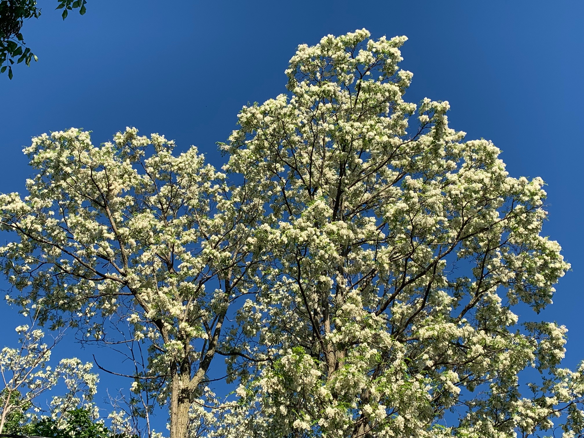
Locust tree over the weekend fully in bloom, St. Albans,
Vermont. These trees probably contributed to what I'm
calling a "pollen storm" in Vermont Saturday.
Today is less breezy, so things outside might be a little better. But it's still dry, so pollen can easily float in the air. It's that time of year. I think a lot of it is coming from pine trees. I also have flowering locust trees around my house, and they reached peak bloom Friday.  Yesterday, the pollen and flower petals were blowing off those trees like crazy.

Rain expected later Tuesday will at least tamp down the "pollen storm" in Vermont a little bit. 

The slight pollen haze that was noticeable yesterday prompted an interesting discussion on Twitter about summer haze. The always extremely helpful folks at the National Weather Service in South Burlington explained the more traditional bluish haze we often see during the summer. 

As NWS Burlington explains, that common blue haze we often see in the summer is to a large extent made up of tree isoprene. It's a natural chemical compound trees release to manage heat stress.  The Blue Ridge and Smoky Mountains are in the hot, humid Southeast and that isoprene release down there is probably how those mountain ranges got their names. 

The National Weather Service agreed that any hazy noticeable in Vermont Saturday was likely pollen or dust, since it wasn't particularly hot out. 

TROPICAL STORM ALEX

Wannabe tropical storm Alex finally turned into official Tropical Storm Alex, ironically after doing most of its damage.

As the storm drenched South Florida with up to 13 inches of rain on Saturday, it didn't have a well defined center. It was just a big blob of torrential thunderstorms. 

Satellite view of Tropical Storm Alex northeast
of Florida this morning. 

Overnight, these storms largely left Florida and hit the warm Gulf Stream in the Atlantic Ocean, northeast of Florida.  

The Gulf Stream is even warmer than normal right now, and the thunderstorms took advantage of that heat to organize into roughly a circular wind field. That was enough to make it an official tropical storm. Alex is here.

Not for long, though. It had max winds of 50 mph this morning, and might gain a bit more steam today. 

Then it will begin to weaken, once again falling victim to strong upper level winds.  A tropical storm warning is up for Bermuda for Monday, but I think that island will weather this weak tropical storm fairly well.

Flooding was extensive in South Florida from what was then just a potential tropical storm. But a foot of rain can put a lot of streets and highways under water in a short period of time. Dozens of cars stalled in the water in downtown Miami, and in surrounding communities. 

Floor warnings have since been lifted in Florida. 


Saturday, August 7, 2021

The Return Of A Vermont Summer, Smoke, And Slight Risk Of Flood Issues

Another hazy, smoky sunset over St. Albans, Vermont
Friday evening.
 It got up to 87 degrees in Burlington Friday, which is not exactly a remarkable temperature for early August. 

Still, it was the warmest day since July 15, signaling at least a temporary shift away from the relatively cool conditions we've had for a good month now.  

Your air conditioner is probably going to come in handy for the next week or so.  

Unfortunately, another familiar aspect of this summer returned Friday - wildfire smoke.  We knew this would be an occasional problem through into the fall, so there you go. 

On top of that, there is a minimal, but definitely not zero risk of flash flooding here and there on perhaps a couple days going forward.  That's bad news, too, since there's been damaging floods already in Vermont this summer

The good news is that the chances of any flash flooding look pretty small this week. And if the flooding does occur, it will probably be pretty isolated, and not widespread, fingers crossed. 

First off, the warmth:

The Bermuda High, that perennial summertime heat pump, had been mostly AWOL for the past few weeks, but it has now reasserted itself. We have decent shots of hitting 90 degrees in parts of Vermont over the upcoming week, depending on how cloudy the afternoons get.  It hasn't been 90 degrees in Burlington, Vermont since June 29. so this will be a switch.

Friday was also the last day for awhile in which humidity was pretty comfortable. That old Bermuda High is pumping plenty of moisture up from the tropics.  Already, early this morning, the air felt a lot heavier and stuffy here in St. Albans, Vermont than it did last evening, when I lazily lingered out on my back deck.

It will be muggy all week, and nights will be stuffy for sleeping. This state of affairs looks like it will go on at least until Friday. 

A cold front looks like it might flush out the oppressive air by around then.

All that tropical humidity means the air is set up for downpours and thunderstorms. All you need is a trigger to set them off. 

One such trigger arrives this afternoon, in the form of what  I suppose you could call a "cold front" from Quebec and Ontario. It's not really bringing any cooler air, or lower humidity. But it does add a bit of lift to the air and a slight wind shift.  

That'll be enough to trigger some showers and storms, especially this afternoon and evening, and especially along and north of Route 2. It'll all be hit or miss. A lucky few will get a good blast of a downpour, many others will get nothing at all, except perhaps a view of a dark cloud or two passing by to the south or north. 

The "cold front" such as it is, will just sort of fade away over central New England tomorrow. The remains of the boundary, and the usual updrafts around the Adirondacks, Green Mountains and White Mountains, should be enough to set off another round of hit and miss showers and storms Sunday afternoon and evening. 

Where they form and die is an open question.  Once again, many, if not most of us, will see no rain out of this, or very little. A few spots, especially in the mountains, will get a really socking from heavy downpours.  

Whichever storms do form Sunday probably won't move very fast, and with all the wet air around, they'll be able to produce a lot of rain in a short time.  That's where the risk of flash flooding comes in. NOAA's Weather Prediction Center has us in a marginal risk zone for flash flooding on Sunday.

That's the lowest of five alert levels and means there could, maybe be an isolated spot or two with flash flood problems.  If I had to guess where this might happen, if at all, I'd say the southern Green Mountains. 

There are chances for additional torrential downpours Wednesday into Friday, but it's too soon to figure out how widespread and heavy they might turn out to be.

As for the wildfire smoke, there's no fires to speak of in the Caribbean and western Atlantic Ocean, of course so that air coming at us from there is pretty clean.

But dirtier, smokier air can get entrained in this southwest air flow over us, so you will see varying levels of haze over the next week and beyond. So far, it doesn't look like it will be anything extreme over New England, so air quality will be OK.

At least we don't have choking smoke like cities in the western half of the U.S. are experiencing. Air quality alerts are rampant out there, so I'm sure there will be health effects. By the way, I've read that air pollution makes Covid worse.

Sigh.

Wednesday, July 21, 2021

Vermont Smoke Gone; Will It Come Back?

No view of Lake Champlain from St. Albans Hill in 
Vermont due to thick wildfire haze. 
 The air was much cleaner Wednesday in Vermont than it was Tuesday, when air quality alerts were up for the state.  

That was due to the wildfire smoke that drifted in from western wildfires. Air from clean northern and central Quebec is sweeping into Vermont, as I noted this morning, so it will be better, at least for awhile.

The smoke will be back, though! Once winds shift to more of a westerly direction, probably by the weekend, at least some haze will return. 

More than likely, it will be aloft more than it was yesterday, so we'll have hazy skies but not so much of a health threat. 

There's always the possibility that we could have days with air pollution at alarming levels, though. 

This state of affairs will go on well into the autumn, when winter rains and snows finally extinguish the worst of the fires. 

Here's a brief video of what it looked like in northern Vermont amid the smoke Tuesday.  Blogger has trouble displaying videos on mobile devices, so if you can't see it click on this hyperlink.

Video below. Click on the arrow then the YouTube logo for best viewing


Monday, September 28, 2020

California WIldfire Nightmare Stuck On Repeat; Santa Rosa Again?

 In 2017, the so-called Tubbs Fire roared into the city of Santa Rosa, California, killing 22 people and destroying some 7,500 people.   It was one of the most apocalyptic wildfires in California history. 

I bring this up because, to an extent, history is replaying itself in the Napa Valley and Santa Rosa just three years after the Tubbs fire. 

A raging wildfire overnight near St. Helena
California. Photo via Twitter by Caroline Garcia.

Homes are burning, wineries are destroyed and thousands of people are fleeing from wildfires that blew up yesterday and last night in the same areas wrecked by the Tubbs fire. 

California just can't catch a break. 

So far at least, the current devastating wildfires are likely not quite as destructive as the Tubbs fire. 

That's not much comfort, though, for people who have lost their homes and businesses in the past couple of days. Not to mention the thousands of homes destroyed in the West during this extreme fire season of 2020.  Nothing is going right in 2020. 

I can only imagine the horror and PTSD spikes going on with people who lived through the fires of 2017, only to experience the exact same thing again now. 

Since this is a breaking story and people can't really get into the danger zone to assess the damage, we don't know how bad this latest outbreak of fires is. There are plenty of videos and photos on social media of homes and businesses burning.

There are also videos of harrowing drives through flames as people frantically evacuate. Unfortunately, we've gotten used to those videos this year. 

These repeated fires will certainly affect California's economy, population and society for years to come.  I can imagine people - including those who have never had their homes damaged by wildfires - will give up on California and move away. 

The Chateau Boswell winery near St. Helena,
California in flames Sunday.

Who wants to live in a place where you're constantly evacuating or under threat of evacuations?  A place that's hazardously polluted from wildfire smoke for weeks or even months on end every summer and autumn?

In the short term, anyway, the fires will continue to rage today under hot, dry, windy conditions. The weather will turn a little better in northern California later in the week. The winds will be lighter, which is a good thing. 

The fires will continue to burn, though and could explode once again if any other bouts of strong east winds develop, which could easily happen at any time during the next two weeks at least. 

There is no rain in the forecast anywhere in the western third of the United States for at least the next week, except for light showers in northwestern Washington.

Wildfire smoke will continue to drift its way across the United States for the foreseeable future, giving large areas of the nation hazy skies. 

I notice some wildfire smoke overhead in Vermont this morning, making this the eight consecutive day we've noticed the smoke in the atmosphere over the Green Mountain State. 

The fire danger here was fairly high yesterday, but clouds and moist air kept the danger limited in parts of Vermont. We're still looking at a good chance of a decent rainfall later Tuesday into Wedneday morning.