 |
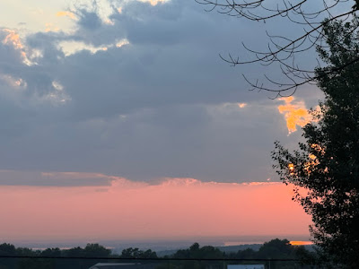
| Hazy skies near sunset last evening as viewed from St. Albans, Vermont as wildfire smoke started making another unwelcome visit.. An air quality alert is in effect for most of Vermont again today |
Some places, like Baltimore, Maryland (102 de
grees), and Newark and Toms River, New Jersey (both 100 degrees) set record highs for the date.
High temperatures in Vermont, meanwhile, held mostly near 80 degrees north and to around 90 south, in places like Springfield.
True, it was awfully humid Thursday. You'd think we'd get some rain. But not really,
The timing of the front during the morning and early afternoon kept most of us from getting a drenching.
My area around St. Albans did better with the rain than almost anyone else. I got an unofficial 0.60 inches, because at least three clusters of brief downpours got me. Most places only received one brief shot at rain with the cold front and that's it. Amounts were a quarter inch or less. Some places in southern Vermont got virtually nothing.
I notice the forest fire in Fair Haven, Vermont was still burning and slowly spreading as of yesterday in nearly rainless Rutland County.
SMOKE ATTACK, AGAIN
Somewhat cooler and less humid air arrived in Vermont last evening. But it came at a price: Smoky air has hit once again. From our friends in Canada,
Atmospheric conditions unexpectedly forced some of the smoke that was aloft to the ground. At around 7 arm, this morning, an air quality alert was hastily issued for most of Vermont and it remains in effect until 11 p.m, tonight
The smoke mixed with fog to create a smoggy Vermont morning. Some monitoring stations had an air quality index as low as 170. Anything under 150 is unhealthy for everyone, not just people who have pre-existing conditions.
The fog is burning off this morning. The smoke will slowly thin just a bit as the day wears on but definitely not entirely go away,
Other than the smoke and haze, we should still eke out a decent Saturday with sunshine filtered by the haze and highs in the 80s. The humidity should stay moderate.
SUNDAY QUESTIONS
I give up on forecasting tomorrow's weather, since the computer generated stuff is so contradictory. The model do not at all have a good handle on where the most rain will set up. And how much will fall.
Suffice it to say it might rain, it might not.
It does look like southern Vermont could get a period of decent rain in the morning especially. It's still very hard to know how much rain will fall and how far north it will come in Vermont. It''s possible places near the Canadian border get nothing,
But it's all a crap shoot. Don't be surprised if it rains, don't be surprised if it doesn't. Just be aware it might.
During the afternoon, there could be enough instability to trigger some more scattered storms, as the humidity will be going up
HOT TO COOL
The increasing humidity Sunday will be a sign of one last gasp of hot, muggy air before the well-advertised weather pattern change arrives.
We'll make a run at 90 degrees again Monday, which might well be the last such hot day for a long while. Depending on how the weather pattern in mid to late August sugars off, it could be the last 90 degree day of 2025. No promises, though.
The change will start Tuesday with a series of cold fronts that will keep coming through on Wednesday.. It should gradually cool down during the time frame, with highs maybe in the 80s Tuesday, near 80s Wednesday and then down in the 70s by Thursday,
At this point, anyway, the fronts don't look like they'll have much oomph to them, so we're not expecting much rain from them.
This will be all thanks to chilly high pressure from Canada. It will stay cool for several days given how slowly that high will be moving. Current projects have in Canada just north of North Dakota Wednesday, and it'll only make it to about Lake Michigan by Saturday.
That will keep us in cool, dry northwest winds. We'll have to see, but it might also keep us in the smoke, since some of the air will be coming from the zone in central Canada that is still burning with widespread forest fires.
Long range forecasts (grain of salt type things) indicate something of a warmup again starting again a week from tomorrow, but it's unclear how warm it will get or how long it would last.

No comments:
Post a Comment