Showing posts with label Polar Vortex. Show all posts

Sunday, January 25, 2026

Climate Change CAN Worsen Winter Storms. But It's Complicated

Upper level forecast shows how cold weather
in eastern U.S will last into early Februarty.
Green lines depict the jet stream. Note how
wavy it is and how it heads southeastward
into the United States. Those red dotted
areas indicate areas of high pressure and warm
air for the region. That so much of the red
dots mean there's an Arctic amplification,
which means cold air is being squashed 
southward toward us. Scientists are 
studying whether climate change is making
weather patterns like this more likely. 
I suppose I can't blame President Trump for wondering where global warming went

There's massive amounts of ice and snow from New Mexico to southeast Canada. The South is locked in ice after a bunch of freezing rain. People are shivering in their homes without electricity. 

Dozens of daily record low high temperatures and record low overnight temperatures have already been set this weekend, mostly in Kansas, Oklahoma and Texas.  More records will fall in the next few days, mostly across the South and southeastern parts of the U.S.  

Whether this storm, or any other extreme winter event in recent years can be tied to climate change is iffy. But there are some picky scientific details that suggest the warming world can paradoxically helping create these epic winter storms and cold snaps. 

As Meteorologist Jeff Berardelli explains, climate change can during relatively brief periods enhance the cold in places like the United States.

Sometimes - and this is occurring now - blocking high pressure settles over the Arctic, especially near or over Greenland - making them warm. At least warm compared to the insane cold you should expect up there. 

This setup shoves the cold air down into places like the United States and western Europe. 

Meanwhile, the Arctic overall is warming at a pace up to four times greater than most of the rest of the world.  That's called Arctic amplification. In fact, right now it's super warm for the season in parts of Greenland. In Nuuk, on the relatively mild southwest coast of Greenland, normal highs this time of year are around 20 degrees with a low of about 12.

The Weather Channel says Nuuk will have a high temperature of 42 degrees today, and it probably won't go below freezing tonight. 

Berardelli notes that the extra warming from climate change amplifies the blocking high pressure over the Arctic or Greenland.  That, in turn even more firmly pushes the cold air toward the United States and other mid-latitude places .

The air coming down from the Arctic because of this pattern isn't any colder than it used to be. In fact it's somewhat warmer. Punches of frigid air that have always blasted into the Upper Midwest are generally a bit milder than the were a generation or two ago. 

For instance, one study by Climate Central noted that the lowest temperature of the year has increased by 12 degrees since 1970. 

But when these Arctic air masses get pulled all the way down into the southern half of the United States, big trouble ensues. Like the winter storm we're having this weekend. 

There's at least circumstantial evidence that a wavier jet stream has started to occasionally send at times unprecedented blasts of Arctic air far south, all the way to the Gulf of Mexico.

We had the big Texas freeze and utility collapse in 2021, the one that killed nearly 250 people. Last January, an unprecedented snowstorm swept the Gulf Coast, burying places from New Orleans to Pensacola, Florida in more than six inches of snow. New Orleans was actually under a blizzard warning in that event. 

Just last week, it snowed again in northwest Florida. Now this storm. 

The Arctic and Greenland blocking helps make the jet stream wavier, which helps explain why there's such a harsh cold spell going on now.  When jet stream plunges south from northern Canada, it's going to be horribly, miserable cold.

There's still a lot of debate in the scientific community on whether climate change itself is making the jet stream much wavier, especially in the winter. 

When that happens, we could see bigger southward dips in the jet stream, like we're seeing now. 

There's at least circumstantial evidence that a wavier jet stream occasional has started  sending at times unprecedented blasts of Arctic air far south, all the way to the Gulf of Mexico.

Per Grist:

"'The problem is that it's really hard to show whether or not that's happening,' said Jacob Chalif, who studies the phenomenon at Dartmouth College. 'Arctic amplification started really kicking off in the '90s, and we only have really solid record of the jet stream going back to 1979.'"

That leaves about a decade of records to help determine whether what's going on now is something new. 

Dartmouth researchers are now using machine learning to get a picture of jet stream patterns during the  the entire 20th century. There's evidence there were even wilder swings in the jet stream between 1900 and 1979. 

So, the jury is still out as to whether a warmer Arctic is increasing the chances that the U.S. will have terrible winter storms due to whacked-out jet streams. 

Another factor is the polar vortex. It's that big whirl of absolutely ridiculous frigid air that roams the high latitudes. When it's in Canada, closer to the United States, chances are at least part of the nation will be on the cold side.

Sometimes, the polar vortex stretches, and becomes more oblong. if it stretches toward the U.S., we get frigid and fast.

Some science suggests that the polar vortex is stretching more frequently than it used to

Per CNN

"Judah Cohen, a research scientist at MIT, said the stretching of the vortex is tied in part to sea ice loss in parts of the Arctic from human-caused climate change. He also said above average snowfall in parts of Siberia raises the likelihood of such stretching events, and this too is influenced by a paucity of sea ice in the Barents and Kara Seas in the Atlantic Ocean."

'"On the southern flanks of the polar vortex, over the U.S. and Asia, an under that where that stretching is happening, there's been an increase in severe winter weather,' Cohen said. 'I'm not saying any one weather event is attributed to climate change,' he said. 'But I do think it loaded the dice here.'"

Even if you ignore the polar vortex and the Greenland Block and the wonky jet stream, the fact of the matter is it's winter. Sure, the climate is warmer, hut that doesn't mean winter is canceled. It can still get brutal out there.

We're living that out right now.  


Friday, April 11, 2025

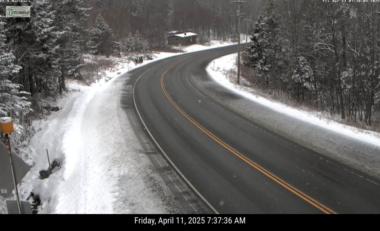
Vermont Just Can't Seem To Escape The Clutches Of Winter

Another snowy April morning in parts of Vermont today.
as this traffic cam view of Route 9 in Marlboro,
Vermont shows. More snow is due in parts
of the state on Saturday. 
 Winter weather keeps poking its head into our April springtime here in Vermont, like an annoying person at the next table continually butting in, interrupting your romantic restaurant dinner to comment on the food, service etc.  

Spring keeps trying to advance in Vermont, but lately, it's been tough, with plenty of setbacks. 

Yesterday morning in Montpelier, it got down to 16 degrees, a record low for the date, beating out the 17 degrees set in 1997.

The snow depth near the top of Mount Mansfield reached 92 inches yesterday, which was actually seven inches deeper than it was at the start of the month. 

In parts of southern Vermont, it snowed again last night. Traffic cameras indicate the high elevations got somewhere around an inch of snow. Even valley floors in southeastern Vermont, like around Brattleboro, got a slushy coating.

And there's more snow on the way. 

SATURDAY

Yes, we have to post yet ANOTHER snow prediction
map for Vermont. April does not spell the end of this 
in the Green Mountain State. Some high elevations
of southern Vermont could see four or five
inches tomorrow. Northern areas mercifully
lose out on snow chances. 
A storm of sort is going to send a band of precipitation northward across Vermont Saturday. When it enters southern Vermont, precipitation should be fairly heavy.

It will also be cold enough for snow. Low elevations in southern Vermont could pick up another inch or two of snow out of this, while high elevations could go as high as four or five inches.  

The band of precipitation will weaken as it heads north and northwest during the day, so snow amounts will diminish the further north you go.

 Plus, lighter precipitation doesn't help cool the air as much as heavier rates do, so chances are a lot of this will be rain in low elevations central and north. 

By the time you get into the central and northern Champlain Valley, and near the Canadian border, the band of inclement weather will have weakened so much that very little rain or snow will fall. If any. 

This state of affairs will make for some "backwards" Saturday temperatures.  The coldest part of Vermont will be in far southern parts of the state, where highs might well just stay in the 30s. By the time you hit Montpelier and Burlington, it'll get up into the 40s.

Way up north, up by St. Albans, Highgate. Alburgh and over to Newport  it could reach 50 degrees.  

BRIEF SPRING BREAK

We'll get a very brief break from our winter in April Sunday and especially Monday. It's now looking like the sun will want to come out Sunday in most of Vermont, which would bring us up into the seasonable low to mid 50s.

Monday looks like it will get into the pleasant low 60s in many valley locations, and well into the 50s elsewhere. So pretty nice. Don't count on it lasting.

WINTER NEXT WEEK

Another cold front will bluster through on Tuesday, dropping our temperatures back below normal again for the middle of next week. 

Tuesday might start out warm-ish but a cold front will probably bring rain Tuesday,  then perhaps some  snow showers by Tuesday night and Wednesday, especially  north and mountains.  As it looks now, highs Wednesday will only be in the 37-45 degree range, again, pretty chilly. 

WHY THE CHILL

Ironically,  our bouts with April chill are a bit of a sign of spring.  The polar vortex, a swirl of intensely cold air takes up residence somewhere in the far north every winter. Its position relatively close or far away from us determines whether it's cold or warm around here,

Every spring, usually around mid-April, the forces of spring disrupt the polar vortex and it kind of disappears and goes into hibernation for the summer.

This year, that disruption happened earlier than usual - in mid March.  When the polar vortex gets wrecked like that in the spring, it can change the jet stream to push cold air into the eastern United States and parts of northern Europe.

That's what happened here. Since the polar vortex mess happened early this year, the resulting cold air up here in New England was more noticeable than it would have been later in the spring. 

Normal temperature are rising rapidly this time of year, so in general, each cold front will create less of a sting as we move forward through the month. 

There's mixed signals as to whether we'll see any sustained warmer weather for the last two weeks of April.  Many forecasters think the effects of the polar vortex's spring demise will fade by late April, and we'll be able to get on with our regularly scheduled springtime. 

We deserve it. 

Monday, February 24, 2025

United States Remained Frigid This Winter While Much Of The Rest Of The World Stays Balmy

Schematic from climate.gov of how cold waves work
Left image is when the jet stream keeps the polar vortex
way up north, preventing much cold air in the winter
from coming south. The right image which has
happened frequently this winter is when the jet
stream gets wonky and wavy, allowing parts of the
polar vortex to get closer, supplying frigid Arctic air.
The world's cold spot this winter, perhaps figuratively, and also literally, it turns out, is the United States. 

No, we weren't colder than the North Pole. But relative to average, the coldest temperatures on Earth seemed to often centered on the Grand Ole US of A. 

January featured a cold continental United States with a warm rest of the world. 

While others around the globe were basking in warmth, Gulf Coast cities like Lafayette, New Orleans, Mobile and Pensacola were experiencing an unprecedented snowstorm and all-time record cold 

February has continued the trend. 

Warm spells continue to grace much of the world, with record heat in places like Brazil, Mozambique, southeast Asia, even Lapland and the Arctic north of Scandinavia. 

Meanwhile, places like North Dakota and Montana were in the 30s below zero.  Dangerous wind chills extended down to the Gulf Coast. 

Along the North Carolina and Virginia coasts last week deep snow blanketed the region. Virginia Beach had as much as a foot of snow. Norfolk, Virginia had 10 inches of snow. 

As the Washington Post reports, a remote area about 50 miles northwest of Pierre, South Dakota was, as of a few days ago was the world's coldest place relative to average. Sure, other places were colder, but none were as much as 11 degrees below average.

We in Vermont have at partly shared in this chill, but at least it hasn't been as bad as other parts of nation. 

Much of the U.S. - including Vermont have seen in the past few days temperatures moderate for now. North Dakota is seeing some above freezing temperatures and it has gotten as high as the 50s in South Dakota. Vermont is expecting temperatures near 40 this week. 

But it doesn't look like we're quite done. The weather pattern in early March will revert at least briefly to that cold one again for the United States. And that winter chill could last at least into mid-March. 

REASONS

The particular chilly weather in the United States especially compared to what's going on in the rest of the world, has revived the discussion and debate over whether climate change is paradoxically sending us these cold blasts. 

We know there's always been bitter Arctic cold waves in the United States, and the basic weather pattern that causes them is usually the same. A big northward bulge in the jet stream forms over western North America. 

That helps create a corresponding sharp southward dip in the jet stream down into the central and eastern United States.  Meanwhile there's the polar vortex, that big upper air swirl of frigid air that usually spins somewhere in the far northern hemisphere in the winter. 

This weather pattern I described displaces the polar vortex southward, closer to the United States. Or the pattern stretches the polar vortex into the shape of a peanut, with one end of the "peanut" close to the U.S. and causing a big chill. 

Bottom line: this polar vortex/jet stream set up  funnels the frigid air direct from near the North Pole to the eastern half to two thirds of the United States. 

As the Washington Post describes it, this winter is probably the most intense siege of polar vortex type weather in the United States since 2014. Though the cold in 2014 was more consistent and much worse than what we have experienced this winter. 

Of course, a bit of a factor why this winter has been a little milder than 2014 is that the whole world has continued to warm since then.  So it's a bit harder for it to get as cold as it once did - though there's always exceptions. 

CLIMATE CHANGE?

A hot topic that's been going on for years now is Arctic warming. The Arctic is getting toastier much faster than the mid-latitudes. Is this causing the jet stream and the polar vortex to get weird, taking more excursions south toward the United States or Europe more often than it used to?

The question is still not settled.  

There are also picky details regarding those unsettled questions that are still being hashed out. We know that winters in general have been getting warmer almost everywhere. But some studies suggest some areas - the northeastern U.S. among them - seem to be having much more variable winters.  Some are super warm, a few are pretty intense. 

Even there, it gets muddied. Researchers know the winters are getting milder. They've also found that the absolute coldest temperature in each winter is warming at an even faster clip. 

VERMONT EFFECTS

Our winter is not over, but like much of the rest of the nation, the vigorous winter of 2025 seems like a mild April breeze compared to 2014.  The polar vortex was a frequent visitor to the Northeast in the winter of 2015, which locally was more harsh than the year before. 

So 2015 is the most recent winter that was extremely cold. February that year had an average temperature of 7.6 degrees the third coldest on record behind 1934 and 1979. 

Depending on what this week's anticipated warm spell will do, February, 2025 might turn out to be the coldest since 2015, but will be far, far, milder than that year. 

February, 2025 will be snowier than than 2015, when 22.7 inches fell. We're already about nine inches ahead of 2015 this month.  

However, in 2015, the storm track was just to our east. Late January and February was the historic "snowmageddon" in Boston, when 95 inches of snow fell within a month

The bottom line for Vermont is this winter will end up as a more "traditional" one than we've seen in recent years, but it will be far, far from the coldest. And not nearly the snowiest, either, unless we have an enormous surprise in March and April. 


Saturday, April 6, 2024

Far Fetched But Possible It Turns Out: Northern Lights Can Cut Your Winter Heating Bill

Geomagnetic storms, which cause northern lights, might
lower your fuel bill, believe it or not! 
 Since our brains might be still on celestial mode, given the wonderful eclipse we had this week, another event in the sky is making some science news.

Northern Lights.  None are in the immediate forecast, but hope springs eternal. 

In any event, this is a good excuse to lay out some new science that seems very strange, but quite possibly true:

The northern lights can lower your winter heating bill.

It's a convoluted, Rube Goldberg kind of process, but here goes, courtesy of an article in the Washington Post: 

The sun spews charged particles toward Earth, especially when there's a solar flare, basically an eruption on the sun. 

Those charged parcels bang into the extreme top of the atmosphere, where it excites molecules, which emit light. Those lights are the aurora borealis. 

Those particles eventually start falling toward Earth very slowly, and create molecules of nitric oxide and other chemicals. Once these fall into the stratosphere gradually over weeks and months. The stratosphere is where the ozone layer is, and those molecules can destroy ozone. 

If you destroy ozone in the stratosphere, it can cool that layer of the atmosphere. If scientists are correct, solar flares and the aurora can prevent something called a  "sudden stratospheric warming."

When that happens, it can disrupt the the polar vortex. The polar vortex, you might recall, is a swirling pool of intensely cold air in the atmosphere that lives in various places, usually in the Arctic during the winter.

If the polar vortex is tightly wound and near the North Pole, winter weather in places like the United States and Europe is usually relatively mild. 

If the polar vortex is disrupted buy a sudden stratospheric warming, it can stretch, weaken and move to weird areas. When that happens, it very often opens the door to Arctic blasts invading North America, Europe and/or Asia. 

Cold waves in the mid-latitudes increase electric and other utility bills. Which means if solar eruptions and the northern lights are more active than usual, it might keep money in your wallet.  

Saturday, January 6, 2024

What's With Vermont's Balmy Winter Nights?

Jackson the Weather Dog out after dark Friday evening
measuring the meager snow cover and checking out
our little-used snow shovel. The lack of snow cover
has helped lead to warm nights, relative to normal in Vermont.
 Friday morning was the chilliest so far this winter in Burlington, Vermont, dipping down to 13 degrees.

  But chilly is an awfully strong word to describe that temperature.  

Considering that temperature is just about normal for a time of year when temperatures have historically gotten into the 20s below zero.   

Simply put, we haven't had any truly cold mornings this winter.  And won't for a little while at least. 

Remarkably, it hasn't even gotten even into the single numbers above zero in Burlington, never mind below.  I don't recall seeing such sustained warmth so deep into any winter.  

WARM WEATHER PATTERN

There's at least a couple reasons for this dearth of cold nights so far. The first is the general weather pattern, which has been really, really persistent all winter so far. Most of the time, air is making a cross country trip from the Pacific to the Atlantic.  

This is preventing frigid air from making its way down from northern Canada.  It's locked away near the North Pole, kept there by a strong polar vortex up there keeping the truly frigid air close to its heart.  

This state of affairs isn't necessarily permanent. It never is.  

As I've previously noted, some, but not all long range forecasts have the polar vortex weakening or stretching out into an elongated mess.  If that were to happen, it would be easier for bitter air to head south toward the United States. 

The latest long range forecasts (keep that grain of salt handy) have the polar vortex doing that weakening thing, shifting and allowing frigid air to plunge into the western and central parts of Canada and the United States. This would start this coming Wednesday or Thursday. 

This should lead to a volatile weather pattern featuring intense cold in the northwestern United States and lots of storminess across most of the Lower 48.

We should expect a fair amount of storminess in Vermont out of this, but it remains to be seen whether any of that bitter air makes it as far east as New England. We shall see!

NO SNOW COVER 

Another big reason for the warm nights is a lack of snow cover. On any clear night, snow cover helps reflect any lingering heat back up to space, so temperatures crash. If there's a fresh, deep snow cover on a clear, calm winter night, temperatures would really hit rock bottom.

A 2017 article from meteorologists at WCCO in Minnesota helped explain this further

"Snow gives out what's called long-wave radiation. Essentially, it's letting go of whatever heat it nay have and cools the air even more. This is especially true with fresh snow."

Bare ground exposed the air to the warmth of any moisture in the soil. Which means if there's no snow on the ground, it's harder to get colder at night. 

If the forecasts are right, most of Vermont should finally see a decent snow cover by Sunday afternoon.  In the short term, though, that won't lead to any particularly cold nights. Southern Vermont might get a little chilly - single digits above zero, if skies clear Sunday or Monday nights. 

Otherwise the weather pattern has featured cloudy nights, which tend to be warmer. That'll be the case heading into midweek. Plus, the parade of storms is, for now, pumping mild air our way, keeping nighttime temperatures warm. Despite the snow cover, which might end up melting Wednesday depending on how warm it gets during the day,

CLIMATE CHANGE TRENDS 

 Though there are a few years thrown in with a higher number of frigid nights, the trend in subzero temperatures in Vermont is downward, due largely to climate change.   . 

Take last winter for example.   The temperature never got below zero until February 1 in Burlington. It was just one of  small handful of winters that lasted that long without a first zero of the season. 

 I don't know how long we'll last this winter without a zero or below, but this isn't your grandparents' winter. They would have froze their bloomers off on many mornings by the first week in January. 

In the past, most years had their first zero in Burlington sometimes in December, or perhaps early January in the warmest years. 

Only one winter in Burlington, 2001-02 stayed above zero all winter. I doubt we'll repeat that winter, as subzero nights have historically happened as late as March 29 in Burlington. It's still awfully hard to get through a winter without at least one spell of frigid Arctic air. 

But there's still no sign of any major cold for at least a week around here in New England. 

Friday, December 29, 2023

No, Bitter Cold Isn't Coming Anytime Soon, Despite Social Media Click Bait

A brief but intense cold wave last February 3 brought steam
devils and funnels over the relatively warm waters of
Lake Champlain. That cold spell hit in an otherwise
warm winter. Despite the hype, there's no 
guarantees on whether it will turn frigid 
later this winter. 
 If you pay attention to any of the click bait weather sites on social media, you'd think we're headed into a new ice age later on in January. 

Oh, we have a sudden stratospheric warming!  The polar vortex is going to go haywire! Incredible cold is going to envelop the Northern Hemisphere for the rest of the winter! We're ALL GONNA DIE!!!!!!

Um, no. Relax, folks. 

For us here in Vermont, and for the rest of the nation for that matter, we probably will see some sharp cold spells in January and February. 

It's winter, after all. Climate change does not prevent subzero cold waves. It just makes them somewhat less likely, 

And honestly, it's incredibly hard to imagine our January will be nearly as much warmer than normal as this December has been. This month will very likely be the second warmest December on record in Burlington. 

THE REALITY

Like all internet hype, there are grains of truth in them and the basic science behind the hype is also fairly accurate. But that doesn't mean a frigid Armageddon.  It just means we'll have interesting weather. Nobody in their right mind is able to tell you what kind of interesting weather we'll see beyond, say New Year's Day.  So we'll have to work with what we have.

To set this up, let's review the basics. First, the polar vortex.  It's a big whirl of cold air in the atmosphere that's always somewhere in or near the Arctic during the colder months. Depending on where the polar vortex is, and how the jet stream is oriented around it, the Arctic air might slip down into Europe, or Asia, or North America. Or it could remain bottled up near the Arctic.

For the most part, the polar vortex has lately been pretty tight and sitting way up there in the far north. That's keeping the bulk of the ridiculously cold air far to our north. That's why it's so warm. 

The jet stream is in the process of reconfiguring itself, so it might get a little colder as we head into the New Year, but it will still be fairly mild. 

The next big thing in the hype machine is that sudden stratospheric warming.  For some reason, in roughly half of all winters, the stratosphere warms up over the far north. It's part of a pattern in which the polar vortex abruptly weakens and gets disorganized. The polar vortex can also stretch out in weird directions and can temporarily relocate it further south. 

When this happens, bitter Arctic air can easily slam southward........somewhere.  Again, could be Europe, could be Asia, could be southern Canada and the United States.

The reason people online are getting the vapors is because there are signs a sudden stratospheric warming might be about to happen.  We're not absolutely sure whether it will happen, but the way signs are pointing, experienced meteorologist wouldn't' be surprised if it does in the next couple of weeks. 

The effects of this on the ground are delayed a bit. So whoever loses the luck of the draw - if anybody - in this, it won't happen until maybe the second half of January into February. 

On top of all this, we have other factors to consider.  We're in a raging El Nino, which keeps the southern end of the jet stream across the U.S. South active. Will a weirded out polar vortex work in concert with El Nino to direct Arctic cold and blizzards into the United States?   Or will El Nino direct any cold air toward Europe?  

The answer? Dunno. 

But wait, there's more! Other complex factors will help determine whether we have any kind of old fashioned Arctic blast later this winter, or will it be another pffft type of season.  

 Will the weather pattern feature a jet stream blowing hard into the West Coast then heading east across America? That could keep us on the warm side. Or maybe a ridge of high pressure will develop over the Rockies and western Canada. That would send cold air plunging our way. Or maybe there will be blocking high pressure in or near Greenland, which could also make us cold and stormy. Another possibility is a ridge of high pressure off the southeast coast, which keep us in New England mild.

Yeah, it's complicated. 

BOTTOM LINE

It's fun to try to read the tea leaves to figure out what the rest of the winter will be like. I plead guilty to that sort of thing. 

Some weather enthusiasts love to imagine epic East Coast blizzards.  That's all well and good. But some of them are wishcasting - defined as forecasting for the kind of weather they want, and not necessarily what will actually happen. 

Basically, don't believe any forecast you hear that's more than five days out. If you wake up on Saturday morning to hear that a blizzard is coming the following Saturday, ignore it until midweek, and then see whether wintry weather is coming or not. 

Chances are, thet blizzard that one computer model run out of of hundreds spit out will go poof, and we'll just have boring January weather instead.  

Wednesday, February 1, 2023

The Arctic Cold Gathers, Then Weather Whiplash In Vermont

Latest wind chill forecast map from the National Weather
Service office in South Burlington, valid 7 a.m. Saturday.
Most of us are in the upper 30s to mid 40s below
on the wind chill scale. 
We got our first taste of true winter cold this morning, with much of Vermont going below zero.

Burlington got to minus 2.  This was the fourth latest first zero of any winter I'm aware of.  Meanwhile, Island Pond, Vermont and Saranac Lake, New York dipped to 20 below. Lake Eden, Vermont was close behind at 18 below.  

We'll see a warmup of sorts today and tomorrow ahead of the long-anticipated Arctic blast, but it won't be all that balmy. Today will get into the low to mid 20s.

Thursday could hit the low 30s in warmer valleys. But gusty south winds will make it feel colder. Then we get into the nastiness: 

Thursday Night: During the first half of the night, the cold front arrives, probably accompanied by a band of snow squalls. Those will create quick drops in visibility and danger on the roads amid brief heavy snow and blowing snow. 

Overall accumulations won't amount to much, perhaps an inch or two, but that's not the real story, of course Temperatures will rapidly crash, and probably be below zero by dawn across much of Vermont, central and north. 

Wind chills will have drop into the 30s below overnight and before dawn. We do have that wind chill watch for all of Vermont and surrounding areas from late night Thursday through Saturday. 

Friday: A real ugly day for sure. If you greet the dawn Friday at below zero, there's a good chance actual temperatures won't get above zero all day.  The warmest anyone in Vermont will get will be close to 10 in the "warmest" southern Vermont valleys.

North winds will continue blasting all day at around 20 mph with higher gusts. Wind chills will be in the upper 30s and 40s below all day. This is truly dangerous weather, especially since we're not accustomed to it. 

If you must go out, be sure to keep skin covered. Make sure your car is ready with a good battery and a full tank of gas. And keep some extra blankets and other warm clothes in the car in case you get stuck out there. Also, how's the fuel tank in your house? Full enough? Check it now. 

Lake Champlain will look interesting amid the frigid temperatures and strong winds. It's still largely ice-free, thanks to the warm winter we've had until now. You'll see lots of wind blown steam, and perhaps some whirls or funnel clouds out there.  Lake effect snow will probably fall southeast of the lake, but accumulations will be light. 

Friday night: That, of course, is when we bottom out as Arctic high pressure noses, aided by the Polar Vortex, which by then will have swooped into eastern Quebec and touching the northern tip of Maine. 

Although winds will diminish, they won't entirely die out, which means two things. On the bad side, wind chills will still be in the basement, staying in the 30s and 40s below. On the good side, the winds will keep the air mixed in some locations, so the actual temperature won't go as low as it could if everyone had calm winds. 

That's not saying much. Temperatures through most of Vermont will pretty uniformly be within a few degrees of 20 below.  Probably mid and upper teens below in the Champlain Valley and warmer valleys of southern Vermont, and mid 20s below in the colder spots. Deeper northern valleys could be protected from the wind. I wouldn't be at all surprised to find some 30s below actual temperatures in Vermont by Saturday morning. 

Climatology Comparison:  It certainly is possible for even Burlington reach 20 below. If it does, it will be the first time it's gotten that cold since January 7, 2018

This will also probably be the coldest February temperature since February 24, 2015, when it was 19 below in Burlington. In the off chance it gets to 20 below in Burlington, it will be the first time it's gotten that cold in February since an especially intense cold wave on February 7, 1993 brought Burlington down to 27 below.

As intense as this Arctic blast is, it certainly won't be the coldest February readings on record. In Burlington, that honor goes to a 30 below temperature on February 12, 1979.  Statewide, the coldest on record in February is 46 below in East Barnet in 1943

Saturday: After that horrifically cold start, temperatures will only slowly warm under a fair amount of sunshine. North winds will continue to make for a terrible wind chill. Most places in northern Vermont won't even get above zero. But at least winds will temporarily diminish in the afternoon. 

Saturday night: Here's where weather whiplash starts to get us. I told you this would be a brief Arctic smash. Temperatures wills start to crash at and just after sunset, especially east of the Green Mountains. But before they get too cold, they'll level off as the core of the cold air zips off to the northeast. Plus, south winds will start to blow. 

Here's something to warm your heart. After our Arctic
blast Friday and Saturday, long range forecasts call
for warmer than normal weather in the eastern U.S.,
including in Vermont, next week. 

Temperatures will bottom out during the first half of the night in the teens below zero in much of eastern Vermont and single digits below west.

Temperatures in many places, especially the Champlain Valley, will rise overnight and during the wee hours of the morning. It'll actually get pretty windy in the Champlain Valley overnight, so blowing snow will become a problem. 

Sunday: Weather whiplash continues. We're dealing with a strong warm front and a strong cold front. Neither will have much moisture with them. .But what they lack in moisture they'll make up for with winds. 

The Champlain Valley will "warm up cold" as I like to say. Temperatures will rocket upward, but the stiff winds will make it feel colder. Pretty much everyone in Vermont will see some pretty good south breezes. By late afternoon expect highs to actually be at or a wee bit above normal.  That means highs in the 27 to 35 degree range. 

Sunday night: The one trouble with the approaching cold front will be the risk of more snow squalls Sunday evening, so we'll have to keep an eye on that. The "cold" air coming in behind the cold front won't be cold at all, so we should expect a normal winter on Monday. Highs in the 20s to near 30.

Beyond that, it could be 40 degrees by Tuesday. 


Monday, January 30, 2023

The First Truly Hard Core Winter Week Of The Season In Vermont Is Here

Just one of many forecast maps that show the Polar Vortex
right near us in southern Quebec at the end of the week.
This will create a brief, but intense Arctic blast in Vermont 
If you have been waiting for a true Vermont winter, this will be your week. 

Colder weather started last night. It will stay cold,  then colder, then ridiculous as the week wears on. By the time Friday and Saturday come along wind chills will be solidly in the 30s and 40s below. Temperatures might or might not get above zero Friday and Saturday afternoons. 

Friday night and Saturday morning, it will be in the teens below in the "banana belt" towns right near Lake Champlain and in some far southern Vermont towns. For pretty much everybody else, it will be in the 20s below. Actual temperature, not wind chill.

It might seem late to dig out your winter gear, but now's the time to do it.

Before we get there, the first half of week won't be too bad, at least not by Vermont standards. But the warm weather is gone. Though this will be the longest period we've had below freezing all winter. It dipped below 32 degrees last evening and will stay there for awhile. 

Wind chills this morning, actually are in the single numbers, so kind of cold. Roads might be icy in spots this morning, especially north, where a little wet snow fell, then froze yesterday. Up here in St. Albans, we collected 1.4 inches of slush, which then turned mainly to an icy snow cover once temperatures dropped.

More little disturbances in the atmosphere should touch off more light snow today and tonight. Most places will only see an inch or so of new snow, but the ski areas of northern Vermont are probably in for a good three or four inches. 

Today's little packet of snow will reinforce the gathering cold, so it will only make it into the upper teens for highs on Tuesday. That will make it the chilliest day since December 24 in Vermont. 

We'll get a false sense of security on Wednesday and Thursday as temperatures actually moderate to normal for this time of year - which means 20s for highs. Really not bad! 

Then the hammer hits.

ARCTIC BLAST

The polar vortex, that whirl of intensely cold Arctic air that pretty much always spins somewhere in the high latitudes in the winter, has spent pretty much this entire winter a safe distance from us here in Vermont. It's been way, way north and pretty compact, so that opened the door for mild Pacific air to make cross country trips to New England. 

Now, the polar vortex is stretched, and about to take a quick plunge, ending up way south, into southeastern Quebec by Friday. 

That is more than close enough to give us a taste of true Arctic  air. 

A cold front will blast through Thursday night with some good snow showers, and temperatures will take the plunge.

It will be a horrible Friday with actual temperatures holding in the low single numbers or even falling. Strong north winds will blast in, leading to those intense wind chills. 

Though the wind will relax somewhat Friday night, the temperatures will plunge to the minus 20s, as mentioned. 

 A cold snap of this intensity is also in one respect worse than other, similar ones we've had in the past. During most winters, we've usually gotten used to a few subzero mornings, so 20 below wouldn't seem like that much of a stretch. 

This year, it IS a stretch. The National Weather Service in South Burlington is already sounding the alarm about the fact that this will come as a shock, and we might be unprepared. In their forecast discussion this morning, the NWS wrote, "Extra caution will likely be needed to combat complacency built up through what has been an abnormally warm winter thus far."

One thing to worry about is cars and trucks haven't been put through the wringer yet this winter with intensely cold air. They break down easily in subzero temperatures. 

I expect to see a lot of cars disabled on the roads Friday through Saturday morning. Since tow truck operators might be busy, it could take awhile to get rescued if your car dies. 

This is a great time to stock your vehicle with extra blankets, clothes, high energy snacks and such. 

Also, make sure your gas tank is filled right before the cold hits. 

Check your home fuel supply now and get ahold of your dealer today if it's getting low. They'll have a lot of emergency calls during the cold snap, and might not get to you very fast if you run out. 

A frigid house with frozen water pipes is a terrible place to be. 

While you're at it, check on your elderly neighbors especially to see if they're stocked up and ready for this.  It probably isn't a bad idea to hit the grocery store between now and Thursday afternoon to stock up on supplies. Maybe stuff to make a hearty stew to have during the cold snap.

SHORT LIVED

In an earlier post, I mentioned this winter could be like 2007. That one started warm, then turned frigid for March and April. At this point, though, this winter is looking more like 2016.  It was a warm winter throughout, except for one, big Arctic blast in mid-February.

The Arctic cold that's coming Friday and Saturday is not going to stick around. The polar vortex will get swept east and north, kind of fall apart a bit, and start to reorganize well to the north again. 

By Sunday afternoon, we'll pop back up in the balmy 25-30 degree territory as it looks now. Long range forecasts call for normal or even above normal temperatures starting Sunday and going into mid-February. 


Sunday, January 22, 2023

Intense Cold In Corners Of China, Russia Are One Big Exception To Generally Warm Global Winter

Reports out of northeastern China (pink and red areas)
indicate parts of the region might have had all
time record low temperatures for the nation.
 It's winter, and it has to be cold somewhere, 

Better elsewhere than here in Vermont, at least as far as I'm concerned. I'm definitely no fan of temperatures far below zero. 

In northeastern China in the past couple of days, the temperature got as low as 63 below zero. I hasten to add that this is not as of yet a confirmed report. 

If the report is true and the measurement is verified as accurate,  this would be the coldest temperature recorded in China any year, anywhere. A few other areas got under 60 below in this intense cold snap.

The deep chill is spreading into adjacent North and South Korea, and on to Japan, but the chill will not set as many records there as it has in China and Russia.

Yep, I mentioned Russia. That's because before the deep cold reached China, it was in part of Russia, namely Siberia.

Around January 18, the temperature reportedly dropped to 81 below in Tongulak, Russia. Now, that's normally a very cold place that often gets into the 50s and 60s below zero in the winter. (I would NOT be able to stand that!)

Still, that 81 below, if verified would be a record low for that town, and the coldest it has reached anywhere in Russia since 1982.

Part of the reason for this intense cold is the polar vortex has been far north and tightly wound for weeks.  That has helped keep the mid-latitudes warm. Often, the polar vortex will stretch, or pieces of it will break off, causing nasty cold spells in Canada, the United States, Russia or parts of Asia.

Of course, those blasts of Arctic air get rid of some of the intense cold in the polar vortex. For weeks now, though, the polar vortex hasn't stretched, wobbled or broken, so the air under it has just been getting colder and colder and colder in the darkness of an Arctic winter. 

Now, the polar vortex is finally showing some signs of instability.  The cold in Siberia and China was probably the first effect of that. 

Meteorologists see signs that parts of the United States, especially northwestern and central parts of the nation, could see some pretty intense cold by in the final days of January and the first few days of February. 

However, we don't know quite yet exactly how cold it will get and how widespread the chill will get.

Now that I've mentioned a possible all time low temperature for a nation, I'm sure some wags or idiots will announce that proves climate change is a hoax.

Um, no. 

The amount of climate change we've had so far definitely tilts things so that the chances of record warmth are greater than that of record cold. But climate change does not entirely get rid of the chances of dramatic dips in temperature. 

One example of the this is the number of nations or territories that experienced all time hottest temperature records compared to the number that saw all time record lows.

Eleven nations and territories saw all time record highs in 2022, while three saw all time record lows. 


Monday, December 26, 2022

I Know, I Know, Climate Change Gets Blamed For Everything, But Hear Me Out On Latest Megastorm

Green Mountain Power released this image of tree damage
in Vermont after last week's superstorm cut power to 
much of the state. Is climate change making these
extreme winter storms more likely? 
 The gigantic "bomb cyclone" storm that pummeled practically the entire United States last feel sure didn't feel like global warming.  

Blizzard and winter storm warnings covered parts or all of at least 17 states. More than half the Lower 48 was below zero.  It sleeted in Melbourne, Florida on Christmas Day.  So much for climate change, right?

Or not. There's a case to be made that climate change made last week's weather situation worse than it otherwise would have. Climate change doesn't only make things warmer. Often and under the right conditions, it can just make things more extreme.

That said, here's a caveat with this storm:  There's no proof climate change had anything to do with this, at least not yet. Scientists will probably study this huge, rambling system to learn if there was any connection. We can say there are consistencies with this storm and it's accompanying Arctic outbreak and climate change. 

First of all, climate change does not cancel winter. Sure, winters are warmer than they used to be. But for most of the United States, it's easily still often cold enough in our now balmier winters to have snow. 

Also, pretty much every winter storm that has ever existed needed warm air to survive. Low pressure systems in the winter pull warmth and moisture from places like the Gulf of Mexico or the warm Atlantic waters off the southeastern coast. 

This warm, wet air encounters the usual cold air that exists in winter. That air is forced to rise up and over that colder air. Rising air cools and condenses, and unleashes a literal blizzard of snowflakes.  This is just basic physics. 

Under climate change, that warm, moist air is even toastier than it used to be decades ago.  The warmer the air, the more moisture it can hold.   More moisture more often than not means more precipitation. So it follows that winter storms can produce heavier snow than they used to. They have more moisture to deal with, so they can make more snowflakes than storms did decades ago.

In last week's storm, however most places didn't have extreme amounts of snow, with the exception of places blasted by lake effect snows around the Great Lakes. 

The storm was certainly huge, both in how strong and big it was. Honestly, the storm was the largest in size that I can remember. This giant tempest was also able to pull down a rapidly advancing Arctic air mass that had its origins in Siberia. 

If you want a big Arctic outbreak and/or a big storm, you want a wildly meandering jet stream. No piddling mini southward excursions or wimpy northward turns here!  If the jet stream has a big plunge southward, it'll pull frigid Arctic air southward from near the poles. 

Then, if that big plunge turns a corner at the bottom and heads back northward, you probably have a big storm on your hands

One reason the storm was able to get so big was an enormous dip in the jet stream deep into the heart of the nation. Then, the jet stream  took a corresponding northward sweep up the East Coast and well into eastern Canada. 

Whether the jet stream can meander like crazy in the winter frequently depends on the polar vortex. The polar vortex, you remember, is that giant swirl of frigid air that's usually somewhere in or near the Arctic all winter. 

If the polar vortex is well north, and tightly wound, the truly frigid air stays up by the Arctic circle where it belongs. 

If the polar vortex weakens, it can get pulled, elongated and/or migrated south toward the mid-latitudes of  Asia, Europe or North America. The polar vortex can even break up into pieces temporarily.

When all this happens, trouble usually follow. It makes the jet stream meander all over the place and somebody gets a big Arctic blast and probably a nasty winter storm. 

 The jet stream depends upon a nice big contrast in temperatures between the Arctic and points further south. Such a contrast helps the jet stream "know its place" and not meander too much. The contrast probably encourages the polar vortex to keep its act together and not get weird or have a breakdown. 

 Here's the controversy:  We know the Arctic is warming faster than the mid-latitudes, where most of us live. There's not as much of a contrast between, say, Houston and Whitehorse as there used to be. This diminished contrast might be encouraging the jet stream to meander, with bigger dips southward and bigger bulges northward.

Bigger dips and bulges in general mean bigger, more powerful storms, and more wild Arctic outbreaks in the winter. 

Additionally, the Arctic warming might be messing with the Polar Vortex, that tightly wound core of super cold air that always hangs out in the far north during the winter.

Increasingly, it seems, this tightly wound vortex that would keep the coldest air above the Arctic circle gets oblong and oddly shaped, allowing the cold air to plunge south occasionally. Is climate change causing this?

As the Washington Post reports, the science isn't settled yet on whether the warming Arctic is creating more havoc with the jet stream, allowing these episodes of frigid air to blast into the United States, periodically. 

It'll take years of more observation and study to really see if there's a connection between the warming at the top of the world and these weird cold blast in otherwise relatively warm years.

However, as Jennifer Francis, seniors scientist at the Woodwell Climate Research Center tells the Washington Post: "We've see the same situation basically the last three years in a row.....Here we go again."

So we have anecdotal indications that climate change can paradoxically give us these huge winter storms and Arctic outbreaks. 

This is obviously bad news.  As of Monday morning, the death toll for last week's superstorm in the U.S. had risen to 46.  It'll probably go up more. This death toll is one of many sad consequences of a stormier, weirder weather world brought to us by climate change 

Even if it is indeed true that we'll have to endure more winter superstorms like the one we just had, overall winters are clearly warming. 

True to form, long range forecasts starting later this week and going through the first week of January call for above normal temperatures for most of the nation.

A week or two of relatively balmy weather in the middle of winter does nothing to prove or disprove climate change, but it is consistent with what we've been seeing in recent winters with the aftermath of these cold blasts and winter storms. 

Tuesday, September 21, 2021

Does Climate Change Make Winter Cold Snaps Worse? More Evidence On That

Frozen Texas last February.  A new study indicates 
climate change might occasionally "stretch" the winter
Polar Vortex, increasing the chances of freeze 
disasters like this one. 
 It's a little early to be thinking about intense winter cold, but new information suggests that a warming Arctic puts us at risk of sharper, more dangerous cold snaps.  

This idea has been the subject of debate among climate scientists for years, and I've brought this up from time to time. But new information paints a weirder, darker picture of that horrible cold wave last February in Texas.

Remember that? Temperatures fell to record, sometimes unprecedented levels across much of Texas, and in  big sections of the Plains and South for that matter. That's the cold wave in which Texas Senator Ted Cruz briefly fled to Cancun to escape the cold until nationwide derision brought him back to frigid U.S soil.

Anyway, to review. You've heard of the Polar Vortex, right? It's that roughly circular pool of frigid air that roams the Arctic, especially in winter. If it moves closer to the United States, it gets cold here. If it moves closer to Europe, it gets cold there.

All that is perfectly normal is just the way the atmosphere works.  Except lately, the polar vortex seems not to be always working the way it is supposed to.

This brings us to a recent news about the Polar Vortex.  As the Washington Post reported early this month:

"In a study released (earlier this month) in the journal Science, the devastating Texas cold wave in February is linked to a stretching of the polar vortex in the stratosphere miles above ground. This stretching mode, only recently categorized, has become more common over the last 40 years, the paper finds, and the increase may be related to human-caused climate change."

When you stretch the polar vortex, or split it in two, it can rearrange the jet stream to direct frigid air from the Arctic right down well into the mid-latitudes, including the United States, including Texas.

Until now, scientists have looked more at how splitting the polar vortex into two or more pieces can cause severe mid-latitude frigid outbreaks, because often one of the pieces of the polar vortex in this scenario sinks south, bringing the gelid air with it. 

The new study indicates that a stretched polar vortex delivers icy air south more effectively than a vortex that has been split up. That stretched vortex is what happened in Texas and much of the rest of the middle United States last February.

The study also suggests that this stretching of the polar vortex has become more common since around 1980, the Washington Post reports. 

It appears that changes in Arctic sea ice and snow cover in far northern Europe and Asia,   seem to be contributing to this more frequent polar vortex stretching.  Scientist think this is related to climate change (of course!) but the view is not unanimous.  It could be just natural variability.   

However the early read on this is there might be some natural variability involved, but climate change seems to be screwing around with the polar vortex, too.

Which means we will probably be faced with the following scenario: Winters in general will continue to get warmer. But those more often than not warmer winters will be punctuated by periods of extreme record cold.

And you never know where these Arctic plunges will occur.  Last February's intense cold pretty much missed us here in Vermont.  We might not be so lucky next time.

Like everything else involving possible links to climate change, this messes up all kinds of things for us humans.

The obvious is the suffering and deadly consequences of these intense winter cold spells, as we saw in Texas last year. 

Another issue I thought of is this.  There are few bright sides to climate change, but maybe crops and other plants that used to be confined to the South can spread north a bit. Not if a super bad cold snap one every couple of few winters kills them off. 

The sad fact of the matter is climate change will continually provide unhappy, sometimes dangerous surprises.

Saturday, January 9, 2021

Sudden Stratospheric Warming: No, Not Some Fresh Hell, But......

If you are even a slight weather geek, you might have heard about the latest "Now What!" thing going on, big, but far removed from the insurrection chaos in Washington. 
Something called a Sudden Stratospheric Warming could
easily flip us in Vermont to a much colder, snowier
pattern toward the end of the month. 


The event is something called a "Sudden Stratospheric Warming," which sounds ominous enough for people to ask what fresh hell is this going to be. 

Before you panic, Sudden Stratospheric Warming," or what we'll all SSW for short, isn't another sign of the apocalypse.  Though it does have the potential for making it kind of unpleasant to be outdoors for awhile. 

CBS meteorologist Jeff Berardelli has a great, detailed explainer on this, but I'll also give it to you in a nutshell.  

What the SSW involved was the temperature in the stratosphere, about 50,000 to 100,000 feet overhead suddenly jumped by 100 degrees, which of course is a LOT. 

Major SSW's like this one is, happen on average perhaps six times per decadeSo it's relatively rare, but nothing we haven't easily dealt with before. 

This sudden warming screws up the Polar Vortex, which is another thing you've probably heard hyped quite a bit in recent years. 

To review, the Polar Vortex isn't some new hazard that cropped up in recent years. It's always been there, especially during the winter, and it's completely normal. 

The Polar Vortex is just a huge spinning mass of frigid air near the Arctic. This vortex can move around quite a bit, and pieces of it can break off. If the Polar Vortex gets relatively close to us, or a piece breaks off near us, it gets bitterly cold in these parts. Just one of those Arctic outbreaks we Vermonters should be used to by now. 

When a SSW happens, it can rip the Polar Vortex apart, splitting it into two, three or even four pieces. Those Polar Vortex pieces then head south toward the mid-latitudes, causing frigid, stormy weather in places where  lot of people live, like Europe, Asia, southern Canada and the United States.

This turn to cold and stormy weather is already taking place in parts of Europe and Asia.

It's only a matter of time before the SSW and the messed up Polar Vortex pieces will end our mild, quiet weather around here. 

Just how that will play out is the question. 

It can easily get colder around here than it's been, and it certainly can't get much quieter in terms of storms. 

As things develop, it seems like it will temporarily turn even milder here next week as the jet stream buckles and allows frigid air to flood first into the northern Rockies and upper Plains states next week. 

Eventually,  later this month, the cold air probably comes our way.  The new pattern caused in large part by the SSW also seems favorable for East Coast snowstorms, but again, the devil is in the details. There are no guarantees of how much snow we might get later this month. 

We also don't know where the core of the cold air might set up.  It could set up well to our west, so we'd stay relatively close to average for winter.  Or, the cold waves we'd get would be sort of brief and not anything to write home to ma about. We'll just have to wait and see.

There's also no guarantee as to how long the effects of the SSW will last. They rough weather often continues for four to eight weeks, but it won't be constant cold and snow.  It would just be chilly and snowy most of the time, with a few warmer breaks thrown in.

As Berardelli writes, it's possible climate change might be making these SSW's more likely.

One theory being explored is that a lack of Arctic sea ice might play a role in triggering SSWs.  Sea ice up there has been low for years now, as the Arctic has warmed faster than the rest of the planet due to climate change. 

The lack of ice allows more warmth and moisture to enter the atmosphere as it takes longer for ice to re-form in the autumn. This, in turn, seems to cause some changes in the wintertime jet stream over northern Asia.

We saw record high pressure over Mongolia earlier this winter and record low pressure in the northeast Pacific. All these things that I've just described can lead to a SWW or are symptoms of it.  Berardelli gets into much more detail on this, and it's worth the read.    

There is still some conflicting evidence, but indications are that the SSWs are getting more frequent with the diminishing ice up in the Arctic. 

That screws up life for us.  While the climate and winters around here are generally getting warmer (this winter so far is Exhibit A), places like the Northeast and parts of Europe are apparently getting more prone to intense winter cold waves and epic snowstorms that interrupt this generally warming scenario. 

As noted, we don't know exactly how the weather will play out here in late January and February due to this SSW, but it sure looks like our mild winter is going to get less so.