
 |
| Frosted and half wilted plants in my St. Albans, Vermont gardens this morning. Record cold throughout the state. |
 |
| This was a magnolia bloom in Williston, Vermont before last night's freeze decimated it |
Let's start by going through a preliminary list of records. Do note that as of early this morning, I might not have captured the coldest readings, as not all the reports were in as of 7 a.m. But here goes:
Burlington managed to experience its snowiest May 17 on record Wednesday. True, only a handful of snowflakes drifted down. But this is the first May 17 in data going back to the 1880s on which is snowed on this date.
It wasn't the latest snow flurry on record, though. On May 31, 1945, snow briefly mixed with a cold rain on a notable cold day.
Burlington's high temperature Wednesday of 48 degrees ties the record for the coldest high temperature for May 17. Montpelier only made it to a high of 43 degrees on Wednesday, its chilliest high temperature for the date.
Before midnight, Saranac Lake, New York was already down to 21 degrees, setting a record low of 21 degrees. That notorious Adirondacks cold spot eventually got down to 16 degrees this morning, which is whopping and also of course a record. And, it was 17 degrees there for at least three consecutive hours!
Burlington got to at least 29 degrees, cold enough to tie the record low for the date set in 1983. Montpelier got down to 24 degrees, smashing the record low for the date by three degrees.
 |
| Crabapple blooms in Williston, Vermont showing damage from this morning's freeze. |
Across Vermont, temperatures were shockingly low for May 18. The coldest I've seen so far are 19 degrees in Island Pond a Gallup Mills, both up in the Northeast Kingdom. It was 22 degrees in Morrisville and 23 in Lebanon, New Hampshire, so I assume White River Junction was just as cold.
The chill extend through southern Vermont. Bennington and Springfield both reached 26 degrees.
DAMAGEIt's too soon to say how much damage this cold wave caused. As I write this at 7 a.m., it was still below freezing in most places, so any harm isn't really apparent yet. I'm sure orchardists and others will be assessing their plants and crops during the day today.
Lake Champlain did its job and held temperatures to 32 degrees or a little higher in most of the Champlain Islands, which is great.
I noticed Plattsburgh, with a little hint of a breeze off the water, stayed above freezing until 6 a.m., when it briefly touched 32 degrees there.
 |
| Frost on garden plants this morning, St. Albans, Vermont. |
The freeze is of course disheartening to gardeners and nature lovers, but many plants have a remarkable capacity to recover. This will all be forgotten by June at the latest.
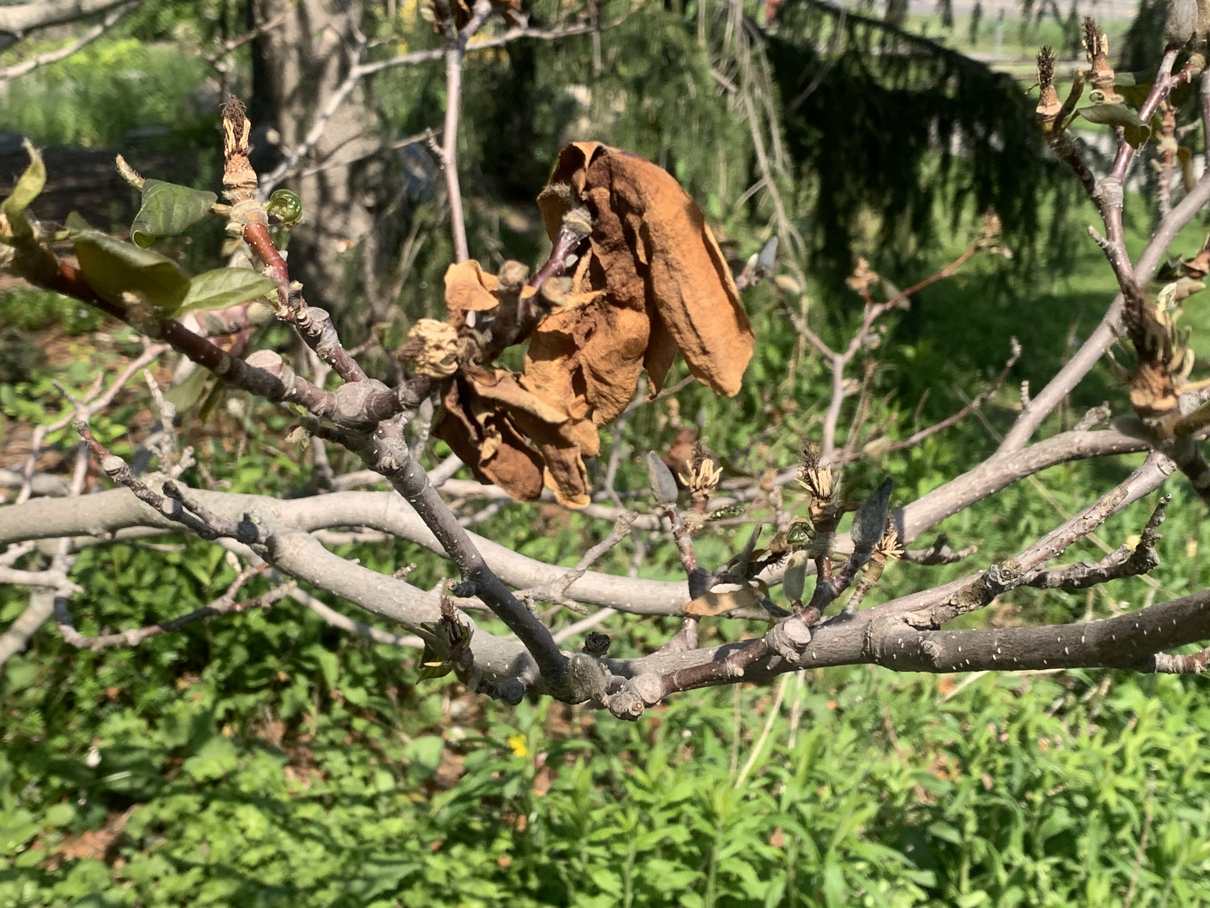
A potentially depressing sight among many will be the coldest areas of Vermont where leaves had appeared on trees. You'll see patches of brown or wilted leaves in forested areas for awhile until trees can sprout new growth.
Most Vermont forests can withstand temperatures down to the mid-20s for brief periods, so if you stayed at, say, 26 degrees, most if not all of your trees should stay green. Flowers on those trees might turn brown, though.
Lilacs are in full bloom in many areas. Those bushes are tough old birds, so I've got my fingers crossed the blossoms will do OK, except where it got especially cold. My lilacs, so far, look OK, but I'll have to take another look once it warms up. At that point any harm will become apparent.
RECORD LOWS NOW RARE
As we well know, cold snaps, even record cold, is still very possible in the age of global warming. It's just now, the dice are loaded. Roll the weather dice these days and you're more likely to hit a record high. But every once in awhile, that roll of the dice will give you a real chill, like today.
 |
| A frosty leaf in a St. Albans, Vermont garden this morning. |
Burlington's data really shows that. Checking back this morning, I discovered that before today, the last time the city broke or tied a record low was on November 11, 2019.
In the time since frigid November day in 2019, Burlington tied or broke 29 daily record highs. Two of those - in May, 2020 and November, 2022 - were hottest ever for those entire months.
CLIMATE CHANGE INFLUENCE
I hate to blame climate change on every instance of weird weather. Still, this cold wave could possibly, maybe have some relation to climate change.
An enormous "heat dome" a massive area of warm high pressure has set up over western Canada and the northwestern United States. Heat records are being shattered in western Canada because of this.
This heat dome has steered the jet stream way north into northwestern Canada and the Arctic northeast of Alaska. The huge northward excursion of the jet stream set up a corresponding major dip in the jet stream that roared southeastward from the Arctic toward Quebec and New England.
This arrangement grabbed some frigid air from the still-frozen Arctic and slammed it down on us. At least briefly. Some scientists suspect these huge heat ridges, and corresponding dips in the jet stream, have become more likely with climate change.
The newly erratic jet stream, if verified by scientists, would mean that overall, we're warming up, which helps explains what was until now a rather warm spring in Vermont. But that snaking jet stream can create nasty cold spells that briefly interrupt the overall warming trend. t
Of course, there are consequences to this. Everything bloomed early this spring, making plants, trees, crops and gardens all the more susceptible to a late frost.
This big ridge ridge of high pressure out west will plop another cold snap on us early next week, but that one won't be quite as bad as the one we experienced yesterday, overnight and this morning. Still, there's a very real risk of frost and local freezes in at least some parts of the state, probably Monday night.
After that, a change in the weather pattern will flatten that western ridge and help push warmer air into our neck of the wood, This new pattern would also block any other bowling balls of cold air to smash their way south into New England to further ruin our spring
No comments:
Post a Comment