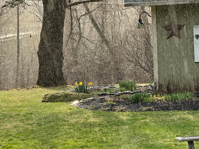
This Saturday will be the sixth consecutive one with at least some precipitation. This one will be a real soaker, but still, it probably won't rain all day. We hope.
THURSDAY THUNDER
We'll get to the forecast details in a second, but I want to acknowledge Thursday's weather in Vermont, which in some places proved kind of interesting.
During a nice long interval of sunshine Thursday afternoon, Burlington topped 70 degrees for the first time this month and for the first time since March 20.
That sunshine helped destabilize the air ahead of a disturbance coming in from west and northwest late in the afternoon.
The result was the expected hit and miss showers and rumbles of thunder. In Franklin County, Vermont, here in St Albans, we got a solid thunderstorm with a good downpour, several lightning strikes and peals of thunder and wind gusts to 25 mph or so.
Definitely not severe, but it was a nice brief spring storm for this fan of thunderstorms.
Many places did miss out. Burlington only saw a trace of rain and no thunder.
WET FORECAST
Up next, our next storm, which will be a decent soaker, as mentioned.
Aside from perhaps a few sprinkles, we should be OK today at least until late afternoon or early evening, when a few showers might arrive.
The main show is tonight and a good chunk of Saturday. That's when most of the steady rain will come through. You might hear an occasional heavier downpour on the roof and maybe even a rumble of thunder later tonight and the first half of Saturday.
Showers will probably continue all day, but in the afternoon, there might be gaps here and there in which it stops raining or a time. So, maybe not a complete washout, but close.
Rainfall with this thing will amount to anywhere from a half inch to an inch of rain. That's not nearly enough to cause any flooding worries whatsoever, but it will make things a bit muddy underfoot.
The rain and clouds will hold temperatures down into the 55 to 65 degree range for most of us. So kinda seasonable, really.
This will be the sixth Saturday in a row with at least some rain and/or snow in Vermont. Also, at least a trace of rain or snow has fallen each weekend since mid-December. I guess things really do go in regular patterns, sometime.
COLD DAMP SHOT AND SNOW?
The storm's cold front will come through later in the day and it will cool off quickly during the evening as a result. The original hope was that the storm would move right along, leaving us with a bright, breezy and cool Sunday.
But nope!
The damn thing is going to linger near Maine and Nova Scotia during the day, throwing back clouds, cold winds and rain showers back into Vermont for a good chunk of Sunday. And it will get cold enough for snow up in the mountains.
Granted, it's the end of April, so we can't expect much out of this. But the Green Mountain summits should see one to three inches of snow. A few snowflakes might even make it down into valley floors Sunday morning, but we won't see any accumulation.
It will be a raw, gusty day, with many of us not even making it to 50 degrees for a high. Some places over 1,500 feet of elevation in northern Vermont could stay in the 30s all day.
QUICK TURNAROUND
Sunday's chill does not mean spring is pre-empted. It will just be an annoying interruption. We're still expecting highs back to near 70 Monday and in the 70s Tuesday.
The overall trend for the first half of May is beginning to trend toward the cool side, but we don't know for sure it that's entire accurate quite yet. We also don't know yet if "cool" means just "not quite summer" or whether it means "whatever happened to spring."
We'll keep you posted as always.


No comments:
Post a Comment