Monday, August 31, 2020

It's Autumn In Vermont As Far As I'm Concerned

I have a very mild condition that many, many other people have. When I exercise or work hard in chilly air, I'll  have a bit of a cough for up to 18 hours afterwards.  It's called exercise induced asthma, and unlike the severe form of asthma we most often hear about, what I experience is harmless. 

It's coming! It'll look like this pretty soon
here in Vermont 

The reason I bring this up is because yesterday, I spent much of the day working vigorously outdoors, and afterwards briefly detected a hint of that winter time cold weather exercise cough.  

As far as I'm concerned, that means for me, it's autumn. 

Goodness knows it wasn't exactly cold on Sunday.  Daytime temperatures were in the 60s, but there was also a pretty stiff northwest wind.  Low stratus clouds mixed with the sun, and made the sky resemble what it's like during peak foliage season.

Speaking of foliage, I saw quite a few orange sugar maple leaves mixed in with the greenery. 

The onset of a new season is basically whatever a person feels. Sure, there's official dates, like the autumn solstice later in September. But for me, I'm now in autumn mode, and Sunday sealed the deal. 

We will still have warm, humid days, but the chances of another long stretch of 90 degree heat are pretty low at this point. That means we won't break the record for the year with the most 90 degree days.  We've had 20 such days this year in Burlington, Vermont. The record is 26 days. 

We'll find out tomorrow whether this was climatologically the hottest summer on record, based on data from the National Weather Service in South Burlington. It's going to be close. The bottom line is, as we turn toward autumn, we can certainly say we weren't cheated out of a summer in 2020. 

Now that summer weather is almost over.  There's no getting around it. 

You see it everywhere. Pallets of wood pellets are parked near basement doors. Most of the vegetable gardens look exhausted and depleted. I've noticed the pink Clarence Brown home fuel delivery truck going up and down my road in the past few days.

The entirety of this upcoming week will be warmer than it was Sunday, but not exactly oppressive. The season has turned in Vermont. It's time to start thinking about taking the sweaters and hoodies and boots out of summer storage, I'm afraid.


Sunday, August 30, 2020

Tornadic Week In New England, New York

The tornado warnings have been flying for the past few days in parts of New England and New York as a couple dynamic systems have gone through. 

Large thunderstorm erupting over the northwestern
tip of Vermont Saturday evening.

Here in Vermont, no tornadoes are known to have touched down. However, a supercell that did produce a probable tornado in eastern New York prompted a tornado warning in Bennington yesterday. 

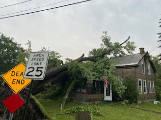
The first outbreak came Thursday, as a system roared down from central New York and into Connecticut. A strong EF-1 tornado roared along an 11-mile path around North Haven and Hamden, Connecticut, causing extensive damage to several homes and trees.

Microburst and something called a rear-flank downdraft caused added destruction. A rear flank downdraft is an area of very strong winds that follow behind a tornado and help feed it.

Yesterday, an area in the Albany/Saratoga area in New York and southwestern Vermont appeared primed for rotating stormsl

Sure enough, a rotating supercell developed well southwest of Albany and then produced an apparent tornado near Ballston Spa, Stillwater and Schaghticoke, New York.  A house reported had its roof torn off and a high school was damaged.  

 Both Thursday and Saturday, meteorologists sensed trouble days in advance as forecast conditions called for a lot of instability and winds changing speed and direction with height. That's a good recipe for rotating thunderstorms.  That's especially true just south of warm fronts, which happened both Thursday and Saturday. 

Thunderstorms departing to the east of Sheldon,
Vermont glow in Saturday evening's sunset.

There's no sign of anything major coming up in the next few days, so I guess we're safe from twisters.

It was interesting seeing what the changing wind speeds and direction with height could do with a storm that wasn't as intense as those in Connecticut and eastern New York in the past few days 

A thunderstorm right along the Canadian border in northwestern Vermont prompted a severe thunderstorm warning Saturday evening. 

Driving around in the thunderstorm, I did not see any signs of damage from it. 

At one point, I was on the southwestern flank of the storm in Swanton, Vermont.  That's often the part of the storm where you'd find a tornado.

To be clear, this was NOT a tornadic thunderstorm, and I saw no real funnels or fast rotation. But over Swanton, you can see some weak rotation and fairly rapidly rising, marked by filaments of scud clouds rising fast and twisting gently. You can see in this video that I've speeded up (double speed) to see.


Saturday, August 29, 2020

Severe Storms Possible In Vermont Today, Especially South Of Route 2

UPDATE 1 PM

NOAA's Storm Prediction Center has upped the chances of a brief tornado today in New York's northern Hudson Valley and the southern Champlain Valley of Vermont. 

Back deck of my house getting a good wetting
during downpours this morning in St. 
Albans, Vermont.  Chances remain of 
severe storms this afternoon, especially
from about Burlington south

The chances of a twister are still very low, but not zero.  I'm pointing this out because this area seems like a possible focal point for severe storms today.  Skies seem the most likely to partly clear in this area, which will promote instability and the possibility of stronger storms.

Further north in northern Vermont, another band of showers, some pretty heavy were passing through at around 1 p.m. today.  These showers seem destined to stabilize the air over the north today, somewhat minimizing the chances of severe storms. Even there, severe storms may erupt this afternoon, so keep your eyes to the skies. 

PREVIOUS DISCUSSION

It felt sort of tropical stormish around my house in St. Albans, Vermont this morning. Heavy rain came down in sheets and waves, and gusty winds tossed the branches of the big poplars that are just outside my home office window. 


This is all part of a rather dynamic storm for late August, one that could bring some severe weather later today.

To be clear, this morning's weather had nothing to do with a tropical storm, despite my description of the weather. It was a warm front passing through. Wet air was being lifted up and over some cooler air as the warm front approached, and that touched off the heavy rain. 

All of Vermont needs the rain, but the southern half of the state needs it more. However, the heaviest rain went through northern parts of the state this morning. Oh well.

The warm front will get to a point a little north of the Canadian border by later this morning, and the air will take on a humid feel.

Then the set up: A strong cold front will be approaching from the west this afternoon. As the front approaches, the wind above us will change direction with height, and blow pretty strongly.  That's a recipe for severe storms, even possibly rotating supercells, if things work out just right.  

But will they?

We'll need quite a bit of instability for storms to really fire up.  One way to get that instability is sunshine, which would heat the air near the surface, to contrast with colder air up above.  This warm surface air, cold aloft scenario helps clouds billow upward into those towering thunderstorms.  

The problem is, nobody is quite sure how much sunshine will develop late this morning and early afternoon to set the stage for those storms.

There was a narrow band of at least partly cloudy skies in parts of western and central New York early this morning.  If that moves in and maintains itself, that could contribute to some severe storms.

As it stands now, all of Vermont is under a little bit of a threat of severe storms, with southwestern Vermont having the highest chance. 

As is usual in these situations, most of us won't get blasted. If the strong storms form, they'll only affect localized areas.  The biggest threat from any severe storms today would be damaging straight line winds.

Because there's a chance some of these storms might be rotating, there's is once again, a very minimal chance of a brief tornado. But don't hold your breath for that. Just take shelter in a sturdy building if your area goes under a severe thunderstorm warning. 

The timing is such that the best chances of strong storms would be between mid afternoon and early evening. Do note that any thunderstorm that gets going, including the ones that aren't severe, could have a lot of cloud to ground lightning. You don't want to be outside in that. If you hear thunder, that's your alarm bell to go indoors. 

After this cold front goes by, we're getting another shot of autumn like weather for the second half of the weekend   It'll stay in the 60s all afternoon Sunday, with partly cloudy skies and perhaps a light sprinkle here and there.  

Possible Severe Storm Threat Around Vermont, Surrounding Areas Today

It felt sort of tropical stormish around my house in St. Albans, Vermont this morning. Heavy rain came down in sheets and waves, and gusty winds tossed the branches of the big poplars that are just outside my home office window. 

My back deck in St. Albans, Vermont getting a 
good drenching early this morning. There's a 
chance this same deck could get a bit of 
a blasting from strong thunderstorms
later today. 

This is all part of a rather dynamic storm for late August, one that could bring some severe weather later today.

To be clear, this morning's weather had nothing to do with a tropical storm, despite my description of the weather. It was a warm front passing through. Wet air was being lifted up and over some cooler air as the warm front approached, and that touched off the heavy rain. 

All of Vermont needs the rain, but the southern half of the state needs it more. However, the heaviest rain went through northern parts of the state this morning. Oh well.

The warm front will get to a point a little north of the Canadian border by later this morning, and the air will take on a humid feel.

Then the set up: A strong cold front will be approaching from the west this afternoon. As the front approaches, the wind above us will change direction with height, and blow pretty strongly.  That's a recipe for severe storms, even possibly rotating supercells, if things work out just right.  

But will they?

We'll need quite a bit of instability for storms to really fire up.  One way to get that instability is sunshine, which would heat the air near the surface, to contrast with colder air up above.  This warm surface air, cold aloft scenario helps clouds billow upward into those towering thunderstorms.  

The problem is, nobody is quite sure how much sunshine will develop late this morning and early afternoon to set the stage for those storms.

There was a narrow band of at least partly cloudy skies in parts of western and central New York early this morning.  If that moves in and maintains itself, that could contribute to some severe storms.

As it stands now, all of Vermont is under a little bit of a threat of severe storms, with southwestern Vermont having the highest chance. 

As is usual in these situations, most of us won't get blasted. If the strong storms form, they'll only affect localized areas.  The biggest threat from any severe storms today would be damaging straight line winds.

Because there's a chance some of these storms might be rotating, there's is once again, a very minimal chance of a brief tornado. But don't hold your breath for that. Just take shelter in a sturdy building if your area goes under a severe thunderstorm warning. 

The timing is such that the best chances of strong storms would be between mid afternoon and early evening. Do note that any thunderstorm that gets going, including the ones that aren't severe, could have a lot of cloud to ground lightning. You don't want to be outside in that. If you hear thunder, that's your alarm bell to go indoors. 

After this cold front goes by, we're getting another shot of autumn like weather for the second half of the weekend   It'll stay in the 60s all afternoon Sunday, with partly cloudy skies and perhaps a light sprinkle here and there. 

Friday, August 28, 2020

Laura's Destruction, Storm Surge Issues, VERY Accurate Forecast, Bad Gulf Luck And More

The last of Hurricane Laura faded over Arkansas last night, and its remnants will produce potentially flooding rains over parts of the Tennessee Valley today. 

Flooding and wind destruction Thursday in 
Cameron, Louisiana. Photo by David J.
Phillip/AP

Hurricane Laura will be remembered mostly for its extreme wind damage.  At least six deaths have so far been attributed to Laura.  That's a huge tragedy, but the death toll is pretty low for such a terrible storm.  Evacuations and people heeding warnings probably very much contributed to the relatively low death toll. 

Now that Laura is going down in the history books, I have some final thoughts and answers to some questions.

STORM SURGE 

Very strong hurricanes like Laura of course produce a lot of wind damage, but these storms also contain terrible, deadly storm surges.

There was a nasty storm surge with Laura, but it wasn't as bad as feared, and hit mostly unpopulated areas.

As the Weather Channel and other outlets point out, a few factors came together to prevent any confirmed 20 foot storm surges, the type that had been predicted.

First, Hurricane Laura came ashore at Cameron, Louisiana and moved north into Lake Charles, causing all that wind damage. However, the worst storm surge in a northward moving hurricane is immediately east of the eye. Strong southerly winds in that part of a hurricane would drive water onshore into the Gulf Coast. 

Because the hurricane moved directly over Cameron and Lake Charles, the hurricane force winds came out of the east as the eye approached the coast. The wind wasn't pushing the water onshore as much as it would have if the wind had been from the south. 

The result was about a nine foot storm surge in these two cities rather than 20 feet.  The storm surge probably was higher to the east of Laura's path. However, areas where the wind blasted ashore from the south was low, swampy ground where hardly anybody lives and there are almost no tidal gauges. 

Storm surges were higher with Hurricane Rita in 2005 and Hurricane Ike in 2008.  Those two hurricanes were bigger in area than Hurricane Laura.  A larger storm in size would push more water onshore than a smaller one. 

BAD GULF LUCK

A worst case scenario for hurricanes is if they are already strong and still strengthening as they make landfall. A hurricane that's growing stronger has a better ability to bring more powerful winds a few thousand feet overhead down to the surface than a weakening hurricane would.

In three of the past four years, very powerful hurricanes were strengthening as they hit the Gulf Coast. Category 4 Hurricane Harvey did that in 2017.  So did Category 5 Hurricane Michael in 2018. Now we have Hurricane Laura, Category 4 and just below Category 5 strength hitting Louisiana.

I think the Gulf Coast has had enough hurricanes for awhile.

NATIONAL HURRICANE CENTER ROCKS!

The National Hurricane Center always does great work during hurricane season, but with Hurricane Laura, they really shined. 

Hurricanes are notoriously difficult to predict. Their paths and strength can veer off in all kinds of directions.  This time, the NHC pretty much nailed it. 

Three and a half days before landfall, the NHC said Hurricane Laura would make landfall somewhere near Cameron, Louisiana.  The exact position of Laura's landfall was just 0.6 miles from that prediction.  A forecast of that accuracy was basically an impossible feat but the meteorologists at the NHC pulled it off. That's pretty incredible. 

Forecasting a hurricane's strength is even more of a formidable challenge.  For at least four days in advance, the NHC said Hurricane Laura would strengthen quickly once it reached the Gulf of Mexico.  The NHC plays things conservatively, so at first they weren't publicly forecasting a Category 4 storm at first, but made it clear that residents of Louisiana and Texas definitely had something to worry about.

I'm sure this saved a lot of lives. 

LAURA'S SENSE OF IRONY

A Confederate statue called the South's Defenders Memorial Monument that consisted of a flag bearing soldier looking over the local courthouse lawn.  It's been creating quite a bit of controversy in Lake Charles, but the county government recently voted to leave the monument in place. That didn't thrill the large Black Lives Matter contingent in the region.

However, Hurricane Laura knocked the soldier off the pedestal, and by Thursday, the figure was a broken mess on the court house lawn, along with the rest of the debris. I guess that takes care of that!

UP NEXT

Hurricane season is in full swing, and it ain't over yet.  The National Hurricane Center is watching two systems way out in the Atlantic.  They are not yet anywhere near a threat, and might or might not develop. But the chances are there, so we'll have to watch those little storms in the next week in case they develop into new hurricanes

NEW ENGLAND STORMS

As expected, severe storms developed over New York and southwestern New England yesterday.  Some storms developed into supercells, and tornado warnings went out. 

One storm in particular produced what I think is a likely tornado around the adjacent towns of North Haven, Hamden and Branford, Connecticut. There are reports of major damage to houses and widespread tree damage.

I'm pretty sure National Weather Service meteorologists will be investigating that area today to determine for sure whether it was a tornado or destructive straight line winds.

At first, it looked like the next storm for us here in Vermont would just be a chilly, steady rain on Saturday.  Some indications indicate the storm might now go by just to our northwest and lift a warm front to near or just north of the Canadian border.

If that happens, there's a low but real chance we could have weather problems similar to Connecticut's on Thursday,  If we get some clearing in the afternoon - which is iffy - that would destabilize the air. 

There will be strong winds aloft, which would change direction and speed with height. If the skies clear, some strong thunderstorms could develop, and some of those could start rotating. Worst case scenario would be a few severe thunderstorms and a very slight risk of a brief tornado.

This, as noted, is extremely iffy, and we'll have a better sense of what might go on by tomorrow morning. 


Thursday, August 27, 2020

Southwest Louisiana Reeling From Hurricane Laura

 As I write this, dawn is breaking on coastal southwestern Louisiana as Hurricane Laura pushes deeper inland toward Shreveport and southern Arkansas.  

Most of the windows in the Capital One building
in downtown Lake Charles were blown out
Photo by Stephen Jones

There's not a lot of confirmed news out of the hardest hit area yet. It's still early. But from what little I've seen so far, it's terrible to say the least.   

Laura crashed ashore in Cameron, Louisiana last night with top winds of 150 mph. That's just shy of Category 5 status, but the categories don't matter much here. 

This was one catastrophic hurricane.  The population center in the area that seems to have taken the biggest hit is Lake Charles, Louisiana, population about 78,000.

Video on social media show large sections of the roof at the Golden Nugget Casino and Hotel blowing off. At least half of the windows of the 22-story Capital One building in downtown Lake Charles blew out, and there is surely extensive interior damage to that building. 

I'm not sure on this yet, but the expected storm surge might not have been quite as high as some forecasts suggested. But nobody as of this writing has been able to report yet out of coastal locations hardest hit by the surge. 

I suspect, due to the track of Laura, ,that the highest storm surge was east of Lake Charles. That's a good thing, since the area with the suspected highest storm surges are very sparsely populated.

Probably the best way to see and follow what happened with Hurricane Laura is to follow hurricane chaser Josh Morgerman (@iCyclone) on Twitter.   As always with his hurricane chasing, Morgerman, is releasing some amazing footage and reporting.

One thing that concerns me the most is people who couldn't evacuate.  A big proportion of the people in the worst hit areas are living in poverty.  

Hurricane Laura was huge and scary as seen
in this satellite view Wednesday afternoon

Lucky people like me, if I had lived in Lake Charles, would have easily been able to collect my dogs, important papers, medications, devices, momentoes and such to get in the truck and drive away well before the storm hit.  I can afford to stay in a hotel or whatever in safety until the storm passed.

What about people who had no car, no money, no way to move out of the way?  I imagine some people were bused out, but I don't think everyone was helped.  I wonder how they fared in possibly flimsy house. 

Ferocious hurricane force winds will continue in western Louisiana and southern Arkansas this morning, as it will take a few hours for Laura to weaken as it pushes inland.  

The governor of Louisiana just told MSNBC that he was aware of one death from the storm, that of a 14  year old girl.  I'm sure the death toll will rise as search and rescue people head out into the worst of the hurricane zone.

As always, Covid-19 complicates things, especially in terms of putting people in evacuation centers if their houses are destroyed or damaged. The Lake Charles area currently has the highest Covid transmission rate in Louisiana.

I'm sure there will be news updates as we go through the day.   

Wednesday, August 26, 2020

Dangerous Laura Ramping Up To Cat 4 Catastrophe

As expected, Hurricane Laura overnight exploded into a powerful storm and was still rapidly intensifying as it heads toward the Texas and Louisiana border late tonight. 

Visible satellite image of Hurricane Laura
in the Gulf of Mexico this morning. This
satellite presentation is classic for very
strong, growing and intensifying hurricanes

The warnings are dire for the area around Beaumont and Port Arthur, Texas and Lake Charles, Louisiana.  Sustained winds could be near 130 mph at the time of landfall.  But that's not the biggest problem. 

Laura is now expected to shove ashore a storm surge of up to 15 feet above normal water levels. This is very low and flat country, so the surge could travel as much as 30 miles inland. Storm surges are usually the deadliest and most destructive parts of powerful hurricanes.

Hurricane Laura has become a physically large storm, filling up much of the Gulf of Mexico.  In general, the larger the storm, the worse the storm surge.

Not surprisingly, the cities I mentioned above are emptying out as people get out of the way ahead of Laura.   There's been a lot of strongly worded warnings to get out of the way. Many people have heeded that advice, but worryingly, many people have not. 

The area Laura is hitting is a major oil producing part of the nation.  I expect gas prices to rise after this.  The refineries are already shut down due to evacuations, and these plants are sure to suffer damage that will take time to repair after the storm.

As The Weather Channel reports, some estimates say perhaps 60 percent of Beaumont, Texas's 118,000 people aren't leaving.  Perhaps they think they can ride it out.  Or more likely understandably worried about Covid-19 if they go to potentially crowded evacuation centers.  This really is kind of a no-win situation.

Covid-19 could actually kill a bunch of people who aren't actually infected with the virus because these fears are keeping people in the hurricane's path. 

Hurricane Laura will probably cause a lot of problems well inland, too.  Like virtually all hurricanes, Laura will likely weaken rapidly once inland. But its forward speed has it moving right along, so hurricane force winds will push well north into west central Louisiana.

The only slight glimmer of good news is that Hurricane Laura won't score a direct hit on the Houston metro area after all.  Some indications early yesterday suggested a more westward track that would take Laura over the nation's fourth largest city.

Now it appears that Houston will suffer some effects from Hurricane Laura, but it won't be a devastating blow like it will further up the coast toward Louisiana. 

This will be a major disaster on top of all the major disasters and calamities we've had in 2020.  This is not our year, is it?

SEVERE WEATHER UPDATE

Not to be outdone,  a couple severe weather outbreaks are due in the Northeast Thursday and again on Saturday. While this outbreak will obviously be much less dire than Hurricane Laura, it still looks to be a nasty situation. 

On Thursday, a sharp warm front will push into New York and New England. Along and just south of the warm front, it will become very, very humid. Worse, the wind will change direction and speed with height.  

This is a recipe for very severe thunderstorms and tornadoes in the southern tier of New York, the Hudson Valley all the way down into the New York metro area, and in Connecticut and western Massachusetts.

It's a little tough right now to know exactly where the severe weather will focus, but all these areas are in play tomorrow.

Most if not all of Vermont will stay north of this warm front, so it will just be chilly, and likely rainy at times with no severe storms expected here at this time.  If the warm front lifts a bit further north than expected, there could be a bit of severe weather trouble in far southern Vermont. We'll update this tomorrow morning 

The rain will focus in Vermont mostly south and west of Interstate 89, but even further north, it looks like there could be a little light rain. 

A similar situation to Thursday looks like it's setting up for Saturday in the Northeast.  Early indications are most of Vermont will escape the severe weather, but we might get a soaking rain Saturday.  

Tuesday, August 25, 2020

Laura Could Blast Houston; Evacuations Already Under Way; Severe Weather North

Now-Hurricane Laura finally got away from land masses overnight and is now in the open waters of the Gulf of Mexico.  

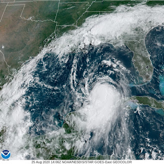
Visible satellite shot of Hurricane Laura 
has the look of a new, and strengthening
and dangerous storm

Without land to disrupt its circulation, satellite images of Laura have "that look," by which I mean the appearance I've seen tropical storms have right before they explode into a major hurricane.

That's the fear right now. As soon to be Hurricane Laura takes aim at the upper Texas coast, it has a very good  chance of becoming a major Category 3 hurricane, with winds over 115 mph and destructive storm surges.

It's very hard to predict future hurricane strength, but there are signs Laura could become an even more dangerous Category 4.  

Worse, at least so far, is that various predictions keep nudging projected landfall Wednesday night further and further west, closer and closer to Houston. 

 The greater Houston metropolitan area has close to 7 million residents.  To some extent, Houston is still reeling from the extreme Hurricane Harvey floods that devastated the city in 2017.

Nobody needs a major hurricane, and Houston in particular does not. 

That's not to say Houston is guaranteed to take the worst of it.  So far at least, the projected path would be far enough east to spare Houston the worst, but we don't know that for  sure. Everybody in that area should be preparing for a major hurricane right now, and hope it hits a little further up the coast toward Louisiana, which has a much lower population density.   

That's not to say I want people near the border of Louisiana to suffer.  And it's not like nobody lives there. For instance, Beaumont, Texas, population about 118,000 could take a direct hit. It's just that avoiding a major hurricane landfall with Laura is now probably a lost cause, so you need to hope for the least bad options

People along the upper Texas coast, especially in low lying areas near the beaches, should be getting out of Dodge now before the weather starts to deteriorate during the day Wednesday. The storm surge from Laura looks like it will be especially nasty. That's especially true for any coastal area just to the east of where Laura makes landfall, because the winds would really shove the water onshore .

STORMS IN NORTHERN UNITED STATES

While not nearly as dire as a major hurricane, the northern United States roughly from Minnesota to Maine and down as far south as the Mid-Atlantic States have been dealing with rounds of severe thunderstorms.  That state of affairs looks to continue through Thursday in at least some places.

Yesterday, here in Vermont and surrounding places, there were pockets of severe storms. The worst of it hit around Whitehall, New York, just over the border from Rutland County, Vermont. 

Storm damage in Whitehall, NY Monday

There, rounds of severe storms - one after the other - produced damaging winds and extensive flash flooding around Whitehall. About 20 buildings suffered at least some flooding and some homes in town were damaged by falling trees.

As the storms pushed east into Vermont, that flooding extended into the neighboring towns of Poultney and Fair Haven, Vermont, where several streets and roads were blocked by high water and washouts.  

Elsewhere, quarter sized hail cracked windshields and strong winds blew down trees around Lincoln and Buels Gore, Vermont.  Another strong storm tossed down trees in Grand Isle.

Today that strong cold front we've been talking about will come through, but too early in the day to produce much severe weather in northern Vermont. The more you  head south and east, the greater the chances of damaging winds from storms today. 

The best chances of severe storms today run from around Washington DC up through New Jersey and into southern and possibly central New England. 

The western half of the cold front that's coming through here today will stall from the eastern Great Lakes to the Mid-Atlantic states, prompting a severe weather threat from northern Michigan and down through western New York and Pennsylvania. None of this will affect us here in Vermont.

On Thursday, a wide band of severe weather potential runs from South Dakota all the way to southern New England and the Mid Atlantic States.  Southern Vermont might get into the act, depending upon how far north a warm front manages to come.

So yes, that's rough and tumble, but nothing like Texas and Louisiana are about to go through with Laura  Months ago, they warned us that this would be an active and possibly destructive hurricane season, and it looks like those predictions are coming true. 


Monday, August 24, 2020

Marco Goes Pffft, Laura Shows Resiliance, Gulf On Alert, Still Storm Risk Here

Well, the good news, I suppose, is there won't be two simultaneous hurricanes in the Gulf of Mexico after all, and southern Louisiana might not get two tropical storms.    

In this dawn photo of the Gulf of Mexico
Tropical Storm Marco is actually centered
in the clear air southwest of the blob of
storms near the Florida Panhandle. Tropical
Storm Laura can be seen in the lower right 
of the photo

This news sounds terrific, but it's not all that great for people along parts of the Gulf Coast. 

Here's today's update on the tropical storms, and of course, things will keep changing. 

Tropical Storm Marco briefly achieved hurricane status Sunday afternoon in the central Gulf of Mexico.  That turned out to be its heyday.  Strong upper level winds are tearing Marco apart, and even if it does make it to shore as a tropical storm, it won't exactly be a powerhouse. 

Marco is now expected to fall completely apart within a couple of days, but will still dump some heavy rains on those areas.

The problem, though, is Marco's brief stint as a hurricane stirred up a push of water which is heading toward low, swampy southern Louisiana. 

Then there's Laura.  It's certainly a resilient little bugger.  It went over Puerto Rico, Hispaniola and is new around Cuba. Being over land so much would have killed many tropical storms. But not Laura. She has pulled every trick up her sleeve to keep some of her circulation over water, or just rejigger itself so that the center kept shifting back toward water. 

The result this morning was a Tropical Storm Laura with highest sustained winds of 65 mph.  The center of this storm will skirt the southern coast of Cuba today as it heads toward the Gulf of Mexico, so Laura should maintain its strength for now. 

Once it gets into  the southern Gulf of Mexico tomorrow, look out! The very warm waters of the Gulf plus the fact this thing will finally be moving away from land will give it an opportunity to blossom into a full blown hurricane. 

The question now is, how big and bad of a hurricane?  The signals are still mixed.  On the one hand, we'e seen other resilient tropical storms go full bore monsters in the Gulf, with devastating results. On the other hand, upper level winds or dry air could temper the power of this storm.

It seems like we should lean toward a nasty, stronger Laura, because upper level winds, at least on Tuesday and Wednesday won't be gusty enough to interfere with development, and that hot water will certainly contribute. 

Of course, the big issue is where will Laura go? Unfortunately, all bets are that it will make a United States landfall.  Early guesses suggest it would hit somewhere near the Louisiana-Texas border.  But anyone between the central Texas coast and Alabama should watch closely.   This could easily be the nation's worst hurricane so far this year.  

SEVERE STORMS HERE

Once again yesterday, there were a couple reports of severe storms in Vermont, as expected. Most of the rough weather, though hit southern New Hampshire and parts of Massachusetts.

Still, there were reports of numerous trees and power lines down in Springfield, Vermont, and penny sized hail in Benson.

Some showers skirted the northern border areas of Vermont overnight. Here in St. Albans, I got 0.3 inches of rain. Not a huge amount, but welcome nonetheless.  Rainfall in August has been OK, but it will take a lot to get over the dry conditions from the spring and earlier summer. When I dig into the soil around my house, I hit dry, dusty earth just an inch or two below the wetter surface.

There will be some more chances of rain, though no earth-shattering amounts over the next few days.  It looked like another band of showers with a couple embedded lightning strikes was approaching my area in far northwestern Vermont as of 8:15 this morning, but it remains to be seen whether they will hold together.

(UPDATE: Yes, the showers held together and we got some more rain in St. Albans).

Once again, some of the storms that develop this afternoon and evening could be strong to severe in a handful of locations.  As has been the case, very few of them will be damaging, but one or two spots could see trouble. It's hard to say who would get nailed, as these really are hit and miss, by definition.

A strong cold front will come through tomorrow morning or early afternoon at the latest.  The timing - in the morning - would limit the amount of severe weather with this front.  Thunderstorms usually peak in intensity in the late afternoon or evening. 

Still, the cold front could bring a few strong to severe storms to us as it passes through, so watch for that. 

The coldest air since spring is set to come in behind the front, with highs Wednesday for many of us only reaching the 60s.  That's not super cold for late August, but it is somewhat chilly, as we haven't seen anything like this in a long time. 

The last time the high temperature in Burlington failed to get above 70 degree was June 14.

Sunday, August 23, 2020

Two Hurricanes In Three Days In Louisiana? Also Some Severe Threat Up Here

The forecast has turned pretty ominous for Louisiana, as it's now possible that two hurricanes will strike its coast within three days of each other. 
Here's one forecast map that shows Laura 
and Marco both hitting Louisiana in the
upcoming days.

Tropical Storm Marco is spinning in the Gulf of Mexico and could strike Louisiana as a hurricane on Monday.  Tropical Storm Laura, near Hispaniola this morning, is forecast to strike basically the same spot on Thursday. 

While there's still a lot of uncertainty as to whether this will play out like I describe, such back to back strikes in the same spot are really rare. And really dangerous.
 
If it happens, both storm surge and inland flooding caused by Marco would still be going on when Laura arrives. 

Of course, as more forecast information comes in, the path and strength of the two storms could be quite different than currently predicted when the event actually unfolds. But whatever happens, it ain't good news.

First up is Tropical Storm Marco. Its top winds early this morning were 70 mph, just under hurricane strength.  It is heading steadily northwest toward Louisiana.  Rather strong upper level winds are interfering with Marco's development. 

Marco ramped up pretty quickly on Saturday, but then leveled off.  The Gulf of Mexico waters are very warm, so that would help with development, but the upper level winds would probably keep Marco at Category 1 strength, with top winds at landfall just near 75 to 80 mph. 

The real danger from Marco, despite its small size, is the storm surge and heavy rain that would prime the pump for Laura. 

Tropical Storm Laura is hanging in there surprisingly well, given its interaction with land over Hispaniola.  If a tropical storm is over land, it often weakens, especially in mountainous places like that island. 

Laura is larger in size than Marco, so that is keeping some of its thunderstorms over water, which is helping it stay together. 

This tropical storm probably won't get much stronger for the next couple of days as it goes over or near the length of Cuba.

There are definite worries as to what would happen with Laura once it emerges into the Gulf of Mexico early in the week. Those strongish upper level winds that will have interfered with Marco will be mostly gone. Those very warm Gulf waters have the potential to ramp Laura up into a monster hurricane.  We don't know for sure, but it's definitely worth watching. 

In any event, 2020, is the year in which everything seems to go wrong, so these twin potential hurricanes are par for the course. 

NEW ENGLAND SEVERE WEATHER

Yesterday, a tornado touched down on Lake Winnipesaukee in central New Hampshire, and likely caused damage in shoreline Wolfsboro, New Hampshire. 

No severe storms that I'm aware of hit Vermont yesterday, but I guess we are in a pattern.  There were a couple severe storm reports in Rutland County Friday, and we have a low but real chance of more severe weather today, Monday and Tuesday. 

Some showers and a few lightning strikes were in northern Vermont and northern New York this morning as a weak weather front lifts toward the Canadian border.  This front will  probably set the stage for more storms this afternoon.  A few could be strong or even locally severe, with sharp wind gusts being the primary threat. 

The same set up looks like it will hang around on Monday, so it's basically rinse and repeat.  For both days, NOAA's Storm Prediction Center has Vermont in a marginal risk zone for severe storms.  That means there could be a few brief, isolated severe storms, but nothing super widespread. 

It's beginning to look like more of a severe weather outbreak will hit the Northeast on Tuesday ahead of a strong cold front moving into the region. 

There's a lot of question as to whether we here in Vermont will get any severe storms Tuesday and if so to what extent. 

At this point, the cold front seems like it wants to come through  the Green Mountain State in the morning, To get widespread severe storms, a cold front should come through in the afternoon or evening. That gives a chance for the atmosphere to heat up, making the air less stable and more prone to strong storms. 

That heating won't have a chance to occur if the front comes through in the morning.  The cold front looks like it will be strong enough to create rambunctious storms, even if it comes through in the morning.  If the front is delayed until afternoon, watch out!

As it is, we know that cold front won't come through until later in the day in places south and east of us, so that could turn out to be interesting. 


Saturday, August 22, 2020

California Fires, Smoke, Laura, Marco, Storms And Us

 Wildfires in California continue to burn through much of the San Francisco Bay area and northern and central parts of the state.  So, once again, there's another extreme fire season out west.  

No end in sight with massive 
California wildfires

Vox has a great explainer as to why this week's wildfires are so extreme and weird.  It started with that very rare lightning barrage last weekend across northern California. It's really dry out there and those thunderstorms had very little rain with them. 

But they had a LOT of lightning strikes. Here's a money quote from Vox:

"'We had close to 11,000 strikes in a matter of three days,' said Brice Bennett, a spokesperson for the California Department of Forestry and Fire Protection (Cal Fire) 'With an already warm weather pattern and very, very dry conditions here in California, with those lightning strikes coming through, over 367 new fires were started.'"

Those spot lightning fires merged and congealed into three massive fires. Two of them are already among the top five largest in California history, and they're not even close to being contained yet.

We know that wildfires are common in California, but they usually burn in dense forests inland from the Pacific Ocean or through dry shrub lands in southern California.

These fires started much closer to the coast, invading the state's famed redwood forests, which almost never catch fire. Some redwoods, perhaps some that were 1,000 years old, were likely destroyed this week. 

Of course, Covid-19 is making matters worse. California prison inmates are often called upon to fight wildfires, but many were released from prison to ease Covid risks. Others are under quarantine, or sick, or can't travel to fires due to restrictions.  Seasoned firefighters need to practice social distancing, and I imagine that hampers the cooperation needed to battle the fires.

The fires have already burned more acreage than in an entire wildfire season in California. Keep in mind, this is just the start of the fire season.  Wildfires usually peak in California between mid-September and early November.

Plus, to politicize a bit, our Dear Leader Trump is not helping much so far.  He is reported to blame California again, repeating his bizarre "logic" from the past two years.  He said, "You gotta clean your floors. You gotta clean your forests. They have many, many years of leaves and broken trees.. .We say 'You gotta get rid of the leaves. You gotta get rid of the debris, You gotta get rid of fallen trees.'"

Sigh. 

California has more than 30 million acres of forests. It's hard enough to do leaf and debris removal each spring on my one-acre plot in Vermont.  Trump has no idea what it would be like to "clean" 30 million acres. And doing this somehow without wrecking the forest ecosystem? 

Here's another Covid related problem with the wildfires:  Air pollution is though to make symptoms in many people worse than they otherwise would be. Smoke from the wildfires made parts of California suffer the worst air pollution in the world at some points last week. 

The smoke is spreading throughout the West.  Actually, it's spreading all over the country. Even here in Vermont, we will often see hazy skies over the next several days at least because of the wildfires, thoug pollution levels here won't rise to dangerous levels.

TROPICAL STORMS

Meteorologists with the National Hurricane Center are still carefully watching Tropical Storms Laura and Marco. 

Forecasts for these two systems will inevitably change, but at the moment, Tropical Storm Laura, near Puerto Rico this morning, only had top winds of 40 mph. Laura is forecast to slowly strengthen, but it also looks like it will struggle as it encounters land in Hispaniola and Cuba. Once it gets past Cuba, Laura could still easily turn into a dangerous hurricane when it eventually reaches the Gulf of Mexico.

Meanwhile, Tropical Storm Marco is just about to pass Mexico's Yucatan Peninsula and enter the western Gulf of Mexico.  It has top winds of 50 mph. It is forecast to strengthen for a time, then perhaps weaken amid strong high level winds in the northwestern Gulf of Mexico. I would also note that Marco seemed to be overachieving this morning, strengthening faster than many meteorologists predicted. 

Unlike earlier forecasts, Marco is now expected to become a hurricane later today.

Forecasts for the two storms will likely change as new information comes in, so stay tuned. 

By the way, clickbait on social media is saying that Laura and Marco will get close enough together to merge into a mega hurricane.  That is total hype. Not happening. There is a 100% chance that they will NOT merge into a mega hurricane. The two storms might affect each others' path and strength somewhat, but tropical storms and hurricanes don't merge to become super storms. Just chill, OK?

SEVERE WEATHER

As expected a few isolated strong to severe storms erupted in Vermont yesterday, but it was nothing too extreme. Trees came down along Route 30 near Lake St. Catherine, and the same happened nearby along Route 140 in Middletown Springs, according to storm reports. 

Some relatively strong storms were moving through far southern Vermont early this morning, but basically we get a break from a storm threat today. 

Scattered showers and storms, some of which could be on the strong side, could erupt in Vermont tomorrow, Monday and Tuesday, but forecast details are iffy at this point. It doesn't look like there will be anything super widespread, except possibly on Tuesday.  Once again, stay tuned. 


Friday, August 21, 2020

"Fair Weather" Nostalgia, Twin Tropical Storms? And Some Severe Weather Threat

Last evening, in the slightly cool air in my garden, I found myself nostalgic and this year, anyway, a little sad over the type of "fair weather" we Vermonters have experienced over the past few days.  

Classic "fair weather" last evening in St. 
Albans, Vermont. The summer heat has waned,
but autumn chill hasn't hit.  Sky has less
buoyant clouds, and the leaves on the trees
are looking tired after a long summer. 

Most people think of fair weather as nice sunshine, with a few pretty puffy clouds, and that's accurate enough.  Here in Vermont, fair weather refers to a specific season.   

It's that time from about mid-August to mid-September during which the heat of summer is gone, but the chill of autumn is not quite there. 

We call it fair season because this interim step before autumn weather comes when most of Vermont has county, regional and state fairs. 

It's the kind of weather where you're sweating in a t-shirt on a partly sunny afternoon at the fair as you check out the Tilt A Whirl, go to the animal barn and snack on deep fried onions or something.  At night, it cools off enough so that you wear a hoodie to the Grandstand Show. 

I don't mean all this to suggest that summer is over. We'll have some more very warm or even hot, humid days. But the end of summer is nigh, as they say. 

The weather has been classic fair weather this week, and as mentioned, it made me a little down.  Fairs and carnivals aren't happening this year due to coronavirus.  We need to enjoy fair weather without the actual fairs this year 

So, we turn to nature to enjoy our fair weather.  Real fair weather, like the kind we had this week, rarely if ever involves absolutely clear skies. The sun is in and out between the clouds.  The clouds themselves are different.  You often get the boiling, puffy, towering cumulus or thunderstorms in height of summer. Now, the clouds often seem flatter, less volatile.

Outdoors, it feels hot under the sun, but a cool breeze under the clouds tells you what's coming later in the season 

Refreshing breezes blow into the house at night, and for once, the air conditioner is silent, having been turned off.  Outdoors, there's splashes of color, and many of the green leaves on the trees just look tired after a long hot summer. 

So, maybe take your laptop out on the deck during this fair weather, and enjoy images of county fairs virtually, online.  It's the best we can do in these Covid times, unfortunately. 

THE TROPICS

Some forecasts are calling for something unseen since 1933: Two simultaneous hurricanes in the Gulf of Mexico.

Sounds extreme, but before you get your panties into a knot, this probably won't work out as forecast.  True, there's two systems that have the potential to develop into hurricanes. However, one or both of these budding storms might not get that strong. Or even if they do, their paths might get weird and go off in some odd direction.   

This scenario is not super likely but certainly
possible: Two hurricanes at the same time
early next week making landfall
on the U.S. Gulf Coast.

First the weird paths.  Sometimes, when two tropical storms or hurricanes get too close to one another, they dance with each other in something called the Fujiwhara Effect.

When this happens, the two hurricanes rotate around a common pivot point half way between the two storms. Often, if one of the hurricanes is weaker than the other, the weaker will eventually get absorbed into the other. 

Regarding the two storms that could affect the Gulf of Mexico, one is coming up from the south, and will cross the Yucatan Peninsula into the western Gulf.  The other is coming from the direction of the Puerto Rico and heading toward the Gulf. 

Once the two storms get to the Gulf, instead of the two heading straight toward their destinations, the Fujiwhara effect could have the two systems circle each other, creating a really uncertain track forecast. 

On top of all that, the outflow from one of the storms could squelch the development of the other. If either or both of these storms turn into hurricanes, this will be one of the toughest forecasts the National Hurricane Center has had to deal with in a long time 

To make matters worse, all this would be going on somewhere near the southern United States coast, so the stakes are high here. Stay tuned, it's going to be quite a ride!

SEVERE VERMONT WEATHER?

Vermont is coming off its peak severe weather season, such as it is in these temperate parts. But we still often do see severe thunderstorms this time of year and into September, and there are some low chances of these happening over the next few days. 

A weak weather front will be windshield wipering north and south back and forth across Vermont over the next few days.  This will be enough to trigger a low, but still real chance of some severe thunderstorms.

NOAA's Storm Prediction Center has a marginal risk of severe storms over Vermont for three days in a row - today, tomorrow and Sunday. Marginal risk means that there is a risk of some isolated, rather short lived bouts of strong to severe storms here and there. 

Most of us won't get a severe or damaging storm, but a few places could get a damaging wind gust or two.  The risk is highest - if you can call it that - in the northern half of Vermont today and through the state Sunday. 

Although August has been wetter than previous months, all of Vermont remains either in moderate drought or is abnormally dry, according to the U.S. Drought Monitor

The upcoming unsettled weather might help in that regard. However, early indications are most of the rain will fall in the northern half of Vermont. Southern Vermont needs the rain more than the north. 


Thursday, August 20, 2020

Tropical Storm/Hurricane Risk Over The Next Week Even More Uncertain Than Usual

 As we've repeated noted, the tropical Atlantic was widely expected to get way more active starting in mid-August and that has definitely happened.

So what's in it for us?  

Just one forecast for what looks like will be Tropical
Storm Laura. Expect this projected path to change,
possibly by a lot 

Um, I dunno

Predicting the strength and path of a potential hurricane that hasn't even formed yet is still one of the biggest challenges facing meteorologists. The science really isn't there yet, though it is improving a lot. 

The situation in the Atlantic Ocean now, though, is even more of a tossup than ever, it seems.

Forecasters have been watching two areas in the Atlantic Ocean as candidates for possible hurricanes, or at least tropical storms.  One of these disturbances has taken the interim step of becoming a tropical depression, which means it has a definable circulation but is not strong enough yet to be a tropical storm. 

It will probably grow into Tropical Storm Laura later today, but then what? Talk about tossups!  

Wannabe Laura is in the central tropical Atlantic Ocean and headed generally westward. It's certainly not nearly close enough to be any threat to the United States, but it could eventually.  Computer models are all over the place with this thing. 

Wannabe Laura could turn into a powerful hurricane near Florida by next Monday or Tuesday or it could just go pffft and be yet another nothing burger. Other models take a middle approach and turn it into a strong tropical storm, but not a hurricane. 

Conditions are ripe for strengthening, but if dry air from the north gets sucked into the system, or it goes right over land in Hispaniola, Wannabe Laura could die a quick death. 

Meanwhile, there's that second thing they've been watching.  It's now much further west than Wannabe Laura. This other system is over the central Caribbean Sea and has a good chance of strengthening into Tropical Storm Marco.

(Of course, if Wannabe Marco turns tropical storm first, it will be Laura and the other thing I just talked about would be Marco. Yeah, I know, confusing).

For now I'll call the problem in the Caribbean Sea Wannabe Marco unless facts change. Wannabe Marco is also in a good spot to develop, and could cause trouble in Honduras and southeastern Mexico within a few days. 

After that, who knows? Does it head northward into the Gulf of Mexico, get strong and threaten the United States? Or does in crash into Mexico and cause a lot of grief there? Or does it somehow go poof and turn into just a batch of lousy weather?

Meanwhile, an impressive batch of storms is just about to move off the west coast of Africa and head into the Atlantic, to possibly become another tropical storm in the future. 

It's true this post isn't all that enlightening.  You've basically just read a series of questions. But here's the point: We are now entering what is normally the busiest, most dangerous part of hurricane season, and this will last through September.

Since conditions in the Atlantic Ocean are favorable for potentially strong hurricanes, all these questions about Wannabe Laura and Wannabe Marco are proof that coastal residents from Texas to Maine need to be on their toes now.  If you don't have your hurricane preparedness stuff now, run out to Costco or Lowe's or wherever to get it. Today. 

Those of us inland from the coasts need to pay attention, too.  A hurricane or tropical storm heading inland can unleash a lot of dangerous flooding.


Wednesday, August 19, 2020

"Iowa's Katrina": Slow Response To Huge Disaster Cripples Cedar Rapids, Other Cities

The derecho that ravaged Iowa hit nine days ago, and only now are people starting to pay attention to what some in that state are calling "Iowa's Katrina." 

Major damage in Iowa from the August 10 
derecho. Winds likely reached as high as
140 in a few spots. This is a huge disaster

The slow response to such a big disaster is a little shocking considering the scale of destruction. Close to 90 percent of all properties in Cedar Rapids alone received at least some damage. 

More than 1,000 homes in Cedar Rapids have declared uninhabitable.  Statewide, more than 8,000 homes are damaged or destroyed. Many people are going on a week and a half without electricity.

At least 14 million acres of Iowa crop land were damaged or destroyed, up from the estimate of 10 million acres reported last week. 

The lack of help has caused scenes that did remind of Katrina. There is inadequate shelter, so you have people living in roofless apartment buildings, or in tents outdoors. Children and their parents are surrounded by dangerous debris, including lots of boards with rusty nails, soggy drywall, building mold problems, wires dangling and a tangle of fallen trees. 

"It feels like I'm in a third world nation, this to me seems as if its our version of Katrina minus the deaths," said Cedar Rapids resident Kelly McMahon, as quoted by television station KCRG the other day.  "Five days in, where in the world is our government helping us out?"

Attention is finally focusing on Iowa, days later than it should have.  Major media outlets have swooped in to tell us all about it. Donald Trump was in the state yesterday pledging federal help.  People in other parts of the nation are now looking for ways to help.  Charities and GoFundMe pages are appearing.

Still, this is different from other major American disasters. Usually the response is almost immediate. Not this time.

WHY DID THIS HAPPEN?

From what I can tell several factors have influenced the lack of response to the destruction in Cedar Rapids and elsewhere in Iowa. 

Iowa is not exactly the media center of the universe.  Local television stations and newspapers were on top of it from the start and did incredible work. But the force of the storm was initially missed by national media.

Derechos are lines of intense thunderstorms covering long distances. I think they can often be dismissed as severe thunderstorms, the kind many of us get every summer. People do know that derechos are more widespread and destructive than regular storms. But this one was way, way, worse and we outside Iowa were slow to realize this. 

It took time to understand the scale and breadth of the storm strength and damage. It's pretty easy to see the direction and strength of a hurricane slowly lumbering onto a shoreline city.  A derecho roars through in  just a few hours, and you don't immediately understand the scale and area hit hardest.

National Weather Service meteorologists over the past week who have been studying the damage tell us the storm was stronger, and covered a larger area than first reported. True, we had a report  immediately after the storm of a 112 mph wind gust in one town.

But meteorologists now say that winds in a few spots likely gusted to 130 mph.  There's at least one report of an estimated gust to 140 mph.  An accurately measured gusts reached 126 mph. This was a more intense derecho than most experienced meteorologists can ever recall.  Gusts of 100 mph sometimes occur in the worst derechos, but 140 mph?

The destruction was worse than many of us would have expected because we're used to severe storms lasting only a five, ten, maybe 15 minutes at most before they move on. This lasted 45 minutes in any given spot, helping to add to the damage.

 It was hard to get the word out about the destruction in the immediate aftermath of this storm.  Power was out to virtually everyone, and communications were spotty at best. Most private citizens upload videos of storms to YouTube and other social media as soon as a storm is over.  Most people in Iowa couldn't do that.  I didn't start seeing some of the more dramatic videos until days after the storm.

I think a main reason, if not THE main reason why help for Iowa is slow is because we're dealing with so much already.  The pandemic.  Black Lives Matter. Chaos in Washington. Other disasters that keep coming one on top of each other, unrelentingly.  We're all exhausted and confused.  

As I write this, wildfires are rapidly worsening in California and moving into populated areas. This could be another enormous disaster in the making.  What would be our reaction to that? The Atlantic Ocean is now bubbling with new hurricanes a possibility soon. It any of these storms grow monstrous storm and God forbids hits the United States, what then?

The only time I've seen a natural disaster in the United States with an anemic response at first was Hurricane Katrina in 2005.  But that disaster was on a much bigger scale than "Iowa's Katrina" this month. Katrina cost at least $81 billion in damage. 

I worry as we get into the heart of the deadly late summer/autumn season of destructive wildfires and dangerous hurricanes, people in need won't get the help they require. I don't have confidence the Trump administration has the capacity or the desire to provide coordinated aid.  The federal response to the pandemic, as we all know, has been pretty pathetic so far, despite the efforts of heroic medical professionals and essential workers.

As terrible as the Iowa derecho was, as devastating as it was to Iowa farmers and homeowners and residents, this disaster wasn't nearly as bad as some of the worst calamities this nation has faced in recent decades. 

I don't know how we step it up for the inevitable next disaster, but we sure have to try.   

More videos: 

The storms lasted a LONG time. This video goes on for a half hour  but it's worth watching. Gusts through most of the video keep increasing.  People must have thought it would never end. A huge gust would come, then it would calm down a bit, likely leading people to think the worst was over. Then an even bigger gust would come. Rinse and repeat as the storm kept escalating. Watch:

Here's a video explainer from a budding Cedar Rapids entrepreneur who was in his painting business shop as it was destroyed. Spoiler: He survived, and seems to have a remarkably good attitude. But still!  Both terrifying and sad. Things get really horrifying starting about 3:40 or 3:45 into the video:

Inside Edition's report on the derecho:


Tuesday, August 18, 2020

California Lightning Barrage Sets New Fires. Also, Tropical Trouble

 Two days of rare northern and coastal California lightning have sparked a bunch of new wildfires as a record heat wave rolls on. 

It's certainly rough going out there this week. 

The thunderstorms only produced a little rain, but created lots of lightning strikes. The vegetation is bone dry, so even the bits of rain that came with the storms failed to prevent fires.

Summer lightning storms like this are extremely rare in the San Francisco Bay area and Napa Valley, so this is another example of weather off the rails.

As the Los Angeles Times reported: "'Wild night in the San Francisco Bay Area. This is probably the most widespread and violent summer thunderstorm event in memory for the Bay Area, & it's also one of the hottest nights in years,' tweeted Daniel Swain, climate scientist with UCLA and the National Center for Atmospheric Research."

These types of thunderstorms are rare in California because the air is dry over land. The nearby ocean water is cool, which stabilizes the atmosphere. But moisture from a dying tropical storm made it northward all the way to the Bay Area.  The heat wave added to the unstable air mass, and thunderstorms blossomed.

Water temperatures along the coast of California are still cool, but warmer than normal, so that might have contributed as well.

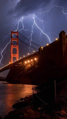
By 4:30 a.m,  Sunday, firefighters were at seven brush fires in the Bay Area caused by lightning, the L.A. Times reported.  More storms and dry lightning hit on Monday. A video compilation of the lightning is at the bottom of this post. It's pretty cool.

This comes in the middle of a strong, long heat wave. Records highs have been set all up and down the West Coast in recent days.  After what might be a world heat record of 130 degrees Sunday in Furnace Creek, California, the town had a chillier day Monday as the high only reached 127 degrees.

Today, heat warnings and advisories are up for a huge area of the West from central and southern California, Arizona all the way up to Idaho and Montana.

Red flag warnings for high wildfire risks cover most of these same areas.

TROPICS HEATING UP

Right on cue, the Atlantic tropical storm machine is cranking up right about now, as forecasters have been telling us they would at this time.

Last week we had tropical storms Josephine and Kirk, both of which were really nothing burgers that didn't affect anybody on land to any extent. 

Right now, though, there are two storms brewing that seem to to warrant being put on the watch list. 

The first is a disturbance just about to head westward into the Caribbean Sea.  Its forward motion is so quick that the disturbance can't get its act together, so it's unimpressive now. The National Hurricane Center thinks this batch of showers will slow down and encounter better conditions to develop into something more serious in the western Caribbean in a few days. 

Further to the east out in the open Atlantic, an impressive cluster of storms moved off the coast of Africa a few days ago. This patch of storms is getting more organized, and a tropical storm should form out of this within a few days. 

It's way to early to know how, or even if, either of these wannabe storms will affect the United States or other populated areas.  However, both do show signs that they could hit land eventually.  The National Hurricane Center is certainly monitoring all this. The two wannabe storms will probably be featured in future posts of this here blog thingy.  

Video:

Different views of the California lightning:


Monday, August 17, 2020

Hottest Temperature On Earth Might Have Been Set Sunday In Death Valley

That huge heat wave is grinding on in the western third of the nation, and that might have led to a world record Sunday.  

A couple enjoying the nice 130 degree 
temperatures in Furnace Creek, Death
Valley, California Sunday

It got up to 130 degrees in an aptly named place called Furnace Creek on Sunday.  If verified, it would probably break  the record for the hottest reliably recorded temperature on Earth.

I say "probably" because there are disputes to many so called record hottest temperature readings. 

There's other reports in the past of higher temperatures on the planet than the 130 degrees on Sunday, but most if not all of those have been debunked, or at least seriously question. Researcher Christopher Burt took us through these dubious records a few years ago in a Weather Underground column.  Some of his conclusions follow: 

You might remember from old encyclopedias and what not that the hottest temperature recorded on Earth was 136.4 degrees in Al Azizia, Libya, September 12, 1922.  However, the World Meteorological Organization invalidated that record a few years back because there were problems with instruments, how the thermometer was sited, and other procedural problems. 

 A 134 degree reading in Algeria was also dismissed as being climatologically impossible. 

Yet another 134 degree reported reading in Death Valley, California is unlikely to be real. During heat waves in that part of the country, nearby stations report temperatures that are just about as hot.  But in 1913, the second warmest spot in the region was "only" 118 degrees. There were problems with the siting of this thermometer as well. 

Burt, in his 2016 analysis concluded that the actual hottest temperature on record was a tie.  That reading was 129.2 degrees in Mitribah, Kuwait on July 21, 2016 and also at Furnace Creek, Death Valley, California on June 30, 2013 and at Greenland Ranch, Death Valley on July 20, 1960,

Burt bases this conclusion on the fact these readings were measured in pretty precise ways under accepted scientific guidelines.

That leads us to Sunday to the reported 130 degree reading in Furnace Creek, California. Scientists will look at the measurements and if they were taken properly to determine this was a real world record for hottest temperature. 

If you want cooler thoughts, note that the forecast high today here in Vermont, at Burlington is just 79 degrees.

There have been other hot spots going on in recent days. Japan on Sunday tied its national record for hottest temperature with a reading of 106 degrees.   Stockton, California had its all-time August maximum at 113 degrees. Phoenix, Arizona tied its August record with 117 degree last week. And they've had 38 days this year with temperatures at or above 110 degrees, the most on record. 

Way up toward the Arctic, St Paul Island in the Bering Sea just tied its all time record high of 66 degrees. Not that warm, true, but awfully toasty by their standards.  

Sunday, August 16, 2020

California Fire Tornado and Vermont Funnel Cloud Is So 2020

This year is as twisted a time in history as possible, so of course it makes sense that on a single day we had at least one fire tornado in California and a rare funnel cloud in Vermont's Northeast Kingdom. 

We'll get into the California tornado first, then the Vermont funnel.  

Rare fire tornado in California
on Saturday

And things kept going this morning, with a rare lightning barrage in San Francisco. We're using that word "rare" in this post a LOT! It's 2020 after all.  

FIRE TORNADO 

The western United States is enduring a record heat wave and a drought. The inevitable result of that is wildfires.  It's so dry and winds are so erratic that we're getting extreme fire behavior out there

Large wildfires sometimes create something called pyrocumulonimbus clouds.   (Say that five times fast!) The heat generated by the wildfires create strong updrafts which create tall, sometimes violent smoky thunderstorms. 

Such was the case in northeastern California on Saturday. 

As Washington Post Meteorologist Matthew Cappucci engagingly explains, that strong pyrocumulonimbus cloud was in an area of wind shear - the wind was changing direction with height. That created a spin. Plus, the atmosphere was primed for updrafts even without the fire.

The updrafts and the changing wind direction with height helped the pyrocumulonimbus cloud to rotate. At times, parts of the rotation tightened and you had tornadoes.

This was a true tornado, not a fire whirl in which the flames get caught in a tight rotation just near the ground. This tornado lowered from the smoky cloud.  It touched down in a fairly remote area, so the actual tornado didn't cause a lot of damage. The wildfire did, of course. 

Fire tornadoes have  happened before, but they are not observed often at all.  If you want a notable example other than yesterday's an area near Redding, California had a massive fire tornado in 2018.

Yesterday's fire tornado in northeastern California is the first known in the United States to prompt a National Weather Service office to issue a tornado warning. 

VERMONT FUNNEL

While all this was going on, Vermont's Northeast Kingdom had it's own twisty excitement.  In this case, it wasn't particularly dangerous, but not something you see in Green Mountain State,  that's for sure.

Like in the fire tornado above, wind shear played a large role in creating the Northeast Kingdom funnel cloud.  Winds were coming from the east at elevations below 10,000 feet, and from the west at elevations above 10,000 feet or so. 

The air flow also tended to converge in the area where the funnel formed, which encouraged its development.

Funnel cloud near Newport, Vermont Saturday. Photo
by Bob Minnie 

There was enough instability in the air to create some showers and thunderstorms, as a pocket of cold air aloft helped clouds billow upward into storms. 

 That chilly air aloft and the spin created what is known as a "cold air funnel" that caused that stir around Newport and Lake Willoughby Saturday evening. 

There were no tornado or severe storm warnings as the parent storm that spawned the funnel wasn't severe. Plus, cold air funnels don't usually make it all the way to the ground.  On some occasions they do and can cause damage, but in this case, the funnel stayed aloft. 

SAN FRANCISCO'S TURN

Cool, stable air created by the chilly waters of the Pacific Ocean tend to help squelch thunderstorms around the San Francisco Bay Area, so they don't see many summer lightning storms. 

But the extreme heat in California, and I think warmer than normal Pacific Ocean water temperatures, helped create a lightning barrage early this morning in the Bay Area.  

Here's that word again: Rare.  

Storms that created funnel clouds over 
Vermont's Northeast Kingdom weakened
as they moved westward, causing this 
fiery sunset in St. Albans, Vermont

Rare severe thunderstorm warnings were issued for much of the central coast of California this morning because of gusty winds associated with the storms.  

The storms didn't contain much rain, so the lightning was particularly dangerous because it could set off more wildfires. The strong, gusty winds associated with the storms didn't help. 

This was just happening as I wrote this, so I'm unsure yet if these storms sparked any wildfires.

Like I said, if you wanted a bizarre year, 2020 is it, for sure!