Showing posts with label Covid. Show all posts

Thursday, February 3, 2022

Blizzard Twitter Thread Hilariously Abuses People In "Alternative Realities"

A Twitter thread set the logic of anti-vaxers and anti-maskers
to last weekend's blizzard in New England
to hilarious effect. 
I spotted a Twitter thread  this past Sunday that perfectly and hilariously used the Blizzard of '22 in New England last weekend as a jumping off point to highlight the absolutely logistic boneheadedness we see in the national "dialogue" over Covid vaxes and masks. 

You've heard all the stupid ways of "thinking" in the examples below, but applying the line of "reasoning" to winter weather just makes it both funny and sad. It also makes it clear how a lot of people don't think at all before opening their mouths.

 James Hamblin (@jameshamblin) started it with this post: 

"So we're supposed to ''prepare for blizzard conditions' just because the scientific establishment and the media say so? And anyone who says it will be sunny and 70 is canceled? All's I' saying is, lots of $ changing hands in snow shovel industry. Do your own meteorology."

The post garnered responses like these:

"I can't breathe with a scarf covering my face. Gloves are for the fearful. Frostbite only affects 1% of total skin surfaces."

Joe Rogan and his misinformation sort of gets a shoutout here: "I never listen to MSM weather. I get my info from Snow Rogan. He drives in blizzards all the time and doesn't even use snow tires. It is a hoax perpetrated by Big tire. Don't be a sheep."

How about the "just take your vitamins and let your immune system protect you" crowd?  Here's a good takedown: "If you exercise, eat well, megadose on vitamin C+D, you won't even need coats, gloves or hats. Your natural immunity to cold will take care of you. Everyone wearing warm clothes are sheep with pre-existing sensitivities to temperature. Do your own research and stick it to big cotton."

Photo of a commie socialist using government overreach
to clean up after a snowstorm. 
Some people get Covid even if they've had the vaccine, cry the anti-vaxers. So how's this? "And some people still freeze to death when they wear a coat! What's the point of wearing one if it's not guaranteed to keep me from dying of hypothermia? Not to mention it's made out of 50% Luciifester. That's how the satanists will control us in the blizzard!  

 Those people on Facebook outsmarted Anthony Fauci with their miracle cures, right?  "My aunt's next door neighbor started drinking this stuff called 'rum.' It doesn't freeze! So if you drink it, you won't freeze!"   

Or: "My neighbor Bob had an accident even after putting on winter tires. Some drivers are already on their 3rd set of tires, which proves their ineffectiveness. We do not know what the tires are made of. The tire manufacturers scare us with winter just to enrich themselves."

And: "I just talked to my sister in Texas...get this. No snow where they are. None. But all these liberal northeast states are screaming about snow? Something doesn't add up."

We can't get through this discussion without bringing up our "rights", um, right? "What about my rights as a parent? I don't want some atheist communist weatherman telling my kid that water freezes at 32 degrees. If I say it's safe to drive it's not their place to contradict me." 

So yeah, we covered pretty much all the talking points that the anti-maskers and anti-vaxxers have, but applied the logic to the Blizzard of '22.  

It all seems pretty silly, no?

Saturday, August 28, 2021

Hurricane Ida As Bad As It Gets; Enormous Trouble For Louisiana

UPDATE 2:15 pm. Saturday

Compare this satellite view of Hurricane Ida taken
early this afternoon compared to the early morning
image below and you can see that it has strengthen
and organized a lot since then
As expected, Hurricane Ida is gaining strength pretty rapidly. 

I wrote the post you see below at around 8 a.m., and in the six hours since, the hurricane has looked a lot more organized and symmetrical, and a well-defined eye formed.  An increase in strength usually lags a little while after an eye forms and a hurricane gets more organized.

That strengthening trend has definitely begun.  As of 1 p.m., strongest sustained winds with Ida were estimated at 100 mph.   Ida was moving over very warm Gulf water and upper level winds, or lack thereof, would encourage further strengthening, possibly rapid strengthening. 

This remains a huge, devastating threat to Louisiana. Hurricane Ida's track is now just a little bit east of where it was forecast, which is potentially bad.  If it keeps on that slightly more easterly track, it'll come ashore closer to New Orleans, and make things there worse.

However, strong hurricanes tend to wobble a bit in a subtle zigzag pattern, so it might sneak back west a tad. Who knows?

Wherever Ida hits, there will be real danger. To emphasize things, here's what the National Weather Service office in New Orleans tweeted this afternoon (capital letters theirs, not mine): "We once again stress that if you are under evacuation order or can leave, PLEASE LEAVE., DEVASTING conditions WILL happen." 

The evacuation itself is beginning to worry me. 

 Highways in the area are bumper to bumper, with some accidents and vehicle breakdowns making things worse. You want everybody off the highways before the rough weather arrives. People can be sitting ducks for real danger if they're on the road and the hurricane arrives.

There's still a little time to get everybody out of the way, so this piece is not a crisis yet.  But it's looking a little too chaotic for my tastes.

PREVIOUS DISCUSSION, 8 PM

Meteorologists for the past day or two have been filled with dread over Hurricane Ida.

For good reason. 

Hurricane Ida already looking ferocious early this morning
on this satellite image. It will only get stronger as the day
goes on and poses an enormous threat to Louisiana.
Everything is set up for it to be an extremely powerful hurricane as it roars northward through the Gulf of Mexico today and tomorrow with its sights set on Louisiana.

It's the worst kind of hurricane. It's expected to be a Category 4 storm at landfall and will be strengthening probably all the way to the coast.  There is going to be huge destruction in Louisiana, which has already been battered by several hurricanes in the past year or two

You could by yesterday that Ida was going to be in trouble. You could see it blossom from a disorganized tropical storm to a well-organized hurricane in just hours.  The center of Ida crossed the rugged terrain of western Cuba. You'd expect that land interaction to really disrupt Ida's circulation.

Instead, Hurricane Ida just seemed to hiccup, and this morning was rapidly developing once again.  After Ida emerged into the Gulf of Mexico early today, two extremely intense thunderstorm complexes formed on opposite sides of the eye and started to swirl around the center. That setup is usually a sign that a hurricane will intensify quickly.

So far, 150,000 people have been ordered out and away from the expected path of Ida in Louisiana. There really isn't time to evacuate all of New Orleans, but people there are being urged to go today.

New Orleans erected a $20 billion levee system after the extreme devastation of Hurricane Katrina in 2005. I guess this will be a test of whether these levees can hold back Ida's expected 11-foot surge. Meanwhile, more than a foot of wind-driven rain is expected to fall on New Orleans.  Will the pumps be able to at least partially keep up with the flooding rains, or will power fails and such silence the pumps, with extreme flooding resulting? 

Unfortunately, that's the question right now. 

By the way, Hurricane Ida is forecast to make landfall on the exact 16th anniversary of Katrina's strike on Louisiana.

Other parts of Louisiana and Mississippi are going to get bulldozed by this, too.  Remember, hospitals in this region are already overwhelmed with Covid cases.  Dozens or hundreds of injuries and other emergencies from Ida won't be managed as well as usual.  This problem will extend well inland, as torrential rains will spread dangerous flooding all the way to Tennessee and probably beyond.

I know a lot of this seems like hype. After all, didn't the last one -Henri in the Northeast - turn out to be not as bad as advertised?

Sure, there's a chance Ida might not strengthen as much as forecast. Perhaps the Gulf Coast will get lucky and some dry air will get sucked into the circulation, causing Ida to falter.

Don't count on that.  Hurricane Ida will travel over super warm Gulf of Mexico waters. Such hot water is jet fuel for hurricanes. Upper level winds will be light, so the thunderstorms that surround Ida's center will continue to get stronger, thereby boosting the hurricane further. 

A lot of it comes down to exactly where Hurricane Ida comes ashore. The hurricane will be catastrophic no matter where it lands. So I guess you want it to come in where it will affect the least amount of people.

The worst case scenario is if it comes in just west of New Orleans. That would put NOLA into the most extreme push of storm surges, and the strongest winds.  

People in Louisiana don't have much time left to prepare or get out of Dodge. The weather will start going downhill this afternoon or tonight in southern Louisiana. Gasoline, drinking water and other supplies are probably going fast.

People who are sheltering in place will face no electricity and even worse gas and supply shortages in the days immediately after the storm, so that will be an issue.

Even if everybody heeds warnings and gets out of the way, many of the deaths and injuries from hurricanes comes after the wind dies down.  People get hurt chain sawing their way out of a sea of fallen trees, they have heart attacks and strokes from the stress, come down with heat-related illnesses since there's no air conditioning, or get hurt or injured in a myriad of ways during the immediate post-hurricane cleanup.

And, as mentioned, there's Covid, and the highly contagious Delta variant of that virus. Put a bunch of unvaccinated people in emergency shelters and that just makes the wave of Covid hospitalizations and deaths that much worse.

So yeah, I'm absolutely dreading this storm. We'd be crazy not to.

Sunday, February 14, 2021

Sunday Evening Storm Update: Horrible Nationwide; Vermont Update

Some changes to the snow forecast from the NWS
Burlington this evening. Northern and central Vermont
snow totals increased to near 10 inches, give or take.
Far southern Vermont totals now down under 6 inches
due to expected mixed precipitation. 
 As everyone expected, the National Weather Service in South Burlington this afternoon upgraded the winter storm watch to a warning.   

A watch means "maybe" and a warning means "pretty much definitely"   So let's get into it.

STORM #1 

There's a few changes to the forecast for this storm, compared to what we saw this morning. 

Snow accumulations now look to be a little more than what was expected earlier north of Route 4 and a little less than forecasts earlier today south of Route 4. 

It looks - at least for now - like a good eight to 12 inches will come down, especially north of a Middlebury to St. Johnsbury line. 

The higher totals central and north are because it appears there will be slightly better lift in the atmosphere than previous forecasts suggested. The better the lift in the atmosphere, the heavier the snow comes down. 

NWS Burlington says snow fall rates will be a healthy inch per hour or a little more during the pre-dawn hours Tuesday and into the time of the morning commute. 

Which means say home Tuesday morning if you can. 

The slightly reduced totals in the south are because forecasters are now more confident that those areas will have sleet and freezing rain, after an initial hard thump of snow. 

On the bright side, most of the mix will be sleet, which is less hazardous that freezing rain, which clings to everything and causes a lot of damage. The layer of cold air near the surface will be thick enough, so that if snowflakes melt on the way down due to warm air aloft, they'll have time to re-freeze before they hit the ground.

Far southern Vermont is more likely to see some freezing rain, and it still looks like damaging freezing rain will hit from inland areas of the Mid-Atlantic states through southern New York into southwester New England. 

As far as timing goes, an initial period of snow out ahead of the main storm should come through from late tomorrow  morning to evening with maybe one or two inches of snow. You'll want to be careful driving around Monday afternoon. 

The main show would start Monday night, with the heaviest snow ending by late morning Tuesday. Lighter snow seems likely to continue during Tuesday afternoon.

Quiet and cold-ish weather will come back for Wednesday and the first part of Thursday before the next big event arrives. 

STORM #2

The next storm, Thursday night and Friday could be a real doozy.  It's coming with oodles of moisture, so whatever comes out of the sky could come down quite hard. 

The question remains: Exactly what will come out of the sky?  We're in for either a whole bunch of snow, a lot of mixed precipitation, or even rain. 

It'll be a mess whatever happens.

The large storm will come out of the Gulf of Mexico and head north or northeast.  If, as some forecasts indicate, the storm will head due north and pass by a little to the west of us.  If that happens, we get a thump of snow, then a bunch of sleet and freezing rain, and even some plain rain in the valleys. Yuck.

If other forecasting models are right, the storm will get shoved east a bit or redevelop along the coast.  If that happens, Vermont will get mostly snow out of the storm, especially north and west. 

We simply don't know. 

We do know that snow banks, already decent sized, will get a lot taller as the week goes by.  There's also a bright side: Vermont is completely escaping the core of the frigid air with this.  Had we gotten a direct shot, we would have had several nights in 20s below zero afternoons that remained in the minus numbers. 

Instead, it was a little cold late in the week, and average going forward. 

MORE NATIONAL IMPACTS

Nationwide the winter weather continued unabated and punishing. The entire states of Texas, Oklahoma and Arkansas were under a winter storm warning.  As of 3:30 p.m., the winter storm warnings extended roughly 2,245 miles form around Albuquerque, New Mexico to around Newport, Vermont.  

Damage from freezing rain in Oregon over the
weekend. The winter storms affected almost all
of the nation. Photo from Oregon DOT

It also still looks like the first of the two storms will drop a continuous swath of dangerous freezing rain from Texas to coastal Maine.  All of this freezing rain is and will cause travel nightmares. In many spots, it will be enough to cause tree damage and power outages. 

Largely because this siege of winter weather is covering almost all of the Lower 48, is lasting a long time and is hitting many populated areas, it will surely cause more than a billion dollars in damage. 

This storm and frigid weather is screwing up the battle against Covid, too. Vaccine shipments to Texas will be delayed by three or four days. Outdoor vaccination sites in Texas are understandably shut down, though indoor ones will remain open, according to CNN.

A major Covid vaccination site in Portland Oregon was shut down Sunday due to an ice storm there. 

It's clear by the large number of traffic crashes in the South that people in those areas do not have experience driving in winter weather. 

And a few are stupid. One pickup truck doing 90 mph (!!) on an ice covered Oklahoma highway slammed into a salt truck.  No word on injuries.

It looks like that fatal pileup in Fort Worth Texas last week is doomed to repeat itself in some shape or form.  There are already early reports of a big fiery pileup on Interstate 44 in Oklahoma and another huge multi-vehicle crash on Interstate 10 near El Paso, Texas on Sunday. 

Let's be careful out there! 


Monday, December 21, 2020

Christmas 2020: Strong Winds, Flood Risk And A Flash Freeze

One model run for early Christmas morning shows
a sharp cold front in western Vermont. Low 50s from the
Greens east, upper 20s far west. Timing of the cold front
and its intensity are still in question.
Details are slowly coming together on an expected nasty Christmas Eve and Christmas Day storm here in Vermont and the rest of the Northeast, but timing questions are huge.  

Note The automated ads associated with this blog post might be a little out of control today. If so, please be patient and scroll down to keep reading. 

Forecasters are pretty sure we're in for a good dousing of rain, some strong, potentially damaging winds and something known as a flash freeze, which I'll get into in just a bit. 

 There will probably be some snow with this, too, but just how much is really up in the air.  

Here's what's going on: A parade of storms has been smacking into the Pacific Northwest, dumping a lot of rain out that way, which is pretty typical for winter.  

These storms, most of them in somewhat weakened and definitely dried out form, are eventually zipping through New England with little fanfare, just some light precipitation. 

One came through yesterday, another goes by a little to our south tonight and tomorrow, no big deal. 

However, one of these Pacific storms has a lot of energy with it.  Plus, a deep dip in the jet stream will form as this storm gets going.  

This will allow deep subtropical and warm air to fly north on strong upper level winds ahead of the storm's cold front.

This will unleash what looks like quite a bit of rain on us Christmas Eve day and night. Storm totals could easily go over an inch. 

That deep snow in southern Vermont will rapidly melt with the warmth and rain.  Flooding is definitely a possibility.  

Already, some river forecasting models depict some flooding along the Otter Creek and Mad River, and it's likely most other rivers will rise. 

Most of the trouble with this thaw and rain will most likely be small stream, street and basement flooding. This would literally put a damper on Christmas celebrations, already seriously cut back due to Covid. 

Remember those strong upper level winds I just mentioned that are bringing that warm, wet air to us?  Some of those winds could mix down to the surface, though it's unclear to what extent that will happen.

The rapidly diminishing snow cover in southern Vermont might, just might help create a temperature inversion that would help keep the strongest winds from reaching the surface. But we're not sure.

At this point, the western slopes of the Green Mountains and the Champlain Valley have the best chance of getting slapped by strong, potentially damaging wind gusts. This would be mostly a tree and power line issue. Again, something you don't want to have at Christmastime. 

We could see temperatures get well into the 50s Christmas Eve night. That would get us close to record highs most days this time of year. Except Christmas Eve is the anniversary of a bonkers 2015 holiday heat wave that brought Vermont temperatures as high as 70 degrees. So no record highs that day. 

I suppose there could be readings close to record highs for Christmas Day in the early morning before temperatures fall.

Incredibly, what seemed like a lock for a white Christmas in southern Vermont, which got two to three feet of snow in many areas last week, now looks questionable.  That will depend on the timing of the storm's cold front. 

The cold front on Christmas Day looks to be a real humdinger. I picture a line of heavy downpours just ahead of it, followed abruptly by crashing temperatures and a changeover to snow.

This is that flash freeze I referred to.  All that water from the rain will instantly freeze on roads and sidewalks, presenting a hazard to anyone driving or walking. 

The rain will change to snow with the passing of the front.  It's unclear how much snow will fall, as forecasts are all over the place. It depends mostly upon the timing and strength of a new storm riding northward along this strong cold front. 

Computer models are all over the place, because they don't have a handle on the situation yet. According to this morning's forecast discussion from the National Weather Service in South Burlington, one model has Burlington receiving somewhere between a half inch and 18 inches of new snow on Christmas Day.

I'm guessing the low end of that range, but that's just a guess right now. 

The timing of the powerful cold front is a question mark, too.  It could enter western Vermont before dawn and sweep right through, or it could wait until during the day.  Which means right now, it's impossible to know what conditions will be like when you wake up Christmas morning.  It could be in the 50s and raining, it could be way below freezing with snow and blowing snow outdoors.

Again, the models are all over the place.  One run of computer models has the temperature in Burlington at around dawn somewhere between the upper single numbers to low 50s. Yeah, no help there. 

Whatever happens, the wind will continue to crank as temperatures fall during Christmas Day.  

We might not yet know the timing or the intensity of this year's Christmas storm. It's 2020, after all, anything can happen.

Just plan on rough weather outdoors.  It will be yet another good excuse to heed the warnings of the Vermont Health Department to just stay home with your immediate family and not venture out to somebody else's house. 

This would prevent the spread of Covid, and also prevent you from getting trapped or in a crash on bad, icy or flooded roads. 

Friday, December 11, 2020

Covid Pandemic Reduced Carbon Emissions; Won't Make A Difference

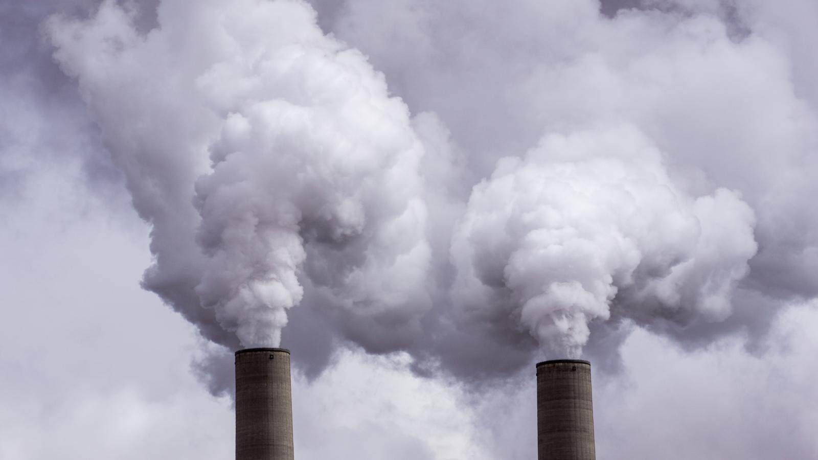
 Carbon emissions declined in 2020 due to the Covid 
pandemic, but blip won't really have an
effect on climate change. 
We got an update from academics on now much the Covid pandemic has reduced carbon emissions. 

The "good" news is that carbon emissions plunged in 2020 by a record amount.  

The very bad news is two-fold.  The reduction in carbon emissions is basically a drop in the bucket and won't have much if any effect on climate change.

Worse, the price we paid for this year's carbon reductions was so, so not worth the price: Hundreds of thousands killed by the pandemic, and millions upon millions of people suffering because of it. 

According to CNBC:

"Global greenhouse gas emissions plunged by roughly 2.4 billion tons this year, a 7% drop from 2019 and the largest decline on record......according to new research from the University of East Anglia, the University of Exeter and the Global Carbon Project."

When Covid-related lockdowns were most prevalent in the spring, carbon emissions plunged by 17 percent, but recovered to nearly the same levels as 2019 later in the year as restrictions eased, at least temporarily. 

All this accounts for the 7% drop. 

Medical experts are hopeful that next year, with Covid vaccines being distributed, the pandemic will ease and perhaps disappear altogether by Christmas 2021. 

With that, carbon emissions are expected to rise again.  Climate activists are urging governments and industry use the anticipated 2021 economic recovery as an excuse to switch to cleaner energy sources as things ramp up. 

Even with this year's reduction in carbon emissions, the amount of CO2 in the atmosphere will continue to rise. Think of CO2 in the atmosphere as water filling a bathtub.  In 2020, the bathtub faucet was turned down, but was still running. That means the bathtub is still filling up, just more slowly. 

To really help with climate change, we'd need to cut an additional 2 billion tons of carbon emissions yearly for the next decade, according to the BBC.  At that point, maybe the drain in the "bathtub" would be partially opened, allowing our metaphorical water (atmospheric CO2 concentrations) to start receding. 

"The atmospheric CO2 level, and consequently the world;s climate, will only stabilize when global CO2 emissions are near zero, " lead researcher Prof. Pierre Friedlingstein from the University of Exeter UK told the BBC.

Meanwhile, the effects of climate change continue to trouble the world.  This year is set to be among the top 5 hottest years on record. The rest of the top 5 have been since 2015.  Disasters likely made worse by climate change, such as intense hurricanes and wildfires, have caused billions in dollars in damage. 

In 2021, many experts say we'll finally start to see some real relief from the Covid pandemic. Unfortunately, the effects of climate change will probably continue to worsen.


Monday, November 23, 2020

Thanksgiving Travel: It's Discouraged, But Not Really Because Of Weather

Travel weather this Thanksgiving week will be OK, but 
DON'T GO!  Stay home to minimize Covid spread! 
About this time of year, every year, I do a piece on anticipated Thanksgiving travel weather, and I always hope the conditions are great for those of us taking trains, planes and automobiles. 

This year, I'm actually hoping for horrendous weather, dreaming that storms would discourage travel and big get togethers, the kind that spread Covid-19.

Things are looking grim in Covid department. Health officials and many leaders, including Gov Phil Scott here in Vermont, are pretty much begging people to call off big Thanksgiving gatherings involving people from multiple households. This is the type of event that seems to be a major driver of the current trend in soaring Covid cases and hospitalizations. 

There's actually an order in Vermont now from Governor Scott that bans these type of multi-household gatherings. 

Against that background, I have to say that travel conditions, particularly here in the Northeast, will unfortunately be pretty good this week.  That means it might be an OK week to get last minute pre-winter stuff done in your yard. 

Despite the relatively placid weather, I'd blow off the idea of going over the river and through the woods to Grandmother's house.  If you avoid that trip this year, you'll really up the chances you'll enjoy grandma's loving company and her exquisite apple pie for years to come. 

Anyway, the weather details go like this:

Today, here in Vermont, rain will eventually taper off, and maybe mix with some snow toward the end later today as temperatures drop.  The best chance of snow will be in the mountains, and it won't amount to much. 

Tuesday will be dry and wintry cold, with highs in most places in the 20s.  This cold snap, like the last one, will be brief and feature some sunshine. 

It will start to warm up Wednesday, but the characteristic overcast of November will return.  As the warm up starts, we might get a little mixed precipitation, much like we did toward the end of the day Sunday, but it will all change to rain .

A cold rain will continue Wednesday night and probably well into Thanksgiving Day.  But it won't freeze. 

Then, through the weekend, it looks cloudy, but not particularly stormy, and a tiny bit warmer than average for this time of year (Highs mostly in the 40s, lows in the upper 20s and 30s).

Nationally, there will be some trouble midweek in the middle of the country, Wednesday, there could be some snow in parts of the Upper Midwest.  More troublesome will be the risk of thunderstorms, some possibly severe, in the southern Plains and the southern half of the Mississippi Valley Tuesday and Wednesday.

However, by the standards of many Thanksgiving weeks, the U.S. will feature less storminess than we've sometimes have had this time of year. 

Still. Stay home unless it's absolutely necessary to go somewhere.  And wear a damn mask!  

Sunday, September 20, 2020

Persistent Wildfire Smoke Likely Killing People, Injuring Lungs

 It'll probably be impossible to count the number of deaths and illnesses caused by the smoke over the past month from all those wildfires in the West, but the situation is definitely creating health problems. 

Given the current fire situation and weather forecasts, this state of  affairs will likely go on for some time yet.   

Dense smoke enshrouds Seattle last week. Photo by
Sigma Sreedharan, via Twitter.

The air quality has improved somewhat over the West in the past couple of days, at least temporarily, but several areas in the northern and central Rockies are still under air quality alerts. 

Smoky, hazy skies still cover much of the United States. 

The air is dangerous and deadly, and was downright scary at times along the West Coast.  Seattle and Portland, Oregon had the worst air quality in the world last week.  I'm sure you saw those images on the news of the creepy orange, dark  daytime photos in the West. 

Street lights stayed on all day, if you drove you needed your headlights, and everybody was warned to stay indoors to avoid the thick pollution. 

According to The Guardian, Stanford University recorded hospital admissions for asthma rose by 10% and strokes jumped by 23% in the days following the first outbreaks of fires. 

Even worse, this is all  happening in the middle of a pandemic.  The pollution very likely makes Covid cases worse, and increased the risk of serious illness for those exposed to the virus. 

In buildings, you want a lot of outside air flowing in to HVAC systems to help flush Covid viruses floating in the air out of the structure. But during these wildfire smoke sieges, HVAC systems had to be switched to recirculate to keep the dangerous wildfire particles out. So much for flushing rooms with outdoor air. 

The smoke was so thick that it would seep into houses, making the indoor air dangerous, too. Air filtration systems sold out quickly. Residents resorted to making "MacGyver Fans" to purify the air. (People are attaching furnace filters to the front of box fans to purify indoor air).

Generally healthy people have a lot of capacity for their lungs to self-heal after dealing with pollution.  As people get older, their lung capacity diminishes.  If pollution is persistent, will a lot of these younger, healthy people end up with lousy lungs at an earlier age than they otherwise would have? 

A lot of scientists say yes.

The longer the exposure to pollution and the thicker the pollution, the worse it gets for the lungs. This is pretty much the fourth summer and autumn in a row with choking wildfire smoke in the west. This isn't good.

The wildfire smoke is not great for mental health, either. Let's face it. This year really sucks. There's Covid, unrest in the streets, massive failures of leadership, tragedies and climate change.

As noted, the wildfire smoke is billowing high up into the atmosphere and blotting out the blue sky coast to coast. Social media was full of posts with photos, and comments on how the haze and smoke was turning an incredibly depressing year into something even worse.

Last week that thick haze was overhead in Vermont, and will probably come back for a time later this week, according to forecasts. 

The smoke was too high up in the atmosphere over the Green Mountain State to really have any health effects on the ground. But the blah skies were and are a constant reminder that climate change is worsening, and everything seems to be going to hell now. 

I was actually relieved when a Canadian cold front rolled through on Friday. Even though the subsequent frost would wreck my gardens, it was so comforting to see blue sky again.

Get used to the smoke, though. And the health hazards. The fires out west continue to burn. Some welcome rain hit the Pacific Northwest over the weekend. California remained dry and on fire. Weather forecasts call for another round of near record heat, wind and dry air over the western United States into early October at least. 

With climate change fires will keep getting worse, not only in the West but elsewhere on Earth as well. Get used to those smoky summer and autumn skies. 

It's just another way climate change is messing with our lives.   

Saturday, August 22, 2020

California Fires, Smoke, Laura, Marco, Storms And Us

 Wildfires in California continue to burn through much of the San Francisco Bay area and northern and central parts of the state.  So, once again, there's another extreme fire season out west.  

No end in sight with massive 
California wildfires

Vox has a great explainer as to why this week's wildfires are so extreme and weird.  It started with that very rare lightning barrage last weekend across northern California. It's really dry out there and those thunderstorms had very little rain with them. 

But they had a LOT of lightning strikes. Here's a money quote from Vox:

"'We had close to 11,000 strikes in a matter of three days,' said Brice Bennett, a spokesperson for the California Department of Forestry and Fire Protection (Cal Fire) 'With an already warm weather pattern and very, very dry conditions here in California, with those lightning strikes coming through, over 367 new fires were started.'"

Those spot lightning fires merged and congealed into three massive fires. Two of them are already among the top five largest in California history, and they're not even close to being contained yet.

We know that wildfires are common in California, but they usually burn in dense forests inland from the Pacific Ocean or through dry shrub lands in southern California.

These fires started much closer to the coast, invading the state's famed redwood forests, which almost never catch fire. Some redwoods, perhaps some that were 1,000 years old, were likely destroyed this week. 

Of course, Covid-19 is making matters worse. California prison inmates are often called upon to fight wildfires, but many were released from prison to ease Covid risks. Others are under quarantine, or sick, or can't travel to fires due to restrictions.  Seasoned firefighters need to practice social distancing, and I imagine that hampers the cooperation needed to battle the fires.

The fires have already burned more acreage than in an entire wildfire season in California. Keep in mind, this is just the start of the fire season.  Wildfires usually peak in California between mid-September and early November.

Plus, to politicize a bit, our Dear Leader Trump is not helping much so far.  He is reported to blame California again, repeating his bizarre "logic" from the past two years.  He said, "You gotta clean your floors. You gotta clean your forests. They have many, many years of leaves and broken trees.. .We say 'You gotta get rid of the leaves. You gotta get rid of the debris, You gotta get rid of fallen trees.'"

Sigh. 

California has more than 30 million acres of forests. It's hard enough to do leaf and debris removal each spring on my one-acre plot in Vermont.  Trump has no idea what it would be like to "clean" 30 million acres. And doing this somehow without wrecking the forest ecosystem? 

Here's another Covid related problem with the wildfires:  Air pollution is though to make symptoms in many people worse than they otherwise would be. Smoke from the wildfires made parts of California suffer the worst air pollution in the world at some points last week. 

The smoke is spreading throughout the West.  Actually, it's spreading all over the country. Even here in Vermont, we will often see hazy skies over the next several days at least because of the wildfires, thoug pollution levels here won't rise to dangerous levels.

TROPICAL STORMS

Meteorologists with the National Hurricane Center are still carefully watching Tropical Storms Laura and Marco. 

Forecasts for these two systems will inevitably change, but at the moment, Tropical Storm Laura, near Puerto Rico this morning, only had top winds of 40 mph. Laura is forecast to slowly strengthen, but it also looks like it will struggle as it encounters land in Hispaniola and Cuba. Once it gets past Cuba, Laura could still easily turn into a dangerous hurricane when it eventually reaches the Gulf of Mexico.

Meanwhile, Tropical Storm Marco is just about to pass Mexico's Yucatan Peninsula and enter the western Gulf of Mexico.  It has top winds of 50 mph. It is forecast to strengthen for a time, then perhaps weaken amid strong high level winds in the northwestern Gulf of Mexico. I would also note that Marco seemed to be overachieving this morning, strengthening faster than many meteorologists predicted. 

Unlike earlier forecasts, Marco is now expected to become a hurricane later today.

Forecasts for the two storms will likely change as new information comes in, so stay tuned. 

By the way, clickbait on social media is saying that Laura and Marco will get close enough together to merge into a mega hurricane.  That is total hype. Not happening. There is a 100% chance that they will NOT merge into a mega hurricane. The two storms might affect each others' path and strength somewhat, but tropical storms and hurricanes don't merge to become super storms. Just chill, OK?

SEVERE WEATHER

As expected a few isolated strong to severe storms erupted in Vermont yesterday, but it was nothing too extreme. Trees came down along Route 30 near Lake St. Catherine, and the same happened nearby along Route 140 in Middletown Springs, according to storm reports. 

Some relatively strong storms were moving through far southern Vermont early this morning, but basically we get a break from a storm threat today. 

Scattered showers and storms, some of which could be on the strong side, could erupt in Vermont tomorrow, Monday and Tuesday, but forecast details are iffy at this point. It doesn't look like there will be anything super widespread, except possibly on Tuesday.  Once again, stay tuned.