Showing posts with label cloudy. Show all posts

Sunday, June 1, 2025

If You Thought This May In Vermont Was Awfully Wet And Cloudy, Then BINGO!

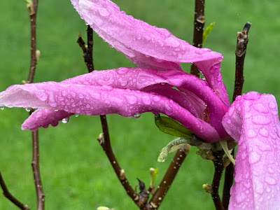
Magnolia blooms struggle in a May 10, 2025 
rain storm in St. Albans, Vermont. The month
proved exceptionally wet and cloudy throughout
the Green Mountain State.
 The May, 2025 Vermont climate numbers are in and they confirm it was an oddly wet, cloudy month at a time of year when spring sunshine normally predominates.  

TONS OF RAIN, AND A LITTLE SNOW

Burlington was in the "driest" part of the state as northwestern Vermont didn't get quite as much rain as the rest of the state. 

Still the 6.11 inches of rain that fell in Burlington still made it the seventh wettest May on record. Precipitation was 2.35 inches above normal. 

Montpelier was deluged with 7.51 inches of rain during May, more than double the normal for the month. It was the same story down in Bennington, which also had more than double the normal rain fall. They received about 7.5 inches of rain in May, compared to the normal of 3,5. St. Johnsbury with 6.86 inches of rain in May, 2025 was three inches above normal.

The wettest place I found  so far - but probably by no means the wettest in Vermont - was Woodstock, in the southeastern part of the state. They had 8.36 inches of rain in May, a full 4.75 inches above normal.

Considering the amount of rain we had, Vermont was lucky we only had one flood event during May, and even that one wasn't terribly widespread. Especially considering the big, destructive ones we've had in recent years.

The flood on May 17, though damaging, only really affected a handful of towns, most notably White River Junction, Hartford, Waitsfield and Warren. And to an extent Bristol.

The May 17 storm was also notable for the amount of sometimes damaging hail that hit some parts of the state  especially southern Chittenden County and parts of the central Vermont.

The lack of flooding I think was partly due to the fact the rain was distributed through the month, instead of falling in just a few days. Burlington had only eight days without rain during the month. Three of those days had more than an inch of rain, but most days brought a half inch or less.

The gradual rains - except for the torrential downpours of May 17 - meant that streams, creeks and rivers in Vermont usually behaved themselves pretty well, despite the constant rain. 

We even had bouts of unseasonable snow, at least in the mountains, especially on May 22 to 24 where most elevations above 3,500 feet were dusted with snow.

That snow helped keep measurable snow on the ground atop Mount Mansfield until yesterday, when it was down to a trace. The graduals decrease in snow cover up there stopped on May 21, as it stopped at a depth of five inches from that date through the 25th.

CLOUDS INFLUENCED TEMPERATURE

It was a very cloudy May with all the rain we had. That influenced temperatures a great deal.

Across Vermont, the average temperature for May, believe it or not, was really close to normal. It seemed colder than that. 

The reason was the clouds. Cloudy skies keep daytimes cooler than they otherwise would be. But those clouds keep nights warmer than they would be if the skies were starlit.

Because of the clouds, the average high temperatures in May, 2025 were much cooler than normal, while nights were much warmer than they should have been. That's unusual because the average high temperature and low temperature usually closely match the overall mean temperatures for the month, if that makes any sense.

Across Vermont, average high temperatures were around two degrees cooler than they should have been for May. But nights were on average about two degrees warmer than you'd expect. So the bottom line was May, 2025 had normal temperatures on paper even though the month was anything but.

Still we did manage to have a couple warm periods. Burlington had five consecutive days in the 80s mid month, and a couple more 80 degrees last week.

LOOKING AHEAD

As always, it's very hard in advance to determine who the upcoming month will shape up. And it's often wrong. In late April, NOAA said May in Vermont would be warmer than  normal, with equal chances of above or below normal precipitation.

So much for that. 

But we'll play the game again anyway. NOAA says that in June, the parts of the nation that stand the greatest chances of hotter than normal weather are in the central Rockies and in New England, including here in Vermont. 

The month is opening today with much, much chillier than normal weather for the opening day of June, which would seem to contradict that prediction. But, a sharp warming trend will bring us to near normal temperatures by Tuesday and warmer than normal weather by Wednesday and Thursday. Overall, the forecasts call for mostly warmer than seasonal temperatures through mid-month, at least, so we'll see. 

As in the forecast just before May started, NOAA is giving Vermont equal chances of above or below normal rainfall in June. So, flip a coin on that one. 


Saturday, February 1, 2025

January Turned Out Quiet And Dry In Vermont, A Break From Recent Chaotic Weather

The tone of January in northern Vermont: Snowy 
mountains, but not much in the valleys. 
We just got through a Vermont January and to sum up the weather for the month, I guess we can describe the month as, honestly, a little boring. 

Vermont weather during January frankly lacked personality. It didn't bring any exciting tales to tell in terms of storms. The month didn't wow us with temperature extremes.  If January, 2025 was a person, they would not be the type you'd want to invite to a wild party.  

We can't complain, though. Exciting usually means damaging and disruptive and chaotic when it comes to weather. 

Vermont has had more than our share of that kind of thing in recent months, so it was kind of a nice break to experience a rather colorless January. 

January temperatures statewide averaged out to be right near normal.  Of course this is the "new normal" as "average" is based on the past 30 years of weather. Climate change had already made things around here warmer over those three decades, so "normal" is toastier than it was a couple generations ago. 

A chilly mid-January sunset near Fairfield, Vermont.
This was a relatively rare day in which the sun
was out for a good part of it. 
Had this same month occurred, say in the 1960s or 1970s, we'd be remarking about how mild January was. 

The dull nature of the January, 2025 becomes more apparent when you dive deeper into the temperature data for the month. 

Across the state, average high temperatures for the month were a little colder than what is considered normal these days. Overnight lows for the month were a little on the mild side. 

That at least partly reflects the grey feel we had in January. It was usually cloudy, so that held daytime temperatures down while keeping nighttime temperatures up.

Despite all the clouds, it didn't really snow or rain much. Except for the northern Green Mountains, the entire state had a very dry January.  Most place had less than  half their normal installment of January rain and melted snow. 

It was driest in northern Vermont in towns west and east of the Green Mountains, where less than an inch of precipitation came down. The 0.75 inches of precipitation in Burlington tied with 1933 as the 13th driest January on record since the late 1880s, when reliable records started. 

After another cloudy day, late afternoon sun breaks
through to light up the trees if not the 
clouds in St. Albans, Vermont on January 15. 
Snowfall was below normal too, except for a small area in the northern Green Mountains. Generally speaking, most places in valley locations were about a half foot on the light side. 

Seasonal snowfall is seriously lagging especially in the Lower Connecticut and Champlain Valleys. Burlington should have had 46.6 inches of snow so far this season, instead only 31,2 inches had appeared through January 31. 

FEBRUARY

We've gotten ourselves into a highly variable weather pattern with lots of temperature swings, as I mentioned in an earlier post,  It's usually almost impossible to anticipate what the weather will be like for an entire upcoming month. February, 2025 is even more uncertain than usual.

For those of you who are not dark winter fans, on average, we're on the upswing. On average, the third week of January is the coldest of the year.. February begins a gradual upswing.

First of all, on Friday we had our first post 5 p.m. sunset of the year, at least as observed in Burlington. By February 28, the sun will set at 5:39 p.m. 

The average temperature does not go up much from January during February, but at least there's some improvement. Today's normal high and low temperature in Burlington are 29 and 12 degrees.  By February 28, the normal high and low are 35 and 18

Sunday, October 29, 2023

A Damp, Flaky Vermont Forecast; Incredibly Raw Start To Week

An interlude of sunshine Saturday lit up these lingering
golden leaves in St. Albans, Vermont, but the gloom is
back and so is the chill. 
 The cold front that ended our long of warm autumn weather came through as scheduled Saturday.

It gave us a brief window in which the persistent clouds over the past two or three weeks gave way to bright blue skies during the afternoon.  

Now, this Sunday morning, we're back to the gloom we've been under, and it's a lot cooler out there. 

The cold front temporarily stalled to our south, just as expected. A couple little storms are rippling along the front, or are about to. 

Last gasps of warm air are trying to ride up and over the front and the cold air behind it, created another round of dull overcast that will last through Monday.

To add to the chilly misery, occasional rain will be the rule today through most of Monday. Some of the rain will be white - as in snow. 

The first wave of precipitation was trying to move in by 8 or 9 a.m. this Sunday morning, but dry air near the surface was drying up the rain as it fell, so it was initially not making it to the ground. The rain will be spotty north, and some places have a shot of staying generally dry, if dark and gloomy. 

Actually, the rain is probably in the form of snow way up high, near summit levels around here. It's changing to rain on the way down. But that evaporation is cooling the air further, so when the a little rain finally does make it to the ground, some people might find a few wet snowflakes mixing in. 

It would just be a few snowflakes, and mostly confined to north-central Vermont away from Lake Champlain and the Northeast Kingdom.

This one isn't much, but this is the first of I'm sure many
National Weather Service/South Burlington snow
forecast maps you'll see this winter. As you can see
higher elevations, at least are in for a little snow
now through late night Monday. 
The precipitation might wane a bit this afternoon, but really pick up and become steady overnight. 

Rain and snow will never come down particularly heavy overnight and Monday, but it will make things sopping wet again. 

Rain or melted snow will probably amount to too much - about a half inch north to a little under an inch far south in Vermont. 

 This will vault Burlington into the top ten list of wettest Octobers. We've already established it will among the top ten warmest, so yeah, this month has indeed been weird, in case you haven't noticed. 

You also see I'm mentioning snow in this outlook.   Higher and even some mid elevations, mainly above 2,000 feet or so, might expect a slushy coating to an inch of snow from this late tonight and Monday morning. Some more wet flakes might  make it to valley floors. 

There's always a chance this could over-perform, too. The National Weather Service in South Burlington has a nifty winter weather page that, among many other things, gives percent chances of different snow totals. For instance, Island Pond has a 59 percent chance of seeing 0.1 inches of snow.

There's a low chance, it things turn out right, that even the Champlain Valley gets involved. St. Albans has a 22 percent chance of at least 0.1 inches of snow, and Burlington has an 18 percent chance. Bad odds if you're a gambler, but still, interesting. 

This snow isn't weird for the very end of October, but it's a reality check for those of us who were lulled into the never ending summer the past couple of months. 

I don't see any signs of a big warmup anytime soon. There might even be some snow showers around Wednesday. We're lucky that a nor'easter that could have brought accumulating snow to us midweek is going way too far out to sea to bother us. 

It might get vaguely warmer toward the weekend, but not nearly enough to throw open the windows again. 

This type of weather pattern - very typical of November, really - tends to keep the clouds locked into place. Yeah, you'll see glimpses of sun, and maybe even some bonafide partly sunny skies at times toward Thursday and Friday.  

But for those of you with solar patterns, you still won't be making tons of electricity for yourselves anytime soon. But that's typical for this time of year. 

Thursday, September 22, 2022

This Isn't Exactly Turning Out To Be The Sunniest September

Skies cleared suddenly over Richmond, Vermont Wednesday
after a temperature inversion suddenly lifted. It was almost 
completely overcast ten minutes before this photo was
taken. More clouds began arriving a couple hours later
as the next system kept our rather cloudy 
September going. 
 Septembers in Vermont often bring us long strings of sunny, mellow pleasant days.

This hasn't been one of those Septembers, as you probably guessed. 

We've certainly had nice, bright days this month, but we've also endured strings of cloudy, sometimes downright gloomy days. 

It's just the luck of the draw, I guess. We've been victimized by stalled or nearly stalled weather fronts at least three times this month.  Frequent storm systems have also been able to take advantage of plenty of moisture working its way up toward us from the Gulf of Mexico. 

I guess you can find the beauty in rain, overcast and fog. The spookiness and darkness of it all is pretty interesting, in my view. I put a video up, which you can see at the bottom of the post, that sort of embraced the rain, fog and dreariness we dealt with this past Sunday and Monday. 

Today dawned with another round of rain and scattered downpours. Though we'll see glimpses of sun today, a cold front will also bring scattered showers and plunging temperatures this afternoon.  

Some sun will break through Friday, but we'll have quite a chill in the air. We'll actually have a rather sunny, though not completely clear weekend before another long stretch of cloudiness takes over.

I don't really have statistics on how this September ranks in terms of cloudiness compared to other Septembers.  How do you define a cloudy day, anyway? Does it have to feature a solid overcast, or could you get an hour or two with a few small breaks in the clouds? Is a high, thin overcast in which the sun can filter through a little bit truly a cloudy day? 

Yeah, it's subjective. 

To me, I'd register this year as a cloudier than average September. Which is contrary to earlier long range forecasts for the month which predicted warmer and drier than average weather. 

Early next week, another trough of low pressure will linger nearby, creating another three days in a row or so of cloudy, showery weather. 

The cloudiness we've seen this month is a prelude to what normally happens in late autumn in Vermont By November, we can expect near constant gloom.  Sorry I'm not cheering you up there.

Part of the problem with late autumn is you get inversions, which is a layer of warm air atop cooler air. This will often leave us sulking under a low overcast. The tops of the mountains poke up above these clouds into sunshine, but the rest of us are stuck under the gloom.

This actually happened during the first half of Wednesday. An inversion kept low clouds, fog and drizzle going through midday. Again, another prelude to late fall. The low overcast persisted in Vermont until increasing south winds abruptly scoured all this out. 

Of course, the south winds were announcing the arrival of the new weather system that came through last night and this morning. The sunshine in Vermont was short lived as clouds swept in during the late afternoon and evening. 

It's the story of this September, I guess. 

Video. If you don't see an image below click on this link to view. Otherwise, click on the image below to watch.