Showing posts with label wet. Show all posts

Tuesday, June 2, 2026

A Cool, Wet Spring In Vermont Kept Gardens Blooming, Frustrated Warm Weather Fans. With Some Exceptions

The cool, wet character of May, 2026 made it a great daffodil
growing month. This photo was taken May 10 in St. 
Albans, Vermont.
I didn't finish our May Vermont climate summary yesterday, so my bad. 

The weather forecast this week is straight forward enough. Sunny with a warming trend through the week, with perhaps some showers late in the week. Summer weather is here .


So let's 'get into what we Vermonters went through during the month of May

 The month of May in Vermont that just ended was definitely on the cool side, and in most places, wet, too.

We didn't break any records with temperatures or precipitation, but it was cooler, cloudier and more damp that we've gotten used to in recent Mays.

COOL MAY

In Burlington, the average temperature was 57.1 degrees, or 1.3 degrees below what is now considered average. As I always mention, average isn't what it used to be.  Nowadays, we compare months to the average of a recent 30 year period. Months in the 20th century were cooler than they are now. 

You can see that in the stats. Out of the past 135 years, this May was the 82 coolest, or 53rd warmest. So by historical standards, May was a little on the warm side.  

Most weather stations in Vermont were about the same degree cooler than the modern average as Burlington. Rutland, Montpelier and St. Johnsbury were all around one to two degrees on the cool side. Bennington was 2.3 degrees below normal. 

Nineteen days in Burlington were cooler than  normal, but the cold was never extreme. All of the cool days were less than 10 degrees below normal. The month's chill was offset by a brief heat wave that set temperatures soaring to near record heights on May 18-19. The low temperature in Burlington on the 19th was a muggy 71 degrees, a record for the date.

WET MAY

It was a wet month, with rainfall pretty well distributed throughout the month. We never came close to dealing with any flooding issues.  

Burlington had 4.88 inches of rain, which was a little over an inch above normal. It was the 22nd wettest May out of the past 143 years. (The wettest May was in 2013, with 8.74 inches.)

Most other places in Vermont, with the exception of the far south, had a wetter than average May, too. Montpelier had nearly six inches of rain, which was 2.39 inches above average. St. Johnsbury was given a boost by a super soaker of a rainstorm on the 30th. Their month total worked out to 6.46 inches, which was 2.7 inches above average.

Far southern Vermont was drier. Bennington had 2.56 inches of rain, nearly an inch on the dry side.

LOOKING AHEAD

For what it's worth, NOAA's monthly outlook says odds lean fairly heavily toward a warmer than normal June. There's also a somewhat greater than even chance of a dry June, according to NOAA's predictions.

That matches the forecast for the opening week of June, anyway, which will be warm and dry. 

NOAA got May's prediction basicalliy right. They said the month's temperatures would be near to somewhat below normal, and that's true. They also said there were equal chances of above or below normal precipitation. Since most of the state was wet but the south was dry, I'll give it to them.


Thursday, June 12, 2025

Northern Vermont Actually Slightly Dry This Month As We Keep Complaining About Wet Weather

After getting plenty of rain in May, these peonies in
my St. Albans, Vermont gardens seemed to be 
enjoying the June sunshine this morning. 
We in Vermont have pretty much spent the entire spring and the first part of June complaining about the wet weather.  

It has been wet, of course.  The National Centers for Environmental Information says Vermont had its second wettest May on record, as one example.

But a funny thing happened as we got into June. 

Believe it or not,  northern Vermont has been a bit on the dry side so far this month, and that trend looks like it will continue for perhaps up the next six or seven days at least. Maybe more. 

Don't worry. Northern Vermont is definitely not going into drought. The ground is still pretty damp and river flows are certainly healthy. 

Plus, it's still raining in northern Vermont, just not as hard as it did in April and May. In fact, I heard a brief downpour on my roof in St. Albans in the hours before dawn today. Burlington picked up a tiny bit of rain after midnight, too. 

Through yesterday, Burlington has has 0.62 inches of rain so far this month, which is a little less than half of what would normally have fallen so far in June.  

Montpelier has only had about a half inch of rain so far in June, which is a full inch on the light side for this point in the month.  St. Johnsbury has also had less rain than average for June so far.

Southern Vermont still continues to slog through wet weather, though. Parts of southeast Vermont even suffered some flash flood damage last Friday. 

Even places near and south of Route 4 that had no flooding have been pretty wet in June. Bennington has had 2.44 inches of rain so far this month, agains an average of 1.39 inches through June 11. 

Union Village Dam in Thetford, a little north of White River Junction, has had 3.11 inches so far in June, against an average of about an inch and half. (I'm not counting the 1.75 inches of rain listed on June 1 in Thetford, as that rain actually fell on May 31. The measurement was just taken on June 1 when somebody checked the rain gauge there).

OUTLOOK

The trend toward a wetter south will continue this weekend, to an extent.

Meteorologists have backed off on how much rain Vermont will see this weekend. Still, the south looks like it will be a little wetter than the north. The bottom half of Vermont probably will get a quarter to a half inch of rain through Sunday, while the top half is scheduled to see less than a quarter inch.

All this doesn't tell us how the month will ultimately end up. Rainfall is incredibly variable in the summer, since most of it comes from hit or miss showers and thunderstorms. 

Also, things could even out so that the south might get drier and the north could get wetter. Who knows?

After this weekend, the next shot of rain come Wednesday. Early guesses are that next week's rains will focus a little more on the north than the south, but of course, we can't be sure about that yet.  

Long range forecasts going to about the end of the month slightly lean toward a somewhat wetter than average second half of June in Vermont. But as we all know, we need to take weather forecasts more than five days out or so with a Mount Mansfield-sized grain of salt. 

Thursday, June 5, 2025

Vermont June Beginning To Follow May's Wet Reputation, Except Much Warmer

It's the season of irises and Korean lilacs in St. Albans,
Vermont as we hit early June.  Peonies are budding,
and should get more drinks of water as an unsettled
weather pattern continues. For the first time in years,
we're into June and I haven't had to water the 
gardens yet this season. 
 Picking up where we left off in May, there's June rain chances in Vermont coming almost every day for the next week, starting today. 

True, we've had a couple sunny, lovely if smoky days (those darn Canadian wildfires again). We're now going to be harassed by a series of weather systems. 

At least it won't be particularly chilly under these rain storms.  It'll range from vaguely coolish and definitely damp to warm and humid during this upcoming period of unsettled weather. 

We'll do it day by day here again. Note that the forecast will get more iffy the further we go into the future, as there's greater opportunity for predictions to shift as more information comes in.

TODAY

We're still dealing with a weak cold front bumping into to warm, and now increasingly humid air over Vermont.  Showers and thunderstorms are still expected to blossom today.  A few strong ones could pop up this afternoon.  

The National Weather Service office in South Burlington says those storms could happen anywhere in Vermont this afternoon. But as of this morning's forecast, the stronger cells are most likely in central and south central Vermont. 

In far northwest Vermont, the cold front might come through early enough in the afternoon so there's only a short window before 3 p.m. in which a strong storm could get going there. Unless the front slows down, then the risk would last a bit longer.

The slow moving cold front will probably not even make into southeastern Vermont today, so the chances of  storms there is lower there. But still possible.

For now, NOAA's Storm Prediction Center still has all of Vermont (along with most of New York, New  Hampshire and Maine) in a marginal risk zone for severe thunderstorms. That means a  few isolated thunderstorms  could become severe, with damaging winds.

Even storms that aren't technically severe can pack a punch with gusty winds, torrential rain and lightning, so beware of that. 

This will be hit and miss. I think most places in central Vermont should see at least some rain today. A few unlucky places that get hit by more than one downpour could see very local, minor flooding. It'll be more hit and miss in northwest Vermont, and especially hit and mis in the southeast.

Oh, and it will be uncomfortably warm and humid today, too, so take it easy.

FRIDAY

The further north you go in Vermont Friday, the better off you'll be. Today's cold front will stall over or near southern Vermont. A ripple of low pressure, just a little disturbance, really, will make more showers and a few thunderstorms pick back up again by afternoon. At least in southern Vermont. 

After maybe some morning sun clouds and a chance of showers will work their way north during the afternoon. I'm not sure whether  the showers will make it all the way north past Route 2. So the northern third of Vermont cold eke out a decent Friday. 

SATURDAY

As I've said a zillion times before in 2025, if it's Saturday in Vermont, it will rain. Everybody in the state from Alburgh to Guilford and from Canaan to Pownal stands an excellent chance of seeing at least some rain on Saturday. 

Computer models are continuing to struggle with who gets the most rain. They're agreeing with each other a bit more than they did yesterday, so that's a good trend, I guess. We'll definitely have a better idea of what's going on by tomorrow.

Early indications are the heavier rain would stay over southern and central Vermont, but we still have no guarantee on that. There's even a chance - just a chance - that we could have periods of dry weather on Saturday in some areas.

But don't count on it.  There's also a risk there could be some heavy rains in some areas with this. We don't know exactly if and where yet. But it's something to watch in case we have to worry about some minor flooding again. 

It'll be cool on Saturday under the clouds, but not as bad as last Saturday's washout.  Highs should be in the mid and upper 60s, with some low 70s possible in areas that get lucky enough in which the rain stops for awhile. 

More details on Saturday's mess coming in tomorrow morning's post. 

BEYOND SATURDAY

The weather pattern should stay active into next week, with frequent disturbances coming through. It's too early to tell when exactly it will rain next week and how hard. But count on frequent chances of showers and maybe thunderstorms. 

At this point, Sunday at least looks better than Saturday. We might even get through the day with no rain at all. Yippee! 

MORE PHANTOM HURRICANES

As it has done for more than a week now, the American computer forecasting model keeps spitting hurricanes about ten days to two weeks from the date the computer forecast is released. As I've noted before, it's a quirk of the model, these storms won't happen.

I'm bringing it up again, because the American model from overnight really had too much to drink at happy hour yesterday and brings a powerful hurricane into Florida then races it right north up to Vermont with flooding rains around June 19.

I'm sure this WILL NOT HAPPEN!  This morning's subsequent run of the American model that just came in does not have any signs of that hurricane, so I guess the computer system sobered up.

I'm only bringing this up because some people on social media like to highlight "scaricanes" to power clicks and views. Which unnecessarily frightens people, And cries "wolf" so many times that people will ignore real dangers when and if they arise. 

Your best bet if you're worried about hurricanes and floods and such in Vermont, go to the National Hurricane Center and the National Weather Service office in South Burlington for actual reality. I'll do my best as I always do to forward their messaging to this here blog thingy. 


Sunday, June 1, 2025

If You Thought This May In Vermont Was Awfully Wet And Cloudy, Then BINGO!

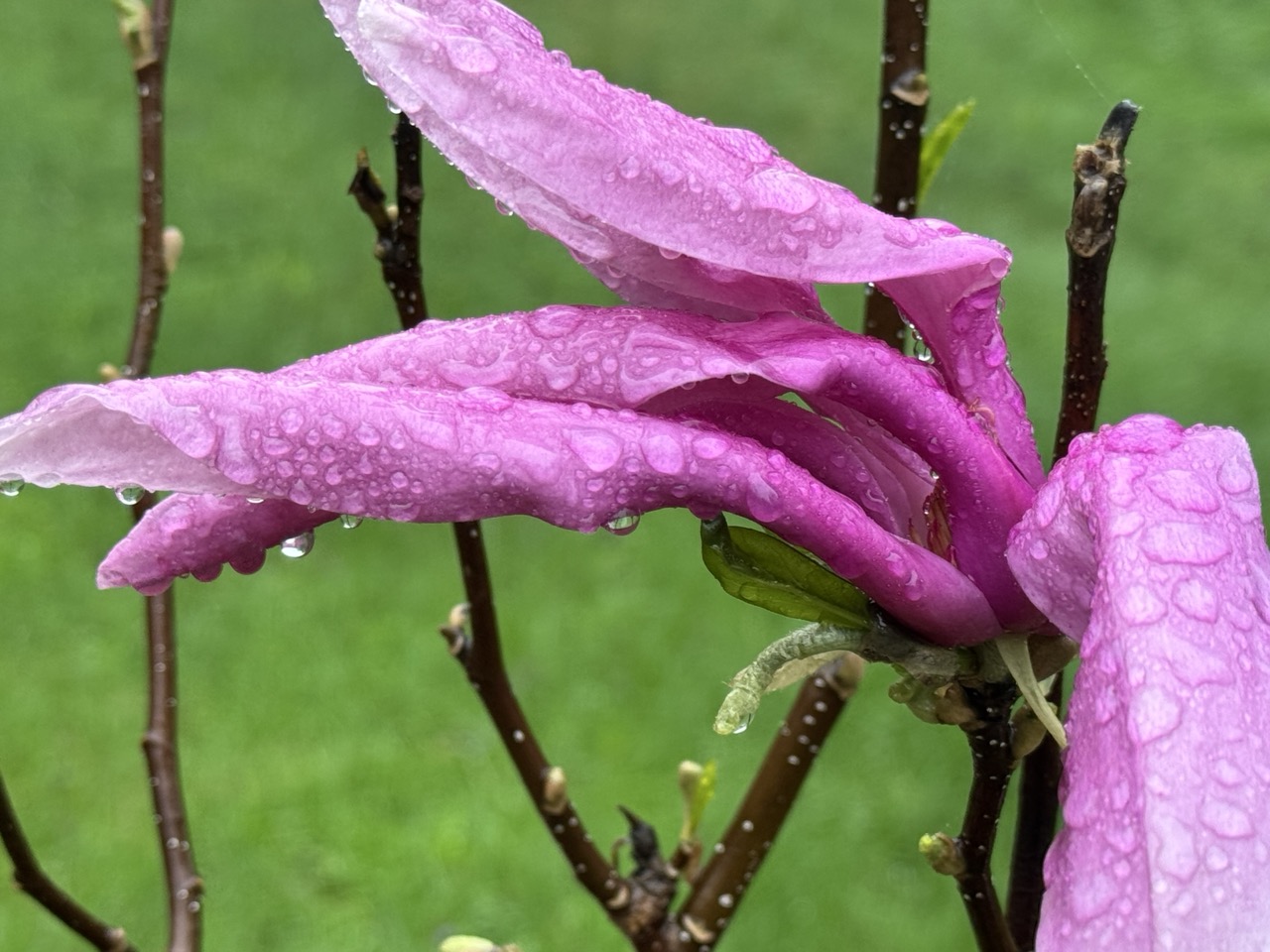
Magnolia blooms struggle in a May 10, 2025 
rain storm in St. Albans, Vermont. The month
proved exceptionally wet and cloudy throughout
the Green Mountain State.
 The May, 2025 Vermont climate numbers are in and they confirm it was an oddly wet, cloudy month at a time of year when spring sunshine normally predominates.  

TONS OF RAIN, AND A LITTLE SNOW

Burlington was in the "driest" part of the state as northwestern Vermont didn't get quite as much rain as the rest of the state. 

Still the 6.11 inches of rain that fell in Burlington still made it the seventh wettest May on record. Precipitation was 2.35 inches above normal. 

Montpelier was deluged with 7.51 inches of rain during May, more than double the normal for the month. It was the same story down in Bennington, which also had more than double the normal rain fall. They received about 7.5 inches of rain in May, compared to the normal of 3,5. St. Johnsbury with 6.86 inches of rain in May, 2025 was three inches above normal.

The wettest place I found  so far - but probably by no means the wettest in Vermont - was Woodstock, in the southeastern part of the state. They had 8.36 inches of rain in May, a full 4.75 inches above normal.

Considering the amount of rain we had, Vermont was lucky we only had one flood event during May, and even that one wasn't terribly widespread. Especially considering the big, destructive ones we've had in recent years.

The flood on May 17, though damaging, only really affected a handful of towns, most notably White River Junction, Hartford, Waitsfield and Warren. And to an extent Bristol.

The May 17 storm was also notable for the amount of sometimes damaging hail that hit some parts of the state  especially southern Chittenden County and parts of the central Vermont.

The lack of flooding I think was partly due to the fact the rain was distributed through the month, instead of falling in just a few days. Burlington had only eight days without rain during the month. Three of those days had more than an inch of rain, but most days brought a half inch or less.

The gradual rains - except for the torrential downpours of May 17 - meant that streams, creeks and rivers in Vermont usually behaved themselves pretty well, despite the constant rain. 

We even had bouts of unseasonable snow, at least in the mountains, especially on May 22 to 24 where most elevations above 3,500 feet were dusted with snow.

That snow helped keep measurable snow on the ground atop Mount Mansfield until yesterday, when it was down to a trace. The graduals decrease in snow cover up there stopped on May 21, as it stopped at a depth of five inches from that date through the 25th.

CLOUDS INFLUENCED TEMPERATURE

It was a very cloudy May with all the rain we had. That influenced temperatures a great deal.

Across Vermont, the average temperature for May, believe it or not, was really close to normal. It seemed colder than that. 

The reason was the clouds. Cloudy skies keep daytimes cooler than they otherwise would be. But those clouds keep nights warmer than they would be if the skies were starlit.

Because of the clouds, the average high temperatures in May, 2025 were much cooler than normal, while nights were much warmer than they should have been. That's unusual because the average high temperature and low temperature usually closely match the overall mean temperatures for the month, if that makes any sense.

Across Vermont, average high temperatures were around two degrees cooler than they should have been for May. But nights were on average about two degrees warmer than you'd expect. So the bottom line was May, 2025 had normal temperatures on paper even though the month was anything but.

Still we did manage to have a couple warm periods. Burlington had five consecutive days in the 80s mid month, and a couple more 80 degrees last week.

LOOKING AHEAD

As always, it's very hard in advance to determine who the upcoming month will shape up. And it's often wrong. In late April, NOAA said May in Vermont would be warmer than  normal, with equal chances of above or below normal precipitation.

So much for that. 

But we'll play the game again anyway. NOAA says that in June, the parts of the nation that stand the greatest chances of hotter than normal weather are in the central Rockies and in New England, including here in Vermont. 

The month is opening today with much, much chillier than normal weather for the opening day of June, which would seem to contradict that prediction. But, a sharp warming trend will bring us to near normal temperatures by Tuesday and warmer than normal weather by Wednesday and Thursday. Overall, the forecasts call for mostly warmer than seasonal temperatures through mid-month, at least, so we'll see. 

As in the forecast just before May started, NOAA is giving Vermont equal chances of above or below normal rainfall in June. So, flip a coin on that one. 


Tuesday, April 1, 2025

Vermont March Weather: Warm And Weird

A warm March sent daffodil shoots growing much
earlier than normal in Vermont this year. This new
spring greenery had to endure occasional wintry
setbacks, as seen here on March 21. That state
of affairs will continue into April. 
 Well, we got through another month, so it's time to look back at our overall Vermont weather in March, which, as you might have noticed was weird. And warm. 

MARCH TEMPERATURES

Burlington came in with a mean temperature for the month of 38.0 degrees. That puts us in a three way tie with 2010 and 1902 for the sixth warmest March on record. 

It's also the sixth time in a year a month in Burlington was in the top ten warmest list. 

This March was even warmer than the one a year ago, in 2024 which was merely the seventh warmest on record. Yeah, we've had a lot of hot Marches lately. A lot of hot months and years, actually, thanks to climate change. 

The entire rest of Vermont was much warmer than average in March, too. But figures are incomplete, as I noticed missing data on a few days from several of our regular long standing weather stations like Rutland and St. Johnsbury. 

The warmest March day in Burlington was 72 on the 19th and 20th.  This makes March, 2025 one of only 11 Marches in the past 140 years or so to get that warm.  It was not close to the hottest March day on record, though. It was 84 degrees in both March, 1946 and March, 1998.

Rapid snowmelt and some rain led to widespread, but minor flooding across Vermont around St. Patrick's Day. 

You could see the effects of such a mild March by the unusually early signs of spring. Crocuses were blooming by mid-month in a few locations. Green daffodil shoots poked up all through the second half of the month. The sound of returning red wing blackbirds filled the air in marshy areas way earlier in the month than usual. I even had a report of two of people in southern Vermont hearing spring peepers yesterday. That's really early for the season. 

Burlington had its final zero degree reading of the season on March 3. That meant nine days this past winter got to zero or below.  Historically we'd have roughly 20 or more such days per winter, so the downward trend in very cold days continues. 

MARCH PRECIPITATION

It was a little wetter than average virtually everywhere in Vermont in March, which is a good thing since we still have lingering effects from last autumn's drought. 

Precipitation wasn't overwhelming, though, as Burlington had 2.81 inches of rain and melted snow and ice. That's just a little over half an inch above average. By my count, Burlington had its 37th wettest March on record, so not all that impressive.

Precipitation around the state was similarly above average, but not to an extreme extent. 

Winter this March was notably absent until the end of the month. Early in the month, the summit of Mount Mansfield did have its highest snow depth since at least 2019.

But in most of Vermont aside from high elevations, very little snow fell into the end of the month. 

As we just saw, the last weekend of the month brought a big thump of five to nine inches of snow to the north, and a quite damaging ice storm to parts of central and southern Vermont.   

The snow and ice melted quickly during another very warm final day of March, though as of early yesterday, there was still 89 inches of snow near the Mount Mansfield summit. 

APRIL OUTLOOK

April is often regarded as a cruel month, as you think spring is coming, but you always end up getting slapped in the face with winter. 

That's no different this year. 

Today will be much colder than yesterday as many of us won't get out of the 30s. 

And, of course, Wednesday night, we're in for yet another round of snow, sleet and freezing rain. Though it won't be as bad as the last one, eastern Vermont in particular will likely see a glaze of ice, slick roads, and maybe an isolated power outage or two by early Thursday. 

The precipitation should change to rain on Thursday. 

Long range forecasts also call for mostly chillier than normal weather around here through at least the first half of April. We shall see. 

Even if it's a cool April, the forces of spring will win out. Normal temporaries rise rapidly. Today, the normal high temperature in Burlington is 48 degrees and the low is 30. By April 30, the normal high and low temperatures are 63 and 42 degrees.

You're going to see a much greener Vermont landscape by the end of the month compared to what it looks like now. 

Wednesday, September 4, 2024

Yes. Vermont/Northeast Dangerous EEE Outbreak Likely Influenced By Climate Change

 Just great.

Eastern equine encephalitis, spread by certain mosquito
breeds is in Vermont. Climate change increases the risk
that this dangerous disease would be present. 
Like many Vermonters, I now find myself fearing mosquitoes instead of just being annoyed by them. 

THE EEE OUTBREAK

Eastern equine encephalitis, or EEE is here.  It's still a pretty rare disease, but it's often fatal or permanently debilitating to its victims. 

A New Hampshire man has died of the disease, and another person in Vermont's Chittenden County tested positive for EEE.  

The virus is turning up in lots of mosquito samples, especially in northwestern Vermont. Residents of several towns in that part of the state are being told to stay indoors from 6 p.m. to 6 a.m. to avoid possibly infected mosquitoes. 

This whole thing is getting pretty disruptive. 

Big outdoor events are being canceled.  In Burlington, the sold out Oktoberfest on the waterfront, which had been scheduled for September 20 and 21, has been canceled over EEE fears. Ticket holders for that event are in the process of being refunded. 

Also in Burlington, Summervale, a weekly food and entertainment event in the Intervale, canceled its final two days on August 29 and September 5 due to the threat.

The Intervale is along the delta of the Winooski River right before it enters Lake Champlain. The Winooski flooded this summer, leaving many pools of standing water which bred mosquitoes. I did a little volunteer work with flood recovery at one of the farms down there in late July. I could NOT believe how thick the clouds of mosquitoes were. 

Schools in the communities that are high alert - think Colchester, Burlington, Swanton, Alburgh - are trying to move games and matches to safer areas. 

Other outdoor events are looking for indoor alternate spaces. 

CLIMATE CHANGE

Our warming world does not cause EEE. A virus does.

But climate change creates the conditions in which the disease can get a foothold and spread. 

Grist reports that climate change is a major driver of the disease, especially in the Northeast. That's for a variety of reasons. 

Earlier last frost of the season in the spring and later first autumn frosts give mosquitoes a longer window in which to breed. (The last time Burlington had subfreezing temperatures was on April 26).

Hot, humid summers encourage mosquitoes as that makes their metabolism rise, so they'll want to feed more. We just got through our third hottest summer and by many measures the most humid on record. 

Finally, heavier rains create more mosquitoes. We just got through one of our rainiest summers on record. The more rain you get, and fewer dry spells in between the showers, the more stagnant pools of water you get. That's where mosquitoes breed. It doesn't help that rivers and streams flooded back in July. As those floodwaters receded, they left big pools of standing water. Perfect for those little buggers to multiply. 

The hot summer made those pools of water warm, which reduces the incubation period for the type of mosquito that spreads EEE. Shorter incubation periods mean more mosquitoes. 

Additionally, warmer winters can make some mosquito species survive more effectively. Last winter was the warmest in record in the Champlain Valley. 

This year's EEE problem in Vermont will go away when the first hard freeze hits later this fall. Of course, we don't know know exactly when that might happen. 

But climate change is working against us even there. A warmer world increases the chances that are first big subfreezing cold blast of the autumn will hit later than it historically did. Last year, Burlington didn't have its first freeze of the season until Halloween. That was the latest or second latest initial freeze of the season on record, depending on whether you consider where the temperature was recorded. 

EEE tends to come and go in multi-year waves. But climate change helps increase the likelihood of future outbreaks, since the world - and Vermont - will continue to warm. 

Maybe this year will buck the trend and give us an early freeze. We can only hope. Meanwhile, wear long sleeves and pants, and pass the bug spray, please.  

Sunday, September 1, 2024

Confirmed: August And Summer As A Whole In Vermont Hot, Wet

 Hot and wet.

Dark thunderstorm clouds invade blue sky on a humid
day over Colchester, Vermont on August 4. That
turned out to be typical weather for the entire month.
That's definitely how you can describe the summer of 2024. We knew that already, but the final figures are in to prove it. 

TEMPERATURES

The August figures are in and we had another warmer than normal month, at least if you look at all the historical averages dating back to the 1880s.

Even so, August was the "coolest" relative to normal of the three summer months in Vermont this year.  Overall temperatures for the month were near what has become a new normal. 

"Normal" temperatures are the average of the period from 1990 to 2020.  This is moved ahead every decade. Until 2020, the "normal." was the average between 1980 and 2010. You see how it's updated every decade.

Under this arrangement, Burlington was actually a touch cooler than this new normal in August, 2024, with a mean temperature of 70.4 degrees compared to this so-called "normal" of 70.7 degrees.

But this August was decidedly warmer than the 20th century average in Burlington. In the past 132 years, I could only find 29 Augusts that were as warm or warmer than this year. And only fifteen of those were before 1990.

Elsewhere in Vermont, August came in just a bit warmer than the new average, mostly by a degree or less. 

The month was humid in general, and you can see evidence of that in the numbers. Humid days tend to keep high temperatures suppressed a little bit, and overnight low temperatures on the higher side. 

Across Vermont, average high temperatures in August, 2024 were a bit below the "new normal," But average lows for the month were solidly on the warmer than average side. 

RAINFALL/OTHER EVENTS

Precipitation was generous across Vermont in August, 2024, but thankfully not nearly as torrential or destructive as in the previous month. 

Still, the Northeast Kingdom did have some more flooding in early August, and more heavy rain associated with the remnants of Hurricane Debby around August 9-10. Over those two days. St. Johnsbury had 2.78 inches of rain. 

Debris from a roof that blew off a house in St. Albans Bay,
Vermont on August 9 due to high winds produced by
former Hurricane Debby 

For the entire month, pretty much everyone was about an inch on the heaver than average side, except ultra wet St. Johnsbury, which had 6.11 inches of rain in August, about two inches more than normal. 

We did get a scare with Debby on August 9 to 10, as forecasts prior to the storm indicated Vermont might be in for another devastating flood. Instead, the severe flooding hit Pennsylvania, western and northwestern New York and on into Quebec.

High winds with that storm,  however, did cause quite a bit of damaging in the Green Mountain State, especially in and near the Champlain Valley. 

Like in many recent summers, we also dealt with occasional bouts of wildfire smoke during August, but the pollution wasn't nearly as bad as last year. 

FULL SUMMER

Meteorological summer runs from June 1 to August 31. This year, there's some pretty impressive records for the season.   .

St. Johnsbury  - very remarkably - had both its hottest and wettest summer on record, reports the National Weather Service office in South Burlington. 

It's especially wild since records in St. Johnsbury go back to 1894. The longer the period of record at a weather station,  the less likely they are to break big records like seasonal temperature and rain. The average summer temperature in St. Johnsbury was 70.3.

St. Johnsbury's wettest summer record was so off the charts I still can't believe it. From June 1 through August 31, they had an incredible 29.48 inches of rain over the three months, including that insane 17.15 inch total for July. 

St. Johnsbury's wettest day in history was the 8.08 inches that fell on July 30. Even if you subtract out the July 30 from this summer's rainfall, St. Johnsbury would still have had its wettest summer on record.  

Burlington tied with 2018 for the third hottest summer on record, with a three-month average of 72.1 degrees. That means four of the top five hottest summers in Burlington have been since 2018.  That's quite a trend that certainly hints at climate change. 

It reached at least 90 degrees on 14 days this summer. It's looking really unlikely we'll see any more such days, so that should be the total for the year. Only 13 other summers in Burlington since the late 1880s had as many or more 90 degree days than that. 

Montpelier had its third wettest and sixth warmest summer on record in 2024. 

Vermont managed to see a rare year in which at least one place managed to get to at least 100 degrees. North Springfield, Vermont, reached 101 degrees on June 21. They had quite a heat wave, with daily highs on June 19-21 at 98, 99, and that 101.

Speaking of quite a heat wave, Lebanon, New Hampshire had the most consecutive 90 degree days on record as each of the 12 days from July 6 through 17 reached at least 90.  Lebanon is a good proxy for White River Junction since it's right across the Connecticut River. 

LOOKING AHEAD

Long range forecasts, as I always like to point out are prone to error. But they often do provide hints as to what's coming up, even if they're not always reliable. 

In recent years, summer weather has extended well into September, another sign of climate change. 

This year, though, the first half of September looks like we'll be a little closer to autumn than usual. Temperatures over the next two weeks are forecast to be near or a little cooler than average across Vermont. 

Longer range forecasts from NOAA, however, hint at better odds of a warmer than average autumn overall.  NOAA gives the best chances of a toasty autumn to the southern Rockies and New England.   

That's also consistent with recent autumn. Seven of the ten warmest autumns on record in Burlington have occurred since 2011. Records go back to the 1880s.

Saturday, August 24, 2024

Fog Season In Vermont Has Arrived And This Year Could Be A Doozy

Sunflower stalks on a foggy morning late last
fall in St. Albans. Vermont 
 Every year, in the final days of summer and the first half of autumn, dense morning fog is a frequent visitor in Vermont.  

The nights begin to get a little cooler. Meanwhile, lakes, ponds, rivers, even the soil is near its peak temperature of the year. 

These bodies of water, and the soil, and the leaves on the trees, emit moisture. When the temperature drops overnight, that moisture condenses into fog. It clings to the river valleys and can cut visibility to near zero until it burns off by mid morning. At least usually. 

The season has started already, as it often does in August. Patchy dense fog was scattered around Vermont early this Saturday morning. 

This autumn could well be an especially foggy one.  It was a much warmer than normal summer, last week notwithstanding, so water and soil temperatures are higher than they usually are. 

The increased contrast between the cooling nights and the warm water and soil is a recipe for fog.

Satellite view this morning shows fog in river 
valleys, especially the lower White and Connecticut
River valleys. 

You surely noticed this summer was also really, really wet. Soils moistures are high, so that adds a lot of water to the atmosphere. The more moisture available in the air, the more likely you're going to have fog.

Even in nights when humidity is low, the moisture coming from the ground, the rivers, the lakes, the leaves on the trees can really add plenty of ingredients for fog.

From now into October, any night that is at least sort of clear and calm will give us a bunch of fog. 

The morning fog in the autumn can be spectacularly beautiful. When foliage season hits, I always recommend people get an early start. The photographs of the fall foliage emerging into sunshine from the fog can be incredibly gorgeous. 


Of course, the autumn fogs can be dangerous. You're blasting down the road in clear air, and all of a sudden you punch into a fog bank. 

Visibility goes to zero, and you don't even see the car braking ahead of you, until it's too late. And yes, the fog can be dense enough so that you don't see the brake lights.  

Over the next few weeks, the sun is still strong enough that the fog will surely burn off by mid morning. The sun heats the air, the contrast between the cool air and the warm ground disappears, so blue sky and sunshine quickly re-appear by 10 a.m or so.

Dense fog cuts visibility to near zero on a 
St. Albans, Vermont street last year. 

Later in the autumn, the sun angle is lower, so the heat is not as strong. Especially this year, I imagine, we'll end up with several days that on paper should start out foggy then turn sunny. Instead, those days sometimes turn out to be entirely gloomy. The fog lingers, then maybe lifts into a low, gray overcast. The mountain tops end up in the sun, but us valley dwellers experience a dreary day. 

On some of those days, the sky finally clears late in the afternoon, only to fog up again that night. 

Fog can be beautiful, giving our surroundings a mysterious air. But much like in the winter, plan on leaving a few minutes early for work on calm mornings. Patches of fog will mean you'll need to drive more slowly. 

Sunday, May 5, 2024

Still Goldilocks, But Maybe A Wetter, Cooler Version Coming Up

Debris from a large tree that fell on this perennial garden
on my St. Albans, Vermont property is long gone thanks
to husband Jeff. This morning, the fully recovered
garden begins another drink of water on a wet Sunday. 
The Goldilocks weather I referred to in yesterday's post continues in Vermont, despite the fact that this is definitely going to be an indoors kind of Sunday. 

Rain overspread the state this morning. Turns out this could end up being the wettest week we've had in Vermont for quite awhile. But don't worry, it's nothing dire.  

Plus, we'll have a little more of the type of nice weather we had Saturday early this week before it gets rainy again. 

First, today. It will feel rather raw compared to the placid weather we've had recently. The rain will hold temperatures during the day in the 50s That's a little cooler than average for this time of year, but nothing really out of the ordinary. 

Gusty south winds, especially in the Champlain Valley will make it feel worse, and of course the rain will make a day on the golf course or anything like that pretty challenging. 

Aside from the risk of brief embedded downpours, this won't be anything heavy.  It'll amount to maybe half an inch of rain, give or take, before it all tapers off later tonight. A nice wetting for the gardens, but that's about it. 

The best days of the week should be Monday and especially Tuesday. It should get sunnier and sunnier as we go through tomorrow. Tuesday looks spectacular, with highs up near 70 again. 

After that, the fast pace of spring we've seen will slow down. That wetter trend from Wednesday onward is part of a pattern change that will keep us on the cool side probably well into the middle of the month. 

National Weather Service radar showed lots of rain
overspreading Vermont Sunday morning. 
Between the end of the week and through much of the following week, high temperatures on many days will probably hold in the 50s. Again, cool for this time of year. 

Showers are in the forecast every day Wednesday through Saturday. It won't rain all the time during that period, but we will be dodging raindrops.  

If forecasts are accurate, most of the Green Mountain State will have had 1.5 to 2.5 inches of rain between this morning and next Sunday morning.  This won't lead to any flooding, unless we get an incredible surprise late in the week. But it's still rather soggy. 

Last May and early June, it was beginning to look like Vermont was heading into a summer drought. Only a third of an inch of rain fell in Burlington between May 4 and 31 and the dry weather extended into the first few days of June.

You know what happened after that, though.  One of the wettest summers on record gave us repeated, sometimes catastrophic flooding. 

Especially with this upcoming week's weather, we're having anything but a drought.  I have no idea whether this summer will be the opposite of last year. 

But it will be interesting to see how it plays out.  

Saturday, April 13, 2024

Wet Spring Weather To Continue In Vermont - Showery Regime Lives On

I guess we really did get lucky back on eclipse day April 8. 

The Winooski River level (blue line) is higher than
predicted levels (black line) due to yesterday's have rain.
Minor flood stage is in orange. It'll come close to
that today, but there won't be anything major going on. 
It was one of the few days this spring without rain or snow a without much in the way of clouds cover.

Though we've had some nice days, unsettled weather has predominated. Starting with the first full day of astronomical spring on March 20, I count only six days I could regard as mostly to completely sunny.  

This month, only the three days centered on the day of the eclipse were sunny.  

Don't expect any major changes in the near future. 

Friday's over-performing storm luckily didn't leave us with too much flooding. River levels are peaking higher than forecast, but so there's been nothing major. The Ottauquechee River was still at minor flood stage this morning. 

The Otter Creek was expected to crest just under flood stage, but it was in minor flood this morning. That should last a good part of today, though only the lowest lying roads nearby should have water on them.

The Winooski River in Essex Junction is getting a lot closer to flood stage than earlier predicted, but should stop just short of flood stage. Elsewhere, I noticed a part of Route 118 in Belvidere, was under water yesterday. I'm sure the same is true for a few more local roads out there. Take care if you're out driving. 

 RAINY OUTLOOK

Guess what? It's going to rain today. It could rain at any time, but best chances are this afternoon. Cold air aloft combined with the sun heating the ground through the clouds will create quite a few instability showers. 

It'll be mostly light, but a few spots could see briefly moderate to borderline heavy rain. Anything heavier would last only minutes in any given location. The rain today won't be nearly enough to cause any new flooding, so we're good there. 

Pretty much the same is true Sunday. A little storm will zip by, causing another round of showers in the afternoon.

The early part of the upcoming week looks OK. There might be some isolated showers Monday, but no biggie. A new storm brings us more rain Wednesday through at least Friday. So far, it doesn't look like that rain will be heavy. Just annoying for anyone with outdoor plans. 

Unless we get some surprisingly huge storms toward the end of the month, this by no means will be a record wet April.  But the frequent showers have been keeping us on our toes and will continue to do so. for awhile yet.  

Monday, April 1, 2024

Vermont March Was Among Wettest, Maybe THE Wettest, And Among Warmest

Heavy snow falling in St. Albans, Vermont on
March 20.  The month was among the wettest
and warmest on record in Vermont. A fair amount
of that heavy precipitation fell as snow. 
 If you thought March this year was a never-ending mud season in Vermont, you have good reason to think that. 

It was among the wettest Marches on record, and parts of Vermont might have had the wettest March.  

In Burlington, 3.97 inches of rain and melted snow fell, enough to make it the fourth wettest March on record. 

However, Burlington was "dry" compared to most other places in the Green Mountain State. Montpelier had 5.09 inches of precipitation. St. Johnsbury clocked in with 5.23 inches. Both those places had more than double the normal amount we should expect in March. 

It was even soggier in southern Vermont. Rutland reported 6.29 inches of rain, which was 3.65 inches above normal. Bennington saw 6.35 inches, about two and a half times their normal March allotment. Woodstock had a whopping 7.24 inches.  

So yeah, March really was a waterlogged month. Small wonder you felt like you were going to sink completely into our Vermont dirt roads.  

Unlike the super wet Marches of 1913 and 1936, the precipitation was distributed through the month, and often came in the form of snow, or at least mixed with snow. This kept runoff manageable.  There were a couple bouts of minor flooding but nothing to get excited about. After last summer and this past December, we definitely were happy about the lack of March flooding this year. 

March was also super warm in Vermont this year, especially during the first half. Overall, pretty much everyone in the Green Mountain State was between five and six degrees warmer than average. At Burlington, March turned out to be the seventh warmest on record. 

That first half of the month put us on pace that would have made March the warmest or second warmest on record. By March 15, Burlington was running a full ten degrees warmer than normal.

The second half of the month brought a few bouts of winter weather, though mild days were interspersed in there. 

The big event, of course came on March 22, which brought one of Vermont's largest spring snowstorms on record. Up to 33 inches of snow was reported in the southern Green Mountains, and numerous towns had more than two feet.

Now that we're into April, we're at risk of another big spring snowstorm that could also rewrite the weather history books. But never fear, spring will win out. 

In fact, long range forecasts give us a nice glimmer of hope, if they turn out to be accurate. That prediction has warmer than average April weather after the first week of the month. 


Monday, January 1, 2024

2023 Was Hottest Year On Record In Burlington, Vermont. One Of The Wettest, Too `

Spectators watch near record flood waters in the Winooski
River blast past Winooski on July 11, 2023. Not only did 
the past year bring lots of extreme weather to Vermont,
it also turned out to be the hottest year on 
record, at least as measured in Burlington. 
 It's official. 

For the first time since they started keeping track of these things back in the 1880s, Burlington, Vermont had its first year with an average temperature of 50 degrees.  

That beats the old record for hottest year, set in 2012, which came out to 49.9 degrees. 

Even more remarkably, this makes it the fourth year in a row that was among Burlington's top 10 record hottest years.  The years 1953 and 1898 are tied for the 10th warmest years in Burlington, but all of the top nine years have been since 1998, just a quarter century. 

By contrast, 1978 was the last  year to score in the top ten coldest, and that year barely made #10.

Climate change is really re-writing the weather history books in Vermont, as well as the rest of the planet. It's not just Burlington, after all. When the data is all in, it's widely expect that the entire globe will have had its hottest year on record in 2023.

In fact, some climatologists believe 2023 was the world's hottest year in the past 125,000 years.

Back here in Vermont, climatologists say that in general, Vermont's is not only getting hotter. It's becoming wetter through climate change, though that wettest will be interrupted by at times more serious drought. 

That trend bore out big time in 2023.  Burlington had its seventh wettest year on record, with 44.78 inches. This is despite largely missing out on the torrents of rain in July and the area experiencing a spring drought.   

The correlation with climate change and wetness in the Burlington weather records isn't as strong as it is with temperatures but it's there.   Six of Burlington's top 10 wettest years have happened since 1998, but only one of the top ten driest years happened in that time frame (2001, to be exact).

Over the course of 2023, Burlington saw daily record highs broken or tied on 10 days. That included the hottest temperature on record for all of October, with 86 degrees. Only one record low was hit, on May 18. 

Last year, I didn't think we'd have a fourth year in a row with a top 10 hottest temperature. Although I've been proven wrong this year, I do wonder if 2024 will be among the hottest on record in Vermont. Maybe, but doubtful, though the world is expected to break 2023's mark for hottest year, or at least come close to it. 

Here in Vermont, if 2024 isn't another top 10 warmest year, it will very, very likely be warmer than normal. Even with climate change, it's still possible to have the occasional cooler than average year thrown in over the next few decades. But they'll be increasingly few and far between.

I also highly doubt we'll ever have another year that ends up in the list of top 10 coolest, unless something dramatic and unlikely happens, like a massive volcanic eruption on the scale or bigger than the 1815 Tambora eruption. That caused temporary cooling, and gave us in Vermont the famous "Year Without A Summer in 1816

Tomorrow, I'll have a review of some of the many weather extremes Vermont endured in 2023.


December Weather Was Extreme One In Vermont; Made Several Top 10 Lists

Floodwaters cover fields near Williston, Vermont on
December 19. The month was wild, with a destructive flood
combined with extreme warmth for the entire month in Vermont.
 I'll have a post later today with some wild weather news about the just-ended year of 2023, but I figure I'll start with an appetizer by reviewing December in Vermont.  

There's plenty to cover. If you thought the weather in December was weird, you're absolutely right. 

 Burlington, Vermont had its second warmest, second wettest and eighth least snowy December on record. It's very rare to have so many different items in the Top 10 list. 

INCREDIBLE WARMTH

December, 2023 would have easily been the warmest on record if not for the absolutely bonkers month of December, 2015, which was off the charts warm by nearly seven degrees above the old record. The just past month was an impressive 2.2 degrees hotter than what until now had been the second warmest December. 

The warmth was consistent, and most prominent at night. Burlington only had the fifth warmest average high temperatures for December, but easily the second warmest average minimums (again behind the tropical December, 2015).

An impressive 13 days during December never went below freezing, and the low for the entire month was a balmy 14 degrees.  I believe all Decembers in Burlington dating back to the 1880s - except for 2015 and 2023 - got into the single number at least once. Most had below zero readings. 

All of Vermont was - of course - wicked warm in December.  Many places, including Montpelier, Rutland and Bennington, were more than 7 degrees warmer than average. The average low temperature during December in Rutland was a whopping 10 degrees above normal. 

The warmth was also widespread beyond Vermont. It looks like all of the Lower 48 might have had a milder than  normal December. Areas around the western Great Lakes and northern Plains were especially warm. 

Normally frigid International Falls, Minnesota, known as the "Icebox of the Nation", was a whopping 15.8 degrees warmer than normal and never got below zero during December.  Mornings there are normally below zero in late December and it's been as cold as minus 41 degrees there during the month

I'll have complete national statistics for December in a week or two.

RAINFALL

December was punctuated by yet another destructive Vermont flood, so of course it was wet. Burlington saw 5.78 inches of rain during the month, easily the second wettest on record. Only 1973, with 5.95 inches, was soggier. 

Not only was December warm and wet, it was also gloomy.
Most days were overcast and fog was frequent, like
in this scene from St. Albans on December 28
Woodstock measured 6.05 inches during the month, and more than half of that came during the December 18-19 flood storm. 

The damage tally for the flood is still being assessed, but I'm sure at least parts of Vermont will be declared a disaster area again. 

And that wasn't the only impressive storm of the month. Systems on December 3-4 and December 10-11 deposited fairly heavy rains in the valleys, certainly enough to pre-soak the ground for the December 18 deluge.

Those two early month storms also featured heavy, wet snow in high elevations, which each cut power to more than 10,000 Vermont homes and businesses. So definitely a rough month. 

The month was remarkably gloomy as well.  I count 23 out of 31 days that were overcast.  December is normally a cloudy month, but 2023 was especially so. We had a number of foggy days as well, especially toward the end of the month. 

SNOWFALL

You'd think with such a wet December, a fairly big portion of the precipitation would fall as snow. In the valleys, that definitely wasn't the case. Burlington only mustered 2.9 inches of snow, making this the 8th least snowy December. 

For comparison, that super wet December, 1973 in Burlington included a respectable 24.1 inches of snow for the month. 

Other valley locations were on the light side with snow, too. St. Johnsbury, for instance, only had 7.5 inches, more than a foot below average. 

OUTLOOK

As always, it's not really worth it to get into any detailed forecasts beyond five days out. But, for laughs and giggles, the temporary period of relatively quiet weather we're enjoying as the New Year dawns might not last. 

Long range forecasts into the middle of the month suggest it might turn stormier, though it could stay relatively warm. Not bonkers warm like December was, but still, a little milder than average, in general. 

That doesn't mean we won't have a hard core winter. There's plenty of time for that in the second half of January, February and much of March. 

Tuesday, October 31, 2023

It's Official: First Autumn Freeze Across Vermont; Record Late; Icy Roads Too

Fog and drizzle and chill made for an appropriate pre-
Halloween mood yesterday before last night's freeze arrived.
 Early this morning, it was below freezing everywhere in Vermont, except perhaps right along the shore of Lake Champlain. 

For most of us, that's the latest first autumn freeze on record.

It's complicated for the official National Weather Service readings in the Burlington area.  Weather measurements have been taken at the airport in South Burlington since 1941.  This is the latest freeze at the airport since at least then, and most likely well before that.

The old record for latest first freeze at the airport was October 28, 2022 - yes, just last year. 

Prior to 1941, weather measurements were taken closer to Lake Champlain, where it is warmer on clear, calm autumn nights. So the record latest freeze from those days was November 1, 1920.  It's unknown if the site where temperatures were taken way back when got below freezing this morning. 

The cold weather this morning prompted one of those dreaded special weather statements from the National Weather Service. Water from yesterday's rains probably froze on some of the roads, especially on bridges and overpasses.

As you're driving to work this morning remember that some areas of the harmless "wet road" is actually glare ice that can send you careening into other cars or off the road.  This includes main roads. I have reports of at least one crash on an Interstate 89 overpass in Richmond.  Other crashes closed stretches of Interstate 89 between Montpelier and Richmond. I'm sure other bridges on the Interstate are icy, too. 

My truck parked in St. Albans, Vermont looking 
very iced over this morning. 
By the way, yesterday's rain brought the month's total to 6.41 inches in Burlington, which makes it the third wettest October on record as well as one of the warmest.

I'll have much more complete climate data for October in a post tomorrow,

Meanwhile, the chill continues on.  Highs today and tomorrow will barely make it to 40 if we're lucky in most of northern Vermont. Southern valleys might be a tad warmer than that. More freezes are coming tonight and tomorrow night, with lows for most places in the 20s.

For the little monsters trick or treating this evening, they can expect temperatures in the 30s, but at least it will be dry, with no rain or snow. 

Another disturbance will probably give us some snow showers Wednesday, mixed with rain in the valleys. Don't worry, any accumulations will be really light to non-existent. 

It still looks like it will turn a little warmer toward the end of the week, but not spectacularly so. For a change, there's no sign of yet another big warmup coming.

Monday, October 30, 2023

Monday Snow Falling Far North And West; Most Of Vermont In A Cold Shivery Rain

 The fairly weak but soggy storm system sliding by to our south is giving us a very miserable Monday morning as expected.  

Vermont Agency of Transportation traffic cam shows
snow falling along Route 114 in Canaan, which is at
the extreme northeast tip of Vermont. Snow is widespread
in southern Quebec this morning but so far
it's been almost all rain in Vermont, as expected.

Most of us in Vermont were near 40 degrees as of 8 a.m. and a steady rain was falling. For those of you looking for snow, so far it's been just north of the Canadian border, and in northwestern New York, 

As of 8 a.m., it was snowing in Montreal, Quebec City, Ottawa and Massena, New York.  The storm flung a bit of slightly warmer air aloft over most of Vermont and New Hampshire, so it's been almost all rain so far. 

You can tell that "warmer" air is lurking above by mountain reports. It was only 25 degrees atop Mount Washington, New Hampshire, but they were getting freezing rain, not snow. 

As the storm moves east, some of the colder air aloft on its northwestern flank might manage to bleed south some. That means the northern Green Mountains and perhaps even lower elevations in the north, including maybe the Champlain Valley could see some snowflakes before the precipitation tapers off by early afternoon.

I did notice a Vermont Agency of Transportation traffic camera this morning along Route 114 in Canaan, Vermont shows snowfall with a slushy coating on the road. Canaan is in the extreme Northeast Kingdom, right where Vermont, New Hampshire and Quebec meet. 

The rain has pushed October to become the seventh wettest in Burlington as of 8 a.m. today. If the city gets just 0.13 inches more, it will be third wettest. It will also be among the top ten warmest Octobers.

FREEZE, FINALLY

If for some reason you haven't brought in plants from outdoors you want to save, now's the time. The weather pattern has changed. I'm impressed by the huge area of freeze warnings the nation is under right now.

We brought our hibiscus indoors a couple weeks ago.
The warmer indoor air encouraged an explosion of
blooms, but some yellow leaves, as we get every
autumn as it doesn't like being indoors as much.
If you still have any sensitive plants outdoors, go
out in the rain and get 'em in now. Freeze tonight.
The freeze warnings extend from Arizona to Pennsylvania and southern Wisconsin to northern Mississippi. 

We won't be under a freeze warning here in Vermont, because the growing season is normally thought to be long past.  

But we are going to see our first, very belated freeze of the season tonight. Some parts of Vermont will have their latest first autumn freeze on record tonight.

Even in the Champlain Valley.  So empty those hoses if you still have them outdoors and bring them in.  

We brought our hibiscus, orange tree and geraniums in about a week and a half ago, figuring we'd have to do it sometime. But if you have stuff like that on your deck. rush 'em into the house. 

We finally have to button up for winter.  Not that hard core winter is going to hit quite yet.

COOL, BUT BENIGN

At least for now, we get a reprieve from the forces of winter. This week will be on the cool side, but trending milder to become close to normal by the end of the week and the weekend. There will be no big storms.  It'll often be cloudy, and we have the risk of a sprinkle or flurry here or there, but nothing major he season 

Wednesday, October 25, 2023

Vermont Having Trouble Escaping Rain This Week

 For the second morning in a  row, surprise showers are rolling through Vermont.

Some fairly rare asperatis clouds over Georgia,
Vermont Tuesday, which was another overcast, 
gray day among many lately. 
Once again, they are not going to amount to anything huge, but it's certainly keeping things damp for people doing fall cleanup before winter arrives. 

The gods have been steering extra rain toward us since Saturday.

The weekend storm over-performed, as I noted previously, dumping more than two inches of rain on many parts of Vermont. 

In northern Vermont Sunday, the rain continued all day, without a break. On Monday, skies were slow to clear and drizzle unexpectedly lingered in some areas until mid-day.

Tuesday was supposed to be dry, but what were those pesky light showers doing around all morning. (There was even a pocket or two of freezing rain briefly early in the morning up in the Adirondacks).

At least the thicker than expected overcast also brought us a glimpse of some rare asperitas clouds, which are these weird wavy gray clouds you see in first photo in this post. 

That brings us to this morning. I checked radar when I got up and it was lit up with an army of showers rushing in from New York State and into Vermont.  These are a bit more convective in nature, with a hint of the tall clouds you'd see in summertime showers and thunderstorms. 

It doesn't look like any of these showers contain any thunder or lightning, so don't worry about that. Though I did note a couple lightning strikes west of Montreal, which is interesting. 

Much like yesterday, the showers should pretty much be out of here by this afternoon, knock on wood, fingers crossed for no more surprises.

It is much warmer this morning, so that part of the forecast was spot on. 

Although it will be oddly warm for the next couple of days, it won't be exactly be sunny. And we'll still be prone to these little batches of "surprise" showers.  

Ahead of this morning's batch of showers, convective
clouds began to bubble up around dawn over
St. Albans, Vermont 

The air is going to be really humid for this time of year.  Not uncomfortably so, but still not the type of dry air that is characteristic of late October.

Dew points will be in the 50s.  That will help lead to lots of clouds.  Often when the air is that damp, we can get some good rains. 

But there's no big triggers to set off any steady downpours. Instead, clumps of decaying showers and thunderstorms from the Midwest might pass through from time to time in the form of fast-moving light showers or sprinkles through Friday. 

Most of the time it will be dry, though. 

The warm spell ends over the weekend.  Sunday at this point is looking overcast, cool with increasing chances of rain.   Go figure on a Vermont weekend this year!  The cold rain is probably going to last into Monday, which is Halloween. Hopefully it will end in time for trick or treating that evening. 

We're also going to end this long mostly warm spell that began at the end of August.  For the first time in a long time, we're in for what appears to be a fairly extended period of chillier than normal weather, starting on Halloween. 

For the first time this autumn, the National Weather Service mentions a chance of snow even in the valleys next Monday night and Tuesday. It'll only be flurries, so it's panic time.  But it is a reminder that winter will come, despite the messages this warm autumn has been sending us so far. 


Monday, October 23, 2023

Vermont October "Cold Snap" Really Isn't Cold, Barely Snowed Mountain Tops, Warmth To Return

The National Weather Service in South Burlington
put out this map Sunday showing storm totals 
from Friday into Sunday. Up to an inch of additional
rain fell after this in far northern Vermont. Click
on the map to make it bigger and easier to see.
 I'm still amazed by how a spell of average weather can seem so chilly compared to how weirdly warm it is. 

And spoiler: The warmth will return this week.

It's true that Sunday, as long advertised, was not a nice day.  In far northern Vermont, it rained all day.  In fact here in St. Albans, at least light rain and drizzle has fallen continuously since late Friday night.  It was still drizzling as of 7 a.m. today. 

The extra rain in far northern Vermont really added up. By this morning my unofficial storm total was up to 3.2 inches. 

 The map in this post does not necessarily show rainfall for all of Sunday and Sunday night, so some northern areas really ended up especially soggy, too

Elsewhere in Vermont where there were only occasional showers under gray skies Sunday.  

Rainfall totals through 4:30 p.m. Friday shows widespread two to three inch rain totals throughout western Vermont, all of Bennington and Windham counties and some spots in the Northeast Kingdom.

Despite two record soakers in Burlington this month, the city hasn't quite made it yet into the top ten list of wettest Octobers. So far, 5.6 inches of rain has fallen in Burlington this month. The tenth wettest October had 5.81 inches, so we're close. 

 Depending on what happens toward next weekend, that could change, but we're getting ahead of ourselves. 

WINTRY? NOT REALLY

A colored tree lights up a gloomy morning in St 
Albans, Vermont today. Excuse the bad formatting,
Blogger won't let me position photos where 
they should be today. 
As semi-wintry as Sunday felt, it was actually a pretty average day for late October. High temperatures were a little cooler than average, low temperatures were near normal to slightly on the mild side. 

Mount Mansfield finally had its first snow, which for them was awfully late. To put it in perspective, the average date of the first snow flurries of the season in Banana Belt Burlington is October 15.  The summit of Vermont's highest peak usually gets a little snow way, way before that. 

If you thought Sunday's weather was icky, consider this. On Sunday's date in Burlington way back in 1969, 5.1 inches of snow fell. That 1969 snowstorm was an introduction to what would turn out to be arguably the harshest winter on record, if you consider the combination of very low temperatures and extreme snowfalls. 

Don't worry, we won't be seeing any winter conditions quite yet. 

TODAY

It's going to be tricky to scour out the clouds due to a temperature inversion trapping clouds beneath a layer of somewhat warmer air above.  

Dry air is trying to work in, and that could eventually break up the clouds this afternoon. The best shot at seeing the sun is in the lower Connecticut River Valley, and just maybe valleys of western Vermont, including the Champlain Valley.  

As we've been saying for days, tonight will be chilly, but nothing odd for October.  Many areas away from the Champlain Valley will likely see a frost or freeze, which once again is awfully late for the first one of the season.

Much of the Champlain Valley is going to go another week at least without a frost.

BIG WARMUP

The warm air coming in this week is looking more and more impressive.  This won't necessarily be a big sunshiny and super dry warm spell, but still very odd for this time of year. 

At this point, Wednesday through Friday, it looks like a fair number of clouds will hold temperatures in the 65 to 72 degree range, so we will probably fall just short of daytime record highs. 

The air coming in is fairly humid for this time of year (not uncomfortable like summer, but still a little muggier than you'd expect in late October). That means nights, especially in the Champlain Valley will be ridiculously warm. Like leave your windows open warm. 

Lows should be in the upper 50s to maybe near 60 Wednesday and Thursday nights in the Champlain Valley and closer to 50 in central and eastern Vermont. This sets the stage for some possible record warm overnight lows Thursday and Friday. 

It'll probably turn cooler again next weekend. 

Winter will eventually get here. I noticed the first winter storm watches of the season today in Washington State and the northern Rockies. Eventually the cold air will get here. In fact, some long range forecasts call for colder than normal temperatures here during the first week in November