Showing posts with label April. Show all posts

Saturday, May 2, 2026

April In Vermont Was Warmer Than Average, Calmer Than Usual (With An Asterisk)

Every April has its wintry setbacks and April, 2026 was
no exception. Here, snow accumulates on forsythias 
on April 19 in St. Albans, but.......
The numbers are in for April''s weather in Vermont and we enjoyed a warmer than average month with near normal precipitation. 

Compared to many past Aprils, this one was pretty easy for most of us. No extreme snows, no statewide wild windstorms. Temperatures were only occasionally out of whack. 

At Burlington, the average temperature was 47.6 degrees, or two degrees above the "new" normal.  I keep calling it that because normal these days is based on the average of 1990-2020. By those years, the effects to climate change had already kicked in, so "averages" are nowadays warmer than what we saw in the 20th century. 

Looking back at 142 years of records in Burlington, by my calculation, it was the 38th warmest April on record. Nothing extreme, but still balmy. 

Other weather stations in Vermont tended to show that April was two to three degrees warmer than average, as well. 

Rainfall in April was about as normal as you can get.  I checked Burlington, Montpelier, St. Johnsbury. Rutland, Woodstock and Bennington, and all of them were with 0.29 inches of the average for the moth. Burlington had 2.95 inches of rain, just 0.12 inches below normal.

While there were days with wide temperature differences across Vermont, we didn't have the extremes we've seen in many recent Aprils. The month's low of 16 degrees in Burlington was the coldest since 2016, But I was able to find 30 Aprils in the past 128 years that had temperatures as cold or colder than that. 

Over in ice box Saranac Lake, New York, it got below zero on April 8. That tied the record for the third latest in the season subzero temperature 

The one moment when weather got volatile in Vermont was during the middle of the month. A weather front pretty much stalled west to east across the middle of the state. Summer-like weather prevailed in southern Vermont while the north stayed relatively cool.

The contrast set up some thunderstorms. One of those storms, a supercell, produced an EF-1 tornado in Williamstown on April 16. The top winds in the brief tornado were 90 mph, which damaged a barn, a house, outbuildings and trees. It was the first Vermont tornado since 2023 and the first April twister on record for the state.  

....the flowers survived and went on to keep blooming
when warmth and sunshine returned later in the month. 

There were also a few reports of golf ball sized hail with that supercell.  Other strong to even severe thunderstorms roamed through southern Vermont on April 14, 15 and 16. 

A sharp, brief cold wave struck on April 20-21, causing some snow to fall. A hard freeze probably damaged some garden plants, but the freeze didn't really interrupt the progress of spring. 

The weather turned dry at the end of the month, which is the worst time of year for that sort of thing. The dry vegetation from last year hadn't greened up yet, and the strong April sun was able to penetrate forest floors because trees hadn't leafed out yet.

At least 15 fires burned around 100 acres in Vermont between April 22 and May 1. That includes a large forest fire in the hills near Ripton that consumed over 50 acres.

MAY OUTLOOK

The April outlook from NOAA before the month started indicated equal chances of warm or cold, and above normal rainfall. It looks like equal chances should  have been applied to precipitation, since rainfall in April was so close to normal.

But to give NOAA another chance, their May outlook calls for temperatures to trend near to slightly cooler than normal for the month. NOAA gives us equal chances of wetter or drier than average month.  

Sunday, April 19, 2026

Winter In April Vermont Sunday Evening Update: Snow Mostly Done, But The Cold Will Intensify

A patch of miniature daffodils endures Sunday's snow
in St. Albans, Vermont. Unfortunately, intense cold
tomorrow night will probably kill them off 
 It was a wintry day here in Vermont as we start the third week of April. It snowed much of the day across most of the state. 

The snow came during the middle of the day after a warm spell. The ground was warm and some sunlight was trying to get through the clouds. 

Those two factors prevented a lot of accumulation. Had this been a month or two ago, we would have had several inches of snow in the valleys .

The fact that snow accumulated at all testifies to the intensity of it for awhile today. 

In the valleys, the roads stayed mostly wet, maybe with a few slush patches during heavier bursts of snow. Higher elevation roads got slick and slushy, which is incredibly uncharacteristic for an April afternoon 

Route 15 near Rowell Road in Walden had to be closed due to slide-offs. Interstate 91 in Sheffield Heights in the Northeast Kingdom also had some crashes. 

The cold, elevated surface of my truck accumulated 1.6 inches here in St. Albans. Of course, there was less snow on the ground, but it did accumulate on grassy surfaces and trees. Burlington reported just 0.2 inches of snow. .

The snow pretty much ended here shortly around 3 p.m.m but as of 5 p.m. there is surprisingly sone snow still in the ground. It's not melting all that fast. 

The last and of heavier snow was in central Vermont late this afternoon and heading east. 

A few breaks in the clouds were appearing over western Vermont, so that might melt the rest of rte snow before sunset.  New snow showers have developed in New York, so we'll probably see some of that in Vermont this evening. Some of the snow showers could be very briefly heavy early this evening, but they won't lead to any new accumulation. 

TONIGHT, TOMORROW, TOMORROW NIGHT

A reinforcing cold front late tonight and early tomorrow morning could reinvigorate the snow showers briefly, but again they won't amount to much. 

But early morning commuters will start the day amid subfreezing temperatures. Left over water might freeze, and any snow showers might briefly stick to the pavement better than it did today.  Monday continues to continue blustery and cold. 

Unfortunately, we've gotten no good news for Monday night cold temperatures in the afternoon forecast updates  The forecast lows for Tuesday morning still look to be in the 15 to 25 degree range. Lots or spring garden freeze destruction looms.

I'll have more updates on this cold weather tomorrow morning, of course!  

Friday, April 10, 2026

Friday Morning: Hard Core Spring Arrives In Vermont

After a windy, dry day, some wind-roiled, interesting 
clouds set up shop overhead in St. Albans, Vermont
Thursday at sunset. Clouds are back today, and
by the end of the day they'll yield some April showers.
 As expected, we had our gusty, mild Thursday, as temperatures reached the low 60s in many areas.

The wind made outdoor spring clean up difficult, especially in the Champlain Valley. I see that Burlington gusted to as high as 49 mph on Thursday. The relative humidity was down in the teens and low 20s, so the forecast of a high fire danger was also correct. 

I'm sure there were a few instances of out of control fires yesterday in Vermont. Small, but potentially dangerous. 

I'm aware of one fire up on Skunks Misery Road in Franklin, Vermont. I had to mention this blaze, which was quickly brought under control, because it's my favorite street name in the state.

TODAY

Anyway, there's still some lingering fire danger today, especially in southern Vermont, where it's drier. Winds are lighter, but not calm, so we still have to be careful out there. A cold front is approaching, and that will provide a little rain later this afternoon and evening to tamp down the fire risk a little bit. 

The clouds will come in from the west and north, and that will have an effect on the temperatures. Where it clouds up first in  northwest Vermont, temperatures should still make it up to around 60 degrees, which is still relatively mild for this time of year. So, fine. It'll be in the 60s in central Vermont and near 70 in warmer valleys south. 

We'll have a  rising chance of showers this afternoon first in the northwest, then spreading south and east. It looks like very little rain will fall until very late this afternoon and into the evening, when the bulk of it will come down.

"Bulk" is a bit of an extreme word for the situation we're actually facing. We're only going to see a quarter to a third of an inch of rain, give or take, north and central, with a tenth of an inch or less in the lower Connecticut River Valley. 

This all might end as a few snowflakes in the highest elevations north overnight, but most of us won't see any snow this time. It fact, if you're a weird hard core snow lover, you're kind of screwed. For once, no snow is really in the forecast at all. I think that's the first time since late October I could say that!

WEEKEND

It'll be a cool April weekend, but certainly not frigid.  Saturday will be a classic April day: Highs will be in the 40s to around 50. We'll see some nippy north breezes, but bright sunshine should take the edge off the chill. 

It'll be below freezing overnight Saturday night, but it won't be the deep, near record cold we saw Wednesday morning. Instead, it'll just be a typical April freeze with lows in the 20s to around 30.

You'll notice skies clouding up Sunday as temperatures hold in the low 50s. We'll see a rising chance of rain as we go through the day, too.  Get your outdoor stuff done in the morning if you can. 

NEXT WEEK

We have some hard core spring weather coming with warm temperatures, relatively humid air and a frequent risk of showers, especially in northern Vermont. 

There will be a front nearby separating relatively cool air to the north with almost summer-like air south. It's hard to say exactly where the front will set up, but it should waver north and south occasionally as disturbances roll through. 

The early guess is northern Vermont will be on the warm side,  with highs most of next week in the 60s to possibly near 70.  I'll happily take that if we comes!

Far southern Vermont could see a few days in a row of downright summer conditions, with highs in the 70s to possibly near 80 and mild low in the 50s. You might even be tempted to get you air conditioning set up for the summer. 

That's no guarantee, the forecast is going to need refining and updating between now and Monday. But regardless, I think you're going to see things turning greener and buds swelling outside very nicely over the next week or so. 

Next thing you know, you'll be mowing your lawn. It'll hit sooner than you think. Especially with the kind of weather that's in the forecast. 

Despite the usual snowy setbacks, it's been an incredibly easy spring in Vermont so far. It looks like that will continue.  I hope I''m not jinxing it. The last thing we need is a wintry May! 

Tuesday, April 7, 2026

April Snow Over-Performed In Vermont Today, Oddly Frigid Night Tonight Before Spring Returns

Back to the middle of winter early this evening in 
St. Albans, Vermont after a day-long snowfall. Small
dark splotches on ground in foreground are 
daffodil shoots coming up. 
As expected, it was a snowy one in much of Vermont today. It seemed the most persistent snow was over the Champlain Valley and the central and northern Green Mountains. 

Had this snow come through at night, several areas in the Champlain Valley and elsewhere in northern as Vermont would have had perhaps two to five inches of snow.  

Almost all the snow today hit during daylight hours. Though it was below freezing out there when it was snowing, enough heat came through the clouds from the high angled April sun that some of the snow melted as more while was falling from the sky. 

If you measured on pavement or bare ground, there was little if any snow, because of that solar radiation. This was good, because main roads, especially in low elevations, stayed pretty much just wet. Roads today weren't as bad as they could have been, but I did see some slick spots out there.

On grassy services and elevated decks, the snow piled up. On Facebook, people in such disparate places in Vermont as Milton and Jamaica reported to the National Weather Service they had two or three inches of fresh snow on their decks. 

Still, this snow turned out to be a bit on an over-performer, especially for this time of year.  Some mid and high elevations really got some serious accumulation. Walden, Vermont reports 4.9 inches of new snow. About 3.5 inches of new snow graced Camels Hump State Park. 

Here in St. Albans, I measured 1.4 inches of new snow on my deck as of 6 p.m. It was still snowing a little at the time, but it was tapering off and I don't anticipate much additional accumulation. Either here or anywhere else in Vermont. 

In Burlington, the National Weather Service reported 1.6 inches of new snow so far today. That's nowhere near the record, because a large snowstorm hit on this date in 1974, dumping 7.3 inches of snow on Burlington. 

We escaped anything like that, so I guess we were lucky, but it still looks like the middle of winter out there. At least in the Champlain Valley and northern Greens. 

Southern Vermont got their inch or so of snow early this morning, and ended up getting very little during the day. I noticed areas east of the Green Mountains south of Route 2 appear to have gotten little or no snow, too.

 TONIGHT

Now, there's snow on the ground in most of northern Vermont and New York, It's really unlikely to melt before sunset. Satellite imagery early this evening showed the disturbance causing the snow is moving out and clearing skies were moving in from the north and west. 

Those skies should be pretty clear by a few hours after sunset. Winds will go light and variable, so the stag is set for one of the coldest April nights in a decade, or more than a generation, depending on how things work out. 

The last time Burlington had an April temperature as cold or colder than what's anticipated tonight was in 2016 when it hit 14 degrees.  The last time it was colder than that was 10 degrees in April, 1995. 

It doesn't look like much snow accumulated around Montpelier today, but they still have an excellent shot of reaching a record low of 14 by morning. 

I'll  have updates, of course, tomorrow morning. 


Monday, April 6, 2026

Monday Morning: Back To "Winter Echo" In Vermont For A Couple Days

This garden, as of a this morning covered with a dusting of
snow and a mess of dead leaves and disheveled ground,
will someday be pretty again. Sooner rather than
later, we hope!
 Just for a reminder I live in Vermont, I woke up to a dusting of snow on the ground and some snowflakes in the air outside her in St. Albans, Vermont. 

That's not the least bit odd for early April, I know. But, everyone is anxious to see our world finally start to green up after a long, brown, gray, colorless winter.

Don't worry, the big green-up is coming and soon, but we'll have to deal with the usual "winter echo" we get every spring, in which winter weather continues to reverberate after the main show is done.

This year's episode of "winter echo' is pretty mellow compared to some years, so we have that to be thankful for, too.

COLD SPELL

This semi-return to winter really kind of started yesterday. It never really was able to partly clear up and warm up much across the Green Mountain State yesterday. It stayed rather chilly and raw all day even as rain tapered off as expected in the afternoon. 

Colder air coming in last night left us that lovely dusting of snow. At least in some parts of Vermont. It looks like the mountains picked up and inch or two of snow. Vermont Agency of Transportation web games showed is snowing pretty hard again around Jay Peak as of around 8 a.m. this morning. 

This morning's snow showers might tend to dry up during the day today, though they might not entirely die out. I imagine they might especially hang on like a bad party guest in the northern and central Green Mountains off and on all day. 

Highs today will only make it to around 40, give or take, which is about ten degrees chillier than average for this time of year. 

But then it gets worse.

TUESDAY

A reinforcing shot of frigid Canadian air is about to give us a January in April day tomorrow. Highs across most of northern Vermont won't get above freezing, and warmer southern valleys should mostly stay at or below 40 degrees.  

For comparison, valleys north should be around 50 degrees during the afternoons this time of year, while southern valleys should be in the low 50s.

This reinforcing shot of cold air will also bring through a disturbance during the day that should kick off quite a few snow showers. That it's coming through during the day means snow accumulations should be limited. Maybe an inch or less in the valleys and a couple inches in the mountains. 

It might be one of those days in which  you actually get a couple inches of snow, but never actually see that much on the ground. With the strong sun angle of April, you might get a half inch of snow in a burst, then it melts, to be followed by another half inch that melts, etc, 

The orientation is a little in question, so it's hard to tell who gets the most snow. It doesn't really matter that much, because it won't be a lot. Especially first thing tomorrow morning, that snow might be creating slick spots on the roads, though, so keep that in mind.  

The April cold will be a little more intense than we've seen in recent years. The National Weather Service is going for a high tomorrow of 32 in Burlington and a Wednesday morning low of 19. 

If that happens, it'll be the first time since 2016 that a day didn't;t get above freezing in April. It would also be the first time since 2016, and the second time in 20 years that it gets into the teens. It'll be a close call.

Before climate change kicked in, we would much more often see subfreezing highs in April and lows in the teens and even single numbers during the month. The world is warmer now, so we're not used to cold snaps that were once routine, but are now kind of exceptional. 

THE WARMUP

We're not going to flip to anything record warm or anything like that, but you'll find the second half of the week, next weekend and beyond much more palatable. Wednesday afternoon should still be cool after that frigid start, but the warm April sun will make it feel OK. 

It's hard to get a feel for exactly how warm it might get starting Thursday, but 50s and low 60s for daily highs looks reasonable at this point. That's somewhat milder than average, and we'll take it. Since the warm up looks like it will last at least several days, you'll start to see lawns green up a little, garden perennials sprout, and tree buds swell.

It's a promise. Despite "winter's echo," spring is inevitable. 


Thursday, April 2, 2026

March Was A Solidly Warm Month In Vermont

Paw prints left in the snow from Henry the Weather
 Dog after he took some weather observations on 
March 20 in St. Albans, Vermont. The month 
turned out to be solidly warmer than average.
The weather headlines in the United States was the extraordinary heat that shattered all-time record March highs. 

Vermont was on the outside of all this weather excitement, much cooler than the extreme heat in the South and West. 

Even so, we in Vermont ended up with a March that was solidly warmer than normal. As measured in Burlington, the average temperature was 36.4 degrees, a good 4.1 degrees milder than average. It was 19th warmest out of the past 139 years.

As the month opened, we had just been through four consecutive cooler than normal months, and were entering yet another winter cold wave. By the morning of March 2, it was below zero statewide.

But then, that was about it.  The warming trend peaked on March 7-12, when every day was at least 14.4 degrees warmer than normal. 

The heat peaked on March 10. Burlington reached 73 degrees, breaking the date's record high by an impressive 10 degrees. It was also the warmest temperature for so early in the season. Other hot Vermont cities that day include  71 in St. Johnsbury and 74 in Bennington, 

Before the mid-month heat wave, Vermont rivers were locked up in thick ice from a long, cold winter. The sudden warmth led to numerous ice jams in the Green Mountain State, Some of them caused minor flooding. It could have been a lot worse if there had been a lot of rain, but precipitation during the warm spell was light. 

The rest of the month toggled between relative warmth and winter chill, but there never were any particular extremes. 

Winter did return after the heat wave that was centered around March 10. A storm on March 20 had been forecast to dump half a foot of snow on northeastern Vermont, but only a couple inches in the Champlain Valley. 

Instead, nearly five inches of "wet cement" snow came down in just a few hours during the late morning an afternoon. It turned out to probably be the biggest traffic snarler since a similar late day dump of wet snow in November. 

It was a reminder that winter was not over. 

That day's snow (which fell as rain in southern Vermont) was a good shot of some needed precipitation, though. There's drought lingering from last autumn in parts of the state, so a wet spring is actually a good thing this  year. 

The news on the precipitation front in Vermont was sort of meh as rain and melted snow rain just about normal statewide. An exception was in the southwest, where Bennington turned up with a nice 4.36 inches of precipitation, which was 1.71 inches above normal ,

On the hand, Burlington;s precipitation of 2.27 inches was only 0.03 inches above average,  That was just the 68th wettest March out of the past 144 years. 

APRIL OUTLOOK

The month has begun with its usual schizophrenic attitude, with rapidly changing temperatures, and weather. 

Overall, NOAA expects most of the the U.S. to be warmer than normal in April. An exception is the Great Lakes a New England area a tossup: It'll end up either warmer or colder than normal, out somewhere near average. Precipitation would be above normal if NOAA's forecast is accurate. 

Thursday, May 22, 2025

April Was World's Second Warmest, Continuing This Year's Hot Trend

Another hot month in April. As has been the case
in recent years and will be for the foreseeable 
future, we'll see a continuing trend of
warmer and warmer global temperatures. 
April, 2025 was the world's second warmest on record
Granted, I'm late to the party with this, but the figures are in and to nobody's surprise, the world has its second hottest April on record.

According to the National Centers for Environmental Information:  

"Globally, the April, 2025 temperature was 1.22 degrees C (2.20 degrees F) higher than the 20th century average. This was the second-warmest April in NOAA's 176-year record and only 0.07 degrees C cooler than the record warm April of 2024.  

Notably the ten warmest Aprils on record have all occurred since 2010, with nine occurring since 2016, April 2025 also marked the 49th consecutive April with about average global temperatures,"

As usual, there were plenty of hot spots around the world.  The warmest spots relative to average were much of the Arctic, most of Asia, parts of Antarctica, the southeastern U.S., the British Isles, Indian Ocean, and parts of the Southern Ocean. 

The few cool spots relative to average- and they weren't that cool - were in the oceans north of Scandinavia,  a small patch of ocean south of Greenland, easter Antarctica, southern South America and a few spots in Australia.

Since 2024 was the warmest year on record by far, it's unlikely 2025 will set a new mark. However, NOAA gives this year a 99 percent chance of scoring in the top five warmest. 

UNITED STATES APRIL

The United States had its 13th warmest April on record. 

The United States had its 13th warmest April on 
record. The most warmth, relative to average
was in the southeastern U.S.
All states were warmer than normal except the northern Plains, which were close to normal for the month.  

The warmest part to the country relative to average was the Southeast. Nine states in that region had one of their top ten toastiest Aprils on record. North Carolina and Virginia each had their second warmest April in the 131 years they've been keeping track of this. 

The nation also had its 35th wettest April on record, meaning it was kinda wet but not a blockbuster.

As usual, they're particularly wet and also fairly dry regions. 

The western United States and Florida were dry. Parts of the Midwest were wet. Kentucky had its second wettest April, and Oklahoma had the third wettest April. 

Climate change is of course driving month after month record and near record heat globally,  It doesn't seem to matter if there's a La Nina, El Nino or neither. I virtually guarantee that all future months will at least score in the top five warmest on record.

The world will keep getting warmer so brace yourself, 

Thursday, May 1, 2025

Vermont's "Normal" April Weather Was Actually Quite Warm By Historical Standards, Climate Change Rules

A mild April in Vermont got the spring flower season
off to a fairly early start, as seen here 
in St. Albans in photo taken April 20. 
 At first glance, April's temperatures seemed pretty close to average.

Burlington reported a mean temperature of 47.0 degrees for the month, which is regarded as just 1.4 degrees above "normal." 

But once again, we're running into the "new normal."   

"Normal" is the average temperatures from 1990 to 2020, when climate change had already altered the temperatures in Vermont and in so many other places.

Historically, April was colder. If April, 2025 had happened a few decades ago, we'd be remarking about how warm it was.  In fact, in Burlington, by my count, April 2025 was the 14th warmest on record out of the past 125 years or so. 

Statewide, it was pretty much the same. Most places were a little over a degree warmer than the new average.

It's also striking how comparatively warm April nights have gotten. It used to routinely get down into the teens and even upper single numbers in Burlington during the first half of the month.  That's rare now.

This year, the coldest it got was 22 degrees on April 2. In the past 20 years, it's only gotten into the teens once in Burlington during April. That was back in 2016. 

In the previous two decades, 1984 to 2004, it got into the teens during April on eight occasions. In an even earlier era, all but one April from 1962 to 1978 got into the teens, and three of those were in the single numbers.

Winter is definitely ending earlier than it used to in Vermont. 

RAINFALL/SNOWFALL/STORMS

The amount of rain Vermont saw in April was kinda unremarkable.  Far southwest Vermont and the Champlain Valley was a bit on the wet side, while the rest of the state was a half inch or so on the dry side. 

Not much snow fell, either, except in the highest elevations of the northern Green Mountains. Most valley locations had an inch or less of snow. Burlington clocked in with just 0.4 inches, compared to a normal of 4.1 inches. 

Another thing I noticed about April, 2025 in Vermont was how "boring" the weather was. 

That's a good thing!

It seemed that every day in April the headlines were filled with some weather horror from somewhere in the United States - marauding tornadoes, epic floods, terrifying wildfires and bombardments of giant hail.

Here in Vermont, just frequent April showers interspersed with a few sunny, pleasant days to set the stage for the inevitable May flowers. We had no giant storms, no floods to speak of, no devastation, no disaster areas. Which, given Vermont's recent weather history, is a big gift.

There was some pretty good snow squalls in northern Vermont on April 8 and some late season snow in parts of the state on April 27 and some thunderstorms on April 3 and 29, but nothing major. 

April was windy, though, in keeping with what has been an oddly windy year. During April, winds gusted past 30 mph in Burlington on 18 days and to at least 40 mph on seven days. We had eight consecutive days mid month in which winds blew to at least 30 mph. 

MAY OUTLOOK

As always, it's hard to tease out what the next month will look like. 

A month ago, I did say that at least the first half of April would be on the cool side. And it was, sort, of coming out close to long term averages. The second half of April was quite mild, though. 

The first part of May is looking even more iffy than usual. An upper level low is expected to roam somewhere near the East Coast for the first several days of the month.  Depending on where it sets up, Vermont could see lots of showers, or lots of warm sunshine.  If the low sets up close by, it'll be wet. If it's further down the coast or off the eastern seaboard, warm and dry. 

Take your pick. 

For the record, NOAA's Climate Prediction Center leans toward a warmer than normal May for most of the eastern two-thirds of the United States, including here in Vermont. They give us equal chances of above or below normal temperatures. 

With any luck at all, May weather in Vermont will be as mellow as April was.  

Thursday, April 24, 2025

"Boring" Vermont Spring Weather A Welcome Change From The Usual Chaos

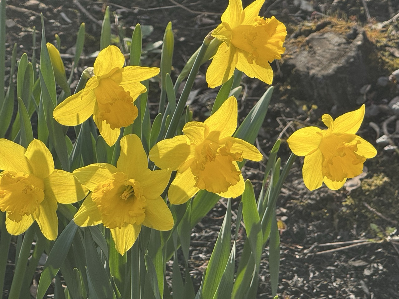
Daffodils enjoying another mild spring morning today
in their St. Albans, Vermont garden plot.
This spring in Vermont - pretty much this year so far actually - has been remarkably mellow, at least in terms of weather. 

Sure, we had a big February snowstorm, some weird mid-March warmth and a damaging ice storm at the end of March, but - knock on wood - we have not had a chaotic weather year so far in Vermont. 

No epic spring snowstorms, no record summer-like heat waves, no floods to speak of, and few wild swings from hot to cold. 

That's a nice contrast to the extremes and disasters we've seen in Vermont in recent years, and the many dangerous, deadly tornadoes, floods and wildfires many other parts of the U.S. have endured so far this year. 

April so far has been especially quiet in the Green Mountain State. 

Conditions in the past couple of weeks have plodded along with extraordinary ordinariness, if that makes sense. Temperatures and precipitation this month have been close to normal. Temperatures have never really gotten that hot or that cold. 

We've had only one day in Burlington so far this month that was more than ten degrees above or below normal. We sometimes have several April days that are 20 degrees warmer or colder than the average for the date

I know I've probably jinxed it with this post and we'll now face months of scary weather. But for now, I'm not seeing any big weirdness coming our way.

However, things in the weather department are about to shake up from the doldrums just a little. 

On the agenda is a low risk of thunderstorms today, a likely soaking weekend rain, and - perhaps - the first summer like day of the season in northern Vermont. (Southern parts of the state already had one summery day a little over a week ago).

TODAY

A little disturbance racing through late this afternoon and early tonight might be enough to set off some showers and maybe even a couple weak thunderstorms. Anything that develops will be hit and miss and if storms do get going, they not even be close to severe. It's just another reminder that we're getting into that warm season showery regime.

So far this month, when it has rained, for the most part each episode has featured only pretty light showers. There's been a couple of exceptions, but there's been no "wow" factor to any storms.

WEEKEND SOAKER THEN WARMTH?

Friday night and Saturday, it looks like we are in for a pretty good wetting. This one won't be extreme, either, but early indications are most of us should see a half inch of rain at least, with a few places getting an inch.

That amount won't break any records and absolutely won't cause any flooding worries, but it could be the wettest storm of the month for many of us. The gardens could use a good soaking, so that's OK. 

In northern Vermont, temperatures have not gotten above 70 degrees since mid-March. In the past decade or two, it's gotten rare to have an April without any 70 or even 80 degree weather, so this month is so far an oddity.

But as the month draws to a close, it looks like we might finally get a brief squirt of summer-like air. If the showers hold off long enough next Tuesday, places like Burlington could make a run at 80 degrees.

We shall see.

The only disconcerting thing I see in the extended forecast is the possibility of a cold storm stalling overhead or nearby around May 7. If that happened, we'd have a big interruption in spring and maybe even some snow.

I would rate this as highly unlikely, though. Such long range forecasts are seldom accurate, so I wouldn't worry too much about that.    

Saturday, April 12, 2025

Another Snowy Vermont April Morning Underway; But Compare To Some Aprils, This Is Easy

Traffic cam grab from Route 11 in Winhall, a high 
elevation town in southern Vermont, shows 
seemingly midwinter conditions early this morning. 
 So far early this morning, the April snow in Vermont is working out about as forecast.

A band of at least moderate intensity snow had moved into far southern Vermont at dawn and was pushing northward. 

It was a really wet snow, especially in the valleys, as temperatures as it snowed were around 33 or 34 degrees. It's piling up more quickly up in the slightly chillier hills and mountains. 

As it is, we do see snow covered roads, especially in higher elevations of southern Vermont this morning. 

So you might want to be careful if you're traveling around the southern half of the state today. Especially if you're headed for the hills.

We might see a few scattered power outages, too ,as the wet snow piles up on trees and power lines that criss cross along higher mountain roads. 

Winter weather advisories remain in effect for the southern half of Vermont, except for the western portions of Rutland and Addison counties, which will get little snow out of this. People in the advisory area can expect two to six inches of sloppy snow, the most in the mountains, of course. 

The main show with this storm will be this morning in southern Vermont. Bursts of moderate snow will continue, but later today, the band of precipitation will head north, leaving behind a gloomy afternoon of light rain showers, with some wet snowflakes in the high elevations 

As impressive as this band of snow and some rain looks on radar, it's still expected to fade as it works its way northward today. Pretty much everybody in Vermont will see some rain and snow today, but it will be pretty light and inconsequential up by the Canadian border.

It still might be cold enough to snow - especially  above 1,000 feet in elevation in central and parts of northern Vermont, but that will only amount to a coating to a slushy inch most places. It'll be close, but it looks like any light rain in the Champlain Valley probably won't mix with any snow. But no promises. 

In the grand scheme of things, this isn't a blockbuster snowstorm. It's April, so you'd think we'd avoid the Big Ones, but not necessarily. 

 If you're not happy with today's snow, it could have been worse. Much worse.

APRIL SNOWS COMMON

Could be worse. After a warm April in which trees 
started leafing out, more than a foot of snow fell
on St. Albans, Vermont, causing severe tree
damage and widespread power outages in
town and across northern Vermont. 
We have many, many examples of Vermont Aprils that were much snowier than this year. A cold, gusty snowstorm dumped 10 to 20 inches of snow on southern Vermont on April 6-7, 1982. 

A year after that, on April 16-17, 1983, a snowstorm dumped 15.6 inches of snow on Burlington.

 Then it kept snowing off and on for five days after that. That month ended up with 21.3 inches of snow in Burlington, the snowiest April on record.

An almost identical storm to 1983 hit in April, 2000, depositing a four-day total of 19.1 inches of snow on Burlington. 

Even unusually warm Aprils can get snowy. April 2010 featured record highs in the low 80s early in the month. Then on April April 27-28, 10 to as much as 23 inches of snow fell across northern Vermont. In the valleys, the trees were already starting to leaf out due to the early spring. As a result, the wet snow caused a lot of tree damage and many power outages. 

Then, just four days after that snow ended, temperatures rose into the low and mid 80s.

April and early May can really be fickle, huh?

By the way, this month's snow has been mostly avoiding Burlington. So there, at least, April snowfall this year will be below normal. So far only 0.4 inches of snow has fallen this April in Burlington. Normal snowfall for the month is 4.1 inches. 

It's also nearly impossible to get through a Vermont April without snow, even in the Champlain Valley. In the past 140 years or so, only two Aprils - 1941 and 2005 - have gone by in Burlington without so much as a snow flurry. 

And in 1941, there were snow flurries on May 1 and 2 in Burlington. 

END TO THE SNOW?

There is light at the end of the snow tunnel, so to speak.  The end of the snowy regime this April is coming but we'll have to wait several days for Vermont to fully escape the flakes. 

It will warm up briefly on Monday before we get hit by another cold snap later Tuesday and Wednesday. That one still looks like it will spit out some more snow showers, especially north.  The Tuesday night/Wednesday thing at this point looks a little bit similar to a week earlier, when the northern Green Mountains received several inches of snow.

This next one doesn't look quite as impressive as last week's, but I wouldn't be surprised to see at least a few inches of  additional snow in the mountains by Wednesday. 

Now, on to tthat hopefully snow-free future: After next Wednesday, I'm still not seeing signs of a big springlike warm up. I also see frequent chances of inclement weather through the end of the month. But, fingers crossed! It looks like each little storm to close out the month will come as your standard April showers, not late season snow blitzes.  

Then again, I can't tell you how things will work out in May.  I have seen it snow in May, so there's that. 


Friday, April 11, 2025

Friday Evening Vermont Snow Update: Yes, An Update, As Forecast More Wintry Than This Morning

Snowfall mostly in southern and central Vermont looks
like it will be more widespread and a little heavier
than forecasts had indicated this morning. 
 Vermont - at least a sizable chunk of it, looks like it's going to be snowier than originally thought on Saturday. 

Winter weather advisories have been posted for basically the southern half of Vermont excluding the western parts of Addison and Rutland counties. 

Essentially a band of precipitation that I mentioned in this morning's post that we know will move south to north over Vermont will have more oomph that first thought. 

That means the snow and rain will be heavier that expected in southern Vermont and will have more staying power than originally thought as it works its way north. 

Heavier precipitation tends to cool the air, so the marginal temperatures we're expecting means some parts of southern Vermont are in for quite a bit of late season snow.

Who gets how much will depend on elevation. Valley towns in southern Vermont like Bennington, Brattleboro and Springfield will probably see about two inches of wet snow. It'll be hard for snow to accumulate in the valleys. 

It'll be snowing hard enough, but the sun angle this time of year is the same as it is in late August. Some of the heat will penetrate the clouds and melt some of the snow as it melts.

It might be a different story though in the slightly colder southern Green Mountains. Those areas could see six inches of snow in spots, or even a little more than that. Some roads will be slick across southern Vermont, especially in the morning before the sun can really come up.

Since this will be a wet and heavy snow, I wouldn't be surprised if there are a few power outages as well. 

The snow will tend to lighten up and mix with rain in southern Vermont during the afternoon. 

Meanwhile, the snow will continue to make its way further north than this morning's forecasts suggested. High elevations as far north as Stowe could see two to four inches of wet snow, while valleys away from the Champlain Valley could see a slushy coating to as much as an inch. 

There's a big caveat here. If the trends in forecasting meteorologists saw this afternoon continue on that path, central and northern Vermont could actually see a little more snow than what I'm outlining here.

This morning, I said that the northern Champlain Valley might get no rain at all. Since this push of precipitation has more oomph than expected, now it looks like it will probably rain at least a little, so Saturday won't be a nice day 

The bulk of the precipitation will hit northwest areas in the afternoon, when it's warmest. Plus, rainfall rates won't be that impressive, so folks in Burlington and St. Albans very likely won't see any kind of changeover to snow.

Unless this little stormy episode continues to surprise. 

Sunday is looking much better, as skies will start to clear, at least in western Vermont. Eastern Vermont might stay cloudy with a risk of a few light showers. At least it will be warmer, with highs near 50 east and in the 50s west.

That should start to melt Saturday's snow in a hurry.  

Yes, The United States HAS Had A Lot Of Tornadoes This Year

A massive tornado in Lake City, Arkansas on April 2.
So far, this has been a very busy season for 
tornadoes in the U.S.
 If you been thinking that almost all you've heard in weather news this spring is tornadoes, there's a reason for it. 

The United States has had an exceptionally busy early part of tornado season. Through April 7, there have been 473 tornadoes. 

On average by April 7, there's normally about 270 tornadoes this far into the season, according to NOAA's Storm Prediction Center. 

That doesn't necessarily mean that will continue, but for now, we're way ahead of normal.

March got things off to a rousing start and the first week of April was even worse. A lull in tornado activity started on Monday and will probably last at least a week during which few tornadoes will touch down. 

But there are tentative signs that things could get really busy again toward the end of the month as we head toward the heart of tornado season. (Tornadoes activity usually peaks in May and early June).

 MARCH

There were no fewer than 175 confirmed tornadoes in March, and that number might go up as other reports are confirmed.

That's double the amount the United States usually sees in March..

March was punctuated by an unusually large tornado outbreak in the middle of the month with 116 twisters reported.  That's a big outbreak for any time of year but it's really odd for so early in the season. 

 The two busiest years for March tornadoes were 234 in 2022 and 208 in 2023.  Part of the issues is weak tornadoes are better detected than they were years and decades ago, so those are added to the count. 

March is usually just the beginning of tornado season. The vast majority of U.S. tornadoes strike in April, May and June. 

APRIL

April got off to an explosive tornado start. So far, no fewer than 182 tornadoes have been counted in the first seven days of April. That number -  182 - happens to be the average number of tornados for an entire April.  That's easily one of the busiest early Aprils on record. Through Monday, tornadoes had been reported somewhere in the U.S. on 12 consecutive days. 

That's the earliest in the year on record in which there were at least ten consecutive days with tornadoes.

As noted above, we have a lull going in tornado activity. Especially given super April tornado outbreaks in 1974 and 2011, I doubt there will be record number of twisters this month. Still forecasters are expecting at least the possibility of a notable uptick in severe storms and tornadoes toward the end of this month. 

Generally speaking more tornadoes occur in late April rather than early in the month. 

The record for April twisters is 757 in 2011. Interestingly, last year had the second highest number of April tornadoes with at least 356 twisters.

By the way, last year was the second busiest tornado year on record, with just under 1,800 twisters in the U.S,

LA NINA/CLIMATE CHANGE

However, the Washington Post reports that the increase in March tornadoes in recent years can't be fully explained by better counting. 

Part of it might be La Nina, a periodic cooling of eastern Pacific waters. One of the effects of that cooling is a wavier jet stream across the continental United States. A wavy jet stream means more and stronger storm systems. 

If these storms can produce the correct clash of warm, humid air from the south and frigid air from the north, and adequate shifting winds in the atmosphere, you get tornadoes. 

Both 2022 and 2023, those busy tornado Marches, were La Nina years.

La Nina has pretty much faded away, so that will probably be no longer much of an influence on the rest of tornado season. The second reason for so many tornadoes might not go away so fast. And this second reason has to do with climate change.  The Gulf of Mexico is toastier than normal, a trend that has been consistent in recent years as a warmer atmosphere also heats up the oceans. 

When the Gulf water is warmer, it allows even more moisture to stream northward into the kind of storm systems that spin off tornadoes. Humid air is a key ingredient for tornadoes, so the more moisture the merrier, at least from the perspective of twisters. 

La Nina is fading. And besides, the effects of La Nina tend to fade as we head further into spring.

However, warm Gulf of Mexico waters do influence tornadoes well into spring and early summer. 

That's not to say the rest of tornado season will be supercharged. It just increases the odds somewhat. 

But you never know what will happen. March, 2012 was a busy and tragic month for tornadoes, with 223 twisters reported. 

That month was punctuated by an intense tornado outbreak on March 2-3 that produced 81 tornadoes which killed at least 40 people.

But it turned out the rest of the 2012 tornado season was pretty unremarkable. The year ended up with about 1,000 tornadoes, Which seems like a lot but was still about 300 below normal.

By contrast, there weren't many tornadoes in March and early April, 2004. But the year turned out to have the most tornadoes on record, with 1,819 twisters, including 389 in just the final 11 days of May that year.   Tornado deaths that year were mercifully low considering the numbers, amounting to 35 people 

That's tragic of course, but fewer than in many of the slowest tornado years.  

Vermont Just Can't Seem To Escape The Clutches Of Winter

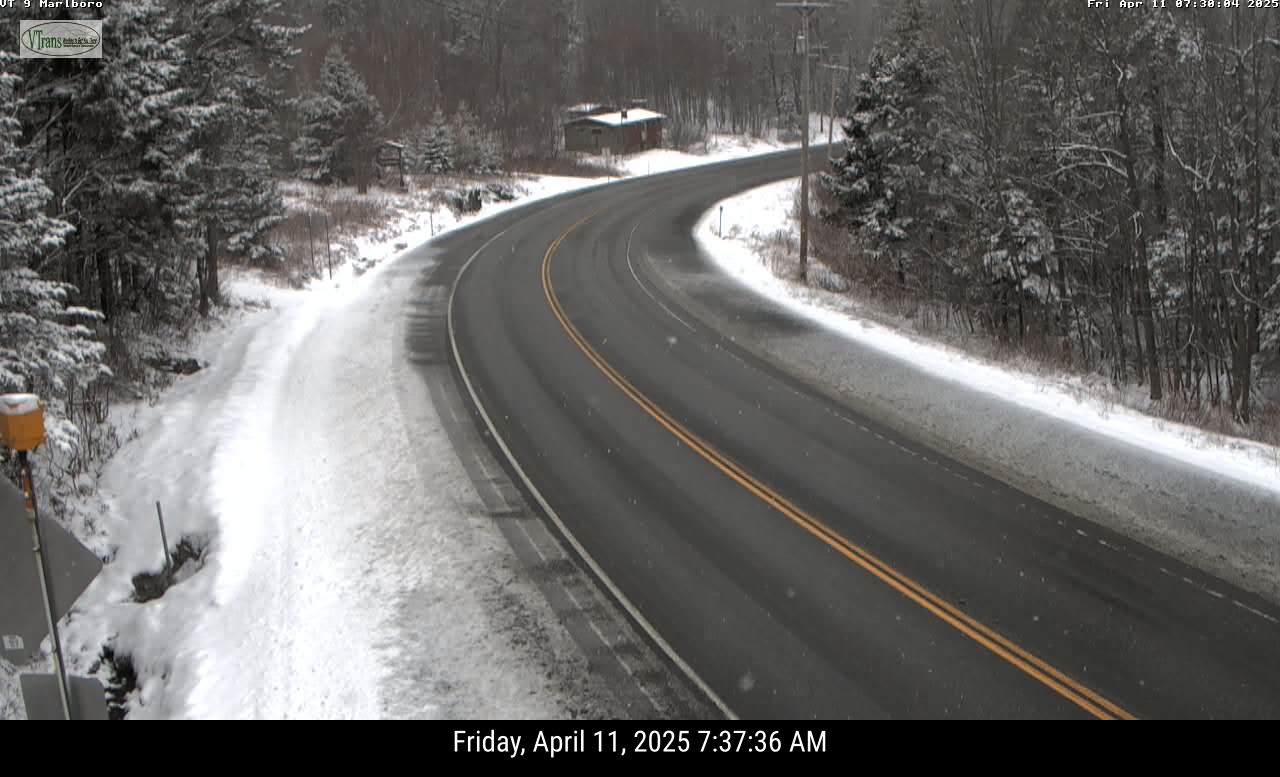
Another snowy April morning in parts of Vermont today.
as this traffic cam view of Route 9 in Marlboro,
Vermont shows. More snow is due in parts
of the state on Saturday. 
 Winter weather keeps poking its head into our April springtime here in Vermont, like an annoying person at the next table continually butting in, interrupting your romantic restaurant dinner to comment on the food, service etc.  

Spring keeps trying to advance in Vermont, but lately, it's been tough, with plenty of setbacks. 

Yesterday morning in Montpelier, it got down to 16 degrees, a record low for the date, beating out the 17 degrees set in 1997.

The snow depth near the top of Mount Mansfield reached 92 inches yesterday, which was actually seven inches deeper than it was at the start of the month. 

In parts of southern Vermont, it snowed again last night. Traffic cameras indicate the high elevations got somewhere around an inch of snow. Even valley floors in southeastern Vermont, like around Brattleboro, got a slushy coating.

And there's more snow on the way. 

SATURDAY

Yes, we have to post yet ANOTHER snow prediction
map for Vermont. April does not spell the end of this 
in the Green Mountain State. Some high elevations
of southern Vermont could see four or five
inches tomorrow. Northern areas mercifully
lose out on snow chances. 
A storm of sort is going to send a band of precipitation northward across Vermont Saturday. When it enters southern Vermont, precipitation should be fairly heavy.

It will also be cold enough for snow. Low elevations in southern Vermont could pick up another inch or two of snow out of this, while high elevations could go as high as four or five inches.  

The band of precipitation will weaken as it heads north and northwest during the day, so snow amounts will diminish the further north you go.

 Plus, lighter precipitation doesn't help cool the air as much as heavier rates do, so chances are a lot of this will be rain in low elevations central and north. 

By the time you get into the central and northern Champlain Valley, and near the Canadian border, the band of inclement weather will have weakened so much that very little rain or snow will fall. If any. 

This state of affairs will make for some "backwards" Saturday temperatures.  The coldest part of Vermont will be in far southern parts of the state, where highs might well just stay in the 30s. By the time you hit Montpelier and Burlington, it'll get up into the 40s.

Way up north, up by St. Albans, Highgate. Alburgh and over to Newport  it could reach 50 degrees.  

BRIEF SPRING BREAK

We'll get a very brief break from our winter in April Sunday and especially Monday. It's now looking like the sun will want to come out Sunday in most of Vermont, which would bring us up into the seasonable low to mid 50s.

Monday looks like it will get into the pleasant low 60s in many valley locations, and well into the 50s elsewhere. So pretty nice. Don't count on it lasting.

WINTER NEXT WEEK

Another cold front will bluster through on Tuesday, dropping our temperatures back below normal again for the middle of next week. 

Tuesday might start out warm-ish but a cold front will probably bring rain Tuesday,  then perhaps some  snow showers by Tuesday night and Wednesday, especially  north and mountains.  As it looks now, highs Wednesday will only be in the 37-45 degree range, again, pretty chilly. 

WHY THE CHILL

Ironically,  our bouts with April chill are a bit of a sign of spring.  The polar vortex, a swirl of intensely cold air takes up residence somewhere in the far north every winter. Its position relatively close or far away from us determines whether it's cold or warm around here,

Every spring, usually around mid-April, the forces of spring disrupt the polar vortex and it kind of disappears and goes into hibernation for the summer.

This year, that disruption happened earlier than usual - in mid March.  When the polar vortex gets wrecked like that in the spring, it can change the jet stream to push cold air into the eastern United States and parts of northern Europe.

That's what happened here. Since the polar vortex mess happened early this year, the resulting cold air up here in New England was more noticeable than it would have been later in the spring. 

Normal temperature are rising rapidly this time of year, so in general, each cold front will create less of a sting as we move forward through the month. 

There's mixed signals as to whether we'll see any sustained warmer weather for the last two weeks of April.  Many forecasters think the effects of the polar vortex's spring demise will fade by late April, and we'll be able to get on with our regularly scheduled springtime. 

We deserve it. 

Monday, April 7, 2025

Monday Morning Vermont Weather Update: Wintry, Then Blah

Traffic camera image from around 7 a.m to day shows
snow falling along Route 7 in Shaftsbury. Far southern
Vermont had some light accumulations this morning
with more snow on the way pretty much 
statewide on Tuesday. 
We shouldn't be surprised to see snow in the Vermont forecast in the first half of April, but those of us pining for spring are always a little disappointed. 

Prepare for just a bit of disappointment. 

It was already snowing lightly in far southern Vermont this morning, as a weak wave of low pressure scoots by to our south. 

It looks like a dusting of snow made it as far north as about Mount Holly. Traffic cameras show up to an inch of new snow near and along Route 9 not far from the Massachusetts border. 

Today the nicest, warmest weather will actually be in northern Vermont, where some sun will boost temporaries to 50 or so in the mildest valleys and 40s elsewhere. 

Clouds will keep the southern half of the state in the 40s. 

This will actually feel warm compared to tomorrow and Wednesday. 

TUESDAY

We're still looking at a pretty potent disturbance and cold from to come through late tonight and Tuesday morning. Most of us won't get much snow, but we're still looking at some bad timing. 

The heavier snow showers should hit in time for the morning commute, so even the Champlain Valley might see some slick roads.  

The snow map is back again. National Weather Service
in South Burlington is calling for an inch or
two of snow tomorrow in the valleys. The Green 
Mountains could see several inches of new powder
Snow showers will also continue all day and it will be unseasonably (but nowhere near record) cold. The coldest high temperature on record for Tuesday in Burlington is 28 degrees, and it will get warmer than that. Sort of.

Highs should say in the 20s in higher elevations and 30s in the valleys. Blustery winds and continued snow showers will make it feel Januaryesque. 

Valleys will only see a half inch to at most two inches of snow, but this is a situation in which the Green Mountains will have a decent late season dump. 

 I'd say most of our mountains should see at least two to six inches of snow through Tuesday evening. The northern Greens, especially around Jay Peak could easily see eight or more inches of snow.

Late season skiers are probably happy about that. 

LATE WEEK

After a chilly Tuesday night with lows in the teens and 20s, Wednesday will be chilly and dry.  With some sun.  

At this point, it looks like Thursday will cloud up, introducing what might well be extended period of blah, chilly April weather. 

And narrow, steep dip in the jet stream will set up over the East Coast for the end of the week and weekend.  This will set up either a nor'easter type storm or a series of weaker storms riding north along the coast and on through New England. 

Unless things change radically in the forecast, this would guarantee cloudy skies, cool temporaries and high chances of rain Thursday night through Sunday. 

It's hard to say how much rain we'll get.  Early indications are the heaviest stuff would be south and east of us, and we'll be just stuck with occasional light rain.  But, we'll have to wait and see on that to be sure. 

It also looks like whatever comes from the sky Thursday and into the weekend will be rain. There might be some snow up in the high elevations, but that's to be determined. 

I don't see anything in the weather pattern beyond that suggesting lots of warmth and sunshine, so boo on that. But this time of year, normal temperatures are rising rapidly, so cool weather just doesn't have the same sting as it did even a couple weeks ago. 


Saturday, April 5, 2025

One More Day Of Extreme Rains, Tornadoes To Plague Battered U.S Middle, Here In Vermont, Just Minor Weather Hassles

Hopkinsville, Kentucky is one of a great many communities
in the middle of the U.S. suffering flooding as a weeklong
torrential rain storm and severe weather outbreak causes
havoc from Texas to Ohio. Photo by George Walker IV/AP
 The nation's middle needs to get through one more day of torrential flooding rains today and maybe some more tornadoes before relief begins to arrive tomorrow. 

 Since Tuesday, the Midwest and South have endured at least 83 tornadoes, and that number will go up as damage areas are assessed.  

This includes at least 14 twisters on Friday scattered around northeast Texas, Arkansas and southeast Missouri. 

More tornadoes are in the cards today for parts of Louisiana, Mississippi and southeast Arkansas.

The real story, as expected, is shifting toward the torrential rains, which will continue unabated today. 

The area under the gun is huge. A long string of flash flood warnings extended from northeast Texas to southern Illinois this morning. Flood watches go from Texas to southwest Pennsylvania.

Already, we tragically have one flood death, that of a nine year boy swept away and drowned in Frankfort, Kentucky.

As in virtually all disasters, the flooding is beginning to hit some towns harder than others in the same region. 

Downtown Hopkinsville, Kentucky was under water as six to 10 inches of rain swamped that area. A dozen people had to be rescued from flooded homes.  Similar water rescues were reported in far flung places like Van Buren Missouri and Texarkana, Texas. Four inches of rain fell in Cape Girardeau, in southeast Missouri within eight hours. Three inches of that came within two hours. 

Hundreds of Kentucky roads were blocked by high water as of Friday. It was still raining hard in Kentucky this morning. 

Friday's rainfall curved a little north and west of where it was centered the day before. It was mostly Arkansas and Kentucky that saw the worst of it. 

Both states will get nailed today by up to nine inches of rain falling on already waterlogged ground. Which will exponentially worsen the flooding.  Today will be the worst day of the flooding as a result.  The torrents will also creep back southeastward back into Tennessee and northwest Mississippi, so the flooding will broaden.

 The stalled weather pattern will finally begin to break down Sunday.  There could be some severe storms and local flooding in the Gulf Coast states Sunday, but it won't be as bad as what we've seen this week from Texas to Ohio. 

Even after the rain stops, the flooding will continue and in some cases worsen in the coming days as larger rivers crest.

FLOODS AND CLIMATE

I can't definitively say that this mess was "caused" by climate change but it's consistent with the planet's warming.

Torrential rains and flooding have always struck the South and Midwest occasionally in the spring storm season. But this storm - and several others earlier this year and in recent years - have proven especially torrential and disastrous. 

For instance, this is Kentucky's second "100 year rainstorm" in less than two months. 

Climate change turbocharges storms, and makes what would have been a heavy rain especially torrential. In other words, the weather setup that is causing this week's flood disaster might have happened anyway without climate change. 

But chances are the rain associated with it is much more intense than it would have been in a cooler world. So the flooding is worse than it otherwise would be.  

VERMONT WEATHER

We're getting remarkably close to daffodil bloom
time in St. Albans, Vermont. Earlier than normal 
once again due to a string of warm springs 
recently. However, chilly weather over the next
several days should temporarily slow our 
progress through the spring green up season.
We continue to be blessed with pretty benign weather here in the Green Mountain State, at least compared to so many other areas of the nation. 

The weather will be far from perfect for the next few days, but you have to expect that around here in early April. 

The good news is forecasters have somewhat backed off from the idea of freezing rain in eastern Vermont and the Green Mountains. 

There could still be patchy ice up high in the mountains.  Swaths of the Northeast Kingdom should also be cold enough for freezing rain this afternoon and tonight. 

Those temperatures will be marginal, so the ice will be patchy.  It'll be enough to make some of the roads up that way treacherous today and tonight, but very likely not enough to create some power outages.

The other trouble spot today is the northern Champlain Valley. Ice won't be a problem there, but gusty winds might. 

A wind advisory is up in the central and northern Champlain Valley from mid-afternoon today to after midnight tonight. Gusts could reach up to 50 mph.  The rain falling during this time period might tamp the wind gusts down a little though. 

Everybody will be rainy this afternoon and tonight. It won't really come down that hard, though, so this won't cause any flooding. It'll make mud season a little worse than it already is, but that's about it. 

Sunday is looking a little more optimistic than earlier forecasts, especially the further north and west you go. After a gray morning that will carry the risk of a little lingering rain, we expect some sun in the afternoon. 

It won't be all that warm with highs mostly in the 40s, but still, not bad for early April. 

The next problem is Monday night and Tuesday, when a potent little disturbance and blast of chilly air invade. There won't be much accumulation, but the timing looks lousy. At this point, some heavy snow showers look like they might come through right during the Tuesday morning commute. 

It'll be enough snow in many areas to make the roads slick and awful.  Stay tuned for updates on that.

After that, the weather pattern is shifting for awhile, anyway, in which we'll see mostly near normal temperatures  and  no blockbuster storms in or near Vermont as we head into the middle of the month. 

Tuesday, April 1, 2025

Vermont March Weather: Warm And Weird

A warm March sent daffodil shoots growing much
earlier than normal in Vermont this year. This new
spring greenery had to endure occasional wintry
setbacks, as seen here on March 21. That state
of affairs will continue into April. 
 Well, we got through another month, so it's time to look back at our overall Vermont weather in March, which, as you might have noticed was weird. And warm. 

MARCH TEMPERATURES

Burlington came in with a mean temperature for the month of 38.0 degrees. That puts us in a three way tie with 2010 and 1902 for the sixth warmest March on record. 

It's also the sixth time in a year a month in Burlington was in the top ten warmest list. 

This March was even warmer than the one a year ago, in 2024 which was merely the seventh warmest on record. Yeah, we've had a lot of hot Marches lately. A lot of hot months and years, actually, thanks to climate change. 

The entire rest of Vermont was much warmer than average in March, too. But figures are incomplete, as I noticed missing data on a few days from several of our regular long standing weather stations like Rutland and St. Johnsbury. 

The warmest March day in Burlington was 72 on the 19th and 20th.  This makes March, 2025 one of only 11 Marches in the past 140 years or so to get that warm.  It was not close to the hottest March day on record, though. It was 84 degrees in both March, 1946 and March, 1998.

Rapid snowmelt and some rain led to widespread, but minor flooding across Vermont around St. Patrick's Day. 

You could see the effects of such a mild March by the unusually early signs of spring. Crocuses were blooming by mid-month in a few locations. Green daffodil shoots poked up all through the second half of the month. The sound of returning red wing blackbirds filled the air in marshy areas way earlier in the month than usual. I even had a report of two of people in southern Vermont hearing spring peepers yesterday. That's really early for the season. 

Burlington had its final zero degree reading of the season on March 3. That meant nine days this past winter got to zero or below.  Historically we'd have roughly 20 or more such days per winter, so the downward trend in very cold days continues. 

MARCH PRECIPITATION

It was a little wetter than average virtually everywhere in Vermont in March, which is a good thing since we still have lingering effects from last autumn's drought. 

Precipitation wasn't overwhelming, though, as Burlington had 2.81 inches of rain and melted snow and ice. That's just a little over half an inch above average. By my count, Burlington had its 37th wettest March on record, so not all that impressive.

Precipitation around the state was similarly above average, but not to an extreme extent. 

Winter this March was notably absent until the end of the month. Early in the month, the summit of Mount Mansfield did have its highest snow depth since at least 2019.

But in most of Vermont aside from high elevations, very little snow fell into the end of the month. 

As we just saw, the last weekend of the month brought a big thump of five to nine inches of snow to the north, and a quite damaging ice storm to parts of central and southern Vermont.   

The snow and ice melted quickly during another very warm final day of March, though as of early yesterday, there was still 89 inches of snow near the Mount Mansfield summit. 

APRIL OUTLOOK

April is often regarded as a cruel month, as you think spring is coming, but you always end up getting slapped in the face with winter. 

That's no different this year. 

Today will be much colder than yesterday as many of us won't get out of the 30s. 

And, of course, Wednesday night, we're in for yet another round of snow, sleet and freezing rain. Though it won't be as bad as the last one, eastern Vermont in particular will likely see a glaze of ice, slick roads, and maybe an isolated power outage or two by early Thursday. 

The precipitation should change to rain on Thursday. 

Long range forecasts also call for mostly chillier than normal weather around here through at least the first half of April. We shall see. 

Even if it's a cool April, the forces of spring will win out. Normal temporaries rise rapidly. Today, the normal high temperature in Burlington is 48 degrees and the low is 30. By April 30, the normal high and low temperatures are 63 and 42 degrees.

You're going to see a much greener Vermont landscape by the end of the month compared to what it looks like now. 

Sunday, May 19, 2024

Yet ANOTHER World Record Hottest Month Recorded In April

Once again, hard to find cold areas (blue) that were chillier
than the 20th century average around the world in April. 
The world just had a record hot month, something that's been happening for nearly a year now. The April data is now in from NOAA's National Centers for Environmental Information, and the month was toasty again. 

Says NCEI:

"This is 0.18 degrees C (0.32 degrees F warmer than the previous April record set most recently in 2020, and the eleventh consecutive month of record high global temperatures. April, 2024 marked the 48th consecutive April with global temperatures, at least nominally, above the 20th century average."

The hottest areas compared to long term averages are northern South America, western Africa and the stretch of Atlantic Ocean between those two continents. Other notable hot spots relative to average were northern Canada, areas around the Indian Ocean, places near the border between Asia and Europe and eastern Asia.

As usual, cold spots were hard to come by. Parts of Antarctica were cold, which has been a trend in recent months. Other areas that came in slightly on the cool side (but not by much!) include central Australia, the southern tip of South America and a few lonely spots in the far North Atlantic. 

Overall, it was an early spring. The snow extent in the Northern Hemisphere was the lowest on record. 

Since the first four months of 2024 were record warm, NCEI gives the entire year a 61 percent chance of being the warmest on record, even beating the boffo warm 2023. NCEI also says that 2024 is a sure bet to score at least in the top five warmest. 

El Nino has ended, which tends to boost global temperatures. That, combined with climate change, helps explain why the past 11 months have been globally the hottest on record. 

The opposite La Nina  is taking hold which tends to cool the world just a bit. That's probably why NCEI is hedging its bet on this year being the hottest on record. I've seen some climate change observers suggest the run of global record warm months will end in about June. 

We shall see!

UNITED STATES

 For the Lower 48, April was the 12th warmest on record. No individual states had their warmest April on record, but a few scored in the top ten. 

The January to April period in the U.S is the fifth warmest on record. 

I could not find one county in the Lower 48 of the
United States in April that was cooler than average,
White counties were near normal, Orange ones
were warm, 

For the second month in a row, cool temperatures were hard to come by anywhere in the United States. 

That's odd, because even in a warm month, you usually see at least a small section of the nation with cooler than average temperatures. 

Not in April, at least not really.  A found quite a few areas that were pretty close to average, mostly along the West Coast, northern Plains and Florida. But a county-by-county breakdown of April temperatures revealed no areas that were noticeably cool for the month. 

The warmest areas relative to average were mostly in the Ohio Valley and Mid-Atlantic states. 

April in the U.S. was on the wet side, but not by a huge margin. It was the 41st wettest out of 130 years of records. In addition to the warmth, the Ohio Valley was among the wettest parts of the U.S. relative to average Parts of the central Plains and western Gulf Coast were also on the soggy side. 

Five more disasters costing $1 billion or more were added to the growing list for 2024. That brings the total documented so far to eight this year. 

The new ones included severe storm outbreaks in February and early April, along with two winter storms, one in the Northwest and one in the central U.S. during January. This list does not include the huge tornado outbreak in the nation's middle in late April.

Though that disaster is virtually certain to have cost more than $1 billion, proper assessments aren't done  yet. I also suspect a tornado outbreak earlier this month, and the epic storm in Houston Thursday evening will also each cost more than $1 billion.