Showing posts with label eastern New England. Show all posts

Thursday, January 27, 2022

Big Nor'Easter Almost Definitely A Miss For Vermont; Eastern New England Still Target

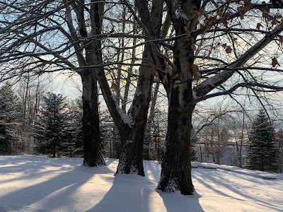
The thin snow cover, about five inches, on my property
in St. Albans on Tuesday. It's looking unlikely that
the expected big nor'easter on Saturday will add any
snow cover for the this part of Vermont. 
I'll get into the updates on the nor'easter in a sec, but I have to acknowledge another impressively cold morning in and around Vermont.  

Island Pond got down to at least 35 below early this morning, which at least ties for the chilliest reading of the winter in the Green Mountain State.  Most everyone else in Vermont was in the teens and 20s below this morning.

The way things are shaping up, this morning and last Saturday will pretty likely - but not definitely - be the coldest spells this entire winter. We have more cold weather coming up, but it doesn't look like it will be that frigid again for awhile.

Now, that nor'easter.  As usual with this type of storm,  the computer models have been "windshield wipering" with its path, sometimes taking the storm a little further offshore, others bringing it a little closer. 

At this point, things are consistently pointing to a nothing burger for Vermont, aside from gusty north winds, a nasty wind chill and maybe some light snow in southeastern Vermont on Saturday. 

There's still a slight chance we could get a surprise hit, as a small number of models blitz Vermont with snow. But as of this Thursday morning it's looking pretty doubtful we'll join in the "snow fun." 

That leaves us with the question as to how extensively this thing will battered eastern New England.  As the National Weather Service in Boston notes, a lot will depend on how a dip in the jet stream aligns itself in the Ohio and Tennessee valleys tomorrow. 

A sharper dip would bring the storm a little closer to the coast, less sharp, it would be a little more offshore.  In any event, this will be a rapidly strengthening and powerful storm as it passes by New England Saturday. 

Either way, it seems like a lock that at least some of eastern and perhaps central New England will get a lot of snow out of this.  High winds and coastal flooding are also going to be a problem. How bad those two issues will get will depend largely on how close to the coast the storm ultimately gets. 

We still have some questions as to how far west the heavy snow reaches on Long Island, and will it reach to near New York City and the Mid-Atlantic States.

For now winter storm watches hug the coast from Virginia, on up through New Jersey and the New York City area, and then roughly into the southeastern third of New England. 

By the way, after this goes by and another shot of frigid air arrives, it's beginning to look like we back here in Vermont could get our first real thaw since New Year's Eve.  Temperatures could reach the 40s Wednesday and Thursday.

A weather system accompanying this warmth appears to want to give us rain toward Thursday, so Vermont's snow drought will continue on. 

Saturday, December 5, 2020

Eastern New England About To Be Blasted By Nor'Easter. Vermont Is Meh

Heavy rain was moving into southern New England before dawn today, the opening salvo of what promises to be a humdinger of a nor'easter for the region today and tonight. 

Big nor'easter for the eastern half of New England, but
as this forecast map from NWS Burlington, Vermont
will largely escape this storm

That is, with the exception of most of Vermont, which should escape anything earth-shattering. 

The storm, just off the Mid-Atlantic coast this morning, is heading north, and strengthening fast.  The rate at which it's getting stronger will actually increase further as it heads towards New England later today. 

Had there not been warm air in place ahead of the storm, some parts of eastern and northern New England would be looking at two feet of snow out of this.   As the storm approaches, it will cool the air and quickly change the rain to snow, except not so much on Cape Cod and the Islands. 

Given the fact the nor'easter will be strong and getting stronger as it passes New England, things will get wild east of the Connecticut River this afternoon and tonight. 

Snowfall rates in some spots will be a whopping one to three inches per hour.  Thundersnow is likely in a few areas.  The snow will be wet and heavy and coming down fast.  Winds will increase with gusts over 40 mph.

That wet, heavy snow is a recipe for  a lot of power failures. 

On the other hand, LOTS of snow is in the 
forecast for New Hampshire and western Maine. 
This will be a pretty memorable storm for eastern New England.  

Parts of northern Massachusetts, New Hampshire and Maine could easily see a foot of wet snow. It's conceivable parts of interior Maine could get close to two feet. This is certainly not the worst  New England storm ever, but still, fairly impressive. 

Not so in Vermont. We'll see the outer edges of the storm. It won't really be anything to write home to ma about here in the Green Mountain State. 

Interestingly the Connecticut River seems to be working out as the dividing line between a full blown winter storm and something less dire. 

True, the northeast corner of Vermont could still see six inches of snow out of this, but if current forecasts hold, the Connecticut Valley on the Vermont side should only see two to four inches of snow. 

Once you get west of the Green Mountains, most places should expect an inch or less later today through Sunday morning. 

I mentioned yesterday that forecasts for the storm were really uncertain.  Things have gotten clearer this morning in terms of what most forecasters think the storm will do. 

However, there's still room for surprises. The western edge of the storm will have a sharp cut off between heavy snow to the east and practically nothing to the west. If the storm ventures just a wee bit further to the west that most of the region's meteorologists expect, parts of Vermont come into play. 

The storm will be fairly compact in size for a nor'easter.  If it somehow gets a little wider than expected, eastern Vermont could pick up some extra snow. 

In any event, things will definitely turn more wintry, more seasonal here in Vermont for a few days. 

Central Massachusetts is also under the gun for a big
wet snowfall from this nor'easter
It was awfully mild in Vermont at dawn this morning, with pretty much all of us in the 30s.  

As the storm approaches, winds will pick up from the north, gusting into the 30s mph this afternoon. That will add some bite to the air, especially as temperatures start to slowly fall this afternoon. 

With that, many of us won't get above freezing again until about Wednesday.  Highs Sunday through Tuesday will be close to 30 degrees. That's not at all odd for this time of year, but still, a shock to the system after such a warm November and early December.

The upcoming week does look quiet, with temperatures once again heading to above normal levels (mid 30s to mid 40s for highs) by the second half of the week.