
 |
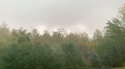
| Screen shot of trees near my house in St. Albans, Vermont being tossed by estimated wind gusts of 50 mph as a damaging squall line roared through Saturday afternoon. |
Tree and power line damage was reported across many scattered locations in eastern New York and western Vermont.
For what it's worth, I took a video of the storm as it passed through St. Albans with gusts estimated of at least 50 mph.
Just up the hill from my house, the storm dropped a tree on a car and some power lines, and apparently started a house fire.
Video is at the bottom of this post. It won't show up automatically if you're reading this on a phone, so click on this hyperlink to view.
On to the storm analysis!
In advance of the storm, it had looked like some brief spin up tornadoes could possibly form in the Champlain Valley.
It turns out there were just two intriguing spots that could have produced a spin up, one in New York, one in Vermont. By far the most suspicious area was a little southwest of Saranac Lake, New York.
There, radar seemed to indicate debris lofted into the air at one point. That's a pretty powerful signal of a potential tornado, but it's still not clear as to whether anything touched down there or not.
One video taken in the area at the time shows what could be a funnel or tornado, perhaps. Hard to tell because whatever was there was partly obscured by heavy rain. Some trees in that area were damaged, and part of a barn roof was torn off, according to WPTZ meteorologist Ben Frechette.
In Vermont, a radar scan briefly showed what is known as a "couplet" near Vergennes. That's where radar detects strong winds blowing in opposite directions in very close proximity aloft. That could be a sign of an impending tornado.
In this case, the couplet dissipated really quickly, and that makes me pretty sure nothing twisty touched down there.
The straight line winds that raked the region with the squall line were certainly damaging, but they could have been worse, too. Some of the worst winds were deflected just a few hundred feet above ground level.
One radar scan clocked winds of up to 79 mph approaching Burlington just 200 feet above the surface. But down where people live, the highest gust at the National Weather Service office was just 44 mph, and a few places around Burlington surely gusted to about 50 to 55 mph.
In most of northern Vermont north of Route 2, Saturday's storm for most people probably did more good than harm.
The U.S. Drought Monitor still has areas along the Canadian border in moderate drought, and the area of Vermont considered "abnormally dry" expanded in the past couple of weeks to two thirds of the state, instead of the northern third the previous week.
Saturday's rain was a good soaker. Burlington reported 1.2 inches of rain, and my unofficial rain gauge in St. Albans, Vermont captured 1.45 inches. We need the rain.
Going forward, I guess we can now finally declare that summer is over. The weather in Vermont could have passed for August in the past week. The well-advertised cooler air is now here, and that will only intensify tonight and tomorrow.
As I've been saying right along, this colder air isn't at all unusual for October, but it is quite a change. They're still expected some wet snow flakes at high elevations tonight through Tuesday. Quite a few clouds and scattered light, chilly rain showers are a good bet, especially in northern Vermont into Tuesday.
Nights will be too cloudy and breezy early this week to create any frost, so most of us will keep creeping closer to the record for the latest first autumn frost on record.
We might or might not break those records. The next chance for a frost/freeze I see is probably next weekend.
Here's the St. Albans storm video: Click on the arrow, then the YouTube logo to view it in full size:
No comments:
Post a Comment