
 |
| Hand print in the frost on my truck this morning, St. Albans, Vermont. Growing season is over for this year. |
Northern and central Vermont outside parts of the Champlain Valley were icy this morning, with temperatures generally between 29 and 32 degrees as of 6 a.m.
The northern Champlain Valley away from the immediate shore of the lake did have a frost and freeze, as demonstrated by the thick layer of ice on my truck windshield in St. Albans this morning.
Plattsburgh, New York was also below freezing before dawn today.
St. Johnsbury established its record for the latest first autumn freeze on record as it finally got below 32 degrees there early this morning. The old record was October 21, 1905, says the National Weather Service in South Burlington.
Montpelier will not be setting a record for latest freeze. It was 31 degrees there this morning, so their latest freeze record of October 31, 1975 will stand.
Burlington looks like it just barely missed a freeze this morning, but broke its record for the latest first 40 degree reading. It got down to 35 degrees in Burlington this morning, so that establishes the record for the latest first 40 degrees. The old record was October 21, 1975.
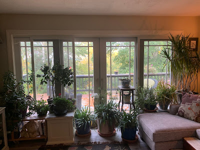 |
| Plants we wanted to save were warm and snuggly inside our house this morning after my husband Jeff remembered to bring them indoors ahead of this morning's frost. |
Normally, I wouldn't make a big deal about frost in late October so it's so common, but in this topsy turvy weather year, what was once normal is now strange. Go figure.
VERY ACTIVE WEATHER PATTERN
Two days ago, I mentioned heavy rain moving into California this weekend, the product of two intense storms and an atmospheric river.
Since weather generally flows west to east, you can't expect the California storminess to just disappear. What goes on in California doesn't stay in California.
These systems will move across the nation, causing all sorts of hazards, and giving us in Vermont a really wet week. That represents a change in the forecast, as the upcoming week was originally scheduled to be kind of dry. More on that in a moment.
In northern California, the storms will prove to be a little too much of a good thing. They desperately need the drought relief, but the moisture coming into California is basically a fire hose.
Parts of northern California can expect seven or more inches of rain just on Sunday. As these torrents blast the areas burned by recent wildfires, there could be massive and destructive debris flows. Parts of California have been placed under a high risk of this happening.
The initial wave of the California storminess has already come and gone out there, and is emerging into the Plains States. This is going to cause the first of two severe storm outbreaks in the middle of the nation.
Some severe storms are forecast around parts of Nebraska, Iowa and Missouri today, but the main show comes Sunday.
That will be centered in and around Missouri on Sunday, with tornadoes, large hail and damaging straight line winds expected. This activity will shift into the southern and central Appalachians Monday.
That second, stronger wave of storms off the Pacific Ocean will make their way into the Plains by Tuesday and Wednesday, promising another wave of severe storms and tornadoes.
Usually, we expect big severe outbreaks to happen in the spring out there, but there's a smaller, secondary peak in activity in the autumn, and that's what we're experiencing. This autumn's peak seems bigger than most years, as we've already seen tornadoes in Oklahoma earlier this month, and in Ohio and Pennsylvania just the other day.
VERMONT IMPACTS
As noted, it's going to be a wet week. Initial forecasts had the storm causing the severe weather this weekend to pass mostly south of us, but now, we're in on the action. By the time the system gets here, it will have slowed down, so we'll have a long period of rainy weather starting late Sunday night and continuing at least through Tuesday.
It might not rain constantly, but it will be wet most of the time during this period. During the onset, it might be cold enough on the mountain peaks for a couple inches of wet snow. The vast majority of us will only see a chilly rain out of this, however.
At this point, rainfall totals look like they will amount to a half inch to an inch Sunday night through Tuesday night.
That second, stronger wave of storminess looks to affect us toward the end of the week. Early indications show the potential for strong winds and heavy rain, but it's too early to know for sure.
This is one of those evolving weather patterns, so I and everybody else will need to keep updating and making forecast adjustments as we go through the week
No comments:
Post a Comment