 |
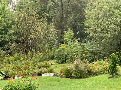
| Dark, cool and dreary for August this morning in St. Albans, Vermont. It's going to be like October probably through Thursday. |
It won't be the coolest August weather on record, not by a long shot. As I wrote the other day, we used to regularly have autumn-like episodes of weather in August on a regular basis.
Still, this will probably be the nippiest August regime since at least 2014. That was the last time we had three consecutive days in Burlington in which high temperatures never made it out of the 60s.
Even then, those three days in August, 2014 were in general about as cool, or even possibly slightly warmer than what's in the forecast for today through Thursday.
Originally, today was supposed to the coolest day of the bunch. And it will be chilly by August standards with highs only in the 60s.
But we should see glimpses of sun every once in awhile between the clouds, and there won't be all that many showers around. So you'll actually get to go outside and, I don't know, enjoy the isolated pockets of fall foliage that have already popped up?
Wednesday now looks to be the more shockingly chilly day of this. At least shockingly compared to what we've seen most of the time this summer.
The cold upper level low pressure causing this brisk weather will be right on top of us. That will inspire lots of clouds, and numerous showers, though they will be light showers.
But it will be a nasty day for late season summer visitors to Vermont. I hope they brought more than t-shirts and shorts. High temperatures will range from the mid-50s - that's it - over somewhat higher terrain of the north, to the mid-60s in banana belt towns in the Champlain Valley and lowlands of southeast and southwest Vermont.
The forecast high of 63 in Burlington is normal for October 6. We still probably won't have the coldest high on record for the date. That honor goes to August 21, 1982, when the "high" in Burlington reached a less-than-balmy 58 degrees. That was the day I mentioned previously in which people were skiing three inches of snow atop Killington.
Speaking of snow, I do wonder if Mount Washington. The forecast high up there Wednesday is just 40 degrees, with lows in the mid-30s. That might be cold enough for a few wet snowflakes atop New England's highest peak.
It won't get cold enough for snow on the higher summits of Vermont's Green Mountains. Still, hikers should take note that summit temperatures will only be within a few degrees either side of 50 today through Thursday. Rain showers will make it seem colder. A cotton t-shirt and sandals won't cut it, folks!
The cool, showery weather is now forecast to continue well into Thursday, which is a change from forecasts issued a few days ago. Those earlier forecasts had said a warmup would start then, but now the warmer weather is postponed until Friday, and won't really kick into gear until the weekend.
By Saturday and Sunday, we should see daytime highs poke into the low 80s for many of us. That's about normal, or a little warmer than average for this time of year.
Until now, this August has been running decidedly on the warm side. But this cool spell might take the month down to the cool side of what is the new climate change normal for the month. It all depends on how balmy it gets - and stays - after this cold snap departs.
I'm making a big deal out of a spell of autumn in August, only because by today's standards, it's odd. But like I said earlier in this post, and in a post I put up on Sunday, this kind of thing used to happen all the time in mid and late August.
It's all just another way we've adjusted to a new normal in the age of climate change.

No comments:
Post a Comment